Managing and Using Digital Spatial Archives
Managing Digital Spatial Archives, Libraries, and Databases
Researchers in the digital spatial humanities have access to extensive collections of geographical datasets and other spatial media, and thus the potential for spatial storytelling may seem limitless. One of the major challenges for developers, archivists, and researchers, however, is the management of the sheer volumes, sizes, and complexities of geographical data (Flewelling, 1999). Another is the difficulty of browsing and synthesizing information from large geodatabases. In a time of greater digital connectivity, an overarching challenge still lies in the interoperability of geospatial data sets and databases. Just as volume and complexity are a challenge for archivists, the vast scope of such databases can affect researchers’ abilities to tap into the locative, generative, and connective potential of geographical information.
These challenges are addressed at least in part through the use of metadata schema which document the characteristics of data (including who collected the data, where, when, why, and how, to the extent that such information is available). Digital geographic metadata, specifically, refers to data used to document the characteristics of geographic digital data resources, including geographic information systems (GIS), geospatial databases, and geospatial or earth imagery, among other other location-based resources. Geospatial metadata might include core library catalog elements (e.g. title, abstract, publication data), geographic extent and project information, and database elements such as attribute label definitions and attribute domain values (Natural Resources Canada, 2021). In Canada, geospatial metadata policies and standards related to “the use, integration, and preservation of spatial data” are primarily set through the Canadian Geospatial Data Infrastructure (CGDI). For more information on definitions and (inter)national standards for metadata documentation and terminology, see also Natural Resources Canada and the Federal Geographic Data Committee.
Using Digital Spatial Archives and Geodata for Storytelling: Resources and Examples
In the previous module, we shared some examples of spatial archives and encouraged students to examine them further. We recommend revisiting those examples for this module and the related lab. Below, we share some examples of more complex, interdisciplinary spatial archives.
Empire, Trees, and Climate: Toward Critical Dendroprovenancing using HGIS (Nipissing University’s Centre for Understanding Semi-Peripheries (CUSP))
Scholars collaborating through the interdisciplinary Centre for Understanding Semi-Peripheries (CUSP) at Nipissing University use materials from various iterations of “archives” (traditional, digital, national, local/community, more-than-human, and spatial archives) to understand the historical geographies of the timber trade, slavery, and climate change in Bermuda and the British North Atlantic. As their HGIS storymap for “Empire, Trees, and Climate: Toward Critical Dendroprovenancing using HGIS” explains:
Historic timbers from heritage buildings and shipwrecks provide clues into past cultures and climates, including those in Atlantic Canada, Bermuda, and the Caribbean. Our research aims to uncover and interpret those clues for the purpose of better understanding contemporary cultures and climates. In order to achieve this goal, we are employing a methodology called ‘critical dendroprovenancing’.
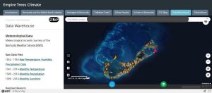
Extensive types of archives and data were used to better understand the provenance of timbers used for buildings in Bermuda. This included working with spatial archives to map the geographies of timbers, tree ring data, ship mobilities, and meteorological records, among other topics. These data were used to produce storymaps based on different themes, including tree and other climate proxies, colonial and imperial “vantages” using georeferenced paintings, and the historical and sonic geographies of birds (as well as bird conservation and recording) on the island. Of course, this requires housing a considerable amount of data, a summary of which can be found on the Data Warehouse tab at the top of the website and which we encourage you to explore. Given the use of the site as a repository of several digital collections, the HGIS serves as its own digital archive, library, or catalogue, serving as a useful tool for other researchers across the digital spatial humanities.
Polar Data Catalogue (University of Waterloo, Interdisciplinary Centre on Climate Change)
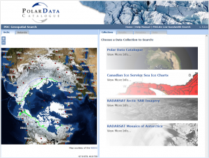
The Polar Data Catalogue provides access to an extensive collection of data and metadata from Arctic and Antarctic researchers. Following metadata standards outlined by ISO 19115 and Federal Geographic Data Committee (mentioned earlier in this module), the online repository covers an interdisciplinary range of interests from across the sciences, social sciences, and humanities, including but not limited to: climate studies, environmental geography, history, health studies, and policy research. The Polar Data Catalogue (PDC) also features a PDC Geospatial Search tool, which allows users to search or input Arctic and Antarctic data through a mapping interface. At the time of writing this module, the Geospatial collections included Polar Data and Metadata, RADARSAT Arctic SAR Imagery, RADARSAT Mosaics of the Antarctic, and Canadian Ice Service Sea Ice Charts (Polar Data Catalogue, 2022). Visit the catalogue to learn more about the collections and the stories told (or that might be told) through them.
A Song for Our Warming Planet interdisciplinary climate music project (University of Minnesota Duluth)
Using spatial proxy data to develop information on past climates and environments is one thing; communicating this information to a broader public is another. In the following example, scholars at the University of Minnesota Duluth show how geospatial data (e.g., global annual surface air temperatures) and music can combine to tell unique stories about climate change through the piece, “A Song for Our Warming Planet.” Have a listen as we close out this module, and consider the new types of stories or audiences by turning climate data, or other geospatial data, into music.
