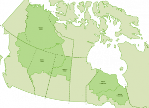
31 Numbered Treaties
Introduction

The Numbered Treaties are a series of treaties signed between First Nations and the Canadian government between 1871 and 1921. After Confederation, Canada experienced a surge in immigration and decided an expansion in landownership west and north would be necessary. Land that is covered in the Numbered Treaties is considered to be ceded to the federal government by First Nations.
Numbered Treaties 1-5
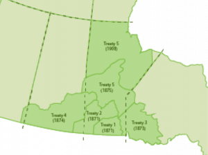 Commonly referred to as the First Five, Numbered Treaties 1-5 were the first treaties signed post-Confederation and established the groundwork for treaties to this day. Treaties 1-5 were signed between 1871 and 1875, and at the time, these treaties covered land found in what was then known as Manitoba and the North-West Territories; this area is now known as northwestern Ontario, southern Manitoba, Saskatchewan, and Alberta. Please see the maps for a better understanding of how Canada’s provincial boundaries have shifted since the treaties were signed. These treaties were meant to permanently transfer land to the Crown for the purpose of European settlement along with agricultural and industrial development. In exchange for ceded lands and rights, First Nations were to receive the following: reserve lands, annuities, allowances for blankets and tools, farming assistance, schools if they wished, annual censuses, and hunting and fishing rights. An exception was built into the treaties stipulating that should the federal government need the lands it could suspend hunting and fishing rights on Crown lands and build infrastructure it deemed crucial. The treaties also required First Nations to keep the peace, maintain law and order, and adhere to the prohibition of alcohol on reserve lands.
Numbered Treaties 6 and 7
 The Indian Act was signed in 1876 and impacted future negotiations and treaty agreements for a multitude of reasons. Most significantly, it made Indigenous Peoples wards of the federal government. After 1876 all Status Indians wishing to travel off reserve were required to carry identification in the form of an ID card. It also granted the government ownership of Indigenous lands and took away Indigenous rights to self-government.
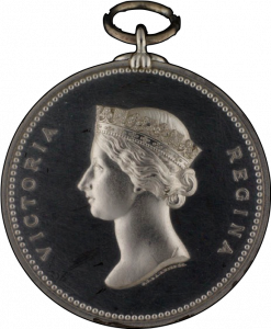
Treaty No. 6 was signed in 1876 and covered modern-day central Alberta and central Saskatchewan. Its context and contents differed from the Numbered Treaties 1-5 in two significant ways: First, although the First Nations communities affected were concerned about western expansion and initially resisted efforts by the Crown to force an agreement, they had little choice but to sign. Their population numbers had been affected by outbreaks of small pox, and buffalo and deer were becoming scarce due to over hunting. Second, Treaty No. 6 is the only treaty to include a clause requiring the federal government to provide health care (Taylor, 1985b). Despite this, access to health care was initially denied, but more recently, this clause – known as the medicine chest clause – has ensured access to full health care, including dental and optical, for First Nations communities.
Treaty No. 7 was signed in 1877 and covers modern-day southern Alberta. For the most part, the parameters are similar to Numbered Treaties 1-5 with two exceptions: First, five different Nations signed this treaty; their different languages and cultures led to conflicting (mis)understandings of the purpose and terms of the treaty. As a result, it remains a very contentious treaty (Tesar, 2016b). Second, some communities were granted more money and supplies than in previous treaties (Tesar, 2016b).
Numbered Treaties 8-11
 Known as the last of the Numbered Treaties, these were signed between 1899 and 1921. For the most part, these treaties cover the northwest of Canada, with the exception of Treaty No. 9, which covers northern Ontario and a small portion of Manitoba (Morrison, 1986). After Treaty No. 7 was signed, there was a 22-year gap prior to the negotiations of Numbered Treaties 8-11. This happened for two reasons: The federal government had spent large sums of money to negotiate the first seven treaties and didn’t want to be perceived by new European settlers to be spending funds on First Nations (Canada in the Making, 2004). Second, the federal government had no reason to negotiate for northern lands it saw as having little to no value (Canada in the Making, 2004). The Klondike Gold Rush in 1896 changed the federal government’s perspective on the northern regions of Canada, and it began treaty negotiations again.
Treaties No. 1 and No. 2
Treaty No. 1, also known as the Stone Fort Treaty, was signed August 3, 1871, between the Crown and the Anishinabek and Swampy Cree; Treaty No. 2 was signed August 21, 1871, between the Crown and the Anishinaabe of southern Manitoba (Albers, 2015). The government had wished to negotiate these treaties together, but they were ultimately signed in two parts. The treaties cover lands in what is currently southern Manitoba and south-eastern Saskatchewan.
Gallery 6.3 Treaty No. 1 and Treaty No. 2 maps
Background
After Confederation in 1867, the Canadian government sought to expand the country’s borders by acquiring Rupert’s Land and the North-Western Territory from the Hudson’s Bay Company (HBC). To facilitate the sale, HBC sold the land to the United Kingdom, who transferred it to the new Dominion of Canada (Daugherty, 1983a). Neither First Nations nor Métis communities were consulted regarding the sale, and they contested it on the grounds that the lands had not been ceded. In response to the sale, the Métis under the leadership of Louis Riel mounted the Red River Resistance, which led to the Manitoba Act, settling some, though not all, matters in question. No settlement was reached with the First Nations communities. Chief Peguis, the most powerful First Nations chief in the area, and son Henry Prince petitioned the Aboriginal Protection Society in the United Kingdom for a mutually beneficial treaty (Albers, 2015). Peguis argued that the First Nations had never ceded the land nor jurisdiction over their communities to HBC and thus the company had no standing to make the sale of land to begin with (Albers, 2015).
Gallery 6.4 Some people involved in Treaties No. 1 and No. 2
The new Canadian government, under the impression that lands had been ceded to Lord Selkirk in 1817 (in the Selkirk Treaty) and that HBC had the authority to sell the land, sent Adams G. Archibald, the lieutenant-governor for Manitoba, to conduct treaty negotiations in 1870 (Miller, 2009, p. 163). Archibald returned not long after meeting with Chief Peguis and told Secretary of State Joseph Howe that negotiations could not be quickly achieved with the “savages” (Daugherty, 1983a).
Gallery 6.5 Illustrations and cartographic material for Treaty No. 1
By spring of 1871, the First Nations communities were impatient for treaty negotiations to begin again; a sign was posted on a church door in Portage la Prairie that warned settlers to stay off the land until a treaty was established (Daugherty, 1983a). By then, Howe had given the Indian Commissioner, Wemyss Simpson, a great deal of authority to negotiate treaties for land between Thunder Bay and Fort Garry. Simpson, Archibald, and two other government representatives re-opened negotiations with First Nations on July 16, 1871 – again they were unable to reach a settlement (Daugherty, 1983a). Frustrated with the delay and concerned with preserving timber and agricultural developments, the government representatives decided to focus on two separate treaties for land west of Portage la Prairie (Daugherty, 1983a).
On July 18, 1871, an invitation was sent to First Nations to meet at Fort Garry on July 25 to negotiate the terms of the treaty (Daugherty, 1983a). Archibald instructed that no alcohol be sold to any First Nations, and he invited the military and arranged for a feast to be provided to impress the chiefs (Daugherty, 1983a). While Archibald and Simpson arrived on July 24, negotiations did not formally begin until July 27 when all participants had arrived (Daugherty, 1983a).
Negotiations
In his opening remarks, Archibald spoke of the Queen as a shared mother and imparted her good wishes for the treaty negotiations. He explained the concept of reserves and outlined the hunting and fishing rights of First Nations under treaty law (Daugherty, 1983a). To avoid claims that the chiefs acted without authority or the consent of their people, as had happened with the Selkirk Treaty, participants were asked to select representatives to negotiate on their behalf. After two days of deliberations, both parties returned to the table to negotiate Treaty No. 1 (Daugherty, 1983a). Immediately the First Nations representatives expressed concerns about a “dark cloud” impacting negotiations; they were referring to the imprisonment of members of the Swampy Cree as a result of conflict with the HBC (Daugherty, 1983a). Archibald agreed that in a one-time-only act of goodwill he would have them released; arguably, this greatly contributed to the willingness of the First Nations to negotiate. The First Nations’ representatives also asked for a reserve that would equate to roughly three townships per person, a request Simpson and Archibald found foolish. Instead, each family of five was offered 160 acres and an annuity of $12 (Daugherty, 1983a). This offer was presented as an ultimatum and the First Nations accepted (Daugherty, 1983a).
Treaty No. 1 was signed on August 3, 1871, at Fort Garry (Albers, 2015). On August 21, 1871, Treaty No. 2 was signed at Manitoba Post (Albers, 2015).
Interactive 6.3
Click to read a PDF version of Treaties No. 1 and No. 2

Treaty No. 3
Gallery 6.6 Treaty No. 3 maps
Treaty No. 3, also known as the North-West Angle Treaty, was signed on October 3, 1873 (Talbot, 2009, p. 69). The treaty covers land in northwestern Ontario and eastern Manitoba and was required to complete a passage to the West, so the newly formed country of Canada could stretch sea to sea. Three significant factors contributed to the urgency to have Treaty No. 3 signed: First, after the ratification of the British North American Act establishing Canada’s independence, the British wanted to leave. It was believed that Canada would be more likely to survive as a new state if it stretched from coast to coast. Second, the Americans had embraced the doctrine of manifest destiny and were aggressively acquiring land westward under the leadership of President Ulysses S. Grant (Daugherty, 1986b). The Government of Canada was concerned that the Americans would move north as they moved west if it did not own the land. Finally, British Columbia had not yet joined the confederacy and would only do so with the establishment of the Canadian Pacific Railway. To confront these factors, Canada needed to negotiate quick, low-conflict solutions with both the Métis and First Nations.
Gallery 6.7 Some people involved in Treaty No. 3
Treaty No. 3 would prove one of the more difficult of the Numbered Treaties to negotiate, taking four years to finalize. The government sought to acquire land that would allow it to use the old fur trade routes established by the First Nations and Métis and used by the North West Company to reach the West. These routes required travel through the unceded territory of the Saulteaux. The Saulteaux were one of four Ojibwe tribes whose territory was divided by the American–Canadian border; the others were the Potawatomi, Ottawa, and Mississauga. Many community members lived on the American side of the border, contributing to the difficult negotiations that would follow (Daugherty, 1986b).
Simon J. Dawson, chief engineer on the project, was concerned about the Métis and the Red River Rebellion affecting the negotiations. In a letter to Ottawa, Dawson requested that Robert Pither of the HBC become the Indian Agent for the “expressed purpose” of keeping the Saulteaux happy with the government during negotiations; he was familiar to the Saulteaux and had spent time among them. Secretary of State Joseph Howe approved Pither and a Métis assistant.
Background
On June 7, 1870, Howe instructed Simpson, along with Algoma MP Lindsay Russell, to establish a right-of-way agreement (Daugherty, 1986b). Simpson thought poorly of the Saulteaux. Because they had refused Christianity, he thought them filthy and incapable of gratitude (Talbot, 2009, p. 70). Still, he warned that they could successfully prevent or seriously delay north-west expansion.
On June 19, 1870, an estimated 1500 Saulteaux arrived in Fort Francis, approximately 600 of them from the American side of the border. Simpson warned that soon Canadian troops would pass through the area on their way to Red River where the government hoped to assert Canadian sovereignty after the Red River Rebellion, and he offered to hire First Nations as guides and labourers (Daugherty, 1986b). Under the leadership of the Fort Francis band chief, they refused (Talbot, 2009, p. 70). The Saulteaux put forward the following demands in exchange for the right-of-way passage: $10 for every man, woman, and child on a yearly basis and supplies such as flour, pork, tea, and tobacco for the feast that would accompany the annual pay. In return, the government could build any infrastructure required for the purpose of safe travel through the territory; the payment did not cover settlements for farmers. During negotiations, the Saulteaux refused any gifts from the government as they did not want to be bound by debt to the Crown.
Initially Simpson dismissed the Saulteaux’s demands. However, the Saulteaux pointed out that Dawson had met their requests when negotiating passage through Saulteaux territory in the past (Daugherty, 1986b). Informed of the Saulteaux’s resistance, Howe sought the guidance of Lieutenant Governor Archibald, who felt that Dawson’s previous agreements with the Saulteaux should be taken into consideration during this current round of negotiations. Archibald was not concerned about the annuities demanded, as he was certain that the agricultural potential of these prairie lands would cover these additional costs over time. The lands of the Woodland Saulteaux were an exception, as they were thought to be ill-suited for agricultural development (Daugherty, 1986b). As a result, it was agreed that payments would be calculated based on the value of the trade route. The southern trade routes were of greater value, as they allowed settlers to travel west using American rail lines. In contrast, the northern Dawson Route was a canoe route, which took longer to traverse and was thus less valuable (Daugherty, 1986b).
Simpson and Archibald each submitted reports to the Crown outlining the need to acquire the land and not just a right-of-way passage; Dawson also submitted a report in which he expressed a greater understanding of the First Nations’ point of view and was more sympathetic to their demands (Talbot, 2009, p. 70).
In late June the commissioners, including Simpson, McKay, Dawson, and Pither, met with the Saulteaux in Shebandowan Lake at Fort Francis where negotiations broke down (Filice, 2016b). Simpson noted that they needed more time; most likely the terms of the offer had been rejected by the Saulteaux (Daugherty, 1986b). In addition to the negotiations going poorly, disease had broken out, causing many of the Saulteaux to disperse in order to minimize the spread of the illness. All parties agreed to meet the following year.
Gallery 6.8 Cartographic material related to Treaty No. 3
1872 Negotiations
In June 1872 Simpson, along with the commissioners, again met with the Saulteaux, although the meeting proved short and unsuccessful. Simpson insisted on a military presence at the negotiations and offered $3 per head and nothing more. The First Nations argued that the recent discovery of gold in the territory should be taken into consideration and result in a much higher per annum (Daugherty, 1986b). Saulteaux from the American side of the border pointed out that the US government had paid more than what Simpson was proposing. Negotiations broke down, and the parties agreed to meet in the fall at Fort William.
When fall came, Simpson and the commissioners had new terms with which to negotiate. Responding to complaints that had arisen from Treaties No. 1 and No. 2, the government had given the commissioners permission to offer $25 per year for chiefs and $15 per year for headmen. However, too few Saulteaux arrived at Fort William for a general council to be called, and negotiations were again put on hold.
Final Negotiations
The Canadian Pacific Railway stretch between Pembina and Red River was set to be completed by December 31, 1874, and the stretch from Lake Superior to Red River by December 31, 1876. The latter required still unceded territory from the Saulteaux (Daugherty, 1986b). Pressure was mounting for Prime Minister John A. Macdonald to complete Treaty No. 3. Dawson advised the government that if it wished to settle this matter, it needed a significantly better offer, one that was on par with American agreements (Daugherty, 1986b). The US government had offered the Saulteaux $14 per head per annum – $4 in cash, and $10 in goods – as well as agricultural implements, schools, and infrastructure. When compared to Simpson’s offer of $3 a head, it was clear why negotiations repeatedly failed. Dawson recommended that the government offer $14 per head as a gift for signing the treaty and a max annuity of $10 per head, noting that the Saulteaux would likely accept $6. He also recommended sending Alexander Morris, the new lieutenant governor of Manitoba and the North-West Territories. Minister of the Interior Alexander Campbell accepted Dawson’s suggestions; he sent instructions with Morris that the commission was authorized to offer $15 per head for the ceding of the land with annuities of $7 per head and one square mile for each family (or a proportion of that dependant on the size of the family). Morris was encouraged by the federal government to not use the maximum amount available as the terms of this treaty would impact negotiations for future treaties.
The deputy superintendent general of Indian Affairs, William Spragge, was sent by the Canadian government to investigate the terms of the American treaty with the Saulteaux, which they had held up as an example in negotiations. Spragge discovered that the terms were significantly different; the Canadian annuity being offered was higher and for an indefinite period of time. Campbell urgently wrote to Morris advising him not to offer anything close to the approved amounts. Meanwhile Dawson urged the government to secure a military escort for the commissioners to the treaty negotiations, believing that this would be viewed favourably by the Indian leadership and signify that the Crown was acknowledging the significance of the negotiations.
On September 23, 1873, Lt.-Gov. Morris arrived in North-West Angle, accompanied by a military escort, to meet the other commissioners. These included Dawson, who had taken the place of Russell after being recently elected to a parliament seat, and the newly appointed commissioner of Indian Affairs, Lt.-Col. J.A.N. Provencher (Talbot, 2009, p. 71). James McKay, Robert Pither, and Molyneux St. John were also present.
The Saulteaux had initially requested to meet in Fort Francis on September 10, 1873; perceiving this to be a test of wills, Morris refused and set the meeting in North-West Angle (Daugherty, 1986b). Over 1400 Saulteaux attended, with more than 11 bands represented (Daugherty, 1986b). Morris was forced to put off the start of negotiations while the bands organized themselves and resolved outstanding business within their group. Negotiations finally began on October 1, 1837, after Morris threatened to break camp if they were put off any longer (Miller, 2009, p. 168).
Taking up the tone set by Morris’s ultimatum, the Saulteaux opened negotiations by demanding that their grievances rising from settler use of their land and resources be resolved. Dawson countered that the Saulteaux had always been compensated for use of their land. Morris redirected the conversation to the purpose of the meeting, outlining the Crown’s offer: land for farms, reserves in the ratio of one square mile per family (proportionately), use of lands for hunting and fishing, schools at the request of the bands, and sums of money as follows: $10 per head for the current year, with annuities of $5 per person, and finally gifts of provisions. At some point the commissioners had decided to offer less than had been authorized. Camp broke to allow the Saulteaux to discuss the offer.
On October 2, 1873, the Saulteaux leadership presented their counter offer. Chief Ma-We-Do-Pe-Nais opened the meeting by speaking of sovereignty (Miller, 2009, p. 167), then the Saulteaux presented their demands in writing: $15 per head for the current year with annuities of $10 per head, $50 annuities for the chief, and $20 annuities for each council member (Filice, 2016b). The Saulteaux also asked for agricultural provisions that included agricultural tools, livestock, tools, and seeds (Filice, 2016b). These demands, though more significant than what the Crown was prepared to offer, had not changed since the first negotiations in 1869. Both Morris and Chief Ma-We-Do-Pe-Nais refused to move on their offers.
At this point, the chief representing Lac Seul and English River, Chief Ka-Katche-way, decided to break from the other bands and expressed his wish to negotiate independently (Miller, 2009, p. 167). This move, likely anticipated by Morris, gave the commissioners the upper hand in negotiations as they were able to express their wish to not divide the Saulteaux and reach a settlement with the whole Nation. Morris encouraged the Saulteaux to take the night to discuss and reconsider; the motion was supported by Chief Blackstone (Daugherty, 1986b).
That evening Saulteaux leadership was joined by four Métis: James McKay, Pierre Leveillée, Charles Nolin, and Mr. Genton (Filice, 2016b). There are conflicting reports as to who invited the Métis to join the council, whether it was the wish of the Saulteaux or the government representatives; nevertheless, they were part of the discussions in which the Saulteaux decided to return to the bargaining table (Miller, 2009, p. 168). At the same time, the commissioners met and agreed to increase the one-time payment from $10 to $12 per family of five and to provide some of the agricultural provisions requested (Daugherty, 1986b).
On October 3, 1873, Treaty No. 3 was signed. The Saulteaux requested that community members on the American side of the border and the Métis families living with them be included in the treaty (Daugherty, 1986b). Morris stated that the treaty was for British Indians only; however, those Saulteaux living in the US could return to Treaty No. 3 lands if they did so within two years (Daugherty, 1986b). He did not allow the Métis families to be included in the treaty.
Following the close of negotiations, Dawson travelled to Shebandowan Lake to secure the adhesion of two more bands (October 13, 1873), and Pither secured the adhesion of the Saulteaux living in Lac Seul (June 9, 1874) (Daugherty, 1986b).
Interactive 6.4
Click to read a PDF version of Treaty No. 3

Treaty No. 4
Treaty No. 4, also known as the Qu’Appelle Treaty, was signed September 15, 1874, in Fort Qu’Appelle, Saskatchewan (Filice, 2016a). The treaty was between the Crown, the Cree, Saulteaux bands of the Ojibwa, and the Assiniboine (Filice, 2016a). The treaty covers modern-day southern Saskatchewan, land that had been previously under HBC control (Taylor, 1985a).
Gallery 6.9 Treaty 4 maps
Background
After signing Treaties No. 1, No. 2, and No. 3, the Canadian government lost interest, at least temporarily, in negotiating further treaties. Lt.-Gov. Morris, however, believed that establishing treaties with First Nations would encourage stability in the West and encouraged the government to continue negotiations (Taylor, 1985a). The buffalo population had declined so significantly that the First Nations faced starvation and, as a result, were in conflict with one another (Talbot, 2009, p. 80). In addition, they faced the pressure of encroaching settler and Métis populations (the Métis had been forced west after not being included in treaties), illegal traders (of arms and alcohol) from America, and surveyors from both Canadian and American governments (Taylor, 1985a). First Nations viewed treaties as a way of potentially resolving these issues and as the Queen’s promise to protect the land (Taylor, 1985a), while the government was only interested in negotiating treaties when it needed access to the land for some purpose.
Morris tried on multiple occasions to gain government approval to negotiate treaties west of Treaty No. 2. The conflict between the Blood Indians and some Cree had already resulted in considerable loss of life, and Morris was certain the situation would worsen without a treaty (Taylor, 1985a). After the Macdonald government fell and was replaced by Alexander Mackenzie and his Liberal government, Morris wrote to David Laird, Minister of the Interior, and earned the confidence of the government to begin negotiations (Taylor, 1985a). Morris disagreed, however, with the appointment of HBC’s William J. Christie as a commissioner and urged the government to create a distinction between the new Government of Canada and the old HBC (Taylor, 1985a). Despite Morris’s opposition, Laird and Christie were appointed commissioners under his lead, and they set out to meet with the Cree, Saulteaux, and Assiniboine in the fall of 1874 (Filice, 2016a).
Negotiations
On September 8, 1874, negotiations got off to an inauspicious start. Otakaonan (The Gambler), who was representing the Saulteaux in place of Chief Cote, expressed skepticism of the government and the negotiations, although Chief Kakuishmay (Loud Voice), representing the Plains Cree, was more optimistic (Talbot, 2009, p. 86). In addition to this wide difference of opinion between the Indigenous representatives, few First Nations people were present to negotiate because many were participating in the buffalo hunt. Morris agreed to postpone negotiations for three days until September 11 to ensure greater participation (Filice, 2016a).
On September 11, all parties were prepared for negotiations; however, the Saulteaux demanded that the site be moved to their camp: the commissioners’ camp was on HBC reserve land and they argued that that would negatively impact the negotiations (Taylor, 1985a). Initially, the commissioners refused to move, but tensions were so high that eventually it was decided to move closer to the Saulteaux camp (Filice, 2016a).
Gallery 6.10 Some people involved in Treaty No. 4
Talks resumed at the new meeting place on September 13, but they broke down again quickly (Taylor, 1985a). Chief Pasqua expressed confusion and anger that the government had purchased HBC lands that the original Indigenous owners had not been compensated for (Filice, 2016a). Concerned that these digressions would force negotiations to be called off, Chief Kakuishmay asked the First Nations leaders to work together in “unity”; Morris echoed this sentiment and warned that if negotiations were not successful now, the government would likely not negotiate again in the near future (Talbot, 2009, pp. 86-87).
September 14, 1874, would be the last day of negotiations. The Nations initially requested $15 per person and that the Crown settle their debts with the HBC, but the commissioners refused (Filice, 2016a). The chiefs also requested that the Métis be included and allowed hunting rights; the commissioners gave assurances that the Métis would be treated fairly, but they were not mentioned in the treaty (Taylor, 1985a). In the end, the Nations agreed to the same terms as Treaty No. 3; after the terms were translated and explained to the people, the treaty was signed on September 15, 1874 (Filice, 2016a).
Adhesions
After the treaty was signed, Morris and Laird travelled to Fort Ellice to secure the adhesion of the Saulteaux there. Their land bordered the territories covered by both Treaties No. 2 and 4. Because the Saulteaux of the area never joined Treaty No. 2, they were now given the choice of which treaty to join. The terms of Treaty No. 4 were perceived to be better, so the Saulteaux of the area chose to join it (Filice, 2016a). The following year Christie and M. G. Dickieson, Laird’s secretary, travelled to pay the annuities promised in Treaty No. 4, and they secured the adhesion of six more Nations, mostly Cree and Assiniboine (Taylor, 1985a).
Interactive 6.5
Click to read a PDF version of Treaty No. 4

Treaty No. 5
Treaty No. 5, also known as the Winnipeg Treaty, was signed between 1875 and 1876 (Coates & Morrison, 2010). The treaty was signed between the Government of Canada and the Ojibwa and Cree, and covers the land in present-day central and northern Manitoba, and portions of Saskatchewan and Ontario (Filice, 2016c).
Gallery 6.11 Treaty 5 maps
Background
During previous negotiations for a treaty, many of the First Nations in this area and their representatives had been unable to travel the long distances to reach Stone Fort and Manitoba House, where treaty negotiations were held, but the lack of attendance at these negotiations was not representative of a lack of interest in treaties (Coates & Morrison, 2010). Using Reverend E. R. Young as an intermediary, the Nations of the area informed the government that they wished to negotiate a treaty (Coates & Morrison, 2010). Norway House Nation in particular was eager to reach an agreement with the government that would relocate the Nation to land more suitable for farming (Filice, 2016c). Norway House initially sent its petition to the Manitoba Free Press outlining the dire situation it was facing. Due to HBC trade route changes, many community members were without work (Miller, 2009, p. 173). Furthermore, the Nation had been impacted by the presence of settlers and the same political and environmental factors that had led to the signing of Treaties No. 3 and No. 4. Put simply, the people of Norway House were facing starvation (Miller, 2009, p. 90). Chief Henry Prince (Mis-Koo-Ke-New) informed the Council of the North-West Territories of the situation, bringing matters directly to the attention of Alexander Morris, Lt.-Gov. of Manitoba (Coates & Morrison, 2010).
David Laird, Minister of the Interior, was not interested in negotiating any new treaties and suggested communities that wanted a treaty could join Treaty No. 1 (Miller, 2009, p. 90). However, the government did agree that Norway House should be moved (Filice, 2016c). Morris argued that factors such as the new HBC trading routes, discovery of minerals, new lumbering initiatives, and the agreement to relocate Norway House required a new and different treaty than those that had been previously negotiated (Coates & Morrison, 2010). On July 2, 1875, the government approved Morris’s proposal to negotiate a new treaty, although he was not permitted to negotiate any deals with Nations north of Lake Winnipeg other than Norway House (Filice, 2016c).
Negotiations
Gallery 6.12 Some people involved in Treaty No. 5
In the fall of 1875 Morris, along with James McKay, set out to negotiate Treaty No. 5 with the Nations around Lake Winnipeg. The commissioners were permitted to offer the following: a one-time payment of $5 per person for signing the treaty; and annuities of $25 for the chief, $15 for the headmen, and $5 for each community member (Coates & Morrison, 2010). As well, the offer included: 160 acres per family (less than was offered in Treaties No. 3 and No. 4 but equal to Treaties No. 1 and No. 2); provisions for schools; control of liquor; and other provisions similar to those found in previous treaties (Filice, 2016c). As in other Numbered Treaties, the Nations received reserve lands that could be reclaimed by the government for development or public works; in such a case, compensation would be provided to the Nations. These reserve lands were to be selected and agreed upon as soon as the treaty was signed, the first time this occurred (Talbot, 2009, pp. 89-90).
The signing of the Treaty No. 5 took place over two trips. The first trip, made by Morris and McKay in the fall of 1875, included both negotiations and the signing of the treaty (Coates & Morrison, 2010). The second trip took place the following year and was made by Thomas Howard and John Lestock Reid who had been appointed by Morris to collect outstanding signatures (Filice, 2016c).
On September 20, 1875, Morris and McKay met with the Berens River Band at the Wesleyan Mission School House (Filice, 2016c). While some details of the negotiations took time to resolve, the Nation accepted the terms rather quickly and the commissioners headed to Norway House the next day (Filice, 2016c).
On September 24, 1875, Morris and McKay arrived at Norway House to negotiate Treaty No. 5 (Filice, 2016c). The Cree of the area were divided into two groups – those who identified as Christians (Norway House) and wished to relocate to Fisher River and those who did not identify as Christians (Wood Band) and wished to stay at Cross Lake (Filice, 2016c). The commissioners agreed that reserves would be set up at Fisher River and Cross Lake (Filice, 2016c).
On September 28, 1875, Morris and McKay met Thickfoot, a member of the Jack Head Point peoples of Big Island, and members of Big Island, Black Island, Wapang, and other island communities. They expressed their interest in joining treaty negotiations (Filice, 2016c). Thickfoot asked for reserve lands that would allow for farming and fishing; the commissioners agreed, offered land at Fisher River, and told Thickfoot and the other community members to meet next summer at Dog Head Point to pick reserve lands (Filice, 2016c).
Prior to returning to Winnipeg, Morris and McKay decided to extend the treaty boundary to include the Swampy Cree living in The Pas (Wahpahpuha) on the Saskatchewan River (Filice, 2016c). The new method of assigning reserves at treaty signings was successful; the commissioners were able to secure agreement from the Swampy Cree then negotiate to move their reserve lands. The commissioners agreed to pay the Swampy Cree $500 to move to the other side of the river, thereby preventing Indigenous Nations from controlling both banks (Miller, 2009, pp. 74-75). Despite the successful negotiations and the inclusion of many Nations in the treaty, Morris appointed Howard and Reid to ensure adhesion of outstanding bands the following year when they delivered the first annuities (Coates & Morrison, 2010).
Adhesions
The following year, on July 24, 1876, Howard and Reid visited Lake Winnipeg to secure signatures from Bloodvein, Big Island, Sandy Bar, St. Peter’s, and Jack Fish Head (Filice, 2016c). Initially, matters did not go well. Thickfoot believed his dealings with Morris and McKay made him chief among his people, but others did not hold the same view and were upset with the leadership selection process (Coates & Morrison, 2010). Further, many members had been away the previous fall hunting or working for the HBC and did not know they too would be bound by the treaty (Coates & Morrison, 2010). To resolve the issue, Reverend Henry Cochrane, who was known to the community and working as a translator for the commission, convinced the First Nations to select one chief to represent all bands as well as one councillor from each band. To do this, they used a majority ballot system, a significant shift from traditional ways of selecting leaders (Coates & Morrison, 2010). Chief Sa-ha-cha-way was selected, and the bands signed on to the treaty.
On August 4, 1875, Howard and Reid secured outstanding signatures in Berens River; they then separated and travelled separately to secure the remaining signatures (Filice, 2016c). Howard went to Grand River to pay the $500 fee negotiated by Morris and McKay the previous fall. There he was surprised to find that some chiefs believed the negotiations were ongoing and had new demands (Filice, 2016c). Eventually he was able to convince them that he had no authority to negotiate matters further, and the chiefs signed the treaty though they made it clear they believed they had been misled by the commissioners. Howard also successfully collected signatures from The Pas, Moose Lake, and Cumberland House (Filice, 2016c).
Reid meanwhile travelled from Berens River to Norway House to plan the band’s move to Fisher River (Filice, 2016c). During this journey, he was met by the chief and council from Oxford House (Bunibonibee Cree) who expressed their interest in joining the treaty. He was not authorized to add First Nations from northern Manitoba, but he assured them he would notify the government of their desire to negotiate (Filice, 2016c).
Almost immediately upon the completion of the negotiations and signing of Treaty No. 5, discrepancies between what the parties understood the treaty to mean arose; the approach used and the speed at which Treaty No. 5 had been established left many communities and members confused and dissatisfied (Coates & Morrison, 2010).
Interactive 6.6
Click to read a PDF version of Treaty No. 5

Treaty No. 6
Treaty No. 6 was signed on August 23, 1876, in Fort Carlton and on September 9, 1876, in Fort Pitt, Saskatchewan, between the Government of Canada and the Cree, Assiniboine, and Ojibwe leaders of the area (Filice, 2016d). The treaty covers land in the central area of present-day Alberta and Saskatchewan (Filice, 2016d).
Gallery 6.13 Treaty No. 6 maps
Background
There are reports suggesting that the First Nations of this area had been seeking to negotiate treaties with the Government of Canada as early at 1871 (Taylor, 1985b). W. J. Christie, Officer of the Saskatchewan HBC post, wrote to Lt.-Gov. Archibald discussing a meeting he had with Cree chiefs of the area in which they expressed that they were seeking a treaty due to concerns with the declining buffalo population and settler diseases, such as small pox, threatening their communities (Taylor, 1985b). The Métis were also lobbying for a treaty, citing similar concerns to the First Nations (Talbot, 2009, p. 95). Morris forwarded a letter his office had received from a Charlie N. Bell on March 23, 1874, which outlined the following concerns: That the settlers would come with or without a treaty, that HBC surveyors had been on their lands without a treaty, and that the communities were facing starvation (Talbot, 2009, p. 95). Alfred Selwyn, head of the Geological Survey of Canada, echoed the concerns of Christie and Bell (Taylor, 1985b). Morris recommended that the government send Rev. George McDougall, a Methodist missionary who had worked in the prairies, to promise negotiations would commence the following year (Talbot, 2009, p. 96).
In July 1875 Lawrence Clarke, HBC manager at Fort Carlton, wrote a letter to the government saying that the Cree planned to prevent telegraph workers from establishing a line from Winnipeg to Edmonton (Talbot, 2009, pp. 95-96). The North-West Mounted Police (NWMP) were dispatched to maintain order (Filice, 2016d). Edward Selby Smyth, major general commanding officer of the Canadian Militia who was out West inspecting the NWMP, wrote a letter to the government expressing that these tensions could be resolved with a treaty (Taylor, 1985b). Eventually, the Government of Canada agreed to treaty negotiations, although for the first time, it did not provide Morris with much instruction beyond that he had the confidence of his superiors (Taylor, 1985b).
Negotiations
Gallery 6.14 Some people involved in Treaty No. 6
On July 26, 1876, Morris, accompanied by W. J. Christie as commissioner; Dr. Jackes, M.D., as secretary; interpreters; and a NWMP escort, headed to Fort Carlton for the first round of negotiations (Taylor, 1985b). They were met there by James McKay, another commissioner (Taylor, 1985b).
On August 15, 1876, Morris met with the head chiefs of the Carlton Cree, Chief Mistawâsis (Big Child) and Chief Atâhkakohp (Star Blanket), prior to the rest of the Cree arriving (Filice, 2016d). By August 18, the assembly at Fort Carlton had grown to about 250 lodges with an estimated population of 2000 people (Taylor, 1985b). Prior to beginning the negotiations, the Cree performed a sacred pipe ceremony in which the commissioners participated (Taylor, 1985b).
On August 19, 1876, Morris met with the chiefs, with the exception of the chief of Duck Lake Band who had sent a messenger in his place (Filice, 2016d). To those in attendance, Morris explained reserves and the offer of provisions for farming; however, he did not explain land cession (Filice, 2016d). Immediately following Morris’s presentation, Chief Pitikwahanapiwiyin (Poundmaker) angrily objected, pointing out that the government wanted to assign land to the Cree in the form of reserves that already belonged to their people (Filice, 2016d).
The First Nations had brought their own Métis interpreter to the negotiations, Peter Erasmus. Chief Mistawâsis instructed Erasmus to write everything down – a sign that the Nations did not trust the commissioners (Talbot, 2009, p. 99). Erasmus noted in his account that Morris was visibly shaken by the disturbance Poundmaker ignited (Taylor, 1985b). Morris, likely playing on the fears of his audience, warned the group that should they chose not to negotiate they would soon be crowded out by settlers (Filice, 2016d). Mistawâsis and Atâhkakohp, who had significant political standing with their people, stepped in to silence Poundmaker, believing their people would suffer if they did not reach a treaty agreement (Filice, 2016d). (At some time during the negotiations, Erasmus came under the pay of the commission and it later became clear that he believed that the government’s efforts to assist the Cree was the only chance they had of survival, a belief shared by Chief Atâhkakohp and Chief Mistawâsis (Taylor, 1985b).)
On August 20, 1876, no negotiations nor council were held; the people discussed matters among themselves. They held a council meeting the following day (Taylor, 1985b). On August 22, the chiefs and commissioners met to discuss food scarcity, the only topic of discussion that day (Taylor, 1985b).
On August 23, 1876, the chiefs and commissioners negotiated the final terms of the treaty and it was signed (Filice, 2016d). The treaty terms were similar to Treaties 1-5 with three notable additions: The parties were to receive more agricultural provisions than past treaty signatories had; a medicine chest was to be stored at the Indian Agent’s house; and a clause was included that provided assurances that the government would assist in times of “famine and pestilence” (Taylor, 1985b).
On August 28, 1876, the commissioners met with Duck Land Band to secure its adhesion (Filice, 2016d). Chief Kamiscowesit (Beardy) expressed his desire for the government to ensure protection of the buffalo; while Morris promised to have the government review the matter, it was not added to Treaty No. 6 when signed (Taylor, 1985b).
Gallery 6.15 Some of the people involved in Treaty 6 negotiations.
Cree chiefs from Crooked Lake.
Seated: Flying in a Circle, Big Child, Star Blanket. Standing: O’Soup – a Blackfoot chief – and P. Hourie, an interpreter. Taken at Brantford, Ontario, at the unveiling of Brant memorial, October 13, 1886 (identities provided by two of Rev. Edward Ahenakew’s sisters).
“Old Generation, File Hills Indian Agency”
The image includes (back row, from left) Mrs. Keewaydin, Mrs. Jack Fisher, Mrs. Miss-ta-tik, Mrs. Buffalo Bow, Day Walker, Mrs. Yellow Belly, Mrs. Pimotatt, and Mrs. Playful Child (Tuckanow); (front row) Chief Hawke, Crooked Nose, Chief Star Blanket, Pointed Cap (Cheepoostatin), Buffalo Bow, Miss-ta-tik, and Kuinness (Cree).
Indigenous men in ceremonial clothing celebrating 50 years of peace since 1885. Three of them are Battle River Indians who fought against the Queen’s forces at Cutknife Hill in 1885. They are, top right, Fine Day; lower centre, Meesegon; and lower right, Kasokio the strong man. Back row, left to right, Tom Tootoosis (Poundmaker), Iron Child (Little Pine), Frank Knife (Sweet Grass), Peter Horsfall (Pasqua), Antoine Lonesinger (Sweet Grass), Edwin Wuttunee (Red Pheasant), Mokanis (Saulteaux, Jackfish), and Fine Day. Front row, left to right, Chief Swimmer, Ewesekan (Poundmaker), Kasokio, and two Stonies.
After completing negotiations at Fort Carlton, the commissioners headed to Fort Pitt to complete negotiations with Nations in the area; they arrived on September 5, 1876 (Filice, 2016d). Approximately 100 lodges were set up to join the negotiations, but many were not present: notably, the 65 lodges commanded by Chief Mistahimaskwa (Big Bear) and the 25 lodges commanded by Chief Minahikosis (Little Pine). This meant that the majority of the Fort Pitt Cree population was not present (Taylor, 1985b). After Morris promised the same terms as in Fort Carlton, Chief Weekaskookwasayin (Sweet Grass) allowed him to present (Filice, 2016d).
After two days in council, the parties met on September 9, 1876, to sign the treaty presented by Morris (Filice, 2016d). The terms were as follows: a $25 annuity for the chief, $15 annuity for the headman, and $5 annuity for each band member, and a one-time payment of $12 per band member for signing the treaty (Filice, 2016d). As in past treaties, provisions for schools, hunting, fishing, trapping, and agricultural support were included. However, for the first time, annuities of $1500 for twine and ammunition were added, as well as a three-year payment of $1000 for agricultural provisions (Filice, 2016d). Finally, the treaty included the provisions for a medicine chest in the Indian Agent’s home and “famine and pestilence” protection (Taylor, 1985b).
When Chief Mistahimakwa returned from the visiting other Nations in the prairies, he warned that promises made in Numbered Treaties 1-5 had not been fulfilled; unfortunately, the treaty had already been signed (Filice, 2016d). Angered that the other chiefs had not waited for him, he declared the treaty “a rope around my neck,” a statement initially interpreted as a death sentence for the commissioners, but later understood to be about his people’s loss of freedom, a concern shared by Chief Poundmaker in Fort Carlton (Talbot, 2009, pp. 180-181).
Adhesions
Treaty No. 6 saw adhesion of many bands up until 1956; the 1889 adhesion of Montreal Lake extended the initial boundary of the treaty (Taylor, 1985b).
Sidebar 1: Metis Scrip
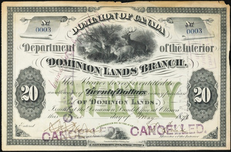
For over 30 years, from 1885-1923, Métis were part of land negotiations that took the form of “scrip.” Although Métis were left out of treaties, these negotiations involving scrip are significant in that they show that the government dealt with the Métis as a distinct group after 1870 (because in 1870, the Manitoba Act laid out the requirement that Métis land claims be addressed). Métis scrip was a certificate for land: 240 acres (or $240 in hand in the case of Treaty No. 8). As author J. R. Miller explains, “Scrip buyers, often representing banks, followed the treaty commissioners and offered cash at a discounted rate in exchange for scrip signed over to them … the land that scrip was supposed to represent rarely ended up in Métis hands, and they did not assemble a land base of any sort” (1999, p. 207). A key aspect of scrip was that, unlike treaties, it did not require the government to make ongoing commitments to the people; it was a one-time cash or land payment. With so many ready to take advantage of the negotiable and transferable nature of scrip, very few of the initial scrip allotments (cash or land) were kept by Métis families.
Interactive 6.7
Click to read a PDF version of Treaty No. 6

Treaty No. 7
Treaty No. 7, also known as the Blackfoot Treaty, was signed September 22, 1877, at Blackfoot Creek (Dempsey, 1987). The treaty was between the Government of Canada and five First Nations: Siksika (Blackfoot), Pikuni (Peigan), Kainai (Blood), Stoney-Nakoda, and Tsuu T’ina (Sarcee); this was the last of the Numbered Treaties to be signed between the government and the Plains Cree people (Tesar, 2016b).
Gallery 6.16 Treaty No. 7 maps
Background
There were a multitude of factors affecting both the government and the First Nations leading up to the negotiations and signing of Treaty No. 7. The Blackfoot Nation was composed of the Siksika, Kainai, and Pikuni; these tribes were allied with the Tsuu T’ina (Dempsey, 1987). The Blackfoot Nation, however, was in conflict with the Stoney-Nakoda; this was a significant factor in the push for a treaty as conflict between these Nations was increasing as a result of the depleting buffalo population (Dempsey, 1987). There were concerns about survival, as these Nations struggled to withstand the increasing pressure on food sources due to encroaching settler, Métis, and Cree populations, along with diseases such as small pox (Tesar, 2016b). Another issue was the whisky forts established by American settlers; the introduction of alcohol was proving to have a detrimental effect on the First Nations communities (Dempsey, 1987). In addition to addressing rising conflict and food scarcity, the government had a vested interest in securing land in what is now Alberta. In 1871 the government had promised British Columbia that a railway would reach the province within 10 years to secure adhesion to the confederacy; the First Nations’ land needed to be ceded in order to fulfill this promise (Dempsey, 1987).
In 1874 the government sent Col P. Robertson-Ross, adjutant general of the Militia of Canada, to assess the situation in what is now Treaty No. 7 territory (Dempsey, 1987). Robertson-Ross reported that over 10,000 people lived in the area, acknowledged increasing conflict, and recommended an immediate police presence (Dempsey, 1987). Robertson-Ross’s report was a contributing factor in Macdonald establishing the North-West Mounted Police (Dempsey, 1987). In the summer of 1874 the NWMP under the command of Col James Macleod dissolved the whisky forts and reported back to Ottawa that the First Nations wanted to negotiate a treaty (Tesar, 2016b).
In the summer of 1875 Crowfoot, one of the Siksika leaders, spoke with John McDougall, a Methodist missionary who had previously worked for the government, who assured him that treaties were being planned (Tesar, 2016b). Crowfoot also spoke to Edward Selby Smith, major general of the NWMP, about Ottawa’s plans; Smith too assured Crowfoot that plans were in the works and that the government would be fair to the First Nations (Dempsey, 1987).
Tired of waiting for the government to take action, the Siksika, Pikuni, and Kainai met in the fall of 1875 and prepared a letter to Morris outlining their concerns (Tesar, 2016b). That same year, the Lakota, who had recently won the Battle of Little Bighorn against the Americans, arrived in Canada along with their chief, Sitting Bull, who met with Crowfoot. This meeting caught Ottawa’s attention; the Canadian government had so far negotiated treaties peacefully and was cautious of the Lakota and the threat of war (Tesar, 2016b).
Negotiations
In the fall of 1877 treaty negotiations began. Although this was the first treaty negotiations between the Crown and those within the territory, the Nations had previously negotiated treaties among themselves and some had participated in the 1855 treaty with the US government (Tesar, 2016b). The commissioners were David Laird, Lt.-Gov. of the North-West Territories, and James Macleod of the NWMP (Miller, 2009, p. 182). The Blackfoot did not have a single leader or hierarchical structure so elders were chosen to represent the Nations at the negotiations.
The First Nations understood the treaty they were negotiating to be a Peace and Friendship agreement to share the land in exchange for a series of promises; they did not understand it as a surrendering of the land or their sovereignty (Miller, 2009, pp. 181-182). A contributing factor to this misunderstanding was a fundamental difference in how settler and Indigenous communities perceived their right to land. Also the commissioners’ interpreter, Jerry Potts, reportedly did not have a strong grasp of the Indigenous languages spoken nor the English language (Tesar, 2016b).
The negotiations were to take place at Fort Macleod; however, the Siksika asked for them to be moved to Blackfoot Crossing in their territory (Tesar, 2016b). Initially the commissioners refused, but ultimately negotiations were moved. This decision caused the absence of some Nations because the new site was too far from their hunting grounds; the Kainai declined to participate because they wanted the meeting at Fort Macleod (Dempsey, 1987).
Gallery 6.17 Some people involved in Treaty No. 7
By September 16, 1877, the Siksika, Stoney-Nakoda, and Tsuu T’ina had arrived at Blackfoot Crossing for negotiations. The commissioners decided to wait for two days for the Pikuni and Kainai to arrive (Tesar, 2016b). During this time the NWMP searched out those not in attendance and encouraged them to participate in the negotiations (Dempsey, 1987). At the negotiation site, the NWMP attempted to provide rations to the First Nations at camp; Crowfoot and other leaders declined, worried about the perception of accepting any gifts before the negotiations were complete (Dempsey, 1987).
On September 19, 1877, the commissioners and some First Nations leaders met to discuss the treaty terms, even though not all leaders were present. In his opening speech, Laird acknowledged the seriousness of the buffalo population decline and stated that the First Nations would need to transition to agriculture and ranching to survive (Tesar, 2016b). Hunting rights, annuities, and schools were also discussed (Tesar, 2016b). However, Crowfoot made it clear that he would not sign an agreement until Red Crow, head chief of the Kainai, had arrived (Tesar, 2016b).
On September 20, 1877, Laird listened to the First Nations’ position (Dempsey, 1987). Medicine Calf, war chief of the Blood Tribe, a respected elder who had signed the 1855 treaty with the Americans, opened the discussion (Dempsey, 1987). Medicine Calf rebuffed Laird’s statement that the Queen of England owned the land, saying that only the Great Spirit, not the Great Mother (the Queen of England), could be thanked for the land (Dempsey, 1987). Medicine Calf then thanked the NWMP for dealing with the whisky forts (Dempsey, 1987). Finally, he took issue with the declining interest government had shown in honouring its treaty responsibilities; he asked for assurances that any treaty signed would be honoured (Dempsey, 1987). While Laird did listen to Medicine Calf, he also pushed back, saying that the First Nations should pay the government for solving their whisky problem (Dempsey, 1987).
On September 21, 1877, Red Crow of the Kainai arrived at camp (Tesar, 2016b). Because he trusted Macleod, who had previously provided security for the Blackfoot, Red Crow hardly negotiated at all before signing the treaty (Dempsey, 1987). The following day the outstanding leaders signed the treaty, including Medicine Calf (Dempsey, 1987).
The final terms of Treaty No. 7 dictated that the First Nations living within the boundaries cede roughly 130,000 square kilometres from the Rocky Mountains to Cypress Hills, and the Red Deer River to the American border (Tesar, 2016b). All Nations retained their right to use the land for hunting, fishing, and trapping (Tesar, 2016b). The treaty also dictated that reserve lands would be established with each family of five receiving 2.59 square miles (6.47 square kilometres) (proportionately) (Tesar, 2016b). The Siksika, Tsuu T’ina, and Kainai established reserves along the Bow River; the Pikuni at Crow’s Creek; and the Stoney-Nakoda near the Methodist Mission in Morleyville on the recommendation of John McDougall (Tesar, 2016b).
Each person was to receive a one-time payment of $12 for signing the treaty with annuities of: $25 per head chief, $15 per minor chief or councillor, and $5 per person (Tesar, 2016b). All chiefs and councillors were to receive new suits every three years (Tesar, 2016b), and each chief was to receive a Winchester rifle along with $2000 for ammunition for the band (Dempsey, 1987). Chiefs were also to receive a bull, and families to receive cattle in proportion to their family size (Tesar, 2016b). Finally, schools were to be established with teachers’ salaries paid by the government (Dempsey, 1987).
Interactive 6.8
Click to read a PDF version of Treaty No. 7

Treaty No. 8
Treaty No. 8 was signed on June 21, 1899, between the Crown and the First Nations of what is now the southwest portion of the Northwest Territories, northern Alberta, and northwestern Saskatchewan (Treaty 8 Tribal Association, 2015).
Gallery 6.18 Treaty No. 8 maps
Background
Prior to this treaty, the government had only been interested in negotiating treaties along the Canadian–American border or for agricultural development; it had little interest in the North and its resources. With the decline of the fur trade, however, First Nations communities living in the forested areas of the North were looking to sign treaties that would provide some stability in the changing economic landscape of the late 1800s (Ray, Miller, & Tough, 2008). Until the 1870s the HBC had assumed responsibility for providing social and health services to the First Nations of the area; however, the company, too, had been impacted by the decline in the fur trade and was looking to transfer responsibility to the government (Ray et al., 2008).
In 1890 HBC and Chief Kinosayoo of the Lesser Slave Lake band called on the government to begin treaty negotiations (Madill, 1986). Around this time the Calgary Tribune began to report on the hardships First Nations communities were facing, which had previously been out of the public eye, and pressure increased on the government to respond, but it held the position that HBC was responsible for social services in the area and would not provide assistance (Madill, 1986). In 1891 northern exploration revealed oil and other minerals in the Athabasca–Mackenzie area; again there were calls from HBC and others in Ottawa to begin treaty negotiations, but nothing would happen until 1897 (Madill, 1986). This sluggish start may be due to the death of John A. Macdonald in 1891 and the political instability that followed (Madill, 1986). Another factor may have been the declining significance and influence of Indian Affairs under the Wilfrid Laurier government and the fact that it had come to be staffed with inexperienced men with less sympathy for First Nations matters (Madill, 1986).
In 1897 a surge in the number of settlers in the North and the Klondike Gold Rush prompted renewed calls for treaty talks (Tesar, 2016d). James Walker, a retired Indian Agent, wrote to Clifford Sifton, superintendent general of Indian Affairs, in November 1897 to say that it would be easier for the government to negotiate with First Nations before they learned the monetary value of their land (Madill, 1986).
Negotiations
In the summer of 1899 Commissioners David Laird, former Lt.-Gov.; James Andrew Joseph McKenna, a civil servant; and James Hamilton Ross, a politician, set out to negotiate Treaty No. 8 with the Cree, Denesuline (Chipewyan), Dane-zaa (Beaver), and other First Nations of the area (Tesar, 2016d).
Gallery 6.19 Some people involved in Treaty No. 8
Treaty No. 8 commission at Pelican Portage, 1899.
Left to right, seated: H.B. Round, transportation manager; David Laird, commissioner; Harrison Young, secretary. Left to right, standing: Pierre d’Eschambault, interpreter; two NWMP constables; Henry McKay, camp manager; and Lafrance, cook.
The commissioners set out from Athabasca Landing, accompanied by Father Lacombe, on June 3, 1899 (Tesar, 2016d). Inexperienced in dealing with northern communities, the commissioners were initially mocked by the Northern Cree when they tried to use their knowledge of First Nations in the prairies to establish leverage in early negotiations (Tesar, 2016d). The majority of the details of this treaty were negotiated orally, with significant discussion dedicated to the care of young and elderly members of the community and to medical needs, as well as retaining the rights to hunt, fish, and trap without interference (Tesar, 2016d). Treaty No. 8 was signed on June 21, 1899, at Lesser Slave Lake.
On July 13, 1899, at Fort Chipewyan, James Ross and James McKenna met Nations with similar issues as those in Lesser Slave Lake. They too signed the treaty, although an interpreter for the Denesuline, Pierre (Peter) Mecredi, said later that the treaty they signed had no hunting clause and that one was added in later, which would have represented an act of bad faith on the part of the commissioners (Tesar, 2016d).
Following negotiations at Fort Chipewyan, David Laird went to Peace River, Fort Vermilion, and Fond du Lac, and Ross and McKenna travelled to Fort Dunvegan, Fort Smith, Fort McMurray, and Wabasca (Tesar, 2016d). The commissioners were able to secure signatures from the Denesuline, Cree, and Dene-zaa First Nations – all of whom would eventually agree to the terms negotiated at Lesser Slave Lake (Madill, 1986).
The Terms of Treaty No. 8
Similar to previous Numbered Treaties, reserves were established: 1 square mile (2.6 square kilometres) per family of five (or in proportion). However, the treaty acknowledged that northern societies were structured differently and people generally lived in smaller groups (Madill, 1986). The treaty also dictated that individuals could receive up to 160 acres separate from the reserve (Madill, 1986). The annuities were negotiated as follows: chiefs would each receive one-time payments of $32 with annuities of $24; headmen would each receive one-time payments of $22 with annuities of $15; and band members would each receive one-time payments of $12 with annuities of $5 per person (Madill, 1986). As in past treaties, clauses were included requiring the Crown to cover the costs of schools, teacher salaries, agricultural implements, cattle, ammunition, and twine (Madill, 1986).
Adhesions
February 1900 – J. A. Macrae, Indian Affairs department inspector, negotiated the adhesion of First Nations at Fort St. John and Fort Resolution (Tesar, 2016d). The Dane-zaa band signed at Fort St. John. The Tlicho, T’atsaot’ine, Denesuline, Dehcho, along with the Sturgeon Lake Cree and Upper Hay River, signed at Fort Resolution (Tesar, 2016d).
1909 – Commissioner H. A. Conroy negotiated the adhesion of the Fort Nelson bands, the Dehcho, and some Tsek’ehne (Sekani); they signed August 15, 1910 (Tesar, 2016d).
1911 – Indian Agent Assistant Harold Lair negotiated the adhesion of Fort Nelson bands who had not signed the year prior; they signed on August 4, 1911 (Tesar, 2016d).
1913, 1914, 1915 – First Nations and individual members who had previously not entered the treaty but were from within the originally negotiated boundaries were admitted to the treaty (Tesar, 2016d).
1930s – Several Métis were admitted to the treaty (Tesar, 2016d).
2000 – The Tsek’ehne of McLeod Lake were brought into Treaty No. 8.
Interactive 6.9
Click to read a PDF version of Treaty No. 8

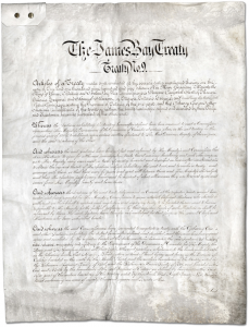
Treaty No. 9
Treaty No. 9, also known at the James Bay Treaty, was signed in two parts, in the summers of 1905 and 1906, between the Cree and Ojibwe First Nations in northern Ontario, the federal government of Canada, and the provincial government of Ontario.
Gallery 6.20 Treaty No. 9 maps
Background
Under John A. Macdonald’s National Policy, Canada saw a surge in European immigration, the development of transcontinental railways, and a manufacturing boom – these developments required First Nations to cede a great deal of their land.
As early as the 1880s, reports of Cree and Ojibwe protests against HBC employees working in the James Bay area surfaced (Leslie, 2016). The First Nations were concerned with both Métis and non-Indigenous trappers on their lands; often outside trappers would “strip mine” an area, leaving First Nations communities to starve (Miller, 2009, p. 208). Chief Sahquakegick (Louis Espagnol) wrote to James Phipps of Indian Affairs in December 1884: “All of my people who used to hunt near here are in great need. The trappers have stolen all our beavers, so there is nothing left for them to hunt and they are too old to go anywhere else … they all join me in asking you to help us” (Miller, 2009, p. 208).
n his response, Phipps noted that only some of those represented by this letter were his responsibility as many lived outside treaty territory and thus were not the concern of Indian Affairs (Morrison, 1986). Chief Sahquakegick’s brother had been a signatory to the Robinson-Huron and Robinson-Superior treaties; now Sahquakegick called for treaty negotiations (Morrison, 1986). Other Nations followed suit as construction on rail lines in the North brought more settlers and geological surveyors (Leslie, 2016).
Ottawa, aware that many leaders understood the treaty process and their rights, cautioned that treaty negotiations should “conclude … before the Indians come into closer contact with white people, as they are apt to be easily influenced to make extravagant demands” (Miller, 2009, p. 209). In April 1904 Wilfrid Laurier received notice that minerals had been discovered in northwestern Ontario on unceded First Nation lands, which acted as a catalyst for moving treaty negotiations forward quickly (Morrison, 1986).
Complicating matters was the fact that the federal government and the provincial government of Ontario had had a conflict over the western boundary of the province. In 1884 the Privy Council had ruled in favour of the provincial government; it took an additional decade to sort out the reserves promised in Treaty No. 3 (Miller, 2009, p. 209). The fallout of this conflict was that the Ontario government now had to be included in any treaty negotiations with First Nations residing within the province’s boundaries (Leslie, 2016).
In order to begin negotiations for Treaty No. 9, the federal government had to agree to four demands from the Province: First, one of three appointed commissioners had to be from Ontario; second, First Nations could not select their own reserve lands (this would be done by the commissioners); third, annuity payments and any related costs were to be the responsibility of the federal government; and finally, no site suitable for hydro power exceeding 500 horsepower was to be located within a reserve boundary (Leslie, 2016). The Province also had veto power; this ultimately took away any power the First Nations had in negotiations (Leslie, 2016).
On July 3, 1905, an Order-in-Council was approved to negotiate Treaty No. 9 (Leslie, 2016). The lead commissioner was Duncan Campbell Scott, who represented the federal government along with Samuel Steward from Indian Affairs (Leslie, 2016). A mining specialist from Perth, Ontario, Daniel G. MacMartin, was chosen as the provincial representative (Leslie, 2016). The commission was to be accompanied by two Royal Canadian Mounted Police (RCMP) officers and a medical doctor (Miller, 2009, p. 210). Many Indigenous communities had been gravely impacted by the introduction of European diseases, compounded by food scarcity and poor trade conditions; the commission may have felt that the presence of RCMP officers and a medical doctor (a profession that rarely visited Indigenous communities) would attest to its integrity and good intentions when meeting with communities (Miller, 2009, p. 211).
Unlike with previous treaties, the commissioners were not given permission to negotiate the terms of the treaty. This treaty was prewritten, and commissioners travelled only to secure signatures. As in past treaties, the First Nations were to cede their lands in exchange for reserve lands of one square mile per family of five or in that proportion; they were to receive provisions, as well as schools, teacher salaries, and resources as deemed necessary by the government (Leslie, 2016). The treaty provided for a single payment of $8 per person for signing, with annuities of $4 per person (Leslie, 2016).
Negotiations
In the summer of 1905 the commissioners travelled to Cree and Ojibwe communities to explain the treaty (in either Cree or Ojibwe dialects) and secure signatures. At Lac Seul, Chief Missabay expressed concerns that his people would be relocated to reserves and prevented from hunting and fishing, but he ultimately signed, trusting the good intentions of the commissioners (Miller, 2009, p. 210). Chief Moonias questioned why the commissioners were giving his people money they had not asked for, but again ultimately signed (Miller, 2009, p. 211). Each time a community signed the treaty, reserve lands were chosen under the watchful eye of MacMartin (Leslie, 2016). Most requests for lands near water, and all for lands near hydro-producing waterways, were denied (Miller, 2009, p. 213).
Gallery 6.21 Some people involved in Treaty No. 9
In September 1905 the commissioners returned to Ottawa, and on November 6, 1905, Scott submitted his report to the superintendent general of Indian Affairs confirming the signatures of chiefs from Osnaburgh, Fort Hope, Marten Falls, English River, Fort Albany, Moose Factory, and New Post (Leslie, 2016). The vast size of the Treaty No. 9 boundaries and the disbursement of the First Nations in the area required the commissioners to make a second trip the following year to secure more signatures.
In the summer of 1906 the commissioner’s secretary, Pelham Edgar, was replaced by T. C. Rae, an English professor from the University of Toronto who was also a friend of Scott’s (Leslie, 2016). The commissioners followed a process similar to the year before: meeting with the chosen representatives in each community, explaining the terms but not negotiating them, securing signatures, and then selecting reserve lands. This process generally ended with a feast. At Fort Abitibi they ran into a complication: First Nations from Quebec had arrived wishing to sign adhesion to the treaty. The commissioners had no authority to work with Nations living on the Quebec side of the border, but said they would convey the request to Ottawa (Long, 2010, p. 84).
Gallery 6.22 Treaty No. 9 negotiations
On October 5, 1906, Scott and the commissioners sent their report to the superintendent general of Indian Affairs confirming the adhesion of First Nations in Abitibi, Matachewan, Mattagami, Flying Post, Chapleau (Ojibwe), Chapleau (Cree), New Brunswick House, and Long Lake (Leslie, 2016). At this time both governments considered the Treaty No. 9 process to be complete.
Adhesions
In the years that followed, any Cree, Algonquin, or Ojibwe–speaking people who wished to sign adhesions to Treaty No. 9 could do so under federal and provincial supervision (Leslie, 2016).
After 1915 Indian Affairs began to receive petitions from those living farther north who were concerned with high food prices, depleted hunting, and new hunting regulations (Leslie, 2016). However, it was not until 1929 that treaty talks would resume. By the end of the summer of 1930, adhesions had been secured that covered 331,500 square kilometres of land north of the original treaty boundary and brought approximately 2000 more First Nations people under the treaty (Leslie, 2016).
Interactive 6.10
Click to read a PDF version of Treaty No. 9
Treaty No. 10
Treaty No. 10 was signed between 1906 and 1907 between the Government of Canada and the First Nations in northern Saskatchewan and Alberta (Tesar, 2016c). While treaties had been signed with First Nations in these provinces before, they had not been signed with people in the northern regions, which were considered “undesirable” because they were unsuitable for agricultural development (Tesar, 2016c).
Gallery 6.23 Treaty No. 10 maps
Background
The lead up to negotiations, the negotiations themselves, and the outcomes of Treaty No. 10 are all contentious. The Crown held the position that unless settlers were interested in the lands, it had no interest in establishing any new treaties (Miller, 2009, p. 198). Furthermore, the government had made it known that it considered any matters of First Nations welfare in unceded areas the responsibility of the HBC and the North West Company (Miller, 2009, p. 198). Some people in Ottawa, however, had started to think that the Crown had a paternalistic responsibility to take care of the “primitive” natives, a belief that would foreshadow assimilation efforts to come (Coates & Morrison, 1986a).
In 1879 First Nations from Lac La Ronge, Pelican Narrows, and Stanley Mission asked for a treaty that would address food scarcity and declining fur prices (Tesar, 2016c). The government, maintaining that this was not its responsibility, denied the request (Tesar, 2016c).
In 1881 a proposed rail line connecting Peace River to Churchill, Manitoba, caused the government to reconsider its position of not negotiating treaties in the area (Tesar, 2016c). Chief Red Head of Lac Du Bonnet wrote to the deputy superintendent general noting that if the land was to be used for railways, the government would need to open negotiations with his people (Coates & Morrison, 1986a). While the government agreed this was the normal process, no negotiations took place, which caused growing concern among the First Nations (Coates & Morrison, 1986a).
In 1883 Ottawa sought to learn more about the First Nations claims in the area. Edgar Dewdney, commissioner of the North-West Territories, who was not sympathetic to First Nations issues, urged the government to negotiate, as he was concerned that the Nations would demand more if they ever became aware of the land’s value (Coates & Morrison, 1986a). Lawrence Clarke of the HBC estimated that the negotiations would cost $16,000 and concurred with Dewdney that they should happen prior to the Nations learning the monetary value of their land.
As plans for the railway withered, so did the Crown’s interest in treaty negotiations, but the superintendent of Indian Affairs reported that First Nations continued to demand a treaty (Coates & Morrison, 1986a).
In 1899, when the commissioners were travelling to gain signatures for Treaty No. 8, there were discussions about travelling through the proposed Treaty No. 10 territories to include those Nations; ultimately this was abandoned as the area was too vast and not rich in gold (Tesar, 2016c).
In 1902 Métis communities at Île-à-la-Crosse in northern Saskatchewan asked James A. J. McKenna, regional scrip commissioner, to deal with their claims (Tesar, 2016c). However, the government had already set a precedence during Treaty No. 8 negotiations of dealing with First Nations and Métis claims simultaneously. Ultimately, it would be a desire to settle with the Métis that would force the government into negotiating with First Nations as well.
Debate continued about whether it was better to have the northern Nations sign adhesions to Treaty No. 8 or if a new treaty covering the distance between Treaty No. 8 and No. 9 should be established (Coates & Morrison, 1986a). Under the direction of Frank Pedley, deputy superintendent of Indian Affairs, it was decided to negotiate a new treaty that would reflect that this region was a lower national priority (Coates & Morrison, 1986a). Following the formal establishment of the province of Saskatchewan, in 1905, it was determined that an agreement covering the northern portion of the province was imperative.
Negotiations
In 1906 McKenna led the commission, along with two secretaries, the superintendent of the NWMP, and Bishop Pascal, a well-known missionary in the North (Tesar, 2016c). McKenna left late in the season in an attempt to minimize time available for negotiations; this tactic was not well received by the First Nations (Miller, 2009, p. 215).
On August 26, 1906, the commissioners arrived at Île-à-la-Crosse to meet with members of the English River First Nation and some families from Clear Lake (Tesar, 2016c). Chief William Apisis of the English River First Nation greeted the commission with a declaration that his people had not invited them but rather the Métis had, and that if they were to negotiate, he wished for his people to be paid arrears for terms not honoured in Treaty No. 6 (Miller, 2009, p. 216).
Chief Apisis also threatened to shut down negotiations if McKenna did not slow down and respect the treaty process, a fact that McKenna never reported to Ottawa (Miller, 2009, p. 218). McKenna did not agree to pay any arrears, although he did agree verbally to provide support to the elderly (Miller, 2009, p. 216). Ultimately, McKenna would get the treaty signed by the parties present without altering the wording (Tesar, 2016c). Following negotiations at Île-à-la-Crosse, the commissioners travelled to Portage La Loche to settle Métis scrips extinguishing title (Tesar, 2016c).
On September 19, 1906, McKenna met with Canoe Lake First Nation back in Île-à-la-Crosse (Tesar, 2016c). Chief John Iron asked for more education in the form of day schools for his people; Chief Apisis had also been worried about education, in particular that the existing form of Catholic schools would be altered by treaty terms (Tesar, 2016c; Coates & Morrison, 1986a). McKenna assured both that they would have access to the education they wished as the government deemed necessary. The assurances worked: three bands, and approximately 394 people, signed Treaty No. 10 that summer (Coates & Morrison, 1986a).
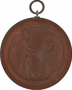
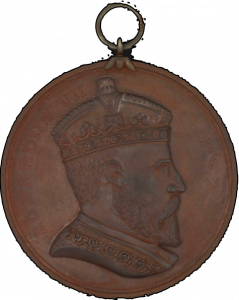
Adhesions
In the summer of 1907 Thomas Borthwick, a local Indian Agent, was sent to conclude negotiations (Tesar, 2016c). A notice was sent out that those wishing to sign adhesion to Treaty No. 10 should meet with Borthwick when he travelled to deliver annuities (Coates & Morrison, 1986a). As McKenna had found, it was difficult terrain to travel; often Borthwick would need to detour to collect adhesions and secure scrip signatures. As a result, he was often late to meetings, which upset many communities (Coates & Morrison, 1986a). Arriving in Lac la Hache 10 days late, First Nations were short on provisions for the negotiations and Borthwick had to borrow provisions from the HBC and the Revillon Brothers, another merchant company (Coates & Morrison, 1986a).
While Borthwick heard grievances from both Chief Apisis and Chief Iron about the speed and process of negotiations the year prior, ultimately he was successful in gaining the adhesions of many more Nations that summer with no changes to the treaty terms (Tesar, 2016c).
Interactive 6.11
Click to read a PDF version of Treaty No. 10
Treaty No. 11
Treaty No. 11 was signed in 1921 between the Government of Canada and the First Nations living in present-day Yukon, Northwest Territories (NWT), and Nunavut – including the Dene, Gwich’in, Tlicho (Dogrib), and Sahtú (Tesar, 2016a). As in the past, Canada had been uninterested in northern treaty negotiations until natural resources were found in the area. The discovery of oil and gas prospects in the Mackenzie region prompted Ottawa to negotiate Treaty No. 11 (Tesar, 2016a).
Gallery 6.24 Treaty No. 11 maps
Background
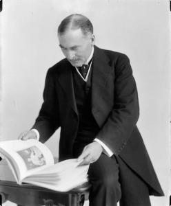
In 1920 H. A. Conroy, who had been instrumental in the Treaty No. 8 negotiations, wrote to Duncan Campbell Scott advocating that the boundaries of Treaty No. 8 be expanded to include the Nations and land that were being discussed for Treaty No. 11 (Tesar, 2016a). Initially his request was denied, but after Norman Wells’s labour strike in the NWT caused an economic scare, the government felt pressure to negotiate for the oil-rich land and Scott changed his mind (Tesar, 2016a).
In the summer of 1921 Conroy led a commission to negotiate Treaty No. 11; Conroy was accompanied by Gabriel Breynat, the “flying bishop,” a Catholic bishop known in the Mackenzie region (Tesar, 2016a). Their party included a doctor and an RCMP accompaniment (Miller, 2009, p. 219).
Prior to leaving, Conroy and Breynat met with the Fisheries Department seeking authority to include a clause in the treaty that would protect First Nations’ fishing rights; they were denied and reminded to make no oral promises (Tesar, 2016a). It became clear that Conroy and Breynat were travelling to secure signatures for a prewritten treaty and to deliver Métis scrips, not to negotiate (Tesar, 2016a).
Negotiations
On June 24, 1921, the commission arrived in Fort Providence for the first stage of negotiations (Tesar, 2016a). The northern Nations in attendance had a very different style of governance than those in the South and were forced by the commissioners to select a single chief to sign on their behalf – they chose Paul Lefoin as he was reportedly generous and a good hunter (Tesar, 2016a). Lefoin did not want to sign the treaty, having heard that the Cree had been forced onto reserves and prevented from hunting; he refused, and it is possible that he never signed (Tesar, 2016a).
Catholic records show that the First Nations in Fort Simpson also refused to sign on July 8, 1921, but by the 11th, all had signed (Tesar, 2016a). It is likely that Breynat played a role in persuading the Nations as Fort Simpson had a large Catholic population (Tesar, 2016a). Korwergen (Johnny Norwegian), who had been selected as a signatory leader, also did not want to sign the treaty, so when he went for lunch, the commissioners had Nakekon (Old Antoine) sign instead (Tesar, 2016a). This highlights some of the significant issues with the process, including how signatories were selected, the pace at which treaties were negotiated, and the understanding communities had around what was signed.
In July 1921 the commission arrived in Fort Wrigley to secure the signature of Chief Julian Yendo; a witness reported that while the people did not understand the process, they trusted Breynat (Tesar, 2016a).
The commission arrived in Fort Norman when two-thirds of the population was away hunting, but they had left a note agreeing to the treaty (Tesar, 2016a). This further suggests that they may not have understood the importance of what was being signed. On July 19 and 24, 1921, signatures were secured in Fort Good Hope and Arctic Red River, respectively (Tesar, 2016a).
In August 1921 Conroy travelled to Fort McPherson without Breynat as the population was predominantly Anglican (Tesar, 2016a). Again, a large portion of the population was away fishing; Conroy was able to convince those who were there that nothing would change and secured the signatures needed (Tesar, 2016a).
By late August the commission arrived in Fort Rae; with a population of over 800, it was the largest settlement in the NWT (Tesar, 2016a). Chief Monfwi of the Tlicho Nation was dismissive of the treaty as other Tlicho communities had signed treaties and reported being unhappy with the outcomes (Tesar, 2016a). Chief Monfwi, in an unprecedented move, outlined the boundaries on a map where his people would live undisrupted; Breynat signed his name to the map agreeing and Treaty No. 11 was signed (Tesar, 2016a). Chief Monfwi kept both documents, but they have since gone missing.
Gallery 6.25 Treaty-signing celebrations
Adhesions
On September 11, 1921, the commissioners arrived back in Edmonton, successful in all stops with the exception of Fort Laird. Thomas William Harris, an Indian Agent, was sent the following year to secure adhesions (Tesar, 2016a). It is likely that the parties who signed in 1922 did not understand what they had agreed to as reports continued to surface 50 years later, questioning the reason for the $5 payments (Tesar, 2016a).
Interactive 6.12
Click to read a PDF version of Treaty No. 11

References
Albers, G. (2015, September 24). Treaties 1 and 2. In The Canadian Encyclopedia. Retrieved from http://www.thecanadianencyclopedia.ca/en/article/treaties-1-and-2/
CBC News Online. (2005, November 17). The treaties: A summary. Retrieved from http://www.cbc.ca/news2/background/aboriginals/treaties_summary.html
Coates, K. S., & Morrison, W. R. (1986a). Treaty Research Report – Treaty No. 10 (1906). Indigenous and Northern Affairs Canada. Retrieved from http://www.aadnc-aandc.gc.ca/eng/1100100028870/1100100028872
Coates, K. S., & Morrison, W. R. (1986b). Treaty Research Report – Treaty No. 11 (1921). Indigenous and Northern Affairs Canada. Retrieved from http://www.aadnc-aandc.gc.ca/eng/1100100028912/1100100028914
Coates, K. S., & Morrison, W. R. (2010, September 15). Treaty Research Report – Treaty Five (1875). Indigenous and Northern Affairs Canada. Retrieved from http://www.aadnc-aandc.gc.ca/eng/1100100028695/1100100028697
Daschuk, J. (2013). Clearing the plains: Disease, politics of starvations, and the loss of Aboriginal life. Regina, SK: University of Regina Press.
Daugherty, W. E. (1986a). Treaty Research Report Treaty One and Treaty Two (1871). Indigenous and Northern Affairs Canada. Retrieved from http://www.aadnc-aandc.gc.ca/eng/1100100028660/1100100028662
Daugherty, W. E. (1986b). Treaty Research Report – Treaty Three (1873). Indigenous and Northern Affairs Canada. Retrieved from http://www.aadnc-aandc.gc.ca/eng/1100100028671/1100100028673
Dempsey, H. A. (1987). Treaty Research Report – Treaty Seven (1877). Indigenous and Northern Affairs Canada. Retrieved from http://www.aadnc-aandc.gc.ca/eng/1100100028789/1100100028791
Filice, M. (2016a, January 11). Treaty 4. In The Canadian Encyclopedia. Retrieved from http://www.thecanadianencyclopedia.ca/en/article/treaty-4/
Filice, M. (2016b, August 17). Treaty 3. In The Canadian Encyclopedia. Retrieved from http://www.thecanadianencyclopedia.ca/en/article/treaty-3/
Filice, M. (2016c, August 24). Treaty 5. In The Canadian Encyclopedia. Retrieved from http://www.thecanadianencyclopedia.ca/en/article/treaty-5/
Filice, M. (2016d, November 10). Treaty 6. In The Canadian Encyclopedia. Retrieved from http://www.thecanadianencyclopedia.ca/en/article/treaty-6/
Leslie, J. F. (2016, June 15). Treaty 9. In The Canadian Encyclopedia. Retrieved from http://www.thecanadianencyclopedia.ca/en/article/treaty-9/
Long, J. (2014). Treaty No. 9: Making the agreement to share the land in Far Northern Ontario in 1905. Montreal: McGill-Queens University Press.
Madill, D. F. (1986). Treaty Research Report – Treaty Eight (1899). Indigenous and Northern Affairs Canada. Retrieved from http://www.aadnc-aandc.gc.ca/eng/1100100028809/1100100028811
Mainville, Sara J. (2007). Manidoo Mazina’igan: An Anishinaabe perspective of Treaty 3. Retrieved from https://search.library.utoronto.ca/details?6262754&uuid=537cd45a-b237-46e9-a122-5f54255b80c6
Miller, J. R. (2009). Compact, contract, covenant: Aboriginal treaty-making in Canada. Toronto, ON: University of Toronto Press.
Morrison, J. (1986). Treaty Research Report – Treaty No. 9 (1905-1906). Indigenous and Northern Affairs Canada. Retrieved from http://www.aadnc-aandc.gc.ca/eng/1100100028859/1100100028861
Ray, A. J., Miller, J. R., & Tough, F. (2008). Bounty and benevolence: A history of Saskatchewan treaties. Montréal: McGill-Queens University Press.
Seymour, J. R. (2016). Manitoo Mazina’igan: An Anishinaabe legal analysis of Treaty No. 3. Retrieved from https://mspace.lib.umanitoba.ca/bitstream/handle/1993/31039/seymour_janine.pdf?sequence=1&isAllowed=y
Talbot, R. J. (2009). Negotiating the numbered treaties: An intellectual & political biography of Alexander Morris. Saskatoon, SK: Purich Publishing Ltd.
Taylor, J. L. (1985a). Treaty Research Report – Treaty Four (1874). Indigenous and Northern Affairs Canada. Retrieved from http://www.aadnc-aandc.gc.ca/eng/1100100028685/1100100028687
Taylor, J. L. (1985b). Treaty Research Report – Treaty Six (1876). Indigenous and Northern Affairs Canada. Retrieved from http://www.aadnc-aandc.gc.ca/eng/1100100028706/1100100028708
Tesar, A. (2016a, April 10). Treaty 11. In The Canadian Encyclopedia. Retrieved from http://www.thecanadianencyclopedia.ca/en/article/treaty-11/
Tesar, A. (2016b, August 19). Treaty 7. In The Canadian Encyclopedia. Retrieved from http://www.thecanadianencyclopedia.ca/en/article/treaty-7/
Tesar, A. (2016c, August 29). Treaty 10. In The Canadian Encyclopedia. Retrieved from http://www.thecanadianencyclopedia.ca/en/article/treaty-10/
Tesar, A. (2016d, August 29). Treaty 8. In The Canadian Encyclopedia. Retrieved from http://www.thecanadianencyclopedia.ca/en/article/treaty-8/
Treaty 8 Tribal Association. (n.d.). Treaty 8 Agreement. Retrieved from http://treaty8.bc.ca/treaty-8-accord/
Media (in order of appearance)
Buell, O. [photographer] (1885). Poundmaker, also known as The Drummer, (ca. 1842-1886), a Cree chief, later adopted by Crowfoot of the Blackfoot Nation. [photograph]. MIKAN 3241485. Library and Archives Canada, Ottawa, ON. Retrieved from http://collectionscanada.gc.ca/ourl/res.php?url_ver=Z39.88-2004&url_tim=2018-06-07T15%3A22%3A06Z&url_ctx_fmt=info%3Aofi%2Ffmt%3Akev%3Amtx%3Actx&rft_dat=3241485&rfr_id=info%3Asid%2Fcollectionscanada.gc.ca%3Apam&lang=eng
Hon. Adams George Archibald, Secretary of State for the Provinces. [photograph]. (1868, April). MIKAN 3214516. Library and Archives Canada, Ottawa, ON. Retrieved from http://collectionscanada.gc.ca/ourl/res.php?url_ver=Z39.88-2004&url_tim=2018-06-07T16%3A08%3A03Z&url_ctx_fmt=info%3Aofi%2Ffmt%3Akev%3Amtx%3Actx&rft_dat=3214516&rfr_id=info%3Asid%2Fcollectionscanada.gc.ca%3Apam&lang=eng
Topley, W.J. [photographer] (1869, July). L’honorable Joseph Howe, secrétaire d’État pour les provinces. [photograph]. MIKAN 5015360. Library and Archives Canada, Ottawa, ON. Retrieved from http://collectionscanada.gc.ca/ourl/res.php?url_ver=Z39.88-2004&url_tim=2018-06-07T16%3A19%3A29Z&url_ctx_fmt=info%3Aofi%2Ffmt%3Akev%3Amtx%3Actx&rft_dat=5015360&rfr_id=info%3Asid%2Fcollectionscanada.gc.ca%3Apam&lang=eng
Topley, W.J. [photographer] (1869, December). Hon. Alexander Morris, (Minister of Inland Revenue) b. Mar. 17, 1826 – d. Oct. 28, 1889. [photograph]. MIKAN 3476623. Library and Archives Canada, Ottawa, ON. Retrieved from http://collectionscanada.gc.ca/ourl/res.php?url_ver=Z39.88-2004&url_tim=2018-06-07T16%3A11%3A51Z&url_ctx_fmt=info%3Aofi%2Ffmt%3Akev%3Amtx%3Actx&rft_dat=3476623&rfr_id=info%3Asid%2Fcollectionscanada.gc.ca%3Apam&lang=eng
Conference with First Nations chiefs during Manitoba Indian Treaty. [illustration]. (1871). Image No. NA-1406-72. Glenbow Archives, Calgary, AB. Retrieved from http://www.glenbow.org/index.cfm
The Manitoba Indian Treaty – Indian Chief Harranguing at the Stone Fort. [leggotype]. (1905). MIKAN 3022506. Library and Archives Canada, Ottawa, ON. Retrieved from http://collectionscanada.gc.ca/ourl/res.php?url_ver=Z39.88-2004&url_tim=2018-06-07T18%3A02%3A47Z&url_ctx_fmt=info%3Aofi%2Ffmt%3Akev%3Amtx%3Actx&rft_dat=3022506&rfr_id=info%3Asid%2Fcollectionscanada.gc.ca%3Apam&lang=eng
Treaty No. 1 Lake Winnipeg. Plan of south-west quarter section 31 of Township No. 16 Range 5E of 1st Meridian small additional reserve for St. Peters’ Band. Surveyed August 1895 by the late J.C. Nelson, D.L.S. [cartographic material]. (1895). MIKAN 4147715. Library and Archives Canada, Ottawa, ON. Retrieved from http://collectionscanada.gc.ca/ourl/res.php?url_ver=Z39.88-2004&url_tim=2018-06-07T18%3A04%3A12Z&url_ctx_fmt=info%3Aofi%2Ffmt%3Akev%3Amtx%3Actx&rft_dat=4147715&rfr_id=info%3Asid%2Fcollectionscanada.gc.ca%3Apam&lang=eng
Simon James Dawson, M.P., (Algoma, Ont.). [photograph]. (1879, April). MIKAN 3215719. Library and Archives Canada, Ottawa, ON. Retrieved from http://collectionscanada.gc.ca/ourl/res.php?url_ver=Z39.88-2004&url_tim=2018-06-07T17%3A08%3A05Z&url_ctx_fmt=info%3Aofi%2Ffmt%3Akev%3Amtx%3Actx&rft_dat=3215719&rfr_id=info%3Asid%2Fcollectionscanada.gc.ca%3Apam&lang=eng
Topley, W.J. [photographer] (1878, March).Hon. Alexander Mackenzie, M.P. (Lambton) [photograph]. MIKAN 3194716. Library and Archives Canada, Ottawa, ON. Retrieved from http://collectionscanada.gc.ca/ourl/res.php?url_ver=Z39.88-2004&url_tim=2018-06-07T16%3A09%3A22Z&url_ctx_fmt=info%3Aofi%2Ffmt%3Akev%3Amtx%3Actx&rft_dat=3194716&rfr_id=info%3Asid%2Fcollectionscanada.gc.ca%3Apam&lang=eng
Robert John Nicholson Pither. [digital image]. (n.d.) Retrieved from http://www.mhs.mb.ca/docs/people/pither_rjn.shtml
Topley, W.J. [photographer] (1902, April). Molyneux St.John. [photograph]. MIKAN 3337438. Library and Archives Canada, Ottawa, ON. Retrieved from http://collectionscanada.gc.ca/ourl/res.php?url_ver=Z39.88-2004&url_tim=2018-06-27T13%3A11%3A31Z&url_ctx_fmt=info%3Aofi%2Ffmt%3Akev%3Amtx%3Actx&rft_dat=3337438&rfr_id=info%3Asid%2Fcollectionscanada.gc.ca%3Apam&lang=eng
Plan shewing the region explored by S.J. Dawson and his party between Fort William, Lake Superior and the Great Saskatchewan River, from 1st of August 1857, to 1st November 1858. Lithographed by J. Ellis, Toronto. [cartographic material]. (1858). MIKAN 4149054. Library and Archives Canada, Ottawa, ON. Retrieved from http://collectionscanada.gc.ca/ourl/res.php?url_ver=Z39.88-2004&url_tim=2018-06-27T18%3A55%3A33Z&url_ctx_fmt=info%3Aofi%2Ffmt%3Akev%3Amtx%3Actx&rft_dat=4149054&rfr_id=info%3Asid%2Fcollectionscanada.gc.ca%3Apam&lang=eng
Indian Reserve No. 17A under Treaty 3 Chief Wah-shis-kinee (Reserve A).. [cartographic material]. (1878). MIKAN 4137286. Library and Archives Canada, Ottawa, ON. Retrieved from http://collectionscanada.gc.ca/ourl/res.php?url_ver=Z39.88-2004&url_tim=2018-06-26T17%3A53%3A53Z&url_ctx_fmt=info%3Aofi%2Ffmt%3Akev%3Amtx%3Actx&rft_dat=4137286&rfr_id=info%3Asid%2Fcollectionscanada.gc.ca%3Apam&lang=eng
Chief Paskwa Pictogram. [digital image]. (1874). Retrieved from https://commons.wikimedia.org/wiki/File:Treaty_4_pictograph_by_Chief_Paskwa.jpg
Rossie, E. [photographer] (c. 1910-19). Ometoway “The Gambler” Saulteaux [photograph].First Nations University of Canada, Regina Library, Regina, SK. Retrieved from http://saskhistoryonline.ca/islandora/object/uregina%3A36531
Chief Paskwa. [photograph]. (n.d.). Retrieved from https://royalalbertamuseum.ca/exhibits/online/southesk/saskatchewanCountry.cfm
Hall, S.P. [artist] (1881, August 13). Chief Cote, at Fort Pelly. [graphic material]. MIKAN 2838947. Library and Archives Canada, Ottawa, ON. Retrieved from http://collectionscanada.gc.ca/ourl/res.php?url_ver=Z39.88-2004&url_tim=2018-06-07T15%3A12%3A00Z&url_ctx_fmt=info%3Aofi%2Ffmt%3Akev%3Amtx%3Actx&rft_dat=2838947&rfr_id=info%3Asid%2Fcollectionscanada.gc.ca%3Apam&lang=eng
Brock, J.A. [photographer] (c. 1880-1900). Chief Pi-a-pot (Piapot) – a Cree chief. [photograph]. MIKAN 3358522. Library and Archives Canada, Ottawa, ON. Retrieved from http://collectionscanada.gc.ca/ourl/res.php?url_ver=Z39.88-2004&url_tim=2018-06-07T15%3A20%3A49Z&url_ctx_fmt=info%3Aofi%2Ffmt%3Akev%3Amtx%3Actx&rft_dat=3358522&rfr_id=info%3Asid%2Fcollectionscanada.gc.ca%3Apam&lang=eng
Rev. John Semmens. [digital image]. (n.d.) Retrieved from http://www.mhs.mb.ca/docs/people/semmens_j.shtml
Topley, W.J. [photographer] (1876, October). L’honorable David Laird, ministre de l’Intérieur [photograph]. MIKAN 5015361. Library and Archives Canada, Ottawa, ON. Retrieved from http://collectionscanada.gc.ca/ourl/res.php?url_ver=Z39.88-2004&url_tim=2018-06-07T16%3A13%3A28Z&url_ctx_fmt=info%3Aofi%2Ffmt%3Akev%3Amtx%3Actx&rft_dat=5015361&rfr_id=info%3Asid%2Fcollectionscanada.gc.ca%3Apam&lang=eng
James McKay. [photograph]. (c. 1860s). Archives of Manitoba, Winnipeg, MB. Retrieved from http://pam.minisisinc.com/scripts/mwimain.dll/144/LISTINGS_IMAGES/LISTINGS_DET_IMAGES/SISN%20121010?sessionsearch
Thickfoot, two other men, a young child and several dogs beside Thickfoot’s tent at mouth of Loon Creek, Manitoba. [photograph]. (n.d.). MIKAN 3367435. Library and Archives Canada, Ottawa, ON. Retrieved from http://collectionscanada.gc.ca/ourl/res.php?url_ver=Z39.88-2004&url_tim=2018-06-07T15%3A33%3A52Z&url_ctx_fmt=info%3Aofi%2Ffmt%3Akev%3Amtx%3Actx&rft_dat=3367435&rfr_id=info%3Asid%2Fcollectionscanada.gc.ca%3Apam&lang=eng
Bell, R. [photographer] (1878). Intérieur du fort de Norway House (situé dans l’actuelle Manitoba). [photograph]. MIKAN 3624883. Library and Archives Canada, Ottawa, ON. Retrieved from http://collectionscanada.gc.ca/ourl/res.php?url_ver=Z39.88-2004&url_tim=2018-06-07T17%3A15%3A45Z&url_ctx_fmt=info%3Aofi%2Ffmt%3Akev%3Amtx%3Actx&rft_dat=3624883&rfr_id=info%3Asid%2Fcollectionscanada.gc.ca%3Apam&lang=eng
Chief Thunderchild in western style clothing. [photograph]. (c. 1925). University of Saskatchewan Libraries Special Collections, Saskatoon, SK. Retrieved from http://digital.scaa.sk.ca/ourlegacy/permalink/24253
Topley, W.J. [photographer] (1886, January). Portrait of a native named Big Bear. [photograph]. MIKAN 3358338. Library and Archives Canada, Ottawa, ON. Retrieved from http://collectionscanada.gc.ca/ourl/res.php?url_ver=Z39.88-2004&url_tim=2018-06-07T15%3A03%3A54Z&url_ctx_fmt=info%3Aofi%2Ffmt%3Akev%3Amtx%3Actx&rft_dat=3358338&rfr_id=info%3Asid%2Fcollectionscanada.gc.ca%3Apam&lang=eng
Baltzly, B. [photographer] (1871, October 14).
Geological Survey of Canada Party to British Columbia. Alfred Selwyn seated at centre, John Hammond on his right and Benjamin Baltzly on his left/Équipe de la Commission géologique du Canada en excursion. Alfred Selwyn, John Hammond et Benjamin Baltzly [photograph]. MIKAN 3192721. Library and Archives Canada, Ottawa, ON. Retrieved from http://collectionscanada.gc.ca/ourl/res.php?url_ver=Z39.88-2004&url_tim=2018-06-27T18%3A58%3A03Z&url_ctx_fmt=info%3Aofi%2Ffmt%3Akev%3Amtx%3Actx&rft_dat=3192721&rfr_id=info%3Asid%2Fcollectionscanada.gc.ca%3Apam&lang=eng
Lawrence Clarke. [photograph]. (n.d.). Retrieved from http://canadaehx.blogspot.com/2014/03/lawrence-clark-instigator-of-northwest.html
Gentleman Joe McKay and Mistawasis sitting [photograph]. (c. 1885). Prince Albert Historical Society, Prince Albert, SK. Retrieved from http://digital.scaa.sk.ca/ourlegacy/permalink/28859
Portrait of Peter Erasmus. [photograph]. (c. 1864). University of Saskatchewan Archives, Saskatoon, SK. Retrieved from http://digital.scaa.sk.ca/ourlegacy/permalink/32237
The Great Beardy Making a Speech [graphic material]. (188?). Prince Albert Historical Society, Prince Albert, SK. Retrieved from http://sain.scaa.sk.ca/items/great-beardy-making-speech
Metis Land Scrip. [digital image]. (1905). Retrieved from https://commons.wikimedia.org/wiki/File:Metis_land_scrip_005005-e010836018-v8.jpg
Image of four Aboriginal male chiefs and an non-Aboriginal man posing for the camera. [photograph]. (c. 1885). Prince Albert Historical Society, Prince Albert, SK. Retrieved from http://digital.scaa.sk.ca/ourlegacy/permalink/30143
Old Generation, File Hills Indian Agency. [photograph]. (1914). University of Saskatchewan, University Archives & Special Collections, Saskatoon, SK. Retrieved from http://scaa.sk.ca/ourlegacy/permalink/23880
Peters, J. [photographer] (1885). “Pow-wow with Beardy” [photograph]. MIKAN 3246026. Library and Archives Canada, Ottawa, ON. Retrieved from http://collectionscanada.gc.ca/ourl/res.php?url_ver=Z39.88-2004&url_tim=2018-06-07T14%3A59%3A25Z&url_ctx_fmt=info%3Aofi%2Ffmt%3Akev%3Amtx%3Actx&rft_dat=3246026&rfr_id=info%3Asid%2Fcollectionscanada.gc.ca%3Apam&lang=eng
A photograph of a group of Aboriginal men in ceremonial clothing celebrating 50 years of peace since 1885. [photograph]. (1935). Saskatoon Public Library Local History Room, Saskatoon, SK. Retrieved from http://digital.scaa.sk.ca/ourlegacy/permalink/28394
Topley, W.J. [photographer] (1876, July).McLeoud Col. (McLeod) . [photograph]. MIKAN 3434690. Library and Archives Canada, Ottawa, ON. Retrieved from http://collectionscanada.gc.ca/ourl/res.php?url_ver=Z39.88-2004&url_tim=2018-06-27T13%3A23%3A23Z&url_ctx_fmt=info%3Aofi%2Ffmt%3Akev%3Amtx%3Actx&rft_dat=3434690&rfr_id=info%3Asid%2Fcollectionscanada.gc.ca%3Apam&lang=eng
Portraits de Crowfoot, de sa femme crie Old Woman, du chef Rabbit Carrier et du chef Bobtail. [photograph]. (1891, April). MIKAN 3629853. Library and Archives Canada, Ottawa, ON. Retrieved from http://collectionscanada.gc.ca/ourl/res.php?url_ver=Z39.88-2004&url_tim=2018-06-07T15%3A13%3A38Z&url_ctx_fmt=info%3Aofi%2Ffmt%3Akev%3Amtx%3Actx&rft_dat=3629853&rfr_id=info%3Asid%2Fcollectionscanada.gc.ca%3Apam&lang=eng
Barry, D.F. [photographer] (1883).Chief Sitting Bull [photograph]. Retrieved from https://commons.wikimedia.org/wiki/File:Chief_Sitting_Bull.jpg
Treaty commission. 1899y. [photograph]. (1899). Image No.NA-949-87. Glenbow Archives, Calgary, AB. Retrieved from http://www.glenbow.org/index.cfm
Lacombe, Albert, with Native Leaders [photograph]. (1886). Retrieved from https://www.thecanadianencyclopedia.ca/en/article/albert-lacombe/
Marcel, M.B. [photographer] (c. 1913). Le père Albert Lacombe. [photograph]. MIKAN 3623426. Library and Archives Canada, Ottawa, ON. Retrieved from http://collectionscanada.gc.ca/ourl/res.php?url_ver=Z39.88-2004&url_tim=2018-06-07T15%3A49%3A40Z&url_ctx_fmt=info%3Aofi%2Ffmt%3Akev%3Amtx%3Actx&rft_dat=3623426&rfr_id=info%3Asid%2Fcollectionscanada.gc.ca%3Apam&lang=eng
James Bay Treaty [digital image]. (1905). Archives of Ontario, Toronto, ON. Retrieved from https://commons.wikimedia.org/wiki/File:James_Bay_Treaty.jpg
Karsh, Y. [photographer] (1933, Sept. 16). Monsieur Duncan Campbell Scott. [photograph]. MIKAN 3628521. Library and Archives Canada, Ottawa, ON. Retrieved from http://collectionscanada.gc.ca/ourl/res.php?url_ver=Z39.88-2004&url_tim=2018-06-07T15%3A46%3A11Z&url_ctx_fmt=info%3Aofi%2Ffmt%3Akev%3Amtx%3Actx&rft_dat=3628521&rfr_id=info%3Asid%2Fcollectionscanada.gc.ca%3Apam&lang=eng
(Treaty 9) John Wesley and his wife, interpreter during Treaty Negotiations with Indians at Windigo and Deer Lake, Ont. [photograph]. (1930). MIKAN 3366815. Library and Archives Canada, Ottawa, ON. Retrieved from http://collectionscanada.gc.ca/ourl/res.php?url_ver=Z39.88-2004&url_tim=2018-06-07T17%3A46%3A18Z&url_ctx_fmt=info%3Aofi%2Ffmt%3Akev%3Amtx%3Actx&rft_dat=3366815&rfr_id=info%3Asid%2Fcollectionscanada.gc.ca%3Apam&lang=eng
[Treaty 9] Commissioners Stewart and McMartin and party. [photograph]. (July 25, 1906). MIKAN 3193333. Library and Archives Canada, Ottawa, ON. Retrieved from http://central.bac-lac.gc.ca/.redirect?app=fonandcol&id=3193333&lang=eng
Chief Louis Espangnol [Sahquakegick], Chief of the Eshkemanetigon (Spanish River Band), Treaty 9, Biscotasing, Ontario [photograph]. (July 25, 1906). MIKAN 3358386. Library and Archives Canada, Ottawa, ON. Retrieved from http://central.bac-lac.gc.ca/.redirect?app=fonandcol&id=3358386&lang=eng
Scott, D.C. [photographer] (1906, July). Chief Michel Batise Fort Matachewan, Ont. [photograph]. MIKAN 3366790. Library and Archives Canada, Ottawa, ON. Retrieved from http://collectionscanada.gc.ca/ourl/res.php?url_ver=Z39.88-2004&url_tim=2018-06-07T15%3A15%3A05Z&url_ctx_fmt=info%3Aofi%2Ffmt%3Akev%3Amtx%3Actx&rft_dat=3366790&rfr_id=info%3Asid%2Fcollectionscanada.gc.ca%3Apam&lang=eng
Scott, D.C. [photographer] (1906). Artist Edmund Morris painting model Chief Chessequim. [photograph]. MIKAN 3191846. Library and Archives Canada, Ottawa, ON. Retrieved from http://collectionscanada.gc.ca/ourl/res.php?url_ver=Z39.88-2004&url_tim=2018-06-07T15%3A09%3A42Z&url_ctx_fmt=info%3Aofi%2Ffmt%3Akev%3Amtx%3Actx&rft_dat=3191846&rfr_id=info%3Asid%2Fcollectionscanada.gc.ca%3Apam&lang=eng
Government officials and Indians who signed Treaty 9. L. to r. (seated): K. Bayly, interpreter, and Commissioners Walter C. Cain and H.N. Awrey; (standing): Dr. Bell, Mrs. Garret and Rev. Garret and the Indians. [photograph]. (June 1929). MIKAN 3191763. Library and Archives Canada, Ottawa, ON. Retrieved fromhttp://collectionscanada.gc.ca/ourl/res.php?url_ver=Z39.88-2004&url_tim=2018-06-27T19%3A34%3A55Z&url_ctx_fmt=info%3Aofi%2Ffmt%3Akev%3Amtx%3Actx&rft_dat=3191763&rfr_id=info%3Asid%2Fcollectionscanada.gc.ca%3Apam&lang=eng
Scott, D.C. [photographer] (1906, July 25). Women and children [of Brunswick House First Nation] at the feast during Treaty 9 payment ceremony at [the Hudson’s Bay Company Post called] New Brunswick House, Ontario. [photograph]. MIKAN 3193401. Library and Archives Canada, Ottawa, ON. Retrieved from http://collectionscanada.gc.ca/ourl/res.php?url_ver=Z39.88-2004&url_tim=2018-06-07T17%3A52%3A55Z&url_ctx_fmt=info%3Aofi%2Ffmt%3Akev%3Amtx%3Actx&rft_dat=3193401&rfr_id=info%3Asid%2Fcollectionscanada.gc.ca%3Apam&lang=eng
Chief Samson Beardy standing and Commissionners Cain and Awrey seated at the table during the negociations of Treaty 9 payments. From left to right, front row: Simeon and Jeremiah McKay, Isaac Barkman. At the left of Chief Samson, Johnny Anderson. [photograph]. (1929, July). MIKAN 3192265. Library and Archives Canada, Ottawa, ON. Retrieved from http://collectionscanada.gc.ca/ourl/res.php?url_ver=Z39.88-2004&url_tim=2018-06-07T15%3A23%3A46Z&url_ctx_fmt=info%3Aofi%2Ffmt%3Akev%3Amtx%3Actx&rft_dat=3192265&rfr_id=info%3Asid%2Fcollectionscanada.gc.ca%3Apam&lang=eng
Topley, W.J. [photographer] (n.d.). Pedley, Frank Mr. [photograph]. MIKAN 3412164. Library and Archives Canada, Ottawa, ON. Retrieved from http://collectionscanada.gc.ca/ourl/res.php?url_ver=Z39.88-2004&url_tim=2018-06-07T15%3A51%3A19Z&url_ctx_fmt=info%3Aofi%2Ffmt%3Akev%3Amtx%3Actx&rft_dat=3412164&rfr_id=info%3Asid%2Fcollectionscanada.gc.ca%3Apam&lang=eng
Indian Chiefs Medal, Sub-Chief Medal, presented to commemorate Treaty No. 10 (King Edward VII). (1906-07). MIKAN 2851158. Library and Archives Canada, Ottawa, ON. Retrieved from http://collectionscanada.gc.ca/ourl/res.php?url_ver=Z39.88-2004&url_tim=2018-06-27T18%3A43%3A33Z&url_ctx_fmt=info%3Aofi%2Ffmt%3Akev%3Amtx%3Actx&rft_dat=2851158&rfr_id=info%3Asid%2Fcollectionscanada.gc.ca%3Apam&lang=eng
Hon. James Alexander Lougheed, Minister without portfolio. [photograph]. (1912). MIKAN 3218458. Library and Archives Canada, Ottawa, ON. Retrieved from http://collectionscanada.gc.ca/ourl/res.php?url_ver=Z39.88-2004&url_tim=2018-06-07T16%3A14%3A58Z&url_ctx_fmt=info%3Aofi%2Ffmt%3Akev%3Amtx%3Actx&rft_dat=3218458&rfr_id=info%3Asid%2Fcollectionscanada.gc.ca%3Apam&lang=eng
Indian Commissioner Conroy making treaty at Providence, N.W.T. (Treaty 11) [photograph]. (1921). Canada. Dept. of Interior / Library and Archives Canada / PA-048473. MIKAN 3367521. Library and Archives Canada, Ottawa, ON. Retrieved from http://collectionscanada.gc.ca/ourl/res.php?url_ver=Z39.88-2004&url_tim=2018-06-27T19%3A45%3A15Z&url_ctx_fmt=info%3Aofi%2Ffmt%3Akev%3Amtx%3Actx&rft_dat=3367521&rfr_id=info%3Asid%2Fcollectionscanada.gc.ca%3Apam&lang=eng
Keefer, C.A. [photographer] (1937).View of the treaty dance. [photograph]. MIKAN 3210527. Library and Archives Canada, Ottawa, ON. Retrieved from http://collectionscanada.gc.ca/ourl/res.php?url_ver=Z39.88-2004&url_tim=2018-06-27T19%3A51%3A20Z&url_ctx_fmt=info%3Aofi%2Ffmt%3Akev%3Amtx%3Actx&rft_dat=3210527&rfr_id=info%3Asid%2Fcollectionscanada.gc.ca%3Apam&lang=eng
Keefer, C.A. [photographer] (1937). “View of the dance, it’s after dawn but they’re still going strong”. Dogrib First Nation Treaty Dance. [photograph]. MIKAN 3191830. Library and Archives Canada, Ottawa, ON. Retrieved from http://collectionscanada.gc.ca/ourl/res.php?url_ver=Z39.88-2004&url_tim=2018-06-27T19%3A52%3A40Z&url_ctx_fmt=info%3Aofi%2Ffmt%3Akev%3Amtx%3Actx&rft_dat=3191830&rfr_id=info%3Asid%2Fcollectionscanada.gc.ca%3Apam&lang=eng
Keefer, C.A. [photographer] (1937). After the treaty dance. [photograph]. MIKAN 3210513. Library and Archives Canada, Ottawa, ON. Retrieved from http://collectionscanada.gc.ca/ourl/res.php?url_ver=Z39.88-2004&url_tim=2018-06-27T19%3A54%3A42Z&url_ctx_fmt=info%3Aofi%2Ffmt%3Akev%3Amtx%3Actx&rft_dat=3210513&rfr_id=info%3Asid%2Fcollectionscanada.gc.ca%3Apam&lang=eng
