4 The Catalogue of the Ships in the Iliad
The Catalogue of the Ships (Il. 2. 494-760) lists the contingents of the Achaean army mustered for the expedition against Troy. It identifies the leaders and their followers, and the districts and places from which they come, and gives the numbers of the ships in each contingent.
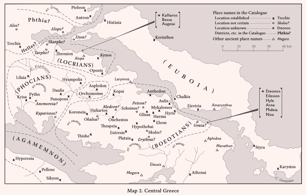
The districts and places are discussed in this chapter in the order of the territorial divisions in the Catalogue. The names are written here in transliterated form, followed by selected references to relevant modern works, usually excavation and/or survey reports and commentaries. References to ancient sources (e.g. Strabo and Pausanias) are normally included in the discussions below. Short summaries are given at the end of each division; more general questions are considered in the Commentary at the end of the Chapter.
REFERENCES
References to articles in periodicals are usually abbreviated, without titles and names of authors.
Special Abbreviations:
CSHI = Hope Simpson, R., and J.F. Lazenby. 1970. The Catalogue of the Ships in Homer’s Iliad (Oxford: Clarendon Press).
GAC = Hope Simpson, R., and O.T.P.K. Dickinson. 1979. A Gazetteer of Aegean Civilization in the Bronze Age, Vol I: The Mainland and Islands, SIMA 52 (Göteborg: Åström).
MG = Hope Simpson, R. 1981. Mycenaean Greece (Park Ridge, NJ: Noyes Press).
MFHDC = Hope Simpson, R., and D.K. Hagel. 2006. Mycenaean Fortifications, Highways, Dams and Canals, SIMA 53 (Sävedalen: Åström).
For material published before 1978, most references were given in GAC and MG, and are not all repeated here. In several cases also there is no need for major additions to the comments and references in CSHI.
This discussion of the Catalogue is not intended as a replacement of CSHI, and should be read in conjunction with CSHI. In cases where important new evidence must be considered, the commentary is more detailed. For some well known sites, such as Mycenae, Tiryns and Athens, only brief further notes and bibliography are given. It has not, however, been possible for the author to guarantee full coverage of all the relevant more recent discoveries and commentaries. A comprehensive treatment of the literary and philological questions involved is given by E. Visser, Homers Katalog der Schiffe (Stuttgart and Leipzig: Teubner, 1997). His very useful bibliography includes a list of all the ancient sources. Visser discusses all the districts and places in the Catalogue, but does not provide a systematic commentary on the archaeological and topographical evidence.
THE ANCIENT SOURCES
Much of the evidence for the locations of the Homeric names is derived from the commentaries of Strabo and Pausanias. Their journeys were subject to the many difficulties of travel in the Greece of their times. Built roads were few even in the Roman period. It is often obvious that Strabo and Pausanias did not actually visit the place they discuss. On many occasions they rely only on local information (and local speculation) and/or on the accounts and conjectures of other antiquarians, most of whom had themselves never seen the sites. Some sites were more accessible by sea than by land; and even these were not always visited by Strabo or Pausanias, but passed by in the course of their voyages (e.g. Anthedon in Boeotia and Helos in Laconia, discussed below).
THE POLITICAL DIVISIONS IN THE CATALOGUE
The districts and places in the Catalogue are listed under Kingdoms and their leaders. In many cases the districts roughly correspond to the later historic divisions (e.g. for the Boeotians, Phoeians and Aetolians). But several important historical centres do not appear in the Catalogue (e.g. Megara, Phlious, Chaeronea, Pharsalos and Larisa). Some of the political divisions, however, seem strange and inexplicable (CSHI, 156), and the numbers of places in some contingents seem peculiar. The Boeotians have 29 place names, whereas the Minyans of Orchomenos have only 2, and Attica is represented by Athens alone. The most frequently cited case is the division of northeast Peloponnese between Agamemnon and Diomedes. These anomalies have added much ammunition to the arsenals of the sceptics (e.g. Dickinson 2007, 235-237). But such inconsistencies are to be expected in oral poetry, and in some cases may be explained as due to the process whereby Homer incorporates the traditional Catalogue into his own Iliad.
THE ORDER OF THE CATALOGUE
The List naturally begins with the Boeotians, followed with the rest of Central Greece in a logical order, ending with Salamis. There is then an abrupt ‘leap’, directly to the Kingdom of Diomedes, and bypassing that of Agamemnon. The order which follows for the rest of the Peloponnese is logical, as is the succession to the Ionian Islands and Aetolia. After this a modern audience, accustomed to maps, might expect the Thessalian Kingdoms. But in the ancient world Mt. Pindus would have been a formidable barrier between Aetolia and Thessaly. Instead, Crete and the Dodecanese follow after Aetolia. And there may have been a former separate traditional list of the Thessalian Kingdoms, in connection with the Legends of the Lapiths and Centaurs and/or of Iolkos and the Argonauts (cf. West 1988, 160-161).
THE ORDER OF THE PLACE NAMES (in Each Division)
There is often no indication in the Catalogue of the identity of a main centre or ‘capital’ of a particular contingent. Apart from those which have only one place name, such as Athens and Salamis, only in the cases of Mycenae, Pylos and Knossos are these obvious ‘capitals’ listed first. In some cases the reason is the constraint inherent in the meter of the hexameter lines, as for the placement of Aspledon before Orchomenos in the Minyan section and of Iaolkos last in the Kingdom of Eumelos. But this does not explain, for instance, the placement of Pharis before Sparte in the Kingdom of Menelaus or the listing of Hypothebai in the 24th position among the 29 Boeotian place names. No conclusions can be drawn from the order of the names in such cases; meticulous consistency is not to be expected in an epic poem.
THE BOEOTIANS
Aulis (Il. 2. 496)
- Sanctuary of Artemis: LH (III?) G A C H R M
Frazer 1898, v. 72-73; Allen 1921, 46-51; Excavations by Threpsiadis in Ergon, PAE, BCH and AR for the years 1955 to 1961; Bakhuizen 1970, 96-100, 152-156; Schoder 1974, 42-45; Fossey 1986, 68-74 with map, fig. 7; MFHDC, 86-87.
- Mycenaean remains in the vicinity of the Temple of Artemis:
PAE 1959, 32-33; Ergon for 1959, 30-31; AR for 1959-1960, 13; GAC, 223-224 (F 65); MG, 53 (B 53); MFHDC, 86-87.
- Mycenaean tombs at Mikro Vathy: LH IIB-IIIB
PAE 1956, 95, 101; Ergon for 1956, 37; Alin 1962, 120; GAC, 224 (F 66); MG, 53 (B 54).
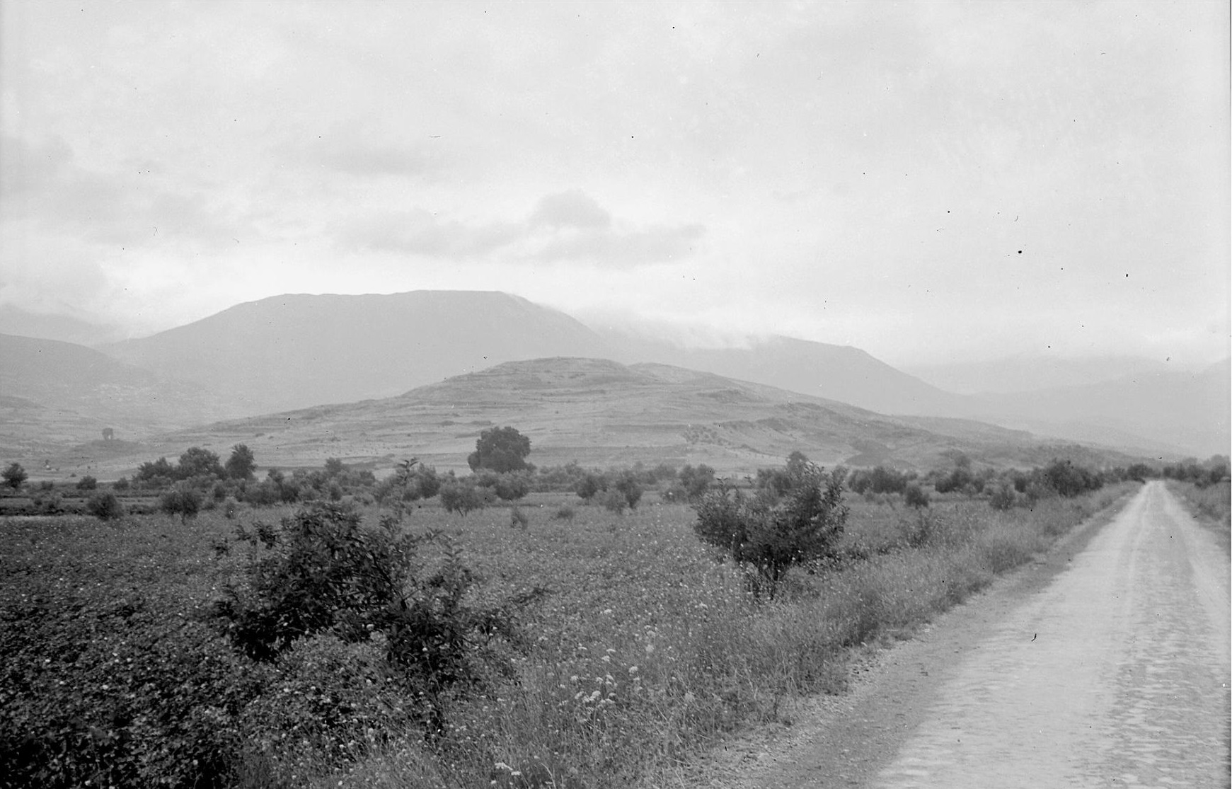
- Vlicha (alias Glypha or Tseloneri): EH I-II MH LH IIIA-IIIC G C (Plate 9A, the wooded hill beyond the viaduct)
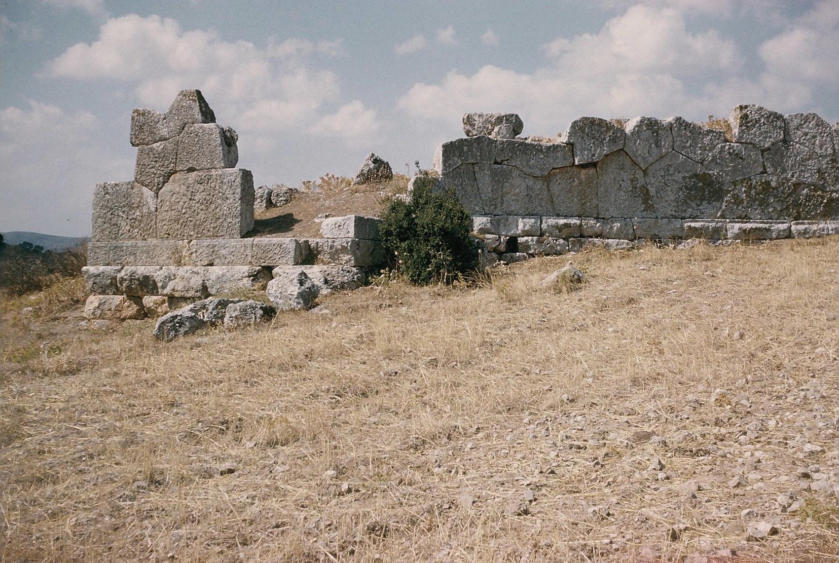
BSA 61 (1966), fig. 10 on p. 58 (sketch map of Chalkis area); AEM 6 (1959), 282, 309, 311, 313; Bakhuizen 1970, 16-17; AD 32 (1977) B, 90-100; GAC, 224 (F 67); MG, 53 (B 55); Mountjoy 1983, 103, 105; AD 42 (1987) B, 213; Fossey 1988, 75-76; AR 32 (1985-1986), 40; AAA 20 (1987), 191-210; Sampson 1999; MFHDC, 87; Crielaard 2006, 278 with n. 25.
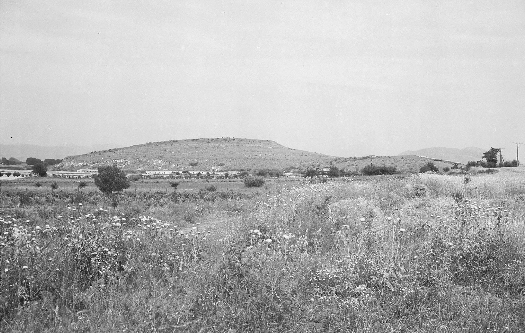
Plate 9A. Chalkis: Vlicha from South.
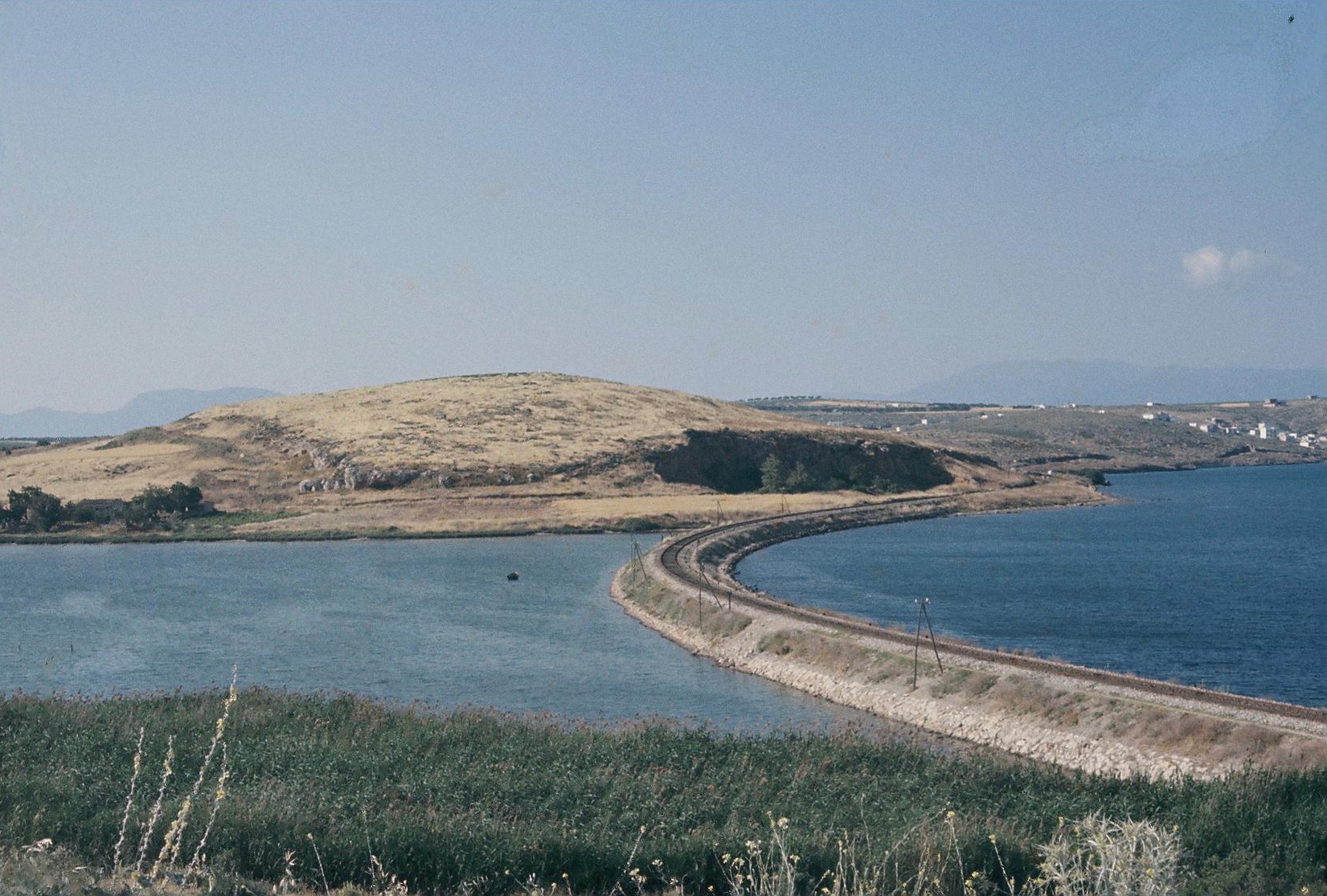
Plate 40A. Chalkis: Vlicha from South.
The Boeotian division, with its 29 place names, is by far the longest in the Catalogue. The names cover most of the territory of the historical Boeotia. Often the Location of one name depends partly on that of another. Such a case is that of Aulis and Hyrie. Since Hyrie was said to be near Aulis both by Strabo and by Stephanus of Byzantium (Strabo 9.2.12 and Steph. Byz. s.v. (ϒϱία), its location is linked with that of Aulis. For this reason, Aulis will be discussed first here (it was only for metrical reasons that Hyrie was placed before Aulis in the line, Il. 2. 496).
Aulis was, of course, prominent in the tradition as the place where the Achaean fleet was said to have been assembled (it was also used later by several fleets in the historic period, cf. Allen loc. cit.). The ships of the Achaean fleet, as listed in the Iliad, would have needed a considerable amount of shore with suitable beaches. The total number of ships, 1186, is obviously the product of poetic exaggeration; but the tradition implies a large extent of appropriate shore in a central location. The shores of the northern bay of Vourko (cf. Fossey 1986, fig. 7 on p. 69), to southwest of the Euripos channel, could have provided perhaps up to 4 km of the beaches required. The bay was probably one of the main harbours of ancient Thebes. It would have been conspicuous and well known; it may indeed have itself suggested the mustering of the ships at Aulis. In contrast, the southern bays of Mikro Vathy and Megalo Vathy, in the vicinity of the historic Aulis and its Temple of Artemis, could only provide at most 2 km of beaches. The bays were separated by the barren limestone promontory of Nisi (alias Yeladovouni or Vesalas, well shown in the air photographs in Schoder 1974, 44 and 91). In Strabo’s time, Aulis, ‘a village of the Tanagraeans’, was located in the valley west of Nisi, between the two bays. Its centre was the Temple of Artemis, near Ayia Paraskevi, as has been established by Threpsiadis’ excavations (cf. the air photography in Schoder 1974, 42). In deference to Homer, remains were kept in the Temple of wood said to be the remains of the plane-tree mentioned in the Iliad (Il. 2. 307); and the spring near which the plane-tree grew was also shown (Pausanias 9.19.6-7).
Strabo calculated that the smaller bay (i.e. Mikro Vathy could only hold 50 ships; he inferred that most of the Achaean fleet must have been beached at the ‘large harbour’, i.e. around the Megalo Vathy bay (Strabo 9.2.8). If Strabo had taken his mathematical calculations to their logical conclusion, he would have realized that even the ‘large harbour’ (Megalo Vathy) would not have sufficed. For 1186 ships, and assuming that all were about 4 metres in width and set about 3 metres apart, over 8 km of shore would have been required, amounting to even more than the total capacity of the bay of Vourko and the Vathy bays combined.
The Mycenaean finds in the vicinity of the historic Aulis do not suggest a major Mycenaean settlement here. LH IIB-IIIB pottery and some weapons were recovered from tombs destroyed during the construction of the cement works on the north side of Mikro Vathy bay (GAC F66 = MG B54; cf. Alin 1962, 120); and traces of Mycenaean settlement were noted nearby, not far to the south of the bay and about 50 m north of the chapel of Ayia Paraskevi (GAC F65 = MG B53). But the “long walls built with large stones” (translation of description in Ergon for 1959, 30-31, cf. PAE 1959, 32 and pl. 32), at the west foot of the Nisi ridge, are of uncertain date (cf. MFHDC, 86-87).
The excavations at Vlicha (alias Glypha or Tseloneri) have now demonstrated the importance of this Mycenaean settlement, which lies at the centre of the west side of the northern bay of Vourko (cf. the plans in BSA 61, loc. cit. and AAA 20, loc. cit.). The site overlooks the bay and the small but fertile plain to the southwest. The settlement was at least 200 m by 120 m in extent. The Mycenaean pottery is of fine quality, including LH IIB-IIIA1 vases from a floor deposit. The most important phase was evidently LH IIIA2 to LH IIIB1, ending with a destruction, probably by an earthquake (Sampson 1999), after which at least one part of the site was abandoned. A stretch of Cyclopean wall on the southwest side was 2.20 m to 3.00 m thick, and preserved to a height of c. 1.50 m (AAA, loc. cit. with ill. 5-6, cf. AD 42, loc. cit., pl. 123c; MFHDC, 87). LH IIIB sherds were found on both sides of the wall, including parts of large storage vessels and abundant fragments of kylikes and skyphoi. The excavators themselves have suggested that Vlicha may be the Homeric Aulis. It may indeed have been the most important Mycenaean settlement in the district. It is, however, not possible to disregard the location of the Artemis temple and the traditions associated with it. Perhaps we should understand Aulis as the name both of a centre and of a district, the latter comprising an extensive coastal area.
Hyrie (Il. 2. 496)
Dramesi: Pyrgos: N EH I-III MH LH I-IIIC C R (Plate 9B)
PAE 1911, 142; AD 1 (1915), parart. 55-56; JHS 64 (1944-45), 90; C.W. Blegen, “Hyria”, Hesperia Suppl. 8 (1949), 39-42; AE 1956 parart. 26-27; Alin 1962, 120; AD 20 (1965) B, 242; AD 26 (1971), 217-218; AD 28-29 (1973-74) B, 446; CSHI 19; Fossey 1970; Vermeule 1972, 258-259, figs. 43 b-c; GAC, 223 (F 64); MG, 53 (B 51); Mountjoy 1983, 58-61, 105; Fossey 1988, 66-68; MFHDC, 85-86; Crielaard 2006, 280-281 with n. 30, fig. 14. 2 (a).
Plate 9B. Dramesi (? Hyrie) from South.
Strabo tells us that Hyrie was near Aulis and that it had formerly been in the territory of Thebes but in his time was in that of Tanagra. Blegen identified Hyrie with the large site of Pyrgos on the low hill above the northwest edge of the village of Dramesi (now Paralia Avlidhos), near the coast and adjoining the extensive Vathy plain. Pyrgos (also named Ayia Paraskevi, after the chapel on its south slope) was a prehistoric “high mound” site, with an upper surface of c. 250 m northeast to southwest by c. 90 m (cf. the sketch plan, Fossey 1970 fig. 2). It was occupied from the late Neolithic period to near the end of the Bronze Age, as was established by the small trial excavation by Papadakis (PAE loc. cit. and AD 1 loc. cit.). Mycenaean pottery of fine quality includes LH I-II from tombs and numerous LH II-IIIC sherds from the surface (Mountjoy loc. cit.). On the south slope there are signs of Mycenaean tombs (AD 20 loc. cit.), and a LH IIIB cemetery, mainly of chamber tombs, was discovered on a low hill c. 1 km to north of the site (AD 26 loc. cit. and AD 28-29 loc. cit., cf. Fossey 1988, 67 n. 89).
A remarkable four-sided stone stele was recovered from illicit excavations on the Pyrgos hill. It is decorated on three of its sides with incised representations of ships. Blegen described and photographed the stele (Hesperia loc. cit. cf. Fossey 1970 pl. 5). He attributed the stele to the Mycenaean period on the basis of the similarity of the design (on the best preserved side) to that on a sherd from tholos tomb No. 1 at Tragana in Messenia (GAC, 132-133 D11; MG, 116 F 6; Vermeule 1972 fig. 43 (b), after AE 1914, 198), especially “the transverse lines to decorate the hull”. The Tragana sherd is assigned to LH IIIC, and Crielaard considers that the ships on the Dramesi stele are also “of late Mycenaean type”. (Crielaard loc. cit., esp. fig. 14.2).
Fossey believed that the Dramesi site was the Homeric Graia, whose exact location was not known in the historic period. The consensus of the ancient testimonia, however, appears to indicate that Graia was near Oropos (see below on Graia). Since Fossey decided to advocate the equation of Graia with Dramesi, he was forced to look elsewhere for Hyrie. His arguments for Chalkis: Vlicha (or Tseloneri) as Hyrie are tenuous (Fossey 1988, 75-76). Nevertheless, his painstaking fieldwork (Fossey 1970 and 1988, 66-68) has further demonstrated the importance of the Dramesi site, probably one of the harbour towns of Mycenaean Thebes.
Schoinos (Il. 2. 497)
CSHI, 21; AD 26 (1971) B, 223; Fossey 1988, 229-232 and figs. 25-27.
A place named Schoinos was certainly in existence in historic times (Oxyrhynchus Papyri v. 174-5, No. 842, col. xiii, line 26); and Strabo says that it was 50 stades from Thebes along the road from Thebes to Anthedon, and that a river Schoinos flowed through it (Strabo 9.2.22). Fossey (loc. cit.) presents a good argument for identifying Schoinos as the site of Ayios Ilias, a small acropolis with walling which includes polygonal (Classical or Hellenistic), to northeast of, and above, the village of Mouriki. Plentiful remains of ancient walls, painted tiles and black-glazed pottery cover the slopes between the acropolis. There are many plundered tombs to south of the village, with Archaic, Classical and Hellenistic pottery (AD loc. cit.). But no diagnostic sherds have yet been found on the acropolis. Burr accepted the conjecture that Ayios Ilias was the Homeric Peteon (Burr 1944, 23, cf. CSHI, 25); but the identification with Schoinos is more in accord with Strabo’s 50 stades. Whether it is the Homeric Schoinos remains a question, since nothing earlier than Archaic has yet been found here. And Strabo’s 50 stades may be from hearsay; he may never have taken the road to Anthedon.
Skolos (Il. 2. 497)
Frazer 1898, v. 21-22; AJA 61 (1957), 9-28; Pritchett 1965, 103-109; CSHI, 21; Fossey 1988, 101-126 with map, fig. 12; Lazenby 1993, 217-222 with map 9.
- The Soros and Neochoraki: G A C H R
AM 1878, 388-397; Pritchett 1965, 107-108, Fossey 1988, 119-123.
- Kallithea (formerly Moustaphadhes): Pyrgari: LH IIB-IIIB H
GAC, 247 (G 26); MG, 73-74 (C 35); Fossey 1988, 122.
The question of the location of Skolos is closely connected with that of the locations of Hysiai and Erythrai. In the ancient sources Erythrai is often coupled with Hysiai, as by Strabo, who says that Hysiai was in the Parasopia, below Mt. Kithairon and near Erythrai (Strabo 9.2.12). Pausanias gives only slightly better general directions: “within the territory of Plataea on Mount Kithairon, if you turn to the right a little from the straight road, you reach the ruins of Hysiai and Erythrai”. (Pausanias 9.2.1). The same imprecise directions are also all we have for Skolos. According to Strabo, Skolos was a village in the Parasopia, and also below Mt. Kithairon, and was a rough and almost uninhabitable place (Strabo 9.2.23). Pausanias says that, for those going from Plataea to Thebes, “before the crossing of the Asopos [river], and turning along [its] stream to the [places] below and proceding about 40 stades [c. 8 km] [they would arrive at] the ruins of Skolos”. (author’s translation of Pausanias 9.4.4, with explanations in [ ] parentheses).
The key to the locations of all these three places is the account given by Herodotus of Mardonius’ movements before the Battle of Plataea in 479 B.C. (Herodotus 9.15; cf. Fossey 1988, 123-126 and Lazenby 1993, 219-220). From this we learn that Skolos was in Theban territory, and that he had arrived at Skolos from Tanagra. Herodotus tells us that Mardonius’ army was drawn up along the Asopos (and obviously to the north of it) from Erythrai past Hysiai to the land of the Plataeans and that the stockade built (for his army) did not extend for this full distance, but that its sides were each 10 stades (i.e. c. 2 km) in length. The order in which the places are named, Erythrai, Hysiai, Plataea, is obviously east to west, which marks Erythrai as the furthest to the east. Pausanias notes a half-finished Temple of Apollo and a sacred well at Hysiai (Pausanias 9.2.1) and a half-finished temple of Demeter and Kore and half-finished images of these goddesses at Skolos (Pausanias 9.4.4). It is probable that he never saw Erythrai. It is not even certain that he visited Hysiai or Skolos. The 40 stades distance he records as from the Asopos crossing (a ford?) to Skolos may be only an estimate given to Pausanias by an informant.
Since Skolos apparently was situated to north of the Asopos, there are strong arguments (put forward by Pritchett and Fossey) for identifying Skolos as the Soros-Neochoraki site, where the ancient remains are indeed impressive, including sculpture and inscriptions from a sanctuary which may have been that of Demeter. The main ancient settlement here appears to have been between the acropolis on the Soros mountain and Neochoraki; and Mycenaean tombs were found near Moustaphadhes (now Kallithea) to east.
Skolos, however, may not always have been subject to Thebes. In Oxyrhynchus Papyri v. 170-171, No. 842, col. xii, lines 12-14 Skolos, Erythrai and Skarphe (formerly Eteonos, cf. Strabo 9.2.24) are said to have at one time formed a state with Plataea; and Strabo (loc. cit.) also records that some people said that Skolos, Eteonos and Erythrai were in the territory of Plataea.
Eteonos (Il. 2. 497)
According to Strabo, Eteonos also was in the Parasopia, but had been renamed as Skarphe (Strabo 9.2.24). According to Ox. Pap. v. 170-1 and Strabo (loc. cit.), together with Skolos and Erythrai it was in the territory of Plataea. There is no evidence for its exact location, although the association with Skolos, Erythrai and Plataea suggests a position to south of the Asopos.
Thespeia (Il. 2. 498)
Thespiai: Magoula: N EH II-III MH LH III(A-) B A C H R
Frazer 1898, v. 140; RE Suppl. VI (1938), 609; French 1972, figs. 10-11, 16 a-d; GAC, 249 (G 34); MG, 74-75 (C 40); Bintliff and Snodgrass 1985; AR 33 (1986-87) 23; Fossey 1988, 135-140.
To south of the village of Thespiai (formerly Eremokastro), and on the south side of the road from Thebes to Domvraina, is a long low ridge, on the north bank of the Kanaveri stream. The higher eastern end of the ridge is called Magoula or Kastro. This was apparently the centre of the historic Thespiai (Frazer loc. cit.). It was presumably here that Heurtley found his Mycenaean sherds (RE loc. cit.). Trial excavations later revealed a Neolithic and EB settlement. MH and LH IIIB are also confirmed (French 1972 loc. cit.). Thespiai was an important town in the historic period, but the extent of Mycenaean settlement here can not be defined.
Graia (Il. 2. 498)
CSHI, 22; Fossey 1970; Fossey 1988, 29-35 (Oropos), with map, fig. 3.
Skala Oropou: Ta Palatia: EH III MH LH III
Petrakos 1968, 11-12; AD 29 (1974) A, 95-97; GAC, 221 (F 57); MG 52 (B 45); Fossey 1988, 34-35.
The exact location of Graia is not known. Pausanias records a typical claim (fabricated from a mythical tale) by people of Tanagra to the name Graia (Pausanias 9.20.2); but Strabo mentions an actual place called Graia near Oropos, and this is supported by Stephanus of Byzantium (s.v. Οϱωπός) and by Eustathius (and Il. 2. 498). Stephanus adds that ‘according to others’ it was a seaside place in the district of Oropos, opposite Eretria.
In view of these testimonies, it appears that Graia should be sought in the neighbourhood of Oropos. The location proposed by Fossey, that of Dramesi, is about 17 kilometres to the northwest of Oropos, and is therefore quite out of the question (see above on Hyrie). His interpretation of the ancient testimonia was based on a series of convoluted etymological speculations rather than of evidence; and his judgement was naturally influenced by his admiration of the Dramesi site, where he carried out some important fieldwork.
Prehistoric sherds, including some Mycenaean, were found on a low mound, c. 100 m in length, about a kilometre to east of Nea Palatia, a settlement near Skala Oropou. The site lies near the edge of the coastal plain and c. 500 m from the sea. No estimate was given of its size; and it was not claimed as Homeric Graia, although its location is consistent with the indications provided by Strabo and Stephanus of Byzantium.
Mykalessos (Il. 2. 498)
Rhitsona: Ancient Mykalessos: EH MH LH III G A C H
Frazer 1898, v. 66; BSA 14 (1907-8), 216-318; RE Suppl. vii (1939), 495-510; AD 20 (1965) B, 243; CSHI, 22; GAC, 253 (G 45); MG, 73 (C 34); Fossey 1988, 80-85, with map, fig. 3.
The ancient settlement at Rhitsona is securely identified as Mykalessos. The location of Mykalessos, on the road from Chalkis to Thebes, is confirmed by several ancient testimonia (e.g. Strabo 9.2.11). Thucydides recorded the sack of Mykalessos by Thracian mercenaries in 413 B.C. (Thuc. 7.29.2-4). In the Homeric Hymn to Apollo (lines 22-24) it is on his way from the Euripos to Thebes. Pausanias lists the ruins of Mykalessos after those of Harma along the road from Thebes to Chalkis (Pausanias 9.19.3-4, cf. 1.23.3).
The centre of the settlement was apparently the low knoll c. 400 m southeast of Rhitsona village and c. 300 m west of the Thebes – Chalkis road. The knoll, c. 100 m north to south by c. 80 m, has traces of circuit walls and other ancient foundations. Classical house walls and architectural fragments have been revealed by ploughing at the north foot of the knoll and on its north and east slopes (AD loc. cit.). Surface finds include EH MH and LH III sherds, although fewer than those of later periods.
The nearby ancient necropolis, excavated by P.N. Ure and R.M. Burrows, was in use from the Late Geometric period to late in the 3rd century B.C., with a floruit in the second half of the 6th century B.C. (cf. the bibliography in Fossey loc. cit.).
Harma (Il. 2. 499)
Kastri (Lykovouno): EH LH III (A-B) G A C H
Frazer 1898, v. 62-63; CHSI, 23; GAC, 247 (G 27); MG, 72 (C 25); Fossey 1988, 85-89 with map, fig. 3.
Plate 5B. Harma (formerly Dritsa): Ancient Eleon, Lesbian Wall from Northeast.
Strabo (9.2.11) said that Harma was in his time a deserted village near Mykalessos, and Pausanias lists Harma after Teumessos and as on the road from Thebes to Chalkis (Pausanias 9.19.4), and, like Mykalessos, in ruins. Strabo, Pausanias and Plutarch (Moralia 307a) all explain the name Harma as derived from the story of Amphiaraos, who was swallowed up by the earth, together with his chariot (ἅϱμα), on his flight from Thebes.
Harma is probably to be identified as the barren and scrub-covered hill of Kastri, on the north side of the Thebes-Chalki road, where it begins to ascend towards the Anephorites pass. The hill, c. 300 m north to south by c. 200 m, is covered by many wall foundations. The summit, at the south end of the hill is enclosed by a wall of polygonal masonry, presumably Classical and/or Hellenistic (Fossey 1988 loc. cit. with sketch plan, fig. 9). Most of the sherds on the summit and the slopes are Classical or Hellenistic, but near the top and on the upper west and south slopes, some Mycenaean sherds and obsidian chips were found over an area c. 150 m by c. 100 m, suggesting a Mycenaean settlement of small to medium size.
Eilesion (Il. 2 499)
CSHI, 23; Fossey 1988, 127-130 with map, fig. 25
The location of Eilesion is unknown; the ancient sources give no information. Strabo’s only contribution (9.2.17) is his inference (based on false etymology) that Elos, Eleon and Eilesion were so called because they were situated near marshes (Elos = marsh). Fossey (loc. cit.), claims that we can identify Eilesion with the ancient site at Chlembotsari (now Asopia): “The sureness of the identification is possible because the ancient place name has been preserved without change; it designates a group of fields on the Eastern edge of the village of Khlembotsari, as I have been told quite definitely by a number of the villagers”.
Fossey (loc. cit.) gives an account of the historic site at Chlembotsari, which had a small acropolis with polygonal and ashlar style circuit walls and Classical and Hellenistic pottery from tombs. But the references given (Fossey 1988, 128 n. 106) for (supposed) Mycenaean tombs here are identical with those for the Mycenaean tombs near Kallithea (formerly Moustaphades) as given (correctly) by Fossey, and as listed in GAC and MG (Fossey 1988, 122 n. 80; GAC No. G 26; MG, No. C 35). It follows that Fossey’s list of Pottery and Small Finds from Chlembotsari (Fossey 1988, 128) is unreliable, especially for the Mycenaean claimed; accordingly it appears that we do not yet have sufficient evidence for Mycenaean habitation here.
Erythrai (Il. 2. 499)
- Daphni (formerly Darimari): Ayios Meletios LH III(A-B) C H R
Frazer 1898, v, 21-22; AJA 61 (1957) 12-15; Pritchett 1965, 103-109; CSHI, 24; GAC, 251 (G 40A); MG, 74 (C 36); Fossey 1988, 116-119 and map, fig. 12; Lazenby 1993, 220-221 with map 9.
- Erythrai (formerly Kriekouki): Pantanassa LH III(A-B) A C H R
Fimmen 1921, 6; AJA 61 (1957) 12-15; Pritchett 1965, 104-105; CSHI 24; AJP 100 (1975) 145-152; GAC, 251 (G 40); MG, 74 (C 37); Fossey 1988, 112-119 and map, fig. 12; Lazenby 1993, 220, 239 with map 9.
As in the case of Skolos, the ancient sources give only rough indications for the positions of Erythrai and Hysiai. Strabo tells us that both were below Mt. Kithairon and close together (Strabo 9.2.12). The only further information from Pausanias is that both were to east of the main road to Thebes (Pausanias 9.2.1). From Herodotus’ account we learn that, before the Battle of Plataea, Mardonius had deployed his army to north of the Asopos river, in a line stretching from [opposite] Erythrai through [opposite] Hysiai to [opposite] Plataea. (Herodotus 9.15, cf. Lazenby 1993, 219-221 with map 9, and see above on Skolos). Erythrai is therefore marked as the easternmost of these three places. Pritchett, like many others, had formerly opted for the site at Pantanassa, to east of Kriekouki as ancient Erythrai. (AJA loc. cit.). But, after further thorough fieldwork in the area, he later realised this site was probably that of ancient Hysiai. He therefore inferred that Erythrai was at the site of Ayios Meletios, to east of Darimari, since this is the only other significant ancient site found in these northern foothills of Mt. Kithairon to east of the road to Thebes (Pritchett 1965, 103-106, cf. Fossey 1988, 114-119).
- Ayios Meletios is a ruined Metochi, c. 800 m west of Daphni (formerly Darimari), on the “rocky table-height at the foot of a spur of Mt. Kithairon” (Frazer loc. cit.), with a spring below on the northeast. This small plateau is on the north side of the road from Daphni to modern Erythrai (formerly Kriekouki). Some Classical and Hellenistic sherds have been found on the surface of the plateau and its edges, and tile fragments are abundant. A Mycenaean kylix stem was found here by Vanderpool (Pritchett 1965, 104). The site is indeed of a kind favoured by Mycenaeans; it may be that, in this case as in many others, activity in later periods has obliterated or obscured prehistoric remains.
- The ridge above the Pantanassa chapel is a lower spur of Mt. Kithairon, c. 1.5 km east of modern Erythrai (formerly Kriekouki). The top of the ridge is c. 130 m north to south by c. 80 m. Remains of a circuit wall were once visible, but can not now be located. Two buildings and associated sherds, and especially a terracotta antefix of 5th century B.C. date, suggest a sanctuary; and two inscriptions (IG vii 1670 and 1671) relate to the worship of Eleusinian Demeter (Lazenby 1993, 239). They were found by Leake in a well at the west foot of the ridge, together with other ancient material, suggesting a connection with the ‘sacred well’ and the ‘half finished temple’ recorded by Pausanias (Pausanias 9.2.1), cf. Fossey 1988, 115). The two Mycenaean sherds from “Erythrai” found by Bölte (Fimmen loc. cit.) were presumably from the Pantanassa site, since this was formerly regarded as the probable location of Erythrai. In 1961 Hope Simpson and Lazenby found here some sherds from LH III deep bowls and part of a LH III animal figurine, among sherds predominantly Classical and Hellenistic.
Eleon (Il. 2. 500)
Harma (formerly Dritsa): Pyrgos N EH I-III MH LH I-IIIC A C H M
Frazer 1898, v. 63-66; Fimmen 1921, 6; RE Suppl. VI (1935) 609; CSHI 24-25; French 1972, figs. 9-14, 16 b-d; GAC, 241-242 (G 25); MG, 71-73 (C 24) with sketch plan, fig. 5; Mountjoy 1993, 103, 105, 106, 108; Fossey 1988, 89-95 with sketch plan, fig. 11; Aravantinos et al. 2001, 263-266, 310, 355-358; AR 54 (2007-2008) 49-50; Mouseion 8 (2008) 252-256 (EBAP survey); Mouseion 12 (2012) 10-13, Mouseion 13 (2016) 217-222, 293-297.
Plate 10B. Harma (Eleon) from Southwest.
Pyrgos (Plate 10B) is a low but steep-sided hill c. 300 m northwest of the village of Harma, overlooking the eastern part of the Theban plain. The almost flat top of the hill is c. 200 m northwest to southeast by c. 120 m; but ancient walls surrounded a larger area, of irregular shape, whose (maximum?) dimensions were estimated by Fossey (loc. cit. with sketch plan fig.11) as c. 215 m east to west by c. 230 m north to south. A stretch of fine Lesbian masonry is preserved on the southeast side. In 1959 surface sherds were abundant. These were mainly prehistoric, including relatively more numerous MH and Mycenaean (cf. French loc. cit. and Mountjoy loc. cit. for those in the BSA collection). The Mycenaean sherds were found throughout the whole hilltop and slopes, over an extent c. 260 m north to south by c. 240 m, especially on the north slope above the plain and in a dense concentration on the southeast slope.
The site was re-examined by EBAP (the Eastern Boeotia Exploration Project), who made an intensive survey of the hill and its vicinity (AR loc. cit.; Mouseion 13, 293-357). Their finds have confirmed the size and importance of the site in the Middle and Late Helladic periods, and include several specimens of the latest LH IIIB and of the LH IIIC Early wares. They consider that the Lesbian masonry, of which a length of about 70 metres is still preserved (to a height of up to 5 m), may be of the Classical period rather than the Archaie. The pottery (including miniatures and figurines) from a ramped entryway is Classical, beginning in c. 550 B.C.
Strabo only tells us that Eleon was a Tanagraean village (Strabo 9.2.12) and one of a group of four villages around Tanagra (the others being Harma, Mykalessos and Pharai, Strabo 9.2.14). Pausanias only tells us that Eleon bordered on Tanagra (Pausanias 1.29.6). There is therefore no proof that Pyrgos is the site of ancient Eleon. But the EBAP survey showed that Pyrgos was the centre of the only large ancient site in this district; it spread over a wide area and had many tombs. The extent of the site in the Mycenaean period and the quantity and quality of its Mycenaean pottery indicate that it was at that time second only to Thebes in the Theban plain. Eleon is apparently also featured on two of the Thebes Linear B tablets. On TH X 105.1 only e‑re-o-ni can be read (Aravantinos et al. 2001, 59, 310, 355-357). On TH Ft 140.5 e-re-o-ni (again in the dative-locative) is read and with it, on the same line, quantities of wheat and olives. On this same tablet four other places are also listed with wheat and olives, including Thebes itself (as te-qa-i, also in the dative-locative) in line 1, and e-u-te-re-u (Eutresis?) in line 2 (Aravantinos et al. 2001, 51-52, 263-265, 355-357). The tablet is complete; the slight damage in the last line is inconsequential. The fact that Thebes itself is included here marks this as a particularly important inventory. Furthermore, the amounts of wheat and olives listed, and correctly totalled in the last line of the tablet, are very large, suggesting that these places were the major collecting centres in the Kingdom. The tablet was assigned to their Ft series by Aravantinos et al. But, except for Ft 182, the other tablets in this series list much smaller quantities (mainly of olives) offered to deities (Aravantinos et al. 2001, 264-274, 370) and are of the one- or two- line ‘palm-leaf’ shape, whereas Ft 140 is of the larger ‘page’ type (Ventris and Chadwick 1973, 34). Ft 182 also records a large quantity of olives and a large amount of another commodity. But only a damaged fragment of this tablet is preserved; its context is unknown, as is its shape. It is suggested that the figures here may be totals (Aravantinos et al. 2001, 71, 268-269, 370).
The Pyrgos hill is now marked as one of the main Mycenaean centres in Boeotia. Preliminary reports of the EBAP excavations, from 2011 to 2014 and continuing, record buildings and strata from LH IIA to LH IIIC Middle, especially LH IIIB and also LH IIIC Early, when there was a destruction. The site seem to have been uninhabited from c. 1050 B.C. to c. 550 B.C.
Eleon is featured elsewhere in the Iliad, as the home of Phoinix and as the place of origin of the boar’s tusk helmet given to Odysseus by Meriones. Phoinix tells the story of his flight from Eleon to Phthia, following the quarrel with his father Amyntor, son of Ormenos (Il. 9. 430-484, esp. 446). The boar’s tusk helmet belonging to Amyntor was stolen from Eleon by Autolochos before its subsequent journey via Kythera to Crete (Il. 10. 260-271, esp. 266; see under THE HELMET in Chapter 3).
Hyle (Il. 2. 500)
Oungra (modern Yliki): Chelonokastro etc. N EH I-II MH LH I-IIIC PG G A C
AM 19 (1894), 457-460; Frazer 1898, v. 130; AD 21 (1966) B 198-202; BCH 94 (1970) 1037 AAA 4 (1971) 319-332; AR 19 (1971-72) 13; BCH 96 (1972) 704-707, AD 27 (1972) B 316; AD 28 (1973) 265-266; AAA 6 (1973) 207-208; MFHDC, 88; Fossey 1988, 235-243, with map fig. 27 and plan of Chelonokastro fig. 29.
The ancient remains near Oungra at the southwest end of Lake Paralimni were investigated by Touloupa, Symeonoglou and Fossey in 1966, after a drop in the lake level, and later by Spyropoulos (references as above, from 1966 to 1973, cf. Fossey 1988, 235-238). An extensive settlement, mainly of the Archaic and Classical periods, had occupied the original shores of the lake at this southwest end. Among the remains of many buildings along a street were those of a small archaic temple. The acropolis of the town was Chelonokastro, a steep-sided spur of Mt. Ptoion above the settlement on its north side (Fossey 1988 fig. 29). Here Noack (AM loc. cit.) had noted a circuit wall 2 m thick, including a small section of wall he described as Mycenaean. Symeonoglou and Fossey traced both an outer and an inner circuit (AD 21 loc. cit., cf. BCH 94 loc. cit.) both built “in the same dry rubble masonry” (Fossey 1988 loc. cit.). Sherds found “in the fabric of” the two walls provide termini post quem for these circuits. The outer circuit was said to contain “LH IIIB pieces”, and the smaller inner circuit, around the flat top of the hill, produced an inscribed Archaic sherd, of Corinthian fabric. The outer circuit enclosed an area c. 180 m northwest by c. 90 m. At the south foot of Chelonokastro Spyropoulos excavated several cist tombs ranging in date from MH to Mycenaean and Protogeometric. From the Geometric period to the 4th century B.C., burials were on the slopes of the hills to south of the settlement (Fossey loc. cit. and map fig. 27).
Fossey presents a good case for the proposition that Lake Paralimni was the ancient Lake Hylike (Fossey 1988, 225-229). In Il. 5. 708-709 Hyle is associated with a lake named Kephissis. Strabo (9.2.20) says that this Kephissis was Lake Hylike, and situated between Thebes and Anthedon. Some other more complicated arguments presented by Fossey are less convincing (Fossey 1988, 239-243). The Oungra site is at least a viable candidate for Homeric Hyle, although certainty is not possible. On TH Gp 179.1 u-re-we is interpreted as the dative of u-re = Hyle (Aravantinos et al. 2001, 292-293, 355-357).
Peteon (Il. 2. 500)
Kirsten, in RE (1957) s.v. Peteon 1128; Burr 1944, 23; AD 23 (1968) 238; CSHI, 25; Fossey 1988, 233-234.
The only one of the ancient testimonia for Peteon (listed by Kirsten loc. cit.) that provides any useful indication is Strabo’s statement that Peteon was in Theban territory near the road to Anthedon (Strabo 9.2.26). Burr (loc. cit.) accepted the location, proposed for Peteon, on the hill of Ayios Ilias, above the village of Mouriki. Fossey, however, designates this hill as the site of Schoinos (for which see above), and therefore looks for Schoinos elsewhere on the route between Thebes and Anthedon. He suggests for Peteon a (small?) site near Platanaki, c. 4.5 km east-northeast of Mouriki; where EH, MH, Archaic, Classical and Roman pottery was found. The modern road from Platanaki to Loukisia (Ancient Anthedon) had cut through a number of tombs, some apparently Classical (AD loc. cit.). The evidence is not sufficient to identify the Platanaki site as Peteon. On TH Ug 12 Peteon appears in the Ionian form pe-ta-o-ni-jo, without context (Aravantinos et al. 2001, 355-357).
Okalea (Il. 2. 501)
CSHI, 25-26; Fossey 1988, 314-318 and 330-336 (Alalkomenai)
Strabo (9.2.26) said that Okalea was midway between Haliartos and Alalkomenion, 30 stades (c. 6 km) from each; he puts Okalea between Haliartos and Alalkomenai in a list of places around Lake Kopais (Strabo 9.2.27). There is no basis for Fossey’s suggestion (Fossey 1988, 318) that this list of places is an intrusive gloss (i.e. that it was not part of Strabo’s original text). Fossey points out, quite correctly, that Strabo’s estimated 60 stades (c. 12 km) between Haliartos and Alalkomenion is too long (the real distance is c. 8 km). But Strabo was not using a tape measure. No ancient site has yet been found midway between these two places. Fossey’s conjecture that Okalea was at the site of Evangelistria near Zagora is unacceptable, since this site is c. 4 km to south of the Kopais and at least 3 km to south of the line of the ancient road between Haliartos and Alalkomenai (whose approximate position is discussed in Fossey 1988, 330-336). It must be admitted that the exact position of Okalea can not be determined.
Medeon (Il. 2. 501)
Davlosis: Kastraki: EH II MH LH III(A-) B A C H
AM 63-64 (1938-9), 177-185; French 1972, figs. 11, 14, 16 b-d; GAC, 241 (G 14); MG, 65 (C 13); Fossey 1988, 312-314, with figs 40 and 42; MFHDC, 80 and fig. 11 (map).
Kastraki is a low and small rounded hill, a rock outcrop in the plain, to west of Davlosis. It overlooks the canals and dykes in the Davlos bay on the east side of the Kopais. This acropolis and ‘lower town’ were surveyed by Lauffer (AM loc. cit.). The upper part, an area c. 170 m east to west by c. 120 m, had a circuit wall, well preserved on parts of the east and south sides and at the gateway on the south. The walling is mainly of rough style, but with some polygonal masonry, and is presumably Classical and/or later. But there are many MH and LH sherds (including LH IIIB) on the surface. Most other diagnostic sherds on the hill and its slopes are Classical and Hellenistic, and a few Archaic were also found. The many building remains are probably mostly of these periods. A cemetery (Mycenaean?) was noted on the west slope of Mt. Sphingion to the southeast.
Strabo says that Medeon was near Onchestos and beneath the Phoinikios mountain and that because of this its name had been changed to Phoinikis (Strabo 9.2.6). And Strabo puts Phoinikis between Akraiphiai and Onchestos in a list of places around Lake Kopais (Strabo 9.2.27). Ancient Akraiphiai has been securely identified near Karditsa (now Akraiphnion), north of Davlosis (Fossey 1988, 264-271), and Onchestos is also securely located (see below). The identification of Davlosis: Kastraki as Medeon is therefore very probable, although not certain.
Kopai (Il. 2. 502)
Kastro (formerly Topolia: Ancient Kopai: N EH II MH LH III G A C H R M
Frazer 1898, v. 131-132; CSHI, 26-27; French 1972 figs. 10, 16b, 16d; GAC, 238-239 (G 7); MG, 64 (C 8); Fossey 1980, 155-156, figs. 1 and 2; Fossey 1988, 277-281 with map, fig. 34; MFHDC, fig. 11 (map).
The village of Kastro occupies most of a low, broad and rounded hill (Fossey 1980, fig. 1, view from south). That this was the centre of ancient Kopai is confirmed by inscriptions, especially IG vii 2792, found at the tip of the Phtelio promontory, above the east side of Lake Kopais, and about midway between ancient Kopai and ancient Karditsa. The inscription marks this point as the boundary between Kopai and Akraiphiai (cf. the map, Fossey 1988 fig. 35). Strabo (9.2.27) lists Akraiphiai after Kopai and before Phoinikis (Medeon). The name Kopai (“oars”) may reflect the time when the normal method of transport to the place was by boat (cf. Pausanias 9.24.1), where he confirms also that Kopai was on Lake Kopais). Strabo indeed says that the lake was named after the place Kopai (Strabo 9.2.18). Frazer (loc. cit.) records that, until a few years after 1895, the hill on which the village (then Topolia) stood was an island accessible only by boat.
Kopai in historic times was clearly an important centre, as is shown by several inscriptions and the many tombs found in the vicinity (Fossey 1988 loc. cit.), although the polygonal walls (of a circuit?) and a ‘lower city’ noted by Frazer on the north side of the village had disappeared by 1959. On the other hand the ancient walling recorded by Fossey outside the north wall of Ayia Paraskivi chapel in the village was still visible in the early 1970s (Fossey 1980 loc. cit. with photograph, fig. 2). As Fossey says, its construction and size invite comparison with the circuit walling of Gla. “…. It is quite possible that this short stretch is the sole survivor of the Mycenaean enceinte”. It is, however, difficult to estimate the extent of the Mycenaean settlement here, because most ancient remains have been destroyed or obscured by modern activity. A few prehistoric and Classical sherds, including LH IIIA and/or LH IIIB, were found in 1959 on open ground on the east side of the village; and Fossey found others and sherds of various other later periods on the hill.
Eutresis (Il. 2. 505)
Parapoungia: Arkopodi (Ancient Eutresis) N EH I-III MH LH I-IIIC Early A C H R M
- Goldman, Excavations at Eutresis in Boeotia (Harvard University Press 1931; Hesperia 29 (1960), 126-167; Desborough 1964, 120; CSHI, 27; GAC, 249 (G 33); MG, 74 (C 39); Mountjoy 1983, 81-102, 105-106; Fossey 1988, 149-154, with map fig. 18; MFHDC, 83-84; Aravantinos et al. 2001, 355-358.
The site is on the northern edge of the plain of Leuktra, a little to north of the ancient road from Thebes to Kreusis (Livadostro) cf. MFHDC, 163-164 for remains of this road). It takes its name from the spring Arkopodi (“Bear’s Foot”) below its west end. It consists mainly of a broad and low hill, c. 500 m long (north-northeast to south-southwest).
The earlier prehistoric levels excavated by Goldman are the best preserved, especially the EH and MH. Only three Mycenaean houses were explored, and most of the pottery was LH IIIB. But a group of vases above the floor of House V (Goldman 1931, 189 fig. 263) are LH IIIC Early, and these provide the date of the end of the Mycenaean occupation (Mountjoy 1983 loc. cit.). In LH IIIB an area c. 213,000 m2 was surrounded by a circuit wall of ‘Cyclopean’ masonry, c. 4.60 m wide and with a gateway on the southwest. The wall, like the walls of the Mycenaean houses, was poorly preserved. It was estimated that only c. 35,000 m2 of the area enclosed was built over in prehistoric times (MFHDC, 83-84).
The identification of Arkopodi as Eutresis is confirmed by the inscription found in Goldman’s excavations (Goldman 1931, 283-284 No. 5, cf. Fossey loc. cit.) which includes part of the name Eutresis (as [Εὔ]tϱεϭις). The only ancient writer who refers to the location of Eutresis is Stephanos of Byzantium (s.v. Εὔtϱηϭις), who tells us that it was alongside the road from Thespiai to Plataea [as Arkopodi certainly is]. Stephanos adds the story that the walls of Eutresis were built by Zethos and Amphion (cf. Strabo 9.2.28).
Apparently there was a gap in the occupation of Eutresis between c. 1200 B.C. and the 6th century B.C., providing a strong indication that the reference to it in the Catalogue reflects the Mycenaean period. The name Eutresis has been recognized on the important Linear B tablet TH Ft 140.2 as e-u-te-re-u, together with te-qa-i (Thebes) and e-re-o-ni (Eleon), and two other places, all listed with large amounts of wheat and olives (Aravantinos et al. 2001, 51-52, 263-265, 355-357 and see above on Eleon).
Thisbe (Il. 2. 502)
Thisvi (formerly Kakosi): Palaiokastro (Ancient Thisbe): EH I-II MH LH IIA-IIIB A C H R M
Frazer 1898, v. 160-164; BSA 26 (1923-25) 41-45; JHS 45 (1925) 1-42 (the ‘Treasure’); AM 73 (1958) 17-25; Winter 1971, 70, 122; AD 25 (1970) B 232-233; CSHI, 27-28; GAC, 249-250 (G 35); MG, 75 (C 43); Mountjoy 1983, 103; Fossey 1988, 177-185 with figs. 21 and 2; Gregory 1992; MFHDC, 84-85, 222; AR 54 (2007-2008) 50-51.
Plate 5A. Thisbe from Southeast.
Plate 15B. Dendra: Palaiokastro (Midea) from Northwest.
The Palaiokastro hill rises above the northwest edge of Thisvi village. The hill (total length c. 400 m) narrows as it slopes down to the southeast. The top surface (c. 150 m northwest to southeast by c. 100 m) and the slopes were strewn (in 1961) with Mycenaean sherds of the finest quality. Recognizable sherds of later periods were fewer, and it is likely that the historic Thisbe was mainly beneath the modern village and on the plateau of Neokastro to the south (Fossey 1988, 179 and fig. 22). Most of the remains of the circuit wall are of good isodomic masonry (AM loc. cit. with plan pl. 18) and are particularly well preserved on Neokastro, including a tower and three gateways. At the north west end of Palaiokastro were remains of a wall of ‘Cyclopean’ character, built mainly with roughly shaped large and medium-sized blocks in a style resembling that of Gla (MFHDC, 84-85, cf. AR loc. cit.). Only two courses could be seen for a length of a few metres. At the south foot of the hill and in the vicinity were remains of chamber tombs, some of which were Mycenaean (BSA loc. cit.). Other tombs were noted to northwest of the village, near Palaiokastro (cf. AD loc. cit. for further tombs); it is perhaps from one of these that the genuine artefacts from among the famous “Thisbe Treasure” (JHS loc. cit.) were looted. Apart from the rings, the other goods in the “Treasure” appear to be genuine, and probably LH IIIA-B.
The Mycenaean settlement at Thisbe was obviously important. As Heurtley observed (BSA loc. cit.), it lies at the junction of the route from the harbours of Vathy and Chorsiai, over Mt. Helikon (via the Steveniko Pass) to Orchomenos, and the route via Thespiai to Thebes. To south of Thisbe its fertile plain stretches to south over c. 2.5 km east to west by 2 km. The ancient dykes seen by Pausanias (9.32.2-3, cf. Frazer loc. cit.) which divided the plain into two halves, may also have carried the road to the harbour(s) of Thisbe. The intensive survey of the vicinity of Thisbe by T.E. Gregory revealed no further Mycenaean sites here (Gregory 1992, cf. MFHDC, 222).
The Homeric epithet for Thisbe, ‘with many doves’ (πολυτϱήϱων) is appropriate. The cliffs in the vicinity of Palaiokastro are honeycombed with the nests of wild pigeons, as Frazer noted, although Strabo (9.2.28) says that the epithet was derived from the harbour of Thisbe, ‘a rocky place, full of doves’.
Koroneia (Il. 2. 503)
Ayios Yeoryios: Palaia Koroneia (Ancient Koroneia): N MH LH(III?) G A C H R
Frazer 1898, v. 170; AAA 6 (1973) 385-392; Fossey 1973, 9; Ergon for 1975, 12-17; GAC, 242-243 (G 19); MG, 66 (C 18); Fossey 1988, 324-330 with fig. 44 (map) and fig. 45 (plan).
Plate 11A. Koroneia from North.
Palaia Koroneia is a large and prominent hill (Plate 11A) c. 2 km east of Ayios Yeoryios village and not far from the southwest edge of the Kopais plain. That this is the location of Ancient Koroneia is confirmed by several inscriptions (Fossey 1988 loc. cit.). Early travellers noted indications of a small Doric temple on the acropolis and of a theatre on the east slope (Frazer loc. cit.). All their accounts mention remains of a circuit wall around the acropolis, of polygonal masonry, of which only a small portion is now visible. This enclosed an area c. 900 m northeast to southwest by c. 400 m (Fossey 1988, fig. 45). Remains of three buildings, ranging from Archaic to 4th century B.C., were excavated by Spyropoulos close to the north foot of the hill. He interpreted them as parts of a sanctuary. Beneath their foundations were remains of a Late Geometric cemetery (AAA loc. cit and Ergon loc. cit.).
Hope Simpson and Lazenby in 1961 were not able to find any evidence for prehistoric occupation on the surface of the hill, but Fossey found Neolithic and LH sherds here later (Fossey 1973, 9, cf. Fossey 1988 loc. cit. No description of the sherds was given). The site was probably inhabited in Mycenaean times. Its position conforms to the pattern of the known Mycenaean settlements around Lake Kopais. But it does not seem likely that a Mycenaean settlement here would have occupied the whole of the large area enclosed by the later circuit wall.
Strabo (9.2.29) records the tradition that the Boeotians took possession of Koroneia only after the Trojan War; cf. Thucydides’ statement that the Boeotians did not enter Boeotia until after the War (Thuc. I. 12.6).
Haliartos (Il. 2. 503)
Aliartos: Kastri (Ancient Haliartos): N EH II-III MH LH II-IIIB G A C H R M
Frazer 1898, v. 164-166; BSA 27 (1925-26) 89-91, esp. 52, 28 (1926-27), 128-140, esp. 129, 139, 32 (1931-32) 180-182, esp. 190; JHS 64 (1944) 89; CSHI, 28-29; French 1972 figs 16 a-d; AD 31 (1976) B 128; GAC, 242 (F 17); MG, 65-66 (C 16); Mountjoy 1983, 105; AR 32 (1985-86) 40-41, 33 (1986-87) 23-24; Fossey 1988, 301-308 with fig. 40 (map) and fig. 41 (plan); MFHDC, 80-81 with fig. 11 (map) and pl. 16b; AR 44 (1997-98) 59.
Plate 11B. Haliartos from West.
Kastri (Plate 11B) is a low ridge, c. 900 m in length (east to west) on the southern edge of the Kopais plain. It lies to west of the village of Aliartos, and on the north side of the road from Thebes to Livadhia (cf. MFHDC fig. 11). The whole ridge was occupied by the town of ancient Haliartos (partly excavated by the British School under R.P. Austin, cf. the reports in BSA listed above). The Mycenaean centre was the acropolis at the western end of the ridge, a higher knoll c. 250 m east to west by c. 150 m. Prehistoric sherds found on the surface of this acropolis and on its north slopes in 1959 included EH, MH and LH IIIB (MG, loc. cit.); a “Mycenaean area” at the east end of the later sanctuary on the top of the acropolis produced sherds said to range from LH II to LH IIIB (BSA 28, p. 129 and BSA 32, p. 190). It is apparent that the Mycenaean settlement also extended for a considerable distance to east along the ridge, since in 1959 Mycenaean sherds were found at a point c. 300 m to east of the acropolis. This was therefore a large Mycenaean settlement, which may have been second only to Orchomenos in the Kopais district. The Mycenaean acropolis was originally surrounded by a circuit wall of ‘Cylopean’ style, of which remains are preserved mainly on the south side (MFHDC, 81 and pl. 16b). It was built with large roughly shaped blocks, some of which were over a metre in length, and with small stones in the interstices. A painted sherd picked out from the fabric of the wall “was thought by Mr. Forsdyke to date from about 1400 B.C.” (Austin in BSA 27, p. 82). This appears to indicate that the sherd was of the LH IIIA period, which would give, at the latest, a LH IIIA2 terminus post quem for the wall. Austin discussed this wall and the walls of various later periods on the acropolis (Fossey 1988 loc. cit.); but no accurate plan of the site and its features was given by Austin (cf. the sketch plan, Fossey 1988, fig. 41). It has been announced that a total-station plan of the ancient walls has been made under the direction of J.L. Bintliff and J. Bell (AR 44 loc. cit.).
The identification of Kastri as the site of ancient Haliartos is confirmed by several inscriptions (Fossey 1988, 307-308). The Homeric epithet ποιήeις (“grassy”) is appropriate for the marshes and swamps in the vicinity of Haliartos referred to by Strabo (9.2.18 and 9.2.30). The Hymn to Apollo (lines 239-240, 244-276 and 375-382) attests the prominence of Haliartos in early traditions.
Plataia (Il. 2. 504)
Plataiai (formerly Kokla): Ancient Plataia: N EHI? EH II MH LH II-IIIC Middle SMyc? PG G A C H R M
Frazer 1898, v. 8-13; PAE 1899, 42-56, esp. 50-51; RE 20 (1950) 2255-2332 esp. plan on 2266; CSHI, 29; Schoder 1974, 178-179; GAC, 251 (G 39); MG, 74 (C 38); Fossey 1988, 102-112 with fig. 12 (map) and figs. 13-14 (plans); AR 44 (1997-1998) 60; AR 47 (2000-2001) 58; AR 48 (2001-2002) 51.
The city of ancient Plataia occupied a broad plateau to east of the village of Kokla, at the foot of a spur of Mt. Kithairon, and overlooking the Asopos plain (cf. the air photograph, Schoder loc. cit.). Up to the time of the famous siege and sack of Plataia by the Spartans in 429-427 B.C. the city appears to have been confined to the higher northwest part of the plateau, an area c. 400 m northeast to southwest by c. 300 m, i.e. c. 120,000 m2, where the earliest circuit walling is seen (AR 44 loc. cit., cf. Fossey 1988, 103 with references). This acropolis would have been vulnerable to attack from the (only slightly lower) rest of the plateau below on the southeast, as is vividly demonstrated by the mining and counter-mining in the siege, as recounted by Thucydides (Thuc. II. 75-78). The later enceinte, which enclosed almost the whole plateau, an area c. 850,000 m2, was probably that of the re-fortification of Plataia by Philip II of Macedon.
Shias made a few trials in the northwest acropolis (PAE loc. cit.) and recorded Pre-Mycenaean, Mycenaean, Geometric and Early Corinthian pottery. Later finds have supplied confirmation of these periods and added others (GAC loc. cit. and Fossey 1988, 109-110). The recent Greek-Austrian trial excavations on the acropolis have provided further information, especially for the prehistoric periods. The Mycenaean is represented by “….. the whole range from the beginning of the LH sequence until at least mid IIIC” (AR 47 loc. cit.). Continuity into the Early Iron Age is also attested (AR 48 loc. cit.).
There is, of course, no doubt about the identification of the site. It may have been the most important Mycenaean settlement in the Parasopia district.
Glisas (Il. 2. 504)
Hypaton (formerly Syrtzi): Tourleza: N EH MH LH I/II LH IIIB G A C H R
Frazer 1989, v. 60-61; RE (1910-1912) 1426-1427; CSHI, 29-30; AD 24 (1969) B 179; AD 25 (1970) 224-227; French 1972 fig. 16d; GAC, 247 (G 28); MG, 72 (C 26); Fossey 1988, 217-225, with fig. 25 (map) and fig. 26 (plan).
Strabo (9.2.31) says that Glisas was a settlement in the mountain Hypaton (the modern Mt. Sagmatas, on the northeast edge of the Theban plain and near Teumesos. Pausanias (9.19.2-4) adds that the mountain Hypaton was above Glisas and had a temple of Zeus Hypatos (Zeus the supreme). He also tells us that Glisas was on the left side (i.e. to north of) the road from Thebes to Chalkis and seven stades (c. 1.4 km) from Teumesos. Most modern scholars agree that Glisas was the ancient site on Tourleza, one of the foothills of Mt. Sagmatas. This identification is interconnected with the identifications of Teumesos and of the temple of Zeus Hypatos (the arguments are fully discussed in Fossey 1988 loc. cit. and, for Teumesos, Fossey 1988, 221-223).
Plate 10A. Hypaton: Tourleza (? Glisas) from West.

Tourleza is a rocky hill (Plate 10A) on the north side of the village of Syrtzi, c. 2 km north of the Thebes-Chalkis road. The hill was the acropolis of an ancient settlement, whose ‘lower town’ was on its extensive southwest slope. The top is a small flat area, maximum c. 80 m northwest to southeast by c. 50 m (Fossey 1988, fig. 26). Except for the south, which is protected by steep cliffs, there was a circuit wall (with some polygonal masonry), and originally also a wall around the lower town (Fossey 1988, 220, with refs.). On the acropolis the sherds are mainly Classical and Hellenistic (as are also presumably the buildings). In 1959 only one Mycenaean sherd was found here; but on the southwest slope were kylix stems (LH IIIA-B) and part of the rim of a LH I/II ‘Vaphio Cup’. Recent excavations have provided evidence of an EH settlement in the ‘lower town’ and MH sherds were noted here and a cemetery said to have been in use from the Geometric to the Classical period (AD 1970 loc. cit.).
Hypothebai (Il. 2. 505)
Thivai: Ancient Thebes: N EH II-III MH LH I-IIIC SMyc PG G A C H R M
Select Bibliography: AE 1909, 57-123; AD 3 (1917) esp. 14-15, 305-308; CSHI, 30; Smyeonoglou 1973; Schoder 1974, 220-223 (air photo); GAC, 244-245 (G 23); MG, 69-70 (C 22); Symeonoglou 1985; Fossey 1988, 199-208 with fig 25 (map); Shelmerdine 1997, 548 with n. 49, 553-554, 558-564 with n. 128, 569, 580; BSA 96 (2001) 81-122 (Dakouri-Hild)*; Aravantinos et al. 2001; BSA 98 (2003) 234-236; MFHDC, 82-83. See also the reports in AR up to AR 55 (2008-2009) 45-46 (*Dakouri-Hild includes most of the important references. For tombs and other sites in the suburbs of Thivai cf. GAC loc. cit.).
Ancient Thebes, at the southern edge of the Theban plain, lies at the cross-roads of the main north to south and east to west routes in Boeotia. The site, inhabited throughout antiquity, lies under modern Thebes (cf. Schoder loc. cit.) and the investigations have therefore been limited. But parts of several important Mycenaean buildings have been explored, and quantities of Linear B tablets have been found in the central area (cf. BSA 96, fig. 11, plan of central Kadmeia). The original Mycenaean centre, “The House of Kadmos” has been studied in detail by Dakouri-Hild, who dates the time of its construction to LH IIIA and the time of its destruction to LH IIIB1, when some other Mycenaean buildings in this central area were destroyed (BSA 96, 95-101, 106-107; AR 55, 45-46). After this, the Mycenaean centre may have moved elsewhere. The evidence for the dates of construction and destruction of the various other buildings is complex. Some were destroyed in LH IIIB1; others, as evidenced by the excavations in Pelopidou street (where many Linear B tablets were found), were destroyed in the transitional LH IIIB2-LH IIIC Early period (BSA 96, loc. cit.). The Kadmeia was surrounded by a circuit wall, whose length was estimated as c. 1700 m and the area enclosed as c. 192,000 m2 (Symeonoglou 1985, esp. 26-32, cf. MFHDC, 83). Only small sections of this wall have been found, and only the lower courses and foundations. But their appearance is ‘Cyclopean’, and widths of 3.50 m and 3.15 m are recorded. It was probably built at the end of LH IIIA2 or the beginning of LH IIIB1, and probably destroyed at the end of LH IIIB2 (MFHDC, 83, citing Aravantinos).
The name Hypothebai (‘below Thebes’) obviously reflects a tradition denoting a settlement around the former Kadmeia, but not on it (cf. Strabo 9.2.32 and Pausanias 2.6.4). This would be in accord with the tradition that the Epigonoi, led by Diomedes, had sacked Thebes before the Trojan War (Il. 4. 403-410). The end of the Palatial Kingdom of Thebes, with its Linear B administration, is now seen to have been at the end of LH IIIB2 or in the transitional LH IIIB2-LH IIIC Early period. The destruction of Troy VIIa is now reckoned to be shortly after this, at the beginning of LH IIIC Early (see Chapter 2). It follows that there is no longer any inconsistency between the archaeological evidence and the tradition that Diomedes took part in the sack of Thebes and subsequently in that of Troy. The role of the Boeotians is discussed at the summary at the end of this division of the Catalogue.
Onchestos (Il. 2. 506)
Kazarma (Ancient Onchestos): EH I-III MH LH III(A-B) C H R
Frazer 1898, v. 139-140; AR for 1961-62, 31; AD 19 (1964) B 200-201; AD 21 (1966) B 303; CSHI, 30-31; French 1972, figs. 16b-d; AAA 6 (1973) 379-381; AD 28 (1973) B 269-271; GAC, 241-242 (G 16); MG, 65 (C 15); Fossey 1988, 308-312 with fig. 40 (map).
Strabo and Pausanias give clear indications of the location of ancient Onchestos. Strabo lists Onchestos between Phoinikis and Haliartos (Strabo 9.2.27) and in the Haliartia, near the Kopais lake and next to the Teneric plain (Strabo 9.2.33), i.e. between the plain (the western part of the Theban plain) and the Kopais. Pausanias says that the ruins of Onchestos were 15 stades (c. 3 km) from the mountain Sphingion (the modern Mt. Phagas), and that Onchestos, a son of Poseidon, lived there and that there was a temple of Onchestian Poseidon with an image of Poseidon and the grove praised by Homer (Pausanias 9.26.5). Strabo, however, remarks that Onchestos and its shrine of Poseidon were bare of trees. In addition to Homer’s grove (Il. 2. 506) Onchestos is featured in Apollo’s journey in central Greece (Hymn to Apollo lines 229-242).
Onchestos has been identified in the vicinity of the low rounded hill of Kazarma (named after the ruined building of the Turkish period on its top), on the north side of the old road from Thebes to Livadhia, where this enters the southeast corner of the Kopais through a narrow defile, appropriately named Steni (cf. Fossey loc. cit.). Bronze Age sherds, mainly EH and MH, but including Mycenaean, were found (in 1961) with later sherds (mainly C and H), over an area of about 50 metres in all directions from the ruined building, and extending even further down the southeast slope. One the ridge opposite Kazarma, on the south side of the road, ancient buildings have been partially revealed in excavations by Spyropoulos (AAA loc. cit. and AD 28 loc. cit.). These include part of a sanctuary presumed to be that of Onchestian Poseidon and a building tentatively identified as the Bouleuterion of the Amphictyonic and Boeotian Leagues. Further details of these and other finds and of the numismatic and epigraphic evidence are given by Fossey (loc. cit.). The ancient remains at Kazarma and Steni are indeed substantial and widespread, confirming the account given by Stephanos of Byzantium (s.v. Ογχηστός) that Onchestos was a large city between Haliartos and Akraiphnion. The evidence suggests a Mycenaean settlement of at least medium size.
Arne and Mideia (Il. 2. 507)
The ancient sources do not provide much useful information for Arne and Mideia. Strabo (9.2.34-35) records different accounts concerning Arne: that Arne and Mideia had been swallowed by the Lake [Kopais]; and that Zenodotos had written Ἄσκϱα instead of Ἄϱνη [in his version of the Iliad]. Here, however, Strabo comments that the Homeric epithet “with many grapes” would be inappropriate for Askra, the home of Hessod, especially in view of Hesiod’s disparaging remarks about his home town. Pausanias (9.40.5-6) says that Arne was the old name of Chaironeia, but this is obviously a claim by the people of Chaironeia who (like the citizens of several other Greek cities, especially in Thessaly) wished to secure a mention in the Catalogue.
The case of Midea is similar. The only further addition is that made by Pausanias (9.31.1) who says that Mideia was the old name for Lebadeia; and his statement is echoed by some later commentators. But, as in the case of Arne, this claim is suspect. The only inference to be drawn is that both Arne and Mideia were thought to have been in the region of Lake Kopais.
The former suggestion, that Arne should be identified with Gla, has finally been disproved by Iakovidis’ excavations, which demonstrate that Gla was not the centre of a city but a fortified depot for the storage of agricultural produce, principally cereal grain (see Chapter 1). Fossey has presented a different hypothesis (Fossey 1973-1974 and Fossey 1988, 336-337, 382-383, 416-418). For this he attempts to correlate Strabo’s statement, that Arne and Mideia had been swallowed by the Lake, with the (supposed) connections of Arne with Chaironeia and of Mideia with Lebadeia made by the later commentators. Consequently, Fossey looked for Mycenaean sites in this district (i.e. around southwest Kopais) whose lands might have been inundated when the Mycenaean system for drainage in Kopais was no longer functioning. For Arne, Fossey suggested Magoula Balomenou (GAC, 254, G 47; MG, 76, C 46), as being near Chaironeia; for Mideia, he suggested Kalami (GAC, 243, G 20; MG, 66, C 19) as being near Lebadeia. There is, however, no real basis for these conjectures. It is not even certain that the land around these sites would have been inundated (except in the case of flash floods). A breakdown in the drainage system would have been more likely to cause inundation in the lower parts of the Kopais, on the north and northeast. The Mycenaean site at Stroviki (GAC, 238, G 6; MG, 62, C 6) has been suggested; and another large Mycenaean site at Ayios Ioannis (GAC, 240-241, G 12; MG, 65, C 11) would have been adversely affected. But there are no grounds for identifying either of these places as Arne or Mideia. It must be concluded that the search for Arne and Mideia is hopeless (cf. CSHI, 31-32).
Nisa (Il. 2. 508)
As Apollodoros remarked (ap. Strabo 9.2.14), Nisa is nowhere to be seen in Boeotia. Strabo (ibid.) lists the various emendations suggested by ancient writers for Nisa in this line of the Iliad (Il. 2. 508): Isos, Kreusa, Pharai, Nysa. He begins with Isos, which he says was near Anthedon and had traces of a city (cf. Fossey 1988, 257-261 for finds at Pyrgos, the presumed site of Isos). But Strabo points out that this proposed emendation would necessitate a lengthening (by poetic licence) of the first syllable of Isos. The similarity of the words Nisa and Nisaia may be partly responsible for the confused (and confusing) rival claims of the Megarians and Athenians to have been the founders of Nisaia, the port of Megara (Allen 1921, loc. cit. and CSHI loc. cit.). Nisa can not be found.
Anthedon (Il. 2. 508)
Loukisia: Mandraki (Ancient Anthedon): EH II MH LH IIIB-C G A C H R
AJA 5 (1889) 78, 448-460; AJA 6 (1890) 96-107; Frazer 1898, v. 92-93; AM 19 (1894) 457; Desborough 1964, 47-50, esp. 48 n. 6; AA 1968, 21-102, with bibliography; AA 1969, 229-231; CSHI, 32-33; French 1972, figs. 14, 16c-d; GAC, 252-253 (G 43); MG, 72 (C 32); Mountjoy 1983, 105; Fossey 1988, 252-257, figs. 31 (map) and 32 (plan).
Plate 40B. Anthedon. Harbour, to Northwest from Acropolis.
Strabo describes Anthedon as a city with a harbour, and situated between Salganeus and Larymna (Strabo 9.22.5). Pausanias (9.22.5-7) says that it was below the mountain Messapion (modern Mt. Ktipas) and describes its sanctuaries (in enough detail to suggest that he actually visited Anthedon). Other evidence, including that of inscriptions also confirms the location of Anthedon as Mandraki (named after its harbour) at Loukisia. The acropolis of the city was the small hill above the shore, to southeast of the harbour. This hill is low, with a broad upper surface (c. 180 m by c. 160 m) and with extensive slopes. The American trial excavations on the hill revealed only “two walls roughly built of small irregular stones” (AJA 6, 99). But Mycenaean surface sherds were found here later by Noack (AM loc. cit.) add others found in 1959 included LH IIIB and LH IIIC Early, together with later pottery ranging from Late Geometric to Hellenistic. Further surface sherds collected by the Anglo-German team, Blackman, Schafer and Schläger, also included LH IIIB and LH IIIC (AA 1968 loc. cit.). Their important study of the site and its environs was focused particularly on the harbour, whose installations were shown to be of Late Roman date, very probably of the time of Justinian, although they may have been based on earlier installations. The city walls, presumably Classical and/or Hellenistic, are partly preserved, and enclosed an area c. 600 m by 600 m of roughly circular shape (Fossey loc. cit., with sketch plan, fig. 32). In the previous American excavations, in an area on the southeast and beyond the city wall, the foundations of a building were uncovered, which the excavators interpreted as a small temple (of Dionysos?). In one of the trenches here a collection of bronze tools and ornaments was found, together with a large quantity of bronze slag (20 to 30 lbs.) and some fragments of sheet bronze (AJA 6, 99-100, 104-107, pl. 15). These are interpreted as part of a bronze worker’s hoard. Besides some agricultural implements, part of the rim of a rod tripod was included (AJA 6, 105, pl. 15 no. 8). This may be of LH IIIC date, although most Mycenaean hoards of this type appear to be no later than LH IIIB (Desborough loc. cit., cf. Fossey 1988, 255 n. 6).
THE BOEOTIANS
The Catalogue begins in Boeotia, as would be expected, in view of the location, on its eastern shore, of the muster of the forces at Aulis, a protected harbour, and in the centre of the east coast of mainland Greece. The first two places in the Catalogue are Hyrie, where the crude stone carvings of ships were found, and Aulis. These, together with the other place names in the Boeotian division, occupy most of the same territory as that of the historical Boeotia, although the historical places, Chaironeia, Lebadeia and Tanagra are missing, as are the ports of Siphai and Kreusis. Four of the Catalogue place names can not be located, even approximately: Eilesion, Arne, Mideia and Nisa. Peteon, Schoinos, Skolos and Eteonos existed in historical times, and their approximate locations are known. There are good arguments for identifying Hyle as he settlement at Oungra on Lake Paralimni. The only important known major Mycenaean site missing in the Boeotian division is that of Tanagra. The names of Eutresis and Eleon have been recognized on Linear B tablet TH Ft 140, as e-u-te-re-u and e-re-o-ni, both listed, with te-qa-i (= Thebes) and two other places, with large quantities of wheat and olives (cf. Eder 2003, 301-304.
It has been suggested that the Catalogue may have been originally composed in Boeotia, or for a Boeotian audience, since the number of place names in the Boeotian contingent is so much greater than those in any other contingent. But, beyond this Catalogue entry, the Boeotians have no great part in the Iliad. The Boeotian leaders have no pedigrees (CSHI, 161, 168); and in the rest of the Iliad the Boeotians are referred to as Καδμeῐοι (Il. 4. 358 and 391; Il. 5. 807) or Καδμeίωνeς (Il. 4. 585; Il. 5. 804). The Thebes of the Catalogue is Hypothebai (‘lower Thebes’ or ‘below Thebes’), explained by Strabo as denoting a settlement in the area below the former Cadmeia (Strabo 9.2.32), in accord with the tradition that the Epigonoi had sacked Thebes before the Trojan War (Il. 4. 406). But we now know that Thebes continued to prosper until the time of the destructions there in the transitional LH IIIB2 to LH IIIC1 period (Chapter 1). There is a further difficulty involved in the tradition, recorded by Thucydides, that the Boeotians did not enter Boeotia until 60 years after the Trojan War (Thuc. I. 12. 3), despite the testimony of Homer. Thucydides attempts to harmonize the tradition by suggesting that an advance force of Boeotians arrived in time to take part in the Trojan War. From the ancient evidence Allen inferred that the Boeotians were already settled in Boeotia before the War, and that the “anti-Homeric” story was a fabrication (Allen 1921, 41-46, cf. CSHI, 162). The term Hypothebai seems to imply a Boeotia no longer under Thebes; it suggest a time after the destructions at Thebes at the end of LH IIIB2. The Theban Kingdom at the time of the Linear B tablets seems to have comprised all of Boeotia, except perhaps the Lake Kopais vicinity (Aravantinos et al. 2001, 355-357).
THE MINYANS
Aspledon (Il. 2. 511)
Pyrgos (Aspledon): EH? MH LH IIIA-B A C H M
Frazer 1898, v. 195; Bulle 1907, 116, 119-120, Abb. 31-32; Wace and Thompson 1912, 196-197; AA (1940) 187; AD 26 (1971) B 239-241; French 1972, figs. 16c-d; GAC, 237-238 (G 4); MG, 62 (C 3); Mountjoy 1983, 105 (under Aspledon); Fossey 1988, 360-363, 367-372 with fig. 46 (map) and fig 48 (plan); MFHDC, 76 with fig. 11 (map) and pl. 16a.
The ancient sources do not provide sufficient evidence to confirm a location for Aspledon. Strabo probably never visited Orchomenos or its vicinity. His few remarks concerning Orchomenos and Aspledon appear to be from hearsay. On Aspledon all he says is that its name had been changed to Eudeielos (‘sunny’?) and that it was 20 stades distant from Orchomenos and across the Melas river (Strabo 9.2.41). Despite its obvious proximity to the Kopais, there was a story, apparently accepted by Pausanias, that Aspledon had been abandoned because of a shortage of water (Pausanias 9.38.1). All that can be inferred from these brief mentions is that Aspledon was near Orchomenos and originally of some importance. Three candidates have been proposed for Aspledon: of these, Avrokastro, a small site, may have lacked water and does lie across the Melas from Orchomenos. But the earliest remains found here are a few Classical sherds (Fossey 1988, 261-263). Some commentators (including Fossey, loc. cit.) prefer Polyira, a larger site (top c. 120 m in diameter) nearer to Orchomenos. It had a circuit wall, presumably Classical or Hellenistic (MG, 61-62, C 2; Fossey 1988, 360-363). Excavations (Bulle 1907, 116-118 with plan, fig. 30) revealed habitation from Neolithic to LH IIIB and a re-occupation in the Classical period, and Lauffer found architectural remains of a temple (AM loc. cit. and AD loc. cit.). But Polyira can be reached from Orchomenos without crossing the river Melas. Lauffer rightly rejects the identification of Polyira (as Aspledon) and maintains that it was the site of Tegyra. Fossey’s argument that Tegyra was at Pyrgos (Fossey 1988, 367-372) depends on his interpretation of two passages in Plutarch (Pelop. xvi-xvii and de defectu oraculorum 412B). As Fossey reminds us, Plutarch was a native of the nearby town of Chaironeia. In the first passage Pelopidas was retreating from Orchomenos. He had to take his army back again (πάλιν) through the land of Tegyra (Τeγυϱῶν) by a circuit round the foot of the mountains, since the marshes and pools created by the river Melas made the Kopais plain impassable here. Plutarch says that a little below the marshes was the (then deserted) temple of Apollo Tegyraios, near the mountain Delos, and where the Melas swamps ended. Behind the temple were two springs, named Phoinix and Elaia. In the second Plutarch passage the same pair of springs (δύοιν, dual), with the same names, are said to flow alongside each other. This description clearly identifies the springs as sources of the Polyira river, a branch of the Melas (MFHDC, figs. 10 and 11, cf. MG, fig. 6 – Fossey’s map, his fig. 46, is not sufficiently accurate). They are below the Polyira site, which is therefore marked as ancient Tegyra.
Plate 12A. Orchomenos [Boeotia] from East.
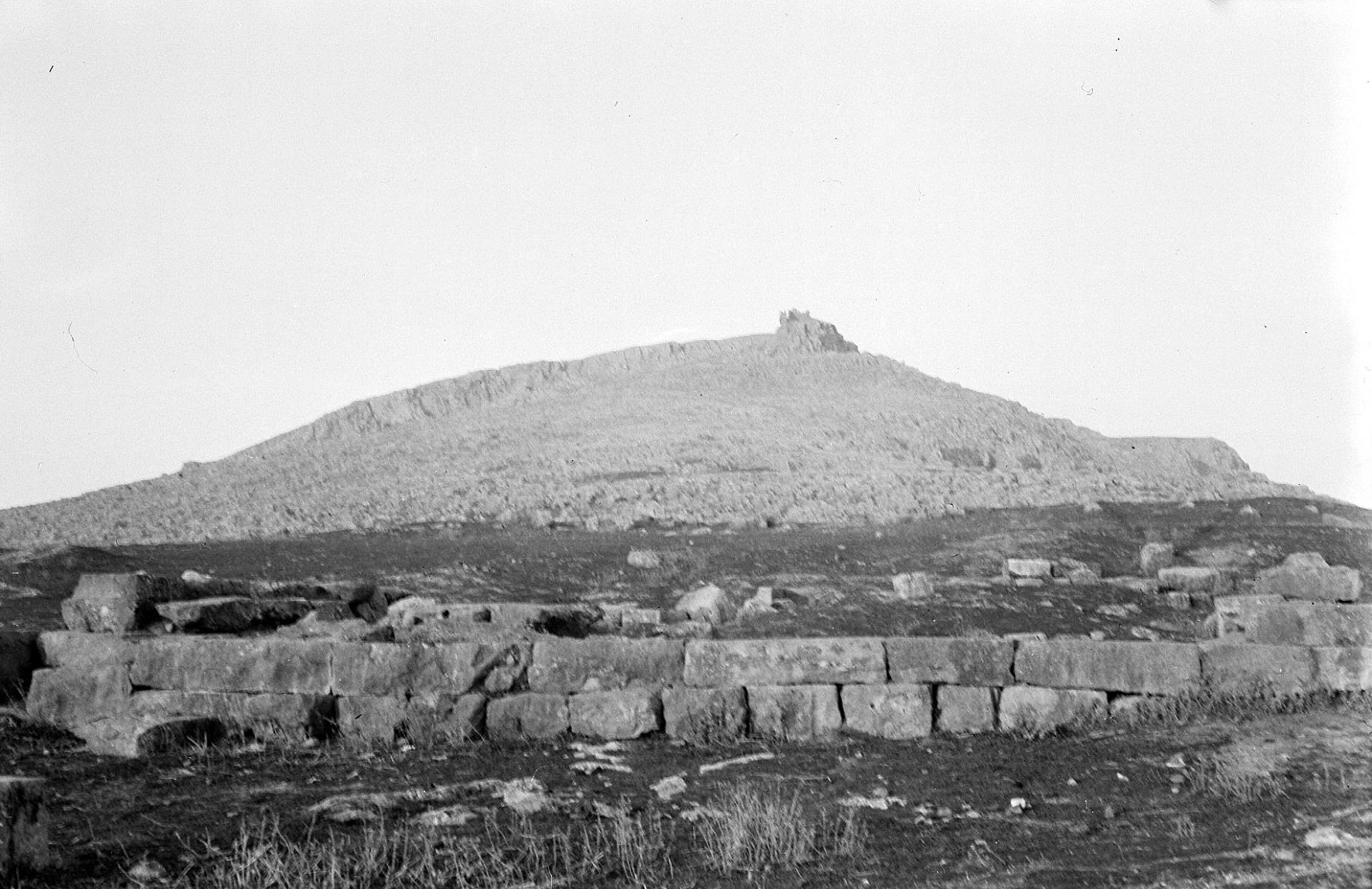
Plate 12B. Pyrgos (? Aspledon) from East.
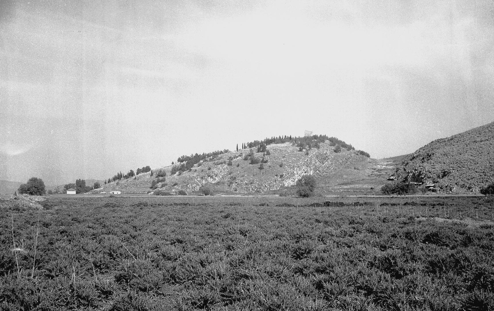
For Aspledon, as Lauffer rightly concluded, the only possible solution is that it was the site at Pyrgos. This, although the least favoured candidate, is the only ancient settlement (in the district indicated) of the required size and significance. The site, above the southeast edge of the village of Pyrgos (formerly Xeropyrgo) is a fairly steep hill, crowned by a medieval tower (Plate 12B). It is an impressive landmark, like the ridge of Orchomenos opposite. The hill is the tip of a spur, connected to the mountain range on the north side of the Kopais. Trial excavations by Bulle (1907) revealed MH and LH pottery and a cist tomb (MH?). The Mycenaean settlement here appears to have been large, comparable in size to that at Haliartos (above), since MH and LH sherds (including LH IIIB, cf. Mountjoy loc. cit.) of fine quality were found all over the hill top (c. 250 m north to south by c. 150 m) and over the broad eastern terraces below (where Archaic, Classical and Hellenistic sherds were also found). Circuit walls, presumably Mycenaean, in Cyclopean style are preserved for a length of at least 30 m, low down on the southeast slope. Up to four courses are partly preserved, to a height of c. 3 m, and these incorporate many large limestone blocks, some of which are more than a metre long, and with the characteristic small interstice stones (MFHDC pl. 16a). This wall may be the “polygonal wall” observed by Lolling (which Fossey mentions but was not able to see). There were also traces of an inner circuit wall of uncertain date (cf. Fossey 1988, fig. 48), enclosing only the small area of the summit (c. 110 m east to west by c. 40 m).
Orchomenos (Il. 2. 511)
Orchomenos (formerly Skripou): Ancient Orchomenos: N EH I-III MH LH I-IIIC SMyc PG G A C H R M
Selected references: Schliemann 1881; JHS 2 (1882) 122-163 (translation of Schliemann 1981); BCH 19 (1895) 177-224 (De Ridder); Bulle 1907 (Orchomenos I); Kunze 1931 and 1934 (Orchomenos II and III); Wace and Thompson 1912, 193-196; CSHI, 38-39 and pl. 1; AD 27 (1972) B 258-263; AAA 6 (1973) 392-393, 395; AAA 7 (1974) 313-325 GAC, 236-237 (G 1) with refs.; MG, 61 (C 1) and pl. 12; Mountjoy 1983 (Orchomenos V) 9-46, 105; AR 31 (1984-85) 31; Fossey 1988, 351-359 with fig. 49 (plan); Shelmerdine 1997, 553-55 n. 94; AR 44 (1997-98) 59, 45; AD 53 (1998) B 336-339; Iakovidis 1998 (Glas II) 197-199, 275-276; AR 45 (1998-99) 55-56; AR 47 (2000-2001) 56-58; AR 51 (2004-2005) 44; MFHDC, 75; Sarri 2010 (Orchomenos IV).
The acropolis of ancient Orchomenos (Plate 12A) was the eastern spur of Mt. Akontion (modern Mt. Dourdouvana). The circuit walls of the historic Orchomenos enclosed the whole of the summit (over a kilometre in length from east to west), but the prehistoric settlement may have been only in the lower eastern part (c. 500 m east to west by c. 300 m) and the eastern slope beyond. The early excavations (by Schliemann, De Ridder and Bulle etc.) revealed strata from Neolithic to Middle Helladic, mainly on the east slope, beginning with Schliemann’s excavation of the famous tholos tomb the ‘Treasury of Minyas’ (Pausanias 9.38.2). This tomb is so similar, both in its architecture and its dimensions, to the ‘Treasury of Atreus’ at Mycenae that it seems both tombs were designed by the same architect. The side-chamber of the Orchomenos tomb has a fine decorated ceiling (MG pl. 12c). The orginal contents of the ‘Treasury of Minyas’ are missing, as are most of those of the ‘Treasury of Atreus’. But both tombs are probably of the same date, LH IIIA2 or LH IIIB1, i.e. within the bracket established for the ‘Treasury of Atreus’ (cf. GAC, 35-36 with references; Iakovidis et al. 2003, 51, 56).
No remains of the Mycenaean settlement on the hill have survived intact. But some fragments of painted frescoes were found (without context), and pottery of excellent quality, from LH I to LH IIIC, in several areas (Mountjoy loc. cit.). The excavations by De Ridder (loc. cit.) yielded good LH IIIA-B pottery from the Asklepieion vicinity and that of the ‘Heraklion’ near the source of the Melas (‘Melas springs’ on MFHDC fig. 11). Mycenaean sherds were found in Schliemann’s trenches halfway up the east slope, and in 1959 LH IIIA-B sherds were observed in the spoil of a drainage ditch higher up on the slope. In another part of the acropolis remains of a building contained LH pottery and fine goods; fresco fragments were found on the summit and, on the east below, with burnt brick and lead. Between the ‘Treasury of Minyas’ and the theatre excavations revealed a LH IIIA2 stratum with pottery figurines and painted wall plaster (AD 53 loc. cit. and AR 51 loc. cit.). The sherds from the excavation dump at the site of the so-called Archaic temple are said to be “entirely of Myc. date” (AR 55 loc. cit.). At the east foot of the hill, in front of the Skripou church, substantial LH IIIA2-B buildings were partly uncovered by Spyropoulos (AAA refs. above and AD 27 loc. cit.). These so-called ‘megaron units’ do not themselves constitute a palace complex, and their construction is not of palatial standard (there was only one hearth, and no column bases, as Shelmerdine observes, loc. cit.). They are rightly compared by Iakovidis (Glas II, loc. cit.) to the houses below the citadel of Mycenae or to those of the Lower Town of Tiryns.
The wealth of Orchomenos was renowned in antiquity (Il. 9. 381-384; Strabo 9.2.40; Pausanias 9.24.6 to 9.25.8). The height of its prosperity appears to have been in LH IIIB, the period to which most of the kept pottery belongs (Mountjoy 1983 loc. cit.). Orchomenos and its district would have gained the most from the system of canals and dykes for preventing floods in the Kopais, since the ground level in the vicinity of Orchomenos was considerably higher than that in the eastern parts of the lake. And most of the land reclaimed for agriculture would have been on the west side of the lake, around Orchomenos. Iakovidis (Glas II) has demonstrated that the fortress of Gla was an agricultural storage depot, principally a granary. It is reasonable to suppose that a corresponding depot would have been established at Orchomenos also, and that this too would have been protected by fortifications. But later construction at Orchomenos, particularly the extensive later fortifications, will have ruined or obscured any traces of earlier circuit walls.
It seems that Orchomenos was abandoned in LH IIIC Early (Mountjoy 1993, 22). One sub-Mycenaean vase is recorded (AM 35 (1910) 35), and there are some Protogeometric graves (Desborough 1964, 120, cf. GAC loc. cit. and Fossey 1988, 356 with refs. in n. 37).
THE MINYANS
Despite its prominence, as reflected in both mythology and archaeology, Orchomenos in the Catalogue is much diminished, “….. huddled into a small corner of Lake Copais, with only Aspledon to comfort her isolation …..” (CSHI, 163-164). The concept of a Kopais divided between the Minyans of Orchomenos and the Boeotians is obviously not appropriate for the LH IIIB period when the canal system in the Lake and the fortified agricultural depot at Gla were in operation, and presumably under the control of Orchomenos. But it would suit the situation in LH IIIC, when Gla had been destroyed and the canals and dykes had apparently fallen into neglect. The traditions recorded by Diodorus and Pausanias ascribe the destruction of the canal system to Herakles, who was said to have blocked a river near Orchomenos and ruined the land by turning it into a lake (Diodorus IV. 18.7) or blocked the chasm (i.e. a katavothra) through the mountain and caused the Kephissos river to flood the Orchomenos plain (Pausanias 9.38.7, cf. 9. 37.21; see also the discussion in MFHDC, 208-209). Many of the places around Lake Kopais are listed in the Catalogue as under the Boeotians: Haliartos, Onchestos, Medeon and Kopai; and it is very likely that Boeotians were responsible for and/or took advantage of, the destruction of Gla.
THE PHOCIANS
Kyparissos (Il. 2. 519)
Antikyra: Kastro tou Stenou: Ancient Antikyra: MH LH IIIB LH IIIC? PG A C H R
AE 1956 parart. 22-27; GAC, 256 (G 52); MG, 79 (C 49); Fossey 1986, 23-24
Paralia Distomon: Ayioi Theodoroi: Ancient Medeon: EH II? EH III MH LH IIIA1-C PG G A C H
Vatin 1969; GAC, 255 (G 51); MG, 77 (C 49); Fossey 1986, 26-29; Lemos 2002, 235
Pausanias (10.36.5-10) gives a detailed account of Antikyra, which he visited (obviously by sea). He records a tradition (presumably local) that the ancient name of Antikyra had been Kyparissos, and that Homer called it Kyparissos, although it was called Antikyra already in his day, because Antikyreus was a contemporary of Herakles. This was clearly an attempt to reconcile the Homeric tradition with a typical ‘oecist’ local myth; both claims are suspect (CSHI, 40).
Mycenaean sherds, including LH IIIB, have been found on the slopes of the Kastro at Antikyra (GAC loc. cit.) and LH cist graves to the southwest (AE loc. cit.). At Ayioi Theodoroi, the acropolis of ancient Medeon, the excavations (Vatin 1969) show a substantial prehistoric settlement, with a variety of LH graves, from LH IIIA1 to the end of LH IIIC. Cremation pits of Protogeometric and Geometric data were also found, but complete continuity here into EIA is not certain.
Python (Il. 2. 519)
Delphi: N MH LH IIIA1-IIIC PG G A C H R
Selected references: Fouilles de Delphes II: 5 (1926) 5 ff; Foulles de Delphes V (1908) 6 ff.; BCH 59 (1935) 329 ff.; BCH 61 (1937) 44 ff.; RA 1938, 187 ff.; BCH 81 (1957) 707 ff.; BCH 85 (1961) 352 ff.; Desborough 1964, 122-125; BSA 66 (1971) 140; GAC, 256-257 (G 55); MG 77-78 (C 52); AR 37 (1990-91) 35-36; BCH 115 (1991) 688-690; BCH 116 (1992) 445-496, MFHDC, 94; Lemos 2002, 234.
Pytho or Python, the former name of Delphi, occurs also elsewhere in Homer, together with Phoibos Apollo and his stone threshold (Il. 9. 404-405; Od. 8. 79-81) and in connection with the abduction of Leto by Tityos (Od. 11. 575-581).
The Mycenaean settlement at Delphi occupied a small area on the slopes to northeast and east of the later Temple of Apollo, covering an estimated c. 16,000 m2 (BCH 116, 458). The few buildings excavated may all be LH III, and most of the pottery is LH IIIB. The settlement lasted until early in LH IIIC, when its abandonment may have been caused by a flood or a fall of rocks from the heights above (cf. the epithet πeτϱήeσσa, Il. 2. 519 and Il. 9. 405). The chamber tombs to west of the Temple of Apollo produced mainly LH IIIB pottery and some pots which may be of the LH IIIB/LH IIIC transitional phase. The 1990 excavation below the Temple of Apollo revealed a section of a wall at least 2.10 m thick. Three to four courses were preserved, of very crude masonry (BCH 115 loc. cit. with figs. 4-6 and AR 37, loc. cit. with figs. 27-29). The wall was probably built in LH IIIA2 or LH IIIB1; it was overlaid by a clay layer with LH IIIC Early pottery. Because of its thickness and its orientation (roughly north to south), it was suggested that it was part of a fortification. But, in view of its crude construction, it seems more likely that it was a demarcation or boundary between the settlement on the east and the cemetery on the west.
It is improbable that Delphi was already an important religious site in Mycenaean times. Many Mycenaean figurines found in a later deposit in the Marmaria area may have been votives, but obviously collected from elsewhere, since there are no signs of Mycenaean habitation or burials at Marmaria (BSA loc. cit. and Desborough loc. cit.). The deposit seems to have been made in the Late Geometric period (BCH 81 loc. cit.), when the real importance of Delphi as a religious centre began (Morgan 1990, cf. Dickinson 2006, 241, 254). There are a few signs of habitation at Delphi in the later LH IIIC periods and again in the Protogeometric period (Desborough 1964, 124-125 and Lemos 2002, 146), but no signs of a cult here in these periods.
Krisa (Il. 2. 520)
Chryso: Ayios Yeoryios: Ancient Krisa: MH LH I/II LH IIIA1-B C H M
Frazer 1898, v. 459-462; RA 8 (1936) 129 ff.; BCH 61 (1937) 299-326 with plan, pl. XXIII; BCH 62 (1938) 110-147; Desborough 1964, 125; BSA 59 (1964) 242; CSHI, 41; GAC, 257 (G 56); MG, 77 (C 51); BCH 116 (1990) 445-496, esp. 45 and figs. 1-3 (air photo, area map and view); MFHDC, 94-95 with pl. 19b.
Plate 13A. Chryso: Ayios Yeoryios (Krisa) from Northeast.
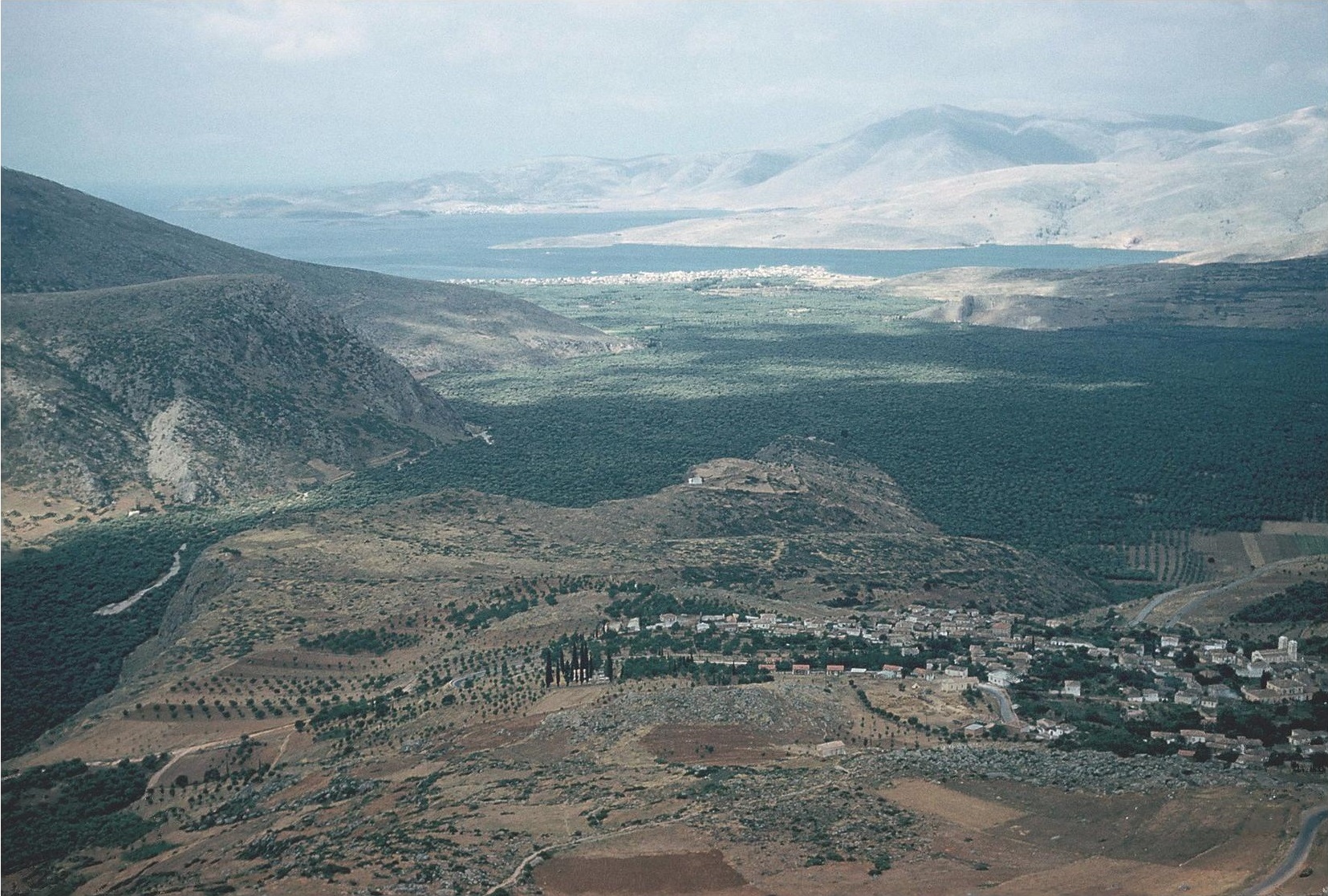
The acropolis of Krisa, about a kilometre to south of Chryso village, occupies the tip of a long spur projecting to the southwest from Mt. Parnassos, and ending in great precipices overhanging the Pleistos valley (Plate 13A). It is aptly described in the Hymn to Apollo lines 282-285: “….. you came to Krisa beneath snowy Parnassos, a spur turned towards the west, with a cliff hanging over it, and a hollow ravine running beneath it …..”
The top surface of the spur is of irregular shape, over a kilometre in length (east to west) and up to 400 m wide (in the eastern part), comprising an area c. 235,000 m2. But the prehistoric settlement occupied only an area of c. 200 m east to west by c. 100 m. The excavations (BCH 61 loc. cit. and BCH 62 loc. cit.) revealed two strata of late MH, followed by a LH IIIA1 stratum and a LH IIIB stratum. One LH IIIA1 building was of megaron form, with two column bases. The LH IIIB buildings were also substantial. The settlement was destroyed by fire at the end of the LH IIIB period or at the beginning of LH IIIC (Desborough 1964, 125), and completely deserted until medieval times. Fortifications were not needed on the precipitous south and southeast, but on the northwest, north and northeast sides there was a continuous Cyclopean circuit wall, probably built in LH IIIB, for a length of c. 1500 m (BCH 61, 323-326). The wall is best preserved, and here to a height of c. 3 m, on the northwest (BCH 61, fig. 26), where in the outer face (MFHDC, pl. 19b) massive blocks were used (one, noted by Frazer loc. cit., is c. 2.70 m long and c. 1.60 m high), neatly fitted together with small stones in the interstices, in true Cyclopean style (MFHDC, loc. cit.). There was a gateway in the north side; it is assumed that the ancient road (“route antique” on BCH 61 fig. 28, cf. pl. XXIII), observed over a length of c. 300 m, and running from east to west to north of the site, led to this gate along the outside of the wall.
The site is clearly identified as the “hill of Krisa” (ΚϱισaiÚον λόfον, Pindar, Pyth. 5.37). It was certainly the most important Mycenaean settlement in the district. It completely dominates the Gulf of Krisa and the route up the Pleistos valley floor, and the upper road via Delphi. Kirrha, which later became the port for Delphi, would have been the harbour town of Mycenaean Krisa (for the French excavations at Kirrha cf. GAC, 258 (G 58), MG (C 58) and reports in BCH, AD and AR from 1995 on).
Daulis (Il. 2. 20)
Davleia: Ayioi Theodoroi: Ancient Daulis: EH I EH II(?) EH III MH LH I/II(?) LH III (A-) B G C H R
Fürtwängler and Lӧschke 1886, 43-44; Frazer 1998, v. 222-225; Wace and Thompson 1912, 201; Alin 1962, 134-135; CSHI, 42; Winter 1971, 216 and fig. 133; GAC, 254-255 (G 49); MG, 76-77 (C 48); Fossey 1986, 46-49, fig. 7, pls. 23-28; Lemos 2007.
The acropolis of ancient Daulis was a large rounded hill (Fossey 1986 pl. 23) about a kilometre to south of the village of Davleia, separated from it by a deep gully; the ruins of the church of Ayioi Theodoroi are on the top. The hill is one of the foothills of Mt. Parnassos, to which it is attached by a narrow ridge on the northwest. The top, enclosed by fortifications, is mostly covered by dense bushes and some trees. Both Strabo (9.3.13) and Pausanias (10.4.7) say that the name Daulis was derived from the clusters of bushes which were called Dauloi (δaυλοί), although Pausanias also records a rival derivation, from the nymph Daulis, daughter of the Kephisos.
In 1881 Stamatakis cleared out a well on the acropolis, from which he retrieved much MH pottery, obsidian blades and small stone whorls and some LH III sherds (Fürtwängler and Lӧschke loc. cit.) including LH IIIB (Alin loc. cit.); in 1959 some LH III sherds were found on the surface and a piece from a stemmed bowl of Yellow Minyan ware, which is MH or LH I/II.
The fortifications, visible only on the northwest, are mainly in coursed polygonal masonry. They include a gateway and towers. According to Winter they are of late Classical or Hellenistic data (Winter loc. cit.). The site overlooks the route to the south towards Delphi, by the road (the σχιστὴ ὁδος) where Oedipus slew Laius (cf. Pausanias 10.5.4 and 10.35.8) and also commands the pass to the north into the Kephissos valley via Davleia. There is a copious spring at the north foot of the hill and nearby are the remains of many ancient mills.
Panopeus (Il. 2. 520)
Ayios Vlasios: Ancient Panopeus: MH LHI? LH IIIA-B A C H
Frazer 1898, v. 215-219; Kirsten s.v. Panopeus, RE 18.3 (1949) 637-649; Winter 1971 index s.v. Panopeus; CSHI, 42-43 and pls. 3a and 3b; GAC, 254 (G 48); MG, 76 (C 47); Fossey 1986, 63-67 with fig. 11 (plan by Gauvin) and 41-46 (photographs by Gauvin); MFHDC, 93 and pls. 21a and 21b.
Plate 6A. Panopeus from North.
Plate 6B. Panopeus, Cyclopean Wall on Southeast, with John Lazenby.
Ancient Panopeus occupied a prominent hill, above the village of Ayios Vlasios, which lies at its south foot. The hill (Plate 6A and Fossey 1986, pl. 41) is over 300 metres above the level of the plain, a broad valley (a branch of the main Kephisos valley), bounded on the west by the foothills of Mt. Parnassos. The site overlooks the routes to north and east and the small pass through the hills on the south. The circuit walls, of coursed polygonal masonry (and of ashlar at the gates and towers), surrounded the whole summit, enclosing an area of up to c. 650 m east to west by c. 150 m. They are well preserved on the south and west. They appear to be early Hellenistic (Winter 1971). The higher eastern part, c. 300 m east to west by c. 100 m, crowned by the chapel of Ayios Athanasios, was evidently the acropolis. The lower western part is interpreted as the ‘Lower Town’, accessed by its south and west gates.
Remains of a Cyclopean wall were observed in 1961 (by Hope Simpson and Lazenby), on the southeast slope, c. 40 m below the southeastern tower of the later fortifications. One section of this wall is preserved to a height of over 2 metres (Plate 6B, cf. CSHI, pl. 36 and MFHDC, pls. 21a and 21b), built with huge limestone blocks. Few interstice stones have remained in the surviving sections (of which only the outer faces survive in most cases). At a point where this could be measured, the wall was c. 3 m thick. It could be traced along the whole of the south side, where it ran below the line of the later fortifications. A less well preserved section is c. 20 m outside the south gate (marked on Gauvin’s plan, Fossey 1986, fig. 11, and shown in her photo, pl. 46). At both ends of the south side there were indications suggesting small bastions projecting outwards from the wall. At the eastern end the Cyclopean wall turned towards the north, and here also it continued outside of and below the later walls. It is possible, therefore, that this Cyclopean wall once surrounded the whole summit and an additional extent of ground (on the south and east) beyond that enclosed by the later fortifications. If this is indeed the case, the area enclosed by the Cyclopean wall may be calculated as c.700 m east to west by c. 160 m, or up to c. 112,000 m2. But, as was shown at Eutresis in Boeotia (above), not all of this area would have been built over in Mycenaean times. The thick thorn bushes on the hill make surface search difficult within the fortifications; and only Archaic, Classical and Hellenistic sherds have been identified there. In 1961 MH and Mycenaean sherds were found on the upper south and east slopes; they included LH IIIA-B from Deep Bowls and Kylikes and a flat base from a MH/LH I Yellow Minyan Stemmed Cup, together with many obsidian chips. There were also remains of small cist graves, apparently associated with Mycenaean sherds. The Mycenaean settlement here appears to have been an important centre, and would have possessed excellent agricultural land (cf. the epithet kaλλiχόϱος given to Panopeus in Od. 11. 581). There is, of course, no doubt about the identification of the site. Its location is in accord with the distances assessed by Pausanias for between Chaironeia and Panopeus and for between Daulis and Panopeus (Pausanias 10.4.1-2 and 10.4.7.; cf. Fossey 1986, 64 and 67). Panopeus was the home town of Schedios, one of the two brothers who led the Phocians. He is characterized as the best of the Phceians and a ruler over many men (Il. 17. 303-311, where he is slain by Hector). This suggests that Panopeus was the capital of the Phocians in the heroic tradition. It was also celebrated in legend as the place where Prometheus made the first men. Pausanias (10.4.4) was shown at Panopeus two huge stones, each big enough to fill a cart, with the colour of clay and smelling very like the skin of a man. He was told that they were part of the clay used by Prometheus to create the whole of mankind.
Anemoreia (Il. 2. 521)
Bursian 1862, 1. 170; Frazer 1898, v. 283; Kirsten, RE 21. 1. col. 215; Dor et al. 1960, 20
When the Delphians had become independent from Phocis (at the instigation of the Spartans) in c. 457 B.C., Anemoria became the marker of the boundary between the territory of Delphi and that of the Phocians (Strabo 9.3.15, cf. Thuc. I, 107-108). Strabo here says that the name Anemoreia was given to the place because of the winds sweeping down on it from the Catopterios cliff protruding from Mt. Parnassos. Frazer thought that the modern village of Arachova might have been the site of Anemoreia, since it lies in the position suggested by Strabo’s description. Bursian (loc. cit.) recorded ancient walls at Arachova, but there are no further reports of ancient remains there. Kirsten (loc. cit.) suggested the site at Kastrouli, c. 3 km southwest of Arachova. But, as the excavators themselves point out, this was not an important Mycenaean settlement. (Dor et al. 1960, 20; cf. GAC, 56, G 54 and MG, 78, C 55). The site is described as a prominent hill on the escarpment above the north bank of the Pleistos river. Some large MH cist tombs and remains of some Mycenaean buildings are recorded. The finds were described as rather poor (they have not been published).
Hyampolis (Il. 2. 521)
Exarchos: Kastro Bogdanou: Ancient Hyampolis: EH I LH IIIB C H R
Yorke (1888) 291-312; Frazer 1898, v. 412-446; Bolte, RE ix 1 (1914) 17-32; French 1972, figs. 9, 16d; CSHI, 43; GAC, 359 (g 60); MG, 78-79 (C 57); Fossey 1986, 72-76 with fig. 13 (plan) and pls. 51-57.
Kastro Bogdanou is on a plateau c. 30 m above the plain, with steep slopes, on the northern tip of a ridge, between two streams at the west end of the little valley which leads to the village of Exarchos, c. 3 km to the east: The Kastro, a natural acropolis, was surrounded by a circuit wall, of good isodomic masonry, probably late Classical or Hellenistic, enclosing a roughly circular area c. 300 m in diameter (cf. the plan by Gauvin, Fossey 1986, fig. 13). Investigations by Yorke (loc. cit.) revealed a stoa and a theatre (?) outside the walls on the ridge to the south.
Hyampolis was obviously of strategic importance, since it commands the pass from Phocis to the coastal plain of Atalante in Locris (cf. CSHI, 43, for the battles fought here in the 6th and 4th centuries B.C.). Jason of Pherai (in Thessaly) on his way back from Phocis to Herakleia in 371 B.C. captured the πϱοάστiον (the suburbs or ‘lower town’) of Hyampolis. The identification of Kastro Bogdanou as Hyampolis rests mainly on the evidence of two Hellenistic proxeny decrees (BCH 37 (1913) 441-445, cf. Fossey 1986, 75) found on the east side of the hill. Less than 2 km to the southeast is another fortified acropolis, also investigated by Yorke, at Palaiochori (Fossey 1986, 78-81, 163-165, fig. 14) has been assumed to be ancient Abai, despite its close proximity to Kastro Bogdanou. An inscription found in Niemeier’s excavations at Kalapodi now proves that this was the site of the sanctuary of Apollo at Abai (AR 53 (200 6-2007) 41-43, AR 54 (2008-2009) 47-46, AR 58 (2011-2012) 19-2, and see Chapter 1). It had previously been thought that Kalapodi was the site of the sanctuary of Artemis Elaphebolos at Hyampolis (although three inscriptions at Kastro Bogdanou contain references to Artemis Elaphebolos or Artemis Soteira). Some confusion may have been caused here by the elliptical nature of Pausanias’ account (Pausanias 10.35.1-7, esp. 1 and 5). Pausanias went to Abai from Elateia by a ‘mountain road’. It seems that this road met with the highway from Orchomenos to Opous, which Pausanias then followed as far as Kalapodi, which would have indeed been ‘a little to the left’ (i.e. to west) of this highway. After visiting Abai (at Kalapodi), Pausanias must then have gone back (he did not go on to Opous) along the highway, and very probably to Chaironeia, since his next subject is the road from Chaironeia to Delphi (Paus. 10.35.8). Hyampolis would have been the first town on his way back from Abai. Since Kastro Bogdanou and Palaiochori are close together, and Archaic to Hellenistic tombs were found between them, the solution would seem to be that both were part of the territory of Hyampolis. The polygonal masonry of the walls of Palaiochori (Fossey 1986, pls. 59-61) is of ‘Lesbian’ style, with “indented trace”, and may be as early as the 6th century B.C. (Winter 1971, 103); and archaic tombstones were found here (IG. ix. 1. 80-83, cf. Fossey 1986, 80). The walls of Palaiochori enclose an area c. 550 m northeast to southwest by c. 300 m (larger than that of Kastro Bogdanou), including a substantial ‘lower town’ in the northeast (c. 350 m by c. 300 m) which could be identified as the πϱοάστιον of Hyampolis captured by Jason. Perhaps Palaiochori was the original site of Hyampolis and Kastro Bogdanou a later foundation.
In 1959, due to the thick cover of Classical, Hellenistic and later material within the walls of Kastro Bogdanou, no prehistoric material was found on the surface here. But on the eroded slopes outside the walls some Bronze Age sherds were found and one LH IIIB, together with some obsidian. This is only slight evidence for Mycenaean habitation here; but surely now the quest for Homeric Hyampolis should include search of Palaiochori. Robbed Mycenaean chamber tombs were found on its south slope (AD 48 (1993) B 209), cf. also Lemos 2002, 235.
οἵ τ’ ἄϱa πὰϱ ποτaμὸν Κηϕισὸν δiÚον ἔνaiον (Il. 2. 522)
(“and those who dwelt along the holy river Kephisos”)
Anthochorion (formerly Belesi): Levendi: Ancient Parapotamioi N MH LH IIIA2-B PG G A C H
Frazer 1898, v. 418-420; Kirsten, RE xviii 4 (1949) 1369-1374; CSHI, 44; French 1972 fig. 16d; GAC, 258-259 (G 59); MG, 78 (C 56); Fossey 1986, 69-71, with fig. 12 (plan) and pls. 47-50; MFHDC, 93-94.
Other sites “along the holy river Kephisos” (See also Chapter 1, for Elateia especially)
Ayia Paraskevi: Ayia Marina: N EH I-III MH LH IIIA-B LH IIIC?
GAC, 259 (G 61); MG, 79 (C 58)
Elateia (formerly Drachmani: Piperi: N EH I-III LH I-LH IIIB LH IIIC?
GAC, 259-260 (G 62); MG, 79 (C 59); Mountjoy 1983, 47-57
Modion: Avlaki Pouri: LH III(A2-B)
GAC, 260 (G 64); MG, 79 (C 61), Lemos 2002, 235
Amphikleia: Palaiokastro (Ancient Tithronion): LH III(A2-B) C
GAC, 260-261 (G 65); MG, 79-80 (C 63)
Amphikleia: Ayioi Anargyroi: LH IIIC Middle to SMyc
GAC, 261 (G 66); MG, 79 (C 62); AD 50 (1995) B 397-398; Lemos 2002, 235
Elateia: Alonaki: LH IIB-IIIA1 LH IIIC SMyc/PG
AD, 40 (1985) B 171, AD 41 (1986 B 65-68; AD 42 (1987) B 231-274; Lemos 2002, 235; Deger-Jalkotzy 1990
It would naturally be assumed that “those who dwelt along the holy river Kephisos” means the inhabitants of the settlements in and around the Kephisos valley. Pausanias (20.33.7-8) records this interpretation but dismisses it as conflicting with Herodotus’ mention (8.33) of a place called Parapotamioi. This is also described by Strabo (9.3.16, citing Theopompos), who notes its strategic position, commanding the pass between Bocotia and Phocis.
Parapotamioi occupied the broad hill called Levendi, with steep sides, c. 40 m high above a bend of the Kephisos, on the west tip of the ridge which bounds the Chaironeia plain on the north and extends to Orchomenos on the east. The hill dominates the defile named Stena between the Chaironeia plain and the broader Kephisos valley to the west. The flat upper surface of the hill, c. 250 m east to west by c. 200 m, is surrounded by a circuit wall of irregular shape (cf. Fossey 1986, fig. 12, but disregarding the incorrect indication of the scale). Where the walling was not occluded by the thick bushes, it was seen to be of “Lesbian” polygonal construction (Fossey 1986, pls. 48-50). A stretch of wall resembling Cyclopean was observed in 1959 on the east side. Small stones were used in the interstices, but its style was also polygonal. In 1959 the surface sherds included some Bronze Age coarse ware and a piece from a plain kylix of LH IIIA2 or LH IIIB date. Most of the surface pottery, however, was Classical or Hellenistic, with many fragments of purple glazed tiles. Fossey (loc.cit.) also records Protogeometric and Geometric.
Lilaia (Il. 2. 523)
Lilaia (formerly Kato Agoriani): Ancient Lilaia: EH I-III MH LH I/II LH III C H
Frazer 1898, v. 410-414; BSA 17 (1910-1911), 60-64; CSHI, 44; French 1972, 16c-d; GAC, 261-262 (G 68); MG, 80 (C 63A, 212; Kase et al. 1991, index s.v. Lilala, esp. 53, 66-67, fig. 4-1 (site 33), fig. 4-14, pls. 4.32 to 4.35
The historic Lilaia was above, and to southeast of, the modern village. The city walls climb up from the plain to a long thin and jagged ridge, precipitous on the east side, and its lower town was at the foot of this acropolis. The dedications at the spring (CIG iii no. 232) confirm the testimony of the ancient authors (CSHI loc. cit.), who unanimously place the source (one of several) of the river Kephisos here (πηγhæς ἔπi ΚηϕισοιÚο of Il. 2. 523, c. Hymn to Apollo 240-241; Strabo 9.2.19 and 9.3.16, citing Theopompos; Pausanias 9.24.1). There is no evidence that the historic Lilaia was inhabited in the Bronze Age or Early Iron Age. But below to the west, and c. 400 m to east of the modern village, there was a prehistoric settlement on a low hill, marked by a small conical peak in the centre. The upper surface, c. 160 m northwest to southeast by c. 60 m, was surrounded by circuit walls, whose polygonal masonry was visible in a few places [Kase et al. 1991, 53, fig. 14 (plan), pl. 4. 34 (air photo) and pl. 4. 35 (wall at earlier gate)]. Wilkie and Alin dug three test pits on the northeast slope, between the top and the village cemetery (near the bottom of the slope). EH I-III, MH, LH I/II and LH III sherds were found, confirming the evidence from surface search in 1959 (Alin and Wilkie in Kase et al. 1991, 66-67, cf. Wilkie in MG, 212). The area within which prehistoric remains were found appears to have been c. 160 m by 100 m, consisting mainly of the northeast and east slopes towards the plain.
THE PHOCIANS
The territory of the Phocian contingent is substantially the same as that of the historical Phocis, although the names of Amphissa and Elateia are absent, and only their valley Kephisos and its source at Lilaia are included. Delphi appears as Pytho (correctly, since Delphi had not yet become an important cult centre). The most recent excavations at Delphi have revealed a Mycenaean settlement of only medium size, which flourished in LH IIIB and was abandoned early in LH IIIC. In the Amphissa valley a more important Mycenaean site was that at Krisa, whose fortified settlement was destroyed at the end of LH IIIB. In eastern Phocis the most significant Mycenaean settlement in LH IIIB seems to have been that at Panopeus, with similar massive Cyclopean circuit walls. Here excavation is needed, especially for determining whether occupation continued into LH IIIC, as at Elateia and Amphikleia in the Kephisos valley.
THE LOCRIANS
Kynos (Il. 2. 531)
Livanates: Pyrgos: Ancient Kynos: EH II MH LH II-IIIC SM? PG G A C H R M
Oldfather, RE xii (1924) 29-32; CSHI, 47; French 1972, figs. 14, 16c-d, 17; GAC, 263 (G 72); MG, 80-81 (C 67); Pritchett 1985, 181-183; Fossey 1990, 81-84, fig. 15 (plan), pls. 55-56; Dakoronia 1993, 115-127; Lemos 2002, 235; Dakoronia 2003, 2006 and 2007; Crielaard 2006; Crouwel 2006; Lemos 2011-2012, 21 with refs.
Plate 13B. Livanates: Pyrgos (Kynos) from Northwest.
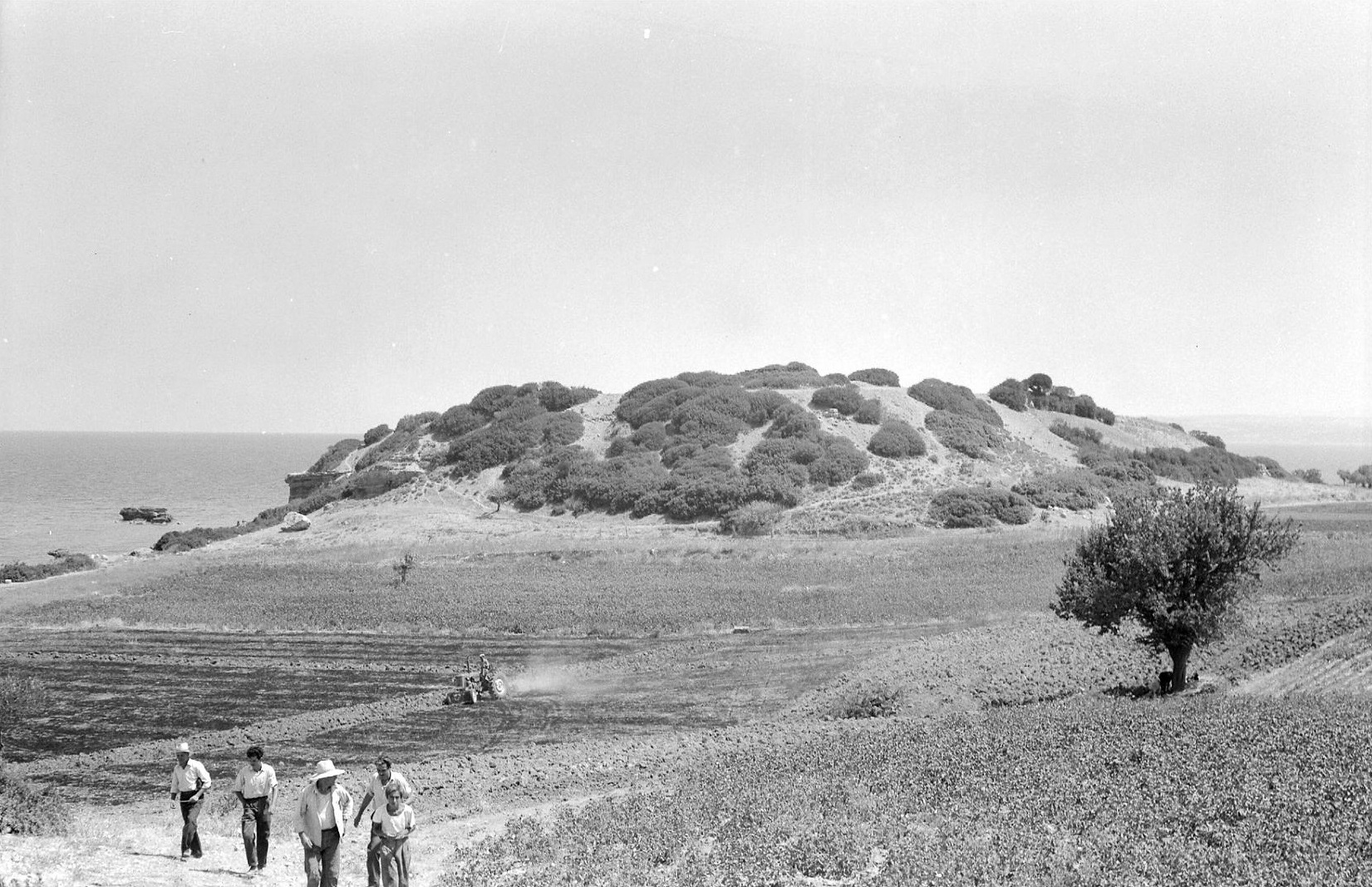
Pyrgos is a small low hill, of ‘high mound’ type (Plate 13B) only about 30 m from the shore, c. 2 km northeast of Livanates. The top surface, c. 130 m north to south and c. 80 m (average) east to west, was ringed by a circuit wall, probably Hellenistic, with small tower and at least one gateway (on the west). Pyrgos was presumably named after the small ruined medieval tower in the northwest corner (Fossey 1990, fig. 14 and pl. 56).
In 1958 and 1959 surface sherds found within the circuit included MH, copious LH IIIA-B of excellent quality and one LH IIIC Early piece, together with several late Geometric and Archaic and many Classical and Hellenistic. The fields below on the west and south were covered with sherds, predominantly Mycenaean, Classical and Hellenistic (MG, loc. cit.). The excavations by Dakoronia from 1985 to 1995 record the almost continuous activity at the site from the Early Helladic to Medieval periods. The settlement flourished in LH IIIC, with stratified deposits of LH IIIC Early, Middle and Late. The site was destroyed by fire (apparently resulting from an earthquake) in LH IIIC Middle, and rebuilt soon after. There was a second destruction at the end of LH IIIC Late, after which only modest structures and some burials are recorded (Lemos loc. cit. and 2001, 235). In the LH IIIC levels were storerooms, workshops and kilns for pottery and metals. Particularly important is a workshop of LH IIIC Middle which produced pictorial pottery, including depictions of warriors on ships (Dakoronia 2007; Crouwel 2006; and especially Crielaard 2006, 277-285 with comparanda from Dramesi and Kalapodi). The close relationships of Pyrgos (Kynos) Kalapodi, Lefkandi, Mitrou and Eleon in LH IIIC Middle are discussed in Chapter 1 above.
There can be no doubt about the identification of Livanates: Pyrgos as Kynos. The ancient testimony (discussed by Oldfather loc. cit.) is virtually unanimous. Strabo (9.4.2-3) says that Kynos was the port of Opous, and that Kynos was 60 stades from Opous and 90 stades from Daphnous, the next harbour to the west (it is actually c. 20 km from Daphnous. The scale on the map in Fossey 1990 end-pocket is inaccurate). The harbour of Kynos is assumed to be just north of Pyrgos where there is a small incurve of the shore, to north of which Oldfather recorded the ruins of a temple. Dakoronia, however, suggests that the centre of ancient Kynos may have been the prominent acropolis of Livanates: Palaiokastra, c. 2.5 km to west-southwest of Livanates, where rich graves of the Classical period were found and two Mycenaean chamber tombs. In this case Palaiokastra and Pyrgos would be “the two parts of Homeric Kynos, the town and the harbor settlement” (Dakoronia 1993, 124-127).
Opoeis (Il. 2. 531)
Oldfather 1916, and RE xviii 2 (1939) 812-818; CSHI, 47-48; Pritchett 1985, 166-189; Fossey 1990, 66, 71-74; Dakoronia 1993; Dakoronia 2006
Kyparissi: Ayios Ioannis: LH IIIB-C G A C H R M
Blegen 1926; CSHI, 47-48; French 1972, fig. 16d; GAC, 262 (G 70); MG, 80 (C 65); AD 33 (1978) B 1, 139-140; AD 34 (1979) B 1, 187; Pritchett 1985, 182-185; Dakoronia 1990; Fossey 1990, 62-65, fig. 12, pls. 40-45; Dakoronia 1993, 117-119 with refs.
Atalante: PG G A C H R M
Begen 1926, 404; AD 26 (1971) B 1, 237; Fossey 1990, 68-74, fig. 13, pls. 46-50; Dakoronia 1993, 119-124 with refs; Dakoronia 2006 with refs.
Opoeis was the home of Menoitios and Patroklos (Il. 23. 83-84), and accordingly may have been regarded as the main town of the Locrians. Opous was certainly the metropolis of the Epicnemidian Locrians (Strabo (9.2.42). Oldfather (1939) identified Opous as the settlement investigated by Blegen at Kastraki (or Kokkinovrachos) and Ayios Ioannis near Kyparissi. Others, however, including Fossey and Dakoronia, are more inclined to locate Opous at Atalante. Strabo (9.4.2) estimated the distance between Kynos and Opous as 60 stades (c. 12 km). From Livanates: Pyrgos (Kynos) to Kyparissi: Kastraki the actual distance, “as the crow flies” is c. 11 km (c. 55 stades); from Livanates: Pyrgos to Atalante it is c. 10 km (c. 50 stades). Kynos could have been the harbour for both Kyparissi and Atalante; the shores at Kyparissi, and to west, up to Livanates, are not suitable for a harbour. Strabo’s account, therefore, provides no basis for locating Opous (or Opoeis).
The high hill of Kastraki (alias Kokkinovrachos), 300 m a.s.l., rises abruptly from the plain (Fossey 1990, pl. 40). It was briefly investigated by Blegen (loc. cit.). The polygonal walls (Fossey 1990 fig. 12 and pls. 41-45), probably Hellenistic, surround only the summit, enclosing an area c. 240 m northwest to southeast by c. 90 m. No traces of buildings were found inside the enclosure, but Classical and Hellenistic sherds were numerous. In the field below the wall on the northeast side were several tile fragments (some black-painted) and black glazed sherds. It seems that this acropolis may have been primarily a ‘refuge’ site, since the main settlement was evidently on the lower northwest slopes, in the vicinity of the Ayios Ioannis chapel, over a kilometre from Kastraki and about a kilometre south of Kyparissi. Here ancient remains cover a wide area. Those investigated by Blegen include a stoa and a Doric peristyle temple (5th cent. B.C.). The recent excavations by Dakoronia at Kyparissi uncovered part of the stoa of a shrine of the second half of the 6th century B.C. (Dakoronia 1993, 117 and fig. 2). In 1959, at a point c. 300 m west of the Ayios Ioannis chapel, and to south of a small ravine, a deposit revealed by erosion contained sherds of many periods, including LH IIIB and early LH IIIC (CSHI, loc. cit. and French 1972 fig. 16d, the latter mis-interpreted in Fossey 1990, 64 n. 2). Later periods represented were Geometric (Early), and Archaic (many sherds) and Classical.
The archaeological investigation of Atalante has been more difficult, since much of the evidence has been destroyed or obscured by the modern town. Nevertheless, recent excavations (partly of ‘rescue’ nature) by Dakoronia (2006) have revealed a large Early Iron Age cemetery with some special features (especially the two sarcophagi and their contents). Several sections of the fortifications have been discovered. One section is preserved for a length of 350 m, and another was found c. 800 m to west of this. They are of the late 4th to early 3rd centuries B.C., indicating a large city at that time. The city may have had an acropolis on the hill above the town on the southwest (Dakoronia 1993 figs. 3 and 4). Several of the inscriptions found at Atalante mention Opous or Opountian. Oldfather thought that the inscriptions might have been moved from Kyparissi (Oldfather 1939, cf. Dakoronia 1993, 119), but the new evidence from the recent excavations seems sufficient refutation of this view. Blegen wisely left the question open, although at the time he inclined to the view that Opous was at Kyparissi. The new evidence, however, strongly suggests that Opous was at Atalante, at least from the late 4th century B.C. As Dakoronia remarks, Atalante dominates the only road to Phocis. The location of Homeric Opoeis remains a question. No prehistoric remains earlier than Early Iron Age have yet been found at Atalante.
Kalliaros (Il. 2. 531)
Oldfather, RE x (1919) 1613-1614; CSHI, 48; Fossey 1990, 175; Dakoronia 1993, 120, 122-124, figs. 1 and 5-6; cf. Fossey 1990, 79-80.
Unfortunately, Strabo’s brief mention of Kalliaros (9.4.5) is interrupted by a lacuna in the text (one of the three gaps in Strabo’s page 426 – the other two apparently once contained the names Bessa and Augeai, discussed below). This lacuna (of about 14 letters) occurs after Strabo’s statement that “Kalliaros is no longer inhabited”, and before the word π eδίον (plain). Du Theil and Meineke conjecturally fill the gap, so as to read: οὐkέτi οἰkeiæτai [eὐήϱοτον δὲ νuÚν ἐσ]τi πeδίον (on the basis of Eustathius on Il. 2. 531-532). The translation of this would be “[Kalliaros] is no longer inhabited [but is now an easily cultivated] plain.” The only plain in Eastern Locris that fits this description is the plain of Atalante. Fossey suggests for Kalliaros the small low mound (c. 150 m by c. 60 m) of Atalanti: Skala, near the coast, on the eastern edge of the Atalante plain, about halfway between Livanates and Kyparissi (French 1972, figs. 11, 13, 13, 16b-d, 19; GAC, 262 (G 71); MG, 80 (C 66), where EH III, MH and LH IIIB sherds were collected. Dakoronia’s larger inland site of Megaplatanos: Palaiokastra had circuit walls, and tombs of the 5th and 4th centuries B.C. Also found was an inscription whose last word ends with IAPWN. About 1.5 km to south of Palaiokastra 6 Mycenaean (LH III) chamber tombs were excavated. Dakoronia does not press the suggestion that Palaiokastra may be Kalliaros; and the site is in an area of low hill country about 4 km to west of the Atalante plain (Dakoronia 1993, fig. 1). If the large settlement at Kyparissi (discussed above) is not to be identified as Homeric Opous, it could perhaps be considered as a candidate for Kalliaros. But it is obvious that no definitive solution of this problem is possible.
Bessa (Il. 2. 531)
CSHI, 48; Dakoronia 1993, 126 and fig. 1 (Roustiana)
There is no guide to the position of Bessa. As in the case of Kalliaros, there is a lacuna (in the same page 426) in the text of Strabo (9.4.5) of about 18 letters. This occurs where the name Bessa would be expected. Du Theil and Meineke again supply a conjecture to fill this gap. The name Bessa must surely have been included here, since, after the gap, the text continues with an etymological explanation of Bessa, which Strabo says does not exist [now any longer] and was a wooded place [although this may be no more than a guess by Strabo, based on the name itself].
Dakoronia presents a possible candidate for Bessa. This is the previously unknown fortified acropolis of Roustiana, c. 6 km west-northwest of Livanates, in “high and steep terrain”. Abundant Mycenaean pottery was found on the surface, and at the foot of the acropolis a cemetery of pithos burials, all of the Classical period. There is, however, no firm basis for this suggested identification, as Dakoronia tacitly acknowledges. The location of Bessa remains unknown.
Skarphe (Il. 2. 531)
Oldfather, RE iiia (1929) 460-461; CSHI, 48; Pritchett 1992, 145-148
Strabo (9.4.4) gives quite precise indications of the position of historic Skarpheia, 10 stades from the sea, to west of the Boagrios river, and 30 stades west of Thronion. And Pausanias (7.15.3) says that Skarpheia was on the route from Elateia to Thermopylai via Thronion (cf. Livy 33.3.6). This places Skarpheia between the two modern villages of Kainourgion and Molos. Some ancient remains were found at Trochala (now Skarphia) between the two villages (Oldfather loc. cit.). But the exact location of the historic Skarpheia remains unknown (cf. Pritchett loc. cit.).
Augeiai (Il. 2. 532)
CSHI, 48.
This name is questionable. Strabo tells us (9.4.5) that he is here only discussing the Locrian cities listed by Homer. So it is to be presumed that Augeiai would be included. Here again there is another lacuna in the text of Strabo (as in the cases of Kalliaros and Bessa the lacuna is on the same page 426). Here again the lacuna (of about 18 letters) has been conjecturally filled by Meineke to read: οὐδ’ aἱ Αὐγeiaι, τὴν δὲ χω] ϱaν ἔχοuσi ΣkaϱϕιeιÚς (“….. neither does Augeai [exist] whose territory is held by the Skarpheians”). Augeiai is listed in Il. 2. 532 as Αὐγeiὰς ἐϱaτeiνὰς (‘Augeiai the lovely’). But exactly the same name and epithet occurs in Il. 2. 583 (also at the end of the line) as one of the places in Menelaus’ Kingdom. “….. one or the other may be due to some very early corruption in the text of the Iliad” (CSHI, 48). In another passage (Strabo 8.5.3) Strabo says that the Augeiai in Locris no longer exists.
Tarphe (Il. 2. 533)
Leake (1835) ii, 179; JHS 28 (1908) 234-249; BCH 61 (1937) 148-163, esp. pl. xv; CSHI, 49, with pl. 4b; Pritchett 1992, 151-155
According to Strabo, Tarphe was situated on a height 20 stades from Thronion. He says that its territory was fruitful and well-wooded (although the latter may be merely an assumption from the meaning of the word Tarphe). He also says that Tarphe is now called Pharygai and has a temple of Pharygaian Hera. Leake conjected that the medieval site of Boudonitza, above the village of Mendenitsa, stood on the site of the historic Pharygai and Homeric Tarphe. From the castle (CSHI pl. 4b) there is a fine view of the Gulf of Malis and of Euboea, and the site overlooks an important pass (the Klisoura) through the hills from Molos in Locris to Drymaia in Phocis (for Drymaia cf. GAC, 261 (G 67) and MG, 84). The walls of the castle follow the line of walls of the historical period in many places, and several portions of the historic walls have been noted (JHS 28, pp. 245-246, figs. 3-4; BCH 61, pp. 154-156, esp. fig. 9). Some of the masonry is ashlar, and the black-glazed sherds found in 1958 suggest a 4th century B.C. date. No evidence of prehistoric habitation here has yet been found, but the site is certainly suitable and, as Leake says, the territory of Mendenitsa “perfectly corresponds to the well-wooded and productive district which Strabo ascribes to Tarphe”. The historic name Pharygai might be derived from the Greek word Pharynx (‘throat’) used to describe a defile or pass (cf. the Latin fauces) which could refer to the Klisoura pass. It might be objected that Mendenitsa is actually c. 10 km distant from Thronion, much more than Strabo’s 20 stades. But Strabo’s estimate was almost certainly made from a boat, on his way to Thermopylae (which he finally reaches at 9.4.12, by way of a digression concerning Western Locris and Aetolia, eventually returning to the subject of Thermopylae by means of a contrived link involving Mt. Oita). Pritchett follows some others in claiming that Strabo’s Pharygai was in fact Naryka, a site south of Thronion in the Boagrios valley. But this would involve the assumption of a complicated scribal error by a copyist of Strabo’s text.
Thronion (Il. 2. 533)
AJA 20 (1916) 32-61 esp. 43-44; Oldfather RE vi a (1937) 609-610; CSHI, 49
The location of the historic Thronion is established by an inscription (CIL ii 533, cf. Oldfather loc. cit.) set up by the council and people of the Thronienses, near the hamlet of Pikraki (now the village of Kainourgion). The site, Palaiokastro sta marmara, lies on the south side of the coastal plain, c. 300 m south of the main road to Lamia and only c. 50 m east of the Boagrios river (cf. Strabo 9.4.4), where this issues into the plain. Palaiokastro is a low plateau-like ridge, c. 300 m east to west by c. 180 m, with a higher knoll c. 150 m to the east, on which is a small chapel. The village of Kainourgion is c. 2 km to the north. Traces of ancient occupation, mainly Hellenistic and Roman sherds, extend over the whole ridge. The site is not very defensible (no circuit walls can be seen), but the position is good, appropriate for this capital of the Epicnemidian Locrians. Although no prehistoric remains were found on the surface (in the 1959 and 1961 visits), it is likely that some would be revealed by excavation. It is unlikely that this fertile plain would have been overlooked by the Mycenaeans. As was noted above (in Chapter 1), little attention has been paid to Epicnemidian Locris by archaeologists.
THE LOCRIANS
The Locrian contingent is drawn from eastern (Opountian and Epicnemidian Locris, defined in the Catalogue as being opposite Euboea. The boundaries implied by the names agree more or less with those of the historical eastern Locris, so far as these are known, except that Larymna and the other historic towns on the Aetolimni peninsula, especially Korseai, are missing. The work of the Ephorate of Lamia, under Dakoronia, in Opountian Locris has confirmed the position of Kynos and clarified the arguments for the location of Opous. The prehistoric settlements newly discovered include candidates for Kalliaros and Bessa. But Epicnemidian Locris remains largely unexplored. No material earlier than Classical has been found at the historic Thronion, and only the approximate locations of Tarphe and Skarphe are known. The excavations at Kynos (Livanates: Pyrgos) and on the island of Mitrou have demonstrated that both these settlements were occupied throughout the Mycenaean period, and that both flourished in LH IIIC, with continuity into the Early Iron Age (see Chapter 1).
The Locians are led by Ajax, the son of Oileus. He is described in the Cataloue as by far inferior to Ajax, son of Telamon and ruler of Salamis. Ajax, son of Oileus is given the epithet τaχὺς (swift, nimble) and portrayed as a small man, with a linen corslet, but superior to the Panhellenes and Achaeans in skill with the spear (Il. 2. 527-530). His followers have no helmets, shields or spears; they are archers and slingers, and at times break the Trojan ranks by volleys of arrows. In the Battle at the Ships they do not accompany Ajax son of Oileus, who fights alongside Ajax son of Telamon, but engage the Trojans at a distance, and with their arrows succeed in unnerving them (Il. 13. 712-722).
In the rest of the epic, Ajax, son of Oileus, is shown as less than heroic. He has a stupid quarrel with Idomeneus during the chariot race at the funeral games for Patroclus (Il. 23. 449-498). According to the lost Iliupersis, he drags the Trojan priestes Kassandra from the shrine of Athena during the sack of Troy, thereby incurring, the wrath of Athena against the Greeks. His sacrilege had to be atoned for by the Locrians, who (at the advice of Delphi) sent pairs of noble young girls annually to serve Athena at Troy (Lyc. Alex. 1141-1173 and scholia; Strabo 13.1.40, cf. S.P. Morris 2007, 60-62). Ajax himself had an ignominious end, perishing in the sea on his return voyage from Troy, as did many of the other Greeks returning from Troy (the stories were recounted in the lost Nostoi, cf. Lyc. Alex. 348-407 and Strabo 13.1.40). According to the tale in the Odyssey, Poseidon wrecked Ajax’ fleet on the rocks of Gyrai (near Naxos) but rescued Ajax from the sea. Ajax, however, boasted that he had escaped the depths of the sea against the will of the Gods, whereupon Poseidon split the rocks which his trident and Ajax was swept into the sea and drowned (Od. 4. 499-511). The passage contains a typical instance of Homeric irony, i.e. that Ajax would have escaped this death, despite Athena’s enmity, if he had not boasted so arrogantly.
EUBOEA
The Euboean sites discussed below are listed in L.H. Sackett et al., “Prehistoric Euboea: contributions toward a survey”, BSA 61 (1966) 33-112, here abbreviated as Euboea (as in GAC and MG). Some important corrections to the accounts in CSHI are now necessary, especially for Chalkis, Eiretria, and Kerinthos.
Chalkis (Il. 2. 537)
Chalkis: Trypa (Vromousa): MH LH I-IIIC PG C H R (Euboea No, 37)
Papavasileiou 1910; PAE 1910, 265-266; PAE 1911, 237-238; BSA 47 (1952) 49-95; AEM 6 (1959) 313; Euboea 57-58; CSHI, 51; GAC, 226-227 (F 76); MG, 53-54 (B 57).
Chalkis: Arethusa: N EH LH? PG C (Euboea No. 43)
AEM 6 (1959) 282, 308; Euboea 59-60; GAC, 227 (F 79).
Chalkis: Kaki Kephali: EH MH LH C H (Euboea No. 38)
AEM 6 (1959) 282, 308; Euboea 58; GAC, 227 (F 77); MG, 53 (B 56).
Mycenaean and Early Iron Age material has been found in several places around modern Chalkis (cf. the map, Euboea (fig. 10), but no main centre of prehistoric habitation has been identified. At Trypa, on the hill slope c. 2 km east of Chalkis, 20 Mycenaean chamber tombs were excavated by Papavasileiou (loc. cit. and PAE refs.). The pottery, published by Hankey (BSA 47 loc. cit.), ranged from LH I to LH IIIC Middle (‘Granary Style’); most was LH II-IIIA2, and LH IIIC was only “sketchily represented”. Theochares (AEM 6, 282) thought that the centre of Mycenaean Chalkis should be looked for near the spring of Arethusa (to northwest of the acropolis), where he found Neolithic and Early Helladic sherds, and where Lauffer had claimed sherds “from the earliest Neolithic to LH” (Euboea 59 with refs.). A group of Protogeometric pots was also found here (Desborough loc. cit.); another Protogeometric tomb was found further north, on the hill of Yiftika (Euboea No. 41) within modern Chalkis (all the Protogeometric sub-periods are represented at Chalkis cf. Lemos 2002, 202 and 233). The acropolis itself, where the Mycenaean centre might be expected, is now almost completely denuded, and part of the hill on the seaward side has been quarried away. At Kaki Kephali, the promontory on the northern edge of modern Chalkis, EH MH and LH sherds were found, and some Classical and Hellenistic.
Eiretria (Il. 2. 537)
Eretria (Nea Psara): Ancient Eretria: N EH II=III MH LH I/II? LH IIIA2- C PG G A C H R M
Euboea, 62-63 (nos. 56 and 57); AAA 2 (1969), 26-28; AE (1969), 143-178; CSHI, 51-52; Auberson and Schefold 1972, 16, 59, 137, 156; AR 15 (1968-69), 8; AR 16 (1969-70), 7-8; GAC, 229 (F 83); MG, 55 (B 68); AAA 12 (1979) 3-14; AR 28 (1981-82) 17-18; AR 41 (1994-95) 29-31; Ant. Kunst 38 (1995) 108-119; Ant. Kunst 39 (1996) 07-111; AR 43 (1996-97) 53-56; Lemos 2002, 202 and 233; MFHDC, 91; Dickinson 2006, 17, 90.
Plate 14A. Eretria. The Acropolis from Southwest.
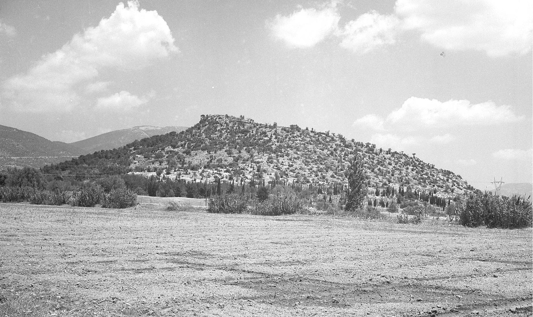
The acropolis of ancient Eretria (Plate 14A) would have effectively controlled the coastal plain and the excellent harbour (only c. 1.5 km distant). Later construction, especially in the Hellenistic period, has destroyed or obscured most of the prehistoric remains on the acropolis. The earlier periods, EH and MH are better preserved, but most Mycenaean structures have obviously been ruined. Nevertheless, Mycenaean sherds have been found at several locations on the hill (cf. the map, AE op. cit. 155, fig. 6). Four sherds (from LH IIIB-C1 Kylikes and Deep Bowls) were found on the surface in 1959 (CSHI, loc. cit. and MG, loc. cit.); the joint Swiss-Greek excavations have later confirmed Mycenaean occupation of the site. The Mycenaean finds on and around the acropolis were listed by Themelis (AE loc. cit., cf. AR 15 loc. cit.). A Mycenaean figurine and a few Mycenaean sherds were found on the southeast slope and a decorated sherd (LH IIIA2 or LH IIIB) by the west gate (AAA 1969 loc. cit., cf. AR 15 loc. cit.). In the excavations a considerable amount of Mycenaean pottery was found in the northeast sector, behind the Hellenistic Tower h (Auberson and Schefold 1972, 137. More recently, LH IIIB and LH IIIC pottery was found, in low ground to south of the acropolis, in the Vouratsa plot (AR 28 loc. cit.). On the acropolis itself, exploration of the summit plateau revealed prehistoric strata, including further Mycenaean pottery, and in particular a LH IIIC Deep Bowl and a wall described as “Cyclopean” (AR 41 loc. cit. and AR 43 loc. cit.). The wall ran from east to west for some distance, and was about a metre wide. It formed the south limit of a Mycenaean room, but the Swiss excavators considered that, because of its thickness, it could also have served as a fortification. The Eretria acropolis is now therefore seen to have been an important Mycenaean centre. There is no evidence of continuity here into the Early Iron Age. The earliest Iron Age remains found are a few traces of the Protogeometric period. After this, the floruit of Eretria began in the Geometric period (Lemos loc. cit. and Dickinson, loc. cit.).
There seems no reason to doubt that the historic Eretria was also the Homeric Eiretria. We have only the testimony of Strabo for the existence of an ‘Old Eretria’ nearby; and this could not have been the city sacked by the Persians in 490 B.C., because we now know that Eretrians had been living at Eretria (i.e. at modern Nea Psara) from at least the beginning of the 8th century B.C. (for the controversy concerning Old Eretria, see the Euboea summary below, and for the Lelantine War see Chapter 3).
Histiaia (Il. 2. 537)
Oreoi: Kastro (Ancient Histiaia): EH II MH LH IIIB-C PG G A C H R M (Euboea No. 6)
Ann. 3 (1921) 276-282, figs. 134-135; BSA 47 (1952) 60 n. 14b, 93; AEM 6 (1959) 327, 310, 313 fig. 31; AD 16 (1960) B 152, pl. 1336; Euboea 39-40, pl. 10 a and b; CSHI, 52; GAC, 267-268 (G 88); MG, 83 (C 80); AD 29 (1973-74) B 487-490; AD 39 (1984) B 1, 125.
Plate 15A. Oreoi: Kastro (Histiaia) from Southwest.
Plate 41B.Oreoi: Kastro (Histiaia) from West.
The Kastro, on the east side of modern Oreoi, is a typical “high mound” site (Plate 15A and Plate 41B), c. 30 m high, near the sea and on the edge of a wide fertile plain. The top surface of the hill, c. 135 m northeast to southwest by c. 100 m, was ringed by medieval fortifications. MH and Mycenaean (LH IIIB) sherds were found (in 1939 and 1959) on the upper part and the northwest slopes; the south and southwest slopes may also have been part of the prehistoric site, although G, C, and H sherds are predominant there. The prehistoric settlement may have occupied c. 200 m northwest to southeast by c. 160 m. The site has been much disturbed and eroded. Trial excavations by Theochares (AEM loc. cit. recovered only EH and MH remains; but Platon later found C, A, G, PG and Mycenaean pottery (including the rim of a LH IIIC Close Style deep bowl), and much Byzantine (AD 29 loc. cit.).
The Kastro of Oreoi is surely the site of the Homeric Histiaia and of the historic Histiaia / Oreoi. Pausanias (7.26.4) says that in his day there were still some who called Oreoi by its ancient name Hestiaia (sic). As Hankey says, it was a point of call for ships travelling (especially to Athens) from the northeast Aegean (cf. Pace in Ann. 3 loc. cit. for the location of Histiaia and the topography of Oreoi as described by Livy 28.7 and 31.45). Excavation has revealed two walls (of two separate buildings) with foundations dated to the 4th century B.C., near the shore at Oreoi (AD 39 loc. cit.). These may have been part of harbour installations. Strabo (1.3.20) tells of an earthquake which ruined the wall by the sea at Oreoi and about seven hundred houses.
Kerinthos (Il. 2. 538)
Kerinthos: Kria Vrisi (Ancient Kerinthos): N? EH MH LH III(A-B) LH IIIC? PG G A C H M (Euboea Nos. 13 and 14)
Ann. 3 (1921) 273-276, fig. 132; AEM 6 (1959) 281, 312; BSA 52 (1957) 2 n. 8; Euboea 43-44, fig. 3 (map), pl. 10 c and d, pp. 103-104; CSHI, 52; AAA 8 (1975) 32-37; AR 22 (1975-76) 5; GAC, 269 (G 92); MG, 83 (C 82); AD 39 (1984) B 124; Sapouna-Sakellaraki 1996; AD 51 (1996) B 1, 309; AR 48 (2001-2002) 55; Lemos 2002, 202, n. 74; MFHDC, 92.
The Homeric epithet ἔϕalος indicates that Kerinthos was on the coast. Strabo (10.1.5) says that it was a small town and near the river Boudoros. The site, known locally as Kastri or Peleki (Euboea No. 13) is a long low ridge, extending c. 800 m east to west, and up to c. 150 m broad, opposite the hamlet of Kria Vrysi, c. 4 km northeast of modern Kerinthos. The river Boudoros (Voudoros) flows below the western foot of Kastri (cf. the sketch map, Euboea fig. 3 showing the position of the estuary here in 1939, as noted by Hankey ibid.). The north side of the ridge, above the shore, was protected by cliffs. Elsewhere there are remains of circuit walls. The historic site occupied the western upper part and the west and south slopes. A building complex of the 4th to 3rd centuries B.C. on the top of the hill was investigated by Sampson (AAA loc. cit.). On the north side of the hill he discovered a building of the 7th to 5th centuries B.C. Pottery found in these trials included PG, G, A and C, and an extensive Hellenistic settlement is reported
(AD loc. cit. and AR loc. cit.). Some EH sherds, obsidian and chert, a Neolithic or EH hand-axe and some possibly MH sherds have been found on the surface at Kastri; but the main centre of MH habitation may have been the adjacent higher hill of Ayios Ilias (Euboea No. 14), where trial excavations by Theocharis revealed MH levels. A few Mycenaean sherds (LH III) were found at Kastri (by the author) in 1959. Sapouna-Sakeliaraki (loc. cit.) lists and illustrates others found by “local enthusiasts and collectors of antiquities”. These include part of a Psi figurine, two fragments of kylix stems, and a krater fragment with tassel decoration “common during LH IIIC” (cf. Mountjoy 1986, 157 fig. 200: 26). There was also an amygdaloid sealstone, of early Late Minoan or early Mycenaean type. The 1959 sherds were all from near the section of the circuit wall halfway down the west slope, where it is about 3 m thick and preserved to a height of c. 1.60 m. The lower part in some places is composed of large roughly shaped blocks. But these were supplemented, presumably at a later date (probably Late Classical or Hellenistic), by only roughly worked smaller stones, of which up to 5 courses remain. Further sections of the wall were seen on the south and at the southeast end, where it is also c. 3 m thick and also employs large stones in its outer face (MFHDC, loc. cit.). Although the lower parts resemble Cyclopean masonry, a Mycenaean date can not be assumed. Now, however, the additional evidence confirms the existence of a Mycenaean settlement at Kastri. Mycenaean fortifications are therefore to be expected here, especially if this had been an important harbour. The estuary, at the mouth of the Boudoros river, observed by Hankey in 1939 (Euboea, fig. 3), may originally have been large enough to provide a sheltered harbour (of cothon type), perhaps the only one on this inhospitable northeast coast of Euboea.
Dion (Il. 2. 538)
- Lichas: Kastri (Ancient Dion?): EH I-III MH LH PG G C R M (Euboea No. 2)
PAE 1912, 140; BSA 47 (1952) 60 n. 146; Euboea 37, 103; CSHI, 53; GAC, 266-267 (G 84); MG, 83 (C 78); AD 49 (1994) B 297.
- Yialtra: Kastelli (Athinai Diades?): N? EH I-III MH LH I-IIIB LH IIIC? PG G A? C H R M (Euboea No. 3)
Plate 41A. Kastelli (? Dion) from East.
PAE 1912, 140; BSA 47 (1952) 60 n. 146; Euboea 37-38, 103, with fig. 1 (plan); GAC, 267 (G 85); MG, 83 (C 79).
- Kastri is a low hill, c. 60 m a.s.l., near the sea, to north of Cape Kenaion and c. 3 km west of Lichas. The flat top of the hill is only c. 30 m by c. 20 m, but the slopes are extensive. On the upper slopes sherds from EH to Geometric are fairly widely scattered; on the lower slopes Classical and Roman were found. The size of the site and its position suggest an important settlement which may have been the Homeric Dion, that Strabo (10.1.5) says was near Kenaion (Euboea No. 1).
- Kastelli is a natural acropolis, (Plate 41A) near the sea about a kilometre to west-southwest of Loutra Yialtron (cf. Euboea fig. 1), on the north side of the road to Lichas. The top surface of the hill measures only c. 70 m north to south by c. 50 m, but there are extensive slopes on the south and east, thickly covered with sherds. The prehistoric pottery is of particularly good quality, especially the MH and LH IIIA-B, and one sherd may be LH IIIC (Euboea, 103). The Mycenaean sherds are said to compare well with those from Chalkis: Trypa (Euboea No. 37, see above). The site is known locally as Tourla or Athinai Diades, and may indeed be the Athinai Diades which Strabo (loc. cit.) mentions, together with Dion, as being near Kenaion and in the territory of Oreoi. Strabo says that Athinai Diades was founded by the Athenians. The name suggests a temple here; there are indeed traces of the foundations of a large building on the top of the hill. This could be the site of the Homeric Dion.
Karystos (Il. 2. 539)
Karystos area: N EH MH LH PG G A C H R M
AEM 6 (1959) 284, 310; Euboea, 80-83; CSHI, 53; AR 51 (2004-2005) 49; BCH 128-129 (2004-2005) 1345-1346 with fig. 197 (map); Sampson 1980; Keller 1985; Chiridoglou 2006; Tankosić and Mathioudaki 2011; AR 58 (2011-2012) 24-25 (Plakari).
The centre of the historic city of Karystos was at Palaiochora, to north of the modern town, on the slopes below the Frankish Kastro, Castel Rosso. Tombs, mainly Classical and Hellenistic, have been found in this vicinity and at other locations around the town, most recently by Chiridoglou (e.g. AR 51 loc. cit.). At Plakari there was a sanctuary in the Geometric period and later; the earliest pottery reported from the current excavations here by A. Karapaschalidou and J.-P. Crielaard is Early Iron Age (AR 58 loc. cit.). Theochares and others have recorded Neolithic and EH finds from the Karystos districts (Euboea, loc. cit., Sampson 1980, Keller 1985). The only MH found was among the surface material (Neolithic to LH) at Ayios Nikolaos, a site of moderate size, but defensible, above Myloi on the northeast edge of Karystos plain. Four Mycenaean sherds were found in the surface survey (Tankosić and Mathioudaki 2011).
So far no signs of Mycenaean settlement have been found in the Karystos plain itself. But, as the authors of Euboea remark, ibid., it is inconceivable that this rich plain was not inhabited and farmed throughout the Bronze Age. The name ka-ru-to on a Thebes Linear B sealing (TH Wu 55b), together with the SUSm (male pig), presumably records a contribution from Karystos (Aravantinos et al. 2001, 355-357).
Styra (Il. 2. 539)
Styra: Nea Styra: N? EH II MH LH IIIC? A C H R M (Euboea No. 88)
AM 16 (1891) 54; AEM 6 (1959) 309; Euboea, 78-80, 104; CSHI, 53-54; GAC, 233 (F 98); AD 54 (1999) B, 343-344; AR 52 (2005-2006) 60.
The ancient Dryopian town of Styra (Herodotus 5.46; cf. Pausanias 4.34.1) was apparently situated about two kilometres south of Nea Styra, where Hankey found Classical and Hellenistic remains on the four hills to south of the plain (Euboea, fig. 15 Nos. 2 to 5). The westernmost hill (No. 2) was on a promontory, off which was a good anchorage, and where remains of a harbour mole had been observed. Nothing prehistoric was seen here, but further north at Lefka, near the shore and only c. 500 m south of Nea Styra, there was good evidence of a substantial Bronze Age settlement (Euboea, fig. 15 No. 1). House walls were partly revealed in a bank at the beach. Sherds included a few possibly Neolithic, EH (including EH II) and several good MH. It is likely that the three marble figurines of Early Cycladic type recovered by Wolters (AM loc. cit.) were also from here. The one possibly LH IIIC sherd (Euboea, 83, 104) is not sufficient to establish Mycenaean occupation; but, as the authors of Euboea remark, “controlled excavation of the area would surely be useful and rewarding”. A Roman building complex was later found nearby (AD loc. cit. and AR loc. cit.).
EUBOEA
The Euboean section has attracted suspicion, since, as Giovannini points out, the Catalogue names here also happen to be those of the later cities of the historical Euboea (Giovannini 1969, 25). But not all of these cities are included; Kyme and Dystos are missing. Moreover, the Catalogue names are also those of the main ancient harbours of Euboea. They would therefore be well known in both the Bronze Age and the Iron Age.
Euboea is not prominent in the ancient Greek traditions. There are no outstanding Euboean heroes in the Iliad, and the Euboean troops are of a tribe, the Abantes, rather than from cities. They are characterized as spearmen of a special kind (Il. 2. 542-544), with the implication that they are somehow different (cf. the elaborate explanation given by Strabo, 10.1.13).
Mycenaean settlement is attested at all the places named in the Euboean section except Styra and Karystos, although the evidence for Chalkis is from tombs only. Despite much recent search, there are still only slight indications of Mycenaean habitation at Styra and Karystos. The location of Homeric Eiretria had previously been in question; the historical Eretria is now shown to have been a substantial Mycenaean centre. There was a significant population increase in Euboea during LH IIIC (Euboea, 99-102, cf. Crielaard 2006, 278-285), as demonstrated particularly at Lefkandi. There are signs that this site lay between two good harbours at this time. In the ‘Megaron’ here continuity into the Early Iron Age is now substantiated (Lemos 2011-2012, 22-24 with refs. and see discussion in Chapter 1 above).
Plate 14B. Amarynthos: Palaiochoria from West.
Lefkandi has been suggested as the site of Strabo’s ‘Old Eretria’ (Popham 1980, 423-427, cf. Lemos 2002, 426, n. 53). Strabo is our only source for this tradition, and it must be remembered that his observations were made from viewpoints along the coast of the mainland opposite Euboea. Accordingly, he places ‘Old Eretria’ as opposite Delphinion and Eretria as opposite Oropos (Strabo 9.2.6). Since Oropos is to west of Delphinion (on the mainland) and, as Strabo correctly says, 20 stades (c. 4 km) from it, the inference would be that ‘Old Eretria’ lay to east of Eretria, whereas Lefkandi is west of Eretria. A further difficulty is that Strabo in another passage says that foundations of the walls of Eretria destroyed in the Persian sack of the city (in 490 B.C.) were still to be seen and that they called the site of these ‘Old Eretria’ (Strabo 10.1.10). Popham (ibid.) realized that Strabo provides no support for identifying ‘Old Eretria’ as Lefkandi, and suggested instead the site of Palaiochoria, to east of modern Amarynthos (GAC, 229-230, F 85). The site has now been identified as ancient Amarynthos. This, according to Strabo (ibid.), was only 7 stades (c. 1.5 km) from Eretria, but the actual distance is c. 10 km. Obviously Strabo is here relying on hearsay; it is not likely that he actually visited many (or any?) of the sites he mentions here (including Oichalia, ‘in the Eretrian territory’, Strabo ibid.). Palaiochoria (alias Gorani or Palaioekklesies) was an important EH, MH and Mycenaean settlement, with “a rich stratigraphy”. All the Mycenaean periods are represented (including some particularly good LH IIIC surface sherds) and there are substantial amounts of both Protogeometric and Geometric pottery from the recent excavations (see Chapter 1). It is now established that Palaiochoria was the site of the sanctuary of Artemis Amarysia.
The occurrence, on Thebes Linear B tablets, of the names a-ma-ru-to and ka-ru-to (on TH Wu 58 and TH Wu 55 respectively) (TITHEMY, 43, cf. Aravantinos et al. 355-357) has been taken as implying that Amarynthos and Karystos were under the “effective control” of Thebes in LH IIIB (Dickinson 2007, 236). But the contribution listed from these places, a-ma-ru-to and ka-ru-to is in each case a pig, an item probably destined for a ceremonial feast (cf. Palaima 2008). The place a-ma-ru-to is also listed as the recipient (a-ma-ru-to-de) of a consignment of wool (TH Of 25.1, TITHEMY, 35, cf. Aravantinos et al, loc. cit.). For Amarynthos and Lefkandi see also Chapter 1.
Athenai (Il. 2. 546)
Athens: N EH I-II MH LH I-IIIC SM PG G A C H R M
Selected references: Iakovidis 1962; CSHI, 56-58; GAC, 198-200 (F 1); MG, 41-43 (B 1), Mountjoy 1993, 130-134; Mountjoy 1995; Wright 1994; Lemos 2002, 14-15, 230-231; MFHDC, 65 with fig. 2 and pl. 19a; Vitale 2006, 194-195, 198-201; Lemos 2006.
Athens was the major centre in Attica throughout the Mycenaean period and continuous thereafter. No further comment on the archaeological data is offered here.
“The Athenians play a most unimportant part in Homer” (Nilsson 1972, 162). Nevertheless, the very obscurity of the Athenian leader Menestheus, son of Peteos, shows that the tradition of his leadership is likely to be genuine. “….. the Athenian contingent was led by the feeble Menestheus, in himself sufficient argument against this passage being a later, Athenian insertion”. (Coldstream 1976, 16, cf. Allen 1921, 24, 55-56, Page 1959, 145-146 with nn. 78 and 79). He plays only a small role in the War, mentioned again only in the ‘Little Catalogue’ of the participants in the battle at the Ships (Il. 13. 690). The Athenian section of the Catalogue begins with the story of the installation, by the goddess Athena, of Erechtheus in her shrine (Il. 2. 546-551). There is no mention here, however, of Theseus, who was later celebrated as the national hero of Athens (Nilsson 1972, 163-186) and is named among the heroes who fought against the Centaurs (the ϕηϱσὶν, Il. 1. 262-268). The synoecism, by which the whole of Attica was organized under Athens, was traditionally attributed to Theseus, as Thucydides recalls. But Thucydides at the same time points out that most Athenians lived outside Athens in independent communities, and were only forced to take refuge in the city by the threat of Spartan invasion of Attica (Thuc. 2, 15-16).
Athens is the only place named in the contingent. “The difficulty with this entry lies not so much in what it contains as what it omits …. The Catalogue elsewhere refers to plenty of places which can hardly be regarded as more worthy of mention than, for example, Eleusis, Aphidna, Marathon or Thorikos” (CSHI, 56 with n. 2). All of these feature in Greek tradition (for Eleusis cf. Hymn to Demeter, lines 97, 318, 356 and 490; for Aphidna cf. Herodotus 9.73; for Marathon cf. Od. 7. 80; for Thorikos cf. Hymn to Demeter, line 126, cf. Nilsson 1972, 159-162) and all of them had significant Mycenaean settlements (GAC nos. F 9, F 54, F 51 and F 25 respectively). It is conceivable that Athenian editors excluded all such places (supposedly in order to project the synoecism of Attica back into the heroic past). But in any case it is likely that some or all of their names were included in the Catalogue accompanying the original Ten Year Iliad, and that the names may simply have dropped out in the course of transmission (cf. Allen 1921, 172). Visser 1997, 437-439 cites the three hexameter lines composed gratuitously by Hope Simpson (1983, 131). These lines were invented as an illustration of a hypothetical expansion of the Anthenian contingent, to include Eleusis, Aphidna, Marathon and Thorikos. The lines combined plagiarisms from the Hymn to Demeter etc. Visser here also adds his own hexameter versions, created by similar means.
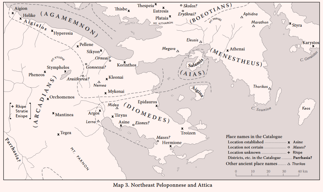
Salamis (Il. 2. 537)
Salamis: Kanakia: MH LH IIIB-IIIC Early C H
AR 47 (2000-2001) 14-15, 48 (2001-2002) 14-15, 49 (2002-2003) 13*, 50 (2003-2004) -9-11, 51 (2004-2005) 10, 52 (2005-2006) 14*, 53 (2006-2007) 9*, 55 (2008-2009) 6-7, 57 (2010-2011) 23, 25; MFHDC 70
[* Reports in the Greek Press]
Other Mycenaean Finds on the island of Salamis
Salamis: The Arsenal: LH IIIC? SMyc
GAC, 204 (F 10); MG, 47 (B 16); MFHDC, 70
Salamis: Ambelakia: LH IIIB LH IIIC? C
GAC, 204-205 (F 11); MG, 47 (B 17)
Salamis: Modern Salamis: EH MH LH IIA-IIIC C
GAC, 205 (F 12); MG, 47 (B 18); AD 33 (1978) B 51; AR 31 (1984-85) 12; AR 32 (1985-86) 18.
The site of Kanakia, on the southwest coast of the island of Salamis, was discovered by Professor Y.G. Lolos of the University of Ioannina during his survey of the previously unexplored area of southern Salamis (cf. CSHI, 59). His excavations have revealed a Mycenaean urban complex, consisting of an acropolis, a ‘lower town’ and satellite settlements (AR 50 loc. cit.). The site adjoins two harbours, from which a road, partly paved, leads along the north side of the site to its higher terraces (see plan, fig. 27 in AR 47). Three of the buildings excavated on the acropolis formed a “solid industrial complex”, which included two ‘megara’, one of which is compared (AR 51 loc. cit.) to the megaron on a terrace within the citadel of Midea in the Argolid. Kanakia was flourishing in LH IIIB, but was partially destroyed by fire early in the LH IIIC. After a short reoccupation in one area, it was abandoned in a very early phase of LH IIIC and never reoccupied. A large amount of pottery was recovered; over 40 shapes are represented. Among other finds are a fragment of a Cypriot copper ingot, a small hoard of bronze implements and a large quantity of crushed murex shells. Trade connections with Aigina, the Dodecanese and Cyprus are noted.
Kanakia is now clearly shown to have been the main Mycenaean settlement on the island “the seat of the local ruling dynasty” (AR 51 loc. cit.). It is also marked as the site of ‘Old Salamis’, referred to by Strabo (9.1.9) as deserted in his day and facing towards Aigina and the south [wind], whereas, as he says, the Salamis of his time was on a peninsular like place opposite Attica. Indeed this latter description correctly matches the location of the historic Salamis. Before the discovery of Kanakia, all the known Mycenaean sites on Salamis (The Arsenal, Ambelakia and Modern Salamis above) were in the north and east of the island. Accordingly, it had been suggested that the Mycenaean capital of Salamis was at Modern Salamis (GAL, 205); and it had been assumed that the great hero Ajax (Aias, son of Telamon), the ruler of Salamis, had only a “comparatively insignificant” kingdom (CSHI, 59). This assumption is now conclusively disproved.
THE KINGDOM OF DIOMEDES
Argos (Il. 2. 559):
Argos: N EH II (- III?) MH LH I-IIIC SMyc PG G A C H R M
Selected references: Deshayes 1966 (Deiras cemetery); CSHI, 61; Hägg 1974 (Smyc, PG and G): GAC, 43-45 (A 8); MG, 24 (A 14); AD 29 (1973-74) B 212-246; AD 35 (1980) B 25-31; AD 47 (1992) B 85-72; AD 49 (1994) B 128-145; AD 55 (2000) B 166-168; Lemos 2002, 12-13, 21, 138-139 with fig. 10 (map), 232; MFHDC, 39. See also reports in AR from AR 43 (1996-1997) to AR 56 (2009-2010). For the MH settlement on the Aspis see reports in BCH on the 2000, 2001, 2006, 2008 and 2009 campaigns by the French School.
There was an extensive MH settlement centred on the Aspis hill to north of modern Argos. Evidence for Mycenaean occupation comes mainly from tombs in various localities in and around the modern town. The few remains of Mycenaean houses found were mainly in the northern part of the town and on the eastern slopes of the Aspis, where a road over 5 m wide separated the Mycenaean settlement from the Mycenaean cemetery to the east (AD 55 loc. cit., cf. AD 46 loc. cit.). Most of the Mycenaean pottery recovered is LH IIIA and LH IIIB, but all the Mycenaean periods are represented, and there was a considerable quantity of LH IIIC. There is no evidence for Mycenaean fortifications on either the Larisa citadel (the acropolis of the historical Argos) or on the Aspis (MFHDC loc. cit.), although the Aspis had a MH circuit wall. There is considerable evidence of continuity through the SMyc. phase into the Protogeometric (Lemos 2002; AR 51 (2004-2005) 20-21).
Since most of the Mycenaean settlement has been destroyed or buried by later construction at Argos, it is difficult to estimate its original size and importance. It was presumably considered to have been the centre of Diomedes’ Kingdom, although this is not specifically indicated in the Catalogue. Argos is one of the three cities most dear to Hera, “Argos and Sparte and Mycenae of the wide streets” (Il. 4. 51-52).
Tiryns (Il. 2. 559)
Tiryns: N EH I-III MH LH I-IIIC SMyc PG G A C H R
Selected references: CSHI, 61; GAC, 41-43 (A 7); MG, 20-21 (A 10); Iakovidis 1983, esp. 3-19; Kilian 1988, esp. 134; Iakovidis 1993; Dickinson 1994, esp. 153-164; Zangger 1994; Shelmerdine 1997, esp. 542-543, 557-559; Iakovidis 1999; AR 47 (2000-2001) 30-31; AR 49 (2002-2003) 26; AR 50 (2003-2004) 23-24; MFHDC, 36, 182-184; Maran 2006; AR 53 (2006-2007) 21-23; AR 55 (2008-2009) 24-25; AR (2009-2010) 35-36; Lemos 2002, 12-14, 17, 22, 139-140, 232-233 (SMyc and PG).
Tiryns was second only to Mycenae in the Peloponnese in the Third Palatial Period (LH IIIA-B), when it became an administrative centre and was also probably the main port of Mycenae (see Chapter 1). After the collapse of palatial administration at the end of LH IIIB2, the Tiryns settlement was substantially rebuilt, both within the citadel and in the ‘Lower Town’ around it. The previous LH IIIB houses outside the citadel had been mostly buried under allurium; but diversion of the Manessi river, by means of a dam and canal, enabled rebuilding (Zangger 1994, cf. MFHDC, 182-184). Tiryns continued to prosper throughout LH IIIC. There is evidence for continuity through the SubMycenaean phase into Protogeometric and Geometric, although the Early Iron Age occupation was on a much smaller scale.
The Homeric epithet τeιχιόeσσa (‘well walled’) is particularly appropriate to Tiryns, whose walls were supposed to have been built for its king Proitos by the Cyclopes (Strabo 8.6.11; Pausanias 2.25.8). Pausanias comments on the Cyclopean unworked stones “so big that a pair of mules could not move the smallest ….”, and he notes also the use of small stones for bonding.
Hermione (Il. 2. 560)
Ermioni: Magoula: EH I-III MH LH I-IIIC C H
PAE (1909) 175-176; AM 36 (1911) 37; CSHI, 62; GAC, 57 (A 41); MG, 31 (A 41); Jameson et al. 1994, 487-488 with fig. A. 24 (site E 13); AD 49 (1994) B 147-150.
Plate 16A. Asine. The Acropolis from West.
Plate 16B. Hermione: Kastri from West.
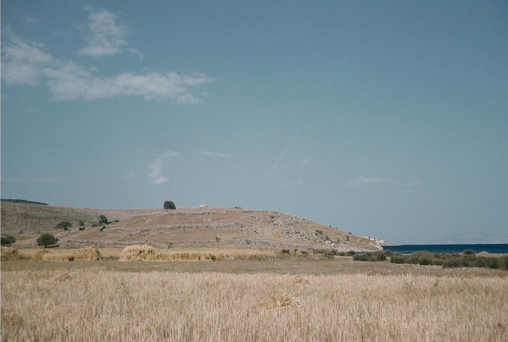
The low hill of Magoula (Plate 16B) is on the coast about a kilometre west of modern Ermioni, which occupies the Bisti peninsula, the site of the medieval Kastri and of ancient Hermion (Jameson et al. 1994, site E 19, index s.v. ‘Hermion’ and esp. 488-489, 581-595 with fig. E. 1). To west of the Magoula hill is a small fertile plain. The upper surface of the hill is not large (c. 125 m northeast to southwest by c. 55 m) but the slopes are extensive (cf. Jameson et al. air photo fig. A 24). Surface pottery on the top and slopes includes all EH periods, and many MH sherds. All Mycenaean periods are represented; a fragment of a ‘Panel Style’ Deep Bowl is LH IIIB2 or LH IIIC Early. Excavations [AD loc. cit., cf. AR 46 (1999-2000) 36] uncovered a Late MH apsidal house and part of an Early Mycenaean house (destroyed by fire). Sherds of all the Mycenaean periods were reported. A Mycenaean settlement of at least medium size is indicated, the candidate for the Homeric Hermione (cf. Jameson et al. 59-60 n. 2).
In his detailed account of Hermion, Pausanias (2.34.9 to 35.11) distinguishes the ‘former city’ from the city of his day. The ‘former city’ apparently occupied the eastern part of the Bisti peninsula, the later city was on the western part and the slopes of higher hill of Pron (modern Miloi) above on the west. The city had good harbours on the north and south; the necropolis was below Pron on the north (Jameson et al. fig. E. 1). The recent exploration (e.g. AD loc. cit. and AR loc. cit.) attests habitation at Hermion from Protogeometric to Late Roman.
Asine (Il. 2. 560)
Ancient Asine: EH I-III MH LH I-IIIC SMyc PG G A C H R
Selected references: Frödin and Persson 1938 (Asine I); Desborough 1964, 82-84; CSHI, 62; GAC, 49 (A 20); MG, 26 (A 24) with pl. 5a; Dietz 1982 (Asine II, Fasc. 1); Fitzell 1986 (Asine II, Fasc. 3); Wells 1976 and 1983 (Asine II, Fasc. 4); AR 32 (1985-86) 27; AR 37 (1990-1991) 20; Wells 1992; Mountjoy 1993, 129-130; Zangger 1994a; Wells and Runnels 1996, 187-190 esp. n. 7; Lemos 2002, 13-14, 17, 21, 136-138, 232; MFHDC, 40.
Kastri, the acropolis of ancient Asine, is a rocky peninsula adjoining a long sandy beach, suitable for the drawing up of ancient ships (Plate 16A). The prehistoric settlement here was large. In late MH it already occupied c. 60,000 m2, including part of the plain east of Kastri. (Dietz 1982). In the Mycenaean period the inhabited area was equally extensive and included LH II-IIIA buildings. Occupation in LH IIIB was “thin” (Desborough loc. cit.); but the LH IIIC period is well represented, both in the mostly large and rich tombs on the east slopes of the Barbouna hill to northwest of Kastraki and in several areas of the settlement. Indeed the settlement may have expanded in LH IIIC (Fitzell loc. cit., cf. Dickinson 2006, 63), especially in LH IIIC Middle (e.g. AR 37 loc. cit.). Continuity into the Early Iron Age is well documented, with a considerable amount of Protogeometric material (Lemos 2002). No Mycenaean fortifications have been found. The fortifications on the Barbouna hill are Late Geometric and the circuit walls of the Kastri citadel are Late Classical (the terminus post quem is c. 300 B.C., Wells 1992, and cf. Wells and Runnels 1996 for Barbouna). For the harbour see Zangger 1994a.
It seems that neither Strabo nor Pausanias visited Asine. Strabo (8.6.11 and 13) cites Theopompos for the story that the Spartans settled the inhabitants of Asine in the Messenian Asine. He also relates the dubious tradition that the Argive Asine was founded by the Dryopes. But he does at least confirm that it was an Argive village near Nauplia.
Troizen (Il. 2. 561)
Ancient Troizen: EH II PG? G A C H R
General references: Frazer 1898 III 273-275; AD 5 (1889) 163-164; reports in BCH 1892, 1893, 1897, 1900, 1905 and 1906; Welter 1911; Burr 1944, 46-47; CSHI, 62; Faraklas 1971; AR 56 (2009-2010) 21 (cemetery).
The Asklepieion: AM 36 (1911) 33-34; Welter 1911, 10, Taf 1, 50; GAC, 54 (A 33); MG, 30 (A 35B).
Galatas: Megali Magoula: MH LH I-IIIB
AR 50 (2003-2004) 13; AR 53 (2006-2007) 9; AR 57 (2010-2011) 22 with fig. 25 (plan).
The historical city of Troizen was partly explored by members of the French School from 1890 to 1905 (BCH refs.), who uncovered remains of the temple of Hippolytos, the Asklepieion and a gymnasion. Tombs in the cemeteries range from G to R. The topography was summarised by Welter (1941) and Faraklas (1971). The only prehistoric finds are the EH II sherds on the Asklepieion site (GAC loc. cit. and MG loc. cit.). This is a broad and low spur on the south side of the plain of Troizen and not far to the west of the city centre.
Megali Magoula is a low hill c. 2 km to east-northeast of the historic Troizen, and overlooking its harbour of Pogon (modern Vidi) mentioned by Strabo (8.6.14). The top of the Magoula hill was occupied by a MH fortified settlement of about a hectare in area. The reports of the excavations here are those in Greek newspapers (cited in AR 50, 53 and 57). On the west slope of the hill three Mycenaean tholos tombs were investigated. They had been disturbed and partly looted. The finds in one tholos were dated MH III to LH I, the pottery in the other two tholoi was LH IIB to LH IIIB, and the chamber of one of these was said to be 11 m in diameter. Finds were said to include gold jewellery, a bronze sword, terracotta figurines and a Caananite jar. The Mycenaean settlement site here has not yet been discovered.
Troizen is rich in legend. Among the many shrines within the city described by Pausanias (2.30.5 to 32.6) is that of Hippolytos, the son of Theseus. According to legend, Theseus was the son of the Athenian king Aigieus and of the daughter of King Pittheus of Troizen. Naturally, the people of Troizen exploited the myth of the birth of Theseus, although most of his later ‘deeds’ (modelled on the ‘labours’ of Herakles) are connected with Athens (Nilsson 1972, 163-180).
Eiones (Il. 2. 561)
Burr 1944, 47-48; CSHI, 62-63; Jameson et al. 1994, 58-60, 484-485.
The location of Eiones is unknown. Strabo’s story (8.6.13), that it was depopulated and made into a naval station which subsequently disappeared, “looks suspiciously like pure invention” (CSHI, 62). Burr conjectured that Eiones was Kandia: Kastro (GAC, A 21 = MG, A 25, cf. MFHDC, 40-41and marked ‘Eiones?’ on CSHI Map 3). Jameson et al. conjectured that it was Sambariza Magoula (site E 9), on the south coast of the Argolid, c. 4 km east of Thermisi, a site where considerable amounts of LH, PG and G sherds were found. They also record other guesses.
Epidauros (Il. 2. 561)
Palaia Epidhavros: Panayia (Ancient Epidauros): MH LH II-IIIC SMyc PG G A C H R M
AD (1888) 155-158; AM 36 (1911) 29; CSHI, 63; GAC, 52-53 (A 28); MG, 29 (A 31); AD 29 (1974) A 70-87; AD 37 (1981) B 87-89; AD 49 (1994) B 158-159; AR 56 (2009-2010) 39-40.
The Asklepieion and Temple of Apollo Maleatas: EH II-III MH LH I-IIIB G A C H R
Ergon (1975) 101-107; Ergon (1976) 111-118; Ergon (1977) 98-105; Ergon (1978) 36-43; GAC, 52 (A 27); MG, 27, 29 (A 30); Ergon (1983) 59-64; Ergon (1987) 92-97; Ergon (1999) 56-58; Reports in AR vols. 22, 24, 25, 26, 31, 35, 46.
The historical town of Epidauros was centred on the headland to southeast of the harbour of the modern Palaia Epidhavros. The acropolis was the steep hill of Panayia which was ringed by a circuit wall around its upper slopes, where there are widespread Classical and Hellenistic sherds. Remains from Geometric to Roman have been discovered within the town of Palaia Epidhavros. The Mycenaean cemetery was on the southwest edge of the town, to west of the road and about a kilometre to northwest of the acropolis. The chamber tombs here range in date from LH II to LH IIIC (AD refs.) and remains were found of a cremation burial of SMyc or PG (AR 56). Epidauros is assumed to have been the main Mycenaean harbour on the east coast of the Argolid. A Mycenaean main highway between Tiryns and Epidauros is evidenced by four Mycenaean bridges of Cyclopean construction in the vicinity of Ayios Ioannis (MFHDC, 158-159 with refs.).
The Classical Temple of Apollo Maleatas in the precinct of the Epidauros Asklepieion was preceded by a Mycenaean shrine, with an open-air altar, and deposits of clean ash, stone and votives, especially figurines, including large hollow animal figurines, and pottery fragments ranging from LH I to LH IIIB. On the slopes of Mt. Kynourtion, and only c. 30 m from the shrine, there was a small Mycenaean settlement, preceded by EH III and MH habitation (Ergon and GAC refs. above). There is, however, no evidence of continuity of cult here into the Early Iron Age.
Aigina (Il. 2. 567)
Aigina: Kolonna: N EH II-III MH LH I-IIIC PG G A C H R
Welter 1938, esp. 7-21; Hiller 1976; GAC, 59 (A 45); MG, 32 (A 47); Walter and Felten 1981; Walter 1983; MFHDC, 72 with refs.; reports in AR vols. 31, 40, 41, 43, 45, 46, 47, 49, 50, 51 and 52; BCH 111 (1987) 527.
Other Mycenaean sites on Aigina
Temple of Aphaia: N LH IIIA-B LH IIIC? G A C H
Furtwängler 1906, 369, 434, 471; Welter 1938, 7; GAC, 59-60 (A 46); MG, 32 (A 48).
Kilindra: LH IIIA2(-B?)
Furtwängler 1906, 435; GAC, 60 (A 49); MG, 32 (A 49).
Mt. Oros: MH LH IIB or LH IIIA1 LH III(A-B) A C H
Furtwängler 1906, 473; Fimmen 1921, 9; GAC, 60 (A 48); MG, 32-33 (A 50); Reports in AR vols. 34, 45 and 47.
Lazarides: MH LH I-IIIC Early
AD 34 (1979) B 70-71; AR 26 (1979-80) 19; AR 34 (1987-88) 14; AR 57 (2010-2011) 23-24.
The island of Aigina has not been intensively surveyed, and excavations have concentrated on the temple sites. The main prehistoric settlement was at Kolonna, a low mound site on the promontory at the northwest edge of the modern town and harbour of Aigina. The site was first fortified in EH, and in MH a wall over 5 m thick separated the ‘acropolis’ from its ‘lower town’. This wall was remodelled in the Early Mycenaean period, and is reported as continuing “sur une longue distance” (BCH 111 loc. cit.) to southeast of the later Temple of Apollo. The settlement was extensive in MH and LH I-II, and continued to prosper in LH IIIA. There is less LH IIIB material, and little LH IIIC. After this the earliest finds are Late Protogeometric, and continuous occupation is attested thereafter until the 2nd century B.C.
At the Temple of Aphaia some figurines and sherds were found, mainly LH IIIA and LH IIIB; one figurine and one sherd may be LH IIIC. At Kilindra, near one of the few beaches on the east coast, some whole vases, mainly LH IIIA, come from a grave. The summit of Mt. Oros was enclosed by a fortified settlement in MH and LH. Later a small Archaic temple and altar was placed in the centre; and in the 6th century B.C. the Sanctuary of Zeus Hellanios was built on the north slope. At Lazarides, midway between the Temple of Aphaia and Mt. Oros, a LH building and three built Mycenaean chamber tombs were found (AD 34 loc. cit. ad AR 34 loc. cit.). Later investigations revealed a prehistoric settlement to southeast of the tombs, occupied from MH to LH IIIC Early. This was apparently of some importance; small scale industrial activity and trade contacts (e.g. lead from Lavrion) are recorded (AR 57 loc. cit.).
Mases (Il. 2. 562)
Koiladha: Magoula Evstratiou (Mases): EH I-II LH G A C H R M
Jameson et al. 1994, 466-467 (site C 11).
General references: Meyer 1930; CSHI, 63; Jameson et al. 1994, index s.v. ‘Mases’, esp. 246-248 with fig. 4. 31 (survey map), 374-377, 574-575.
Pausanias’ account of his jouney from Hermion to Mases (Pausanias 2.36.1-3) shows that Mases (in his day a harbour used by the peope of Hermion) lay in the vicinity of the modern Koiladha bay (cf. Jameson et al. 1994, 574-575). The centre of the historic Mases has been identified by Jameson et al. as site C 11. They also believe that this site, together with the nearby smaller sites C 17, C 41 and C 43, was the Mases of the Homeric Catalogue. Site C 11 (Magoula Evstratiou) is an artificial mound, c. 5 ha in area, in the plain (the Kambos) c. 1.5 km southeast of Koiladha and c. 500 m from the present shoreline. Of the surface sherds EH were the most numerous (about 39% of the total) and LH only 9%; the remainder were Archaic (only a few) and C H R M and modern. Mycenaean sherds were found at several other sites in this district (the territory of the historic Mases, Jameson et al. 1994 fig. 6. 15, cf. fig. 6. 14 Late Bronze Age), including some sherds near the Franchthi cave. The site of Ayios Ioannis (MG, 31 site A 43 = Jameson et al. 508-509 site F 4) is a small promontory to north of Koiladha bay and c. 700 m north of the Franchthi cave (C 13). Here, within an area of c. 1.4 ha, were numerous Mycenaean sherds (69% of the total, and including LH IIIB) from Kylikes, bowls, kraters, jars and cooking ware; also found were some A, C, H and R. A smaller site (F 12) c. 300 m to the east may be connected with the Ayios Ioannis site.
THE KINGDOM OF DIOMEDES
Argos is the first name listed in the Kingdom, and this may imply that it was assumed to be Diomedes’ capital, although the placement of Tiryns at the end of this first line (Il. 2. 559) would have been necessitated by the meter. Tiryns was obviously more important than Argos in the Mycenaean period, and it continued to flourish in LH III, after the collapse of the palatial system, as did also Asine. The territory of the Kingdom appears to comprise all of the Argolid except the Mycenae area in the north. Not mentioned, however, is Midea, an important Mycenaean citadel between Tiryns and Mycenae, described by Strabo (8.6.11) as bordering on Tiryns and on the Argive Heraion (Prosymna). The inclusion of Aigina in the Kingdom is odd. The controversial division in the Catalogue of the Argolid (between Diomedes and Agamemnon) is discussed at the end of the Agamemnon section below.
THE KINGDOM OF AGAMEMNON
Mycenae (Il. 2. 569)
N EH I-III MH LH I-IIIC SMyc PG A C H
Selected references: Wace 1949; Mylonas 1966; GAC, 28-32 (A 1); MG, 11-17 (A 1); Iakovidis 1983, esp. 23-72; Dickinson 1994, esp. 77-87, 153-164; Shelmerdine 1997 esp. 541-543, 580-584; Iakovidis and French (eds.) 2003; MFHDC, 34-35, 38; Dickinson 2006 esp. 24-78. See also reports on Mycenae in Ergon and AR for the years 2000 to 2013 for excavations in the ‘Lower Town’ and houses outside the citadel.
Mycenae, with its extensive town and ‘satellite’ communities reached the height of its magnificance and prosperity in LH IIIA2-B, up to the time of the ‘collapse’ of palatial administration at the end of LH IIIB2 (Shelmerdine 1997 and Dickinson 2006; see Chapter 1). But, although some parts of the citadel were abandoned, there was some recovery in LH IIIC and evidence of continuity into the Early Iron Age on a modest scale.
The description of Mycenae in the Catalogue (Il. 2. 569), ἐϋkτίμeνον πτοlίeθρον (‘well-built city), is obviously appropriate, although the phrase is a metrical expedient. It is also employed in the Catalogue for Medeon (Il. 2. 501), for Athens (Il. 2. 546) and, perhaps inappropriately, for Hypothebai (Il. 2. 505). Elsewhere in the Iliad, Mycenae is ποlυχϱúσοιο Μυκήνhς (‘Mycenae, rich in gold’, Il. 7. 180 and 11, 46, cf. Od. 3. 304) and eὐϱυάγυιa (‘with wide streets’), a description which perhaps suggests some faint recollection of the Mycenae highways (MFHDC, 148-156).
Korinthos (Il. 2. 570)
Ancient Corinth: N EH I-II MH? LH I-IIIC SMyc PG G A C H R M
Selected references: GAC, 61-62 (A 52); MG, 33-34 (A 54); Rutter 1979; Morgan 1999, esp. 354-355, 470-474; Lemos 2002, 233.
Korakou: EH I-III MH LH I-IIIC A C
Blegen 1921; Rutter 1974; GAC, 61 (A 50); MG, 33 (A 51); Morgan 1999, esp. 357-358, 469; MFHDC, 42.
Plate 17A. Corinth. Temple of Apollo from North, with Acrocorinth behind.

Plate 17B. Cleonae. The Mycenaean Site from Southeast.
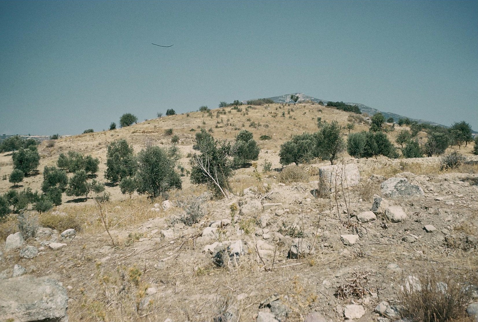
The prehistoric material found at ancient Corinth is scarce, presumably due to the continuous later construction. In almost all cases the Mycenaean remains are in disturbed deposits; but they are widespread, and all LH periods are represented, including SMyc. The pattern suggests a centre in and around the area of the Temple of Apollo (Plate 17A) and subsidiary settlements in other areas, especially at the site of the later sanctuary of Demeter and Kore and at Mylos Cheliotou, c. 750 m from the centre. The few Protogeometric finds are mainly from graves, and are greatly outnumbered by the Geometric, which mark the real beginning of the growth of the historic Corinth. The harbour site of Mycenaean Corinth was at Korakou, near Lechaion, the main harbour of later Corinth. Korakou, a ‘high mound’ site, was a bluff above the south shore of the Corinthian Gulf, only c. 3 km northeast of ancient Corinth. The Mycenaean settlement, partly excavated by Blegen, occupied an area c. 260 m east to west by c. 115 m, with remains of a circuit wall. Subsequent rescue excavations revealed house walls and associated LH IIIB and LH IIIC sherds at a location c. 700 m to south of Blegen’s excavations, indicating a larger extent of habitation here.
The epithet for Korinthos in the Catalogue is ẚϕνeιός (wealthy). Leaf’s assertion, that Corinth was not wealthy was refuted long ago by Allen (1921, 64-66). It is strange that this assertion still survives (in Dickinson 2007, 235). The agricultural riches of Corinth and its vicinity in Mycenaean times are amply demonstrated by the sizes of their settlements in the Corinthia, especially Korakou and Gonia. Some later Corinthians were apparently unwilling to accept that their city had been subject to Agamemnon. An attempt was made to identify it with the Homeric Ephyre, home of Sisyphos and Bellerophon (Il. 6. 152 and 210). This ancient heresy was also refuted by Allen (65 n. 2, cf. CSHI, 66 with n. 12).
Kleonai (Il. 2. 570)
Ancient Kleonai: EH II MH LH I/II-IIIB A C H R M
Frazer 1898 III 82-83; AA 1913, 114 ff.; AA 1939, 271-272; CSHI, 66; Sakellariou and Faraklas 1971, app. II 33-34; GAC, 67 (A 69); MG, 35 (A 62); Morgan 1999, 469; reports in AR vols. 49 to 56; MFHDC, 152-154.
Ayios Vasilios: Zygouries: EH I-III MH LH I-IIIC Middle G M
Blegen 1928; BSA 64 (1969) 269 n. 18; GAC, 66 (A 67); MG, 35 (A 63); Morgan 1999, esp. 359-361, 364-366; Marchand 2002, n. 65.
Ancient Kleonai lies about 4 km northwest of Ayios Vasilios village, in the Longopotamos valley, along which probably ran one of the Mycenaean highways leading to the Corinthian plain (cf. MFHDC loc. cit.). The remains of the historic city are currently being investigated (AR reports cited above). The highest, and westernmost, of the three hills which formed the acropolis was the centre of a large Mycenaean settlement, estimated as c. 300 m north to south by c. 250 m (Plate 17B). The hill is steep on the west and northwest, but slopes more gently on the south; on the east it connects with the ‘lower acropolis’, on which was the so-called ‘Temple of Athena’ (AA 1913 loc. cit.). The Mycenaean settlement is attested by fine surface pottery, including MH, LH IIB ‘Ephyraean ware’ and good LH IIIA and LH IIIB specimens from Kylikes and Deep Bowls.
In the same valley, on the southwest edge of Ayios Vasilios, is another important Mycenaean settlement, the ‘low mound’ site of Zygouries. The mound itself is only c. 170 m northeast to southwest by 90 m., but trial trenches in the plain below also revealed walls and sherds, especially LH IIIB. The EH II and LH IIIB phases were the most important; both ended, with destructions by fire. A LH IIIB floruit is marked by the so-called “Potters’ Shop’, probably the basement of a mansion. After the LH IIIB destruction, settlement continued on a more modest scale into LH IIIC, and some LH IIIC Middle Granary and Close Style pottery was found (Morgan 1999, 365). It can not yet be determined which of the two Mycenaean settlements, Kleonai or Zygouries, was the most important in the Kleonai valley (cf. Marchand loc. cit.).
Orneai (Il. 2. 571)
Dorati: N EH II MH LH I-IIIC
Reports by J. Marchand in Hesperia 71 (2002) 119-148, AR 51 (2004-2005) 18, AR 52 (2005-2006) 23-24, and AR 53 (2006-2007) 14.
The discovery, by J. Marchand, of the prehistoric site of Dorati has now provided a successful conclusion of the search for Homeric Orneai. Dorati, to north of the village of Soulinari in the Corinthia, is a conglomerate buff on the eastern side of the Nemea river, overlooking the coastal plain of Sikyon and Corinth (Marchand 2002). Its top area is a natural acropolis, a plateau with an area of c. 46,595 m2. But abundant surface sherds (56,000 were processed in the field) were found on the hill and its slopes over a (minimum) area of c. 106,000 m2, comparable to the c. 120,000 m2 of Platana (Aidonia – see below under Araithyrea) and larger than Gonia (c. 87,500 m2), Kleonai (c. 75,000 m2), Tsoungiza (c. 75,000 m2) and Korakou (minimum c. 29,900 m2 – the figure of 225,000 m2 in Hope Simpson 1981, 33 was a typographical error). Most of the surface pottery at Dorati is Mycenaean, mainly LH III, and especially LH IIIB and LH IIIC. Apparently the site was not occupied after the end of the Mycenaean period (AR 52 loc. cit.).
Marchand provides convincing arguments for the identification of Dorati as Strabo’s Corinthian Orneai and the Orneai of the Homeric Catalogue. According to Strabo, this Orneai was between Corinth and Sikyon (Strabo 8.6.17). “Orneai is named after the river that flows past it. It is deserted now, although formerly it was well-peopled ….. Orneai is situated above the plain of the Sicyonians …..” (Strabo 8.6.24). In one last passage (Strabo 13.1.12) Orneai is mentioned as near Corinth (Marchand 2002, 132-138). As Marchand points out, the location of Dorati corresponds to that of Orneai in Strabo’s account, near a major river and overlooking the territory of Sikyon; and Dorati was indeed abandoned by Strabo’s time [Marchand 2002, loc. cit. and see figs. 1 and 13 (maps) and figs. 14 and 15 (photos)]. Pausanias (2.25.4-6) may have been persuaded by local traditions when he assumed that the Homeric Orneai was the Argive Orneai. Hope Simpson and Lazenby (CSHI, 66-67), like many others, had put their trust in Pausanias’ account (2.25.5-6) and had accepted his story that Homeric Orneai was the Argive Orneai. But it appears that Pausanias was here repeating local hearsay and may not have heard of a Corinthian Orneai. The discovery of Dorati has now resolved the problem, and, as Marchand says, identification of Dorati as Homeric Orneai would make better sense of the Catalogue’s description of the realm of Agamemnon.
Araithyrea (Il. 2. 571)
Aidonia: EH? MH LH I-IIIB C
Selected references: AR 26 (1979-80) 25; Ergon 1986, 99-100; AR 33 (1986-87) 17; Krystalli-Votsi 1996; Demakopoulou 1996; AD 54 (1999) B 148-149; BCH 124 (2000) 796; AR 47 (2000-2001) 25-26; AR 49 (2002-2003) 21-22; AR 52 (2005-2006) 26.
The ‘Aidonia treasure’, gold and jewellery looted from a Mycenaean tomb there, was returned to Greece in 1996. It was displayed in the National Archaeological Museum of Athens and catalogued before its permanent exhibition in the Nemea Museum (Demakopoulou 1996). The Mycenaean cemetery at Aidonia, from which the ‘treasure’ had been stolen, was a rock outcrop on a broad and gentle hillslope. Twenty tombs (nineteen rock-cut chamber tombs and one shaft grave) were excavated by Krystalli-Votsi in 1978-1980 and in 1986. Most had been plundered. Several of the tombs were well preserved, with long dromoi, monumental facades and large chambers. The tombs and their contents (seals, jewellery, weapons, tools, pottery and figurines) were comparable to those of Mycenae and other Mycenaean cemeteries in the Argolid. The pottery spans the periods LH I to LH IIB. The Mycenaean settlement to which the tombs presumably belong, was discovered in 1999 c. 500 m northwest of the cemetery by the Phlious survey team (under D. Itameier and J. Maran) at Platana, a steep-sided hill, c. 120,000 m2 in area, in a strategic location (AD and BCH refs). Trial excavations by the 4th EPCA revealed three phases of occupation, MH, LH I-II (the period of the shaft graves) and LH IIIA-B (the period of the chamber tombs).
Both Strabo (8.6.24) and Pausanias (2.12.3-6) record that Araithyrea was held to be the forerunner of Phlious. Strabo says that Araithyrea was the country that is now called Phliasia, that it was near Kelossa (the modern Mt. Polyphengo) and that the inhabitants moved from their city of Araithyrea and founded a city which they called Phlious about 30 stades (5 to 6 km) distant. Some lines of Apollonios Rhodios (Argonautica I. 115-117) cited by Pausanias (2.12.6) place Araithyrea near the springs of the Asopos river (i.e. west or south of Phlious). The same lines also name Dionysos as the father of Phlias, the eponymous hero of Phlious, who lived in Araithyrea. Pausanias, although he admits that the Phliasian traditons were contradictory (διάϕοϱa), nevertheless recites their genealogical explanations: Phlias is the son of Araithyrea, daughter of Aras, the founder of the first city of Arantia, on the Arantine Hill, not far from the later city of Phlious; and the graves of the children of Aras are on the Arantine Hill etc. (there is even a genealogical explanation of the name of the river Asopos).
Aidonia was certainly a very large Mycenaean settlement, and the survey and the excavations have clearly demonstrated that it was by far the most important in the Phlious district. Its location is consistent with the indications given for Araithyrea by Strabo and Pausanias. There is therefore every reason to identify the Aidonia settlement as the Homeric Araithyrea, as the excavator of the Aidonia tombs suggested (Krystalli-Votsi 1996, 25).
Sikyon (Il. 2. 572)
Vasiliko: Ancient Sikyon: N EH I-III MH LH I-IIIC G A C H R M
Selected references: AJA 24 (1920) 10; CSHI, 67-68; GAC, 69 (A 76); MG, 36-37 (A 70); Y.A. Lolos (2005); AR 54 (2007-2008) 23-24 and fig. 29 on p. 25; AR 56 (2009-2010) 25; AR 58 (2011-2012) 50.
The centre of ancient Sikyon was the extensive plateau between the Asopos and Helisson rivers on the southwest edge of the coastal plain on the south side of the Corinthian Gulf. As Strabo and Pausanias relate, the city had originally been founded in the plain; and had a harbour. According to Strabo (8.6.25) it was first named Aigialoi and later called Mekone (cf. Hesiod Theog. 536). Pausanias (2.5.6) records the Sikyonian tradition that the city of Aigialeia was founded on the plain by Aigialeus and that its acropolis was on the site of their sanctuary of Athena (i.e. on the plateau). The old city was destroyed in 303 B.C. by Demetrios Poliorketes and refounded on the plateau (Diodoros 20. 102; Pausanias 2.7.1).
Few of the remains of ancient Sikyon have been excavated, and little has been published. Lolos has summarized the previous exploration, and has completed a study of the Land of Sikyon (cf. Lolos 2005, 275). Most recently he has directed a multidisciplinary survey of the plateau. This survey has provided further confirmation of the locations and extent of the prehistoric surface material. There is now evidence for “all phases from Middle Neolithic to LH IIIC …. found in small quantities mosly on the southeast edge of the plateau” (AR 56 loc. cit.).
On the rest of the plateau most of the sherds found in the intensive survey were Hellenistic and Roman, with very few Geometric or Archaic and small concentrations of Classical. The centre of the MH and Mycenaean settlement was the hillock on the east end of the spur projecting from the southeast edge of the plateau, to southeast of the village of Vasiliko. The hillock itself is small, with a top surface of only c. 85 m by c. 30 m, but Mycenaean sherds were also found for at least 100 m down the slopes on the north and northwest sides and along the ridge on the west. Lolos also recorded further traces in the coastal plain on the northeast (Lolos 2005, 296 n. 34). Thirty Mycenaean tombs (chamber and cist graves) were found nearby (AR 58 loc. cit.).
Hyperesie (Il. 2. 573)
Derveni: Solon (Ancient Aigeira): N LH IIIA2-C PG G A C H R
Frazer 1898, IV. 176-178; Öjh 19-20 (1919), Beiblatt, cols. 5-42, esp. Abb. 7 and 12; Op Ath 5 (1964) 97-99; CSHI, 68; AAA 6 (1973) 193-200; AAA 7 (1974) 157-162; AAA 9 (1976) 162-185; AAA 11 (1978) 147-156; GAC, 84-85 (B 36); MG, 89 (D 22); Reports in AR vols. 37-55 (from 1990-91 to 2008-2009); Mountjoy 1999, 399 with refs.
Ancient Aigeira occupied a long ridge, stretching down to the coast, where remains of the harbour were found (at Mavra Litharia). The city reached its greatest extent in the Hellenistic period, when it had a circuit walls several kilometres long, and an aqueduct from a distant spring. The ‘acropolis’ at the highest end on the southwest was of irregular shape, with a top surface c. 140 m east to west by average of c. 80 m. Immediately below the summit were two plateaus, the larger broad ‘Solon’ plateau on the north and the much smaller southeast plateau. These, together with the acropolis, were surrounded, in the Classical period or earlier, by a circuit wall of conglomerate blocks, c. 900 m in length (cf. the plan, fig. 44 on AR 48, p. 36).
The city was first explored by O. Walter, particularly the theatre and the Temple of Zeus (Öjh loc. cit.). In 1960 Hope Simpson and Lazenby found LH IIIA-C sherds on the surface of the ‘acropolis’ (CSHI, loc. cit.). Excavations by the Austrian Institute, under W. Alzinger, from 1972 to 1981, revealed substantial evidence of Mycenaean settlement in LH IIIB and LH IIIC. On the southeast terrace three successive LH IIIC strata (LH IIIC Early to LH IIIC Middle and Late) were distinguished, with remains of two buildings of megaron type (AAA refs. and cf. AR 53, pp. 32-33). In the last phase a fortification wall was built to enclose the acropolis. A votive pit in the foundation trench of this wall contained three LH IIIC Early vases. There is now evidence of occupation in this area from LH IIIB to the Hellenistic period. Study of the finds in now almost completed, and is expected to illustrate the transformation of the Mycenaean and Early Iron Age settlement into the historic city. From 1990 the work of the Austrian Institute at Aigeira has been concentrated on the ‘Solon’ plateau and other parts of the historic city, particularly the monuments indicated by Pausanias (7.26.4-9). According to Pausanias (7.26.2-4), the old name of Aigeira was Hyperesia, but the new name, although adopted while the Ionians were still living there, did not immediately supersede the name Hyperesia, “just as in my time there were still some who called Oreos in Euboea by its ancient name, Histiaia”.
Gonoessa (Il. 2. 573)
Pausanias (7.26.13) relates the story that there was once a town named Donoussa between Aigeira and Pellene, that it was subject to the Sicyonians and laid waste by them, and that it was mentioned in Homer’s catalogue as in Agamemnon’s contingent (i.e. at Il. 2. 573). According to this story, the name was altered (from Donoessa to Gonoessa) “in ignorance”, either by Peisistratos or by one of his colleagues when Peisistratos was collating the poems of Homer. Although the story is obviously a fabrication, it would be logical to look for Gonoessa in this vicinity. Another candidate for Gonoessa is the “Gonoussa above Sicyon” of Pausanias 2.4.4 and 5.18.7. It has also been suggested that Gonoessa might have been the old name of Titane (cf. CSHI, 68-69). But Pausanias does not mention Gonoessa in his detailed account of Titane (Pausanias 2.11.5 to 2.12.1, cf. 7.23.8, “Titane of the Sicyonians”). Lolos has now provided a definitive account of the remains of Titane (Y.A. Lolos 2005), clearly demonstrating that it was not a city, but both a sanctuary and a fort, whose identification is also verified by an inscription. The location of Gonoessa remains unknown.
Pellene (Il. 2. 574)
Pellene (formerly Zougra): Palati (ancient Pellene): A? C H R
Frazer 1898, IV 131-133; RE 19 (1938) 360; BSA 49 (1954) 74; CSHI, 19.
The location of the historical city of Pellene is firmly established, and in conformity with the indications given by Pausanias (7.26.14 to 7.27.8) and Strabo (8.7.4-5), who both place it 60 stades inland from the coast. Pausanias (7.27.12) adds that the territory of Pellene bordered on that of Sicyon. The location is high and remote, but Pellene had a commanding view over the Gulf of Corinth, where it had a port at Aristonautai (Pausanias 7.26.14), and it controlled the routes to south into Arcadia.
The site is the high ridge which extends to northwest of, and above, the little modern village of Pellene. As Pausanias says (7.27.1), the peak at the top of the ridge was uninhabited. The city was spread over the slopes below, especially on the gentler slopes on the north and southeast, extending c. 600 m north to south by c. 500 m. The hill is sheer on the west side, above a deep ravine. As Anderson remarks (BSA loc. cit.), Pellene is a typical Achaian hill city. When Hope Simpson and Lazenby visited the site in 1960, they observed that parts of the town wall, public buildings, and other monuments were being quarried away. The site should be investigated, especially since there are so many features (e.g. the bath buildings and the springs on the northwest) which correspond to Pausanias’ descriptions. Meyer (RE loc. cit.) conjectured that Pellene was also occupied in the Mycenaean period; but no Mycenaean sherds were found on the surface in 1960.
Aigion (Il. 2. 574)
Aigion: Ancient Aigion: N EH II-III MH LH IIA-IIIC PG G A C H R M
Frazer 1898, V 159-161; PAE 1954, 289; Ergon 1954, 39; Op Ath 5 (1964) 89-110; AAA 1 (1968) 136-138; AD 22 (1967) B 214; CSHI, 69; AD 26 (1971) B 175-185; AD 29 (1973-74) B 377-38; Papadopoulos 1976; Papadopoulos 1979; reports in AD vols. 35, 37, 39, 40, 45 and 51, cf. reports in AR vols. 35-39, 42, 48 and 51; Mountjoy 1999, 399-400.
The centre of the historic Aigion was the high bluff above the sea on the peninsula now occupied by the modern city of Aigion. The site controls the coastal route and the fertile terraces and plains to the east and west. It was inhabited from the Neolithic period, and flourished in the Hellenistic and Roman periods (cf. Pausanias 7.24.5 to 25.1). Archaeological investigations have, of course been confined mainly to areas not occupied by modern buildings, so that it is difficult to estimate the extent of the Mycenaean settlement here; but Mycenaean house walls and pottery have been found in several places, and include remains of LH II – LH IIIA1 houses (AD 37 (1982) B 149-154). Mycenaean pottery from Aigion ranges from LH II to LH IIIC. Two groups of Mycenaean chamber tombs have been investigated. One, at Kallithea in the town, was in use from LH IIIA2 to LH IIIC Late (Papadopoulos 1979, 35), the other, at Psila Alonia, the ‘Gymnasion cemetery’, is at the western edge of town, on the south side of the motorway. This large cemetery was in use from LH IIA to LH IIIC. The eleven tombs excavated were of very fine construction (Papadopoulos 1976).
Aigialos (Il. 2. 572)
Αἰγιalόν τ’ ἀνὰ πάντa (‘along all Aigialos’).
Pausanias (7.1.1) says that the whole land between Elis and Sicyonia, “in our time now called Achaia”, was in ancient times called Aigialos. Strabo (8.7.1) says that it was called Aigialeia. Both Pausanias and Strabo say that its inhabitants were called Aigialeis, as did Herodotus (7.94, cf. 5.68). Nevertheless, there may be some confusion here with the town Aigialeia (Pausanias 2.5.6-8) or Aigialoi (Strabo 8.6.25), said to have been the forerunner of Sicyon (see above). According to Pausanias, the Sicyonians derived the name Aigialos from Aigialeus, a former king of Sicyon. But the word Aigialos (Αἰγιalός) could be construed as the seashore (ἁlο-) of Aigion. In any case, it is not possible to infer whether or not “along all Aigialos” would include any territory to west of Aigion. The later political divisions of Achaia can not provide any guidance on this point (pace Anderson, in BSA 49 (1954) 72; cf. CSHI, 69).
Helike (Il. 2. 575)
Ancient Helike: EH III LH IIB-IIIC PG G A C H R M
Selected references: Frazer 1898, IV, 168-169; CSHI, 70; Kolia 2011, esp. 201-204; reports in AR vols. 40-45, 48-50, 54 and 56, with refs.
Keryneia: Ayios Yeoryios: LH III C H
AD 40 (1985) B 123-127; AD 46 (1991) 152-157; AR 43 (1996-97) 41.
Nikoleika: Kallithea: LH II-IIIC
AD 50 (1995) B 233-236; AD 51 (1996) 240; Petropoulos 2007.
According to the contemporary Herakleides of Pontus, the earthquake which destroyed the ancient city of Helike took place on a winter night (in 373/372 B.C.), when the whole district, together with the city, although 12 stades inland, was submerged by the sea (Strabo 8.7.2). Pausanias (7.24.5) says that the city had been 40 stades (over 7 km) distant from Aigion and beyond the Selinous river. Allowing for a slight exaggeration of the distance, this marks Helike as in the part of the coastal plain between the Selinous river on the north and the Kerynites river on the southeast, in the territory of the modern villages of Eliki, Rizomylo and Nikoleika (see map, fig. 48 on AR 45 p. 39).
From 1988 the Helike Proect (ASCS in conjunction with the University of Patras and the 6th EPCA) has explored this whole district and beyond, drilling bore holes and digging trial trenches. An area of about 2 km2 between the Selinous and Kerynites rivers is now known to contain occupation horizons (AR 48). At a depth of 4 m an extensive EH III settlement was revealed, and the sediment above contained marine microfauna, showing that the ruins had been submerged for some time. At a 3 m depth remains of the Classical city included coins and pottery attributed to the first quarter of the 4th century B.C., i.e. from shortly before the earthquake. It was discovered that the city had been covered by an inland lagoon (AR 48). Helike was never rebuilt; its territory was taken over by its neighbours (Strabo 8.7.2). Sporadic Hellenistic and Roman finds demonstrate a modest reoccupation of the district. Earlier remains include the exceptional Geometric temple at Nikoleika, which may have been the sanctuary of Poseidon (cf. Il. 8. 203 and 20. 4; Pausanias 7.24.5-6) as is maintained by its excavator (Kolia 2011, esp. 237-238). On the hill of Kallithea (or Psariarou), c. 400 m to south of Nikoleika, Petropoulos excavated several Mycenaean chamber tombs with rich contents of the LH IIB to LH IIIC periods (Petropoulos 1995 and 2007, Kolia 2011, 203, no. 2 on the map, fig. 2). At the north foot of the Kallithea hill, trial trenches by the 6th EPCA, in the course of the construction of the new Athens-Patras motorway in 2009, revealed a Mycenaean settlement of over a hectare in size, with pottery of the LH II and later periods (Kolia 2011, 203, no. 3 on fig. 2). Further Mycenaean sherds and some Protogeometric and Classical were found at the Klonis site, between Eliki and Rizomylo (AR 48, marked K on fig. 67), where a large Roman building was excavated. On the hill of Ayios Yeoryios (alias Brouma) surface material included some Mycenaean sherds. Petropoulos excavated a Hellenistic temple here (Petropoulos 1985) and Archaic graves were excavated at Diaselo nearby (Papastolou 1978). The Ayios Yeoryios hill (Kolia 2011 no. 4 on fig. 2 and marked ‘acropolis’ on AR fig. 48 on p. 39), at the south edge of the plain, above the centre of the district of ancient Helike, is steep and naturally fortified. It appears to have been the acropolis of ancient Helike (Kolia 2011, 203-204, cf. AD 46 loc. cit. and AR 43 loc. cit.).
THE KINGDOM OF AGAMEMNON
In this Kingdom the places whose locations are known were also Mycenaean sites, with the exception of ancient Pellene. There is good evidence in support of the identifications of Dorati as Orneai and of Aidonia as Araithyrea; and survey has provided further corroboration of the Mycenaean settlements at Kleonai and Sicyon. If Dorati is accepted as Orneai, the places in Agamemnon’s realm from Corinth to Sicyon are in a clear and logical geographical order. They are major centres controlling the coastal plain between Corinth and Sicyon and the valleys of the main rivers that flow into the plain, the Longopotamos, the Nemea and the Asopos (Marchand 2002, 142-145). To west of Sicyon, Agamemnon’s territory extended westward at least as far as Aigion, where a major Mycenaean settlement is now substantiated. Hyperesia, the Mycenaean precursor of ancient Aigeira, is now firmly located; the position of Helike has been established by means of modern technology, with spectacular results.
We can now, therefore, observe that the distribution of the places in Agamemnon’s Kingdom makes sense geographically. There remains, however, the problem of the division of the Argolid in the Catalogue between the Kingdom of Agamemnon and that of Diomedes. This is a favourite target for the critics, who point out (quite correcty) that it is most unlikely that in the ‘Third Palatial Period’ (LH IIIA2 to LH IIIB) Mycenae and Tiryns would have been separate states. And there is the further difficulty that Argos, not Tiryns, appears to be Diomedes’ capital in the Iliad. Dickinson supposes that here “….. the poet is trying to reconcile two separate cycles of legend, one based on Mycenae and the other on Argos”, and that the splitting of the Argolid in the Catalogue “…. is surely best interpreted as a product of the historical importance of Argos…..” (Dickinson 2007, 235). But a simpler explanation may be that, like Herodotus, Homer is here merely following differing traditions, side by side, without attempting to reconcile them. And there is no support for the assumption that ‘Dorian’ Argives were responsible for the Diomedes legends. Since Diomedes plays a prominent part in the Iliad, Homer may have accordingly given him a commensurate Kingdom; it may well be that this was partly ‘stolen’ from a list of places originally attributed to Agamemnon’s Kingdom in a previous Catalogue accompanying a ten-year Iliad. In Homer’s Catalogue the Kingdom of Diomedes follows directly after Ajax’ Salamis, at exactly the point where the Agamemnon section would be expected. And the double mention of Diomedes in the Catalogue (at Il. 2. 563 and at Il. 2. 567) serves to emphasize his importance.
Agamemnon does not play a very active role in the Iliad. But Homer nevertheless constantly stresses the prominence of Agamemnon (Il. 2. 576-580), his power (the epithet kϱeίων), his excellence (the epithet ἄϱιστος), and the superiod quality and quantity of his contingent (ποlὺ πleίστοι kaὶ ἄϱιστοι). He has inherited (from his renowned ancestors) the sceptre made by the god Hephaistos, and given to Zeus, and thereby has become King of many islands and all Argos (Il. 2. 100-108). But there are limits to his power. He appears to have direct rule over the cities named as in his own Kingdom. Euchenor of Corinth is forced to serve at Troy in order to avoid a penalty (Il. 13. 663-672), and Echepolos of Sicyon is able to purchase exemption from this service by presenting Agamemnon with a very special horse (a mare trained in chariot racing, Il. 23. 293-300). But there is no suggestion in the Iliad that any of the heroes in the other contingents owed any such ‘feudal’ obligation to Agamemnon. They are bound to follow him against Troy only by the oaths which they have sworn (i.e. not to return home before they have taken Troy – Il. 2. 284-288). “….. the whole plot of the Iliad turns on the refusal of one of the heroes to fight under Agamemnon’s leadership any longer …..” (CSHI, 71). The Kingdoms led by the heroes are clearly separate and independent. When Adrastos, King of Argos, in the generation before Agamemnon, sent commissioners around Greece to raise an army against Thebes, they called (without success) at Mycenae (Il. 4. 370-382); as Allen points out, “you do not send ambassadors to your own country” (Allen 1921, 66).
Although it is not possible to correlate the situation depicted in the Catalogue with any specific Mycenaean period, the overall distribution of the place names themselves in the Kingdoms of Agamemnon and Diomedes is compatible with the geography. Some important known Mycenaean sites in the districts concerned are missing, for instance now Nemea and Korphos-Kalamianos, in addition to Midea; but a comprehensive list of all major centres is not to be expected in an epic.
In the funerary temple of the pharaoh Amenophis III (c. 1390 – c. 1352 B.C.) in Egyptian Thebes a monumental inscription on the base of a statue records the names of places in Greece familiar to the Egyptians at this time. The names are listed under the headings of tnjw (Danaja/Tanaja), i.e. mainland Greece and kftw (Kafta), i.e. Crete (Edel 1966, 33-40; cf. Lehmann 1985 and 1991, Latacz 2004, 128-133). Under tnjw the following names are included: mkn (Mycenae?), dqjs (Thebes?), msn (Messene?), nplj (Nauplia?) and ktr (Kythera?). For the names under kftw (Crete) see below under THE CRETANS.
THE KINGDOM OF MENELAUS
Lakedaimon (Il. 2. 581)
CSHI, 74, 76; S.P. Morris 1984; Hope Simpson 2009, 323.
Lakedaimon in the Iliad and the Odyssey usually refers to the homeland of Menelaus and Helen (Il. 3. 329, 244, 387 and 443; Od. 4. 313, 702; 13. 414; 15. 1; 17. 21, cf. CSHI 74). It does not necessarily ever mean a city. In the Catalogue, Lakedaimon is accompanied by the epithets kοίlh (‘hollow’) and khτώeσσa (as in Od. 4. 1), which are not appropriate descriptions for a single settlement. The epithet khτώeσσa has usually been taken to mean “full of ravines” or the equivalent. But it is argued by S.P. Morris (loc. cit.) that it should instead be construed as “full of sea monsters” and as reflecting tales of “the perils of maritime Lakonia” in Greek tradition, and in accordance with the normal meaning of kήτος as a sea beast. Such a sailor’s perspective is also suggested by the Homeric epithet ἠμaθόeις (‘sandy’) applied to Pylos. But it seems less likely that the epithet kοίlh would also refer to the maritime aspect of Laconia (i.e. to describe the Laconian Gulf with approached from the south) or to the ‘hollows’ in which the sea monsters might be imagined as lurking, rather that to the Eurotas valley, lying between the high mountain chains of Taygetos and Parnon. In any case, it seems clear that Lakedaimon was principally a district name, referring to the whole realm of Menelaus.
Pharis (Il. 2. 582)
Ayios Vasileios: EH II MH LH I-IIIC Early C H M
Selected references: BSA 51 (1956) 170; BSA 55 (1960) 79-81; BSA 56 (1961) 164; GAC, 110 (C 7); MG, 103 (E 7); E. Banou 1996, 37-39, with plan 6 and Abb. 19-24; CSHI, 74; MFHDC, 47; Hope Simpson 2009, 322-323 and 325-327; preliminary reports of the excavations, by A. Vasilogamvrou of the 5th EPCA, in Ergon for 2010, 33-40, for 2011, 29-31, for 2012, 50-53 and for 2013, 27-30; cf. reports in AR vols. 51, 56 and 57.
Plate 18A: Ayios Vasilios (Pharis) from North.
The low hill of Ayios Vasilios (Plate 18A) is c. 12 km south of Sparta, above the junction of the Sparta-Gythion road and the side road to Xerokambi, c. 4 km to the southwest. The site (first noted by Waterhouse, BSA 51 loc. cit.) was investigated by Hope Simpson in 1956 (BSA 55, loc. cit.), who found numerous Mycenaean sherds, including many LH IIIB, over an area c. 250 m northeast to southwest by c. 120 m (MG, loc cit.) on the chapel hill and on part of the adjoining plateau on the southwest. These already marked Ayios Vasilios as “second only to Palaiopyrgi in the Spartan plain” (BSA 55, 81). In 1990 E. Banou found a much thicker proliferation of sherds (mainly LH IIIA-C, and including many very worn kylix stems) and over a larger area, including the eastern continuation of the hill range, to east of the Sparta-Gythion road (Banou loc. cit.). It is difficult to estimate the extent of the site on the basis of the distribution of the surface sherds, but a rough calculation (based on Banou’s sketch plan) suggests an area of c. 210,000 m2, including, however, some lower slopes.
Since the excavations by Vasilogamvrou are still in progress, only a summary of the 2009-2012 campaigns is given here. Structures and deposits have been revealed of all phases from MH III – LH I/IIA to LH IIIC Early, including MH – LH I cist tombs LH I/II – IIIA1 chamber tombs. By the end of 2012, fragments of 6 Linear B tablets had been recovered, from various localities. Despite later disturbances, including a re-occupation in the 9th and 10th centuries A.D., the Mycenaean remains are often well preserved; some walls survive to a height of over a metre. The excavations are mainly between olive trees on the chapel hill. An early Mycenaean building complex was explored; in another building there was a destruction by fire early in LH IIIB, followed by a re-occupation here, and in other buildings, in LH IIIB2 to LH IIIC Early. Finds include fragments of wall paintings with male and female figures and a chariot wheel, and a hoard of weapons, especially 16 swords, a bronze helmet and remains of a boar’s tusk helmet. One Linear tablet lists over 500 swords, two others concern textiles, and another shows a double axe. The tablets will be published by V. Aravantinos and A. Vasilogamvrou.
The results of the excavations, together with the indications obtained from survey, now strongly suggest that Ayios Vasileios may have been the main Mycenaean administrative centre in Laconia. Although the exact date(s) and contexts of the Linear B tablets found have not been determinded, the tablets themselves are of the same nature and quality as those from Pylos and Thebes.
Ayios Vasilios is clearly marked as Pausanias’ Pharis, which, together with Amyklai and Geronthrai, two other cities of the perioikoi “still in the possession of the Achaeans”, were said to have been conquered by the Spartans (“Dorians”) under Teleklos, grandson of Lykourgos (Pausanas 3.2.6). Pharis is also mentioned by Strabo (8.5.1) in connection with Sparta and Amyklai. For the location of Pharis, Pausanias (3.20.6) is the only ancient testimony we possess. After Tsountas’ discovery of the famous Vaphio tomb, many scholars assumed that Vaphio (Palaiopyrgi) was Pausanias’ Pharis (cf. Frazer 1898 III, 363-364). This popular identification was also adopted by Waterhouse and Hope Simpson (BSA 55, 78 and BSA 56, 173-175). But the location of Vaphio does not correspond to the indications given by Pausanias for that of Pharis. Pausanias says that Pharis was reached (from Sparta) “after going past Amyklai along the direct road towards the sea” (….. eὐθeiaν ὡς ἐπὶ θalaσσaν). This must mean that Pharis was on or near the road from Sparta to Gythion, since the exact same words “towards the sea” (ἐπὶ θάlaσσaν) are used for Pausanias’ journey from Sparta to Gythion via Krokeai (Pausanias 3.21.4) and the same description of the road as direct (τhæς ἐς Γύθiον eὐθέιaς, Pausanias 3.21.5). And Pausanias certainly took this road, because he describes the Lapis Lacedaemonius quarries at Krokeai. He arrived at Gythion after a detour to Aigiai (Pausanias 3.21.5-6). His journey to Gythion was entirely separate from his protracted visit (earlier) to Amyklai and the Amyklaion (Pausanias 3.18.6 to 19.6), which was evidently a day trip, from Sparta and back. Vaphio is only c. 2 km south of the Amyklaion. If there had been anything worth seeing at Vaphio in Pausanias’ day, he would surely have at least recorded this. But, in any case, the road from Sparta to Gythion would have passed over a kilometre to west of the Amyklaion and Vaphio (Hope Simpson 2009, 325-327; cf. CSHI, 74).
Sparte (Il. 2. 582)
Historic Sparta: EH II MH LH I LH IIIA-B PG A C H R M
BSA 55 (1960) 70; BSA 56 (1961) 164; GAC, 108 (C 2); MG, 101 (E 21); Cartledge 1979, esp. 75-101; Cartledge 1992, 49-55; Zavvou and Themos 2009, 109-111.
The Menelaion: N EH II MH LH I-IIIC Early LH IIIC Middle? G A C H [Plates 1A and 8B].
BSA 15 (1906-1909) 108-157; BSA 16 (1909-1910) 4-11; CSHI, 74-76; H.W. Catling and Cavanagh 1976; R.W.V. Catling 1986; H.W. Catling 1998, 26; Cavanagh et al. 1996 (Laconia Survey II); Cavanagh et al. 2002 (Laconia Survey I); H.W. Catling 2009 (Sparta: Menelaion I).
Plate 1A. The Menelaion and Mt. Taygetos from East.
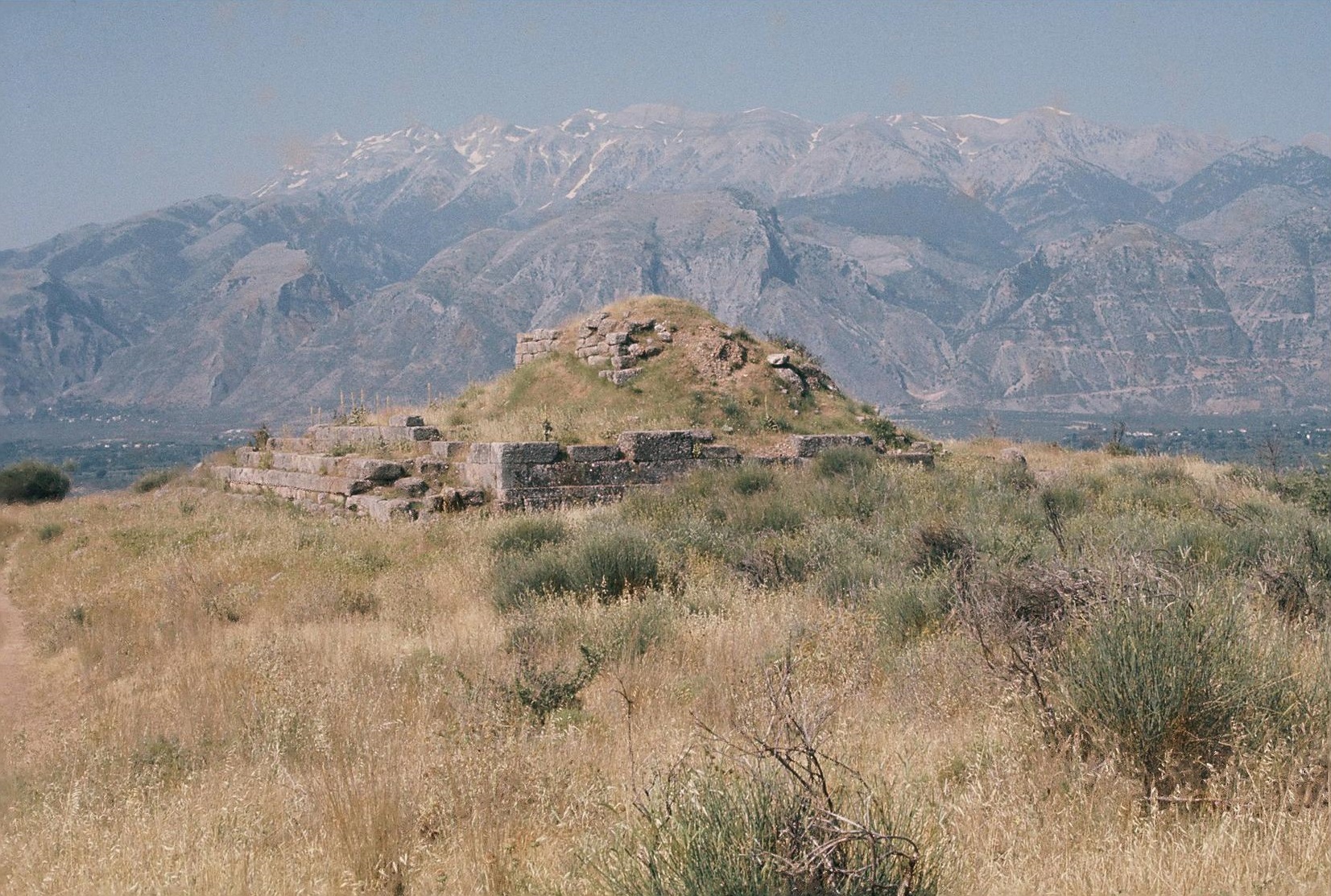
Plate 8B. Kalymnos: Perakastro from South.
Plate 18B. The Menelaion (Sparte) from South.
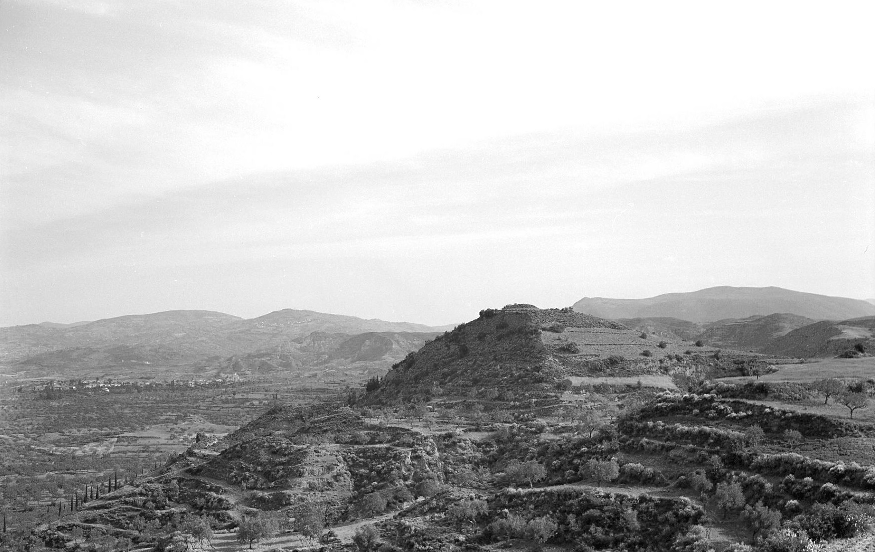
Sparte in the Odyssey usually refers to the home of Menelaus and Helen, i.e. to the site of their palace (Od. 1. 93, 285; Od. 2. 214, 327, 359; Od. 4. 10; Od. 11. 460; Od. 13. 412). Sparte is also frequently coupled with Pylos in the Odyssey. In the only other mention of Sparte in the Iliad, it is one of the cities most dear to Hera, “Argos and Sparte and Mycenae of the broad streets” (Il. 4. 51-52). It was natural for the incoming Dorians to adopt the name Lakedaimon for their country and the name Sparta (the Doric form of Sparte) for their capital. But this capital, the historic Sparta, was clearly a new foundation (Cartledge 1979, 75-101; Cartledge 1992, 49-55). Mycenaean finds at the historic Sparta, and in modern Sparta, are relatively few (cf. Zavvou and Themos 2009, 111); and there is no evidence for re-occupaton of the area until late in the Protogeometric period.
At the Menelaion, however, Catling’s excavations (1974-1989) have provided conclusive proof, in the form of inscribed dedications, that this site was known to the ancient Spartans, from the Late Geometric period at least, as the burial place of Helen and Menelaus (for the dedications see Catling and Cavanagh 1976 and R.W.V. Catling 1986). Catling is sure that this was the site of Mycenaean Sparta, partly because of the size of the Mycenaean settlement and the nature of the buildings, but chiefly because it was where the Spartans themselves believed it to have been (Catling 1998, 26).
According to Herodotus (6.61.3), Isocrates (10. 62-63) and Pausanias (3.19.9 and 20. 1-2), the Menelaion was in the district (χωϱίον) called Therapne (or Therapnai). For settlements, even of small or unknown size, Pausanias uses the term polis (πόliς). There are no signs of habitation on the Menelaion ridge after the Mycenaean period but only of the use of the site as a shrine. The authors of the Laconia Survey comment: “….. Therapnai. The place referred to by this name did not correspond to a settlement or even to a settled landscape, as years of archaeological investigations have clearly proved” (Cavanagh et al. 2002, 233 n. 14, cf. 157-337 passim and Cavanagh et al. 1996, 380-389). Herodotus and Isocrates both describe the Menelaion as in (ἐν) Therapne. And that the Menelaion site did not itself constitute the whole of Therapne is indicated also by the fact that Pausanias himself saw the spring called Messeis in Therapne (Pausanias 3.20.1). Obviously there could not have been such a spring on the Menelaion ridge itself, but there was such a spring at Aphyssou to the north (Cavanagh et al. 1996, 382), which Pausanias would have seen on his way to the Menelaion (Hope Simpson 2009, 324-325). By the time of Pausanias, the name Therapne might also have been applied to some of the area that is now part of modern Aphyssou. In the vicinity of the village the Laconia Survey discovered Classical farmsteads, Hellenistic hamlets and a Roman hamlet and farm, but no site which could be classified as a village (Cavanagh et al. 1996, 380-382). Nevertheless, Dickinson has suggested that the “old” (presumably here meaning “Mycenaean”) name for the Mycenaean settlement on the Menelaion ridge was “most probably Therapne” (Dickinson 1986, 31 and n. 34). And he further asserts that Therapne is “an impeccably ancient sounding name”, which might be expected to have been “inherited from the prehistoric period” (Dickinson 1999, 209). But the earliest known mention of Therapne is in a fragment of Alkman (Page 1962, 34 Fr. 14b), where it is described as “the holy shrine of well-towered Serapna (νaὸς ἁγνος eὐπυϱγω Σeϱάπνaς). This is indeed an apt depiction of the Menelaion ridge as seen from Sparta; it is echoed in Pindar, Isthm. i. 30-32, where Therapne is called “high-placed” (ὑψίπeδον). Σeϱάπνaς is taken to be the correct (Doric dialect) spelling (Cavanagh et al. 2002, 18).
The Menelaion site was important in the early Mycenaean periods, in the times of “Mansion I” (LH IIB) and “Mansion II” (LH IIIA1), and it was of substantial size in LH IIIB2, the time of “Mansion III” and other major structures (Catling 2009, esp. 461). There remains the question “whether there was any single place in central Laconia comparable to Pylos in LH IIIB Messenia” (Cavanagh et al. 2002, 149). The floruit of many other Mycenaean settlements was in LH IIIA2 to LH IIIB1 (see Chapter 1), whereas at the Menelaion the settlement was in decline at that time. Further excavation at Ayios Vasileios may help to answer the question. There is, however, no longer any reason to doubt that the Menelaion site is to be identified as Homeric Sparte.
Messe (Il. 2. 582)
There are no reliable indications in the ancient sources of the location of the Homeric Messe. Strabo (8.5.9) says that some regarded Messe as unknown, and others thought it was a shortened form of Messene. The Laconian spelling of Messe would have been Messa; and Pausanias (3.25.9-10) describes Messa as a town (πόliς) with a harbour, between Hippola and Oitylos; he does not mention the Homeric Messe. Some remains to south of modern Mezzapo are presumed to be those of Pausanias’ Messa. Woodward found sherds ranging from Late Geometric to Hellenistic here [BSA 13 (1906-1907) 243-245]. It had been suggested (CSHI, 76-77) that Homeric Messe was situated on the promontory of Tigani (“frying-pan”) to southwest of Mezzapo. Tigani was the site of the Byzantine castle of Maina and of the fortress of Maina built by William II de Villehardouin, the 4th prince of Morea. The high end of the promontory, the ‘pan’ of the ‘frying-pan’, makes an excellent natural fortress, walls being needed only on the landward side [BSA 56 (1961) 122-123; MFHDC, 50-51]. Before the construction of the medieval walls, there had been a wall across the neck of the promontory. This earlier wall was of rather crude construction, formerly classified as of Cyclopean nature (BSA 56 loc. cit.); but it was later realized that in several parts the walling was of a more polygonal character, suggesting a Late Classical or Hellenistic date. No unquestionably ancient sherds were found on the Tigani promontory, probably because of the intense weathering here. Although Tigani was a good choice for a fortress, it would have been unsuitable as a habitation site. The location of Homeric Messe remains a question.
Bryseiai (Il. 2. 583)
Anthochorion: Analipsis: EH II MH LH IIA-IIIC PG G A C H R M
Christou 1961-62, 1962a, 1962b, 1963; CSHI, 77; GAC, 110 (C 8); MG, 109 (E 8); Catling and Shipley 1989; Cavanagh et al. 1996, 293 (GG 108); Cavanagh et al. 2002, 231-233; Hope Simpson 2009, 327-331; Zavvou 2009; AR 55 (2008-2009) 32.
Pausanias gives only vague indications of the location of Bryseai. His discussions of Bryseai, of the sanctuary of Zeus Messapeus and other places along the eastern foothills of Mt. Taygetos (Pausanias 3.20.2-5) are obviously reconstructed from hearsay. He describes the sanctuary of Zeus Messapeus as “in the plain”. It was apparently close to the foothills of Taygetos, since he next tells us that “after leaving Taygetos from here you come to the district (χωϱίον) where there was once a town, a polis (πόliς) Bryseai” and that “above Bryseai rises Taleton, a peak of Taygetos which they call sacred to Helios”. Frazer (1898 III, 364) and others have proposed the identification of Taleton as the peak of Prophitis Ilias, the summit of Mt. Taygetos.
At 2404 m a.s.l. it is higher by far than all the other peaks. It is therefore naturally, and conspicuously, the first to be illuminated by the rising sun (Helios). And Prophitis Ilias, seen from the east, appears to stand directly behind Xerokambi).
A location for Bryseai previously suggested (CSHI, 77) is the site of the church of Analipsis (or Metamorphosis) near Anthochorion, c. 2 km south of Xerokambi. The church stands on a low mound, formed by the debris of successive periods of habitation. Christou excavated several small trenches around all sides of the church and in the adjacent Phorbis field, where levelling had revealed Archaic sherds, together with some lead figurines, of the kind found at Artemis Orthia and the Menelaion. Christou published only brief reports of his excavations (refs. above), without plans, profiles or other illustrations; but Zavvou has provided some further information and a preliminary account of her excavation of part of the EH II settlement here (Zavvou 2009). The stratigraphy was best preserved in Christou’s trench near the fence between the church and the Phorbis field. In the lowest level here (from c. 3.50 m down up to c. 2.40 m down) the pottery ranged from LH IIA to LH IIIB (and at least one LH IIIC) with an abundance of pieces from tall kylikes. Above this Mycenaean stratum, there was a disturbed level (from c. 2.40 m down up to c. 2.0 m) containing Laconian Protogeometric and Geometric and some Mycenaean. It is generally agreed, however (e.g. GAC, 110) that there was no continuity here into the Early Iron Age. Above this was the richest level (from c. 2.0 m down up to c. 1.20 m) with characteristic Archaic pottery and some lead figurine. The next level (from c. 1.20 m down to c. 0.80 m) contained Classical and Hellenistic black glazed sherds. Above this was an ‘unmixed’ Byzantine stratum. A trench to north of the church and in the middle of the site, produced a mass of sherds of all the periods listed above mixed together. The whole site was estimated by Christou to be about 500 m in circumference (a greater extent than that of modern Anthochorion at the time. From surface survey, Zavvou concluded that the area to south of the church was richer in finds of the historical periods, while in the fields to east of the church there was a higher concentration of prehistoric, especially Mycenaean kylix stems and conical bases of EH saucers, and evidence of building foundations of small unworked stones (Zavvou 2009, 31).
On a stamped tile fragment found on the surface in the area of Christou’s excavations the inscription is restored as
DAMO)SIOIDIOS(
MESSA)PEOSFAR(
That this refers to Messapean Zeus was already clear (Catling and Shipley 1989, esp. 195-196; Hope Simpson 2009, 329-331 with refs.). This reference is now confirmed by Zavvou’s discovery of four more stamped tiles among the material from Christou’s excavations, all of which bore the same inscription (partly restored in some cases)
MESSAPEOS DAMOSIOI
(Zavvou 2009, 31, 41). There are, however, no indications as to where the tile fragments were found in Christou’s excavations or to which level they belong. Zavvou (loc. cit.) assigns all five tile fragments to the 3rd century B.C. They of course indicate the presence, either at the Analipsis site, or nearby, of the sanctuary of Zeus Messapeus. But Christou warned that his excavations had not shown that an ancient shrine lay below the Analipsis church. And the Archaic lead figurines are very different in kind from the dedications at the other Laconian sanctuary of Zeus Messapeus, at Tsakona, nearer to Sparta (Catling, H.W. 1990, 1998 and 2000, cf. Hope Simpson 2009, loc. cit. with refs.). We have no evidence as to when the sanctuary near Analipsis was established. We do, however, have good evidence for a substantial Mycenaean settlement here, of the size of a large village, at least, which would qualify as a candidate for Pausanias’ Bryseai, a former polis, and presumably the Homeric Bryseiai.
Augeiai (Il. 2. 583)
Strabo (8.5.3) says that the name Augeiai was changed to Aigaiai, and that the Augeiai in Locris (i.e. the Augeiai of Il. 2. 532, discussed above) no longer exists. Strabo is obviously referring to the Aigaiai (Aigiai) in Laconia. Pausanias also asserts tha Aigiai was the town (πόlisma) which Homer called Augeiai. On his way from Sparta to Gythion, Pausanias first visited Krokeai and then turned to the right (i.e. to west) from the straight road (eὐθeίaς) to visit Aigiai, which he says was 30 stades from Gythion (Pausanias 8.21.5-6). Although the exact location of the town of Aigiai has not been established, the district indicated is Palaiochora, c. 6 km northwest of Gythion, between Koutoumou, on the east side of the modern road from Gythion to Sparta, and Limni to the west. At Koutoumou are the three artificial mounds known as the ‘Tombs of Kings’; these are presumably Hellenistic or Roman [BSA 13 (1906-1907) 224-225; BSA 56 (1961) 114-115 with fig. 1]. Earlier finds from the vicinity were Archaic terracottas and bronzes, found by peasants, including an Archaic bronze bowl with an inscribed dedication around the rim (BSA 56 p. 175 fig. 27). In 1982-1983 Z. Bonias excavated a rural shrine at Palaiochora. Besides pottery, finds included many female figurines, a small double axe in gold, and a marble offering table. Of particular interest is a stone halter (a weight used in long-jumping) with an inscribed dedication [AAA 18 (1985) 246-253, cf. BCH 113 (1989) 610 with fig. 55 (photo)]. The evidence demonstrates that the shrine was in use from the mid-7th century B.C. to the Late Roman period (Bonias 1998). After prolonged search in 1956 and 1961, no prehistoric remains were found in the vicinity. There is, of course, no proof that Aigiai was Homeric Augeiai.
Amyklai (Il. 2. 584)
The Amyklaion (Ayia Kyriaki): EH II MH LH IIA-IIIC ‘PG’ G A C H R
Tsountas 1892; Fiechter 1918; Buschor and von Massow 1927; Waterhouse and Hope Simpson 1960, 74-76; French 1971, 133-140; GAC, 108-109 (C 3); MG, 103 (E 5); Demakopoulou 1982; Spyropoulos 1981; Calligas 1992; Cartledge 1992; Cavanagh et al. 1996, 290; Banou 1996, 31-32, 82-85; AD 53 (1998) 170-173; Cavanagh et. al. 2002, 143, 145, 149-150; Hope Simpson 2009, 320-322; 325-326; Demakopoulou 2009.
Vaphio: Palaiopyrgi: EH II MH LH IIA-IIIB
Tsountas 1889; Waterhouse and Hope Simpson 1960, 76-78; GAC, 109 (C 4); MG, 101-103 (E 4); Spyropoulos 1982; Cavanagh et al. 1996, 290-291; Banou 1996, 34-36 and Plan 3; Cavanagh et al. 2002, 146, 148, 150; Hope Simpson 2009, 318-320.
Plate 19A. The Amyklaion (Amyklai) from South.
The Amyklaion, the sanctuary of Apollo Amyklaios, occupied the top of the small low hill of Ayia Kyriaki (Plate 19A), the northernmost of the chain of low hills in the centre of the Sparta plain. Successive excavations at the Amyklaion (by Tsountas, Fiechter and especially by Buschor and von Massow) have partly revealed the features of the historic sanctuary. This was apparently preceded by a cult here in Mycenaean times, evidenced by parts of 32 wheel-made figurines, of bulls and other animals, and elaborate Psi figurines (cf. French 1971, 133-140, Demakopoulou 1982 and Demakopoulou 2009, who here rightly dismisses the suggestion, made in Calligas 1992, that these objects were brought in from elsewhere as ‘fill’ for the construction of the Archaic shrine). On the basis of the typology of the figurines, Demakopoulou estimates that a Mycenaean cult here began late in the LH IIIB period and flourished throughout LH IIIC (i.e. from late in the 13th century B.C. to about the end of the 11th century B.C.). Although there is no ceramic evidence for continuity into the Early Iron Age, bronze objects, including spear points, and an iron sword (Type II) suggest some activity here in the 10th and 9th centuries B.C. (Demakopoulou 2009, 103). Pausanias (3.18.6 to 19.6) provides meticulous descriptions of the sanctuary and its statues and memorials etc., including the provisions for offerings to Hyakinthos. The legend of Apollo’s love for, and accidental slaying of, Hyakinthos has naturally suggested that a cult of Hyakinthos may here have preceded a cult of Apollo.
There was also a Mycenaean settlement at Ayia Kyriaki, demonstrated by a considerable spread of LH sherds on the surface, mainly on the southeast slopes and along the ridge to west of the chapel (Waterhouse and Hope Simpson 74-76 with fig. 3); the sherds extend over an area c. 200 m east to west by c. 120 m (c. 24,000 m2). On the southwest slope of the hill Spyropoulos’ excavations uncovered walls of Mycenaean houses, of two building phases, LH IIIA and LH IIIB, with pottery of good quality, especially from kylikes, skyphoi and pithoi and LH III figurines. At Spilakia, on the plateau c. 500 m southwest of Ayia Kyriaki, Spyropoulos (loc. cit.) excavated 3 of the five chamber tombs, which also contained finds of the LH IIIA and LH IIIB periods, including storage jars, piriform jars and alabastra. A LH IIIC lekythos was found later in Tomb 5 (AD 53 loc. cit.).
There is therefore good evidence for Mycenaean habitation at the Amyklaion site. Nevertheless, Demakopoulou believes that the Mycenaean offerings at the Amyklaion suggests a connection with a more important Mycenaean centre, and in particular with the nearby Vaphio: Palaiopyrgi. Since the Amyklaion and Vaphio Mycenaean settlements were only 2 km apart, they may have formed a single community. Banou (loc. cit.) has reported signs of further (probable) chamber tombs in the low conglomerate hills between the two settlements. At the Vaphio site, in the intensive search (by Hope Simpson and French in 1956), copious Mycenaean sherds, particularly LH IIIA2 and LH IIIB1 were observed over an area of c. 200,000 m2, on the Palaiopyrgi hill and its slopes. The top of the hill has been severely eroded, and elsewhere the site has been much degraded by cultivation, which has probably also dispersed the ancient material onto ground beyond the original boundaries of the settlement. By 1956 there had been considerable disturbance (e.g. for the planting of olive trees, as seen in Hope Simpson 2009 fig. 3, whose caption should read “Vaphio: Palaiopyrgi from the southwest” – not southeast). It is therefore difficult to estimate how much of the site was occupied by Mycenaean buildings. It was estimated that considerable depth of soil probably remained in parts of the southeast slope, and that buildings were likely here and on the level ground (with the olive trees) to south of the hilltop. Subsequent trial excavations (Spyropoulos 1982) have only partly clarified the picture. On the top of Palaiopyrgi he found only traces of late MH or early LH structures (cf. MG, 101 for LH IIA sherds found earlier). But on the flat ground (ἐπίπeδο) to east of the summit and above the steep part of the hill slope, a large trial trench revealed some remains of ordinary houses with LH IIIA and LH IIIB pottery, but no stratigraphy. Taken together, the surface investigations and the trial excavations suggest that most of the upper (and flatter) part of the site, comprising an area c. 400 m north to south by c. 300 m (i.e. c. 120,000 m2) may have been at least partly covered by Mycenaean buildings. But until more thorough and extensive excavations are undertaken, it will not be possible to estimate the density of Mycenaean structures within this (supposed) area.
All the indications point to the conclusion that the Amyklaion and Vaphio sites formed one community in Mycenaean times (cf. Allen 1921, 24). The location of the historic Amyklai at Amykles (formerly Slavochori) is well established (Cavanaugh et al. 1996, 290, No. GG 92; cf. Waterhouse and Hope Simpson 1960, 82 no. 3). Amyklai was a constituent part of the polis of Sparta, and the only other large settlement of the historic period in the Sparta plain (Cavanagh et al. 2002, 230).
Helos (Il. 2. 584)
Ayios Stephanos: EH I-II MH LH I-IIIC Early H? R? M
BSA 55 (1960) 97-103; BSA 67 (1972) 205-270; Taylour and Janko 2008; Themos 2007; Hope Simpson and Janko 2011.
The name Helos (‘marsh’) was presumably adopted in reference to the extensive marshes in the Helos plain caused by the deltaic fill at the mouth of the river Eurotas (Strabo 8.5.2, cf. 9.2.17). In the Classical and Hellenistic periods the centre of Helos was on the east of the plain at Stou Manolaki (Hope Simpson and Janko 115). Apart from the mention in the Catalogue, for the earlier history of Helos we have only the traditions recorded by later writers, principally the 4th century B.C. historian Ephoros (cited by Strabo) and in a different version by Pausanias. According to Pausanias, the town of Helos was originally inhabited by Achaeans, i.e. pre-Spartan and non-Dorian Greeks. According to Ephoros (Ephorus 70 F 117 Jacoby in Strabo 8.5.4) Agis, the second king of Sparta in the Agiad line, captured Helos and enslaved its inhabitants (cf. Hellanikos FGrH 4 F 188 ap. Harp. s.v. eἱlωτeύeiν, cf. Shipley 2000, 383). Pausanias preserves a different version, that the Achaean town of Helos “on the sea” had been reduced by the (Dorian) Spartans under Alkamenes, son of Teleklos and that its inhabitants became the first slaves of the Spartans. (Pausanias 3.2.6-7, cf. 3.20.6). In this version Helos was the last of the old ‘Achaean’ cities to fall in the conquests begun by his father Teleklos, who had subdued Amyklai, Pharis and Geronthrai. The verb ἀνέστησaν (Pausanias 3.2.7) indicates that the Spartans drove out the inhabitants of Helos, and implies depopulation. It is not possible to reconcile the two versions (that of Pausanias and that attributed to Ephoros). The Spartan expansion is more likely to have occurred in the 10th or 9th centuries B.C. than on the eve of the conquest of Messenia (Cartledge 1979, 106-107, cf. Hope Simpson and Janko 2011, 119), but a conquest is needed to explain the traces of an Achaean dialect and the subjection of their cities to the Spartans (Cartledge 1979, 96). The discrepancy between the accounts of Pausanias and Ephoros suggests that the dates of the conquests were simply unknown.
The archaeological record, although incomplete, and for most sites from surface survey only, shows a relative density of Mycenaean habitation in the Helos plain to the end of LH IIIC Early and an apparent scarcity of settlement in later LH IIIC and in the Protogeometric and Geometric periods. Ayios Stephanos was the largest settlement here in the Bronze Age, at least until its partial destruction in LH IIIA2 Early. During its period of relative eclipse in LH IIIA2-IIIB1, some of the many other sites of these periods in the plain may have become relatively more important. However, during its short renaissance from late in LH IIIB2 to the end of LH IIIC Early, Ayios Stephanos reached the same dimensions as in LH IIIA2, covering an area estimated as at least 26,500 m2 (Taylour and Janko 2008, 598). Ayios Stephanos was at this time by far the largest Mycenaean settlement in the plain. It had the best harbour, and may have had fortification walls (Taylour in BSA 67, 249-261; Taylour and Janko 377, 386-387, 598-599). The abandonment of the site at the end of LH IIIC Early was accompanied in one sector by evidence of burning and possibly of a massacre, since a pit containing four severed heads was found (Taylour and Janko 2008, 605).
Ayios Stephanos is accordingly marked as the site most likely to have given rise to the tradition of a “city by the sea” in the Catalogue and of a city besieged (as in the later traditions). No other Mycenaean or Early Iron Age settlement has been found in the Helos district of comparable size and importance.
Laas (Il. 2. 585)
Kastro Passava (ancient Las): A C H R M (Plate 20A)
BSA 12 (1905-6) 274-275; BSA 13 (1906-7) 232-234; BSA 56 (1961) 118; CSHI, 79; MFHDC, 50.
Plate 20A. Kastro Passava (ancient Las) from East.
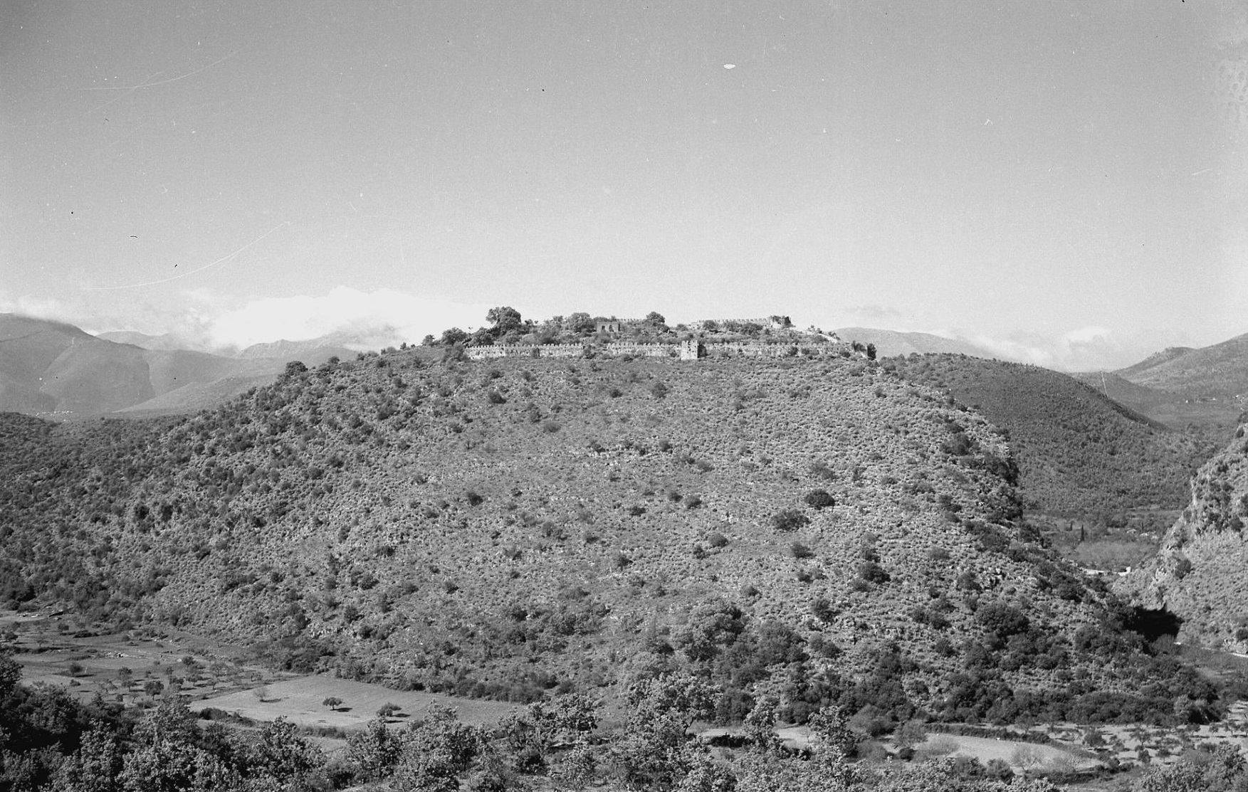
The medieval castle of Passava (BSA 56, pl. 19a) has been securely identified as the acropolis of ancient Las (BSA 13 loc. cit.). Incorporated in the medieval fortifications are some remains of the ancient circuit wall. Some of the lower courses are preserved, in a polygonal style, which (as at Tigani – see above under Messe) bears a superficial resemblance to Mycenaean Cyclopean masonry, but is probably of late Classical or Hellenistic date. After prolonged search by several persons and on several occasions, no certifiably Mycenaean objects have been found on the hill, whereas Classical and Hellenistic sherds are abundant.
Las was of considerable importance in historic times. Strabo (8.5.3-4) recounts the myth of the sack of Las by the Dioskouroi and of its use by the conquering Heraklidai as a naval station because of its good harbour. The Spartans still used it as a naval station in 411 B.C. (Thucydides 8.91.2 and 8.92.3). Pausanias (3.24.6-11) gives a detailed account of the temples and other monuments of Las and outlines the myth of the death of Las.
The traditions concerning Las, together with that of the islet of Kranai (Il. 3. 445) demonstrate the historic importance of this district. And, between Las and Kranai lies the substantial Mycenaean settlement of Mavrovouni [GAC, 20 (C 45)] where Banou has recently recorded a wide spread of surface sherds on the south slopes of the hill of the chamber tomb cemetery (Banou 1996, 59-60, with Abb. 43-46, 71-72).
Oitylos (Il. 2. 585)
Oitylos: C H R M (Plate 20B)
BSA 10 (1903-4) 160-161; BSA 56 (1961) 121; CSHI, 79; AR for 1957, 10.
The hill village of Oitylos (‘Vitylo’ during the Turkish occupation), with its harbour at Limeni, controls the north to south route along the west coast of the Mani and also the western end of the pass to Gythion. [cf. BSA 13 (1906-7) 239]. On the southern slopes of the hill the terraces are strewn with sherds from Classical to Roman, and some fragments of coarse ware which appear to be Bronze Age. On the top of the hill the lower part of the north wall of the church of Ayia Marina may belong to a temple or to a defence wall (AR loc. cit.), and there are ancient remains, including Hellenistic and Roman inscriptions, in other chapels within the village. There is so far no evidence for Mycenaean or Early Iron Age habitation here.
THE KINGDOM OF MENELAUS
Plate 19B. The Island of Kranai from Northwest.
The names in this Kingdom cover only part of the territory of the historical Lakedaimon. The sites which can be identified with the Catalogue names are all in the central Eurotas valley. There is good evidence (detailed above) for the identifications of Pharis, Sparte, Amyklai and Helos. The approximate locations of Bryseiai, Laas and Oitylos are indicated by ancient testimony, but those of Messe and Augeiai remain uncertain. Absent from the list are the whole of the Malea peninsula, most of the Tainaron peninsula and all of Kynouria. Absent also is Pellanes, the home of the Tyndareus legend. Apart from the Catalogue, the Iliad features the island of Kranai, where Paris first made love with Helen (Il. 3. 445). A few Mycenaean sherds were found on this tiny islet [Plate 19B, cf. GAC, 120 (C 44)]. Men from Kythera are also mentioned (Il. 10. 268 and Il. 15. 430-435). At Elaphonisi (ancient Onugnathos), according to Pausanias (3.22.10), Agamemnon was said to have set up a sanctuary of Athena; and here also, it was claimed, was the tomb of Kinados, the pilot of Menelaus’ ship (for the site of Pavlopetri near Elaphonisi, discovered below sea, see Chapter 1).
The current excavations at Ayios Vasilios (identified above as the site of Pharis), and especially the discovery of Linear B tablets there, suggest that this may have been the Mycenaean capital in Laconia. FaÚϱίν (Pharis) is placed before Sπάϱτην (Sparte) in the second line of the Menelaus list (Il. 2. 582); contrary to Burr’s assumption (Burr 1944, 54), this placement was not necessitated by the meter. No conclusion can be drawn here. There are other occasions in the Catalogue where an obvious ‘capital’ is not mentioned first (e.g. Iaolkos in the Kingdom of Eumelos, Il. 2. 712 and the Aetolian Kalydon, Il. 2. 640, in addition to Hypothebai, Il. 2. 505). Consistency in such matters is not to be expected in a poem.
THE KINGDOM OF NESTOR
Pylos (Il. 2. 591)
Chora: Ano Englianos (Mycenaean Pylos): MH LH I-IIIC Early G A C H R M
Blegen et al. 1966, 1973 (Pylos I and III); Lang 1969 (Pylos II); CSHI, 82; GAC, 128-129 (D 1); MG, 115 (F 1); Mountjoy 1997; Davis et al. 1997; Zangger et al. 1997; Davis (ed. 1998); Reports of the Minnesota Pylos Project in AR from 1991-92 to 1994 to 1995; Reports of the Pylos Regional Archaeological Project (PRAP) in AR from 1992-93 to 2009-2010; MFHDC, 52-53, 161, 210-212; Hope-Simpson 2014, esp. 29-30, 53-57.
The ancient controversy concerning the location of Nestor’s Pylos is reflected by the doggerel hexameter line cited by Strabo (8.3.7) “ἐστi Πύlος πϱὸ Πύlοiο, Πύlος γέ mέν ἐστi κaὶ ἄllος” (“there is a Pylos before Pylos, and yet another Pylos”). Strabo (ibid. and 8.3.26-29) dismisses the claim of the Pylos in Elis, but argues in favour of the Triphyllian Pylos, on the basis of the description in the Odyssey of Telemachos’ journey home, from Pylos to Ithaca (Od. 15, 296-300) and of Nestor’s reminiscences in the Iliad of the war between the Pylians and the Epeians (Il. 11. 670-761). But Strabo’s arguments rely on a literal interpretation of the Homeric tales, with no allowance for poetic invention or exaggeration. The same literal interpretation was adopted by Dörpfeld in his claim that his site of Kakovatos: “Nestora” in Triphylia [GAC, 101-102 (B 94)] was Nestor’s Pylos [AM 38 (1913) 97-139, cf. AJA 65 (1961) 221, 230-231 for a more realistic assessment]. The Kakovatos site, with its LH IIA tholos tombs, is now seen to have been one of several sites in southwest Peloponnese which were of importance mainly in the early Mycenaean period.
Plate 1B. Mt. Aigaleon from Northwest.
The discovery of the great Mycenaean palace and town at Ano Englianos and the decipherment of its Linear B tablets (in which the name pu-ro often appears) clearly demonstrate that this was the Messenian Pylos of the legends (CSHI, 82). Strabo indeed records (8.4.1-3) that the Messenian Pylos was a city at the foot of Mt. Aigaleon (Plate 1B), and that, after this city was destroyed, some of its inhabitants settled at Cape Koryphasion (the historic Pylos, cf. Thuc. IV, 3-14).
Blegen’s excavations and the PRAP survey work at Ano Englianos have documented the development of the site, from its MH origin to the final LH IIIB city. By the end of LH IIIB there was a ‘lower town’ estimated as c. 180,000 m2 in extent. The palace itself was built in LH IIIA2, partly above the remains of LH IIIA1 structures. It was destroyed, together with its tombs and ‘lower town’, in the transitional LH IIIB2 to LH IIIC Early period (Mountjoy 1997). The PRAP magnetometer survey revealed a linear anomaly which may indicate a circuit wall around the palace and part of the ‘lower town’ (Davis et al. 1997, 427-430; Zangger et al. 1997, 604-613; a (putative) cothon harbour is evidenced by drilling near the west coast, in the vicinity of Romanou, c. 4 km to southwest of the Palace (Zangger et al. 1997, 613-623, cf. Zangger in Davis (ed.) 1998, 69-74).
Arene (Il. 2. 591)
Kato Samikon: Klidhi: EH II-III MH LH I-IIIB C H
Frazer 1898 III, 478; AM 33 (1908) 320-322; AM 38 (1913) 111-114; AJA 65 (1961) 230 will Ill. 4; AD 20 (1965) A 6-40; GAC, 101 (B 92); MG, 95 (D 68); AD 36 (1981) B 148-149; AD 37 (1982) B 133-134; AD 38 (1983) B 109-110; AR 36 (1989-90) 32; AR 37 (1990-91) 32; Mountjoy 1993, 159-160; MFHDC, 60.
Strabo (8.3.19-20) and Pausanias (5.5.2 to 5.6.3) both say that the usual identification of Arene was with Samikon; and both agree that the river Minueios which, according to Nestor’s tale, flowed into the sea near Arene (Il. 11. 722-723), was the Anigros, a sluggish river which created a marsh to south of Samikon. Strabo and Pausanias here also vividly describe the foul smelling but healing properties of the water from the source of the Anigros (now incorporated in the modern Kiapha spa).
Plate 3B. Kato Samikon: Klidhi (? Arene) from Northeast.
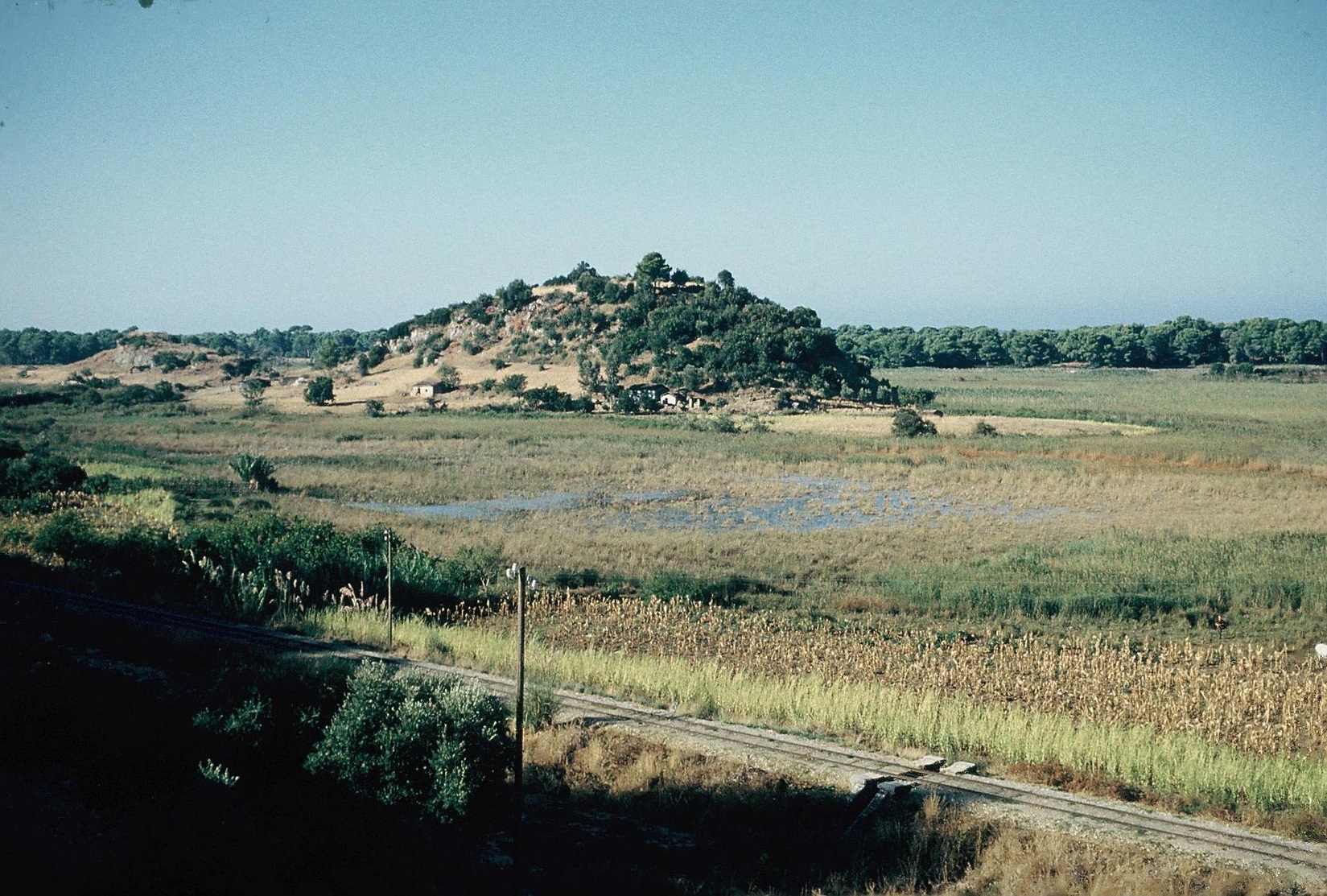
The ancient fortress of Samikon itself is obviously not a Mycenaean site (although a LH III kylix stem was found here). The Mycenaean settlement was an isolated low hill in the centre of the coastal pass of Klidhi (Plate 3B and the plan, Ill. 4 on AJA 65 p. 230), to west of and opposite the ridge of the Samikon fortress. The hill is beside the coastal lagoon (formerly a marsh) of Agoulinitsa. Surface sherds, mainly LH, were found on the hill in 1959, over an area c. 250 m north to south by c. 80 m. In addition to the tumulus excavated by Yalouris to north below the hill (AD 20 loc cit., cf. Mountjoy 1993, 159-160 with plan, Ill. 384), four more tumuli have now been excavated to south of the hill (AD 36, 37 and 38 refs. and AR refs. above). The finds from the burials in the tumuli range from the latest MH to the LH IIIB period, with LH I and LH II predominant. A tholos tomb in the centre of tumulus 5 was in use from LH I to LH IIIA2. The “Cyclopean” fortifications on the Klidhi hill claimed by Dörpfeld (AM 38 loc. cit.) were not visible in 1959 (AJA loc. cit.), but a number of scattered large stones were observed on the north slope in 1959 and again in 1981 (AD 37 loc. cit.), and these may indeed have originally belonged to fortifications rather than houses. In 1981 remains of a huge “Cyclopean” wall were discovered, running from west to east, and descending from the top of the hill. It was presumed that the wall was intended to protect the passage between the hill and the ridge of the Classical acropolis of Samikon opposite on the east (AD 37 loc. cit., AR 37 loc. cit.). The wall was uncovered for a length of at least 60 m. It was 2.60 to 3.05 m wide, composed of very large blocks, of which up to three courses were preserved, to a height of c. 1.60 m. Sherds found in the water-logged trenches were not fully diagnostic, but appeared to range from late MH to early LH, as would be expected, since the wall cuts through the cemetery area; but a Classical or Hellenistic date for the wall is far more likely than a Mycenaean.
Thryon (Il. 2. 592)
Epitalion: Ayios Yeoryios: MH LH I/II-IIIB LH IIIC? C H R
AJA 65 (1961) 227-228 with Ill. 3; AD 21 (1966) 171-172; AD 22 (1967) 210-211; AAA 1 (1968) 201-204; AJA 73 (1969) 129; CSHI, 83; GAC, 98-99 (B 85); MG, 94 (D 62).
Epitalion: Dardiza: LH? A C H
Meyer 1957, 50, 60 with refs.; BCH 83 (1959) 632; AJA 65 (1961) 228 with Ill. 3; AR for 1961-62, 14.
The description in the Catalogue of Thryon as a ford (πóϱον) over the Alpheios river surely indicates that Thryon is the same place as the Thryoessa of Nestor’s tale of the war between the men of Pylos and the men of Elis, where Thryoessa is described as ‘a city, a steep hill far away on the Alpheios, the furthest city in Sandy Pulos (…. Θϱυóeσσa πóliς, aἰπeiÚa κοlώνη, τηlου: ՚eπ՚ Ἀlφeiw/:, νeάτη Πύlου ἠmaθóeντος, Il. 11. 711-712). Strabo (8.3.24) says that this Thryon or Thryoessa was thought to be Epitalion because the whole district was ‘full of rushes’ (θϱυώδης) especially the rivers and even more at the places where the river [the Apheios] can be forded.
Plate 22B. Epitalion: Ayios Yeoryios (Thryon) from South.
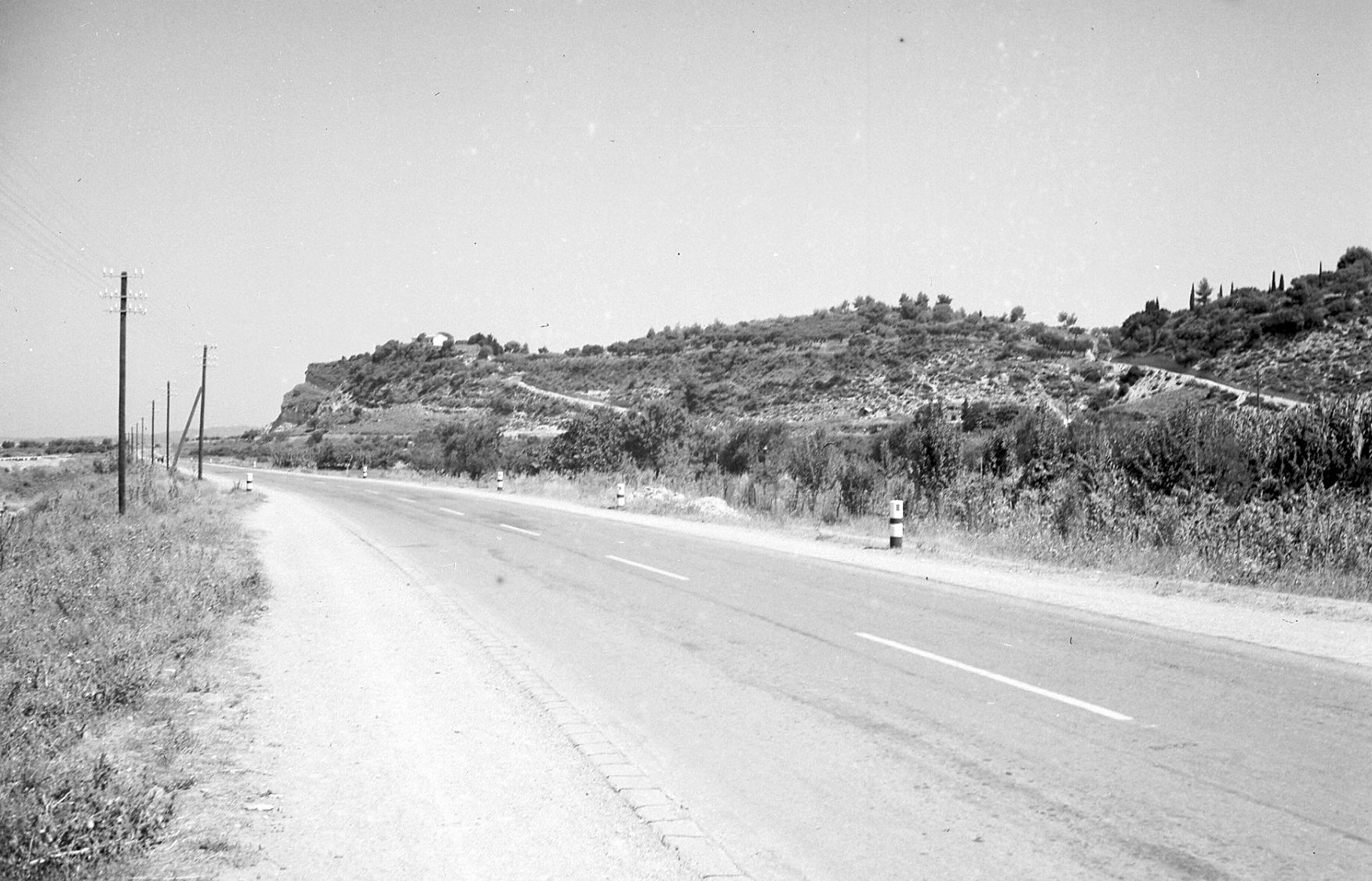
Epitalion: Dardiza has been securely identified as the site of ancient Epitalion (Meyer loc. cit. and AJA 65 loc. cit.). The Dardiza hill ridge is c. 500 m northeast of modern Epitalion, overlooking the Alpheios to the north (AJA 65 Ill. 3). Here potsherds and tile fragments were observed in 1959 over an area at least c. 350 m east to west by c. 150 m, mainly on the top and upper terraces. The finds included several Classical black-glazed sherds and an Archaic terracotta perirrhanterion (AR for 1961-62, 14). The lower slopes on the north are named Samakia, which has the same connotation as Thryoessa, i.e. ‘full of rushes’. No certainly prehistoric sherds were found at the Dardiza site. The Mycenaean settlement (explored by Themelis, and described by him in detail in AAA 1 loc. cit.) was centred on the hill of the chapel of Ayios Yeoryios (Plate 22B), the southwest hill in a group of four small hills called Ayioryitika, c. 500 m northwest of modern Epitalion, between the new highway to Pyrgos and the railway line (AJA 65, Ill. 3). Mycenaean sherds, mainly LH IIIA and LH IIIB, were found on the small Ayios Yeoryios hilltop and its slopes over an extent of c. 200 m northwest to southeast by c. 150 m (cf. AJA 73, 129). On the adjacent southeast hill, named Tou Varkou to Vouno, whose top is only c. 50 m in diameter, a LH III house was excavated by Themelis; there are traces of ruined Mycenaean chamber tombs in the heavily eroded soft sandy rock on the slopes, where Mycenaean sherds of good quality were found in 1959, including LH IIIB and possibly early LH IIIC (AJA 65 loc. cit.). There is therefore evidence for a Mycenaean settlement here of considerable size, in all probability Homeric Thryon/Thryoessa.
Aipy (Il. 2. 592)
Plate 3A. Lepreon: Ayios Dhimitrios from East

From Strabo’s discussion of Aipy (8.3.24) it may be deduced that there was no clear ancient tradition about its location. He points out also that the name Aipy (meaning ‘steep’) may be essentially an epithet used to denote a natural stronghold; he compares it with Helos (‘marsh’) and Aigialos (‘seashore’). There is, however, no support for Zachos’ conjecture that the fine Mycenaean acropolis at Lepreon: Ayios Dhimitrios [Plate 3A, cf. GAC 180 (D 245)] is the site of the Homeric Aipy [Zachos 1984; for Zachos’ excavations cf. also AD 36 (1981) B 152-153 and AR 36 (1989-1990) 32-33.
Kyparisseeis (Il. 2. 593)
Kyparissia: Kastro: MH LH III(A-B) A C H R M
Valmin 1930, 131; Valmin 1939, 39; AJA 65 (1961) 232; AJA 73 (1969) 133; CSHI, 84; GAC, 149 (D 70); MG, 134 (F 200); Andrews 2006, 84-89, pl. xviii; Hope Simpson 2014, 23, 83, 60-67.
Plate 2B. Kyparissia: Kastro from West.
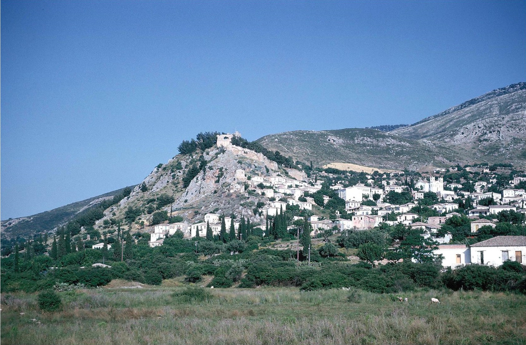
Plate 22A. Kyparissia: Kastro from South.
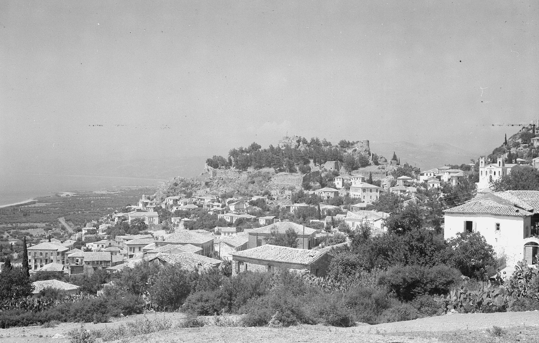
Modern Kyparissia occupies the narrow pass between the Kyparissia mountains (the northern tip of Mt. Aigaleon) and the sea. The Kastro of Kyparissia, on the eastern edge of the town (Plate 2B and Plate 22A) is connected to the mountain by a saddle. It is steep, especially on the north. The summit, enclosed by the walls of the medieval castle of Arkadia (Andrews loc. cit.) measures c. 150 m north to south by c. 65 m (average). Sparse MH and LH surface sherds were found, mainly on an upper north slope, near a section of a Classical or Hellenistic wall, by Valmin (loc. cit.) and later by McDonald and Hope Simpson (AJA 65 loc. cit.). Subsequently a considerable quantity of Mycenaean pottery was recovered by Choremis from excavations for the foundations of a new house at the west foot of the Kastro (AJA 73 loc. cit.). Due to the intensive construction on the Kastro slopes in medieval and early modern times, it is difficult to estimate the size of the Mycenaean settlement here. But, to judge from the distribution of the finds, it was probably at least a ‘large village’. On Pylos tablet An 657, one of the o-ka ‘coast guard’ series 30 men described as ke-ki-de ku-pa-ri-si-jo are listed (DMG, 188-189, 427-430; Hope Simpson 2014, 60-67), presumably from Kyparissia.
Strabo (8.3.22-25) and Pausanias (4.36.7) both briefly mention a Messenian Kyparissia, and Strabo says that the river near it was named Kyparisseeis. Strabo, however, also asserts that there was a Kyparisseeis in Makistia (i.e. in Triphylia) “when Makistia extended beyond the Neda”, but that it no longer existed. This story has the appearance of an antiquarion fiction. Strabo seems to have a predilection for such stories concerning Makistia, in line with his bias in favour of a Triphylian Pylos.
Amphigeneia (Il. 2. 593)
Strabo (8.3.25) says categorically that Amphigeneia, like Kyparisseeis, was in Makistia, in the neighbourhood of the river Hypsoeis, where there was a shrine of Leto. This story is suspect, like the story of a Kyparisseeis in Makistia. The location of Amphigeneia is unknown.
Pteleon (Il. 2. 594)
Strabo (8.3.25) makes the obvious comment that there was another Pteleon in Thessaly (Il. 2. 697); but the story he gives, that the Pteleon in Messenia was a colony from the Thessalian Pteleon, is simply not credible. His further comment, that the Messenian Pteleon “was a woody, uninhabitated place called Pteleasion” is, of course, a deduction based on etymology (πτelέη = elm, e.g. in Il. 6. 419 and Il. 21. 242 and 350). The location of Messenian Pteleon is unknown.
Helos (Il. 2. 85)
The ancient sources do not provide any useful information concerning the Messenian Helos. According to Strabo (8.3.25), some called it a territory (χωϱίον) near the Alpheios, some called it a city, like the Laconian Helos, and others identified it with the marsh at Alorion, where there was the temple of Heleian Artemis, whose worship was under the management of the Arcadians, since they held the priesthood. Pliny the Elder (NH 4.5.15) placed Helos between Methone and Cape Akritas.
Since Helos means ‘marsh’, we should presumably be looking for a conspicuous perennial marsh in the region. The obvious candidate is the extensive marsh below the springs at Ayios Floros, the source of the Pamisos river. Mycenaean ‘villages’ have been discovered at Ayios Floros itself [78 C in AJA 68 (1964) 236-237] and at Ayios Floros: Kamaria [78 D in AJA 73 (1969) 159] and Valmin excavated a temple to north of the village, in use from the Archaic to Roman periods (Valmin 1938: Part II). It may be more than a coincidence that one of the districts in the ‘Further Province’ of the Pylos Kingdom is name e-re-i (the dative locative of e-ro, construed as Helos) on Pylos Linear B tablet Jn 829. It has been conjectured that the district of e-re-i was named after the marsh at Ayios Floros (Hope Simpson 2014, 26, 35, 51 Table 3, 67).
Dorion (Il. 2. 594)
Vasiliko: “Malthi-Dorion” and Malthi: Gouves: MH LH I-IIIC PG G? A? C M
Selected references: Bull Lund (1926-27) 53-89; Valmin 1938 Part I; Valmin 1953; AD 16 (1960) B 119-122; Alin 1962, 76-78; Desborough 1964, 94; CSHI, 85; GAC, 174-175 (D 222 and D 223); MG, 138-139 with fig. 13 (F 217 and F 218); Mountjoy 1999, 303; MFHDC, 56-57 with refs.; Hope Simpson 2014, 28, 37-38, 66-67.
“Malthi-Dorion” is Valmin’s name for the hilltop site he excavated, the north tip of the limestone ridge of Ramovouni, which protrudes from the south into the Soulima valley between the villages of Vasiliko and Kokla (MG, fig. 13 = AJA 73 Ill. 5a on p. 137). The site dominates the valley, the main route from the west coast at Kyparissia to eastern Messenia. The fortifications of “Malthi-Dorion” were probably constructed during LH I-IIA; they enclose an area c. 140 m north to south by c. 80 m, incorporating five small gateways (Valmin 1938, esp. 16-25 and Plate III). The circuit wall varies in width from c. 1.60 m to c. 3.55 m. Up to one metre of its height is preserved; the masonry is uncoursed and mainly of small to medium-sized stones (MFHDC, 56). The latest pottery illustrated is LH IIIA1 (Mountjoy, loc. cit.) and most of the site was no longer in use in LH III. Nevertheless, some occupation may have continued into LH IIIC (Desborough, loc. cit. mentions a probably LH IIIC sherd from a deep bowl and ribbed and swollen kylix stems similar to LH IIIC examples from Kephallenia). The main settlement here, however, was clearly at Malthi: Gouves, a low rise at the southwest foot of the hill, about three hectares in extent. Valmin excavated only a small area of this site (Valmin 1953), uncovering parts of two buildings (or perhaps part of one large building). Of the 14 rooms revealed, two were fairly large (Room 9: 7.0 m x 4.5 m; Room 10: 5.5 m x 4.5 m). The two tholos tombs (Tholos I 6.85 m diameter; Tholos II 5.75 diameter) excavated earlier (Valmin 1938) are only c. 200 m to northeast of the Gouves settlement, near the foot of the “Malthi-Dorion” hill. The few finds from the tombs (mainly from Tholos II) included LH IIIB and some sherds apparently LH IIIC; one sherd from Tholos II has been assigned to LH IIIA1 (Mountjoy, loc. cit.). The tholos tombs presumably belonged to the Gouves settlement, since “Malthi-Dorion” was only partly inhabited in LH III (Valmin 1938, 321).
Valmin was convinced that “Malthi-Dorion” was the site of the Homeric Dorion (Valmin 1930, esp. 11-14). Pausanias began his journey to Dorion at the Arcadian gate of ancient Messene. After crossing the Balyra river (modern Valyra) and visiting the plain of Stenykleros, Oichalie and the Karnasion grove and Andania, he took the road to Kyparissia. After Polichne and the streams Elektra and Koios, he arrived at the spring called Achaia and the ruins of Dorion (Pausanias 4.33.3-7). The crucial identification here is that of the Achaia spring with the spring at the modern village of Kokla, about a kilometre to northwest of Malthi-Dorion (MG, fig. 13). Kokla was a customary Khan or resting-place for travellers until the twentieth century and the advent of the railway. Pausanias may not have climbed up to the ruins of “Malthi-Dorion”, but the remains of its fortifications would have been conspicuous and well known. Apparently Pausanias did not continue along the road to Kyparissia (he must have returned to Messene, cf. Pausanias 4.34.1 and his subsequent itinerary). Strabo obviously never visited Dorion or anywhere else in northeast Messenia. All he can tell us (8.3.25) is that some called Dorion a mountain and others a plain.
After listing Dorion, the Catalogue continues by describing it as the place where the Muses met Thamyris the Thracian coming from Oichalie, from the house of Eurytos of Oichalie, and put an end to his singing (Il. 2. 594-600). According to the Catalogue itself, Oichalie, the home of Eurytos (Il. 2. 596) was in the Kingdom of the Asklepiadai in Thessaly (Il. 2. 730). But Pasusanias says that the Messenians identified Oichalie with Karnasion near Andania, where the bones of Eurytos were kept (Pausanias 4.2.2-3, cf. 4.3.10 and 4.33.4). Strabo, on the other hand, identified Oichalie as Andania in Arcadia (Strabo 8.3.6, 8.3.25, 8.4.5 and 10.1.10). Eurytos’ son, Iphitos, gave Odysseus the famous bow and quiver of arrows when they met in Lacedaimon in Messene in the house of Ortilochos. Ortilochos’ city was Pherai (cf. Od. 3. 488-489), one of the Seven Cities offered by Agamemnon to Achilles (Il. 9. 149-157 = Il. 9. 291-298). There is a possibility that the name Oichalie was listed as in the Kingdom of Nestor in an earlier Catalogue of the participants in the Trojan War (see Chapter 3). “It is also perhaps significant that this particular ‘expansion’ of the Catalogue, dealing with Thamyris, begins in the middle of a line, whereas elsewhere such ‘expansions’ always begin a new line: one is tempted to conjecture that Il. 2. 594 once read κaὶ Πτeleὸν κaὶ Ἕlος κaί Δώϱiον Οἰχalίην τe.
[for the literary tradition and topography of Messenia in historical times see the commentary by Lazenby and Hope Simpson in McDonald and Rapp (eds.) 1972, 81-99. Indispensable also are Valmin 1930 and Roebuck 1941].
THE KINGDOM OF NESTOR
Nestor’s Kingdom presents some problems, especially the lack of coincidence between the Catalogue names and the data provided by the Pylos Linear B archives (cf., e.g. Chadwick 1976, 185-186 and Eder 2003, 297-301). Of the places named in the Catalogue, the locations of Pylos, Arene, Thryon, Kyparisseeis and Dorion have been established, but for Aipy, Amphigeneia and Pteleon there are no reliable indications. In the Pylos Linear B tablets the only Cataloge names recognized are ku-pa-ri-si-jo (Kyparissians, An 657) and Pylos itself (pu-ro), and possibly Helos, if this can be equated with the e-re-i of Jn 829 (Hope Simpson 2014, 51, 67-69). The territory of Mycenaean Pylos, as deduced by study of the tablets, seems to have comprised all of Messenia, as far north as the river Neda, on the east up to Mt. Taygetos, and with the river Sandava as probably the southern border (Hope Simpson 2014, 65). The Catalogue, on the other hand, has Nestor’s Kingdom mainly in western Messenia and up the west coast as far to the north as the river Alpheios. Apparently it does not include the southern part of the Pamisos valley, but extends far beyond the mouth of the Neda, up to Thryon above the south bank of the Alpheios. The ford over the Alpheios at Thryon is mentioned (Il. 2. 592); and Thryon and Arene feature in Nestor’s tale of the War between the Pylians and the Epeians of Elis (Il. 11. 670-761) where Thryon (as Thryoessa here) is described as “a city, a steep hill far away on the Alpheios, the farthest (city) of Sandy Pylos” (Il. 11. 711-712). In another passage in the Iliad the Alpheios is said to flow through the land of Pylos (Il. 5. 541-560). This passage was interpreted literally by Strabo (8.3.7 and 8.3.29) and Dörpfeld, but may surely be categorized as ‘poetic licence’ (the emphasis in the context is on the pedigrees of Krethon and Orsilochos as the descendants of the Alpheios). In the tale of the War with the Epeians, Thryoessa is described specifically as νeάτη Πύlου ἠμaθóeντος. The adjective νέaτος in Homer always denotes position, i.e. it means ‘furthest’ or even ‘lowest’ or ‘uppermost’. That Thryoessa was within the Kingdom of Pylos is implied by the attack on it by the Epeians (CSHI, 86 and n. 36). According to Nestor’s tales, this war against the Epeians and the war between the Pylians and the Arcadians (Il. 7. 132-156) were in the time of Nestor’s youth: eἴθ’ὣς ἡβώοiμi ….. (Il. 7. 157 = Il. 11. 670, and cf. Il. 7. 132-133), “if only 1 were young again, as when …..”.
We now have good archaeological evidence for the expansion of Mycenaean Pylos in the LH IIIA2 and LH IIIB1 periods, during which eastern Messenia was absorbed into the Pylian Kingdom as the ‘Futher Province’ of Pylos, corresponding to the ‘Hither Province’ of western Messenia, centred on the Pylos district. As the Linear B archives reveal, in the year of its extinction the Kingdom was divided into these two provinces, named de-we-ro-a3-ko-ra-i-ja (the ‘Hither Province’) and pe-ra3-ko-ra-i-ja (the ‘Further Province’). The adjective de-we-ro means ‘this side of’ and pe-ra means ‘beyond’. “Hence we can deduce that the Kingdom is divided into two provinces separated by some conspicuous feature” (Chadwick 1976, 43). This ‘conspicuous feature’ is now generally acknowledged to have been Mt. Aigaleon, which, together with its southward extension, divides eastern and western Messenia. The easiest, and probably the earliest, expansion of Pylos would have been to the north, along the west coast (where the more level terrain would have been easier for chariots). The wars against the Epeians and the Arcadians may be faint recollections of actual early forays northwards from Pylos although the fierce battles may be partly imaginary and almost certainly exaggerated.
There is, of course, the problem raised by the story of the Seven Cities offered, together with other rich gifts, by Agamemnon to Achilles, in order to persuade Achilles to give up his ‘wrath’ and return to the fight. In this ‘Embassy’ episode the Seven Cities are described as “all near the sea” and as νέaτai Πύlου ἠμaθóeντος. As in the case of Thryoessa, this should, strictly speaking, mean “furthest (νέaτai) of Sandy Pylos”. But it is obvious from the context that the cities did not belong to Nestor. The audience would have realized that νέaτai should here be understood as ‘on the border of’ or ‘at the edge of’. (CSHI, 86 and n. 38). They would be accustomed to such formulae. From the testimony of Strabo and Pausanias, together with the archaeological data, the Seven Cities are shown to have been situated around the Messenian Gulf (Map 4, and cf. Hope Simpson 1957 and 1966). Kardamyle is at Kardhamili: Kastro (GAC, D 147); Enope (the historic Gerenia) is at Kambos: Zarnata (GAC, D 146); the site of Aithaia: Ellinika (GAC, D 137) at ancient Thouria may be either Antheia or Aipeia; Rizomylo: Nichoria (GAC, D 100) can now be considered a strong candidate for either Aipeia or Antheia (see Hope Simpson 2014, esp. 22-29 for a concordance of the numbering of these sites in various publications). It has been suggested that the Seven Cities were included in the previous Catalogue that is presumed to have been included in the (lost) ten-year Iliad (Burr 1944, 60-61; Wade-Gery 1952, 55-56). If this was the case, it might be supposed that Homer deliberately excluded them from his Catalogue in order to use them for the Embassy episode. But Homer makes no attempt to explain how the cities were available for Agamemnon to give to Achilles (and the audience would probably not welcome such an interruption). It is more likely that the Seven Cities were embodied in a ‘Little Catalogue’ accompanying another epic tale, i.e. one similar to Nestor’s tales or that of the Kalydonian Boar. There are some indications of such a tale in connection with the dynasty of Ortilochos and Diokles of Pherai, descendants of Alpheios (Il. 5. 541-560); and the two sons of Diokles, Krethon and Orsilochos, took part in the Trojan War, apparently as a personal favour, for the honour of Agamemnon and Menelaus. Pausanias says that Nestor was made ruler of all the Messenians except those subject to the sons of Asklepios, ruler of Gerenia. They were, he says, Messenians who went to Troy (Pausanias 4.3.1-2). The Seven Cities are therefore presumably marked as Messenian; and in the Odyssey, Odysseus and Iphitos met in Messene in the house of Ortilochos, i.e. at Pherai (Od. 21. 15-16).
Plate 2A. Kardamyle. The Citadel from West.
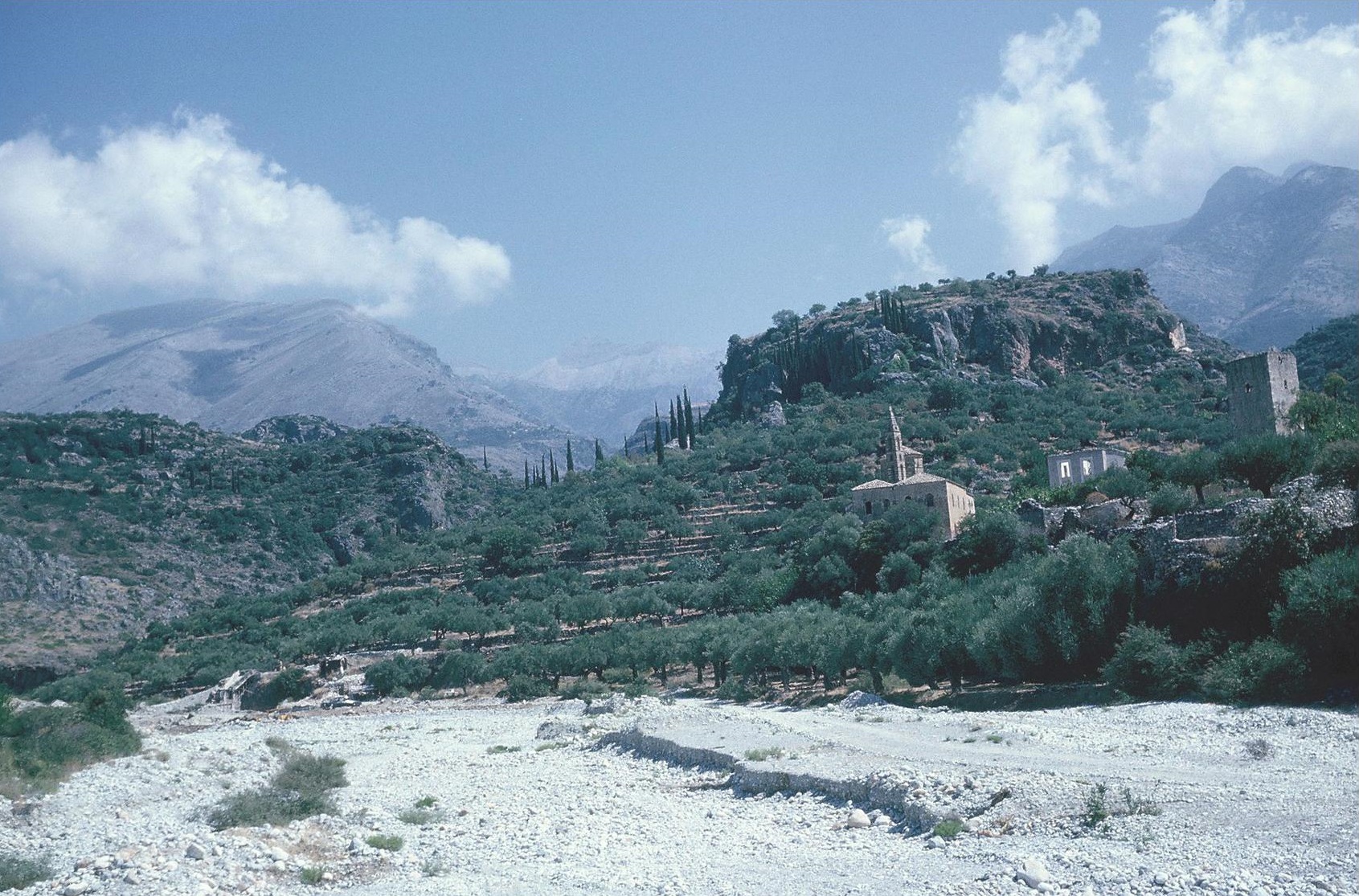
Plate 21A. Kardamyle. The Citadel from South.
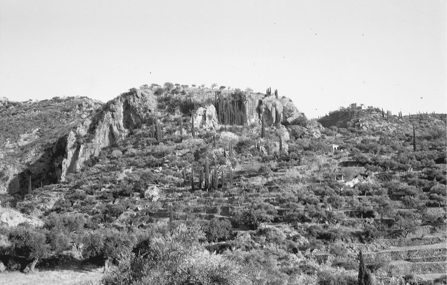
The ancient Greek traditions concerning Pylos and Messenia often appear to be at variance with the hypothetical reconstructions of the Mycenaean Kingdom of Pylos, as deduced from the study of the Pylos Linear B archives (e.g. Hope Simpson 2014, 45-70). But it is questionable whether a concord, between the traditions and our conclusions derived from the tablets, should be expected. The Kingdom of Nestor in the Catalogue and of Nestor’s tales may be a poetic reflection of a loosely controlled and more western and northern domain of the early years of the Pylos polity. And the dramatic context of the tales (i.e. in Nestor’s youth) certainly suggests an earlier stage in the development of the kingdom, whereas the tablets are from the last year of its existence. For the comparative lack of coincidence between the traditional place names and those identified in the tablets there are various possible explanations. Some of the names of the main centres of the Hither and Further provinces appear to be primarily those of districts; and in the Further Province some of these district names may have been newly invented by the Pylos bureaueracy, as is suggested by the adjectival form in which these names occur (Ruipérez and Melena 1990, 115, cf. Hope Simpson 2014, 54, 63). In contrast, all the names in Nestor’s Kingdom in the Catalogue and those of the Seven Cities are of ‘towns’. Some of these names are clearly epithets, i.e. Aipy, Aipeia and Antheia; others, Helos, Arene, Pedasos and Kyparisseeis, and Pylos itself, suggest natural features. Whether or not these Homeric names reflect a period (or periods) different from that of the tablets, there are no cases of direct conflict between known locations of names in either category.
ARCADIA
Pheneos (Il. 2. 605)
Kalyvia: Pyrgos (Ancient Pheneos): N? EH II MH LH IIIA2-B G? A? C H
Selected references: AR (1959-60), 10; AJA 63 (1959) 280-281, pl. 76, figs. 12 and 13; AD 17 (1961-62) B 57 ff.; AD 20 (1965) B 158 ff.; CSHI, 91; Howell 1970, 97; GAC, 84 (B 34); MG, 89 (D 20); Knauss 1990a; MFHDC, 218-219.
Plate 23B. Kalyvia: Pyrgos (Pheneos) from South.
The excavations by Protonotariou-Deilaki from 1958 to 1964 have established that the Pyrgos hill was the centre of ancient Pheneos. The hill is at the northwest edge of the Pheneos plain, about a kilometre to southeast of the modern village of Kalyvia (now re-named Pheneos). It is conspicuous by reason of the pyramidical knoll on its higher western end (Plate 23B). The polygonal walls around this acropolis have been partly cleared; and at the eastern end of the lower southeast part of the hill an Asklepieion of the 2nd century B.C. has been revealed, identified by an inscription. Here fragments of colossal marble figures were found, interpreted as from a group of a seated Asklepios with a standing Hygieia (AD 17 loc. cit.). Trial trenches around the Asklepieion and north of it uncovered MH and Mycenaean strata; sherds of these periods have also been found over most of the surface of the hill, in an area c. 250 m northwest to southeast by c. 150 m, especially on the southeast slopes. Some EH sherds were found on the higher west end of the hill and one sherd apparently Neolithic. The Mycenaean pottery was of quite good quality, indicating several pieces from kylikes, angular bowls and deep bowls. The later material was mainly Classical and Hellenistic, but one sherd appeared to be from the base of a Geometric skyphos.
Pyrgos was evidently an important Mycenaean centre, well situated to control the higher northern part of the Pheneos plain. The lower southern part had at one time been a lake. In his account of Pheneos (8.14.1 to 8.15.4) Pausanias noted the marks (which remain clearly visible) on the mountainside at the southeast end of the plain, which show the level up to which the water once stood. Knauss (loc. cit.) has examined the course of the “channel of Herakles” recorded by Pausanias (8.14.1-3, cf. Frazer 1898 III 235-236), which runs from north to south through the plain. According to Pausanias, Herakles dug this channel for the river Olbios; and the channel is indeed partly artificial. Knauss has also discovered evidence for an ancient dam here, which would have created a polder in the southeast section of the lake, where the land reclaimed would previously been covered by the waters of the lake. Contrary to Knauss’ supposition, however, it is unlikely that these were Mycenaean constructions. Such improvements in drainage and reclamation of land are more likely to have been made during the floruit of the historic Pheneos, i.e. within the Classical and Hellenistic periods, when the increased size of the population would have made them necessary. And the worked stone blocks used in the construction of the dam (illustrated in Knauss 1990) seem characteristic of Classical or Hellenistic masonry (MFHDC loc. cit.).
Orchomenos (Il. 2. 505)
Orchomenos (formerly Kalpaki: Ancient Orchomenos): MH LH IIIB G A C H R
Hiller von Gaertringen and Lattermann 1911, 18-19 and Abb. 4 (plan), Taf. 1-2; BCH 30 (1914) 71-88; Fimmen 1921, 10; Karo, in RE Suppl. vi. 608; CSHI, 91; Howell 1970, 80-84; Winter 1971, 31-34 with notes 64 and 68; GAC, 81 (B 23); MG, 87-88 (D 12); Knauss et al. 1986; MFHDC, 217-218.
Plate 3A. Lepreon: Ayios Dhimitrios from East.
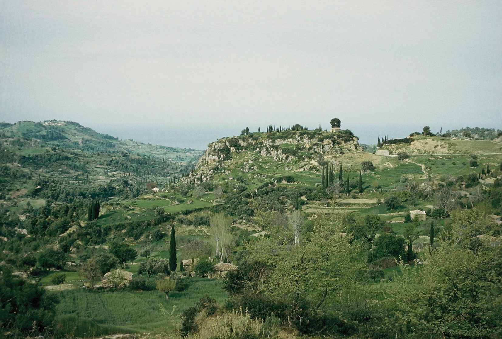
The acropolis of ancient Orchomenos was the high conical hill (Plate 3A) at the eastern end of the chain of hills which separates the plain of Orchomenos from the plain of Kaphyai on the north. The village of Kalpaki lies at the southeast foot of the hill, outside the acropolis fortifications and near a fine spring, presumably that mentioned by Pausanias (8.13.2). By the time of Pausanias the centre of the city had moved to this area, although Pausanias records (ibid.) that there were remains of a former market-place on the acropolis. The earliest pottery found in the excavations by Blum and Plassart (BCH loc. cit.) was Geometric (a few sherds); but Fimmen reported Matt-painted sherds as collected here by O. Walter. Karo mentions Mycenaean sherds, but for these gives only a reference to Fimmen’s report. In 1958 a fragment was found of the float of a LH IIIB kylix near the top of the hill (CSHI, loc. cit.), but no other prehistoric remains were found there at that time or by Howell later (Howell 1970, 83). Winter (loc. cit.) discusses Thucydides’ comment (Thuc. V. 61.5) on the weakness of the (5th century B.C.) walls of Orchomenos and assigns the existing wall remains on the acropolis to the 4th century B.C. or the Hellenistic period.
An ancient dam, the γηÚς χw:μa recorded by Pausanias (8.23.2), between Orchomenos and Kaphyai confined the flood waters from the lake/marsh here to the eastern part of the Orchomenos-Kaphyai basin, and turned the western half into a protected polder, which was further drained by means of a channel (also recorded by Pausanias, loc. cit.) leading to a katavothra (‘swallow-hole’) at its south end (Knauss et al. 1986). The dam was built of soil and stone, and was about 2 km in length and c. 10 m wide; its original height was estimated to have been 2.0 to 2.5 m. Knauss believed that the dam was constructed by Mycenaeans. But the photograph (Knauss et al. 1986, Abb. 14) of part of the wall of the dam at its western end shows that it was built in rough courses of partly isodomic and partly polygonal masonry, in a style typical of late 4th century B.C. or early Hellenistic work. It is in no way comparable to Mycenaean. As in the case of Pheneos (above), the floruit of Arcadian Orchomenos was in the Classical and Hellenistic periods, when there would have been an increased population and a greater need for agricultural land. Mycenaean settlements around the Orchomenos-Kaphyai basin appear to have been few and small (Howell 1970, loc. cit.).
At Mytika, at the edge of the upper plain to south of Orchomenos and c. 3 km to south of the Orchomenos-Kaphyai basin, Spyropoulos partly excavated a substantial Mycenaean settlement [AD 37 (1980) B 119-120, cf. AR 37 (1990-1991) 26 and MFHDC loc. cit.]. The settlement was described as extensive; there were narrow lanes between the houses (cf. the photograph in Knauss et al. 1986 Abb. 166). The pottery found was LH IIIA and LH IIIB, with a smaller amount of LH II. This discovery provides a further indication that this ‘upper plain’ to south of Orchomenos was of more importance to the Mycenaeans than the Orchomenos-Kaphyai basin on the north.
Rhipe, Stratie and Windy Enispe (Il. 2. 606)
The locations of these places are unknown, although the probability is that they were in western or northwestern Arcadia. Strabo (8.8.2) says that it would be difficult to find them and that they would be of no use to anyone who found them, since they are deserted. Pausanias (8.25.12) pours scorn on those who have thought that they were once islands in the river Ladon, because, as he says, the Ladon could only accommodate islands no larger than a ferry-boat. Nevertheless, two candidates have been proposed for Enispe. One is the site of Dhimitra: Troupes, where Syriopoulos collected many sherds, mainly MH and some LH I/II-III(A-B) [BSA 63 (1973) 193-205, cf. Howell 1970, 98-99, GAC, 83 (B 33) and MG, 88-89 (D 10)]. The other site is Kamenitsa: Sakovouni, where T. and G. Spyropoulos excavated part of a settlement occupied in the Neolithic period and in LH I-IIIB2. They claimed that this settlement is probably to be identified as the Homeric Enispe, “….. known from epic (Iliad II) and the tablets from the Myc. Palace at Pylos”. [AR 43 (1996-1997) 35-36]. There is no evidence, however, in support of the identification of either of these two sites as Enispe. No connection between ancient Stratos, to west of the Ladon, and Homeric Stratie has been suggested.
Tegea (Il. 2. 607)
Alea: Ancient Tegea, Temple of Athena Alea: N EH MH LH IIIB LH IIIC? PG G A C H R M
Selected references: Mendel 1901; Dugas 1921; CSHI, 92; GAC, 76 (B 1); MG, 85 (D 1); Østby et al. 1994; Voyatzis 1997; Dickinson 2006, 19, 142, 234-235; reports by Østby in AR vols. 37 to 42.
In the first excavations of the temple, by Mendel from 1900 to 1902, many sherds were found (in the pronaos area) described as “de style géométríque et mycénien” (Mendel 1901). In the later excavations by Dugas, in a trench to north of the temple, similar pottery was found, including two fragments from LH IIIB stirrup-jars (Dugas 1921, 247 fig. 59 (1) and 248 fig. 61. Part of a Psi figurine (Dugas 1921, 424 fig. 63 no. 315 is also LH IIIB (cf. BSA 66 (1971) 183). In the recent excavations by Østby et al. fragments of a Mycenaean figurine and of a Mycenaean horse crater are reported [AR 38 (1991-1992) 17-18] and a substantial amount of Neolithic, EH and Myc. material and large quantities of Protogeometric and early Geometric [AR 41 (1994-95) 13-14 and AR 42 (1995-1996) 12; for the Protogeometric pottery see Voyatzis 1997]. It is therefore now established that there was a prehistoric settlement here (of unknown size) before the establishment of the shrine of Athena Alea, and that part of this settlement was beneath the temple. There is, however, no proof of a cult here in Mycenaean times or proof of continuity at the site from the Mycenaean period to the Early Iron Age.
Several other Mycenaean sites have been discovered (mainly by Howell) in the vicinity of ancient Tegea (Howell 1970, 88-95, nos. 23, 27, 30, 32 and 33 = GAC nos. B 10, B 3, B 6, B 8, and B 9). Probably the most significant of these, and the largest, is Alea: Palaiochori (Howell no. 32 = GAC no. B 8), c. 300 m in diameter and with small early Mycenaean tombs of tholos type. In CSHI (loc. cit.) this site was considered a candidate for Homeric Tegea; but the recent excavations at the temple of Althena Alea have now tipped the balance in favour of this site.
Mantinea (Il. 2. 607)
Pikernis: Gourtsouli (Ancient Ptolis): N? EH MH LH III(A-) B G A C H
BCH 11 (1887) 49; BCH 87 (1963) 766-767; AD 18 (1963) B 88-89; CSHI, 92-93; Howell 1970, 86-87; GAC, 79-80 (B 18); Karagiorgha-Stathakopoulou 1989, 1992-93 and 2008.
Plate 4A. Pikernis: Gourtsouli (‘Old Mantinea’) from South.
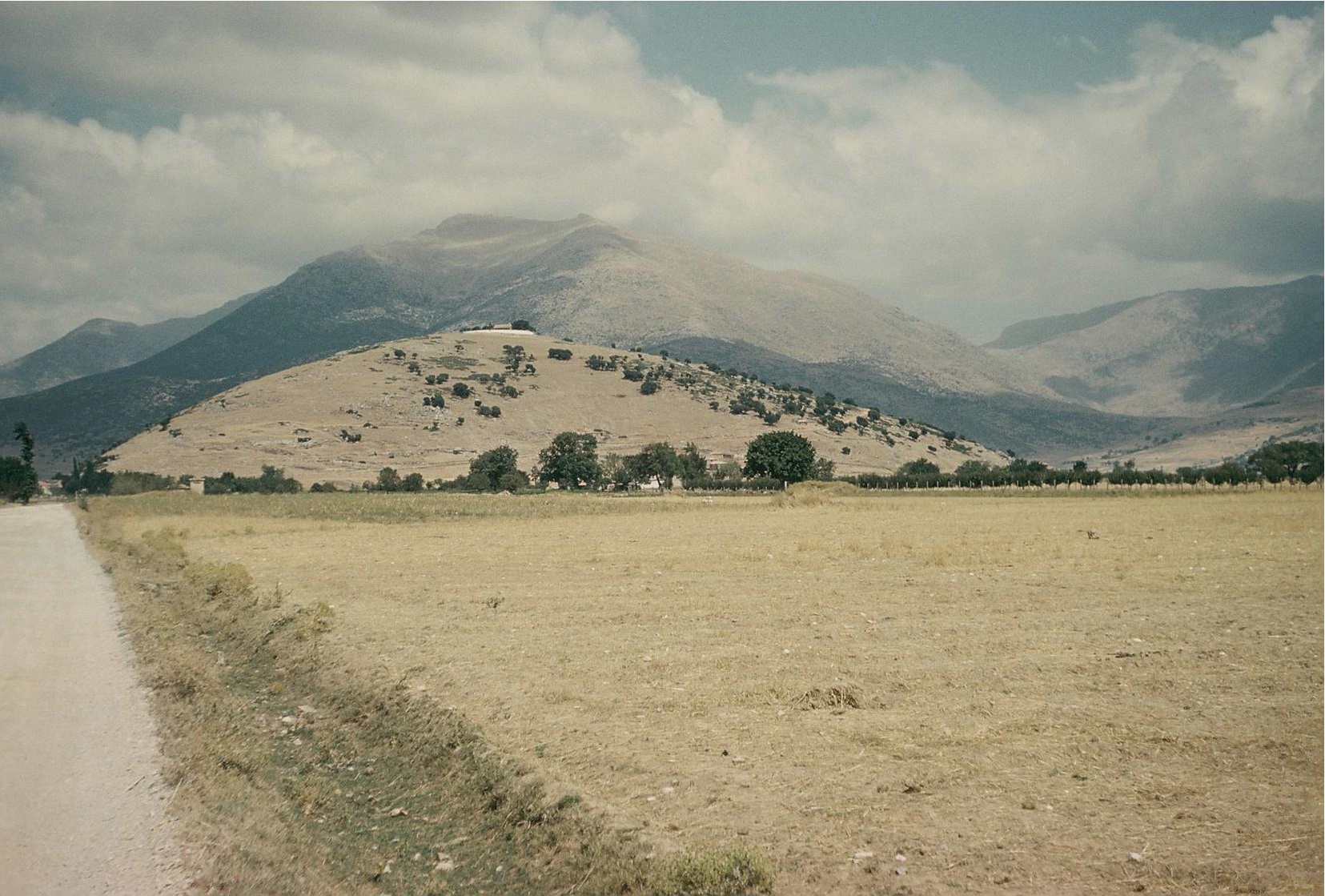
Plate 4B. Gourtsouli. Cyclopean Wall on Southeast, with John Lazenby
The hill of Gourtsouli (or Gortsouli) rises abruptly from the Mantinea plain (Plate 4A), a short distance to north of the walls of the Classical Mantinea. Gourtsouli is now securely identified as the Ptolis or ‘Old Mantinea’ mentioned by Pausanias (8.12.5-7); and the spring of Alalkomeneia (Pausanias loc. cit.) must be the copious spring now called Tripechi (Frazer 1898 IV 201, 221, cf. CSHI, 92 for an explanation of Pausanias’ descriptions here). The top of the rounded hill of Gourtsouli is now occupied by the Panayia chapel and its enclosure, near which is a small spring (dry in summer). On the east side of the hilltop, only c. 100 m from the chapel, there is a 10 metre sketch of wall in a very rough ‘Cyclopean’ style (Plate 4B), of which up to three courses are preserved, to a height of c. 1.50 m. The line of the wall can be traced for about 30 metres further to the south, indicating that this was probably a circuit wall. If so, it would have enclosed all of the upper part of the hill, a roughly circular area c. 200 m in diameter. A Mycenaean date for the wall seems the most probable. Trial excavations by Karagiorgha (BCH 87 loc. cit. and AD 18) and surface collection, by Fougères (BCH 11 loc. cit.), Hope Simpson and Lazenby (CSHI, 93) and Howell (loc. cit.), have together demonstrated EH, MH and Mycenaean habitation on the upper part and the east slopes of the hill. Four LH IIIB sherds (from Deep Bowls and Kylikes) were found in the vicinity of the Panayia chapel on the summit. Karagiorgha subsequently excavated a temple on the west slope and established that the hill was a sanctuary area from about the end of the 8th century B.C. to the middle of the 2nd century B.C. (Karagiorgha-Stathakopoulou 1989 and 1992-93. In the light of all these discoveries, Gourtsouli is clearly identified as the centre of Homeric Mantinea.
Slymphalos (Il. 2. 608)
Kionia: Ancient Stymphalos: EH III? LH IIIA-B A C H R M
Selected references: Frazer 1898 IV, 269; CSHI, 93; Howell 1970, 97-98; GAC, 84 (B 35); MG, 89 (D 21); Knauss et al. 1986; Knauss 1990a; EMC/CV 16 (1997) 23-73; EMC/CV 17 (1998) 261-319; Mouseion 2 (2002) 135-187 (with bibliography on pp. 186-187); reports in AR vols. 43, 44, 46 and 48; MFHDC 62, 219-220 and pl. 12b.
Ancient Stymphalos lies c. 1.5 km to south of the village of Kionia (now re-named Stymphalos) and the edge of Lake Zarakas. The acropolis was a long narrow limestone ridge at the eastern end of a spur of Mt. Kyllini. Excavations from 1994 to 2001 under H. Williams (EMC/CV and Mouseion refs.) have uncovered parts of the ancient town. Its floruit is now established as from the late 4th to mid 2nd centuries B.C., the times of the use of its Sanctuary of Athena and of its successive fortifications. There was also some activity in the 5th century B.C. and “a possible city renaissance” in the early 1st century A.D. Most of the town was in the plain below the acropolis, where the excavators could not dig below a metre “without reaching the water table” (EMC/CV 16, 24). It appears, therefore, that this waterlogged area must have been successfully drained by the end of the 4th century B.C., when roads were built in the plain (EMC/CV 17, 279-280). Knauss et al. have investigated the system of dams, especially the eastern barrier, which would have confined (to the eastern end of the late) the waters which would otherwise have flooded the town. And this eastern barrier must have been in place at the time of Hadrian, when, as Pausanias tells us (8.22.3) an aqueduct was constructed to supply water to Corinth from a spring “in the Stymphalian territory”, since the remains of part of this aqueduct are indeed preserved in the barrier which formed a dam, about 2 km long and c. 2 m high to east of the town of Stymphalos (Knauss 1990, esp. Taf. 8-1 and Abb 8; cf. MFHDC, 220). As at Tegea, Mantinea, Orchomenos and Pheneos, in the case of Stymphalos also there is no reason to attribute the ancient hydraulic works to the Mycenaeans. In all these cases the dates of construction must have been within the Classical to Roman periods.
On the terraces of the acropolis, especially in the lower eastern part, late Mycenaean sherds, including several LH IIIB, were found, together with 2nd century A.D. Roman sherds, in shallow fills (Mouseion 2, 168-170). In 1958 only two Mycenaean sherds were found, on the surface of this eastern section, one from a LH IIIA Kylix and the other from a LH IIIB Deep Bowl (CSHI, 93). The Mycenaean settlement here may have been mainly or wholly confined to this eastern part of the acropolis (an area c. 250 m east to west by c. 50 m), which is separated from the higher western part (the site of the Sanctuary of Athena) by a small saddle. A long stretch of rough walling (MFHDC pl. 12b), recorded in 1958 on the southeast flank of the eastern section was thought to have some resemblance to Cyclopean masonry. Since it was about 15 metres above the level of the plain below, and continued in a straight line for several metres, it was interpreted as part of a circuit wall. But its construction was crude, with quite large but unshaped stones, so that a “Cyclopean” designation may not be appropriate. Both its function and its date are uncertain.
The evidence for Mycenaean habitation at ancient Stymphalos is not sufficient to indicate a settlement of more than modest size here. It is possible that the main Mycenaean settlement in the Stymphalos valley may have been elsewhere. Among the ancient remains shown to H. Williams and his Canadian team near the village of Lafka (about 4 km to southwest of ancient Stymphalos) was “….. what might be the remains of a simple tholos tomb built of rubble (now partially collapsed) of unusual form with a stomion and relieving triangle” (Mouseion 2, 185). As they say (ibid.), “….. It is clear that there are Mycenaean and indeed earlier remains around the valley …..”
Parrhasia (Il. 2. 608)
Pausanias (8.27.2-4) lists the communities which joined in the union of Arcadians at Megalopolis. Among the Parrhasians are the citizens of Lykosoura, Trapezous, Thokneia, Proseia, Akakesion, Akontion, Makaria and Dasea. Of these, Lykosoura, Thokneia, Trapezous and Dasea were to northwest of Megalopolis, along the upper reaches of the river Alpheios. The most impotant Mycenaean site known in this region is Palaiokastro [GAC, 83 (B 32); MG 88 (D 17), cf. AR 43 (1996-1997) 33-34 and BSA 93 (1998) 269-283 and see Chapter 1]. Here over 100 Mycenaean tombs have been excavated; the pottery is mainly LH IIIC. Other Mycenaean sites in western Arcadia are Dhimitra: Troupes and Kamenitsa: Sakovouni (discussed above under Rhipe, Stratie and Enispe) and Dhimitsana (Howell 1970 no. 47). But there must have been many more prehistoric sites in western (and northern) Arcadia; the region has not yet been systematically explored.
ARCADIA
The places in this section whose locations have been established, Pheneos, Orchomenos, Tegea, Mantinea and Stymphalos, are all in eastern Arcadia. Mycenaean settlement is attested at all of these. Although only one Mycenaean sherd has been found at ancient Orchomenos, there is a fine Mycenaean settlement at Mytika nearby. There may have been continuity into the Early Iron Age at Tegea, where Protogeometric pottery of Laconian style has been found in the recent excavations. Rhipe, Stratie and Enispe were unknown in historical times; neither Strabo nor Pausanias could provide any useful clues to their locations. That they, and Homeric Parrhasia, were probably in western Arcadia is an obvious inference. This conclusion is also suggested by the context in Nestor’s tale of the War between the Pylians and the Arcadians (Il. 7. 132-156), in which there is a battle “on the swift flowing Keladon ….. beside the walls of Pheia, by the streams of the Iardanos …..” (Il. 7. 133-135). Pheia is presumably the historic Pheia (Map 5), a harbour town on the west coast of Elis [Ayios Andreas: Pontikokastro (Ancient Pheia), GAC, 194 (E 42); MG, 153 (G 7)]. This site was also inhabited throughout the Mycenaean period and the Early Iron Age. Strabo (8.3.12) also cites the same line (Il. 7. 135) in which Pheia and the river Iardanos appear, and says that there is a small river (ποτάμiον) near Pheia. This small river may be identified as the stream to north of the village of Skaphidia, c. 2 km north of Pheia (cf. CSHI, 94).
THE EPEIANS
Bouprasion (Il. 2. 615)
Bouprasion is usually taken as the name of the district along the west coast of modern Elis from Cape Araxos on the north to Cape Chelonatas on the south. According to Strabo (8.3.8; cf. 8.3.17 and 8.7.5) it lay between the city of Elis (on the east) and the Dymaia (on the north). But Strabo (8.3.8) also says that there was also probably once a considerable settlement (κaτοiκía) called Bouprasion, which no longer existed (here the first, and repetitive mention of this probable settlement in Strabo’s text is regarded by most editors as a gloss). Strabo continues with the conjecture that this Bouprasion may have (then) had some preeminence over Elis, such as the Epeians had over the Eleians, but that later the people were called Eleians instead of Epeians. In the same passage Strabo cites Iliad 23. 630-631 (“as when the Epeians were burying lord Amarynkes in Bouprasion”) as signifying that Homer called the men of Bouprasion Epeians. Strabo does his best to explain the various divisions of the Epeians in Homer and of the later Eleians, but some confusion remains, and it is impossible to define precisely the locations of these divisions.
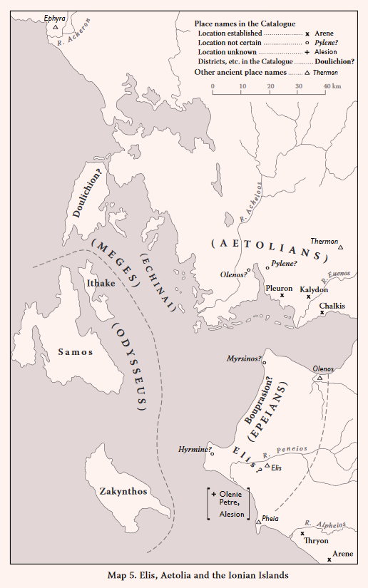
Elis (Il. 2. 615)
Elis in the Catalogue also seems to be a district name, to judge from Il. 2. 626 (see below under The Kingdom of Meges) and Od. 4. 635 and 21, 347 (see below under The Kingdom of Odysseus). The most natural interpretation is that Elis here refers to the district later known as “Hollow Elis” (κοílη Ἤliς), comprising the main broad plain in the modern eparchy of Elis, between the foothills of Mt. Erymanthos on the east and the coastal area (Bouprasion? on Map 5) on the west. According to Strabo (ibid.), the city of Elis developed much later, after the Persian Wars; although there are earlier remains at the site, including 14 Submycenaean pit graves [GAC, 195 (E 45); MG, 153 (G 3); cf. ÖJh 46 (1961-63) 45-58, AD 19 (1966) B 181; CSHI, 97; Mountjoy 1999, 366].
Hyrmine (Il. 2. 616)
Neochori: Chlemoutsi Castle (Kastro): N? MH LH I/II? LH III(A-B) G C
AR for 1956, 16; BCH 85 (1961) 123-161, esp. 157-161; BCH 88 (1964) 9-50; CSHI, 97-98; GAC, 194 (E 41); MG, 153 (G 2).
Plate 24A. Neochori: Chlemoutsi Castle (? Hyrmine) from East.
For the location of Hyrmine the only ancient testimony is the brief note by Strabo (8.3.10), who says that it was a small town, no longer in existence, and that there was (i.e. in Strabo’s time) a mountain promontory called Hormina or Hyrmina near Kyllene. Kyllene was the port of Elis (Pausanias 6.26.4-5), and Otos of Kyllene was a ruler of the Epeians (Il. 15, 218). Servais has shown that ancient Kyllene was at the site of the medieval Glarentsa (modern Kyllini), where he found various Classical and later remains, especially a fragment from an Attic amphora dated to the early 5th century B.C. (BCH 85, 130-144, esp. 143, fig. 11). Strabo’s Hyrmina-Hormina is therefore marked as the promontory of Chelonatas. The site of Hyrmine is almost certainly the Castle of Chlemoutsi (Plate 24B), on an isolated rounded hill to northeast of Neochori, dominating not only the coastal hills but also the plain of Elis for several miles around. The trial excavations at Chlemoutsi in 1963 by Servais revealed considerable MH deposits beneath the castle walls, especially late MH which may overlap with early LH, from a burnt stratum which contained a jar full of burnt grain. There was also some LH III material; and a Mycenaean tomb between Chlemoutsi and the village of Neochori yielded Mycenaean pottery, including a LH III vase, and three stertite spindle whorls (BCH refs.). A cemetery of Geometric tombs near Chlemoutsi had been previously reported (AR loc. cit.).
Myrsinos (Il. 2. 616)
Araxos: Ancient Teichos Dymaion: N EH I-III MH LH IIIAI-IIIC Late G A C H M
AD 18 (1963) B, 111-114; PAE (1962), 127-133, (1963), 93-98, (1964) 60-67, (1965), 121-136; Ergon for 1962, 171-175, for 1963, 186-191, for 1965, 94-105, for 1966, 156-165; Reports in BCH for 1963 to 1967 and in AR for 1961-62 to 1965-66; Op Ath 5 (1964), 102, 110; CSHI, 98; GAC, 195-106 (E 47); MG, 155 (G 6); Mountjoy 1999, 402; MFHDC, 63, fig. 2, pls. 13a and 13b.
According to Strabo (8.3.10) Myrsinos was the Myrtountion of his day, which he describes as extending down to the sea, and situated on the road from Dyme into Elis, and 70 stades (c. 14 km) from the city of Elis. But the district indicated is flat and marshy, and not suitable for a major settlement. (cf. CSHI loc. cit.). Whether or not Strabo’s information concerning Myrtountion is reliable, a much better candidate for Homeric Myrsinos is the important Mycenaean fortress explored by Mastrokostas on the Araxos promontory, near the northwest tip of the Peloponnese and at the northwest corner of Elis. The site, known locally as “Kastro tis Kalogrias” (“The Nun’s Castle”) is clearly to be identified as the Teichos Dymaion mentioned by Polybios (4.59.4; cf. Frazer 1898 IV, 112-113). The Homeric epithet (Il. 2. 616) for Myrsinos is ἐσχaτówσa (‘furthest’); and Pausanias (6.26.10) says that on the coast the boundary between Elis and Achaia was Araxos. Only preliminary reports of the excavations here by Mastrokostas have been published (in PAE and Ergon and summaries in BCH and AR), and the stratigraphy is not clear. Certainly this was a Mycenaean fortress of considerable size and strength. It was also probably a port, since it is apparent that the site of the present marsh on the southwest side was originally sea. This southwest side is precipitous; walls may not have been needed here. The well preserved walls on the other sides, the northwest, northeast and southeast survive up to a height of 8 to 10 metres in some parts of the enceinte [cf. PAE (1962) 12.8 fig 1 (plan) and AD loc. cit.]; in the 190 m long northeast side they are 4.90 m to 5.20 m thick. There were three gates, one in each side, and the main gate, on the southeast was approached by a stairway and had a tower on its northeast side. The walls (unfortunately not adequately discussed or illustrated in Mastrokostas’ reports) are in a style which partly resembles the Cyclopean of the main Mycenaen fortresses of the Argolid, but also has features more characteristic of isodomic masonry (MFHDC pl. 13b), with fewer small stones in the interstices. Their style seems to have been partly due to the nature of the local stone available. The Mycenaean pottery is mainly LH IIIB and LH IIIC, with only a few LH IIIA pieces. The fortifications were probably not built before LH IIIB (GAC loc. cit.). Rooms were built in LH IIIB against the inner face of the fortification walls. The settlement appears to have been destroyed by fire at some time within LH IIIB2 and LH IIIC Early (Mountjoy, loc. cit.). It was reoccupied later in LH IIIC until some time in LH IIIC Late when it was again destroyed; it was subsequently deserted until the Late Geometric period.
Petre Olenie (Il. 2. 617)
The location proposed by Strabo (8.3.10) for the ‘Olenian Rock’, at Skollis (the modern Santameri) ‘finds no followers’ (CSHI, 98). The lines attributed to Hesiod by Strabo (8.3.11) describe Olenie Petre as ‘along the banks of the wide Peiros (river)’. This would in fact support a location near the later ancient Olenos, placed by Meyer at a site west of Tsoukaleika on the coastal plain, c. 8 km east of Kato Achaia and c. 12 km southwest of Patras (Meyer 1939, 119-121 and Abb. 10). But the ‘Olenian Rock’ suggests a prominent geographical feature, for which no appropriate location has yet been suggested.
Alesion (Il. 2. 617)
In Nestor’s tale of the War against the Epeians, as Strabo recalls (8.3.10), Alesion is called Ἀlησíου κοlώνη (‘the hill of Alesion’, Il. 11. 757). Thryoessa in the Tale is called θϱυοέσσa πóliς, aἰπeiÚa κοlώνη (‘the town Thryoessa, a steep hill’), which suggest that Alesion is also envisaged as a ‘town’ (πóliς). There are no clues for identifying Alesion. Servais suggested that it might have been near the Alpheios [BCH 88 (1964) 50]; and many Mycenaean sites have now been found in the district around the later Olympia. Such a location would be consistent with an interpretation of the Catalogue passage (Il. 2. 616-617) as impying that Hyrmine, Myrsinos, The ‘Olenian Rock’ and Alesion marked the limits of the Epeian territory (if it is accepted that Hyrmine was Clemoutsi, Myrsinos was ‘Kastro tis Kalogrias’ and the ‘Olenian Rock’ was near the later Olenos). But perhaps not too much weight should be given to the phrase ὅσσον ….. ἐντὸς ἐέϱγei (Il. 2. 616-617), which taken literally, would mean ‘as much (territory) as they (Hyrmine etc.) encompass’. The poet was here probably more concerned with fitting the four place names into hexameter lines.
THE EPEIANS
The description of this contingent presents some geographical problems. It is difficult to determine the extent of the territory attributed to the Epeians, since the locations of two of the place names, Olenie Petre and Alesion are unknown. And this was obviously not one united Kingdom; the Epeians have four leaders, each with 10 ships (Il. 2. 618-624). If Bouprasion and Elis are assumed to be districts here, it could be inferred that Hyrmine, Myrsinos, Olenie Petre and Alesion were the home towns of the four leaders. The only Homeric names within the region which can be firmly associated with specific sites are Pheia and Hyrmine, both of which are on or near the sea, as was the Mycenaean fortress of Araxos: Teichos Dymaion, probably Homeric Myrsinos. Olenie Petre would also have been close to the sea, if it was near the historic Olenos, which was in the westernmost part of the later ancient Achaea. The Epeian territory appears to have been mostly in the western part of Elis, separated from the eastern hill country, the foothills of Mt. Erymanthos, by the broad and relatively infertile plain of central Elis. But geographical inconsistencies are evident. In the Catalogue the Kingdom of Nestor ends in the north at Thryon and the Alpheios river. But Bouprasion, Olenie Petre and Alesion all feature in Nestor’s tale of the War against the Epeians (Il. 11. 756-758). Bouprasion and Olenie Petre are far to the north of the Alpheios. This has worried some modern commentators, who suggest that the context requires locations for these places “not very far from the Pylian frontier” (Thomas and Stubbings 1962, 293). But “….. the further away Bouprasion, the Olenian Rock and Aleson from Thryon, the greater the glory of Nestor’s exploit!” (CSHI, 99). A further complication is that Odysseus is said to have under his command not only the men from his islands but also men from the mainland opposite (Il. 2. 635), which presumably means Elis, where in the Odyssey Noemon of Ithaca kept twelve mares and their mule offspring (Od. 4. 634-637). But we can not expect any fixed frontiers in a time (that of Nestor’s youth) of political turmoil; and Nestor’s tales are celebrations of his martial valour, not geography lessons.
Many more Mycenaean finds (mainly from tombs and their contents) have been recorded in Elis since 1968 (when CSHI was compiled), not only in the Olympia area but also in the eastern hill country (Chapter 1). There is no mention of these in the Iliad, where most of the places named in wester Peloponnese are on or near the sea. This may be an indication that the traditions concerning these places are partly based on information from sailors.
THE KINGDOM OF MEGES
Doulichion (Il. 2. 625)
Allen 1921, 82-88; Dörpfeld 1927, BSA 32 (1931-32) 230; Stubbings 1962, 398-421; CSHI, 101; GAC, 184-185 (E 11 and E 12); MG, 159 (G 32).
As Allen realized, Dörpfeld’s excavations on Leukas, on the basis of which he identified Leukas as Homeric Ithaca, “… show in reality that Leukas will do for Doulichion” (Allen 1921, 86-87). Strabo’s objection (10.2.8), that Leukas was a peninsula before the Corinthians dug a canal between it and the mainland, is invalid (CSHI, 101). From the Odyssey it is clear that Doulichion must be an island (Od. 9. 21-24 and Od. 16. 122-123 = 19. 130-131), and it must be rich in wheat and grass (Od. 14. 335 and 16. 396). Doulichion should also be large enough to provide almost as many suitors for Penelope’s hand in marriage as those from Samos, Zakynthos and Ithaca combined (Od. 16. 247-253).
Although Mycenaean pottery (LH IIIA2-B) of fine quality was found on Leukas in the Choirospilia cave (GAC, E 12 = MG, G 32) and Mycenaean sherds at Ayios Sotiros (GAC, E 11) and a few painted LH III sherds from Amali and Skaros (Stubbings 1962, 411), no actual Mycenaean settlement has yet been discovered on Leukas. But Dörpfeld did not make a full survey of this agriculturally rich island, and it has not been systematically explored subsequently. More Late Bronze Age sites may be expected here.
The Echinai (Il. 2. 625-626)
The Echinai are securely identified as the Echinades, a group of small islands off the west coast opposite Acarnania. On Meganisi, the largest of these islands, the fields south of the main modern settlement of Spartochori were strewn with Bronze Age sherds, including several Mycenaean [BSA 32 (1931-2) 230, cf. GAC, 185 (E 13) and MG, 159 (G 33)]. On the smaller island of Kalamos also Benton discovered a Bronze Age site (BSA 32, 233-234).
THE KINGDOM OF MEGES
If the identification of Doulichion as Leukas is accepted, the combination of this large island with the neighbouring Echinades would constitute a geographically coherent Kingdom. And this could have been complemented by a ‘peraea’ consisting of part of Acarnania on the mainland opposite (Allen 1921, 87-88; Thomas and Stubbings 1962, 294). But the quota of 40 ships for Meges is still disproportionate, in comparison with the only 12 ships of Odysseus. Meges plays only a minor part (Il. 15. 301-305 and 535-538) in the rest of the Iliad, although he is named in the ‘Little Catalogue’ as one of the leaders of the Epeians (Il. 13. 691-692). Only a few Mycenaean remains were found in Dörpfeld’s excavations on Leukas, whereas Benton found plentiful Mycenaean sherds on the island of Meganisi in the Echinades. But Early and Middle Bronze Age finds were abundant in the tumuli of the Nidri plain on Leukas, where some of the graves had rich contents [Dörpfeld 1927, cf. BSA 69 (1974) 128-138 and GAC, 182 (E 10)]. It is very likely that more prehistoric remains will be found on this comparatively fertile island and in Acarnania on the mainland opposite, where some Mycenaean sherds have been found, at the historic fortress of Palairos: Kekropoula [GAC, 183 (E 8); MG, 160 (G 41)], and a tholos tomb at Loutraki: Amparia, c. 8 km west of Amphilochia [AD 48 (1988), cf. AR 41 (1994-1995), 19].
THE KINGDOM OF ODYSSEUS
Ithaca (Il. 2. 632)
Selected references
- General: Allen 1921, 82-99; Stubbings 1962, 398-421; CSHI, 103; Waterhouse 1996, especially refs. on p. 302 n. 8 to excavations by the British School, in BSA vols. 33, 35, 39, 40, 43, 44, 47, 48 and 68.
- Sites in the vicinity of Stavros:
Pelikata: EH II-III MH LH IIIA1-B LH IIIC? PG? A?
Ayios Athanasios: LH III(A-B) H
Stavros Village: EH II MH? LH III(A-B) C H R
Tris Langadhas: MH LH IIIA1-B
Polis Cave: EH MH LH I/II LH IIIA2-C PG G A C H
[GAC, 185-186 (E 14 to E 18); MG, 158-159 (G 26 to G 30); Coulson 1986, 1991; Waterhouse 1996, 303-304; Mountjoy 1999, 469, 475-478; Dickinson 2006, 15-19; MFHDC, 106-107]
Aetos: EH MH LH IIIB-IIIC Early PG G A C H
[GAC, 186-187 (E 19); MG, 159 (G 31); PAE (1986) 234-242; PAE (1989) 292-295; Ergon for 1984, 1985, 1986, 1987, 1988 and 1982, cf. AR 32 (1985-86) 55, AR 37 (1986-1987) 31-32, and AR 35 (1988-89) 60; Waterhouse 1996, 304-309; Mountjoy 1999, 469; Dickinson 2006, 18].
The descriptions of Ithaca in the Odyssey are ‘put into the mouths of’ the main agents of the story, Odysseus, his son Telemachos and his patron, Athene. In the first description, Telemachos expounds on the contrast between his rugged island of Ithaca and the broad plain of Menelaus’ Kingdom (Od. 4. 602-608),
“In Ithaca there are no wide (eὐϱέeς) roads, and no meadows. It has pasture for goats, and is more attractive than land for horse-breeding, since none of the islands which slope down to the sea are good for driving horses (ἱππήlaτος) or rich in meadows”.
Odysseus (Od. 9. 27) tells Alkinoos, the King of the Phaeacians, that Ithaca is a rough place (τϱηχeiæa) but a ‘nourisher of young men (kouϱότϱoϕoς). In the third passage (Od. 13. 235-249) the disguised Goddess Athene tells Odysseus that he has landed in Ithaca, which she also describes as rough (τϱηχεiæa) and not good for driving horses ((ἱππήlaτος), but not a poor land, although not wide (eὐϱeiæa), where there is grain ‘not to be spoken of even by Gods’ (ἀθέσϕaτoς, i.e. of extra special quality) and wine and where there is always (enough) rain and fresh dew, all kinds of wood, and perennial watering-places (for livestock). The picture is that of a rugged but healthy natural environment.
The unanimous ancient Greek testimony has firmly established the identification of Homeric Ithaca with the present Ithaki (formerly Thiaki), which meets all the requirements of the descriptions in the Odyssey. Some modern scholars, however, have argued against this identification, on the basis of a mistaken interpretation of the passage (Od. 9. 21-26), where Odysseus describes the location of Ithaca. The following translation of this passage (with some explanations) may serve as a basis for a resolution of these doubts,
“I live in Ithaca, the island clearly seen in the distance (εὐδείεloν). In it is the mountain Neriton, thick with foliage and prominent. Around are many inhabited islands, Doulichion and Same and wooded Zakynthos. Ithaca itself is low-lying (χθaμalὴ) and lies furthest in the sea towards the darkness (πaνuπεϱτάτη εἰν ἁli kείτai πϱὸς ζόϕoν). The rest lie apart from it, towards the dawn and the sun”.
‘Low-lying’ is the normal meaning of χθaμalὴ (Od. 9. 25) and πaνuπεϱτάτη (in the same line) must mean ‘farthest’ here, since the alternative meaning, ‘highest’ could not be said of a ‘low-lying’ island. The description, whatever its time of origin, is clearly that of a sailor or passenger approaching Ithaca by sea; it is therefore important to determine the direction from which the island is being observed. If the viewpoint is from the west, Ithaca would certainly not appear the lowest or farthest of the islands. But the usual approach to Ithaca from the Greek mainland would have been from the southeast, and from this direction it does appear to be both low-lying and far off, as compared to the much higher and closer southeast part of Kephallenia (with Mt. Ainos here at 1268 m a.s.l.), which would come into view long before Ithaca (cf. Stubbings 1962, 402 wth refs. and Waterhouse 1996, 315-317). Leukas (Homeric Doulichion?) would not be visible during this approach from the southeast.
For the more detailed topography of Ithaca, some descriptions in the Odyssey seem to be based on reality (Luce 1975, 145-155 with map on p. 145). The harbour of Phorcys, where Odysseus lands, is described as a narrow inlet between steep promontories (Od. 13. 96-101); this suggests the Vathy sound, which resembles a fjord. After landing here, Odysseus hides in a cave the treasures which the Phaeacians have given him. Among these are a tripod from Alkinoos and a tripod from each of his twelve fellow nobles. The cave is described as having stone bowls and jars in it, and long stone looms where the Nymphs weave garments of sea purple: It has two doors, one on the north and the other on the south; the latter is described as so small that only immortals can enter (Od. 13. 102-112). After hiding the gifts in the cave, Odysseus goes to find the swineherd Eumaios. He takes a rocky path over hills and through woods until he comes to the Raven’s Rock and the Fountain Arethusa (Od. 13. 408). The most convincing proposed location for these is in the southeast of Ithaki at the eastern edge of the plateau of Marathia. Here there is an impressive steep cliff below which a spring, Perapigadhi, sends its waters down a steep gully to the sea. The cave on Ithaki which most closely matches the description of the Cave of the Nymphs is Marmarospilia, in the hills to south of Dexia bay at the western end of the Vathy sound. This cave has the requisite stalactites and a hole in the roof of the required diminutive size, but it contained no antiquities.
Archaeological exploration of Ithaki has been mainly in the north of the island and in the vicinity of Stavros village, where several sites were excavated by the British School before World War II. The low round hill of Pelikata c. 600 north of Stavros has the best position of all the Mycenaean sites in the Stavros area. It lies on the central height between the three bays of northern Ithaki. The site has been severely eroded, and no structural remains were found intact in Heurtley’s excavations [BSA 35 (1934-35) 1-44]. The many traces of a circuit wall of large blocks can not be securely dated. The EH sherds in the foundations provide only a terminus post quem, and an EH circuit wall of this kind would be unusual. But Mycenaean sherds were found only on the summit, where Heurtley traced some foundations of a building. The 60 sherds were all of very poor quality and very worn; Mountjoy (loc. cit.) classes them as mostly LH IIIA2-B, with some LH IIIA1. Heurtley claimed that Odysseus’ palace (a necessary part of the Odysseus saga) had once stood on the hill of Palikata [BSA 40 (1939-40) 9-10]; but Benton was not convinced [BSA 44 (1949) 309-312, cf. Stubbings 1962, 421 n. 23]. Only a few Mycenaean sherds were found at Ayios Athanasios, c. 1.5 km northwest of Stavros, and some others at Asprosykia on the west edge of the village and below a Classical and later cemetery [BSA 35 (1934-5) 33]. The best evidence of Mycenaean settlement, and the best and most numerous Mycenaean sherds found on Ithaki, are from Benton’s excavations at Tris Langadhas [BSA 68 (1973) 1-24]. Here, on a steep slope about a kilometre southwest of Stavros, part of a fairly large Mycenaean building was uncovered, and parts of another rectangular building and of three superimposed apsidal buildings. According to Mountjoy (loc. cit.), the pottery is LH IIIA2, with some LH IIIB.
Benton’s excavation of the Polis ‘cave’ have provided the most important archaeological contribution towards our understanding of Homeric Ithaca and the Odysseus saga. It is ironic, but of no consequence, that geological studies have now shown that the ‘cave’ was not a cave, but in reality “….. a small, mostly open, sheltered area, protected from the sea by a large collapsed section of the south cliff face” [AR 52 (2003-2004) 29-38, cf. (2002-2003) 42-44]. The excavations reveal that this was a cult site, possibly as early as LH IIIC, although continuity here from the Mycenaean period to the Early Iron Age is not proved. The Mycenaean sherds (including kylikes with ribbed stems) are dated LH IIIC Late by Mountjoy (loc. cit., cf. Desborough 1964, 108-112) and the next period represented is the Protogeometric. That the ‘cave’ was sacred to the Nymphs by the Hellenistic period is shown by inscriptions on sherds. There was also a dedication to Odysseus (ΕΥΧΗΝ ΟΔΥΣΣΕΙ) on a fragment of a terracotta mask. The most important offerings at the ‘cave’ were, of course, the parts of 13 tripods, some dated to the end of the 9th century B.C. and others to the early 8th century B.C. (Waterhouse 1996, 303-313 with refs.). These, and their number, naturally call to mind those given to Odysseus by Alkinoos, King of the Phaeacians, and his 12 fellow-workers (Od. 13. 14-16 and Od. 8. 387-395). Waterhouse maintains (ibid.) that the dedication of the tripods must have preceded the composition of the Odyssey (which is generally placed later in the 8th century), and that dedications “of this expensive and sophisticated kind” could not have been made only by the inhabitants of an island so small and poor as Ithaca.
Another such cult centre was discovered at Aetos by the British School [BSA 33 (1932-33) 22-65, BSA 43 (1948) 1-124 and BSA 48 (1953) 255-258]. Aetos is the prominent hill above the Ayios Yeoryios chapel on the isthmus which divides southern and northern Ithaca, and between the Gulf of Molo on the north and Pisaetos bay on the south. At Aetos a small Bronze Age settlement (represented only by sherds) was succeeded by Protogeometric buildings. Some of these were so poorly constructed that they were at first thought to be burial cairns; but two partly preserved structures were identified by Benton as small “temples” (BSA 48, 255-259), i.e. shrines (Waterhouse 1996, 306). The later excavations by Symeoneoglou, from 1983 to 1989, confirmed the evidence for a shrine, possibly of Apollo, said to have been in use from c. 1050 to c. 600 B.C. (Ergon for 1989, 136-137). These excavations have also clarified the Mycenaean and Early Iron Age sequence at the site. The Mycenaean pottery is relatively scarce and mostly local, but in the 1986 report (Ergon Commemorative volume, publ. 1987, 78-83) a LH IIIB1 painted kylix and some LH IIIC Early sherds were identified (cf. Mountjoy 1999, 469). They were found with Geometric pottery and are therefore not in context. The Protogeometric pottery was of the same local variety as that from the Polis ‘cave’. The site became more important in the Geometric period; the first imported pottery recognized was Middle Geometric of Corinthian type (Coldstream 1968, 222-224; Coulson 1991; Waterhouse 1998, 309). Aetos and Polis would obviously have been ‘ports of call’ for Greek traders on the way to Italy and Sicily, since they lie conveniently on the protected channel between Ithaca and Kephallenia, which would have been both the safest and the quickest route (cf. Waterhouse 1996, 315-317). Aetos may have been the preferred location for a stop-over, since its Geometric and Archaic pottery is “… quantitively greater and qualitatively more distinguished” (Waterhouse 1996, 309). The little island of Daskalio, which lies on this route, would have been well known to sailors; it may have suggested the story of the ambush laid for Telemachos by the suitors (Od. 4. 663-672 and 842-847, cf. Od. 14. 24-30).
Neriton (Il. 2. 632)
Neriton was a mountain in Ithaca. In Od. 9. 21-22 it is also described as “with quivering leaves (εἰνoσίϕυlloν), and Athene also described Neriton to Odysseus as “covered with wood land” (kaτaεiμένoν ὕlῃ, Od. 13. 351). Neriton was presumably a conspicuous feature. At 2637 m a.s.l., Mt. Anoyi in the centre of Ithaki is by far the highest mountain on the island (Mt. Merovigli in the south is 670 m a.s.l. and Mt. Exoyi in the north is only 510 m a.s.l.).
There is not, and never has been, any reason to confuse Neriton with Nerikos (see CSHI, 103 for Strabo’s pedantic vacillations).
Krokyleia and Aigilips (Il. 2. 633)
These places (or districts) were presumably also in Ithaca. It has been suggested that Krokyleia may have been the region around Vathy bay in the south, where white limestone (kϱokύς) is found. Aigilips is called ‘rough’ (τϱηχεiÚa), which has suggested the mountainous district between Aetos and the south tip of Ithaki (cf. CSHI, 104).
Zakynthos (Il. 2. 634)
Selected references:
BSA 32 (1931-32) 213-218; AA (1934) 161-162; CSHI, 104; AAA 5 (1972) 63-66; AD 28 (1973) A 198-214; GAC, 192-194 (E 35 to E 39); MG, 155-156 (G 7 to G 12); Mountjoy 1999, 479.
Sites:
Zakynthos: Kastro: EB LH (III?) A C
Alikanas: Akroterion: LH II-IIIB
Katastari: Eleos: LH III(B?)
Vasiliko: Kalogeros: LH I-III(A-B) G A
Keri: Klapsias: LH IIA
Kambi: Vigla: LH II LH IIIA2-B
Plate 24B. Zakynthos Town and Kastro above.
“At least there can be no doubt that Homeric Zakynthos is the island which still bears the name” (CSHI, 104). Most of the Mycenaean sites found on the island are on or near the coast. But Zakynthos is by far the most fertile of the Ionian islands; it deserves much more search, particular in the eastern foothills of the main mountain chain of Vrachionas. One prehistoric and later settlement has recently been discovered in this interior district by a Greek-Netherlands survey team [AR 54 (2007-2008) 46]. The site is the north slope of Palaiokastro, a prominent hill with two medieval towers, near Machairado. On the north slope, among a concentration of Classical, Hellenistic, Roman and Later sherds, were some prehistoric, including one either Mycenaean or Early Iron Age. Most of the Mycenaean sites on Zakynthos were discovered by, and partly excavated by, Benton in the early 1930s. Unfortunately, the finds from these sites were destroyed in the 1953 earthquake which wrecked the Zakynthos museum. Benton excavated parts of Mycenaean houses at Alikanas and Vasiliko and a tholos tomb (in use from LH II to LH IIIB) at Alikanas. A ruined structure to south of the Vasiliko site was observed later, and thought to be the remains of another Mycenaean tholos tomb (AAA 5 loc. cit.). On the southwest side of the island two “rescue” excavations were carried out by Agallopoulou. From a small built tomb at Klapsias, c. 1.5 km west of Keri, two LH IIA vases were recovered. On the hill of Vigla above Kambi 14 rectangular rock-cut tombs were investigated; the pottery was mostly LH IIIA2-B with a few LH II (AAA and AD refs. above, cf. Mountjoy loc. cit.). Although this is not confirmed by excavation, it seems probable that the main Mycenaean centre on Zakynthos was the site of the Venetian castle of Kastro, above the modern town and port (Plate 24B). The castle walls enclose the large triangular summit of the steep hill, which was presumably also the acropolis of the historic Zakynthos. At least one Mycenaean sherd was found on the surface within the walls and some coarse ware sherds which appear to be Bronze Age [BSA 32 (1931-32) 217, cf. MG, 155 (G 7)].
Samos (Il. 2. 634)
Selected references: Allen 1921, 86-99; Stubbings 1962, 404-405; CSHI, 104.
Kephallenia: BSA 32 (1931-32) 231-246, esp. 220-226; Excavations by Marinatos in AD 5 (1919) 82-122, AD 6 (1920-21) 175-177, AE (1932) 10-47, AE (1933) 70-97; Wardle 1972; AAA 7 (1974) 186-190; AAA 10 (1977) 116-125; GAC, 187-192 (E 20 to E 34); MG, 156-158 (G 13 to G 25); Mountjoy 1999, 443-444.
- South central region (Argostoli district)
Argostoli: Palaiokastro (Ancient Kranea): EH? MH? LH III(A-B) C H
Argostoli: Diakata and Starochorafa: LH IIIC Late
Prokapata: Gephyri: LH IIIB1
Kokkolata: Kangelisses: MH LH IIIA? LH IIIB LH IIIC? C H R
Mazarakata: LH IIIA2-C
Lakkithra: LH IIIA2-IIIC Late C or H
Metaxata: Ta Chalikera: LH IIIA2-IIIC Late PG G A C H
Pesada: EH? MH? LH III C R
- Lixouri peninsula
Parisata: LH III(A2-B)
Kontogenada: Stous Minous: LH IIIC
Kontogenada: Oikopeda: MH? LH I-IIIA1 C or H
- East and southeast Kephallenia (Same and Poros districts)
Vlachata: Ayioi Theodoroi: LH III(A-B)
Koulourata: Palati: LH III(A-B) H?
Tzannata: Bozzi etc.: EH LH IIIA-C PG C H M
Mavrata: Kotronia: LH IIIC
There is no reason to doubt that the Homeric Samos was the island later called Kephallenia, as Strabo clearly states: “But by Samos he (Homer) means the Kephallenia of today” (Strabo 10.2.10). Here Strabo quotes from the episode in the Odyssey where Antinoos urges the other suitors of Penelope to accept his plan to ambush Telemachos “in the strait between Ithaca and rugged Samos” (ἐν πoϱθμῴ Ἰθάkης τε Σάμoiό τε πaiπaloέσσης, Od. 4. 671, cf. Od. 4. 845). The suitors are “all the nobles who rule over the islands, Doulichion. Same and wooded Zakynthos and rocky Ithaca” (Od. 1. 245-247). As Strabo explains (loc. cit.), the island Samos is here called Same by the poet; Strabo also points out that Homer did not mean the city of Same (one of the four cities of the historic tetrapolis of Kephallenia).
Archaeological exploration of Kephallenia has been mainly in the vicinities of Argostoli and Sami. The far north and northwest have received little attention. Marinatos discovered and excavated most of the Mycenaean sites now known on the island; these are listed by Kalligas (AAA 10, loc. cit.), and the recent Greek-Irish survey in the Livatho valley has provided further information. The most important new discovery is the site at Tzannata, now being investigated by the Greek Archaeological Service.
The most populated district in Mycenaean times was evidently the Argostoli area and especially the Livatho valley, with its cemeteries of chamber tombs at Mazarakata, Lakkithra and Metaxata. The largest group was at Mazarakata, with 16 chamber tombs and a ruined tholos tomb [PAE (1951) 184-185]. At Metaxata two of the six chamber tombs imitate tholoi [AE (1933) 73-109]. All three groups were in use from LH IIIA2 to LH IIIC Late. The only Mycenaean settlements found in the district, however, are the few remains on the later acropolis of Kranea and the Mycenaean house partly explored by Marinatos at Starochorafa nearby. This has been rediscovered in the Greek-Irish survey, and is marked as probably all of one period, LH IIIC [AR 54 (2007-2008) 56].
In the Lixouri peninsula of western Kephallenia there is less good land. The only Mycenaean sites found here are in the hills on the western edge of the plain, at Parisata and Oikopeda. At Pariseta a small settlement was noted. At Oikopeda are a LH IIIC tholos tomb, a LH IIB-IIIA1 settlement and a MH-LHI funerary complex [AD 52 (1966) B 309-311, cf. Mountjoy loc. cit.].
On the east of the island only a few Mycenaean sites have been found. At Vlachata, c. 3 km west of Sami, a Mycenaean house was excavated. To south of Same, some kylix stems were found by Benton at Koulourata in the interior along the main route from Sami to the port of Paros in the southeast. Other sites noted by Benton along this route may also have been Mycenaean [BSA 32 (1931-2) 220-225]. The most important discoveries in this region were at Tzannata, c. 3 km west of Paros. Here at Bozzi the Greek Archaeological Service excavated a tholos tomb (diameter 6.80 m), built in LH IIIA, complete with the remains of the dead ruler and many gold ornaments, two seal stones and other objects. Other burials in the tomb include one of the LH IIIC and a SMyc or PG pithos burial. Only 6 m away was a rectangular built tomb with 72 skeletons and 20 LH IIIA-B vases. The Mycenaean settlement on the Bozzi hill is being excavated; its peribolos wall is said to be c. 1200 B.C. [AD 47 (1992) B 154-157; AR 44 (1997-1998) 46; AR 45 (1998-1999) 44; AR 58 (1011-2012) 17]. The Tzannata site, like Aetos and Polis on Ithaca, lies on the strait between Kephallenia and Ithaca (the πoϱθμός of Od. 4. 671 = Od. 14. 29), and further suggests the importance of this route in Mycenaean times also.
oἵ τ’ ἤπεiϱoν ἔχoν ἠδ’ ἀντiπέϱaia’ ἐνέμoντo (Il. 2. 635).
(“and those who dwelt on the mainland and the lands opposite”)
The word ἤπεiϱoς always means ‘mainland’, and is used especially to distinguish ‘mainland’ from ‘island’. The swineherd Eumaios, when enumerating Odysseus’ livestock (Od. 14. 96-104) lists his herds in Ithaca separately from those “on the dark mainland” (ἠπέϱoio μεlaίνης). Antinoos threatens to send Iros “in a black ship to the mainland” (πέμψω σ’ ἤπεiϱόνδε ἐν νηὶ μεlaίνη) to the mercy of King Echetos with his pitiless blade (Od. 18. 84-87). The adjective μεlaίνη (‘black’ or ‘dark’) is the opposite of white and light, and is used in the Iliad and Odyssey to describe night, death (Il. 2. 834 etc.) and blood from wounds (Il. 4. 149 etc.). It also conveys a sense of the unknown (and therefore dangerous), especially the unknown regions (King Echetos appears to have been an imaginary figure, a children’s ogre).
The word ἀντίπέϱaia is a combination of the preposition ἀντί (‘opposite’) and the adverb πέϱa (‘beyond’). Here it is a further description of the mainland as seen (or imagined) by islanders. But the mainland was obviously not completely unknown to the islanders. Later Greek writers used the word πέϱaia (peraea) to denote territory ‘on the other side of’ a feature (usually a sea or a river). And it is implied in the Catalogue that the Kephallenians (under Odysseus) had some possessions on the Greek mainland. Strabo (10.2.10) thought that this peraea was in Leukas and Acarnania. But, if Leukas as Homeric Doulichion, it would seem more likely that a peraea in Acarnania would be a part of the domain of Meges than that of Odysseus. And Noemon of Ithaca kept his mares and mules in Elis (Od. 4. 634-637). On the other hand, Meges is said to be in command of Epeians (Il. 13. 691-692), which suggests that he also had interests in Elis. It is difficult to reconcile these apparent contradictions, which had perplexed Strabo and Page (CSHI, 104-105); they would not have given the poet or his audience any cause for concern.
[In a recent publication (Bittlestone 2005) the author proposes a novel solution of the ‘Ithaca Question’. The title, ‘Odysseus Unbound’, is provocative, as is the content. The book is lavishly illustrated, with colour photographs and diagrams, and it contains much interesting information concerning the topography and history of Kephallenia, where the author has several friends. But the main arguments, developed with the aid of contrived ‘clues’, are a miracle of self-deception. The author manages to persuade himself and some others (including two eminent Cambridge professors) to accept the theory that Homer’s Ithaca was only a small part of the present island of Kephallenia (cf. fig. 20. 14 on p. 243 and fig. 20. 15 on p. 245). Bittlestone apparently based this theory partly on Professor Diggle’s commentary (Appendix 1, pp. 505-529) and especially on the section (pp. 513-514) in which Diggle discusses Odysseus’ Kingdom according to the Catalogue (Il. 2. 630-637). Diggle here maintains that in Il. 2. 635 “and those from the mainland” (ἤπεiϱoς) denotes eastern Kephallenia and that “and those from the lands opposite” (ἀντiπέϱaia) in the same line denotes western Kephallenia. But to call part of an island ‘mainland’ would be a contradiction in terms; and the Homeric island Samos, later named Kephallenia, is mentioned in the line above (Il. 2. 634), together with the island of Zaknythos. Besides this, contrary to Diggle’s assertion here, it is indeed implied that Odysseus had possessions on the Greek mainland. He is said to have kept livestock on the mainland (Od. 14. 100-102), as did Noemon of Ithaca (Od. 4. 634-637) in Elis. This commentary by Diggle is elsewhere also both devious and selective. For instance, he attempts to show that all the Roman writers thought Ithaca was Dulichia. But he fails to mention Pliny N.H. 4. 53, where Ithaca is mentioned together with Cephallenia, Zakynthos, Dulichion, Samos and Croeyle, as also in Mela 2. 7, 10 (cf. Allen 1921, 85-99, esp. 90-91).
Bittlestone’s main contention, i.e. that Homeric Ithaca was only a small part of the (much smaller) western part of Kephallenia, depends mainly on his interpretation of Strabo’s observation that where the island of Kephallenia is narrowest, it forms a low-lying isthmus, so that is it often submerged from sea to sea (Strabo 10.2.15). Although Strabo does not here actually claim that western and eastern Kephallenia were separated by sea, Bittlestone assumes that Kephallenia was in Mycenaean times two islands, to which separate ancient names must have been given. In contrast, the short section by Underhill (pp. 530-547) is an exemplary presentation of the geological and geomorphological data concerning the Thinia valley at this isthmus, in which he shows that at some time in the past Kephallenia was indeed divided by the sea. The small section of wall by the shore near the isthmus, buried under landslip material (fig. 32. 22 on p. 468 and fig. A 2. 25 on p. 546) is tentatively characterized as “… similar to Mycenaean in style (after 1500 B.C.; Snodgrass pers. comm.)”. It seems, however, to belong to Professor Wace’s category G.O.K. (God Only Knows). As Underhill says, we need definitive age data for the geomorphic processes identified here.
Bittlestone follows up his theory of the location of Ithaca by providing specific identifications (within this supposed location in Kephallenia), i.e. with actual places, of the various features of Ithaca in the Odyssey: The Raven’s Rock, Eumaios’ pig farm, The Arethousa Spring, Laertes’ farm etc. (although the Cave of the Nymphs is missing). There is no consideration here of the possibility/probability that some of these features may have been adapted by, or even invented by, of the Odyssey or his sources. Allen long ago warned against identifying features in the Odyssey with actual places. He pointed out in particular that Telemachos’ journey to Pylos and Sparta, his return, and the ambush laid for him by the suitors of Penelope, are plainly Homer’s own inventions, necessary to the construction of the story (Allen 1921, 92-93). It is vain to look for an island which would exactly fit the description of Asteris in the Odyssey. And there is no need to expect a real palace of Odysseus (although this plays a vital part in the story); even in the real Ithaca. Bittlestone identifies the palace (in his Ithaca, i.e. northwest Kephallenia) as the high and bleak hill of Kastelli, which, according to Bittlestone, also impressed Professor Snodgrass (pp. 437-441, 462-465). Mycenaean sherds are claimed here (p. 465), but not illustrated or described. The Greek/Danish team who explored Kastelli earlier, recorded only some flint flakes and a few hand-made prehistoric sherds [AD 50 (1965) 246, cf. AR 47 (2000-2001, 44]. It is obvious that Kastelli was not a site of any significance; it is totally unlike any known Mycenaean acropolis. In fact there seem to be few actual ancient sites in this area. In general, also, the real archaeological evidence for Mycenaean settlement in Kephallenia is not adequately discussed in this book. There is ony one specific reference (p. 320) to Marinatos’ many excavations in the island; there is no mention of GAC or MG or of the recent discoveries, such as the Tzannata tholos tomb.
In appendix 4 (pp. 550-562) some modern Homeric theories are listed. These do not, however, include the best commentaries on the subject, Allen 1921, 85-99, Stubbings 1962, 399-400 and Waterhouse 1996. For modern Ithaki (formerly Thiaki), the real Homeric Ithaca, Bittlestone’s scheme leaves him only one Homeric name available, that of the Homeric Doulichion. But the island of Ithaki does not have the size required for Homeric Doulichion (where there were 52 suitors for the hand of Penelope). And Ithaki is not, and never was, ‘rich in wheat and grass’ (Bittlestone 270-271 and fig. 21. 13 pretends that it is ‘rich in wheat’). To identify Homeric Doulichion as Ithaki would be even more ridiculous than Dörpfeld’s assertion that Homeric Ithaca was Leukas. And Dörpfeld’s theory was at least occasioned by important archaeological discoveries.
Except for the fine chapter by Underhill, logic and common sense are in short supply in this book, where the tale told by the poet of the Odyssey is treated as if it was a guidebook. No amount of modern gadgets can make up for this basic deficiency.
THE KINGDOM OF ODYSSEUS
The modern heresies concerning the locations of the islands of Odysseus’ kingdom reveal the absurdity of the notion that the ancient Greeks did not know the names of their own islands (the erroneous identifications made by some Roman poets are irrelevant). It is obvous that Homeric Ithaka was Ithaca (i.e. modern Ithaki or Thiaki) and that Homeric Samos/Same was the island later named Kephallenia. But we can not expect to be able to locate all of the places and geographical features of Ithaca named in the Iliad and the Odyssey. Some of the descriptions of these in the poems are at least partly imaginary, and should not be taken literally. Inconsistencies remain, such as the only 12 ships allotted to Odysseus in the Catalogue, as compared with the 40 ships under Meges’ command. And the location(s) and the extent of the territory on the Greek mainland attributed to Odysseus and his Kephallenians are not made clear. But neither the poet(s) nor the audience(s) were historians or antiquarians.
THE AETOLIANS
Pleuron (Il. 2. 639)
Mesolonghi: Gyphtokastro (‘Old Pleuron’?: EH? LH III(A-B) PG G A? C H R
Woodhouse 1897, 55, 130-131; BSA 32 (1931-32) 239; CSHI, 107; AD 26 (1971) B 326-327; AR 22 (1975-76) 17; GAC, 181 (E 1); MG, 159 (G 34); MFHDC, 103-104 and Pl. 24b.
Plate 26B. Mesolonghi: Gyphtokastro (Pleuron) from Southwest.
Gyphtokastro (Plate 26B) is a hill about 100 m above the level of the coastal plain, and c. 2 km north of Mesolonghi. The hill is about 300 m in diameter, with a fairly flat upper area c. 90 m east to west by c. 70 m. It is strewn with rocks and boulders, and among these are many ancient sherds, tiles and wall foundations. A wall of squared blocks observed in 1960 may be part of a circuit wall around the summit. But the remains of a wall noted by Benton the north side (BSA loc. cit.) were lower down on the slope. Only one course of this wall was visible in 1960, but its thickness (over two metres) and length (over ten metres) indicate that it was part of a circuit wall; a similar stretch of walling preserved on the southwest flank (MFHDC, pl. 24b), about halfway down the hill, appeared to be part of the same circuit. This stretch has the large roughly shaped stones and small stones in the interstices which are the characteristics of Cyclopean masonry. Obsidian and apparently Bronze Age coarse ware sherds were observed on the surface of the hill in 1958 and 1960, together with a few sherds of finer fabric which appeared to be L.H. On the west slope four cist tombs were revealed (by quarrying operations), two of which contained Geometric and perhaps Late Protogeometric pottery, and Mycenaean sherds were also found nearby (AD loc. cit.). A cist grave and five pithos burials had been noted in 1960 on the east and southeast slopes (GAC and MG refs.). The pithoi were laid on their sides; most of their contents had been removed, but human bones and a bronze ring were noted. These may also have been Geometric burials.
Gyphtokastro lies to southwest of the much higher and larger hill of Kastro Kyra Irini, which is clearly identified as Strabo’s “New Pleuron” (Strabo 10.2.4, cf. Woodhouse loc. cit.). According to Strabo (ibid.), “New Pleuron” was founded by the former inhabitants of “Old Pleuron” after their land had been ravaged by Demetrios (King of Macedonia from 239 to 229 B.C.). As Benton suggested (BSA loc. cit.), Gyphtokastro was probably the site of “Old Pleuron”.
Olenos (Il. 2. 639)
Ayios Ilias (Ancient Ithoria): N MH LH IIB-IIIC C H
Woodhouse 1897, 153-155, 158; PAE (1963) 203-204; AD 19 (1964) B 295-300; BCH 88 (1964) 762-767; CSHI, 107-108; Wardle 1972, 93-105; GAC, 181-182 (E 2); MG, 159-160 (G 35); Mountjoy 1999, 798.
Plate 26A. Ayios Ilias (? Olenos) from Southwest.
The village of Ayios Ilias is near the north end of the long ridge between the Acheloos river and the head of the Aetolian gulf. To south of the village is a thin hill peak (Plate 6A), presumed by Woodhouse (loc. cit., cf. CSHI, 107) to be the acropolis of ancient Ithoria. On the saddle just below the south flank of this summit a habitation site was discovered by Wardle (loc. cit.), with evidence of MH, Mycenaean and Hellenistic occupation. Mycenaean tombs were excavated by Mastrokostas (AD loc. cit., cf. BCH loc. cit.) on the lower slopes of the ridge. A chamber tomb at Panayia in the village had at least three burials, with pottery from LH IIB to LH IIIB, numerous cornelian and paste beads and a few of gold, bronze knives and a scarab with a cartouche of Amenophis III. At Seremiti, c. 300 m south of the acropolis, a tholos tomb (diameter 5.27 m), only partly preserved, was in use in LH IIIB and LH IIIC. It contained three disturbed burials, the last in the dromos dated LH IIIC (Wardle 1972, 94, cf. Mountjoy 1999, 796). Among the finds were some gold beads with embossed decoration and 1,444 of carnelian. The three tholos tombs at Marathia (diameters 4.14 m, 4.17 m and 3.1 m), between 300 m and 500 m west of the acropolis, were better preserved, up to 19 courses in height, but had been robbed. The pottery found was LH IIIB and LH IIIC; some complete LH IIIC vases were found with the burials in the dromos of Tomb 2, which still retained its slab roofing. Although the extent of the Mycenaean settlement here has not been determined, the rich tombs mark it as an important centre.
Woodhouse conjectured that this acropolis at Ayios Ilias was Homeric Olenos. He argued that Ayios Ilias was the site of Ithoria, on the basis of Polybius’ description of the invasion ofsouthern Aetolia in 219 B.C. (Polybius 4. 64-65), and suggests that Ithoria was “the lineal descendant of the Homeric city” (Woodhouse 1897, 153-154). Mastrokostas’ excavations at Ayios Ilias have certainly provided support for this conjecture.
Pylene (Il. 2. 639)
Woodhouse 1897, 133 and index s.v. ‘Proschion’; PAE (1963) 203-204; CSHI, 108.
Strabo (10.2.6) says that the Aeolians destroyed Olenos and moved Pylene to higher ground, changing its name to Proschion. Various identifications have been proposed for Pylene/Proschion. Woodhouse proposed the ‘Kastro Trion Ekklesion’ not far from ‘New Pleuron’. Others have preferred a site near the valley of Magoula, c. 8 km northwest of ‘New Pleuron’, and not far from the Klisoura pass (CSHI, 108 and see Woodhouse’s map). The name ‘Pylene’ might suggest a pass. Mastrokostas’ conjecture, Lysimacheia (PAE loc. cit) appears to be unsupported.
Chalkis (Il. 2. 640)
Kato Vasiliki: Ayia Triadha: FN EH I MH LH I LH IIIC G A C H Byz
AA (1941) 99; AD 22 (1967) B 320; GAC, 102-103 (B 98); MG, 96-97 (D 74); refs. in AR vols. 42-48 and 51-52; Dietz and Moschos (eds.) 2006.
Plate 25A. Kato Vasiliki: Ayia Triadha (Chalkis) from North.
The isolated hill of Ayia Triadha (Plate 25A) is named after the basilica on its summit. It lies near the sea in the small fertile plain between Mt. Varassova (the ancient Chalkis mountain) on the east and Mt. Klokova (the ancient Taphiassos) on the east, and to east of the modern village of Kato Vasiliki. The excavations, from 1995 to 2001, by the Greek-Danish expedition under Søren Dietz and Lazaras Kolonas, have now revealed that Ayia Triadha was the acropolis of the historic Aetolian Chalkis. The upper surface of the hill, roughly oval in shape, is c. 170 m northwest to southeast by c. 90 m. The summit was ringed by successive Classical and Byzantine circuit walls, which enclosed an area c. 150 m by c. 70 m [AR 44 (1997-1998) fig. 59 on p. 43 (plan)]. There was a substantial settlement here in the historic periods, especially the Hellenistic, when it extended far beyond the circuit walls. Strata of earlier periods, Late Geometric, Archaic and Classical, were also discovered. Prehistoric remains include Final Neolithic to Early Bronze Age, MH III – LH I layers on bedrock in two sectors, and part of a LH IIIC building. Mycenaean sherds were also found in deposit of later dates.
Survey by the expedition also ruled out the possibility that the extensive fortified area, known as Pangali or Kastro, on the east side of Mt. Varassova, had been used for long-term habitation. The previous identification (cf. Woodhouse 1897 s.v. ‘Chalkis’) of this area as the site of historic Chalkis is therefore shown to be invalid. As Dietz and Houby-Nielsen point out (AR 44, 43), the identification of Ayia Triadha as the site of Aetolian Chalkis is in accord with the testimony of Thucydides, Polybius and Strabo. Although Strabo (10.2.21) cites conflicting accounts, given by his sources, of the location of the mountain Chalkis, Woodhouse (1897, 63 and 107) demonstrates that it was indeed the modern Mt. Varassova. And the mountain would have been a suitable landmark for the border between the territories of Chalkis and Kalydon. The excavations have now shown that Ayia Triadha is the site of the historic Chalkis. There is no reason to suppose that Homeric Chalkis was elsewhere. The identification previously proposed (CSHI, 108) with the site at Kryoneri is accordingly disproved (for Kryoneri, see below under Kalydon).
Kalydon (Il. 2. 640)
Ancient Kalydon: LH III(A-B) PG? G A C H R
PAE (1908) 99-100; AA 31 (1916) 220-221; Dyggve, Poulsen and Rhomaios 1934; AE (1937) 315; AD 23 (1937) 231; AD 17 (1961-62) B 183; AD 20 (1965) B 343-344; AD 22 (1967) B 320, CSHI, 108-109; GAC, 103 (B 100); MG, 96 (D 71); AR refs. in vols. 48 to 52; MFHDC, 103.
Kryoneri: N MH LH II-III(A-B) G C H
BSA 32 (1931-32) 238-239 with figs. 29-30; CSHI, 108; GAC, 103 (B 99); MG, 96 (D 73).
Plate 25B. Kalydon. The Acropolis from West.
The ancient city of Kalydon (Plate 25B) is about 6 km inland, near the west bank of the river Euenos (the modern Evinos) and below the foothills of the Arakynthos mountain chain. The highest and northernmost hill of the city appears to have been the Mycenaean acropolis. The hill overlooks the whole Mesolonghi plain of ‘Old Aetolia’, defined by Strabo (10.2.1) as the coastal area between Kalydon and the river Acheloos. Trials on the summit by Soteriades (PAE loc. cit.) uncovered Mycenaean house walls (including one apsidal) and sherds; and LH III and Geometric sherds were found here on the surface in 1960 (although most of the recognizable sherds were Classical or later). Substantial amounts of LH and Geometric finds have been reported in the neighbourhood of ancient Kalydon, including a cache of Mycenaean bronze weapons [AD 20 loc. cit., cf. GAC, 103 (B 101) and MG, 96 (D 72)]. Remains of a tower, on the highest western corner of the acropolis, were thought by Soteriades to be Mycenaean, but his conjecture has not been confirmed subsequently (MFHDC, loc. cit.).
Two Greek-Danish expeditions have explored the ancient city and its environs. The first, under Dyggve, Poulsen and Rhomaios from 1926 to 1935, concentrated mainly on the extra-mural Sanctuary of Artemis Laureia and the Heroon. The second expedition, from 2001 to 2005 under Dietz, Kolonas and Moschos investigated almost all areas of the city, especially the acropolis, the lower town and the city walls.
Geological survey of the district between the city and the sea has shown that the small harbour at Kryoneri, below the steep west side of Mt. Varassova, must also have been the harbour of Kalydon. Nearby is the early settlement discovered by Benton (BSA loc. cit.) on a much eroded terrace under the west cliffs of Mt. Varassova, and c. 600 m to northeast of Kryoneri. The upper surface of the terrace, c. 20 m above the level of the coastal plain, is c. 150 m north to south by c. 100 m. Benton found LH II-III sherds here, together with Neolithic and Geometric and house walls (including one apsidal, which she thought might be MH). To the north, at the base of the mountain are caves which have the appearance of destroyed Mycenaean chamber tombs.
The evidence clearly indicates that the site of the historic Kalydon was also that of the Homeric Kalydon and that Kryoneri served as the harbour for both. The epithets for Kalydon in the Iliad, πετϱήεσσa (‘rocky’, Il. 2. 640) and aἰπεiνή (‘steep’, Il. 13. 217 and 14. 116), are appropriate descriptions of its acropolis, which dominates the coastal plain to south and west.
THE AETOLIANS
Kalydon was obviously prominent in the epic traditioin, although references to Kalydon and the Aetolians in the Iliad are relatively brief and usually in the form of reminiscences by various heroes. The sons of Oineus, King of Kalydon, are featured in two famous legends. One son, Meleager, was king of all the Aetolians (Il. 2. 642-643). He is the hero who kills the Kalydonian Boar (sent by Artemis to ravage his father’s territory) and subsequently defeats the Kouretes who had besieged Kalydon (Il. 9. 529-599). The other son, Tydeus, is one of the Seven Against Thebes (Il. 4. 370-400). The dynasty is traced back to Portheus, King of Pleuron and Kalydon, whose third son was Oineus (Il. 14. 110-125). Thoas, who leads the Aetolian contingent in the Catalogue (Il. 2. 638) is also named as the ruler of Pleuron and Kalydon (Il. 13. 215-218).
Of the five Aetolian towns named in the Catalogue the positions of Kalydon, Pleuron and Chalkis have now been established, and there is a strong candidate for Olenos. Only the position of Pylene remains unknown. All, however, were in the southern coastal district to east of the river Acheloos, which Strabo (10.2.1) says was the boundary between the Aetolians (to east) and the Acarnanians (to west). The territory of the Aetolians may not have extended far into the interior of Aetolia. That this much larger and mountainous country on the north and east was less ‘Mycenaeanized’ appears to be demonstrated by the provincial nature of the Mycenaean pottery at Thermon (see Chapter 1). But Aetolia, and especially the north and east, is still mostly unexplored.
THE CRETANS
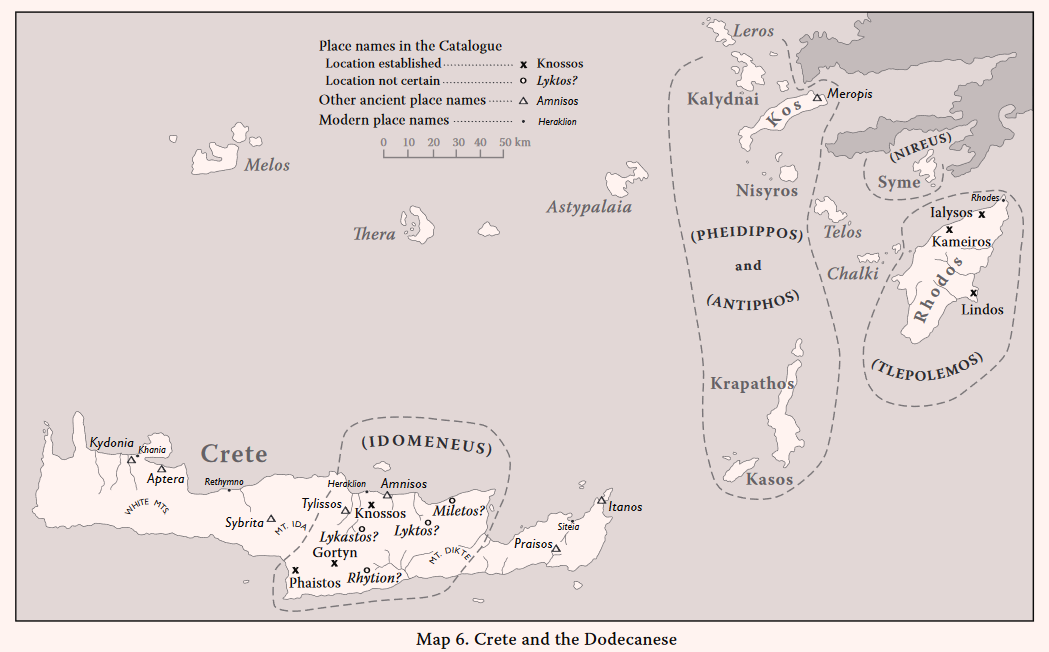
Knossos (Il. 2. 646)
Selected references: Evans, The Palace of Minos; Pendlebury, The Archaeology of Crete (1939); Hood and de Jong 1962; Popham 1970; Hallager 1977; Driessen and MacDonald 1984; Olivier 1994; Dickinson 1994; Popham 1994; Hatzaki 2005; Warren 2005; references in AR for 1950 onwards, esp. AR 57 (2010-2011) 67 with refs.
Since the history of Knossos is well known, only a few brief comments are necessary. After the widespread destructions in central and eastern Crete in the LM IB period, Knossos apparently passed into the control of rulers from the Greek mainland, as has been inferred from the nature of the LM II ‘warrior graves’ at Knossos (Hood and de Jong, 1952). The Linear B archives of Knossos certainly prove that Greek speakers were in charge of its palace in LM IIIA2 when the palace was destroyed. They also show that much of central Crete was then under the control of Knossos. The palace was partly reoccupied in LM IIIB after the destruction, but opinions differ concerning the scale of this reoccupation (Olivier 1994; Popham 1994). Recent excavations suggest a considerable recovery, but this may not have been sufficient to enable Knossos to regain control of central Crete at this time (cf. Warren 2005).
Idomeneus, the leader of the Cretan contingent, is the son of Deukalion and grandson of Minos (Il. 13. 445-454, cf. 12. 117). He is therefore marked as also the ruler of Knossos (cf. Od. 19. 198). He plays a distinguished role in the Battle at the Ships (Il. 13. 221-525, his ‘aristeia’), although Meriones, his charioteer, is at least equally prominent, in the same battle and in other episodes (Il. 14. 524, Il. 16. 322, 603). Merinoes is certainly not an ordinary charioteer, but a hero in his own right. In the Catalogue he is named as co-commander of the Cretan contingent (Il. 2. 650-652; see Chapter 3 for the linguistic antiquity of the formulaic line, Il. 2. 651 = Il. 7. 166, describing Meriones).
Gortyn (Il. 2. 646)
The acropolis: Ann. (NS) 17-18 (1955-56) 207-288; AR for 1954, 17; Ergon for 1957, 92-99; AR for 1958, 17; PAE 1966, 189-191; Desborough 1964, 167-168, 183; Rizza and Scrinari 1968; Desborough 1972, 112-113, 225, 286, 372; reports in AR vols. 25 to 56; Di Vita 1992, 96-103.
Mitropolis: Kannia: Ann. (NS) 19-20 (1957-58) 392-393; Kretika Chronika 1958, 198-199; ILN 26 Dec. 1959, 946-948; ILN 2 Jan. 1960, 16-18; Desborough 1964, 168.
On the Ayios Ioannis hill, the acropolis of Gortyn, apart from a few EM I sherds and one LM II (Ann. 17-18, 216 fig. 13, top right and top left respectively), the Minoan occupation began in LH III (Di Vita loc. cit.). Most of the pottery is from a LM IIIB (or LM IIIC according to Desborough (1964, 183) house, which remained in use in the Sub-Minoan and Protogeometric periods. An Archaic temple was built over the settlement remains (Rizza and Scrinari 1968). At Kannia near Mitropolis, about 2 km to south of the acropolis, a large Minoan villa was excavated, with pottery mainly LM IB. Within it was a shrine, with a snake-tube and statuettes which have been compared with the LM IIIC figures from Gazi and Karphi. A small tholos tomb, with Late Protogeometric vases was found near Gortyn (PAE loc. cit.). The real importance of Gortyn, however, began in the Archaic period, and it reached its greatest extent in Roman times, when it became the capital of a senatorial province [cf. AR 54 (2007-2008) map, fig. 105 on p. 109].
According to Strabo (10.4.11), Gortyn once ranked second to Knossos; but there is no indication of the period to which this tradition refers. Certainly the “circuit of 50 stades” attributed to Gortyn (Strabo ibid.) must refer to the Hellenistic period; the destruction of Phaistos by Gortyn (Strabo 10.4.14) was in the 2nd century B.C. The epithet τεiχiόεσσa (‘well walled’) naturally recalls Tiryns (Il. 2. 559). There is, however, no evidence that the acropolis of Gortyn was walled in prehistoric times (Strabo deduced that it had lost its walls subsequently). In the Odyssey, part of Menelaus’ fleet, returning from Troy, is wrecked on the coast west of Phaistos (Od. 3. 293-299). They are driven northwards towards Phaistos by the wind (the Notos), past “a smooth rock, which falls steeply to the sea, in the furthest part of Gortyn” (ἔστi δέ τiς liσσὴ aἰπεiÚά τε εἰς ἅla πέτϱη ἐσχaτiῄ Γόϱτυνoς …). Evans (The Palace of Minos ii. 86-88) identified this landmark as a headland of white rock on the west coast, south of Phaistos and between Matala and Kommos. That this rock was said to be in the territory of Gortyn might suggest that Gortyn had expanded at the expense of Phaistos (CSHI, 113). But the observations in the Odyssey suggest a sailor’s tale rather than any knowledge of the topography or politics in the region on the part of the poet of the Odyssey or his sources.
Lyktos (Il. 2. 647)
Lyttos: AE 1907, 163; Pendlebury 1939, 294, 352, 372; AR for 1955, 30; AR for 1957, 30; BCH 83 (1959) 733; AD 29 (1973-74) B 886-887; AD 38 (1983) 354; AD 41 (1986) 222-224.
Strabo (10.4.7) assumes that the Homeric Lyktos was the later Lyttos, and he recalls a period when the power of Knossos decreased and that of Gortyn and Lyttos increased. But the relevant historical events are the conquest of Lyttos by Knossos in 343 B.C. and the destruction of Lyttos by Knossos and Gortyn in 221-220 B.C. Except for a Late Minoan sealstone said to have come from Lyttos (AE loc. cit., cf. Pendlebury 1939, 294), the earliest discoveries here are an Archaic house (BCH loc. cit.) and 7th century B.C. tombs (AD 41, 224). The historic city was extensive and had its own coinage (Pendlebury 1939, 352, 372). Hellenistic houses and tombs have been found nearby (AD 29 and AD 38 loc. cit.) and a Roman building (AR 41, 222-224). Polybius (4.54.6) describes Lyttos as the most ancient of the Cretan cities. Lyktos, or men of Lyktos, occur in at least three Knossos tablets; Lyktos is also apparently named (as r/l kt) on an inscription of Amenophis III (c. 1390-1352 B.C.).
Miletos (Il. 2. 647)
Milatos: Evans 1905, 93-103, figs. 105-106; AD 6 (1920-21) 154-156; Pendlebury 1939, 251-252 and 265, 324, 353, 376; BCH 83 (1959) 732; Desborough 1964, 7, 169, 172, 175-177; AD 35 (1980) B 521-523.
In modern Cretan dialect Miletos might naturally become Milatos (in his lists of the finds at Milatos Pendlebury at times writes Miletos). The chamber tombs at Milatos are LM IIIA-B, i.e. much later than the destruction of the nearby palace of Mallia in LM IA, and contemporary with the partial reoccupation of the palace at Mallia in LM IIIA2 and LM IIIB and in the town and plain of Mallia (reports in AR vols. 29, 35, 40, 42, 43, 46, 50 and 53 and corresponding reports in BCH). The most recently discovered chamber tomb at Milatos (AD 35 loc. cit.) contained LM IIIA and LM IIIB pottery and three larnakes. Other finds included a bronze mirror, two bronze vases, beads of amber and faience, and ivory objects (including a tiny woman enthroned and a spoon with a handle depicting a sphinx). This tomb is in the cemetery first reported by Evans (loc. cit. and cf. Pendlebury 1939, 251-252 and refs. in Desborough 1964).
It would be natural to connect Homeric Miletos with the Mycenaean settlement at Milatos evidenced by the tombs. Strabo (10.4.14) asserted that the Homeric Miletos and Lykastos no longer existed in his time. The earliest post-Minoan finds recorded at Milatos are Geometric vases from a tomb (Pendlebury 1939, 324 with refs.); most of the remains observed here on the surface appear to be of the Roman period (Pendlebury 1939, 376 with refs.).
It has been suggested (cf. CSHI, 113) that Homeric Miletos may instead be Mallia, and that it was from here that Sarpedon, the brother of Minos and Rhadamanthys, founded Miletos in Asia Minor (Ephorus FGrH 70 F 127; cf. Strabo 12.8.5) after he had lost the contest, against his brother Minos, for the supremacy over Crete (Herodotus I. 173). But this argument depends on the assumption that Sarpedon was the ruler of Mallia. And this in turn depends on the supposition that Rhadamanthys was the ruler of Phaistos. This would indeed have been a neat division of the three main centres, Knossos, Mallia and Phaistos between the three brothers. But there is no ancient testimony in support of this theory; and the supposed connection of Rhadamanthys with Phaistos depends on an extremely dubious proposed emendation of a passage in Pausanias’ text. The passage (Pausanias 8.53.5) reads …Ρaδάμaνθυς μὲν Ἡϕaίστoυ, Ἥϕaiστoς δὲ εἴη Τάlw… (‘Rhadamanthys son of Hephaistos son of Talos’). The emendation proposed is the substitution of Φaiστός (Phaistos) for Ἡϕaίστoς; and it is claimed that this is supported by the Cretan tradition (Pausanias 8.53.4) that Rhadamanthys (usually named as the son of Zeus and Europa) was the father of Gortys. But the name Hephaistos occurs twice in the passage; it is difficult to believe that a copyist would have made an error of this kind, since invention would be implied.
The question of the location of the Homeric Miletos remains insoluble. It is difficult to believe that Milatos was uninhabited in Strabo’s time, although Strabo (10.4.14) also says that the Lyttians seized its territory. Nevertheless, the suggestion of Mallia is attractive on general grounds. But Miletos maybe either or neither.
Lykastos (Il. 2. 647)
Kanli Kastelli: EM II MM III LH I LH IIIB PG G
Evans, Palace of Minos II 71-73; Pendlebury 1939, 60, 177, 233, 316, 325; PAE 1954 (publ. 1957) 287-390; AD 36 (1981) B 381.
Evans identified Lykastos as the site at ‘Visala’ (‘potsherds’) or Vitsiles (according to Marinatos) to east of the village of Kanli Kastelli, where Nikephoros II Phokas built his great fortress of Temenos after recovering Crete from the Arabs in A.D. 961. Evans (loc. cit.) collected many MM III and LM potsherds on the site of ‘Visala’ (cf. Pendlebury 1939, 177 and 233). Test excavations were made by Marinatos in 1954 (PAE loc. cit.), which revealed an extensive Minoan settlement, especially in the Late Minoan period. Huge heaps of stones indicated a building of palatial size here. One house, partially excavated, appears to have been used as a shrine; most of the pottery from it was LM IIIB. Other trials produced MM, LM and Protogeometric pottery. A Geometric settlement was also discovered a short distance to the northeast (Pendlebury 1939, 316 and 325). In 1981 an empty chamber tomb was found at Kourende nearby (AD loc. cit.).
Kanli Kastelli is in a stragetic position, on the line of the ‘Great Transit Route’ from Knossos to Phaistos and the Minoan port of Kommos (Evans, Palace of Minos II, 60-92, cf. MFHDC 168-169 with refs.). But the equation of the Homeric Lykastos with Kanli Kastelli proposed by Evans is not supported by any ancient testimony. All that Strabo says (10.4.14) is that the Knossians seized the territory of Lykastos after destroying its city. If true, these events would surely have taken place in historical times, most probably within the Late Classical or Hellenistic periods, when Knossos and Gortyn were vying for supremacy.
Phaistos (Il. 2. 648)
Selected references: Pernier and Banti 1935 and 1951; Pendlebury 1939, 234 and 264 with refs.; Ann. 19-20 (1957-58) 255-293; SIMA 11 (1964); Desborough 1964, 32, 168, 182-183; Ann. 43-44 (1965-66) 312-399; Ann. 45-46 (1967-68) 55-166; Desborough 1972, 112-114; AD 4 (1989) B 44; La Rosa 1992, 232-241; AR 41 (1994-1995) 63-64; AR 57 (2010-2011) 70-71.
The Italian excavations (by Pernier in 1900-1906 and by Levi in 1950-1971) have established the overall history of Phaistos (summarized by La Rosa 1992, 240-241). The Minoan palace was destroyed by fire late in the LM IB period, and the LM II and LM IIIA periods are represented only by sparse finds, mainly pottery. But at Chalara, on the southeast slope of the Palace hill there were LM IIIA1 buildings, and tombs at Kalyvia. In later LH IIIB and early LM IIIC there was a partial reoccupation in an area to west of the ‘Theatral Court’ and an increase of the settlement of Chalara (Ann. 45-46 loc. cit., cf. Desborough 1964, 182-183 and Desborough 1972, 112-114). Occupation in later LM IIIC and SubMinoan is evidenced mainly in the Liliana cemetery but in the Protogeometric and Geometric periods there were many houses at Chalara and Ayia Fotini and a considerable settlement to west and southwest of the palace, especially in the Geometric period, when there was a substantial expansion and the palace area itself may have been reoccupied (Geometric and Hellenistic pottery was abundant in the upper levels above the palace which were removed in Pernier’s excavations).
The name pa-i-to (Phaistos) occurs on several Knossos Linear B tablets (listed in DMG 567, cf. Chadwick 1976, 52-54, 79, 129, 151 and 190), but LM IIIA2 pottery is scarce at Phaistos. La Rosa, who excavated at Ayia Triadha (La Rosa 1992, 70-77) believed that the name pa-i-to may have meant the whole territory of Phaistos and Ayia Triadha, i.e. the western half of the Mesara plain (La Rosa 1992, 74 and 235, cf. Chadwick 1976, 129). There is a marked contrast between the monumental LM IIIA2 buildings (especially the ‘Megaron’ and the large ‘Stoa’) at Ayia Triadha and the lack of such buildings at Phaistos at this time; and in early LM IIIB Ayia Triadha continued to prosper and Phaistos was still in decline, and only regained its supremacy in LM IIIC. It was, however, clearly an important place in the Early Iron Age. The Linear B evidence of course shows that pa-i-to (centred at Ayia Triadha at the time?) was subordinate to Knossos in LM IIIA. But the Cretan section of the Catalogue may not reflect this particular period (see summary of this Cretan section below).
Rhytion (Il. 2. 648)
Rotasi: Kephala etc.: LM I? LM IIA PG G A C
BSA 33 (1933-34) 86; Pendlebury 1939, 327, 343 and 353 with refs.; AR for 1954, 566; BCH 79 (1955) 304; BCH 80 (1956) 343; AR for 1958, 16; BCH 83 (1959) 733-735; BCH 84 (1960) 199-201; Desborough 1972, 234, 375; AD 27 (1972) B 622; AR 24 (1977-78) 64.
The ancient site at Rotasi, at the southeast edge of the Mesara plain, is very large, over a kilometre in length, and includes the whole of the Kephala ridge above the village, overlooking the whole eastern part of the plain (for the position see BCH 84, fig. 2 opposite p. 196). Evans (diary 2/4/94) found pithos fragments here which he thought were LM I and noted fine polygonal walls, attributed by Pendlebury (BSA loc. cit.) to the Archaic period. In 1958 Huxley (pers. comm.) found some LM IIIA sherds on the surface, of fine quality and “very Mycenaean in appearance”; a large Minoan installation is claimed here (BCH 83 loc. cit.). Protogeometric tholos tombs have been found near the village at two locations: at Monophatsiou (KChr 1954, 566 and BCH 79 and BCH 80 refs. above; cf. Desborough 1972 refs.) and at Asprolivadhi (BCH 83 loc. cit. and AR for 1968 loc. cit.); in the letter the contents range “from Protogeometric to the beginning of orientalising Geometric”. At another location a ? funerary complex was discovered by accident, with terracotta animal figures and Late Geometric and Early Orientalizing pottery (AD 27 loc. cit.; AR 24 loc. cit.).
Strabo (10.4.14) says that Rhytion belonged to the Gyrtonians; but he may, of course, be here extrapolating from the fact that in the Iliad Rhytion is named in the same line as Phaistos (Il. 2. 648, which he cites) and he has just been discussing the destruction of Phaistos by Gortyn (Strabo ibid.). Spratt (1865 I 333) conjectured that the site at Rotasi was the Homeric Rhytion. It might also possibly be a candidate for the da-wo of the Knossos Linear B archives (discussed below in the summary of the Cretan section).
THE CRETANS
The Cretan contingent is led by Idomeneus, son of Deukalion and grandson of Minos (Il. 2. 645, Il. 12. 117, Il. 13. 446-445, cf. Od. 19. 178-184, where the pedigree is given in Odysseus’ lying tale to Penelope). Although only seven towns are named in the contingent, Crete is described as “all of the hundred cities” (Il. 2. 649; cf. the “ninety cities” in Od. 19. 174), a recognition of its size and importance. All of the seven towns named are in the central part of Crete; in the Odyssey Crete is described as divided between the Achaeans, the Eteocretans, the Kydones (Kydonians), the Dorians and the Pelasgoi (Od. 19. 175-177; for the Kydones cf. also Od. 3. 291-292). The Kydones were in the west, the Achaeans in the centre and the Eteocretans in the east. Where the Pelasgoi and Dorians were supposed to be is obscure. Strabo names Knossos, Gortyn and Kydonia as the most famous cities of Crete (Strabo 10.4.7). According to Strabo (10.4.17-18) the Dorian colonists were led to Crete by Althaimenes, son of Kissos and grandson of Temenos, which would place their arrival in Crete in the 11th century B.C. at the earliest, and probably later. And, on the assumption that the Odyssey was composed at a later date than the Iliad, the reference to Dorians in the Odyssey may also be a reflection of a later period, i.e. of the Early Iron Age (cf. CSHI, 115 and E.S. Sherratt 1996).
The only Cretan towns in the Catalogue that have been securely located are Knossos, Gortys (Gortyn) and Phaistos. From the Knossos Linear B tablets it is deduced that central Crete, including the fertile Mesara plain, was subject to Knossos at the time (within the LH IIIA2 period) of the destruction of the Knossos palace. And it has been inferred (especially from the Knossos warrior burials) that Knossos was already under the control of Mycenaean Greeks in LM II [DMG, 141; Chadwick 1976, 48-60; cf. Bennet in AR 52 (2010-2011) 67]. Cretan place names identified in the Knossos archives include: Knossos (ko-no-so), Phaistos (pa-i-to), Kydonia (ku-do-ni-ja), Lyktos (ru-ki-to), Amnisos (a-mi-ni-so), Tylissos (tu-ri-so) and Aptera (a-pa-ta-wa) (DMG, 141). Although the palace of Phaistos was destroyed near the end of LM IB, Ayia Triadha, only c. 3 km to west of Phaistos, flourished in LM IIIA2, when several monumental buildings were constructed there, including the ‘megaron’, the shrine, and the large ‘stoa’ with its eight rooms (La Rosa 1992, 70-77 esp. 71 and 76). On Knossos tablet F 852, the place named da-wo is listed with a ‘harvest’ (a-ma) of 10,000+ units of wheat, 70 units of olives and 20 units of olive oil, calculated as (not less than) 1,200,000 litres of wheat (775 tons), 8400 litres of olivies, and 2400 litres of olive oil (DMG, 219). As Chadwick says, “there is only one place in Crete which is likely to have grown such a large quantity of grain, and this is the Mesara plain” (Chadwick 1976, 54). He compares this with the figures in another (and complete) tablet, which reads: ‘Men of Lyktos 246.7 units of wheat, men of Tylisos 261 units of wheat, men of Lato 30.5 units of wheat’. (Chadwick 1976, 117-118, where he also remarks that the figures in the tablets are not surprising, since more than 10,000 tons of wheat per annum had been produced in central Crete in modern times). It has been suggested that da-wo was Ayia Triadha (e.g. Dickinson 1994, 75-76). La Rosa describes the eight small rooms on the east side of the large Stoa at Ayia Triadha as “… shops (or were they really storerooms?” (La Rosa 1992, 71, cf. 76). But he adds that the evidence for equating da-wo with Ayia Triadha is indecisive (op. cit. 74). Chadwick indeed points out that, since da-wo is a district named separately from pa-i-to (Phaistos), it may have been in the highly fertile eastern half of the Mesara plain (Chadwick 1976, 54), in which case the site at Rotasi (Homeric Rhytion?) might be considered a candidate for da-wo.
The Minoan settlement at Khania, centred on Kastelli, was the main site of Kydonia in the Late Bronze Age, and presumably the chief town of the Kydones. The Greek-Swedish excavations at Khania from 1970 to 1987, under Tzedakis and Hallager, have revealed here a history similar to that of many other Minoan sites. After an expansion in LM IB, followed by a destruction at the end of this period, the settlement at Khania reached its floruit in LH IIIA2 – LH IIIB1, marked by substantial buildings and some Linear B inscriptions, both on tablet fragments and on stirrup jars (Hallager 1987, Hallager et al. 1990 and 1992). Among the tablets is one fragment with a wheel ideogram, similar to examples from Knossos. Kydonia (ku-do-ni-ja) is named in several Knossos tablets, e.g. Cc 59 (DMG, 212-213, 438) listing oxen; G 820 (DMG, 215, 439), rations of barley for women; Sd 4404 (DMG, 367, 516), chariots without wheels (see DMG glossary s.v. ku-do-ni-ja etc.). The inference is that Kydonia was at least partly under the control of Knossos at this time, i.e. in LM IIIA2 (cf. DMG, 213 and Chadwick 1976, 58, 100). The Khania Lnear B inscription are later, at some time within LH IIIB (the terminus ante quem is LM IIIB2), after the LM IIIA2 destruction of Knossos and during the time of the post-palatial reoccupation of Knossos (cf. Hatzaki 2005 and Warren 2005).
Dickinson complains that neither Kydonia nor any other place in western or eastern Crete is mentioned in the Catalogue. In particular, he asserts that, because Kydonia appears to have been more important than Knossos in the 13th century B.C., (i.e. LM IIIB) it should not have been omitted. But such so-called ‘omissions’ are neither deliberate nor erroneous; they are no more than ‘absences’. In this case, as in several others, the obvious explanation is that there was nothing relevant in the orally transmitted traditions available to Homer. The Kydones, Gortyn and Phaistos all feature in the Odyssey, in Nestor’s account of the return (the nostos) of Menelaus from Troy (Od. 3. 276-300). At Cape Malea a storm sent by Zeus splits Menelaus’ fleet into two parts. One part is driven by the storm to Crete, to “where the Kydones live” and then “to a smooth rock which falls steeply to the sea, in the furthest part of Gortyn” (see commentary on Gortyn above). The ships are subsequently wrecked on the coast opposite Phaistos (Od. 3. 291-299). This ‘smooth rock’ was identified by Evans as the headland of white rock on the coast south of Phaistos and between Matala and Kommos. The headland would have been the landmark used by sailors approaching Kommos from the south. The excavations at Kommos under J.W. Shaw, in 1976-1985 and 1991-1994 have established that Kommos was the port for Phaistos and Ayia Triadha in the Middle and Late Minoan periods (Shaw 2006 with bibliography). Among the finds of these periods were objects from Egypt, Syria, Cyprus and Sardinia. Building P at Kommos was a huge structure, consisting of six parallel rooms, each c. 40 m long and c. 6 m wide, facing the shoreline to the west (Shaw 2006, 124-125). The building was roofed, but the rooms were open to the seaside. It was inferred that the rooms were shipsheds for storage of ships. The building was constructed in LM IIIA2 and went out of use at the end of LM IIIB. Its history therefore runs parallel to that of the monumental buildings at Ayia Triadha.
On the base of the statue in the funerary temple of the pharaoh Amenophis III (c. 1390 – c. 1352 B.C.) in Egyptian Thebes (see above under The Kingdom of Agamemnon) the names under kftw (Kafta, i.e. Crete) are the following: amns (Amnisos ?), bjst (Phaistos ?), ktnj (Kydonia ?), kns (Knossos ?) and r/lkt (Lyktos ?).
THE RHODIANS
Select Bibliography for the Dodecanese:
Dodecanese I, II, III = R. Hope Simpson and J.F. Lazenby, ‘Notes from the Dodecanese’, BSA 57 (1962) 154-175 (I), 65 (1970) 44-77 (II), 68 (1973) 127-179 (III); Mee 1982 = C.B. Mee, Rhodes in the Bronze Age (Warminster); Dietz and Papachristodoulou 1988 = S. Dietz and I. Papachristodoulou (eds.) Archaeology in the Dodecanese (Copenhagen); Benzi 1992 = M. Benzi, Rodi e la civiltà micenea (Rome); Davis 1992 = J.L. Davis, ‘Review of Aegean Prehistory I: the islands of the Aegean’, AJA 96 (1992) 669-756, esp. 743-752; Mountjoy 1998 = P.A. Mountjoy, ‘The East Aegean – West Anatolian interface in the Late Bronze Age: Mycenaeans and the Kingdom of Ahhiyawa’, Anatolian Studies 48 (1998) 33-67; Mountjoy 1999; Hope Simpson 2003 = R. Hope Simpson, ‘The Dodecanese and the Ahhiyawa question’, BSA 98 (2003) 203-237.
Rhodos (Il. 2. 655)
The name Rhodos in the Catalogue must refer to the island of Rhodes. As Strabo points out (14.2.6-9), Lindos, Ialysos and Kameiros were in existence long before the foundation of the city of Rhodes (in 408 B.C.).
Prehistoric Rhodes: Select Bibliography:
Inglieri 1936 = R.U. Inglieri, Carta Archeologica dell’Isola di Rodi (Firenze); Furumark 1950 = A. Furumark, “The Settlement at Ialysos and Aegean History 1550-1400 B.C.’ (Opuseula Archaeologica vi (Lund) 150-271; Desborough 1964, 152-158; Dodecanese III, 127-156; GAC, 348-357; Mee 1982; Dietz 1984 = S. Dietz, Lindos IV. 1. Excavations and Surveys in Southern Rhodes: The Mycenaean Period (Copenhagen); Marketou 1988; Benzi 1988; Benzi 1992; Davis 1992, 743-752; Mountjoy 1998; Hope Simpson 2003, esp. 224-226; Sorensen 2004 = L.W. Sorensen, Lindos IV. 2. Excavations and Surveys in Southern Rhodes (Copenhagen).
Lindos (Il. 2. 656)
Lindos: The acropolis: N? EB(I?) EB(III?) LH IIIA2? LH IIIB-C PG G A C H R M
Ann. 6-7 (1923-24) 252-253; Lindos I = C. Blinkenberg, K.F. Kinch and E. Dyggve, Lindos. Fouilles et Recherches 1902-1914 (Berlin 1931); Dodecanese III, 151 with refs.; GAC, 355-356; MG, 198 (N 24); Mee 1982, 84; Lemos 2002, 239; Hope Simpson 2003, 225; Sorensen 2004.
Lardos: Troullo Vouno: LH IIIA2-C C H R M
Ann. 6-4 (1923-24) 253, 255-256 figs. 159-160; Dodecanese III, 150-151; GAC, 353; MG, 198 (N 28).
Pylona: Ambelia and Aspropilia: LH IIIA2 – LH IIIC Late
Ann. 13-14 (1930-31) 335-343; Dodecanese III, 151 with refs., E. Karantzali, The Mycenaean Cemetery at Pylona on Rhodes (BAR Suppl. 988, Oxford 2001) (Aspropilia); Hope Simpson 2003, 225 with refs.
Plate 27A. Lindos from Northwest.
The acropolis of Lindos was a fine natural fortress, between its two good harbours on the sheltered southeast coast of the island of Rhodes (Plate 27A). The paucity of Mycenaean remains (only a few worn sherds) found in the Danish excavations on the acropolis (Lindos I) is probably “due to the destruction of the Mycenaean levels in the course of the extensive later building on the acropolis in the historic and medieval periods” (Dodecanese III, 151, cf. Mee 1982, 84). The Mycenaean pottery (Lindos I, 68-70, nos. 29-40) ranges from LH IIIB to LH IIIC Early, with one sherd possibly LH IIIA2 (Dodecanese III, 151 with refs.).
The importance of the Lindos district in the Mycenaean period is also attested by the contents of the extensive Mycenaean cemeteries of chamber tombs at Lardos and Pylona, especially those recently investigated by Karantzali, which range from LH IIIA2 to LH IIIC Late. The earliest post-Mycenaean finds in the district are those from Korphia, on the west side of the Lindos acropolis, which are dated by Lemos as PG/Geometric (Lemos 2002, 239, cf. Desborough 1972, 177, 366).
Ialysos (Il. 2. 656)
Trianda village: Potamylo and Paraskeva etc. MB MM III LM IA-IIIA1 LH IIIA2-B1 A H R
Memorie 3 (1938), 57-68; Clara Rhodos 10 (1941) 41-183; Furumark 1950, 150-271; Dodecanese III 135 with fig. 2, 173; GAC, 348; MG, 193-195 (N 1); Mee 1982, 4-7 and passim; Benzi 1988; Davis 1992, 748-749, 751; Mountjoy 1999, 979; Hope Simpson 2003, 225-226 with nn. 155-156; refs. in AD vols. 39, 41-46, 48, 49, 52 and 54, and in AR vols. 36, 38, 40-41, 43-47, 50, 51, 53 and 56.
Trianda:Moschou Vounara and Makria Vounara: LH IIB-IIIC
Biliotti 1881, 366-393; Furtwaengler and Loeschke 1886, 1-18, pls. A-E and 1-11; Ann.2 (1916) 271-274; Ann. 6-7 (1923-24) 86-256; BMCatA (1925) 139 nos. 801-970; Clara Rhodos 1 (1926) 56-82; Ann. 13-14 (1930-31) 254-345; Dodecanese III, 135-137 with fig. 2; GAC, 348-349; MG, 194-195 (N 2); Benzi 1988; Mee 1988, 56-58; Davis 1992, 752 n. 249; Mountjoy 1998 passim; Mountjoy 1999, 982-983; Hope Simpson 225-226 with nn. 152 and 187.
Ialysos acropolis: N? MM or MB PG G A C H R M
Boll. D’Arte series 2 no. 6 (1926-27) 33; BICS 16 (1969) 1 n. 6; Dodecanese III, 137 with nn. 55-56 and fig. 2; GAC, 349; Benzi 1984; Hope Simpson 2003, 225-226 with n. 156.
The Trianda site was a low mound, probably on the coast, but now c. 600 m from the sea and on the northern edge of the modern village of Trianda (Dodecanese III map fig. 2 = MG, fig. 14 on p. 194). The trial excavations by Monaco at Potamylo and Paraskeva (Memorie loc. cit. and Clara Rhodos loc. cit.) revealed three main strata, which were subsequently labelled by Furumark (1950) as Trianda I (LM IA), Trianda IIA (LM IB) and Trianda IIB (mainly LM IIIA1 and LH IIIA1, with some LH IIB). Furumark observed that in Trianda IIB the pottery had become more Mycenaean in style, although the domestic wares tended to preserve their Minoan character. Excavations were resumed in 1982 by the Greek Archaelogical Service, mainly under the direction of T. Marketou. Middle Bronze Age deposits, with some pottery of Middle Minoan style, were found beneath the LM IA floors of Trianda I. This lowest Middle Bronze Age stratum has accordingly been re-labelled as Trianda I, and Furumark’s Trianda I now becomes Trianda II and his Trianda IIA and IIB now become Trianda IIIA and IIIB. (cf. Davis 1992, 748-749). The new excavations (AD and AR references above) have now established that the settlement was much larger than previously known, extending far to the west of Monaco’s excavations, and west of the Trianda river, and c. 300 m further to the south (there is as yet no published map of the exact locations). The LM IA level (the new Trianda II) is the thickest and was of long duration. It was covered by a layer of volcanic ash, c. 10 cm thick in several places [AD 39 (1984) 325-327 and AD 53 (1990) 950-955]. The settlement was at least partially rebuilt in LM IB (the new Trianda IIIA). The LM/LH IIIA1 level above (the new Trianda IIIB) was destroyed, possibly by an earthquake (AD 53 loc. cit.). There are now many more signs of the re-occupation of the site in LH IIIA2, including remains of house walls in several places, and some LH IIIB sherds. The site was obviously a major Minoan emporium and may have also been a Mycenaean emporium [some remains found beyond the northern edge of the LM IA settlement may possibly be those of docks, AD 46 (1991) 481-485].
Plate 27B. Moschou Vounara from Northeast, with Ialysos Acropolis behind
The chamber tombs in the cemeteries on the hillocks of Moschou Vounara and Makria Vounara were in use from LH IIB to LH IIIC (earlier burials of the LM IA period were found at Trianda). There is much LH IIIA2, and in LH IIIC an increased number of burials (Mountjoy 1998, 53), but fewer of the tombs were in use in LH IIIB (Mee 1988, 56-58). The contents are relatively rich in jewellery and other fine objects. It is possible that Moschou Vounara (Plate 27B) was also the centre of a Mycenaean settlement. In 1968 a considerable number of coarse ware sherds were observed on the surface, especially on the north slopes and on the flat ground between Moschou Vounara and Makria Vounara, together with typical Mycenaean fine ware, some of which may, of course, have come from the tombs (Dodecanese III, 137). But the main centre of Mycenaean settlement at Ialysos/Trianda has not yet been located (Hope Simpson 2003, 225-226).
On the acropolis of Ialysos the extensive construction of major monuments in historic times may have removed traces of Mycenaean and other prehistoric activity on the site. It seems likely that the acropolis was used by the Mycenaeans. Its height (c. 250 m a.s.l.) and its size (c. 600 m east to west c. 200 m) would have been unusual for a normal habitation site; but the existence of springs (as evidenced by the Doric Fountain) near the top of the hill would make this a natural refuge. Sherds apparently Neolithic were reported as from the northwest tip of the acropolis [Boll. d’Arte 6 (1926-27) 331-332], and a group of “plain pottery of provincial Middle Minoan character (Coldstream in BICS loc. cit., cf. Dodecanese III 137 nn. 15 and 16; Benzi 1984). Since this group consisted of whole pots (three cups, two hole-mouthed jars and a spouted jug), it may have come from a tomb.
The evidence, both from the Moschou Vounara and Makria Vounara cemeteries and the quantity of LH IIIA pottery at the Trianda site, shows that by LH IIIA2 at the latest, Mycenaeans had taken over the control of the former Minoan colony and emporium of Trianda/Ialysos. The Ialysos of the Catalogue appears to reflect this Mycenaean floruit of the LH IIIA2 to IIIC periods. The earliest later remains in the district are the Late Protogeometric tombs in the Marmaro cemetery (Lemos 2002, 23, 239, cf. Desborough 1972, 177, 366).
Kameiros (Il. 2. 656)
Kalavarda: Aniforo MM? LH IIIA2-IIIC Middle G C H R
JdI (1886) 133; Furtwängler and Loeschke 1886, 17-18, 80-81; Ann. 1 (1914) 369; Boll. d’Arte 9 (1915) 284, 297; Ann. 6-7 (1923-24) 252; Clara Rhodos 6-7 (1937) 11, 133-150; Memorie 2 (1938) 49-51; Desborough 1964, 6, 153, 155, 157; Dodecanese III 141-143 with fig. 4; GAC, 351; MG, 196 (N 9); Benzi 1992, 417-418; Mountjoy 1999, 981.
The low hill of Aniforo lies c. 500 m to south of Kalavarda village (Dodecanese III map, fig. 4). Five Mycenaean chamber tombs were excavated here, and others nearby, the two at Tzitso and the one at Kaminaki-Lures. In 1968 only two of the tombs at Aniforo were still visible, including the one with a double dromos. The contents of the tombs span the periods LH IIIA2 to IIIC Middle. Three were only in use in LH IIIC (Desborough 1964, 153). On the heavily eroded north slopes below the thin Aniforo ridge a scatter of prehistoric sherds, mainly coarse ware, was observed in 1968 over an area of c. 150 m east to west by c. 90 m. They included LH IIIA2-B and some apparently Middle Minoan (Dodecanese III, loc. cit.). The spread of the sherds and the predominance of the coarse ware indicate a prehistoric habitation site here, on the terraces above the tombs (the five at Aniforo). The earliest post-Mycenaean surface pottery was Geometric (two sherds). Classical, Hellenistic and Later pottery was observed on the lower terraces on the north and northwest. The earliest post-Mycenaean finds in the Kameiros district are classified as Late Protogeometric (sherds from the Temple of Athena at Kameiros and tombs in the Patelle cemetery (Lemos 2002, 23, 239; cf. Desborough 1972, 178, 366). Nothing prehistoric has been found at the historic Kameiros (c. 3 km west of Aniforo). The Aniforo settlement itself was not large, but the chamber tombs imply a major Mycenaean settlement in this vicinity.
THE RHODIANS
The Rhodian contingent is led by Tlepolemos, son of Herakles by Astyocheia (or by Astydamia, according to Pindar Ol. vi. 24). Tlepolemos had killed Likymnios, his father’s uncle, and, to avoid retribution from the other sons and grandsons of Herakles, had fled to Rhodes with his numerous followers. These he settled in Rhodes in three divisions by their tribes (τϱiχθὰ δὲ ᾤκηθεν κaτaϕυλaδόν, Il. 2. 668; for this familiar ‘blood-guilt’ motif cf. Allen 1921, 102-103). In Pindar’s expanded version (Ol. vii) Tiryns is named as the place where Likymnios was killed. Pausanias says that his grave was near Argos and that Tlepolemos was banished from Argos (Pausanias 2.22.8).
There is no reason to assume that Tlepolemos was the first Achaean to settle in Rhodes. Diodorus (iv. 58) says that when Tlepolemos arrived on the island it was already inhabited by Greeks. The archaeological data clearly demonstrate a Minoan colonization at Trianda followed by Mycenaean settlement there and in much of the rest of the island. The evidence from the Ialysos tombs indicates a Mycenaean floruit in LH IIIA2-IIIB1 when some of the pottery was evidently imported from the Argolid (Mee 1982, 83-87; Hope Simpson 2003, 228-229 with refs.). The threefold division of his followers by Tlepolemos simply refers to the three towns in his contingent, Lindos, Ialysos and Kameiros. There are no “hidden Dorians” here (Dickinson 2007, 235 contra). For the modern theory that the towns were founded by the Dorians, the only ancient testimony in support of this claim is that of Conon (a contemporary of Strabo). According to Conon (Diegeseis xlvii, Jacoby FGH 1 pp. 208-209), the three towns were founded by Athaimenes, son of Kissos in the third generation after Temenos (which would be roughly in the 9th century B.C.). But it is obvious that Conon was here confusing (or conflating?) Althaimenes, son of Kissos, with the (much earlier) Althaimenes, son of Katreus, the Cretan hero who fled to Rhodes to avoid killing his father (Diodorus v. 59, Apollodorus Bibliotheke iii. 2. 1-2). Conon’s version is thus highly suspect (for a refutation cf. Dodecanese III, 132-133). The Dorian occupation in Rhodes was obviously much later than the original foundation of Lindos, Ialysos and Kameiros, as Strabo says (Strabo 14.2.6). The archaeological evidence suggests that the Dorians arrived in Rhodes no earlier than the Late Protogeometric period (Lemos 2002, 23, 239). As for Tlepolemos, his descent from Herakles does not imply that he was a Dorian hero. Herakles was a Mycenaean hero long before he became associated with the Dorians (he was said to have raided Pylos and Troy, cf. Nilsson 1972, 187-220).
According to Pindar (Ol. vii. 71-76), Lindos, Ialysos and Kameiros were named after the sons of one of the sons fathered on the nymph Rhodos by Apollo. Diodorus (v. 57) records a similar myth, that the three sons were the result of the union of Helios (the Sun) and Rhodos (the island). According to Diodorus (loc. cit.) some of these Heliadai (sons of the Sun) settled in Ialysos and built the city there called Ἀχaίa (Achaia). This story is corroborated by Ergias (ap. Athenaeus viii, 360e, cf. Dodecanese III, 130). This, and other myths, especially concerning Althaimenes, son of Katreus and Telchines and their possible connections with Minoans and Phoenicians in Rhodes, are discussed in Dodecanese III, 129-133. The relations between Rhodes and the Argolid in Mycenaean times are outlined in Hope Simpson 2003, 228-229). After the initial Mycenaean expansion in Rhodes in the LH IIIA2 period, there was a smooth transition from LH IIIB to LH IIIC, and continued prosperity up to and including LH IIIC Middle. This prosperity may, however, have ended in Rhodes before the beginning of the Early Iron Age. LH IIIC Late remains are few (most from Pylona). Present evidence suggests almost complete discontinuity in Rhodes between the LH IIIC Late and the Late Protogeometric periods (Desborough 1964, 158, 233).
THE KINGDOM OF NIREUS
Syme (Il. 2. 671)
Syme: Kastro: EB I LH III(A-B) A? C H R M
Ann. 2 (1916) 1-5, figs. 3-4 (medieval castle); Fraser and Bean 1954 = P.M. Fraser and G.E. Bean, The Rhodian Peraea and Islands (1954) 139-141; BSA 52 (1957) 116 n. 205; Dodecanese I, 168-169, pl. 45 (b) – (d); Dodecanese II, 63-64, fig. 8 and pl. 18 (d); Dodecanese III, 170; GAC, 359-360; MG, 200; Melas 1988, 294-299; MFHDC, 119.
Plate 8A. Syme. The Kastro from Northwest.
The main ancient site on the island of Syme is also that of the modern town and port, on the north coast, opposite the Turkish mainland. The Kastro (Plate 8A) occupies the spur between the harbour of Mandraki bay on the northwest and the bay of Pedhi on the east, around which is most of the (small) amount of agricultural land on Syme. Most of the surviving walls on the Kastro are medieval, but there are some remains of circuit walls of the Classical and/or Hellenistic period(s), enclosing the summit, an area c. 90 m east to west by c. 30 m (MFHDC, 119). A surface sherd found on the Kastro in 1967 is certainly Mycenaean, either LH IIIA or LH IIIB (Dodecanese II, 63 and pl. 18 (d) no. 3). Other surface sherds include some EB I, and good 5th and 4th century B.C. black glaze.
On the smaller area of fertile land, around the Panormiti monastery near the south tip of the island, Melas discovered prehistoric sites in several places. At two locations he found sherds which are probably Late Bronze Age (Panormitis I and Panormitis VI, Melas 1988, 295).
Diodorus (5.53.1) says that Syme was colonized by some of Triops’ followers, led by Chthonios, son of Poseidon and Syme (after whom the island was named). Other ancient sources give a conflicting, and equally unbelievable version, that Glaukos, the sea-serpent, colonized the island and named it after his wife [Mnesias ap. Athen. vii. 296b-c (FGH iii. 151); Eustathios ad Il. 2. 671)]. No attempt seems to have been made to fill in the gap between the original founder (whoever he was) and Nireus. Diodorus (loc. cit.) also says that Nireus ruled over part of the Knidia (on the Turkish mainland opposite) in addition to Syme (cf. Fraser and Bean 1954, 140-141). This tradition, however, appears suspect. Nireus, although portrayed by Homer as the most beautiful (κάλλiστoς) of the men who went to Troy, is also described as feeble (ἀλaπaδνὸς) and with few followers. The separation of his small island of Syme from Rhodes and the rest of the Dodecanese, together with his obscurity and the weakness of his contingent, are not likely to have been later (post-Homeric) inventions (cf. the credentials of Menestheus of Athens, discussed above).
THE KINGDOM OF PHEIDIPPOS AND ANTIPHOS
Nisyros (Il. 2. 676)
Mandraki: Palaiokastro etc.: EB LH III? A C H R M
BSA 12 (1905-1906) 167-168; Fraser and Bean 1954, 138-154, esp. 147-149; BSA 52 (1957) 118-119 esp. n. 213; Dodecanese I, 169; AD 20 (1965) B 602, pl. 768 b and c; Dodecanese III, 171 n. 251; GAC, 363-364; Melas 1988, 284, 286-292, 309.
The main town of the historic Nisyros was centred on the Kastro hill above the modern harbour town of Mandraki on the north coast. The ancient circuit walls of the Kastro seem to be mainly of two phases, the first (with trapezoidal masonry) probably Classical and the second (in rough polygonal style) probably Late Classical and/or Hellenistic (BSA 52 loc. cit. and Dodecanese I loc. cit.). Surface sherds from the Kastro include “striped wares (perhaps going back into the late seventh century”, i.e. Archaic (BSA 52 ibid.). Prehistoric occupation of the island is attested by a Cycladic idol reported as having come from Nisyros (BSA 52, 119 n. 217) and two Early Bronze Age jugs from Nisyros (AD loc. cit., cf. Dodecanese III loc. cit.).
Melas reported sherds probably Mycenaean from four locations in the vicinity of Mandraki: at Dhali on the eastern outskirts of Mandraki, on Krios, the conical hillock overlooking Mandraki on the east and the harbour of Nisyros on the north, and at Zotikou and Khohlakos to north of Palaiokastro (Melas 1988, 288-292 with pl. 51a). Some of the sherds appeared to be LH IIIA-B. But Melas did not claim that any of the sherds were definitely Mycenaean. He concluded that “….. four sites (on Nisyros) showed more or less positive evidence of Mycenaean occupation” (Melas 1988, 309). On Palaiokastro neither Hope Simpson and Lazenby nor Melas were able to find any evidence of Mycenaean habitation; but there have been no archaeological excavations at the site.
Krapathos (Il. 2. 676)
Karpathos: General references:
BSA 9 (1902-3) 176-210; Dodecanese I, 158-168, 173-175; Dodecanese II, 47-48, 68-69; Dodecanese III, 171-174; CSHI, 121-122; GAC, 357-358; MG, 199-210; Mountjoy 1999, 970; Melas 1985 = E.M. Melas, The Islands of Karpathos, Saros and Kasos in the Neolithic and Bronze Age (SIMA 68, Göteborg); Hope Simpson 2003, 210-211, 213-214, 229; Platon and Karantzali 2003 = L. Platon and E. Karantzali, ‘New evidence for the history of the Minoan presence on Karpathos’, BSA 98 (2003) 189-202.
The Minoan and Mycenaean sites below are numbered here as in Melas 1985. The Mycenaean sites are also listed in Platon and Karantzali 2003, 200. Only the main Mycenaean sites are listed below.
Pigadhia: Xenona: (A7) LM IA? LM IIIA1-LM/LH IIIA2 LH IIIB1
Dodecanese I, 160-161; Dodecanese II, 68-69 with fig. 12; Melas 1985, 29-30; Εϱγoν ΥΠΠΟ 3 (1999) 155-156; AD 54 (1999) B 954; AD 55 (2000) B 116; cf. reports in AR vols. 47, 51, 53 and 56.
Pigadhia: Anemomiloi and Makeli: (A6) LM II/IIIA1 LM/LH IIIA2-B1
AD 17 (1961-62) A 35-76; Melas 1985, 28, 51-54, figs. 64-70, 113-140.
Arkasa: Paliokastro: (E 36) N? EB? LH? G? A? C H R M
BSA 9 (1902-3) 201-202; Dodecanese I, 161-163, fig. 3, pl. 43b; Dodecanese II 69, pl. 24d; Dodecanese III, 170; Melas 1985, 37-38, figs. 54 a and b, 179; MFHDC, 117 with pl. 25b.
Arkasa: Vonies: (E 40) LM IIIA1 LM/LH IIIA2-B1
AD 33 (1978) A 249-295; AD 34 (1979) B 459-460; Melas 1985, 39-40, 70-75, figs. 93-103.
Avlona: Pilai to Makeli: LM/LH IIIA2-B1
Platon and Karantzali 2003.
Diafani: Kambi: (I 54) A? C H R M
Dodecanese I, 161, Melas 1985, 43-44.
Diafani? Avlemon? LM/LH IIIA2
JHS 8 (1887) 449, pl. LXXXIII; CR 3 (1889) 333; BM Cat A 971-977; CVA British Museum v. pl. 10, 8-14; Dodecanese I, 161; Dodecanese III, 173; Melas 1985, 43-44, 78-79, figs. 106-108.
This group of seven vases and a bronze sword was presented to the British Museum by Paton. It was said to have come from a place ‘on the eastern slope of the island above Γiaϕάνi’ (JHS loc. cit.). But it now seems more likely that the group was from a tomb (or tombs) at Avlemon.
The main area of settlement on Karpathos from the LM/LH III period onwards was around the bay of Pigadhia, the modern capital of the island. This was formerly called ‘Posin’, probably short for ‘Poseidon’ or Portidaion (the name of the historic town). The discovery of some ninety vases of the LM/LH IIIA1-IIIB1 periods from tombs here at Anemomiloi-Makelli led to the discovery of the settlement of the same period at Xenona, a low bluff on the shore c. 300 m west of the harbour of Pigadhia and only c. 150 m northeast of the tombs. The Xenona site appears to have covered an extent of at least 150 m north to south by 100 m. Excavations in the Tsekou plot have revealed two phases, from LH IIIA1 to LH IIIB1. One room (a workshop?) had much utilitarian pottery, including some imported LH IIIA-B (refs. in AR vols. 47, 51, 53, 56). Some of the pottery from the Anemomiloi-Makeli tombs has also been shown (by ICP-AES analysis) to have come from the Argolid [BSA 95 (2000) pl. 43d and pl. 44a; cf. Hope Simpson 2003, 213 n. 32]. On the acropolis of Potidaion the only prehistoric find was a flake of obsidian. The circuit walls, of which only a few sections of irregular masonry have survived, are presumably Classical or later. The citadels of Arkasa: Palaiokastro (ancient Arkaseia) and Vroukounda (ancient Vrykous) on the west coast are places where Mycenaean settlement might be expected. At Arkasa prehistoric coarse ware and both Melian and Nisyrian obsidian have been found (Melas 1985, 38), but Dawkins had previously found “a small brown flint chipped to a point” (BSA 9, 202). A well preserved section of the upper circuit wall is of ‘Cyclopean’ style (MFHDC, 117 and pl. 25b), and a Mycenaean date has been considered likely (Melas 1985, 37-38). The chamber tomb at Vonies, only c. 1500 m to the east produced pottery similar to that at Anemomiloi-Makelli and of the same range of dates. At Vrykounda (J 56) in the northwest, most remains, including the fine circuit wall, are of the Classical and Later periods; only a few surface sherds were possibly Mycenaean (Dodecanese I, 161-162). At Avlona (J 55), c. 3 km southeast of Vrykounda, pottery was recovered from a destroyed chamber tomb; 14 vases of the LH/LM IIIA2 and LH IIIB1 periods were restored (Platon and Karantzali 2003).
As is suggested above, the grou of seven vases and a bronze sword presented to the British Museum may not have come from Diafani. Paton [CR 3 (1889) 333] suggested a Mycenaean cemetery at Avlona. As at Makelli and Vonies, Paton’s vases and those from the destroyed chamber tomb at Avlona, show a mixture of Minoan and Mycenaean styles.
The Minoan colonization of Karpathos (cf. Diodorus 5.54.4) took place in the MM III and LM I (before the Thera eruption). The new settlements were all in the lowlands of the coastal plains. Melas 1985, 150-162, 173-176 with fig. 5; AD vols. 47, 49; AR vols. 51, 52). In LM II/IIIA1 there was a modest recovery. The LM/LH IIIA2 period was a time of expansion; the contents of the chamber tombs demonstrate prosperity and increasing Mycenaean influences (Melas 1985, 162-164, 178-181 with fig. 6). Melas suggests that by this time Karpathos may have “acted as an emporium”. Mycenaean imports probably came to Karpathos via Rhodes. But Mycenaean settlers in Karpathos may have come from the Argolid. Twenty Mycenaean sherds from Pigadhia proved to be of Argolic composition; and Diodorus (5.54.4) says that those who settled Karpathos, a long time after the Minoans colonized it, were Argives, as were those who colonized Rhodes (Mee 1982, 82).
Kasos (Il. 2. 676)
Fraser and Bean 1954, 152-153; Dodecanese I, 168 and pl. 45a; Dodecanese II, 69-73 with fig. 13 (map) and pl. 25; Melas 1985, 19-20, 46-50, figs. 3-6.
Polin-Kastro: N EB MM III-LMI LM/LH IIIA2 LH IIIB-C G A C H R M
Dodecanese II, 69-70, pl. 25a; Melas 1985, 49-50, 83, 178-181.
Ellinokamara: N? EB? MM(III) LH? C? H R M
Ann. 41-42 (1963-64) 206-208 and figs. 3-6; Dodecanese II, 71, figs. 14-15, pl. 25 (b) and (c); Melas 1985, 48; AD 37 (1982) B 417; Archaeologia 15 (1985) 34-36; AD 42 (1987) 692-694; reports in AR vols. 32, 37 and 40.
The middle Minoan and LM I sites in the southwest end of Kasos were abandoned in the course of the LM I period (Melas 1985, 47). In LM III the Kastro at Polin became the main settlement in the island and remained the centre throughout historic times. As Melas remarks (ibid.), it was probably chosen by incoming Mycenaeans for its defensibility and the good farming land in its plain. The Kastro is a high acropolis (Dodecanese II, pl. 25 (a), with a conical top at its eastern end above a ravine (Melas 1985, fig. 61 c-d). The upper surface is c. 60 m east to west by c. 40 m. The slopes on the west are broad and gentle, above the outskirts of the village of Polin. Among the few surface sherds collected in 1967 were some probably Mycenaean (Dodecanese II, 69-70). A much more thorough search was carried out by Melas later. His collectioin included several LM/LH III, with diagnostic pieces of the LM/LH IIIA2-B and LH IIIB2-IIIC1 periods (Melas 1985 nos 1560 to 1582). Most of the surface pottery on the hill, however, is of the historic periods, from Geometric on wards.
The Ellinokamara cave was explored by Susini (Ann. loc. cit.) who reported sherds of various periods, including Minoan and Mycenaean, but did not illustrate or describe them. The wall across the front of the cave was of dressed masonry of the ‘header-and-stretcher’ type [Dodecanese II, fig 14 and pl. 25 (b)], a style which was not fully developed in the Hellenistic period (Winter 1971, index p. 365). Sakellarakis investigated the cave and the terraces below it in 1982. In his first report (AD 37 loc. cit.) a 3rd or 2nd century B.C. date was suggested. But he later said (correctly) that the date is uncertain. In his exploration of the terraces below he discovered a hoard of 24 4th century B.C. Rhodian bronze coins. The cave had certainly been a sanctuary; stair cases were found, and pits and benches for offerings of pots, together with small unpainted pots of good quality (AD 42 loc. cit.). Among the surface sherds found previously on the terraces by Melas were three probably MM III and one LN or EB. He says, however, that “The majority of the pottery looks Hellenistic, but there are also some Roman and Medieval sherds as well as a possible Classical piece (Melas 1985, 48).
The only ancient traditions about Kasos are that it was once called ‘Akhne’, ‘Amphe’ or ‘Astrabe’ (Pliny, NH 5. 133; Stephanus of Byzantium, s.v. Ἄμϕη; Pliny, NH 4. 70; Stephanus of Byzantium, s.v. Ἀστϱάβη.
Kos (Il. 2. 677)
Kos: General references:
Boll. d’Arte 35 (1950) 54-75, 213-246, 316-331; BSA 52 (1957) 119-227; Dodecanese I, 169-175; Ann. 41-42 (1963-64) 147-202; Desborough 1964, 153, 227, 253; Dodecanese II, 55-63, pls. 19-22; Ann. 50-51 (1972-73) 139-396; Dodecanese III, 173; GAC, 360-363; Mountjoy 1998 passim; Mountjoy 1999, 1075-1076; Hope Simpson 2003, 210-211, 224, 226-229.
Kos: The Seraglio and Kos town: EB III MM II? MM III LM IA-B LH IIIA-IIIC PG G A C H R M
Ann. 50-51 (1972-73) 388-396; Mee 1982, 86-88; Davis 1992, 750, 752; Mountjoy 1998, 33-35, 54; Mountjoy 1999, 1075; Lemos 2002, 17, 22-23, 239; Hope Simpson 2003, 226-227; refs. in AD vols. 42, 45-48.
Kos: Eleona and Langadha: LH IIB/IIIA1-IIIC Middle
Ann. 43-44 (1965-66) 5-311; Mountjoy 1998 passim; Mountjoy 1999, 1075-1076.
Kasello: LH IIIB
AAA 14 (1981) 62-75; AD 34 (1979) B 458-459; Mountjoy 1998, 43 n. 92; Mountjoy 1999, 1076.
Erakles/Psalidi: LH IIIA-B G A C
AD 51 (1966) 689-690; Εϱγoν ΥΠΠΟ 1 (1997) 121, 2 (1998) 139, 3 (1999) 155; AD 54 (1999) 953-954.
Mesaria: EB III LH IIIA2-B
Dodecanese II, 58; AD 34 (1979) B 457-458; Mountjoy 1999, 1076; Hope Simpson 2003, 227 n. 170.
Pyli: Ayia Paraskevi: LH IIIA2-B
Dodecanese II, 60; Mountjoy 1076.
Amaniou: Palaiopyli: EB I MB? LH III(A-B) C? H R? M
Dodecanese II, 59-60, pl. 21 a-b; MG, 201, pl. 3 a-b; MFHDC, 120-121, pl. 26 a-b.
Kardhamaina (Ancient Halasarna): LH IIIA1-IIIC G A C H R M
AD 37 (1982) B 396; AE (1985) parartema 1-18; PAE (1986) 298-330; Mountjoy 1999, 1076.
Other prehistoric sites on Kos are listed in GAC, 360-363 and in Dodecanese II, 55-63. Two small Mycenaean tholas tombs have now been found near the town of Kos. One at Kretika-Platani, 3 km from the town, contained 39 vases, of two phases, LH IIIA2 and LH IIIC [AD 51 (1996) B 690-692]. The other, on the outskirts of the town, was badly damaged; it contained some Mycenaean gold jewellery and cremated remains [AD 52 (1957) B 1109-1112]. These tombs, although small (diameters 4.14 m and 4.5 m respectively) are the first Mycenaean tholos tombs found in the Dodecanese.
At the Seraglio site, and at several and widely separated locations in the modern town of Kos, the stratigraphic sequence established by Morricone (Ann. 50-51 loc. cit.) has been confirmed by the Greek excavations in 1980 to 1993 (reported in AD). Five architectural phases have been recognized, from MM III to LH IIIC, and some Early Bronze Age remains on virgin soil (Davis 1992, 750 n. 236, cf. Hope Simpson 2003, 226-227). The settlement began as a Minoan colony and emporium in the Middle Minoan period, and was already of large size in LM IA, before it was destroyed by the Thera eruption. There is little LM IB pottery, but a real recovery began in LH II/IIIA1. There was a great expansion in LH IIIA2 and LH IIIB, when the pottery became increasingly more Mycenaean in style. A destruction in LH IIIB was followed by a reoccupation, on a modest scale, in LH IIIB2 and LH IIIC. After a gap, Protogeometric tombs (the earliest are Middle Protogeometric) were sunk into the remains of the settlement (Lemos 2002 with refs.).
Morricone estimated that the settlement in LH IIIA2-B had covered an extent of c. 60,000 m2. But it may have been much larger, as the later excavations have shown. The chief excavator, Papachristodoulou, commented that Mycenaean walls at the Gymnasion site were similar to those found by Morricone on the Seraglio, and were further west than the previously assumed limits of the Mycenaean settlement [AD 35 (1980) B 533)]. The tombs in the Langadha and Eleona cemeteries reflect this floruit in LH IIIA2 and LH IIIB; they also demonstrate a considerable increase of burials in LH IIIC Early and LH IIIC Middle (Mountjoy 1998, 53; Mountjoy 1999, 1075-1076).
Most of the other Mycenaean finds on Kos have been in the lowlands of the north and east (at Kastello, Erakles/Psalidi, Asklupi, Mesaria, Pyli and Amaniou). But Mycenaean settlement is now evidenced at Kardhamaina (ancient Halasarna) on the southeast coast and at (another) Eleona nearby (Dodecanese I, 171). There may also have been Mycenaean settlement at the ancient Astypalaia near the coast in the far south (Dodecanese I, 171 with n. 158), and Mycenaean sherds have been claimed at the Aspripetra cave nearby, further to south (but Dodecanese I, 171 n. 157 contra).
Kos, with its excellent harbour on the north, was well situated to serve as an emporium for trade between Greece and the Near East and along the west coast of Turkey. In LH IIIB, when Ialysos on Rhodes was apparently in decline (Mee 1982, 87-89), the cemeteries of Kos, in contrast, show a continued prosperity (Mountjoy 1998, 35 cf. Hope Simpson 2003, 327). It is possible that at this time the harbour at Ialysos may have become partly filled with alluvium. In any case, the location of the harbour would have made it less suitable for an emporium (cf. Hope Simpson 2003, 224-226). Kos, although much smaller than Rhodes, has better agricultural land than in many parts of Rhodes. Further exploration of Kos, especially by intensive survey, would surely reveal more Mycenaean and other prehistoric settlements.
Kos is designated as “the city of Eurypylos” (Il. 2. 676) and described by the epithet εὐ νaioμένην (“well inhabited”), the epithet also applied to the Seven Cities offered by Agamemnon to Achilles (Il. 9. 14 = Il. 9. 291). In the Catalogue the name Kos therefore denotes in particular the city of Kos; but, since all the other names in the contingent of Pheidippos and Antiphos are islands, Kos here must also mean the island. The references in the Iliad to Herakles’ ‘visit’ to Kos on his return from sacking Troy (Il. 14. 249-256, Il. 15. 24-30) imply a knowledge of the story of his attack on Kos-Meropis. In the Hymn to Apollo (line 42) Kos is called “The city of Meropian men” (Κόως τε, πόλiς Μεϱόπων aνθϱώπων). In this list of places ‘ruled’ by Apollo, Kos is named after Miletos and before Knidos and “windy Karpathos” (Κάϱπaθoς ἠνεμόεσσa). In the earliest known version of the story subsequent to the Iliad, that of Pherecydes (FGH 3, F 78), Eurypylos is the king of Kos-Meropis who refuses to allow Herakles to land on the island, whereupon Herakles sacks the town and slays Eurypylos and all his children, except his daughter Chalkiope, upon whom he fathers Thessalos (cf. Apollodorus 2.7.1, schol. Pindar Nem. 4.25.40). But in other versions (Eustathius ad Il. 2. 677 and Hyginus, Fab. 97) Eurypyos himself was Herakles’ son by Chalkiope, or Chalkiope was the wife of Thessalos. All that is said about Pheidippos and Antiphos is that they were the sons of Thessalos and the descendants of Herakles (Il. 2. 678-679). It may be implied that Kos was their home.
Nisoi Kalydnai (Il. 2. 677)
Kalymnos: General references:
BSA 52 (1957) 127-133; Dodecanese I, 172-173, fig. 5 (map), pl. 42 (b) and (c); GAC, 366-367; MG, 202, pl. 31 a and b; Dodecanese III, 174; Mee 1982, 89; Mountjoy 1998, 34, 37-43; Mountjoy 1999, 1125; Hope Simpson 2003, 228.
Pothia: Perakastro etc.: N LH IIIA2-IIIC Middle PG G A C H R M
JHS 8 (1887) 446-449; BMCat A nos. 1001-1004; CVA British Museum 5, pl. 8, 22-28, pl. 9; PPS 22 (1956) 188; Desborough 1964, 154-156, 161; AR 30 (1983-84) 70; Mountjoy 1998, esp. 39, 60; Mountjoy 1999, 1125; Hope Simpson 2003, 228 n. 175.
Rina: Daskalio: N EB I EB III MB LB I LH IIIA1-IIIC Middle
PPS 22 (1956) 188, 193; BSA 52 (1957) 128; GAC, 366-367; Benzi, in Zerner et al (eds.) 1993, 275-288; Mountjoy 1998, 34, 39; Mountjoy 1999, 1125.
Plate 8B. Kalymnos: Perakastro from South.

The island of Kalymnos consists mainly of mountain ranges. Most of the agricultural land is concentrated in two narrow valleys, that of Pothia near the south end and the Vathy valley on the east. The hill of Perakastro (Plate 8B) to west of the town of Pothia dominates both the harbour and the valley. The medieval fort on the top of the hill, enclosing an area c. 80 m northeast to southeast by c. 40 m, has obscured the traces of ancient settlement, but abundant Mycenaean and later sherds were found in 1960 over an area c. 120 m northeast to southeast on the middle and lower slopes, especially near the windmills on the east and south sites (CSHI, 124). Diagnostic sherds included LH IIIA and LH IIIB (Dodecanese I, 172 n. 175). From tombs in the soft ‘pozzolana’ rock in the banks of a torrent bed below on the east, on the south side of the road from Pothia to Sykia, about 30 Mycenaean vases were retrieved by Paton (JHS loc. cit. cf. Dodecanese I, 172), who presented most of them to the British Museum (refs. above). The vases range from LH IIIB to LH IIIC Middle (Mountjoy 1998 and 1999, 1125). Other Mycenaean vases, also LH IIIB and LH IIIC, were seen in the museum at Pothia (Dodecanese I, 173 n. 187). These, and perhaps the Late Protogeometric and Geometric vases in the museum, also came from the Perakastro area. According to the Greek press, four LH tombs were found later on Kalymnos, presumably in the same location (AR 30 loc. cit.). About 400 m to northeast of Perakastro is the cave of Ayia Varvara, from which came Neolithic and Mycenaean (LH IIIB-C) sherds (PPS loc. cit., cf. Dodecanese I, 172 n. 177). From the cave at Daskalio, above the harbour of Rina, at the mouth of the Vathy valley, Neolithic, EB I, EB III, MB (‘Kamares’ style), LB I and LH IIIA1-IIIC Middle pottery was found (refs. above, esp. Mountjoy 1999, 1125).
The general opinion, as recorded by Strabo (10.5.19), was that by Nisoi Kalydnai (Kalydnian Islands) Homer meant Kalymna (= Kalymnos) and the adjacent islands (Pserimos and Telendos), and that in Homer’s day Kalymna had been called Kalydna. But Strabo also says that some believed Kalymna and Leros were meant. The Athenian Tribute Lists of the 5th century B.C. refer to the inhabitants of Kalymnos as Κaλύδνioi, and the people of Leros were assessed separately or included in the assessment of Miletos (ATL 1, 494, 510-511, cf. CSHI, 123). Although Kalymnos and Leros are only separated by a small stretch of sea, the inhabitants of Kalymnos have always lived mainly in the south, since the north part of the island, opposite Leros, is barren. They would naturally look towards Kos rather than Leros. So the general ancient opinion, cited by Strabo, was probably correct, i.e. that ‘Nisoi Kalydnai’ (νήσoi Κaλύδνai) referred to Kalymnos, Pserimos and Telendos, all of which are still inhabited and form a natural group.
THE KINGDOM OF PHEIDIPPOS AND ANTIPHOS
The two leaders, Pheidippos and Antiphos, do not appear in the rest of the Iliad. According to Diodorus (5.54.4), their father Thessalos, the grandson of Eurypylos king of Kos, had brought the Kalydnai (Kalymnos etc.) and Nisyros under the rule of Kos. This combination is certainy plausible, since these islands lie close together. But Karpathos and Kasos are much further away, and the traditions about Karpathos are connected with Crete and the Minoan thalassocracy. Diodorus (loc. cit.) says that “Karpathos was first settled by some of the Minoans who were on expedition with Minos in the time when he established the first Greek thalassocracy” (author’s translation; for the thalassocracy cf. Thucydides I. 4 and Herodotus I. 71). Nevertheless, this combination of islands under Pheidippos and Antiphos is not likely to be a later forgery. The islands themselves were too obscure to have succeeded in foisting a false entry in the Catalogue, and, as in the case of Syme, no ancient Greek interpolator would be likely to have made these islands independent of Rhodes.
Mycenaean occupation is now evidenced at all the islands (except perhaps Nisyros). Kos and Karpathos have the most Mycenaean settlements and tombs. The Seraglio site on Kos was particularly extensive and its tombs were many and well furnished with offerings. Kos, with its fine natural harbour and central position, may have been the main base for the amphibious operations (in LH IIIB1) of Tawagalawa, brother of the King of Ahhiyawa, in western Anatolia (Hope Simpson 2003, esp. 219 and 221). The Mycenaean floruit, both in Kos and in Karpathos was in the LH IIIA2 and LH IIIB1 periods. In Kos and Kalymnos, however, prosperity continued in LH IIIC, up to and including LH IIIC Middle. Mountjoy’s study of the LH IIIC pottery from the Dodecanese and Asia Minor, especially Rhodes, Kos, Kalymnos, Astypalaia and Miletus, reveals a homogenous style indicating an ‘East Aegean Koine’ (Mountjoy 1998, 52-67). With the exception of Rhodes, the interconnections appear to be much closer than those of Desborough’s former ‘miniature koine’ between the Dodecanese, Miletos, Naxos and Perati (Desborough 1964, 115-116, 147-163, 227-228). There appears to have been a revival in LH IIIC in the Dodecanese, similar to that in the Cyclades (at Phylakopi on Melos, Grotta on Naxos, Koukounaries on Paros, and Ayios Andreas on Siphnos – see Chapter 1). The divisions of the Dodecanese in the Homeric Catalogue may partly reflect this period.
THE KINGDOM OF PELEUS AND ACHILLES
General references:
Wace and Thompson 1912 = A.J.B. Wace and M.S. Thompson, Prehistoric Thessaly (Cambridge).
Stählin 1924 = F. Stählin, Das Hellenische Thessalian (Stuttgart).
Béquignon 1937 = Y. Béquignon, La Vallée du Spercheios (Paris).
Hope Simpson and Lazenby 1959 = R. Hope Simpson and J.F. Lazenby, “The Kingdom of Peleus and Achilles”, Antiquity 38, 102-105.
Kase et al. 1991 = E.W. Kase, C.J. Szemler, N.C. Wilkie and P.W. Wallace eds., The Great Isthmus Corridor Route: Explorations of the Phokis-Doris Expedition, vol. I (University of Minnesota, Minneapolis).
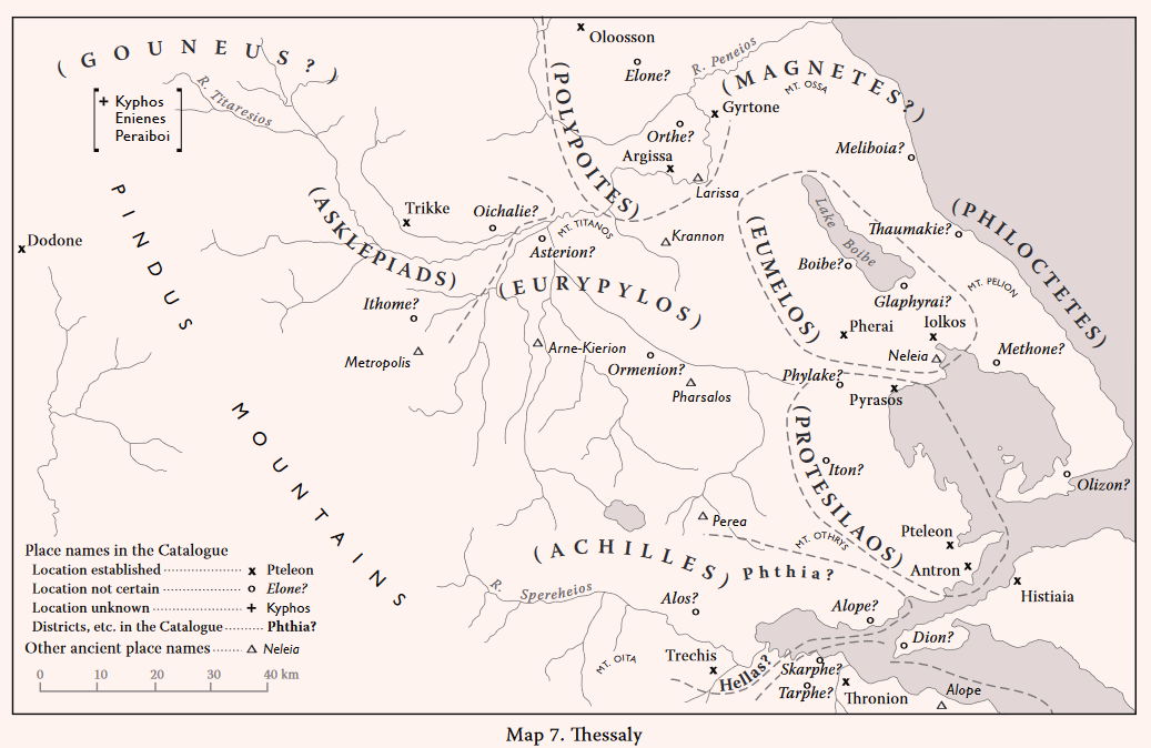
Pelasgikon Argos (Il. 2. 681)
That ‘Pelasgian Argos’ refers to a district, rather than a town is a natural interpretation. It is listed first in Achilles’ contingent, as are districts in some other contingents: Euboea (Il. 2. 536), Lakedaimon (Il. 2. 581), Arkadia (Il. 2. 603), and Rhodos (Il. 2. 654). The name Pelasgikon Argos is thought to have been originally that of the Kingdom inherited by Achilles from his father, Peleus (Allen 1921, 108-113). According to Herodotus (I. 57), the Pelasgoi were people said to have lived in Phthiotis in the time of Deukalion (cf. Strabo 9.5.7) before the Heroic Age. They originally lived in Thessaliotis, in the plain of Kierion (Herodotos loc. cit). They were also associated with Dodona (Hesiod fr. 233). The word argos (ἄϱγoς) is explained by Allen (loc. cit.) as “a common noun” denoting a plain (πεδίoν). Allen gives several examples of this meaning in later ancient Greek literature, especially Strabo’s discussion of the Peloponnesian Argos (….. ἄϱγoς δὲ κaί πεδίoν λέγετai πaϱὰ τoiÚς νεωτέϱoiς ….., Strabo 8.6.9). Pelasgikon Argos may have been the traditional name of the Kingdom of Peleus, inherited by his son, Achilles. The Spercheios valley is marked as the centre of the Kingdom. Polydore, the sister of Achilles, bore a son (Menesthios) to Spercheios (Il. 16. 173-176); Achilles himself promised that, if he returned safely from Troy, he would give Spercheios a lock of his hair and fifty rams (Il. 23. 140-151). It is clear, however, that the Kingdom also included the north coast of the Malian Gulf (cf. Strabo 9.5.9-10 and 13); one town in the Catalogue, Alope, lay in this district.
The region indicated for the Kingdom had been considered “rather marginal so far as the Mycenaeans were concerned” (Desborough 1964, 126). But recent discoveries, mainly the work of the Ephorate of Lamia, under F. Dakoronia, have radically changed the picture. Lamia is now shown to have been an important prehistoric site (discussed below, under Alos). Mycenaean chamber tombs have been excavated at two sites to north of the Spercheios, at Stavros: Bikiorema [LH IIIA-C, PG, G and A, AD 33 (1978) B 136-137] and Archani [cf. Dakoronia, in Kase et al. 1991, 70-73 with figs. 7.1 (map), fig. 7-2, and pls. 7-1 to 7-10]. To south of the river, most of the Mycenaean finds are in the area of ancient Trachis and Herakleia (discussed below, under Trechis). LH sherds and figurines have now been found at Lianokladhi [AD 55 (2000) B 449-450]. Bronze Age sherds were also found at two locations in the western part of the valley, at Kastrorachi and Milorachi [AD 29 (1973-74) B 513; for Kastrorachi cf. Hope Simpson and Lazenby 1959, 104]. In the fertile lowlands along the north coast of the Malian Gulf, several prehistoric sites are now known, all with significant Mycenaean finds. The sites are listed here from west to east (see maps in Hope Simpson and Lazenby 1959 and GAC map G).
Megali Vrysi: Platania: LN EH MH LH IIIB LH IIIC G
[GAC, G 79; MG, C 74; AD 29 (1974) B 518-519: low mound
- 170 m x c. 150 m (max.); 4 levels, LN, EH, MH and LH]
Stylida: LH SMyc PG C R M
[GAC, G 80, AD 36 (1981) B 210-214: LH and SMyc sherds; PG tombs]
Achinos: Ancient Echinous: MH LH IIB LH IIIA2-B C H R
[GAC, G 81; MG, C 75; AD 47 (1992) B 186-192; AD 48 (1993) B 214-216]
Raches: Fourni: LN EH I-III MH LH IIIA1-IIIB LH IIIC? C
[GAC, G 82, MG, C 76: AD 44 (1989); AR 42 (1995-96) 24
Pelasgia: Ancient Larisa Kremaste: MH LH IIIB C H
[GAC, G 83, MG, C 77]
Alos (Il. 2. 682)
Lamia: Kastro (Zitouni) and modern town: EH II-III MH LH I? LH IIIA-IIIC Early PG G A? C H R M
Béquignon 1937, 263-278, figs. 5-6, pl. xii; Lemos 2002, 235; references in AD vols. 29, 32, 34-36, 38, 39, 41, 42, 45 and 47-55, cf. AR vols. 26, 29, 32, 34-40, 42, 44-48, 51, 52 and 56.
Plate 28A. Lamia (? Alos) from West.
Occupation of the Lamia Kastro (Plate 23A, cf. Stählin 1924 Taf. XI) in MH and LH was first discovered by Chourmouziadis [AD 29 (1973-74) B 519-520]. “Rescue” excavations by the Ephorate of Lamia subsequently, mainly directed by Dakoronia, have revealed almost continuous use of the Kastro from EH II to modern times. By 1999 the levels distinguished were post-Byzantine, Byzantine, Hellenistic, Late Classical, Mycenaean, MH and EH. Mycenaean and MH were found throughout the area excavated, and EH II, MH and LH III remains beneath the theatre. Some ‘yellow Minyan’ may be as late as LH I; after a gap, LH IIIA2 and LH IIIB pottery (kylikes, skyphoi, kraters) follow, and other finds, including Phi figurines [AD 54 (1999) B 350-355). In the south part of the modern town were storerooms with LH IIA to LH IIIC pottery [AD 48 (1993) B 199-205] and a LH IIIC fill was found in another location in the town [AD 55 (2000) B 436-437]. Protogeometric and Geometric tombs were discovered on the south slope of the Kastro [AAA 15 (1984) 211-216] and Protogeometric in the town [AD 35 (1980) 244].
The Kastro, the citadel of ancient Lamia, would have dominated the head of the Malian Gulf and also commanded the main pass to north into the plain of Pharsala. In the Mycenaean period the shore at the head of the Gulf would have been a considerable distance inland (to west of) the modern coastline [Kraft, in Kase et al. 1991, 1-16 with figs. 1-5 to 1-13, esp. fig. 1-13 (map)]. Lamia would then have been only c. 2 km north of the coast, and c. 5 km north of the mouth of the Spercheios. The recent archaeological evidence has shown that Lamia was a major Mycenaean centre. It may be considered a candidate for identification as the Homeric Alos of Achilles’ Kingdom. The site of Megali Vrysi: Platania had previously been suggested [CSHI, 126, cf. Hope Simpson and Lazenby 1959 with pl. XIV (b)]. This is an oval low mound (max. dimensions c. 170 m northwest to southeast by c. 150 m), of a size and type comparable with the prehistoric low mound of Lianokladhi (max. dimensions c. 200 m by c. 140 m, Wace and Thompson 1912, 171-192 with photo fig. 116). Platania was a site of only medium size, in comparison with the Mycenaean settlement at Lamia, and not easity defended.
Unfortunately, the ancient sources do not provide any useful testimony regarding the location of the Homeric Alos. As Allen points out, the name Alos (or Halos) was common (Allen 1921, 111-112). Strabo (9.5.8) records the confusion among ancient authors, concerning the locations of the Alos and Alope of Achilles’ contingent, since there were also a Halos in Phthiotis, a Halos in Locris, a Halos in Achaca, and another Alope in Locris. Alos can not yet be identified. But the name Alos (or Halos) suggests a marsh, and it is confirmed that there were marshes at the mouth of the Spercheios (Kraft loc. cit., cf. Pausanias 10.20.7), including the plain south of Lamia, in Mycenaean times. This area would not have been a good location for a harbour; Platania may have been the port for Mycenaean Lamia.
Alope (Il. 2. 682)
Béquignon 1937, 367-368, pl. xx, 3; Hope Simpson and Lazenby 1959; AR for 1961-62, 31; CSHI, 126-128.
Strabo does not include Alope among the sites he mentions to east of Lamia along the north coast of the Malian Gulf (Strabo 9.5.13). After Echinous the next town to east listed by Strabo is Larisa Kremaste (then also called Pelasgia Larisa). He also says that some included Echinous and Lamia in Achilles’ domain (Strabo 9.5.10). But he also includes (ibid.) Phthiotic Thebes as under Achilles, so he may be confusing Achilles’ Phthia with the later Phthiotis. Stephanus of Byzantium (s.v. Ἀλόπη) says that there was an Alope between Echinous and Larisa Kremaste (at both these sites Hope Simpson and Lazenby found Mycenaean sherds – see references above). Béquignon (loc. cit.) found some remains near Rakhes, between Echinous and Larisa Kremaste; but these remains appear to be of little significance and of later date. Hope Simpson and Lazenby (AR loc. cit.) discovered a prehistoric site with Mycenaean sherds of high quality, on the promontory of Rakhes: Fourni, c. 1.5 km east of Rakhes, in a district called Alopeka. The spread of surface pottery here indicates an area of settlement c. 120 m north to south by c. 100 m, on the eroded promontory and its slopes (references under Pelasgikon Argos above). Excavations in 1989 revealed a large apsidal building and remains of mud-brick structures. But the site was obviously of only medium size. The only other known Mycenaean settlement in the vicinity indicated by Stephanus is Echinous itself. This has the required size; an acropolis with an upper surface c. 200 m x c. 150 m and broad slopes [Hope Simpson and Lazenby 1969, 102 and pl. xiv (a)]. But, in this case, as in that of Lamia (suggested above as a candidate for Alos), Echinous would have to be a ‘new’ name for the place. Strabo is ambivalent concerning the status of Larisa Cremaste. In 9.5.13 he allots it to Achilles, but in 9.5.14 he says it was subject to Protesilaus. Larisa Kremaste does indeed lie between their two territories, near the route to east of Mt. Othrys northwards from the Malian Gulf.
Trechis (Il. 2. 682)
Herakleia: LH III(B?) C H R
Béquignon 1937, 243-260, fig. 4, pls. Ix-Ixi; Hope Simpson and Lazenby 1959; Pritchett 1965, 81-82 with refs., pls. 82-83; CSHI, 128; GAC, 264 (G 76); MG, 81 (C 77); Kase et al. 1991, index s.v. Herakleia in Trachis, and s.v. Trachis etc., figs. 1-9, 1-13, 3-1, 3-2, pls. 1-3, 1-4 and 1-6.
Rakhita: N? MH LH IIIA2-IIIC Early G A C H
Hope Simpson and Lazenby 1959, 103-105 with pl. xv(a); CSHI, 128 with n. 18; GAC, 264 (G 77); MG, 81 (C 72), 212; Kase et al. 1991, index s.v. Rakhita, esp. 8-10, 48, 67, 69, 78-81, figs. 1-9, 1-13, 3-1 and 3-2, pls. 1-3, 1-4 and 1-6.
Vardhates: LH IIIB? LH IIIC Early
BCH 63 (1939) 311-312; Marinatos 1940; Hope Simpson and Lazenby 1959; Desborough 1964, 126; GAC, 265 (G 78); MG, 82 (C 73); AD 41 (1986) B 65; Kase et al. 1991, 67, 70, figs. 3-1 and 3-2; Mountjoy 1999, 808.
It is assumed that Trechis is the same as Trachis (Trechis would be the Ionic spelling). The historic Trachis and the Trachinian cliffs are featured in Herodotus’ account of Xerxes’ invasion in 480 B.C. Trachis controlled the pass via the Asopos gorge into Phocis (Herodotus 7.176.1). At this time the shoreline was c. 4 km to the northeast of the Trachinian cliffs (Kraft, in Kase et al. 1991, 8-10 with fig. 1-9 and fig. 1-13). Herodotus (7.199) says that Trachis then possessed the largest area of good farming land between the mountains and the sea. In 426 B.C. the Spartans founded the city of Herakleia in Trachis “40 stades from Thermopylai and 20 stades from the sea” (Thucydides 3.92.6). Herakleia was investigated by Stählin and later by Béquignon (Pritchett loc. cit.). It had an acropolis on a high and steep hill on the northwest side of the Asopos gorge and a lower town on the terraces below above the plain to the north. Livy, in his account (following Polybius) of the siege of Herakleia in 191 B.C. distinguishes between the lower city (urbs) of Herakleia and the upper citadel (arx). Stählin published a schematic plan of the city and a photograph of the mountain (Stählin 1924, 206 and pl. xii). Béquignon (loc. cit.) describes the walls and a gymnasion. In 1958 Hope Simpson and Lazenby investigated the site. The terraces of the lower town extend c. 260 m east to west by c. 140 m (maximum). Most of the surface sherds seen here in 1958 were Classical or Hellenistic, but three were LH III.
Plate 28B. The Trachinian Cliffs and Rakhita below, from West.
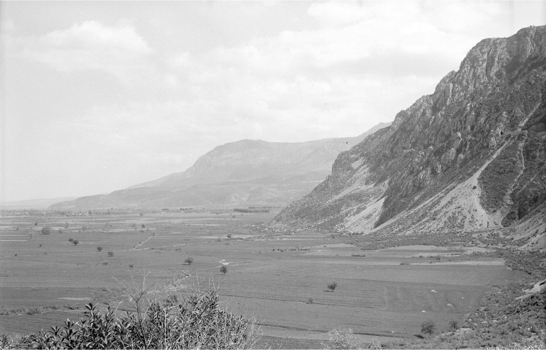
According to Strabo (9.4.13), Herakleia was about six stades (a little more than a kilometre) from Old Trachis (ἀϱχaίaς Τϱaχiνoς). In 1958 Hope Simpson and Lazenby discovered a site at a place named Rakhita (Plate 28B; 1959 reference above, and refs. to CSHI, GAC and MG), c. 1.5 km northwest of Herakleia, which is approximately the same distance as that estimated by Strabo for Old Trachis. Rakhita is a small and low tongue of land, projecting from the foot of the Trachinian cliffs into the plain below (immediate above it are two railway bridges on the side of the cliffs). The top is only c. 60 m east to west by c. 50 m, but the slopes below, on the west, north and east, comprise an extent of c. 180 m east to west by c. 40 m (recorded in the 1958 notebook). In the plain below the site two small streams, fed by springs issuing from the foot of the cliffs, unite to form the Xerias river (the ancient Melas). In 1958, Mycenaean (LH IIIA-B) sherds were found in almost all parts of the site, and some MH. At the time, Hope Simpson and Lazenby had accepted the view (of Béquignon and others) that Trachis had been on the same site as the later Herakleia, and they therefore assumed that Rakhita was only a ‘satellite’ settlement of Trachis. The subsequent exploration of Rakhita by the Phokis-Doris expedition has provided much more information (Kase et al. 1991, refs. above). Their surface investigation in 1977 and trial trench in 1979 have documented occupation of the site in the MH, Mycenaean and later periods, including Geometric and Archaic (Wallace, in Kase et al. 1991, 48). The trial trench produced MH Grey Minyan and Matt-painted in the lowest level, and LH IIIA2, LH IIIB and LH IIIC Early in the middle level, followed by a clear break separating the prehistoric from the Late Classical and Hellenistic in the top level (MG, 212, citing N.C. Wilkie). By drilling in the plain below it was established that the site in c. 4500 B.P. was only a short distance south of the coastline (Kraft, in Kase et al. 1991, 6-10 with figs. 1-5 to 1-13). The full results of the Expedition’s survey and trail trench at Rakhita have not yet been published; but the authors claim that Rakhita “….. can be considered the Homeric city of Achilles and the Malian Trachis of 480 B.C.” (Szemler, in Kase et al. 1991, 81).
A rectangular built grave was excavated by Marinatos (BCH loc. cit. and Marinatos 1940) between the village of Vardhates (c. 2 km northwest of Rakhita) and Rakhita. It contained several burials, with which were found a bronze spearhead and some vases. These are attributed to LH IIIC Middle by Mountjoy (loc. cit.), but some may be LH IIIB (Desborough, loc. cit. and GAC, loc. cit.). The mound to northeast of Vardhates (MG, loc. cit.) is now shown (by excavation) to have been only a stone pile (AD 41, loc. cit.).
Phthia and Hellas (Il. 2. 683)
Allen 1921, 112-113 117-120; Hope Simpson and Lazenby 1959, 104; Thomas and Stubbings 1962, 296-297; CSHI, 128-130.
It is apparent that the names Phthia and Hellas in the Catalogue denote districts rather than towns (although this was disputed by later Greek authors, cf. Strabo 9.5.6-7, and Allen 1921, 119). This is shown by the descriptions of Phthia ‘put into the mouth of’ Achilles in the Iliad. The epithets for Phthia in these passages are construed as: “with rich soil” and “feeder of men” (Il. 1. 155, Φθίῃ ἐϱiβώλaκi βωτiaνείϱῃ, cf. Il. 9. 363, ἐϱίβωλoν). And Phoinix describes Phthia as “mother of sheep” also (Il. 9. 479, ἐϱiβωλaκa, μητέϱa μήλων). These are all descriptions of the fertility of the land of Phthia, and therefore mark it as a district, the homeland of Peleus and Achilles, not their home town. Achilles’ men, however, are never called Phthians; they are Myrmidons, Hellenes and Achaeans. (Il. 2. 684). The only Phthians (Φθίoi) mentioned in the Iliad are Podarkes of the Kingdom of Protesilaos and Medon of the Kingdom of Philoctetes (Il. 13. 693, cf. Il. 2. 704 and 727). It seems that the name Phthia may have originally been applied to a district larger than the Spercheios valley and Malis. Later ancient sources connected both Phthia and Hellas, either as districts or as towns, with various parts of Thessaly (Strabo 9.5.6-7), cf. Allen 1921, 117-120). A wider region of Phthia is perhaps suggested by Hesiod fr. 128, where Phthia is “beside the Peneios” (Πηνεîoυ πaϱ’ ὕδωϱ) and by Strabo’s list (9.5.10) of the places later attributed to Achilles’ Phthiotic domain. Some of the cities of the historical Thessaly tried to secure for themselves a Homeric ancestry by laying claim to the names Phthia and Hellas (Allen 1921, 138-141). The Kreondai of Pharsalos asserted that their city had been the Homeric Phthia (Pherecydes, FGrH 3 F 1, cf. Jacoby, FGrH, 887-888 and Allen 1921, 119-120), and the Greek tragedians also accepted this story (e.g. Euripides Andromache, 16-25, cf. The Little Iliad fr. 19 where Andromache and Aeneas are taken “to Aeneas Pharsalia, the country of Achilles”). The claim of the Kreondai was disposed of by Béquignon (RA 1958, 93-95), who demonstrated that ‘Palaio-Pharsalos’ (Strabo 9.5.6) was probably at Derengli: Palaiokastro (GAC, H 53; MG, H 52) and not at modern Pharsala (GAC, H 48; MG, H 51).
The Pharsalians also believed that a place 60 stades from their city and with two springs, Messeis and Hypereia, was Homeric Hellas (Strabo loc. cit.). This, of course, indicates the site of Ktouri, partly excavated by Béquignon [BCH 56 (1932) 89-191, see below s.v. THE KINGDOM OF EURYPYLOS]. A similar claim was made by the citizens of Melitaia for a place 10 stades from their city and “beyond the Enipeus” (Strabo ibid.).
The presence of the Hellenes under Achilles (Il. 2. 684) and of the Panhellenes in Locris under Aias, son of Oileus, suggests that Hellas may have included some territory to south of the Spercheios valley. And this may also be inferred by Phoinix’ story of his flight, from his father’s home at Eleon in Boeotia, through Hellas to Phthia (Il. 9. 447-484, cf. Il. 10. 266 for confirmation that his father, Amyntor, son of Ormenos, lived at Eleon). That the Spercheios was the heart of the Kingdom of Peleus and Achilles is confirmed by Achilles’ close connections with the river (see above under Pelasgikon Argos). Wace and Thompson (1912, 255) said that the name Elladha (Ἐλλάδa) for the river Spercheios (as recorded by Leake 1895 II, 8) “….. still lingers on …..”. The story of Phoinix’ flight from Eleon implies that Phthia lay beyond Hellas. Peleus gave Phoinix a kingdom “at the far end of Phthia” (Il. 9. 484. ἐσχaτiὴν Φθίης) to rule over the Dolopes. According to Thucydides (II 102, 2; cf. Polybius 21, 25), the historical Dolopia was to west of Mt. Tymphrestos and at the head of the river Acheloos. Phthia therefore appears to have included the Spercheios valley, and, in view of the location of the historic Phthiotis, may also have included the coastal plains along the north shore of the Malian Gulf. But it is not possible to define the extents of the territories of Homeric Phthia and Hellas or determine the relationship between them.
THE KINGDOM OF PELEUS AND ACHILLES
The Spercheios valley and the north coast of the Malian Gulf would have constituted a natural unit, bounded on the north by the Mt. Othrys range and on the south by that of Mt. Oeta, near whose western end was the Thermopylai pass. Lamia and Trachis were well situated to control the routes to north and south respectively. If Alope was near Rakhes, it (perhaps together with Larisa Kremaste) would roughly mark the eastern extent of the Kingdom. To the west it may have extended to the foothills of Mt. Tymphrestos, or even as far as the modern Karpenision (where MH sherds, and possibly LH, have been found [GAC, 295 (J 4)].
Few Mycenaean settlements have been found within this territory, which has, however, not been searched systematically. Many of the sites are represented only by surface sherds; others have been discovered in ‘rescue’ excavations. Trachis has apparently been located, and the recent finds at Lamia and its vicinity mark it as a strong candidate for Alos. In the upper (western) part of the Spercheios valley, only a few Bronze Age sherds are recorded, at Kastrorachi and Milorachi; but this area is still mainly unexplored.
For Achilles, the greatest hero of the Iliad, this Kingdom may seem meagre and his force of 2500 Myrmidons (Il. 16. 168-170) comparatively small. But Ajax has only the island of Salamis (Il. 2. 557), and his force, and that of Odysseus (Il. 2. 637) are also small. The Spercheios valley and Malis were quite unimportant in historical times (Allen 1921, 113), so that the location of Achilles’ Kingdom is not likely to be a post-Homeric invention. “If the Larissaeans or Pharsalians had made the Thessalian Catalogue, they would not have put Achilles at Trachis” (Allen 1921, 141).
THE KINGDOM OF PROTESILAUS
Phylake (Il. 2. 695)
Plate 37A. Phthiotic Thebes from North.
Phylake is Protesilaus’ town, with its half-completed mansion, occupied after his death by his grieving widow (Il. 2. 700-701). There was a temple of Protesilaus at Phylake (Pindar, Isthm. 1. 58-59, Πϱωτεσίλa, τὸ τεὸν δ’ ἀνδϱών Ἀχaiών εν Φυλaκῃ τέμενoς συμβάλλoμai. Strabo (9.5.14) says that Phylake was near Phthiotic Thebes (Plate 37A) “which itself was subject to Protesilaus”. He also adds that Halos, Larisa Kremaste and Demetrion (Pyrasos) were under his rule, “all of them being towards the dawn from the mountain Othrys”. He continues with a description of the Krokian plain, the heart of the Kingdom, and indeed situated to northeast of Mt. Othrys. The historical Phylake was a village (κώμη) of Phthiotic Thebes, on one of whose coins (Hellenistic) Protesilaus is shown in reverse, “leaping ashore at Troy” (Head 1911, 310). Of the sites proposed for Phylake (CSHI, 132) the nearest to Phthiotic Thebes is the Kastro to south of Persouphli, on the route between Pherai (Velestino) and Phthiotic Thebes (Wace and Thompson 1912, 9 No. 37, cf. RE 20 (1941) 983-985 and RE Suppl. 7, 1022 and plan 2). A possible location for Phylake is, of course, Phthiotic Thebes itself [Wace and Thompson 1912, 166-169; GAC, 276 (H 7); MG, 146 (H 6)]. This was the most important centre in the district, in a strategic position on the northern edge of the Krokian plain (cf. Stählin 1924, 171-173 with fig. 21).
Pyrasos (Il. 2. 695)
Nea Ankhialos: Ancient Pyrasos: N EB I-II MH LH II-IIIB PG G C H R M
Plate 29A. Nea Ankhialos (Pyrasos) from East.
Wace and Thompson 1912, 10, No. 59; AM 71 (1956) 176; BCH 81 (1957) 596; Thessalika 2 (1959) 29-68; AD 16 (1960) B 170; PAE (1966) 81 ff.; PAE (1969) 16 ff., esp. plan on p. 18; GAC, 276 (H 6); MG, 163-164 (H 5); Feuer 1983 No. 10; Lemos 2002, 236; Mountjoy 1999, 820-821.
Pyrasos in the Catalogue is called the sacred precinct of Demeter (Il. 2. 696 Δήμητϱoς τέμενoς). According to Strabo (9.5.14), Pyrasos was the old name of Demetrion. He says that it had a good harbour (Plate 38B, cf. Thessalika 2, fig. 2) and a grove and temple of Demeter two stades from the city, but that the city had been razed to the ground. It had been twenty stades from Phthiotic Thebes. The identification of Pyrasos as the site at Nea Ankhialos has been confirmed by the excavations of D.R Theochares (1956-1960 refs. above, especially Thessalika 2 loc. cit.).
Plate 33A. Georgikon: Kouphia Rachi from West.

 Plate 38B. Pyrasos. Harbour from Northwest.
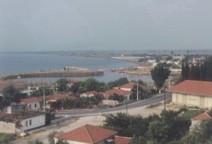
The acropolis of Pyrasos was the low hill (a ‘high mound’ site) above the harbour of the modern Nea Ankhialos. The flat summit of the hill (Plate 33A and Plate 38A) is c. 110 m north to south by c. 80 m. In Trench 1 on the southeast slope Theochares found rich Neolithic deposits from c. 6 m down to c. 9 m down, and some EB; but the top levels were severely eroded. Trenches 2 and 3 on the west slope were not dug very deep. In Trench 2 the finds were Classical and late Geometric, in Trench 3 a few Protogeometric and one or two Mycenaean sherds, but most of the Mycenaean pottery was from trenches near the south foot of the hill, in the flat ground later occupied by the city of ‘Christian Thebes’. Here, at a depth of about 3 metres, much MH and Mycenaean (LH II-IIIB) pottery was found, in trials near Basilica Δ, below Hellenistic and Roman deposits. Few Mycenaean sherds were found on the acropolis itself, where there was no Mycenaean stratum. The painted Mycenaean sherds illustrated (Thessalika 2, 63-64, fig. 26) include one LH II (fig. 26 no. 1) and several LH IIIA and LH IIIB. More Mycenaean sherds were found in other areas below the acropolis foot, indicating an extensive ‘lower town’. Pyrasos with its ‘cothon’ harbour (Plate 38B) may have been a Mycenaean emporium similar to that of Iolkos (Thessalika 2, 64, 68). It was also obviously the port of the historic Phthiotic Thebes.
Iton (Il. 2. 696)
Zerelia: Kastraki: N EB I(-III?) MH LH II LH III(A2-B1) PG?
Wace and Thompson 1912, 150-166 with refs.; Alin 1962, 145; Desborough 1964, 130; CSHI, 132-133; GAC, 277 (H 10); MG, 164 (H 9); AD 64 (2009) B 568-570.
Strabo (9.5.8) says that the historic Itonos was 60 stades from the Phthiotic Halos. It was famous for its shrine of Itonian Athena (Pausanias 1.15.2) near the river Itonos (Strabo 9.5.14). Wace and Thompson [BSA 14 (1907-8) 99] provisionally identified their site of Zerelia as the Homeric Iton, and its distance from Halos is in accord with Strabo’s 60 stades. But at Zerelia the earliest remains of the historic period from their excavations were a few black glazed sherds “which cannot be earlier than the late fourth century B.C.” (Wace and Thompson 1912, 150). They conjectured that the site of the historic Itonos was the classical acropolis on the west side of Karatzdagli “about an hour” to south of Zerelia (Philippson GL I, 306 no. 100). But Wace and Thompson also affirm that the great pan-Hellenic shrine of Athena Itonia was that near Arne-Kierion (cf. Strabo 9.2.29).
The ‘high mound’ site of Zerelia is on a low hill between two small lakes, in the foothills to south of the Krokian plain, c. 5 km to west-southwest of Almyros. The top surface of the mound is c. 110 m northwest to southwest by c. 70 m. Below the thin historic layer was a rich prehistoric deposit 6 to 8 metres thick. Of the eight strata distinguished in the trial excavations (Wace and Thompson 1912) six were Neolithic; most of the Bronze Age material was found in the uppermost of these strata. This produced much MH, a few LH II (Mountjoy 1999, 820) and LH III (with at least one decorated kylix fragment). A bronze double axe head was found on the surface by a peasant. This is also probably of the Late Bronze Age. The evidence, however, is not sufficient support for the identification of the rather small site of Zerelia as the Homeric Iton.
Antron (Il. 2. 697)
Glypha: Phanos: Ancient Antron: LH I/II C H R
Leake 1835 iv. 348-351; CSHI, 133; reports in AD vols. 41,42, 43, 45, 47 and 49; cf. reports in AR vols. 39, 40, 42, 46 and 49.
Plate 39B. Antron. Caves from East.
According to Strabo (9.5.14) Antron was near a submarine reef in the Euboian channel, and on the coast south of Pteleon [Strabo 9.5.8]. Antron is called πετϱήεiς (‘rocky’) in the Hymn to Demeter (line 491). The site of Antron, the Kastro of Phanos, was discovered by Leake (loc. cit.). Hope Simpson and Lazenby visited the place in 1961. The hamlet of Phanos is about 4 km northeast of Glypha, in a small coastal plain. At the south edge of the plain is the Kastro (Plate 39A), a low hill above the sea, whose flat summit, c. 250 m north to south by c. 120 m, was enclosed by a circuit wall. Its masonry is mainly polygonal, but one section on the north side resembles ‘Cyclopean’. Most of the diagnostic sherds within the enclosure were Classical or Hellenistic, but some of the coarse ware appeared to be of the same kind as the local Bronze Age ware seen at Gritsa (ancient Pteleon, discussed below). At the eastern foot of the hill, above the shore, are the eroded remnants of three caves (Plate 39B). It is obvious that this is the feature which gave rise to the name Antron (cave). The location is in accord with Strabo’s directions, and there are no other such caves along this stretch of coast.
Confirmation of Mycenaean habitation here has now been supplied by the excavations of the Greek Archaeological Service (references to AD and AR above). A large ancient cemetery has now been explored at the site. The graves are mainly cist tombs, and most of the burials are of dates ranging from Late Classical to Late Roman. But in tumulus A [AD 47 (1992) B 193-194] four Early Mycenaean cist tombs were excavated within a walled enclosure (peribolos) and in tumulus B [AD 49 (1994) B 309] another Earth Mycenaean cist tomb and two destroyed cists presumed to be of the same period.
Pteleon (Il. 2. 697)
Pteleon: Gritsa: N MH LH IIIA1-C PG C H?
PAE (1951) 129-149; PAE (1952) 164-180; PAE (1953) 120-132; Verdelis 1958 pl. 4 nos. 25, 26 and 62; Alin 1962, 145-146; Desborough 1964, 130-131; AD 23 (1968) B 269; CSHI, 133; GAC, 278 (H 13); MG, 164 (H 11); Mountjoy 1999, 820; Lemos 2002, 236.
Pteleon: Ayios Theodoros: LH IIIA H
PAE (1951) 150-154; PAE (1952) 181-185; Alin 1962, 145-146; Desborough 1964, 130-131; CSHI, 133-134; GAC, 278-279 (H 14); MG, 164 (H 12); Mountjoy 1999, 820.
The site of ancient Pteleon is the rocky hill of Gritsa, about 30 m in height, c. 3 km south of Pteleon village and near the head of the bay of Pteleon. The top surface of the hill is c. 300 m north to south by c. 180 m. Excavations by Verdelis (PAE refs. above) revealed a MH settlement on the northwest slope, where Mycenaean sherds were also found. A little to the east were four MH cists and a small LH IIIC tomb of tholos type. In 1958 MH and Mycenaean sherds were seen on much of the surface of the hill, together the local Bronze Age coarse ware and a few black glazed Classical (and Hellenistic?) sherds. On the low rise named Magoula, on the ridge which runs to west from the hill, were three MH cists and three small tholos tombs (diameters 4.02 m, 5.2 m and 4.2 m), two of which were on the east side of the road to Volos, and one on the west side opposite. The contents of the tholos tombs ranged in date from LH IIIA1 to LH IIIC (fuller details are given in Desborough, GAC and Mountjoy refs. above). Tomb 3 (the largest) contained mostly LH IIIC vases and three Protogeometric (Verdelis 1958 ref. above, cf. Lemos loc. cit.).
About 1.5 km to south of Gritsa, on a hill c. 2 km north of Ayios Theodoros village, another small tholos tomb (diameter 3.54 m) was also excavated by Verdelis. It contained LH IIIA pottery (LH IIIA2 according to GAC, LH IIIA1 according to Mountjoy 1999). This tomb is also probably associated with the Gritsa settlement.
To north of Gritsa is a small marshy plain, whose western end is curved. This plain has the appearance of an alluvial fill, suggesting that this area had been sea in prehistoric times. It seems likely that the shore of the bay of Pteleon was then further to the west and accordingly that Gritsa had then been closer to the sea. The harbour at Pteleon would have been convenient for marine traffic from central Greece to Iolkos and the bay of Pagasai.
THE KINGDOM OF PROTESILAUS
This Kingdom includes most of the territory of the historical Achaea Phthiotis; it comprises the Krokian plain and the western shore of the Gulf of Volos (the ancient Gulf of Pagasai). On the north it bordered on the Volos district, the Kingdom of Eumelos; on the south it was separated from the Kingdom of Peleus and Achilles by Mt. Othrys (the later Larisa Kremaste roughly marks the border between these two Kingdoms).
Of the five towns named in the Kingdom of Protesilaus, two, Pyrasos and Pteleon, had substantial Mycenaean settlements, and Mycenaean remains have now been found also at Antron. The location of Phylake, Protesilaus’ capital, is uncertain; the most suitable candidate is the site of the later Phthiotic Thebes. The location of Iton remains unknown. Zerelia has been suggested, but this site seems too small; and there is the further difficulty that the locations of the historic Itonos and its sanctuary of Itonian Athena have not yet been established. Three of the towns in this Kingdom, Antron, Pteleon and Pyrasos, were on the coast, with harbours and/or anchorages; their names would have been familiar to sailors.
THE KINGDOM OF EUMELOS
Pherai (Il. 2. 711)
Velestino (Ancient Pherai): N EB LH II-IIIC SMyc PG G A C H R M
General references:
Stählin 1924, 104-107 with fig. 5 (plan of Velestino)
- Béquignon, Recherches archéologiques à Phères (Paris 1937); Kirsten, in RE Suppl. vii (1940) 984-1026.
Pherai: Neolithic to Geometric finds (Selected references):
Alin 1962, 142; Desborough 1964, 132; CSHI, 135; GAC, 279 (H 16); MG, 165 (H 14); AAA 10 (1977) 174-187, esp. fig. 1 (plan), fig. 2 (photo); refs. in AD vols. 32, 34, 35-37, 40, 42-46 and 51-53; cf. refs. in AR vols. 29, 32, 33, 36, 37, 40-43, 45, 49, 51 and 52; Mountjoy 1999, 821; Lemos 2002, 236.
Plate 30A. Velestino (Pherai) from Southeast.
The acropolis of the historic Pherai was the hill of Ayios Athanasios, above the southwest edge of the modern town of Velestino (Plate 30A). Evidence of prehistoric settlement at Velestino was found by Arvanitopoulos (PAE 1907, 158 ff.) on the hill of Magoula Bakali, the lower northeast continuation of the Ayios Athanasios ridge (AAA 10 figs. 2 and 3). The Magoula is a “high mound” site, c. 400 m northeast to southwest by c. 100 m. Surface sherds here include Neolithic, MH, LH IIIA-B, Geometric, Classical and Hellenistic. In AAA 10 loc. cit., E. Kakavoyiannis recorded evidence for a much larger extent of prehistoric habitation at Velestino. Stratigraphical investigations and ‘rescue’ excavations have now revealed prehistoric buildings and tombs, especially the Mycenaean, in most parts of the town. Many of the finds are from streets between Magoula Bakali and the Hypereia fountain c. 400 m to the southeast. Other find spots include the hillock of Kastraki to northwest of the fountain and the temple of Zeus c. 300 m to northeast of the Magoula [continuation of cult here from Mycenaean onward was argued by Wrede, AA (1926) 429]. The ancient deposits within the town range from EB to Hellenistic and Roman. The Mycenaean finds are particularly numerous and significant. They include LH IIB from a chamber tomb, and a cemetery to northwest of the Hypereia fountain in use from MH to Protogeometric. Elsewhere, Mycenaean strata include LH IIIC Middle and Late (Mountjoy loc. cit.) and evidence of destructions in Late Mycenaean levels (reports by A. Intzesiloglou in AD vols. 35-36, 40, 42-46 and 51-53). There are many Protogeometric burials (Lemos loc. cit.), and sub-Mycenaean is also reported. A rough estimate of the area within which Mycenaean remains have been found at Velestino is c. 800 m northeast to southwest by c. 400 m, an appropriate size for the Homeric Pherai.
Boibe (Il. 2. 712)
Stephanovikeion: Petra: N EB MH LH IIIA2-B A? C H R M
AM 62 (1937) 60, 65-66; AA (1955) 221-231 with sketch plan, Abb. 22; AA (1960) 150-167; BCH 80 (1956) 311; BCH 81 (1957) 597; BCH 84 (1960) 764-765; AR (1959-60) 15; AD 16 (1960) B pls. 164 B and 165; AD 18 (1963) B 144; CSHI, 135; GAC, 280 (H 17); MG, 161, 165 (H 16); MFHDC, 98, 223 (with refs.)
Stephanovikeion and Kanalia: MH LH IIIA2-B
AD 55 (2000) B 474-475; AD 56-59 (2001-2006) B 499-505; cf. AR 56 (2009-2010) 106; AR 58 (2011-2012) 76-77 with refs.
Plate 30B. Stephanovikeion: Petra (? Boibe), South Hills from Northeast Hill.
Petra is on the southwest shore of Lake Karla (the ancient Lake Boibe), about 20 km northwest of Volos. The site consisted of three low hills and the saddles and hollows between them (Plate 30B). The lake is now mostly drained, and the site is now surrounded by dry land. In ancient times, however, it would have been a peninsula, surrounded by the waters of the lake on all sides, except its neck on the southwest. V. Milojčić of the German Archaeological Institute made trial excavations here at several locations (AA loc. cit.). The whole site, an area of over 1 km2, was surrounded by a circuit wall over 4 km in length [AA (1955) 228 Abb. 22, plan]. These walls were called ‘Cyclopean’ by Milojčić, as were the inner circuit walls which ringed the two larger hills, the northeast and the southeast. The ‘Cyclopean’ walls on the largest hill, the northeast, were reported to be 5 m thick (AA loc. cit.). These did include roughly squared blocks, but the walls were poorly preserved, and many of the blocks were not in situ (in 1958). Good MH and Mycenaean sherds, including LH IIIA2-B, have been observed in many and widespread parts of the hills and the flatter areas between and around them, especially on the surface between the northeast and southwest hills, often associated with remains of houses and cist graves [e.g. AA (1960) 160 and Abb. 2-3, 164 and Abb. 9-10]. The Mycenaean material is particularly extensive, indicating a large and important settlement. If the circuit wall around the whole site was Mycenaean, as Milojčić claimed, this would be the largest fortified Mycenaean settlement known (larger than Eutresis and Krisa, discussed above). But the wall is not well preserved; it is not possible to ascertain its date or its purpose. It would not be characteristic of the Mycenaeans to have enclosed such a large area of comparatively flat land, even if the wall would have been mainly along a shore line. A Classical or Hellenistic date is more likely. Such extensive circuit walls are characteristic of several Thessalian towns of the historical period, e.g. Pherai, Larisa and Demetrias. Knauss suggests that this outer circuit wall, in the low ground around the peninsula was a dyke to prevent flooding from the lake and to convert the low-lying ground into polders (Knauss 1990b, 226-231 with plan, Abb. 55, cf. MFHDC, 223). This indeed may be a partial explanation for the location of the wall, but does not provide any indication of its date. The 5 m thick walls around the northeast hill surely indicate that this was the Mycenaean ‘acropolis’ for the widespread settlement below. But Classical and Hellenistic remains were found in the lower ground near the outer wall.
Plate 35B. Argyropouli. Mycenaean House-wall on East.
In the course of public works around the southeast end of Lake Karla (Plate 35B), MH and Mycenaean sites were found at two localities: on the hill of Koryphoula, in the territory of Stephanovikeion and c. 11 km southwest of Kanalia, a Mycenaean settlement (LH IIIA2-B) together with several small LH IIIB tholos tombs; at Tsingenina near Kanalia a small tholos tomb (LH IIIB adjoining a MH building. Since Koryphoula is close to Petra, they may have been parts of the same Mycenaean community. In any case, Petra is surely to be recognized as the Homeric Boibe.
Glaphyrai (Il. 2. 712)
Plate 37B. Kanalia and Lake Karla from Southwest.
There is no information from later ancient sources concerning the location of Homeric Glaphyrai. Strabo, who usually followed the sequence of the names in the Catalogue, does not even mention Glaphyrai. Wace [JHS 26 (1906) 163] conjectured that it was at Prophitis Ilias near Kapraina, southeast of Lake Karla (cf. Stählin 1924, 61 and end map). This position is shown on Map 7 here as Glaphyrai? But this site (not mentioned in Wace and Thompson 1912) seems unlikely. Its circuit wall was only 1.25 m wide, which suggests a period later than Mycenaean (cf. CSHI, 136). The adjective glaphyros (γλaϕυϱός) appears to mean ‘hollow’ or ‘curving’. In the Homeric epics it is used to describe a lyre (Od. 8. 257 and Od. 17. 262), a cave (Il. 18. 402 and Od. 2. 20) and a harbour (Od. 2. 20). It is often an epithet for ships (e.g. Il. 2. 454). This suggests for Glaphyrai a site with a harbour, in which case the Volos area would seem to be indicated, such as Pevkakia, which would have been one of the ports for ancient Iolkos (see below). But, if Pevkakia had a separate ancient name, this might have been Neleia, i.e. the city of Neleus before he was forced to flee from Thessaly (Od. 11. 254-261, cf. Strabo 9.5.15). In the 3rd century B.C. there was a village (κώμη) named Glaphyrai in the territory of Demetrias, the major town south of Volos (Giovannini 1969, 16-17 with references to the inscription etc.). Not much can be deduced from this detail, although Giovannini uses it as fuel for his skepticism. Wace had looked for Glaphyrai at the southeast end of Lake Karla (the ancient Lake Boibe). Above this southeast end is the village of Kanalia, overlooking the route to the north along the northeast shore of the lake (Plate 37B). Mycenaean habitation here is proved by the tomb at Tsingenina, in the territory of Kanalia (see above under Biobe).
Iaolkos (Il. 2. 712)
Volos: Kastro-Palaia, Nea Ionia, Kapakli and Kazanaki: EB I-III MH LH I-IIIC Middle SMyc PG G A C H R M
Selected references: PAE (1900) 72; PAE (1901) 42; AE (1906) 211-240 (Kapakli tholos); PAE (1956) 119-130; PAE (1957) 54-69; PAE (1960) 49-59; PAE (1961) 44-54; AAA 3 (1970) 198-203 (Nea Ionia); GAC, 273 (H 1); MG, 161 (H 1); AD 39 (1984) B 141-142 (Nea Ionia); PAE 58 (1983) 49-56; AE (1985) 85-94; AD 40 (1985) A 17-71 (Nea Ionia); AR 51 (2004-2005) 59-61 (Kazanaki tholos tomb); AR 57 (2010-2011) 77-78 (Linear B at Kastro); Mountjoy 1999, 819; AR 58 (1011-2012) 77, 79; Lemos 2002, 236 (PG at Nea Ionia and Kapakli); reprts in AD vols. 36-44, 52 and 53 and in AR vols. 34, 36-38, 41, 42, 49-52, 54, and 56-58.
Volos: Pevkakia: N EB I-II MH LH I-IIIB PG? A C H R
Selected references: AM 14 (1889) 262; PAE (1912) 173; F. Stählin et al. Pagasai und Demetrias (1934); AR (1957) 14; PAE (1959) 55; AD 23 (1968) B 263; AD 24 (1969) B 221; AR (1968-69) 20; BCH 95 (1971) 711; AR 24 (1977-78) 39-40; GAC, 274 (H 2); MG, 163 (H 2); J. Maran, Pevkakia Magoula (Bonn 1992) 34-44; AR 40 (1993-1994) 47; Mountjoy 1999, 820; AR 58 (2011-2012) 77.
Dimini: Toumba: N EB I-III MH LH IIA-IIIC EarlY
Selected references: AM 11 (1886) 435-447; AM 12 (1887) 136-138; C. Tsountas, Hai Proistorikai Akropoleis Diminiou kai Sesklou (Athens 1908); Wace and Thompson 1912, 82; Hunter 1953, 23, 36, 38; AD 32 (1977) 132-134; GAC, 275 (H 3); MG, 163 (H 3); AR (1979-80) 39; Εϱγoν ΥΠΠo 1997, 92; Mountjoy 1999, 819; AAA 32-34 (1999-2001) 71-100; reports in AD vols. 35, 36, 38, 39, 42-44, 47, 51, 53-56 and in AR vols. 32, 35-37, 40-41, 45, 48, 49, 51, 52, 56 and 58; E. Zangger, in JFA 18 (1991), 1-15 (Holocene stratigraphy of the Volos plain, pp. 2-7); Adrimi-Sismani 2006 with refs.; Adrimi-Sismani 2007.
The Volos bay, at the inner northern end of the Gulf of Pagasae, provided the most secure harbours on the Thessalian coast, with easy access into the Thessalian plains. This Volos district naturally attracted settlers, by LH III it had become by far the most important Mycenaean centre in Thessaly. Its three major settlements, Kastro-Palaia, Dimini and Pevkakia were on or near the coast of the bay [Zangger 1991, 2-7 with map fig. 1, cf. AR 57 (2010-2011) 77 fig. 124 (air photo)]. All these settlements had adopted Mycenaean material culture (fine pottery, tholos tombs, architecture, and Linear B) by LH IIB-IIIA1, and in LH IIIA2 a palace was built at Dimini and a building of palatial style at Kastro-Palaia.
Plate 29B. Volos: Kastro (? Iolkos). ‘Megaron’ from West. 
The Kastro is a low hill, near the coast at the west end of the modern Volos [Wace and Thompson 1912, 2, fig. 2 (photo)]. The excavations by D.R. Theocharis (PAE 1956, 1957, 1960 and 1961) revealed successive large buildings of LH IIIA and LH IIIB with palatial features (stucco floors and fresco fragments), at the south edge of the site [Plate 29B, cf. Wace and Thompson 1912, fig. 2 (photo) on p. 2 and AR 57, 77 fig. 125]. A test pit on the summit was excavated to a depth of over 9 metres. Above MH strata (c. 2 m thick with 3 building phases) were levels with Mycenaean pottery, mainly LH IIIB1 and LH IIIB2, with some LH IIIA2 and LH IIIC. The level above contained much PG and G pottery and four building phases, and PG cist burials had cut into the Mycenaean levels [AD 43 (1988), cf. AR 41 (1994-1995) 38]. In 2009, during cataloguing of the pottery from Theocharis’ excavations, two fragments of Linear B tablets were identified [AR 57 loc. cit. with refs. to E. Skafida et al.). The ‘palace’ may have been destroyed at some time early in LH IIIC (Desborough 1964, 128; GAC, 273 contra), but occupation of the site continued in LH IIIC at least up to LH IIIC Middle (Mountjoy loc. cit.). Habitation was resumed in PG and continued to Early Christian times (AD 41 loc. cit.). Continuity of habitation is suggested by the SMyc and PG burials (usually in cists) at Nea Ionia, not far from the Kastro (Lemos loc. cit.). Several Mycenaean cist tombs, mainly LH IIB-IIIA1, were also found at Nea Ionia (refs. above, and cf. Mountjoy loc. cit.). Not far from Kastro was the tholos tomb at Kapakli (c. 10 m diameter), with vases of LH IIB-IIIA1. The tholos tomb discovered later at Kazanaki, however, is over 2 km distant from the Kastro, near the southwest bank of the river Xerias [cf. the air photo, AR 57, 77 fig. 125]. It was excavated by V. Adrymi-Sismani, who has provided a preliminary report [AR 51 (2004-2005) 59-61, cf. AR 56 (2009-2010) 105]. Its diameter, 6.7 m is smaller than that of the Kapakli tholos, but its facade had incised decoration. A stone beam above its relieving triangle is inscribed with seven symbols in Linear B, “interrupted by three shallow hollows that are marked with the symbol Ka”. The symbols, four big and three small, were shown to be indications of the four adults and three children buried in the chamber with associated LH IIIA1-IIIA2 pottery; the bones of an adult and a child were found on the floor of the relieving triangle. The already decayed bodies in the chamber were later burned (in LH IIIC) presumably with the aim of purification (Adrymi-Sismani alleges similar practices in other Mycenaean tholos tombs, including the Lamiospitio tholos at Dimini). The Kazanaki tholos strongly suggests the existence of a further Mycenaean settlement nearby, in addition to Kastro, Pevkakia and Dimini.
Pevkakia is a low promontory on the southside of the Volos bay, at the northeast end of the later city of Demetrias (Zangger 1992, fig. 1). It has bays on both sides, and commands the entrance to the Volos bay. The Mycenaean settlement here was extensive, not only on the promontory itself (top c. 150 m by c. 150 m) but also to south (reports in AR vols. 40 and 58). Its floruit was in LH IIIA2-B, evidenced by several buildings excavated by V. Milojčić, including a large house with a courtyard to the south and a main room on the north flanked by storage rooms. There was also a cemetery of cist tomb and rectangular built tombs with entrances, in use from MH to LH IIB (Mountjoy 820, with reference to the publications by Milojčić, J. Maran and A. Eustathiou).
The Neolithic site of Toumba at Dimini was a knoll only c. 18 m a.s.l., at the end of a low spur which projects into the Volos plain. Dimini is now c. 5 km from the coast. But in the Mycenaean period it would have been only 3 km from the coast, and land communication with the Kastro site at Volos would have been easier. A few Mycenaean sherds were found on the Toumba, and two LH IIIA2 cist graves, but Hunter (loc. cit.) found most Mycenaean sherds on its eastern seaward slopes. A tholos tomb (diameter 8.3 m) was set into the north slope of Toumba and another (diameter 8.5 m) further north at Lamiospitio was dug into the slope of the hill opposite. Both tombs had relieving triangles, and both had been robbed. LH IIIA2-B sherds were found in the dromos of the Lamiospitio tomb (reports in AM 11 and AM 12). In 1996 LH IIIC sherds were found, together with parts of a human skeleton [AR 51 (2004-2005) 61]. From 1977 to 1999 V. Adrymi-Sismani has conducted major excavations on the eastern slope of Toumba and the lower ground further east. These have revealed a complex with two megara (Megaron A and Megaron B), a total of 11 houses, most of which adjoined a broad street [AAA 32-34 (1999-2001) 71-100, esp. fig. 1 (map) and fig. 2 (plan) cf. plan of megaron complex, AR 56 (2009-2010) fig. 116]. Both megara were in use in LH IIIA2-B, and both were destroyed by fire in the transitional LH IIIB2/IIIC Early period. Only parts of Megaron A were reoccupied (briefly) in LH IIIC Early. [AD 55 (2000) B 470-473, cf. AR 56 (2009-2010) 103 with refs.]. The LH IIIA2-B megaron complex contained storerooms and workshops. As the excavator concludes, the complex was clearly an administrative centre. This conclusion is supported also by the the presence of the tholos tombs and the use of the Linear B script. In Megaron B the interior of a Kylix rim sherd was incised Linear B signs [AAA 32-34, 93 and fig. 18 (photo)] and from cleaning in Megaron A [AD 51 (1999) 416-417] a stone block was recovered, which also had incised Linear B signs [AR 52 (2005-2006) 73 with fig. 166 (photo)].
Extrapolation from the published plans (AAA 32-34, figs. 1 and 2) indicates that the settlement was at least 20,000 m2 in extent; but, to judge from the street and the house remains along it and from the walls discovered to north of the megaron complex, the actual size of the settlement must have been much larger. Dimini may indeed have been the largest Mycenaean settlement in the Volos district. It would, however, still be premature to label Dimini as definitively the main Mycenaean centre in the Volos district, in view of the Linear B tablets and palatial style buildings at Volos: Kastro-Palaia, which was also a harbour town.
The Homeric Iolkos may have been a poetic reflection of the Mycenaean community in the Volos district as a whole, although in the historic period it was obviously the name of the settlement at Kastro-Palaia. In ancient Greek tradition Iolkos was the place from which Pelias sent Jason and the Argo to recover the Golden Fleece. Strabo (9.5.15) says that Iolkos was on the sea and seven stades (c. 1.4 km) from Demetrias (presumably the distance by sea), and that it was one of the villages of Demetrias, which had become the capital city of the district. Strabo also says that Demetrias was between Neleia and Pagasai. His account here may be confused, since Demetrias and Pagasai seem to have comprised a single city; and it has been suggested that Pevkakia may have been Neleia, “the city of Neleus before he had to flee from Thessaly” (CSHI, 136).
THE KINGDOM OF EUMELOS
The Kingdom includes the main harbours of the gulf of Volos and extends into the plains and foothills along the main route inland towards Larisa [cf. Feuer 1983 with fig. 1 (map) and Appendix 1]. The importance of this district in the Mycenaean period is evidenced mainly by the major Mycenaean towns in the Volos district, represented in the Catalogue by Iolkos, and where Glaphyrai is provisionally located. The inland sites of Pherai and Petra (? Boibe) also had large Mycenaean settlements. At Kastro-Palaia and at Pherai continuity into the Iron Age, albeit on a smaller scale, is shown mainly by evidence from Sub-Mycenaean and Protogeometric burials and a few traces of buildings.
Allen (1921, 120-121) discusses the various legends connected with Iolkos, most of which, even that of the great hero Jason, do not appear in the Iliad or the Odyssey. “The local Thessalian repertory must have included the war of the Lapiths and Centaurs, ….. and the story of Pelias, Jason and the Argonauts who sailed from Pagasai; the funeral games for Pelias, the exploits of Peleus” (West 1988, 160-161). As West points out (ibid.), in the Odyssey (Od. 11. 235-257) Neleus of Pylos and Pelias of Iolkos are said to have been sons of a single mother (Tyro) and of a god (Poseidon). From this West deduces that the Pylian wars against the Epeians and Arcadians became part of the same wider tradition as the Iolkos cycle “….. to join the reservoir of late Mycenaean Thessalian epic which ….. must be postulated as the main source of the later Ionian tradition.” In the Iliad the dynasty of Pelias is represented by Eumelos, his grandson; there is no mention of the sack of Iolkos by Peleus. This, according to Pindar (Nem. 3. 32-36, cf. Pseudo-Hesiod fr. 211) was achieved ‘single-handed and without an army’. This, is, of course, a poetic exaggeration; Apollodoros (3. 173, cf. Pherecydes FGrH 3 F 62) gives Peleus an army. Peleus is described by Allen (loc. cit.) as a foreigner, who (like Bellerophon of Tiryns) “….. left his own place to be cleansed of μύσoς” (pollution).
THE KINGDOM OF PHILOCTETES
Methone (Il. 2. 716)
Wace 1906 = A.J.B. Wace, ‘The topography of Pelion and Magnesia’, JHS 26 (1906) 143-168; Stählin 1924, 47, 53; CSHI, 138; AR 58 (2011-2012) 77-79 (Pelion peninsula).
Ano Lechonia: Nevestiki: MH? LH? C H
Wace 1906, 153-154 with fig. 2; PAE (1910), 211-212; MG, 171; MFHC, 100-10.
Argalasti: Khortos: LH III(A2-B)
Wace 1906, 149-151; Wace and Thompson 1912, 6 n. 1; PAE (1914) 221; Stählin 1924, 54; Hunter 1953, 159; MG, 165 (H 13); AR 58 (2011-2012), 78.
The ancient sources provide only a rough indication of the location of this Methone. It may be deduced (from Strabo 9.5.16 and Scylax, Periplus 65) that it was on or near the coast of Magnesia; an inscription records Magnesian Methonians (Syll3. 239 E 39 Μάγνητες ΜεθωναιÚoi, cf. Stählin 1924, 53 n. 3). The other towns in Philoctetes’ Kingdom, Olizon, Thaumakie and Meliboia, are said by Strabo (ibid.) to be “on the next stretch of the coast” (….. ἃ τηÚς ἐξηÚς πaϱaλíaς ἐστíν), i.e. after Methone, [here it is necessary to accept Allen’s reading of the text of Strabo, i.e. ἃ and not ἣ, in the passage above (Allen 1921, 116 n. 2 cf. CSHI, 139 n. 4), since there is a lacuna here in all of the Strabo manuscripts except Paris 1397]. Both Scylax (Periplous 65) and Pliny (N.H. 4.9.16) list Methone between Iolkos and Olizon. These are within the Gulf of Pagasai, since in the Scylax text there follows a list of towns (including Meliboia) outside the Gulf; and Livy lists Methone and Olizon before Cape Sepias. For Methone the site of Nevestiki has been suggested (CSHI, loc. cit.). This is a low hill on the northeast edge of the fertile Lechonia plain; although not on the coast, it overlooks the bay of Volos. Its ‘Cyclopean’ walls, enclosing an area c. 200 m by c. 150 m, are probably late Classical or Hellenistic (MFHDC loc. cit.) and most surface sherds seen here in 1958 were Classical or Hellenistic, but some prehistoric habitation is shown by obsidian and Urfirnis ware (PAE 1910, 211-212). The only other known candidate along this eastern shore is Argalasti: Khortos, where celts were found and the head of a double axe (Wace and Thompson 1912 loc. cit.). Arvanitopoullos (PAE 1914 loc. cit.) recorded a tholos tomb here, and an alabastron, probably LH IIIA2, seen by Hunter (loc. cit.) in the Almyros museum, was marked as from here. The hill of Pyrgos at Khortos was apparently occupied from the Archaic to Roman periods (AR loc. cit. with refs.).
Thaumakie (Il. 2. 716)
Wace 1906, 147; Stählin 1924, 52-53, 155 n. 9; CSHI, 138.
Theotokou: SMyc PG G C H M
BSA 13 (1906-1907) 309 ff.; Wace and Thompson 1912, 209-214; Desborough 1952, 148 ff.; Desborough 1964, 22, 38, 138, 259; Desborough 1972, 102, 208, 370; AR 58 (2011-2012) 78-79.
The cist tombs excavated by Wace and Thompson (1912 loc. cit. and BSA 13 loc. cit.) were on a hillside near the chapel of Panayia Theotokos at the southeast corner of the Magnesian peninsula and a little to north of the bay of Kato Yeoryi (BSA 13 fig. 1 on p. 309). The burials range from SMyc to Early Geometric (Desborough refs.). The site has been proposed for Homeric Thaumakie, but there is no evidence for this identification either from ancient sources or from inscriptions (cf. Stählin 155 n. 9).
Meliboia (Il. 2. 717)
Allen 1921, 116; Stählin 1924, 48-51, esp. 50 n. 7; CSHI, 138-139.
Kato Polydendri: Kastro: A? C H R
LAAA 3 (1910) 157-158, nos. 11, 12; JHS 33 (1913) 313 n. 2; Stählin 1924, 48-51; AA 1959, cols. 78-82, and Abb. 4-8 on cols. 83-88; CSHI, 138-139.
Plate 36A. Polydendri: Kastro (Meliboia) from North.
Meliboia has been provisionally identified as the site of Kastro at Polydendri (Plate 36A), where inscriptions were found: a 5th century BC gravestone (JHS loc. cit.), a dedication to Hermes and a tile with the letters Δημ[oσ]ia Μελiβoεων [LAAA loc. cit.). The small acropolis hill of Kastro is on the east coast of the Magnesian Peninsula, and c. 10 km southeast of Ayia. The hill is above the promontory at the south end of the beach of Ayiokambos, “….. one of the few places on this whole coast where ancient ships could have been drawn ashore in safety”. (CSHI, 138). This beach may be the place where some of the ships of Xerxes’ fleet took refuge from the storm [Herodotus 7. 188, cf. Tarn, JHS 28 (1908) 210 and Lazenby 1993, 117-127, esp. 126]. The Kastro was explored by H. Biesantz (AA loc. cit.), who recorded the walls and noted sherds of the Greek and Roman periods. In 1961 Lazenby and Hope Simpson noted good 5th to 4th century black-glazed sherds and purple painted tiles which may be as early as Archaic, but nothing prehistoric. Search, however, was difficult, since the top of the hill was then covered in dense bushes. The sherds were all observed on the east slope above the promontory. The Kastro is certainly the most likely place for the Meliboia of historic times. An inscription containing the name Πaϱμενίσκa Μενάνδϱoυ Μελiβoί εσσa (Parmeniska of Meliboia, daughter of Menandros) had been found at Thanatou (now re-named Meliboia), a village c. 10 km northwest of Kato Polydendri and c. 5 km inland [AD 5 (1889) 92, cf. JHS 26 (1906) 143-145 and JHS 28 (1908) 210]. In view of this, Georgiades placed Meliboia at a site between Thanatou and the coast, where he thought he had found a ruined Byzantine fort. The structure was partly built with squared blocks, which he conjectured to have come from an ancient acropolis on the same site (Georgiades 1894, 144). Stählin classified this ruin as “modern”? (Stählin 1924, 48-49).
Olizon (Il. 2. 717)
PAE (1910) 217-218; JHS 26 (1906) 148-149; Allen 1921, 116; Stählin 1924, 54-55 esp. 55 n. 1; CSHI, 139; MG, 171; MFHDC, 101; AR 58 (2011-2012) 78.
The steep hill of Palaiokastro, identified (by Wace, JHS loc. cit.) as ancient Olizon, is on the narrowest part of the isthmus which connects the Trikeri peninsula to the main part of Magnesia. It has a strategic position, between its two harbour bays, Valtoudi at Ayios Andreas on the north, facing onto the Gulf of Pagasai, and Chondri Ammos on the south, towards the Aegean. The summit of the little acropolis of Palaiokastro (c. 80 m a.s.l.) measures c. 100 m northwest to southeast by c. 70 m. On the northeast side Wace observed traces of the lower course of a wall “….. built of big blocks in irregular courses”. He recorded local information that “….. the wall went all round the hill, but was recently destroyed to form cultivation terraces”. This implies that the extant traces were part of a circuit wall. Wace also noted rock-cut graves to the south, and in 1958 Hope Simpson saw plundered cist graves on the way up from the northern harbour bay at Ayios Andreas. The diagnostic sherds seen on the hill in 1958 were Classical and Hellenistic (MG, loc. cit.); the circuit walls are probably also of a date within these periods. No prehistoric remains have yet been reported here. K. Vouzaxakis, who has conducted excavations and survey in this southern Pelion peninsula, records graves and scattered finds here which “….. reveal the dense habitation of the site, which contained ample land for agricultural activity on the flat saddle between the two bays, as well as pasture on the adjacent hills”. (AR loc. cit.).
The identification of Palaiokastro as the Olizon of the historic period is highly probable. Strabo only says that Olizon (together with Thaumakie and Meliboia) was on the coast (Strabo 9.5.16). But Palaiokastro appears to be the only significant settlement in the district indicated. It is also the only suitable candidate for Homeric Olizon, but proof of prehistoric habitation here is still needed.
THE KINGDOM OF PHILOCTETES
The towns of Philoctetes’ Kingdom are spread over the length of the eastern (Magnesian) coast of Thessaly, except for the part below Mt. Ossa. The places, although not in the right geographic order (on account of the needs of the meter), suggest a periplous round the coast. The approximate locations of the historic Meliboia and Olizon are established; but for Thaumakie and Methone only rough indications are given by the ancient authors, principally by Strabo and the Scylax Periplus.
In the absence of Philoctetes, his contingent is led by Medon, the bastard son of Oileus and half-brother of the Locrian Ajax. As is recorded in the ‘Little Catalogue”, Medon had fled (on account of ‘blood-guilt’) from Locris to Phylake in Thessaly (Il. 13. 693-697). This seems to a reminder (to Homer’s audience) of another story in the (presumed) pre-Homeric Aeolian cycle of “Late Mycenaean Thessalian epic” (West 1988, 180).
THE ORDER OF THE THESSALIAN CONTINGENTS
In the Catalogue the Kingdom of Peleus and Achilles and the Kingdoms of Protesilaos and Philoctetes are in sequence along the east coast of Thesaly from the Malian Gulf northwards. But the next Kingdom listed, that of the Asklepiadai, is in the far northwest of Thessaly, an abrupt transition. Arkwright (cited by Allen 1921, 121) reminds us that the ancient Greeks had only a vague idea of north and south etc., and no reliable means of orientation. The rest of the Kingdoms roughly follow the course of the Peneios river from west to east, except for the last Kingdom, that of Gouneus, whose location is problematic.
THE ASKLEPIADAI
Trikke (Il. 2. 729)
Trikala: Ayios Nikolaos: EB MH LH IIIB-C SMyc G C H R M
Selected references:
Ergon for 1958, 68-71; AR for 1958, 12; BCH 82 (1968) 754; Thessalika 2 (1959) 69-79; AD 16 (1960) B 169-170; Desborough 1964, 132; AD 21 (1966) B 247-249; AR 15 (1968-69) 21; GAC, 298 (J 14); MG, 174 (J 9); AD 34 (1979) B 224-225; Feuer 1983, 127-129 with fig. 64; AR 34 (1987-88) 38; Mountjoy 1999, 821; refs. (mainly to the Asklepieion) in AD vols. 31, 32, 42, 44 and 48, and in AR vols. 27, 30-32, 34, 35, 40, 42, 45 and 58.
Trikke is one of the few Homeric place names which have survived practically unchanged. The name Trikkala (recorded by Anna Commena) appears in the treaty of Alexius III, in A.D. 1199 (Allen 1921, 121-122). The Temple of Asklepios at Trikke (Strabo 9.5.17) was famous (it was imitated at Gerenia in Messenia-Strabo 8.4.4). From 1956 to 1958, and again in 1964, Theochares made excavations within the modern town of Trikala, and in the lower levels discovered prehistoric remains underlying Hellenistic and Roman strata.
Plate 32A. Trikkala: Kastro from North.
No excavations have been made in the Kastro (Plate 32A, c.f. Stählin 1924 Taf. V1, 1), the acropolis of historic Trikke. The excavations were in the vicinity of Ayios Nikolaos in the modern town, c. 150 m southeast of the Kastro, between it and the river Lithaios to the south [Stählin 1924, 119-120, with fig. 8 (plan of Trikala)]. The prehistoric deposits here contained EB, MH and LH III pottery (1959-1960 refs. above). The LH III sherds (Thessalika 2, figs. 5-7; Ergon for 1958, fig. 71) were mostly of local manufacture, imitating Mycenaean style, with a limited repertoire of decoration (mainly spirals and wavy lines) and most were from kylikes and deep bowls. Only a few sherds were recognizable imports; the rest were of a red-brown clay usually without slip (Feuer loc. cit.). In 1964 prehistoric levels were found beneath a Hellenistic and Roman ‘stoa’. Above bedrock were EB amd MB sherds. The thin level above contained LH III (including LH IIIC Late, according to Mountjoy loc. cit.). Above this was a level with pebbles and sand (probably the result of a flood from the river Lithaios), below the Classical to Roman layers (AD 21 loc. cit.). In 1979 a pilhos was discovered in situ containing Mycenaean sherds (AD 34 loc. cit.). A pithos burial found earlier is either Sub-Mycenaean or Protogeometric (Ergon for 1958, 68, fig. 70). This may indicate some continuity into the Early Iron Age. The Asklepieion has not yet been located, but some of the Hellenistic and Roman buildings found were probably associated with it.
Ithome (Il. 2. 729)
Leake 1835 iv, 510; Stählin 1924, 128-129; CSHI, 140.
Georgikon: Kouphia Rachi: LH IIIB-C A C
BCH 44 (1920) 395; BSA 31 (1930-31) 11; AJA 61 (1958) 324; BCH 82 (1958) 754; Thessalika 2 (1959) 69; AD 16 (1960) B 171; Alin 1962, 142; GAC, 299 (J 12); MG, 173-174 (J 8); AD 52 (1997) B 478-480; AR 49 (2002-2003) 54; AD 54 (1999) B 408-409; AR (2005-2006) 75-76
Strabo (9.5.17) says that Ithome was in the territory of Metropolis and within the square formed by the fortresses of Trikke, Metropolis, Pelinnaion and Gomphoi. Leake (loc. cit.) placed Ithome at Phanari, c. 8 km northwest of Metropolis, where Arvanitopoulos noted ancient walls (cf. Stählin loc. cit.), but where no prehistoric remains have been found. The Homeric epithet for Ithome, κλωμaκόεσσa (‘rocky’, Il. 2. 729) suggests a location on one of the hills west of the Karditsa plain. But Strabo’s source here claimed that Ithome had previously been called Thome (Θώμη) implying an analogy with θωμός (= σωϱός), meaning a heap or a heap of stones. If this is the case, the analogy could have been suggested by the highly conspicuous artificial mound of Kouphia Rachi, which has now been shown to be a Mycenaean tholos tomb.
Plate 32B. Georgikon: Kouphia Rachi Tholos Tomb from South.
Plate 33A. Georgikon: Kouphia Rachi from West.
Kouphia Rachi is a large artificial mound (Plates 32B and 33A), c. 7 km southwest of Karditsa and c. 700 m west of Georgikon village. It is c. 800 m to south of the Karditsa-Metropolis road. In the vicinity, close to this road, are three other mounds, all much smaller than Kouphia Rachi, and resembling cairns. The Mycenaean tholos tomb built into the mound was first investigated by Arvanitopoulos in 1917 (BCH and BSA refs. above). It was re-opened by Teochares in 1958 (1958 to 1960 refs. above). The chamber was well preserved (the dome was intact); its height was 9.0 m and its diameter 8.85 m. The dromos, 9 m in length, was covered by five massive limestone slabs, a feature also seen in the Mycenaean tholos tombs at Ayios Ilias in Aetolia [GAC, 181-182 (E 2); see also above under THE AETOLIANS]. In 1997 Intzesiloglou carried out a programme of cleaning, excavation and conservation of the tomb and its vicinity, including the ‘cairns’ (AD 52 and 54 refs. above, cf. AR 49 and 52 refs.). Cleaning of the dromos produced some LH IIIB-C painted pottery; in the chamber were disturbed remains of burials and more Mycenaean and later finds, including an iron knife. In disturbed deposits outside the tomb other Mycenaean objects were found: gold and glass beads, three sealstones, rock crystal, and a gold ring with a scene including two griffins (AR 52 fig. 124). To south of the dromos were Classical pots, figurines of humans and horses, coins and a dagger of 5th century B.C. date. In a deposit south of the tholos a Laconian cover tile was found, inscribed in retrograde letters of the 7th or 6th centuries B.C., read by Intzesiloglou as AIATHONN (AR 52, fig. 125). This may be the name of the eponymous hero of the area, Aiatos, father of Thessalos. If so, this would indicate a hero cult. The Classical deposits and the cairns imply ancestor worship here.
Oichalie (Il. 2. 730)
BSA 5 (1898-99) 20-25; Stählin 1924, 114-115; CSHI, 140-141.
Petroporon: Palaiogardiki (ancient Pelinna): A? C H
BSA 5 (1989-99) 20-21; Stählin 1924, 116-117 with nn. 4 and 5 and fig. 7 (plan); AD 56-59 (2001-2004) B 2 589-590; AR 58 (2011-2012) 90 with fig. 146 (photo of wall).
Strabo (8.3.6, cf. 8.3.25 and 9.5.17) reminds his readers that Homer mentions two cities of Oichalie under Eurytos, namely the Thessalian (Il. 2. 730) and the ‘Arcadian’ (Il. 2. 596-597). Strabo also lists (10.1.10) other cities named Oichalie in Eretrian territory and in Aetolia. And here he notes that the Thessalian Oichalie was near Trikke (cf. 9.5.17). This note is the only indication in the ancient sources of the location of the Thessalian Oichalie, and it may, of course, be a simple deduction by Strabo from the Homeric Catalogue itself.
Plate 33B. Ancient Pelinna from South.
The most likely candidate for this Oichalie is the site of Palaiogardiki (Plate 33B) near Petroporon, c. 17 km west of Trikke, on the north side of the main road to Larisa. This has been identified as ancient Pelinna (cf. Strabo 9.5.17 and Livy xxvi. 13, with the commentary by Edmonds in BSA 5, 20-21). It has a strong position on a spur connected to the mountains on the north by a narrow neck. The town occupied the slopes on the south below the conical acropolis, down to a marsh at the edge of the plain. The city walls, of polygonal and isodomic masonry, enclosed an area c. 450 m east to west by c. 300 m (the plan, fig. 7 on Stählin 1924 p. 116 has a wrong scale). They have been dated to the 4th century B.C. (AD and AR refs. above). In 1961 Lazenby and Hope Simpson saw only some worn Classical and Hellenistic on the surface, and no prehistoric material. Nevertheless, they considered that prehistoric habitation was likely here. Occupation in the Archaic period is also probable. Pelinna (Pelinnaion) is celebrated in an ode of Pindar (Pyth. x. 1-7) and there connected with the Aleuadai, the rulers of Larisa (cf. Stählin 1924, 94).
THE ASKLEPIADAI
This Kingdom apparently included much of the territory of the later Histiaiotis (cf. Allen 1921, 118), in the northwest corner of the western plain of Thessaly. Trikke is firmly located at modern Trikala, and that Ithome was probably near the historic Metropolis is indicated by the impressive Myceneaen tholos tomb at Kouphia Rachi, although the Mycenaean settlement to which it belonged has not yet been discovered. Oichalie may have been at Palaiogardiki, the site of the historic Pelinna (or Pelinnaion); but there is no specific ancient evidence to support this identification. Until recently, archaeologists have paid little attention to western Thessaly. It had been assumed that this district was on the fringe of Mycenaean civilization. But the rich finds from the Kouphia Rachi tomb have radically altered the picture, demonstrating that western Thessaly had become part of the Mycenaean world by the LH IIIB period, if not before [cf. the summary by M. Stamatopoulou in AR 58 (2011-2012) 88-91].
THE KINGDOM OF EURYPYLOS
Eurypylos, son of Eunaimon, is one of the more important characters in the story of the Iliad. When wounded in a major battle, his wound is treated by Patroklos (Il. 11. 804-848). The exact location of his Kingdom can not be determined, but it is listed between the Kingdom of the Asklepiadai and that of Polypoites, whose territories are reasonably well defined. It is assumed, therefore, that Eurypylos’ Kingdom lay between these. There are no reliable indications in the ancient sources for the locations of Ormenion and of the fountain Hypereia, but for Asterion and Titanos we have at least a rough guide from the testimonies of Strabo and of Apollonios Rhodios. It is best, therefore to discuss these two places first.
Asterion and Titanos (Il. 2. 735)
Ἀστέϱioν Τiτάνoiό τε λευκὰ κάϱηνa
Leake 1835 iv. 322; BSA, 5 (1898-9) 21, 23; Allen 1921, 123-125; Stählin 1924, 133-135; CSHI, 142-144.
Asterion and Titanos may here indicate two separate towns, or λευκὰ κάϱηνa (‘white heads’) may be a description of Titanos (which itself means ‘white soil’). Κάϱηνa is used in the Iliad of towns (Il. 2. 117 and 9. 24), perhaps alluding to their battlements; but it is also used metaphorically for mountain peaks (Olympus in Il. 1. 44 and Mykale in Il. 2. 869). From Apollonios Rhodios (Argonautica 1. 35-39). Allen deduced that the Argonaut Asterion, presumed to be the eponymous hero of Asterion, lived at Peiresiai, a town mentioned by Thucydides and Livy and which issued coins, situated at Strongilovouni, near the village of Vlokhos, near the junction of the rivers Apidanos and the Enipeus. The similar version in the Orphic Argonautica (1. 164-165), however, places Peiresiai is at the junction of the Apidanos with the Peneios. Stephanus of Byzantium equated the historic Peiresiai with Asterion (cf. Stählin 1924, 134 n. 5). Leake commented that the description of Peiresiai in the Argonautika “….. may be applied to the hill of Vlokho, which is situated between the junction of the Apidanos with the Enipeus, and that of the united stream with the Peneios ….. Peiresiai was believed to be the same place as the Homeric Asterion [Steph. in v] and to have received this appellation from its situation on a high hill, as conspicuous as a star. Nothing can be more appropriate to this etymology than the mountain of Vlokho, which by its abruptness, insulated situation and white rocks attracts the spectator’s notice from every part of the surrounding country” (cf. Georgiades 1894, 205-206, Edmonds in BSA 5, 21). But Strabo (9.5.18) says that Titanos was near Arne, the historic Kierion [Steph. Byz.; Thuc. 1. 12.3; and inscriptions; cf. GAC, 296 (J 8); MG, 175 (J 5) and see under Pyrgos Kieriou in Chapter 1]. Wace (cited in Allen 1921, 124-125) was inclined to equating this place with Titanos, since this would complete a hypothetical system of three major fortresses at Vlokho (Asterion), Arne-Kierion (Titanos) and Ktouri (Armenion – discussed below). As Wace says, “all the three sites … are isolated limestone hills lying like islands in the plain, and also any two are easily visible from the third. Consequently they would be the natural sites to occupy for anyone who wished to dominate the western Thessalian plain”. This view is certainly attractive, but there is no tradition connecting Arne itself with Titanos, whereas the white calcareous rocks of the conspicuous summit of the acropolis at Vlochos are, as Leake says, well suited to the name Titanos. Alternatively, Titanos may be the ὄϱoς Φυλλήioν (Phylleion mountain) at Peiresiai of Apollonios Rhodios (Argonautica 1. 37).
Ormenion and the fountain Hypereia (Il. 2. 734)
Leake 1835 iv. 434; Georgiades 1894, 37, 127, 213; Allen 1921, 125-129; Stählin 1924, 76, 143, 146; CSHI, 142-143.
Ktouri and Ktouri Magoula: MH LH IIIA2-B PG A C H R
BSA 24 (1920-21) Pl. II (map of the battlefields of Pharsalos); Stählin 1924, 76 n. 4, 143 n. 5; BCH 55 (1931) 493; BCH 56 (1932) 89-191; GAC, 290-291 (H 21); MG, 169 (H 47); Mountjoy 1999, 822; Lemos 2002, 237; MFHDC, 99.
Plate 31A. Ktouri (? Ormenion) from Southeast.
Plate 31B. Ktouri. Along Inner Enceinte from North.
Demetrios of Skepsis, cited by Strabo, identified the Homeric Ormenion as Orminion, a village he said was under Mt. Pelion and near the gulf of Pagasai (Strabo 9.5.18). But the actual site of this Orminion is not known. As Allen and others, including Leake, Georgiades and Wace, have realized (Allen 1921, 125), the location asserted by Demetrios is not credible, because an Orminion near the Gulf of Pagasai would be in the territory of Eumelos, not that of Eurypylos. Demetrios had apparently also equated the Hypereia fountain in the middle of Pherai (cf. Pindar Pyth. iv. 125 and Pherecydes fr. 55) with the Homeric fountain Hypereia. Here Strabo (ibid.) does comment that the Hypereia at Pherai belonged in Eumelos’ Kingdom and that it would be strange (ἄτoπoν) to give it to Eurypylos (but see Allen 1921, 126 for the lacuna here in Strabo’s text). The real locations of the Homeric Ormenion and fountain Hypereia in Eurypylos’ Kingdom are unknown, but the Enipeus valley, and the Pharsalos area in particular, seems to be the district indicated. As Allen says, “The absence of Pharsalus in Homer, contrasted with its later prominence and natural importance, suggests this neighbourhood,” (Allen 1921, 125). According to Strabo (9.5.6), the men of Pharsalos were in the habit of pointing out a ruined city which they believed to be Hellas, and two springs near it, Messeis and Hypereia, at a distance of 60 stades from their own city [at modern Pharsala]. It is clear that the site in question is that of Ktouri, whose ruins would have been both prominent and impressive, and where there are springs on both sides of the acropolis. Georgiades and Wace identified Ktouri as the site of Ormenion (Allen loc. cit.). The site was later investigated by Béquignon (BCH references above). The high hill of Ktouri (Plate 31A) was surrounded by a fortification wall in rough polygonal style (MFHDC, pl. 23A) enclosing an area c. 700 m north to south by c. 350 m (mximum dimensions), probably late Classical or Hellenistic. An inner enceinte (named by Béquignon as the ‘Phourion’) enclosed only the small summit at the south end, an area only c. 80 m in diameter (see sketch plan, BCH 56, p. 127 fig. 24). Its wall, c. 2.50 m wide (Plate 31B) was composed of the two wall faces and a rubble fill between them. Béquignon’s trial trenches revealed the foundations at c. 2.30 m below the (modern) ground level. His photos of the face of the wall (BCH 56, figs. 25-29) show that it was of Mycenaean style, with the customary small stones in the interstices. Diagnostic Mycenaean sherds found beside the wall in Béquignon’s trenches were LH IIIB (marked as ‘Phrourion’, BCH 56 figs. 43 nos. 2, 4, 10 and 27, fig. 45 no. 33 and fig. 47 n. 24). And in 1958 a LH IIIB sherd was observed within the wall. These sherds provide a terminus post quem for its construction, and the masonry (resembling that of the walls of the Kopias dykes, for instance) strongly supports a Mycenaean date. But there were no signs of Mycenaean houses within this upper enceinte, where the finds were all much later date, consisting of some inscribed 3rd century B.C. tiles, some pyramidical clay weights and part of an iron sphearhead. These were not associated with the wall of the enceinte. The Mycenaean settlement here was on the low Magoula, c. 500 m west-northwest of the Ktouri hill [GAC, 291 (H 52); Ma, 169 (H 48)]. This was a typical ‘low mound’ site, c. 150 m long; and a fairly large plateau to west of it appears to have been an extension of the settlement. Béquignon’s excavations on the mound produced prehistoric and later material. The Mycenaean pottery was LH IIIA2-B (Mountjoy 1999, 822).
The identification of Ktouri as Ormenion is, of course, still conjectural. If the inner enceinte (the ‘Phourion’) is indeed Mycenaean, this may have been only a small fort at that time, serving both as a watch-tower and as a place of refuge for the Magoula settlement below. The Ktouri summit is an excellent point for keeping watch over the Enipeus valley and the western Thessalian plain beyond. Allen gives a long discussion of the names Hypereia and Messeis (Allen 1921, 125-129), in which he suggests that Hypereia (compounded from ὕπεϱ or ‘upper’) and Messeis (‘middle’) may have been used generically as “the upper and the middle well”. This would be appropriate for Ktouri, where there is a fine spring issuing from the northwest side of the hill and three smaller springs in the vicinity of Magoula.
THE KINGDOM OF EURYPYLOS
Eurypylos, the leader of the contingent is one of the more distinguished minor heroes of the Iliad. He kills two Trojan heroes (Il. 5. 76 and Il. 6. 36) and is twice wounded (Il. 11. 575-584 and 809-810). Except for the information that he was the son of Eunaimon, there are no traditions concerning his origin. None of the place names in his Kingdom can be securely identified. It bordered on that of the Asklepiadai on the west, on that of Polypoites on the northeast, and that of Eumelos on the east. On the south, between it and the Kingdom of Peleus and Achilles, was a ‘no man’s land’, consisting of a large part of central Thessaly (much of the later Thessaliotis) which is absent from the Catalogue. All the candidates for the names in his Kingdom are in the north and east parts of the western Thessalian plain, the northern half of Thessaliotis.
THE KINGDOM OF POLYPOITES
Argissa (Il. 2. 738)
Gremnos (Ancient Argissa) PALAIOLITHIC N EBI-III MH LHII LH IIIA2-B PG G A C H
Tsountas 1908, 108; Wace and Thompson 1912, 9 (No. 30, ‘Krimnos’), 54-55; AA (1955) 219-221; AA (1956) 141 ff.; AA (1957) 37-52; BCH 80 (1956) 310-311; BCH 81 (1957) 593-596; AR for 1958, 12; BCH 82 (1958) 754-756; AD 16 (1960) B 186-194; Milojčić 1960, 3, 21; Milojčić et al. 1962 (Argissa I) 27; CSHI, 145 and pl. 10b; Hanschmann and Milojčić 1976 (Argissa III); GAC, 288 (H 41); MG, 106 (H 23) and pl. 26b; Hanschmann 1981 (Argissa IV); Mountjoy 1999, 821.
Argissa, according to Strabo (9.5.19) was the Argura of his time and situated on the Peneios river. The historic town of Argura has been securely identified, on the north side of the Peneios, c. 6 km west-northwest of Larisa [cf AA (1957) loc. cit. and reports in BCH and AR 1958 above]. The prehistoric settlement, however, was on the large ‘high mound’ site of Gremnos a little to the west of the centre of the historic town. The site was originally on the north bank of the Peneios river, but now below the south side of Gremnos there is a marsh bed, where the river used to run, before it was naturally diverted to the south. The top surface of the Gremnos mound measures c. 350 m southeast to northwest by c. 120 m. The deep prehistoric deposits were conspicuous in profile on the south side, where they had been eroded by the former river (MG pl. 26b = CSHI pl. 10b). Milojčić’s excavations (1955 to 1958) here revealed thick Neolithic strata above the thin Palaeolithic deposit. The Bronze Age strata above were much thinner. Only a few Mycenaean structures were discovered. The Mycenaean pottery was mainly LH IIIA2-B, but earlier Mycenaean included one sherd which seems to be from a LH IIB ‘Vapheio cup’ (Argissa IV pl. 128-5, cf. Mountjoy loc. cit.). Mycenaean surface sherds were widespread; they were more numerous on the edges of the mound than on its top. The Mycenaean level was beneath 4 metres of deposits ranging from Protogeometric to Roman, including Archaic and Classical buildings; evidently the town of Argura had included the Gremnos mound. The identification of Gremnos as the site of Homeric Argissa is confirmed; but LH IIIC is “almost wholly absent” and continuity into the Early Iron Age is uncertain (Desborough 1972, 99, 368).
The locations of the next three towns in Polypoites’ Kingdom, Gyrtone, Orthe and Elone, have been controversial. Wace (cited in Allen 1921, 129-130 n. 2) made a set of proposals based on a theoretical interpretation of the design on the reverse of the coins of Orthe, depicting a horse springing out of a rock. Hope Simpson and Lazenby in CSHI, 145-148, independently adopted the same identifications as those preferred by Stählin and shown on his map [Stählin 1924 Karte von Thessalien (fold-out map)].
Gyrtone (Il. 2. 738)
Gyrtone (formerly Bakraina): Ancient Gyrtone: LH? A C H
Leake 1835 iii 381-382; Georgiades 1894, 154; PAE (1911) 334-337, esp. plan on p. 336; Allen 1921, 129-130; Stählin 1924, 30-32, 91-92; Philippson (1950-59) 1. 307 no. 183; CSHI, 145; AD 43 (1988); AD 48 (1993) 249-253, cf. AR 43 (1998-99) 75.
Plate 34A. The Acropolis at Bakraina (? Gyrtone) from Southeast.
The village of Bakraina is c. 12 km north of Larisa, near the east bank of the river Peneios. The acropolis hill c. 1 km to northeast of the village is now generally acknowledged to be that of the historic Gyrtone. The site (Plate 3AA) is high above the plain, a hill about a kilometre in length, curving from southwest through north to east. It was investigated by Arvanitopoullos (PAE loc. cit.), who commented on its fine polygonal circuit wall preserved on the southeast side. But in 1961 Hope Simpson and Lazenby saw only a few remaining traces of rough masonry. In 1961 the surface sherds (found mainly on the upper part of the southeast slope below the small central summit) were mainly Classical and Hellenistic. Kirsten (in Philippson loc. cit.) marks Gyrtone as Mycenaean to Hellenistic, but the earliest sherds seen in 1961 were Archaic ‘orientalising’). There are signs of an extensive ‘lower town’ in the plain below on the southeast, over an estimated extent of c. 700 m southwest to northeast by c. 400 m. The floruit of the city appears to have been in the 4th century B.C. and the Hellenistic period. A 3rd century B.C. bathing establishment was recently discovered (AD and AR references above).
Gyrtone was briefly mentioned by Strabo (in fragments 14 and 15a of Book 7) and by Livy in the Roman campaign against Perseus (Livy 42. 53). Leake (loc. cit.) interpreted the passage in Livy as implying that Gyrtone was on the left (i.e. west) side of the Peneios, but Strabo definitely places it on the right (i.e. east) side. The only candidate west of the Peneios would be Tatar Magoula, but this was probably the historic Orthe (see below).
Orthe (Il. 2. 739)
Phalanna: Tatar Magoula: N EH I-III MH LH IIIA-B G? C H R
Wace and Thompson 1912, 9 (No. 36); Allen 1921, 129-130; Stählin 1924, 30-32, 35 n. 16, 38; AA (1955) 221, 231; Historia 4, 1955) 471; Alin 1962, 139; CSHI, 145-146; Feuer 1983, 113, 121, fig. 17d and figs. 56-58.
Plate 34B. Tatar Magoula (? Orthe) from South.
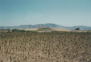
The village of Phalanna (formerly Tatar) is c. 10 km north-northwest of Larisa and c. 2 km west of the Peneios [cf. AA 30 (1955) col. 195, Abb. 5, a map of the area]. Tatar Magoula, c. 1.5 km west of Phalanna, is a mound standing c. 12 m above the plain (Plate 34B, view from the south, cf. Feuer 1983 fig. 56, view from the northwest). In 1954 Milojčić found several LH IIIB sherds here. When D.H.F. Gray and Mr. and Mrs. Hope Simpson visited the site in 1958 the top part was in the process of being ploughed away by a bulldozer. It was estimated that before this destruction this top part had been c. 80 m by c. 60 m. The total extent of the mound measured roughly 300 m north to south by 225 m. And Feuer reported surface sherds beyond the mound. The abundant Classical and Hellenistic sherds, revealed in the cutting by the bulldozer and elsewhere on the surface of the mound, indicated that this was certainly the site of a Hellenic town, as is also shown by the inscriptions from here (IG ix. 2 nos. 1034-1038, cf. RE 7, 2101-2102). Prehistoric sherds noted here in 1958 include Neolithic, MH Grey Minyan and LH IIIA-B; Feuer illustrates some MH and LH III sherds (Feuer 1983, 121 and figs. 57 and 58). These were mainly from goblets, deep bowls and kraters, some of which were of fine quality, of buff fabric and with buff slip. He also found part of an animal figurine (fig. 17d). Tatar Magoula was without doubt a significant Mycenaean settlement, although the Hellenic town was apparently much larger.
Strabo (9.5.19) records that “some have said that Orthe is the acropolis of the Phalannaians”. But the location of ancient Phalanna itself is uncertain. Some modern scholars have suggested Kastraki (or Kastri) near Turnavos [Stählin 1924, 26-27, 30-31, and fold-out map; Milojčić in AA 35 (1960) 169 and 167 Abb. 13]. Ancient sources other than Strabo attest an independent city of Orthe in historical times (Steph. Byz. s.v. Ὄϱθη; Hesychius s.v. Ὄϱθη; Pliny N.H. 4. 32); and this is confirmed by coins of Orthe [c. 350 B.C. to c. 200 B.C., Head 1911, 303]. The principal reverse type of these coins, depicting a horse springing out of a rock, was compared by Wace with a smiliar type on the coins of Pherai, which are interpreted as typifying the famous spring of Hypereia there. This comparison led Wace to assume that such a spring existed at Orthe. But the coins may simply have indicated horses and horse-breeding, for which the Thessalian plains would provide the good pasture required. (CSHI, 146). The existence of a large spring called Mati “about half an hour from the village of Karatsioli” and “gushing forth from the rock” (Wace, cited by Allen loc. cit.) is not sufficient evidence for locating Orthe at Karatsioli (for which see below on Elone).
Elone (Il. 2. 739)
Argyropouli (formerly Karatsioli): Kastri: MH LH IIIA2-IIIC PG? C H
Wace and Thompson 1912, 10 (No. 81); Allen 1921, 129-130; Stählin 1924, 31-32; CSHI, 146-147 and pl. 11; GAC, 286-287 (H 37): MG, 168 (H 38) and fig. 8 on p. 71 (sketch plan); Feuer 1983, 112 and figs. 43 and 44 (photos); AD 36 (1981) B1 255-257, cf. AR 36 (1989-90) 49; Lemos 2002, 287.
Plate 35A. Argyropouli (? Elone) to South from Kastri.
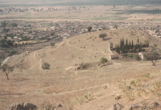
Plate 36B. Argyropouli: Kastri from South.
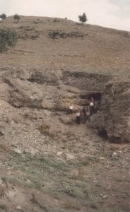
The village of Argyropouli lies at the north end of the Larisa plain, beneath the foothills of Mt. Olympos and near the southern entrance to the Melouna pass, which leads to the Elasson valley. To northwest of and above the village is the hill of Kastri, a long north to south ridge, whose summit on the north is c. 70 m above the level of the village. The ridge is surrounded on all sides except the south by ravines. On the north there is a steep drop to the ravine below; the west and east slopes are less steep, down to the ravines on these sides; on the south the slopes are gentle, ending above the village. In the eastern ravine is a perennial stream, and here there is a good spring near the foot of the hill (MG, fig. 8). Halfway up the hill from the village are a chapel of Ayia Paraskevi and the ruins of a monastery (Plate 33A = CSHI pl. 11a, cf. Feuer 1983 fig. 43). Mycenaean and later sherds, including good Classical black-glazed, were found by Hope Simpson and Lazenby in 1961, mainly on the lower part of the ridge, in the vicinity of the chapel and to south, but also on part of the higher northern end. The Mycenaean sherds, which ranged from LH IIIA2 to early LH IIIC, were spread over an area of c. 350 m north to south by c. 100 m. Some were of fine quality. They were expecially numerous behind the chapel on the neck between it and the summit. Here erosion had created a deep pit, in the north side of which Mycenaean deposits, two to three metres thick could be seen (Plate 36B, cf. Feuer 1983 fig. 44). Nearer to the chapel the erosion had revealed a Mycenaean house-wall, preserved to a height of about two metres (Plate 35B = CSHI, pl. l1b). Unfortunately, as Feuer reported, this wall was no longer in existence in 1979 (Feuer 1983, n. 4 on p. 116). No Protogeometric or Geometric sherds have yet been found on the hill. But small Protogeometric tholos tombs were excavated nearby (AD and AR references above) with finds dated by Lemos (loc. cit.) to Protogeometric and Sub-Protogeometric.
Strabo (9.5.19) describes Elone as below Olympos and not far from the river Europos. The Europos is identified as the modern Xerias, which joins the river Peneios at a point c. 8 km southeast of Argyropouli. (Strabo ibid. also asserts that the Europos was the river called Titaresios by Homer – see below under THE KINGDOM OF GOUNEUS). The quantity and quality of the Mycenaean remains at Argyropouli: Kastri, the nature of the site and its strategic position at the southern end of the Melouna pass, all support its identification as Elone. And Strabo’s statement (ibid.), that the name Elone was later changed to Leimone, seems to demand for Elone a site where remains of the historical period are found.
Oloosson (Il. 2. 739)
Elasson: Panayia etc. LH IIIB G A? C H R
Selected references: Leake 1835 iii. 345-348; Heuzey 1960, 18-28; Head 1911, 304; JHS 30 (1913) 317-319 nn. 9-11; PAE 1914, 150-153; AE 1916, 91-92; Allen 1921, 129; Stählin 1924, 23-24, with refs.; AA 34 (1959) 85-90 and Abb. 14-16 on pp. 93-94; AD 23 (1968) B 269; CSHI, 147; GAC, 287 (H 40); MG, 168 (H 40) and pl. 27A; Feuer 1983, 140 (No. 65) and fig. 82; Εϱγoν ΥΠΠΟ 1997, 100.
Olosson was the historical capital of the Perrhaiboi. The name Ὀλooσσών (or Ὀλoσσών) appears in some of the Thessalian inscriptions listed by Arvanitopoullos (cf. Stählin 1924, 23 n. 5). The name was changed to Elasson in the Byzantine period. Several inscriptions were found in the walls of the monastery of Panayia Olympiotissa, to northwest of and above the modern town of Elasson (cf. Stählin 1924, 23 n. 7). The monastery hill (MG pl. 27a, middle left) was the acropolis of ancient Olosson. There are traces of isodomic masonry on the north side and signs of ancient tombs along the road south to Turnavos. It is likely that the coinage of the Perrhaiboi was minted at Olosson from 480 B.C. to 460 B.C. and from 196 B.C. to 146 B.C. (Stählin 1924, 24 and n. 3, cf. Head 1911, 304).
In the vicinity of the modern Elasson a group of LH IIIB vases was found by chance: a deep bowl, a straight-sided alabastron, a rounded alabastron, a one-handled cup, and three jugs, together with a bronze bracelet. These are probably from a tomb. No prehistoric habitation site has yet been discovered at Elasson, but the monastery hill would have been an obvious choice for a Mycenaean settlement, and it overlooks the pass to west of Mt. Olympos from Thessaly into Macedonia.
THE KINGDOM OF POLYPOITES
The leaders of this contingent, Polypoites and Leonteus, are called Lapithai (the Lapiths) in Iliad 12. 127-130, as are their followers (Il. 12. 181; cf. Od. 21. 297). Their dynasty was “the longest established in Thessaly (Allen 1921, 129), going back to Hypseus (Pindar, Pyth. ix. 9-14; Pherecydes FGH i. 72). Peirithoos, the father of Polypoites, had driven the Centaurs, the ‘hairy beasts’ (Φηæϱaς λaχνήεντaς) from Mt. Pelion to the land of the Aithikes (Il. 2. 742-744). Peirithoos is again named among the heroes who fought against the Centaurs, ‘the wild beasts of the mountains’ (Φηϱσὶν ὀϱεσκῴoiσi, Il. 1. 262-268).
Of the five places named in the Kingdom, Argissa, Gyrtone and Oloosson are firmly located, and Elone and Orthe provisionally; Mycenaean habitation is attested at all except Gyrtone. The Kingdom is of strategic importance, controlling the main route to the north and the entrance to the Tempe pass on the northeast. As is suggested for the Pylian wars against the Epeians and the Arcadians, the war between the Lapiths and the Centaurs may reflect an early stage in the development of Mycenaean culture in Thessaly. In later Greek art the Lapiths are portrayed as civilized; the Centaurs are only half-civilized.
THE KINGSTON OF GOUNEUS AND THE KINGDOM OF THE MAGNETES
For these last two Kingdoms in the Catalogue there are no reliable indications in the ancient sources. The districts are identified only by the tribes said to have inhabited them; and, as Allen said, the Enienes and the Perrhaiboi are “wandering tribes” (Allen 1921, 130), which reappeared in entirely different locations in historical times. It is obvious that the the composer(s) of the original Catalogue, handed down to Homer, had only a vague notion of these Kingdoms, which were on the distant edge of the Greek world known to them. Dodone is “wintry” (δυσχείμεϱoν, Il. 2. 730, cf. Il. 16. 234), and its ruler, Pelasgian Zeus, lives far away (τήλoθi νaίων). It is inhabited by the Selloi, “soothsayers with unwashed feet who sleep on the ground” (Il. 16. 234-235). The later Greek antiquarians were at a loss to explain the Homeric traditions concerning Dodone and Kyphos etc., and indulged in various forms of speculation. Some of the explanations they offered appear to have been contrived in favour of parochial (Thessalian) interest (see below on Dodona); Stephanus of Byzantium (s.v. Γoννoί) resorted to false etymology, by attempting to relate Gouneus to the town of Gonnos.
THE KINGDOM OF GOUNEUS
Kyphos (Il. 3. 748)
Allen 1921, 130-132; Stählin 1924, 7 n. 4, 8 n. 1; CSHI, 149.
The location of Kyphos is unknown. Strabo (9.5.20) assumed that Kyphos, Dodone and the river Titaresios were all in the more mountainous parts of Thessaly near Mt. Olympos and Tempe. But the only basis for this assumption is his own assumption (9.5.19) that the Europos river was the Titaresios of Homer. Various modern speculations concerning Kyphos were collected by Stählin (loc. cit.). These are all no better than the speculations of the ancient Greek geographers.
Dodone and the Titaresios (Il. 2. 750-751)
Leake 1835, i. 415 and iv. 278; Georgiades 1874, 23; Allen 1921, 130-137; Stählin 1924, 22-23, 27-28; CSHI, 149-150.
Dodona (in Epirus): N MB LH IIIA2-C G A C H R
Selected references: Carapanos 1878; PAE 1951, 173 ff.; PAE 1952, 280; AE 1956, 140-141; PAE 1959, 114; PAE 1967, 39; PAE 1968, 56; PAE 1969, 26; PAE 1972, 99; Ergon for 1968, 41-53; Ergon for 1969, 19-21; AR 14 (1967-68) 13-14; AR 15 (1968-69) 21; AR 16 (1969-70) 18; Dakaris 1972, 15-16; Schoder 1974, 60; GAC, 300-301 (K 3); MG, 177 (K 4).
Recent excavations in the Archaic sanctuary area: Ergon for 1981 and most years up to Ergon for 2003, cf summaries in AR vols. 29-31, 35 to 38, 44 to 47, and 49-51.
At Dodona a thin prehistoric stratum was discovered beneath parts of the sanctuary of Zeus (for the Archaic to Roman buildings see PAE for the years 1929-1930, 1952 to 1974 and Ergon from 1955 to 1974). Middle Bronze Age sherds and a hearth were found by D. Evangelidis below the temple of Zeus (PAE 1951 and AE 1956). During his excavations in 1959 to 1974 (mainly in the theatre and the bouleuterion) S. Dakaris uncovered part of a Late Bronze Age settlement to south and east of the bouleuterion (Ergon, PAE and AR refs. for 1967 to 1972 and Dakaris 1972, 65-66). The pottery included LH IIIA2-C with local limitations. The buildings were represented only by post holes and stones around them outlining rectangular rooms. Beneath a large elliptical building, probably Early Iron Age, was a Mycenaean level, whose latest pottery was LH IIIC. Between this time and the late Geometric period (the date of the earliest pottery found in the Temple of Zeus) there were no signs of activity at the site; and there is no evidence of any Mycenaean or Early Iron Age cult at Dodona.
Dakaris with good reason identified this Late Bronze Age settlement as the wintry Dodone of the Selloi (Il. 16. 234-235). This, Homer’s Dodona, is clearly set in Epirus; Odysseus goes to Dodone from Thesprotia (Od. 14. 314-328 and Od. 19. 291-299). But the antiquarians of Thessaly, Cineas and Suidas, maintained that the original Dodona was near Skotoussa in Pelasgian Thessalia (Strabo 7.7.9-12 and Book 7 frags. 1, 1a, 1b, 1c and 2). Their story, according to these excerpts, is roughly as follows: the oracular shrine of Zeus had been transferred (to Dodona) from Skotoussa because the sacred oak tree (believed to be the first plant created and the first to supply men with food) had been set on fire and Apollo had given out an oracle ordering the transfer. Strabo himself notes (7.7.12), this tale was told by Suidas “in order to gratify the Thessalians with mythical stories”.
Homer places part of Gouneus’ realm around the river Titaresios, “….. which pours into the fair-flowing Peneios, but does not mix with the silver-eddying Peneios, but flows upon it like olive oil” (Il. 2. 751-754). Allen devotes several pages to discussion of this phenomenon (Allen 1921, 132-137), which had been observed by early travellers (Leake, Dodwell, Heuzey etc.) at various points where tributaries joined the Peneios. He points out that the phenomenon is quite common (e.g. at the junction of the Rhone with the Saone and at the mouth of the Danube). Allen, however, argues forcibly against Strabo’s equation of Homer’s Titaresios with the Europos (Strabo 9.5.19-20), on the grounds that this district should belong to Eurypylos’ Kingdom, whereas Gouneus “is at Dodona”. This discrepancy is apparent to modern commentators, who enjoy the benefits of maps and compasses. And it is not surprising that Allen favours Leake’s suggestion of a location where a tributary joins the Peneios near its western source, above Trikkala. Here, according to Leake (loc. cit.), the tributary “….. rises at the γaλaκτίτης λίθoς or milkstone, a rock so called because there is a calcareous deposit at the fountain which has the reputation at Metsovo and the other neighbouring villages of having the effect, when pounded and mixed with water, of promoting a woman’s milk”. But Leake’s suggestion, that this tributary is Homer’s Titaresios, is based on a somewhat forced interpretation of Homer’s epithet ἀϱγυϱoδίνῃ (‘silver-eddying’) given to the Peneios (CSHI, 149). Georgiades (loc. cit.) recorded a less spectacular (and more common) occurence at the point where the modern Titaresios (Strabo’s Europos) joins the Peneios: this was simply that at first the two streams did not appear to mix, and that for some distance they could be observed separately.
The Kingdom of Gouneus has induced much speculation, both ancient and modern. In this case, as in some others noted above, topographic, precision is not to be expected. Homer’s audiences would not have been troubled by the apparent inconsistencies, and would have enjoyed Homer’s description of the natural phenomenon.
THE KINGDOM OF PROTHOOS
The Magnetes are led by Prothoos whose lineage is not given, and remains unknown. They are associated both with Mt. Pelion and with the river Peneios (Il. 2. 757-758). Presumably, therefore, this Kingdom would have included Mt. Ossa, since this lies between Mt. Pelion and the Peneios. The name Pelion may here have been used loosely for the whole Ossa-Pelion mountain chain. If this can be assumed, their territory could have been the northern and western flanks of Mt. Ossa, the Tempe valley, the foothills on both sides of it and the coastal strip around the mouth of the Peneios. They would, however, have been denied any harbour from Meliboia to the south, since all this coast would belong to Philoctetes or Eumelos; and on the west the plains were in the domain of Polypoites.
No towns are listed in Prothoos’ Kingdom, and the region indicated has not been adequately explored. Two known Mycenaean sites, however, may have been included in his territory: Gonnoi: Besik Tepe [GAC, 285 (H 33); MG, 167 (H 34); Feuer 1983, 109-110 and figs. 39-42], on the northwest side of the Peneios, and Spilia: Kavaki [GAC, 284 (H 31); MG, 167 (H 33) and pl. 26a; Feuer 1983, 104 and figs. 37-38], high up in the western foothills of Mt. Ossa (see Chapter 1 for details of these sites).
HOMERIC THESSALY AND HISTORIC THESSALY
In the Catalogue there is no mention of Thessaly. Allen discusses the differences between the Homeric Kingdoms in the region and the historic Thessaly (Allen 1921, 138-141). Nevertheless, these Kingdoms, listed in the Catalogue, i.e. from that of Peleus and Achilles to that of Polypoites, are “….. the natural divisions of the country” (except that the central part of the historic Thessaliotis, the district between the Kingdom of Eurypylos and that of Peleus and Achilles, is not included).
Of the names in the Catalogue only a few (Pherai, Iolkos and Trachis) were also those of important later Thessalian towns, although the names of several lesser towns also occur in the Catalogue (e.g. Pyrasos, Tricca, and Gyrton; Allen 1921, 138-139 lists all the equivalents). Several main towns of the historic Thessaly are absent, in particular Larissa, Krannon, Pharsalos, Metropolis and Kierion. The extents of the Homeric Kingdoms are not clear, but neither are those of the main historic divisions of Thessaly, Phthiotis, Thessaliotis and Pelasgiotis. Allen itemizes the various attempts by some of the later Thessalian cities, Larissa, Pharsalos, Gyrton and Krannon, to “….. appropriate the more distinguished personages and places” in the Catalogue, and thereby produce “….. a third Thessaly, imaginary and heraldic ….. that they did not forge the Catalogue is obvious – they fought against it”. (Allen 1921, 141).
In the Catalogue the regions of the later Thessaly and Phthiotis are divided into nine separate Kingdoms. But the archaeological evidence now confirms centres of palatial administration at Dimini and Iolkos, strongly suggesting that a considerable part of eastern Thessaly may have been under palatial control in the LH IIIB period and up to the time of the demise of Dimini early in LH IIIC. The political divisions in the Catalogue may here seem more appropriate to the situation in later LH IIIC, after the collapse of palatial administration. But pottery of LH IIIC Middle has been found mainly along the coast, in the Volos district and at Velestino and Pteleon. There are few reports of LH IIIC Middle on sites in the interior, where the floruit of most of the Mycenaean settlement was in LH IIIA2-B.
