1
The Greek mainland is naturally divided into separate regions by its mountains, especially Mt. Pindos in the north and in the south (the Peloponnese) Mt. Erymanthos and Mt. Taygetos. Travel between these regions would have been difficult and slow, and in many cases easier by sea than by land. For the historic period there are fairly reliable indications of the boundaries between the Greek city states, whose borders, particularly during the Roman administration, were often marked by inscriptions. For the Mycenaean period, however, there are no such indications. From the Linear B evidence it has been possible to reconstruct a reasonable hypothesis for the extent of the territory of Mycenaean Pylos (cf. e.g. Hope Simpson 2014). For the territories of Mycenae, Thebes and Dimini the data are not sufficient for more than rough estimates. For the political organization in other parts of Greece, the only guides are the patterns and distribution of the known Mycenaean settlements. The divisions listed below, therefore, are to some extent arbitrary and provisional, although in most cases the nuclei of the settlements are evident. Only a summary is given in Chapter 1 for each district, and only a few of the sites are discussed (in this Chapter and in Chapter 4). For most sites, fuller details have been given in GAC and MG or in AR (the annual archaeological reports of the Society for the Promotion of Hellenic Studies and the British School at Athens). An attempt is made to identify the areas where there are significant gaps in our exploration. This has indeed been uneven. The members of the Greek Archaeological Service must spend most of their time and limited resources on ‘rescue’ excavations necessitated by rapid urban development and modernization. The Greek Universities and the foreign schools in Athens have greatly expanded the scope of exploration, but the coverage remains partial and selective.
THE DISTRICTS OF MYCENAEAN GREECE
Recent excavations and surveys have confirmed and strengthened the evidence for the most densely populated regions: the Argolid and Corinthia, the Sparta plain, the Pylos district, Thebes, Orchomenos and the Kopais, and the Volos district in Thessaly. In addition to those of Mycenae, Tiryns, Pylos and Thebes, Linear B tablets at Volos and Dimini and at Ayios Vasilios in Laconia attest further administrative centres. Extensive ‘lower towns’ are now evidenced at Mycenae, Tiryns and Pylos, and probably also at Dimini. Intensive surveys have demonstrated particularly dense Mycenaean populations in the Argolid and Corinthia and in Messenia. Elsewhere, many more Mycenaean settlements have been revealed, mainly in Boeotia, East Locris, Achaea, Elis, Phthiotis and Thessaly.
Mycenaean power, prosperity and skill in construction are all amply demonstrated not only by their palaces, fortifications and monumental tombs, but also by their dykes, dams, canals, highways and harbours (MFHDC). Their achievements in these works of civil engineering were only surpassed by those of the contemporary Egyptians. Mycenaean exports (especially of olive oil) are now seen to have been both voluminous and widespread, especially in the eastern Mediterranean.
Much of the evidence attests the power of Mycenae itself, as is shown in particular by the highways radiating from its citadel. These, and the highway between Tiryns and Epidauros, provided a firm network of communications, including built roads at the citadels themselves, Mycenae, Tiryns and Midea. The similarities, both in the highways and in the fortifications of these places (shown especially by Mycenaean style of arch) indicate a strong centralized power here in the LH IIIA2-IIIB palatial period. At this time Tiryns (presumably together with Nauplion) would have been the main port for Mycenae (Dickinson 1994, 78 “Tiryns may well have been subordinate to Mycenae”; cf. Galaty and Parkinson 2007, 12). Epidauros on the east coast was another port; and at Korphos, further north along this coast, an American team have discovered a major Mycenaean fortified harbour town. They suggest that Mycenae used this port to help exert its control over the Saronic Gulf [AR 57 (2010-2011) 24].
Other major discoveries since c. 1980 include the ‘higher order’ Mycenaean settlement at Ayios Vasilios in Laconia with its Linear B tablets, the putative ‘cothon’ habour for Mycenaean Pylos at Romanou, the Linear B archives at Thebes and the palace at Dimini in Thessaly. The density of the Mycenaean population in the Pylos district is now affirmed by intensive surveys, as is the comparable density of Mycenaean population in the Argolid and Corinthia. In Elis more Mycenaean sites (mainly tombs) have been found in the Olympia district and in the western foothills of Mt. Erymanthos to the north. In Achaea several of the cemeteries are now shown to have been in use throughout the Mycenaean period, and almost all include LH IIIC burials. In Boeotia and East Locris recent excavations, especially at Pyrgos/Kynos, Kalapodi and Mitrou, have provided important evidence for the LH IIIC post-palatial period and the transition to the Early Iron Age. Lemos [AR 58 (2011-2012) 19-25] compares this evidence with that from Lefkandi on Euboea.
In Thessaly most of the important new information comes from the Volos district, where the excavations at Dimini have revealed a Mycenaean palace and ‘lower town’; and, at Kazanaki on the outskirts of modern Volos, a monumental tholos tomb. Several other Mycenaean sites recently discovered in Thessaly have shown that the interior regions, especially around Larissa, were also quite densely inhabited, especially in LH IIIA and LH IIIB. Fewer Mycenaean sites are known in the west and south of Thessaly; but the tholos tomb at Kouphia Rachi to west of Karditsa and the evidence from Trikkala have provided ample proof that Mycenaean civilization had reached as far west as the eastern foothills of Mt. Pindos.
To west of Mt. Pindos, however, in Acarnania and Epirus, the Late Bronze Age sites are fewer. In the northwest, most of the LBA pottery at Ephyra and Dodona is of local character, and elsewhere to north of the ‘Mycenaeanized’ southern part of Aetolia, Mycenaean finds are mostly weapons found in graves. The Mycenaean pottery found at Thermon shows at least some penetration of Mycenaean culture into eastern Aetolia, a district otherwise mainly unexplored. Some pottery of MBA or LBA style found at Karpenision on the east side of the Pindos range, provides a hint of a route here from east to west through the mountains.
To north of Thessaly, Mycenaean pottery and local imitations have been found at some of the Late Bronze Age sites, but always greatly outnumbered by local wares. Most of these sites are in Central Macedonia. Almost all of the imported Mycenaean pottery found on sites in Macedonia is LH III; but some early Mycenaean sherds (LH I-II) from Torone on the Chalcidice peninsula show earlier contact with the world to the south, in this case obviously by sea. Although there was no defined border, it seems that the territory to north of Mt. Olympos was outside the Mycenaean sphere, as most of Epirus in the west.
Mycenaean material culture is evident at almost all of the Greek islands. Most of the Late Helladic sites in Euboea were on or near the coast opposite the Greek mainland; and the Mycenaean pottery on these sites is of the same high quality as that of Attica, Boeotia and East Locris. The same high quality is seen also on the offshore islands of Salamis and Aegina, where there were important Mycenaean harbour towns. In the Ionian Islands the Mycenaean pottery is often of a more provincial kind, and in Kephallenia the LH IIIC is of distinctly local style. Fewer Late Bronze Age settlements have been found in the Northern Sporades and Skyros, and on Lemnos, Lesbos and Chios, but in all these islands there are considerable amounts of pottery in Mycenaean style, mostly locally produced. The Late Bronze Age settlements in the Cyclades and on Samos are Mycenaean in character, although much of their pottery exhibits local varieties, some partly developed from Minoan antecedents. The Dodecanese Islands were much more ‘Mycenaeanized’. On Rhodes and Kos much of the fine ware, especially in the tombs, is imported from the Greek mainland, often specifically from the Argolid, and the local imitations are usually also of high quality. Following the discovery of Mycenaean tombs on Astypalaia and Mycenaean sherds on Telos, there is now evidence of Mycenaean habitation on all of the major islands of the Dodecanese (probably including Nisyros). Rhodes and Kos seem to have been particularly important for the Mycenaeans, who were also establishing a foothold in Asia Minor opposite, especially at Miletus and Müskebi (Chapter 2). No major Mycenaean fortresses are known on Kos and Rhodes; it is likely that their large populations, together with Mycenaean sea power, were sufficient to ensure their security. These islands were obviously also important for Mycenaean trade, since they lay on the route to the Near East, as did the Ionian Islands on the route to the west.
The brief summaries below for each district can not provide more that a general overview of the settlement pattern of Mycenaean Greece, for which a revised Gazetteer is now required. Meanwhile, most of the essential new information has been recorded in the AR reports published after GAC and MG, i.e. from AR 24 (1977-78) onwards.
THE ARGOLID, CORINTHIA, THE MEGARID AND AIGINA
Selected references:
GAC, 27-74 (A 1 to A 94); MG, 9-40 (A 1 to A 90); Shelmerdine 1997, esp. 541-545, 550-552; MFHDC, 39-45, 71, 123-160, 170-184, 225-226; Mountjoy 1999, esp. 66-67, 197-198; French 2002; Marchand 2002; Dickinson 2006; Maran 2006; Papadimitriou 2006.
Regional surveys:
Wright et al. 1990 (Nemea Valley Archaeological Project)
Jameson et al. 1994 (Southern Argolid Exploration Project)
Wells and Runnels (eds.) 1996 (Berbati-Limnes Archaeological Survey)
Mee and Forbes eds. 1997 (Methana Survey)
Gregory, Pullen et al. 1999 (Eastern Korinthia Archaeological Survey)
Tartaron et al. 2011 (Saronic Harbours Archaeological Research Survey)
The Argolid was the most important region of Mycenaean Greece. Its two great citadels of Mycenae and Tiryns with their palaces and extensive towns attest a high degree of power and prosperity in the LH IIIA and LH IIIB periods, before the collapse of their palatial administrations in the transitional LH IIIB2/LH IIIC Early period. This power and prosperity depended mainly on successful agriculture and optimal land use. At Mycenae the widespread ancient terraces are in sharp contrast to the modern limited and sporadic cultivation. The original size and wealth of Mycenae presupposes a reliable perennial supply of water, not only for human and animal consumption, but also for essential irrigation. The so-called ‘bridge’, of massive construction, across the Chavos ravine, at Ayios Yeoryios, to south of the citadel of Mycenae, is totally unlike all the known bridges of the Mycenaean highways. The hydraulic expert J. Knauss has interpreted the ‘bridge’ as in reality the dam of a reservoir (MFHDC, 178-181, with bibliography, including a comparison with the Minoan dams excavated on the island of Pseira). Absolute proof that the ‘bridge’ is in reality a reservoir dam could be obtained by investigating the interior (upstream) face to ascertain that it had been made waterproof by a mud facing, like Dam M 9 in Pseira. Certainly all the evidence indicates that Mycenae was the capital of the Argolid, and there are many indications that it was the most powerful state in Mycenaean Greece. Most of the Mycenaean built highways are those radiating outwards from Mycenae in all directions, providing links to Argos, Midea and Tiryns in the south and to the Corinthia in the north. It is generally agreed that Tiryns (together probably with another harbour at the nearby Nauplion) was the main port of Mycenae. There are also substantial remains of another highway (with the same style of ‘Cyclopean’ bridges), between Tiryns and Epidauros (presumed to be Mycenae’s chief port on the east coast). Traces of built highways have been found leading into gates at Mycenae, Tiryns and Midea; and at Tiryns three Linear B tablets list wheels (T1 Si 8, 9 and 10) and one tablet lists cuirasses (T1 Si 5 – see Chapter 3 under BODY ARMOUR. For the few Midea inscriptions see Shelmerdine 1997, 563-564).
The Linear B evidence for palatial administrations at Mycenae and Tiryns and the similarities in the architecture of their fortresses (and that of Midea) also indicate a close connection which points towards control by Mycenae. And Mycenae’s interest in the Corinthia appear to be revealed by the great increase in the numbers and sizes of the settlements in the Nemea district (cf. Cherry ad Davis 2001, esp. 154-156 and Wells et al. 1990). The most spectacular discovery relating to this expansion of the interests of Mycenae is the recent discovery, at Korphos-Kalamanios, in eastern Corinthia, on the Saronic Gulf, far to north of Epidauros, of a fortified Mycenaean harbour town, 7.2 ha. in extent and with satellite settlements. The surveyors suggest that this port was used by Mycenae to maintain control over the Saronic Gulf [Tartaron et al. 2011 and AR 56 (2009-2010) 20-21]. The Cyclopean wall across the Isthmus of Corinth is best explained as a Mycenaean boundary demarcation (MFHDC, 123-140). Although there is no proof of the Mycenaean date proposed by Broneer, there is no viable alternative. Broneer’s excavations were mainly confined to sections of the wall itself; there was little examination of the ground behind the wall, and within the wall the stratigraphy was confused, since so many of its stones had been removed (most of them were obviously ‘robbed’ by the builders of the later Hexamilion wall across the Isthmus). Unfortunately the ‘robber trenches’ were not always recognized by the excavators. Further exploration, using more modern methodology, is required. The masonry of the wall is of Mycenaean style (cf. the parallels cited in MFHDC loc. cit., where other relevant features are discussed). Broneer tried to establish a date for the construction of the wall which would be consistent both with the archaeological evidence and with the ancient traditions of the raids and threatened invasions by the Heraklidai (Broneer 1968, 31-35). The traditions (Herodotus IX, 26, Diodorus IV, 57, 2-58, 5 etc.) are confused and contradictory, but they do at least suggest that inter-state conflict in later Mycenaean times had necessitated defensive measures to safeguard the Peloponnese.
Although excavation and survey had demonstrated a very large Mycenaean population in the Argolid, many areas have not been adequately searched, so that the coverage is not sufficiently uniform. In the Corinthia the recent discoveries of Dorati, Aidonia and Tsoungiza and of larger communities at Sikyon and Korakou reveal that this fertile territory was then also densely occupied (see Chapter 4). There were here no natural impediments to the expansion of Mycenae into the Corinthia. Aigina and Megara, however, were presumably independent (see Chapter 4 for the Mycenaean sites on Aigina). Except for Megara itself (MFHDC, 71) the Megarid has not been surveyed.
Many of the Mycenaean settlements in the Argolid and Corinthia were abandoned at the end of LH IIIB or were then in decline; but Korakou still flourished in LH IIIC Early, and some major settlements in the southern Argolid prospered throughout the LH IIIC period, especially Tiryns, Argos and Asine. Habitation (on a smaller scale) continued at these, and at Mycenae, into the Early Iron Age (Dickinson 2006, Maran 2006, and Papadimitriou 2006).
LACONIA
Selected references:
BSA 55 (1960) 67-107; BSA 56 (1961) 114-175; GAC, 107-125; MG, 99-112, 219; Banou 1996; Cavanagh et al. 1996 (Laconia Survey ii); Cavanagh et al. 2002 (Laconia Survey i); Taylour and Janko 2008 (Ayios Stephanos); H.W. Catling 2009 (Sparta: Menelaion I); Hope Simpson 2009; Banou 2009; Hope Simpson and Janko 2011.
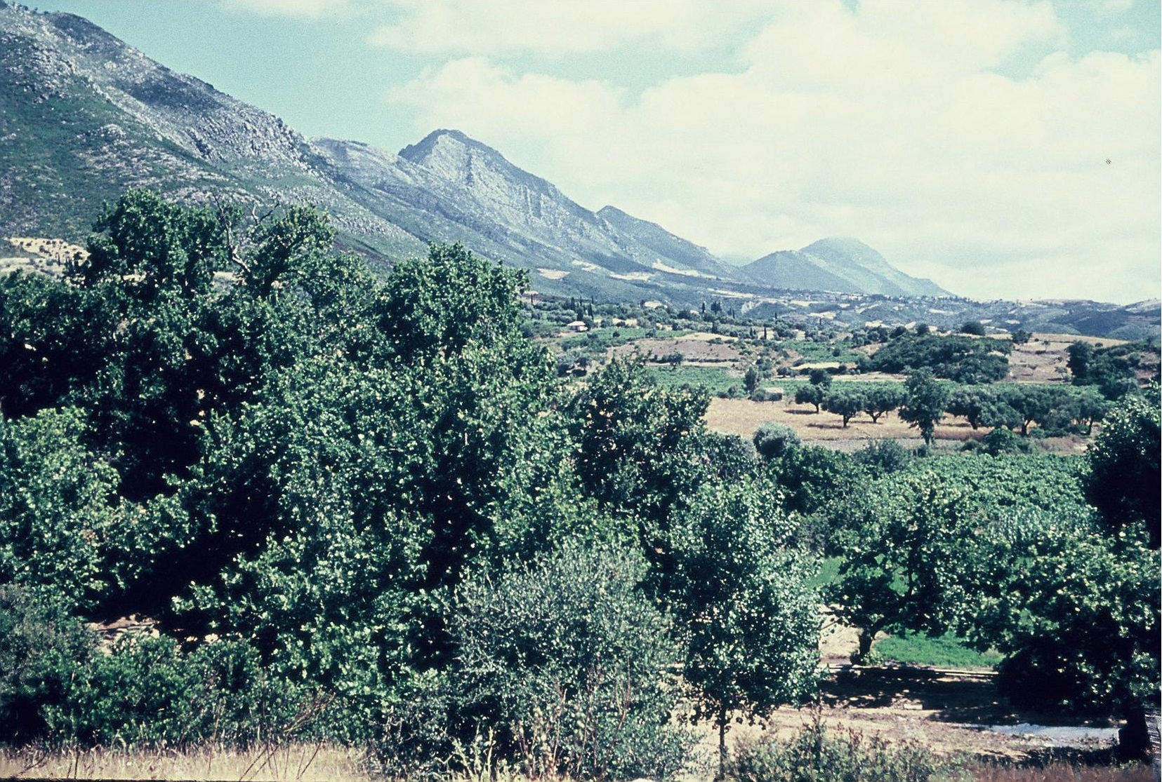
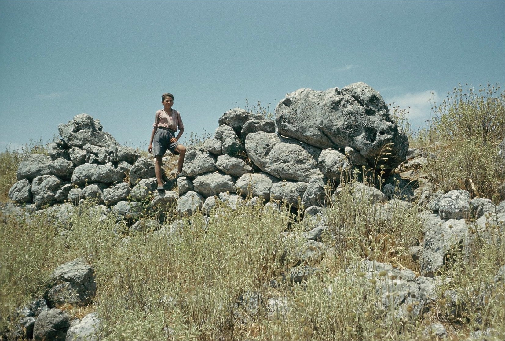
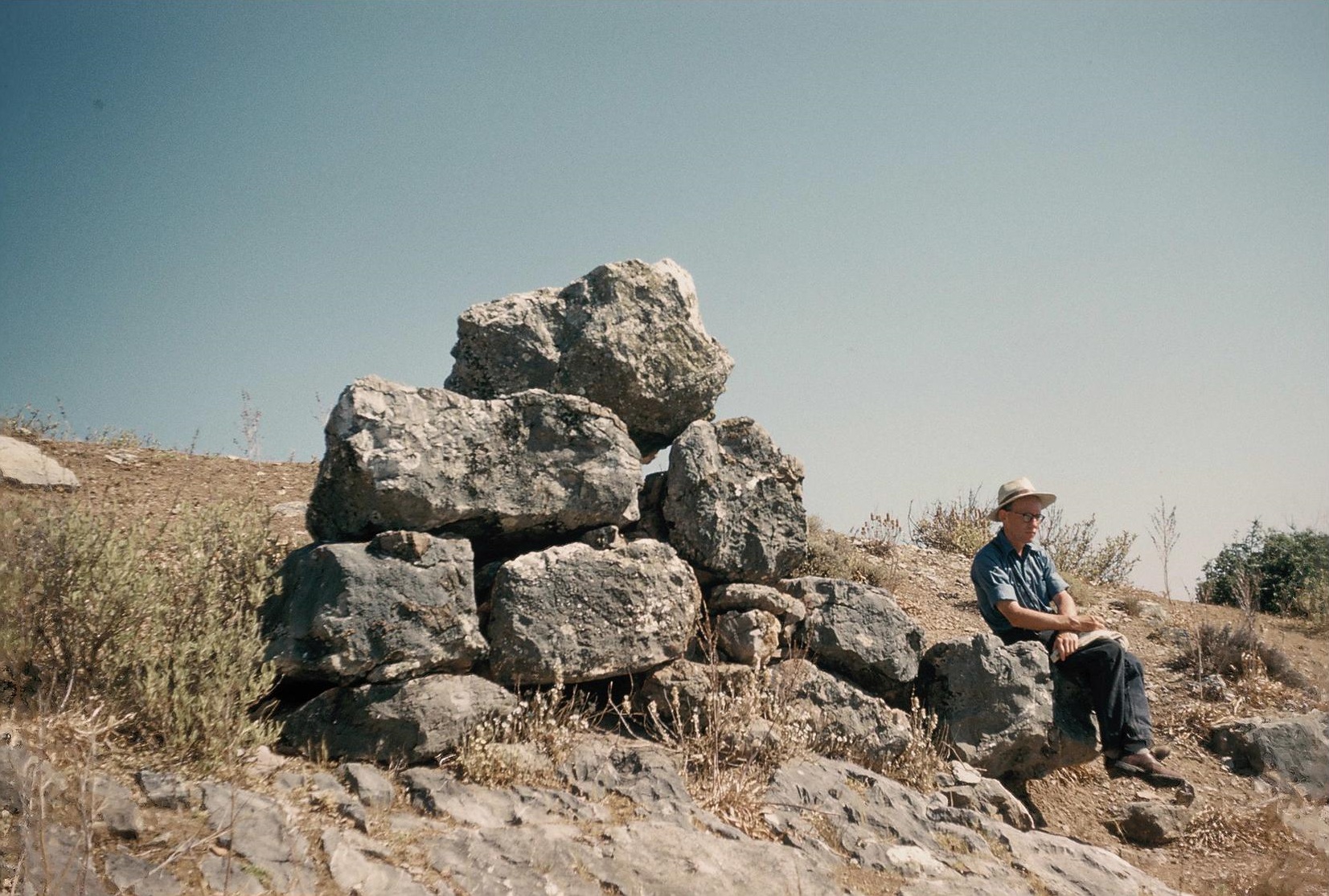
Plate 1B. Mt. Aigaleon from Northwest.
Since the extensive survey of Prehistoric Laconia by Waterhouse and Hope Simpson (BSA 55 and 56 refs. above) our knowledge of Mycenaean Laconia has been greatly increased. Catling’s excavations at the Menelaion and Taylour’s excavations at Ayios Stephanos are now published, as is the British School’s Laconia Survey. Most of the Mycenaean sites in Laconia are listed by Shipley in the survey publication (vol. ii, 264-313). The most spectacular new discovery, however, is that of the ‘higher order’ Mycenaean town at Ayios Vasilios, c. 12 km south of Sparta (A. Vassilogamvrou, preliminary reports in Ergon for 2011, 2012 and 2013). (Fuller discussions of the Menelaion, Ayios Stephanos, Ayios Vasilios, Palaiopyrgi (Vaphio) and Amyklai are presented in Chapter 4). Other important Mycenaean settlements around the Sparta plain are that of Anthochorion: Analipsis (Chapter 4, s.v. Bryseiai) and the two hill sites near Skoura (Vouno Panagias and Ayios Georgios) discovered by Banou (Banou 2009, cf. Banou 1996).
In the Malea peninsula, renewed exploration of the underwater prehistoric town of Pavlopetri has revealed that prehistoric buildings here occupied at least 44,000 m2 (reports in AR vols. 56 to 58). Elsewhere on the peninsula Mycenaean chamber tombs have been excavated at Angelona [3 LH IIIB pots, AD 36 (1981) B 130-131] and at Sykea (4 chamber tombs with LH IIIA – LH IIIC Early pottery, weapons etc., reports in AD vols. 29, 52, 53 and 54. The latest report [AD 54 (1999) B 1009-1111; cf. AR 53 (2006-2007) 27] is an analysis of the skeletons). Gallou has published a commentary on the Epidauros Limera Mycenaean cemetery (Gallou 2009), where almost the whole range of Mycenaean pottery was found, from LH I to LH IIIC Middle (cf. Mountjoy 1999, 251, 287 for the LH IIIC Middle amphoriskos, SM 5444, and connections at this time with Naxos and with Perati in Attica).
In the Tainaron peninsula there are few signs of Mycenaean settlement. But LH IIIB sherds have now been found at Kotrones (Ancient Teuthrone) [AD 56-59 (2001-2004) B 410-411]; and Banou has recorded widespread Mycenaean surface sherds on the south slope of the hill of the chamber tomb cemetery at Mavrovouni near Gythion (Banou 1996, 59-60, with Abb. 43-46, 71-72). The Laconia Survey did not find many traces of Mycenaean settlement to northeast of Sparta. In the northwest, Spyropoulos cleared the Pellanes Mycenaean cemetery (3 large chamber tombs imitating tholoi), where the pottery ranged from LH IIA to Sub-Mycenaean [AD 37 (1982) B 112-113, 114 fig. 1, cf. Mountjoy 1999, 244].
There is still much work to be done in Laconia, especially in the eastern foothills of Mt. Taygetos, and in Vardhounia and the Mani in the southwest. The extensive surveys by Waterhouse and Hope Simpson were selective, and covered only parts of this large territory. The evidence clearly shows that most of the Mycenaean settlements in Laconia were inhabited in the LH IIIA and LH IIIB periods, and some were still occupied in LH IIIC Early. But LH IIIC Middle is certified at only a very few sites (Taylour and Janko 2008, 600-602 with refs.). Continuity in Laconia from LH IIIC Late to Protogeometric is still problematic; there is as yet nothing to fill an apparent gap between sub-Mycenaean and the earliest Protogeometric in Laconia (Taylour and Janko 2008, 605). Both the Menelaion and Ayios Stephanos were abandoned after LH IIIC Early.
MESSENIA AND SOUTHERN TRIPHYLIA
Selected references:
Blegen et al. 1966, 1973 (Pylos I and III); Lang 1969 (Pylos II); AJA 65 (1961) 221-260; AJA 68 (1964) 229-245; AJA 73 (1969) 123-177; McDonald and Rapp (eds.) 1972; McDonald and Hope Simpson 1972; GAC, 126-180 (D 1 to D 246); MG, 113-152 (F 1 to F 242 and Appendices), 211-212; Davis et al. 1997; Zangger et al. 1997; Davis ed. 1998; Mountjoy 1999; Eder 2006; Shelmerdine 2006; reports on Iklaina by Cosmopoulos in Ergon from 1999 on; Hope Simpson 2014 with refs.
Blegen’s discovery of the Mycenaean palace at Ano Englianos and the decipherment, by Ventris and Chadwick, of its Linear B tablets naturally focussed attention on Mycenaean habitation in southwestern Peloponnese. The extensive survey by the University of Minnesota Messenia Expedition (UMME) revealed Mycenaean habitation throughout the region (AJA refs. above and McDonald and Hope Simpson 1972). In the Pylos District two major intensive surveys were later conducted, the Pylos Regional Archaeological Project (PRAP) under Davis et al. and Zangger et al., and the Iklaina Archaeological Project (IKAP) under Cosmopoulos (reports in Ergon from 1999 to 2013). These surveys, together with the excavations in Southwest Peleponnese (Ano Englianos, Nichoria, Malthi-Dorion, Iklaina etc., listed in Hope Simpson 2014) have enabled a retrodiction of the development of the Kingdom (or state) of Pylos from its beginning in LH I to the transitional LH IIIB2 to LH IIIC Early period when the palace and town of Ano Engligianos (Pylos, the pu-ro of its Linear B tablets) were destroyed in a violent conflagration. After this destruction the site was deserted, and most of the Mycenaean settlements in Messenia were apparently abandoned at this time or shortly thereafter. (The evidence is summarized in Hope Simpson 2014, where a hypothesis is presented for the locations of the major places in the Kingdom as named in the tablets. For the palatial administration of the Kingdom see Shelmerdine 2006).
In LH IIIC only a few of the LH IIIB settlements were still in use (McDonald and Hope Simpson 1972, 142-143, cf. Davis et al. 1997, 451-452). In the vicinity of the former palace of Pylos the later LH IIIC periods are represented only by material from two tombs (Hope Simpson 2014, 40, cf. Eder 2006, 550-554): Chamber tomb K 2 at Kokevi, c. 2.5 km south of the Palace, and Tholos Tomb 1 at Tragana, near the coast c. 4 km southwest of the Palace. At Kokevi a LH IIIC Middle Krater has a hunting scene (Mountjoy 1999, 356, fig. 122). At Tragana there was a LH IIIC Late alabastron with a crude depiction of a ship (Mountjoy 1999, 358, fig. 123). Eder (loc. cit.) assumes that this schematic drawing was a representation of an oared galley and that both this and the Kokevi hunting scene were representations of contemporary (i.e. LH IIIC) features. Elsewhere in Messenia the few sites with LH IIIC Late pottery include Aithaia: Ellinika (Mountjoy 1999, 303) and Mila: Ramovouni near Malthi-Dorion. At Nichoria, however, the date of the pottery (classed as “DA I”) subsequent to the LH IIIB remains uncertain.
The Linear B tablets preserved by the fire which destroyed the Palace have provided more data for this Kingdom than for any other Mycenaean state. The bureaucratic control exercised by the Palace authorities was evidently pervasive, but not universal in scope; much work is still needed towards defining the limits of this central control. The preliminary extensive survey coverage of Messenia is far from complete, even in the Pylos district. In eastern Messenia much of the territory on both sides of the Pamisos valley has not even been visited (see Hope Simpson 2014, 34-35 for some of the gaps in the coverage, and a specific recommendation for intensive survey to west of the Pamisos river).
ARCADIA
Selected references:
Hiller von Gaertringen and Latterman 1911; Howell 1970 (Eastern Arcadia Survey); GAC, 75-84 (B 1 to B 35); MG, 85-89 (D 1 to D 21) 98; Forsen and Forsen 2003 (Asea Valley Survey); MFHDC, 60-62, 216-220.
Most of the Mycenaean settlements found in Arcadia are in eastern Arcadia, in and around the Tripolis plain (Howell 1970, and see below in Chapter 4). There is a concentration in the vicinity of ancient Tegea (MG, nos. D 1 to D 6 = Howell 1970 nos. 26, 23, 27, 33, 32, 30 respectively). In this group a site of special interest is Alea: Palaiochori (D 5 = Howell no. 32) with its large extent of surface material and small built tombs of tholos type. Another concentration is in the Orchomenos district (MG, D 12 to D 14 = Howell nos. 5, 3, and 4 respectively and now also the site at Mytika, partly excavated by Spyropoulos (see Chapter 4 under Orchomenos).
Western Arcadia has not been systematically explored. Although this is a large region, only a few Mycenaean sites have been discovered, and few have been tested by excavation. Of those recorded by Howell (MG, D 17 to D 19 = Howell nos. 55, 47 and 43), the most important is Palaiokastro (MG, D 17 = Howell no. 55), where over 100 tombs have been excavated, and most of the pottery is LH IIIC Middle and Late [BSA 93 (1998) 269-283, cf. AR 43 (1996-1997) 33-34; Mountjoy 1999, 296-299; Eder 2006, 556]. Another site in western Arcadia, partly investigated by T. and G. Spyropoulos, is Kamenitsa: Sakovouni [AR 43 (1996-1997) 35-36], where a LH I-IIIB2 settlement was built over a Neolithic village (see Chapter 4 under Rhipe, Stratie, and Windy Enispe). Other recent discoveries in western Arcadia are the Mycenaean tholos tombs at Loutra Heraias with LH IIIA-B pottery [AR 54 (2007-2008) 33] and of further Mycenaean cemeteries at Kakoureika nearby [AR 55 (2008-2009) 28]. Middle Helladic and Mycenaean remains have now been identified at Aspra Spitia: Tourla [AD 55 (2000) B 272, 274], a site to northwest of the confluence of the Alpheios and Ladon rivers. Surface investigation of this site had previously been made by McDonald and Hope Simpson in 1960 [GAC, 100 (B 90), cf. MG, 98]. It is very likely that more Mycenaean sites await discovery in this vicinity, especially along the valley of the Ladon river.
ACHAEA, ELIS AND NORTHERN TRIPHYLIA
Selected references:
Åström 1964 = P. Åstrom, “Mycenaean Pottery from the Region of Aigion, with a list of Prehistoric sites in Achaea”, OpAth 5, 89-110; Papadopoulos 1979 = A.J. Papadopoulos, Mycenaean Achaea (SIMA 55 Göteborg); L. Parlama in AD 29 (1974) A25-28 (Elis); GAC, 79, 84-101 (B 36 to B 94), 191-196 (E 41 to E 48); MG, 89-98 (D 22 to D 70 and Appendix), 153-155 (G 1 to G 6); Mountjoy 1999, 366-369, 399-302; MFHDC, 63, 221; Eder 2006; Deger-Jalkotzy 2006; Reports in AR from AR 24 (1997-78) to AR 57 (2010-2011) with references.
Plate 3A. Lepreon: Ayios Dhimitrios from East.
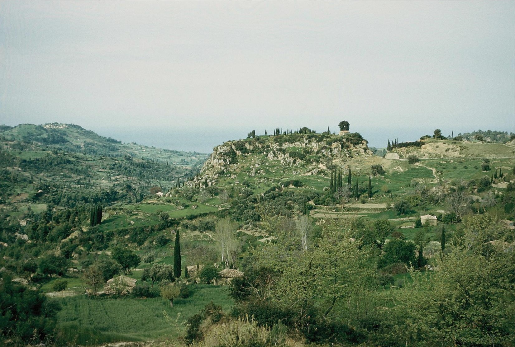
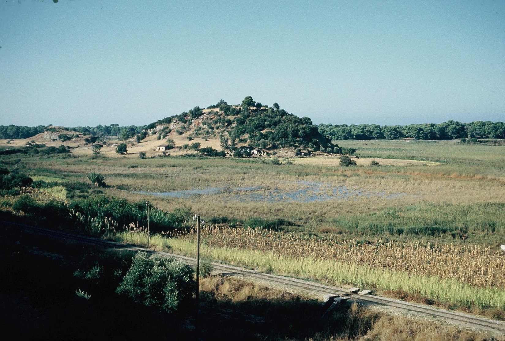
Plate 3B. Kato Samikon: Klidhi (? Arene) from Northeast
Achaea has an abundant water supply; there are many springs on the slopes of its two great mountain chains, Mt. Erymanthos and Mt. Panachaikon. The coastal plains on the north, from Aigion to Patras, are especially fertile, and there are patches of productive land in the interior, between the two mountain chains. The distribution of the Mycenaean settlements is in accord with this land pattern. There are clusters of sites around Aigion (see Chapter 4) and Patras, with large numbers of chamber tombs. There are also several sites along the interior route, between the two mountains, from Patras to Kalavryta, including important tombs at Chalandritsa, Katarraktis and Kato Goumenitsa. In the Patras vicinity are the outstanding sites of Klauss (the small tholos tomb there is LH IIB/IIIA1, cf. Mountjoy 1999, 401) and Kallithea. At both these sites the Mycenaean pottery ranges from LH IIB to LH IIIC Late, and at Aigion from LH II to LH IIIC Late. Early Mycenaean (LH I-II) is scarce in Achaea, but several sites have LH IIIA1, and most sites have LH IIIA2 and LH IIIB. A few sites, especially in the interior, were not founded before LH IIIB. A particular phenomenon is the number of LH IIIC ‘Warrior Graves’ in Achaea (Deger-Jalkotzy 2006, Eder 2006, 557-559). Most of these are LH IIIC Middle, but the most famous, at Kallithea, is LH IIIC Late. Most of these ‘Warrior Graves’ are in the Patras vicinity (Deger-Jalkotzy 2006, fig. 9.2). Achaea certainly maintained its prosperity up to the end of LH IIIC.
In Elis most of the Mycenaean settlements discovered are in the Olympia area, especially the chamber tombs at modern Olympia, Pisa, Miraka and Kladeos. Only a few sherds were found in the area of the Altis at Olympia and LH I/IIA from the north wall of the later stadium and a LH IIIC Late sherd from the Pelopion (Mountjoy 1999, 368). The main Mycenaean settlement at Olympia may have been at Drouva, the low hill to west of the sanctuary (Mountjoy ibid.). Most of the Mycenaean sites in eastern Elis are chamber tomb cemeteries explored in ‘rescue’ excavations. In the western foothills of Mt. Erymanthos important cemeteries have been discovered at Agrapidochori (LH IIIA1 to LH IIIC Early), Prostovitsa and Ayia Triada, a site in the upper Peneios valley (LH IIIA1 to LH IIIC Late; Mountjoy 1999, 366 and Eder 2006, 555-556). But neither eastern Elis nor the central plain have been systematically searched; it is likely that many more Mycenaean settlements existed here. Along the west coast of Elis, Mycenaean sites have been found at the main harbours. For Teichos Dymaion (in the later Achaea) and Chlemoutsi (near Kyllene, the later port of Elis) see Chapter 4 s.v. Myrsinos and Hyrmine respectively. Ancient Pheia, the southernmost port in Elis, was occupied throughout the Mycenaean period, and into the Early Iron Age (SubMycenaean and Protogeometric, cf. GAC, E 42; MG, G1).
To south of the Alpheios river there is a cluster of Mycenaean sites from Epitalion to Makrysia, opposite the sites around Olympia to north of the river (see MG, map D and for Epitalion see Chapter 4 s.v. Thryon). Further down the coast is Kato Samikon: Klidhi with its LH I-IIIB tumuli (see Chapter 4 s.v. Arene). Further south, Kakovatos was important mainly in LH IIA, the time of its megaron and tholos tombs (Mountjoy 1999, 369), although occupation continued here at least up to the end of LH IIIA [latest reports of the survey by Eder in AR 56 (2009-2010) 51-52 and AR 57 (2010-2011) 24].
THE IONIAN ISLANDS
Selected references:
Wardle 1972 = K. Wardle, “The Greek Bronze Age West of the Pindus” (Ph.D. thesis, London); GAC, 183-194 (E 9 to E 40); MG, 154-159 (G 7 to G 33); Waterhouse 1996 = H. Waterhouse “From Ithaca to the Odyssey”, BSA 91 (1996) 301-317; Mountjoy 1999, 443-444, 469, 479; MFHDC, 102, 106-107; Eder 2006, esp. 557-564.
A fuller discussion of the relevant sites in these islands is given in Chapter 4, s.v. THE KINGDOM OF MEGES and THE KINGDOM OF ODYSSEUS. Early Mycenaean pottery, LH I-IIIA1, is rare in Ithaca (LH I/II in the Polis cave) and in Kephallenia (Kontogenada: Oikopeda) but is present at four of the six Mycenaean sites on Zakynthos. The earliest Mycenaean pottery at most of the sites in the Ionian Islands is LH IIIA2, and their cemeteries continue in use into LH IIIC, and in LH IIIC Late in some cases (Metaxata and Lakkithra on Kephallenia). Eder (loc. cit.) discusses the evidence for Achaean participation in trade with the west (the Adriatic and Italy) in LH IIIC, as shown in particular by bronze and other metal artefacts especially in the LH IIIC ‘Warrior Graves’ (cf. Deger-Jalkotzy 2006). The largest finds of amber in Greece (presumably from Italy) come from the LH IIIC chamber tombs on Kephallenia (Eder 2006, 558 with refs.). A main route for this trade would appear to be the strait between Kephallenia and Ithaca, where stop-over harbours were available at Tzannata (and probably also at Same) on Kephallenia and at Aetos and Polis on Ithaca. Waterhouse (loc. cit.) outlines the later increase in this trade in the Protogeometric and Geometric periods and the role played by Ithaca as an intermediary.
There are still large gaps in the exploration of the Ionian islands. Except for Dörpfeld’s excavations in the Nidri plain, Leukas has received little attention. In Ithaca excavation and survey have concentrated on Aetos and the Polis area (where the British School under Morgan is conducting an intensive survey), but other villages in the north have not yet been explored. Excavations in Kephallenia (mainly by Marinatos and mainly of Mycenaean cemeteries) have been mostly in the south. Exploration of northern Kephallenia has only recently begun; and most of the interior of Zakynthos has not been investigated.
AETOLIA, ACARNANIA, THESPROTIA AND EPIRUS
Selected references:
Woodhouse 1897 = W.J. Woodhouse, Aetolia. Its Geography, Topography and Antiquities (Oxford); Wardle 1972 = K. Wardle, “The Greek Bronze Age West of the Pindus” (Ph.D. thesis, London); GAC, 102-108 (B 98 to B 103), 181-183 (E 1 to E 8), 299-303 (K 1 to K 11); MG, 96-97 (D 71 to D 76), 159-160 (G 34 to G 41), 175-178 (K 1 to K 11); MFHDC, 102-106; Mountjoy 1999; Eder 2006, esp. 559-560.
In southern Aetolia Mycenaean culture was firmly established at all the major centres, Chalkis, Kalydon and Ayios Ilias (? Olenos), which are discussed in Chapter 4 (cf. Mountjoy 1999, 798). The earliest Mycenaean in southern Aetolia is the LH I from Chalkis (Kato Vasiliki: Ayia Triada). LH IIB-IIIB pottery was found in a chamber tomb at Ayios Ilias, and LH IIIC from the dromoi of two of the Ayios Ilias tholos tombs [AD 47 (1992) B 125]. LH III surface sherds were found at Stratos, to northwest of Agrinion (Mountjoy loc. cit. with refs. to AA 1971 to 1973). The three hills of the Stratos site have been surveyed by the German Institute (refs. in AR vols. 38 to 46). Eastern Anatolia has received little attention. But a Mycenaean chamber tomb was discovered by chance at Lithovouni (MG, D 76) near the south shore of Lake Trichonis, and a Mycenaean settlement at Thermon to east of the lake. (MG, D 75). The settlement suffered a destruction in LH IIA. Subsequently, the apsidal Megaron A was built, most probably in LH III, when the pottery was most plentiful. The recent work by I. Papapostolou has been concentrated on Megaron B, which preceded the Temple of Apollo. The excavation of Megaron B was completed in 2001 (cf. Papapostolou 2008, and preliminary reports in Ergon for 1987 onwards, esp. 1999 to 2001, 2003 and 2006, cf. reports in AR vols. 43 to 47, 49, 50 and 53). Papapostolou concluded that Megaron B had been inserted into a LH IIIC pottery deposit and was probably constructed in the 11th century B.C. It remained in use until c. 800 B.C. (Ergon 2003, 50-51).
To north of Aetolia Mycenaean pottery is outnumbered by the local Late Bronze Age wares. In Thesprotia the Finnish survey has not discovered much new evidence for Late Bronze
Age Settlement (preliminary reports in AR vols. 53 to 55). LH III sherds were found long ago at Palairos: Kekropoula (MG, G 41) to south of the Gulf of Arta; and further east along the south shore of the Gulf a tholos tomb was discovered at Loutraki: Amparia c. 8 km west of Amphilochia [AD 48 (1988), cf. AR 41 (1994-1995) 19].
The evidence strongly suggests that in Thesprotia Mycenaean material culture was conveyed by sea. The tholos tomb at Parga (MG, K 2), with pottery mainly LH IIIA2-B, is only a kilometre inland. The fortified site of Mesopotamos: Xylokastro (MG, K 1, discussed below in Chapter 4) is at the inner end of the Bay of the Acheron river. The Mycenaean pottery (LH IIIB and probably some LH IIIC) on this site is far less than the local Late Bronze Age wares. At Dodona in Epirus there is even less Mycenaean (Chapter 4). Some LH III was found on a small Late Bronze Age settlement at Kastritsa at the southeast end of Lake Ioannina. Elsewhere in Epirus Mycenaean objects, mainly weapons, have been found in Late Bronze Age tombs (MG, K 6 to K 11). The occurrence of Type F swords in some of the tombs suggests a LH IIIC date. In the recently discovered cemetery at Liatovouni, near the border with Albania, the earliest grave contained a ‘Warrior Burial’ with a Type F sword and a sword of Nave II type C [AD 49 (1994) 367-370, cf. AR 46 (1999-2000) 66-67]. Most Type F swords are from western and central Greece and the Ionian Islands, and most of those found in Epirus seem to have been produced in local workshops. Eder discusses the evidence provided by the swords for a trade route to Albania and thence to southern Italy (Eder 2006, 559-560 with refs.).
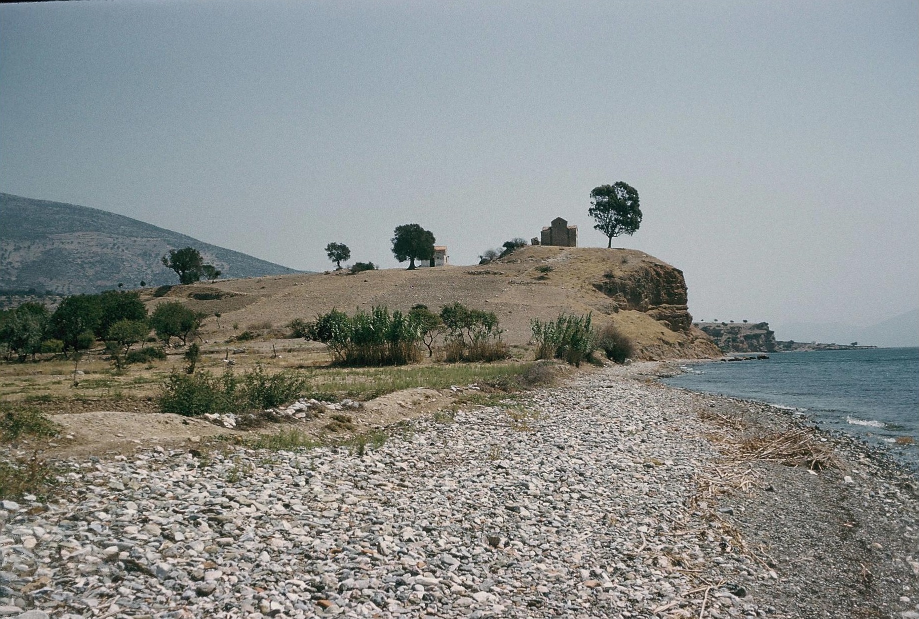
Plate 7A. Mesopotamos: Xylokastro (Ancient Ephyra) from South.
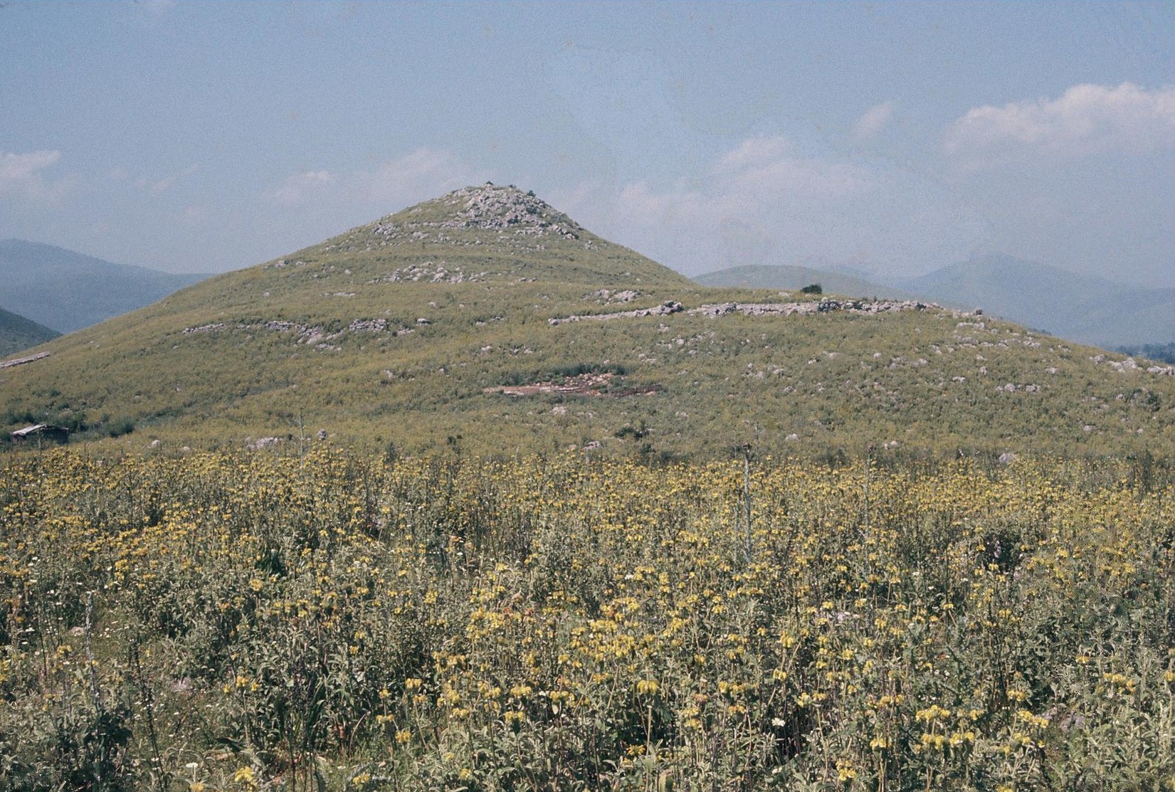
Plate 7B. Xylokastro. Outer Enceine, Southwest side.
ATTICA AND SALAMIS
Selected references:
Iakovidis 1962 = S. Iakovidis, He Mykenaike Akropolis ton Athenon (Athens 1962); Pantelidou 1975 = A.A. Pantelidou, Ai Proistorikai Athinai (Athens); GAC, 199-221 (F 1 to F 57); MG, 41-51 (B 11 to B 44); Mountjoy 1995 = P.A. Mountjoy, Mycenaean Athens (Jonsered); MFHDC, 64-70; Lemos 2006 = I.S. Lemos, “Athens and Lefkandi; a tale of two sites”, in S. Deger-Jakotzy and I.S. Lemos eds., Ancient Greece from the Mycenaean Palaces to the Age of Homer (Edinburgh 2009), 505-530.
Plate 4A. Pikernis: Gourtsouli (‘Old Mantinea’) from South.
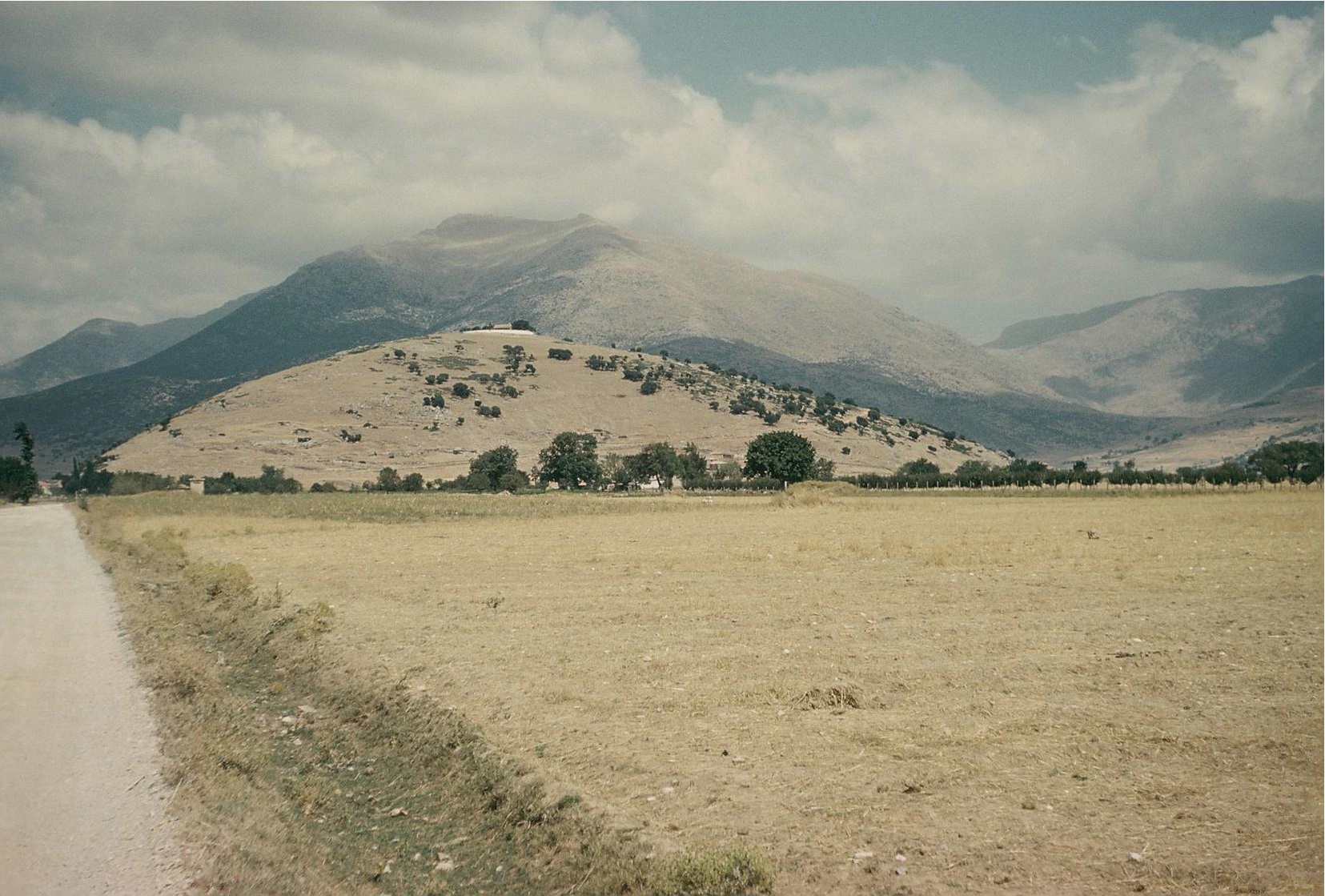
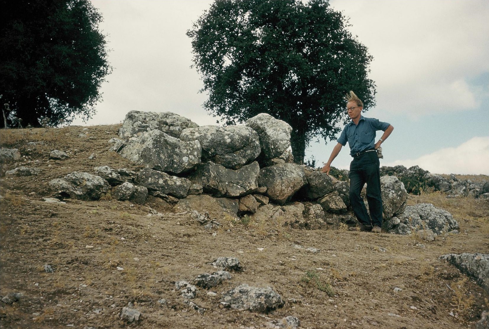
Plate 4B. Gourtsouli. Cyclopean Wall on Southeast, with John Lazenby.
Attica is separated by Mt. Parnes from the rest of central Greece, and the major plains of Attica are separated from each other by the mountain ranges of Mt. Hymettos, Mt. Pendeli and Mt. Aigaleos. The Athens plain was obviously important, but the best land was to east of Athens, especially in the Mesogaia beyond Mt. Hymettos and the plain of Marathon to north of Mt. Pendeli. There were many prehistoric settlements in eastern Attica, particularly along the west and southwest coasts.
In the earliest Mycenaean periods, LH I and LH IIA, there were already several separate communities in Attica, before the development of Athens as the major centre. These included Ayios Kosmas, Eleusis, Varkiza, Thorikos, Brauron, Raphina, Marathon, Aphidna and Vari: Kiapha Thiti. Of special importance are Thorikos with its LH IIA tholos tombs and Kiapha Thiti with its LH I-II fortifications (MFHDC, 66-67). By LH IIIA1 Athens was already flourishing; by LH IIIB it had probably become the major centre of Attica (cf. Lemos 2006, 506-509). The Cyclopean wall of its acropolis was apparently constructed at a time late in the LH IIIB period. In the LH IIIA2 period there had been a great increase in the number of settlements in Attica. Some may have remained independent (i.e. not under the administration of Athens) especially Marathon and Menidi (with its LH IIIB tholos tomb). The important LH IIIB settlement at Kanakia on the island of Salamis is discussed in Chapter 4 below.
In the post-palatial LH IIIC period the most prominent site in Attica was Perati, where the burials in most of its 219 tombs were LH IIIC (Iakovidis 1969). Perati had widespread connections not only with other Greek mainland and island sites but also with Egypt and the Levant. Two of its tombs have been recognized as ‘warrior burials’ (Deger-Jalkotzy 2006, 154-157). In LH IIIC Early occupation continued on the north slope of the Athens acropolis and elsewhere in the vicinity. Activity continued around the acropolis from LH IIIC Late to Early Protogeometric, apparently without a break. A large number of Sub-Mycenaean and Protogeometric graves have been found in many areas around the acropolis (Lemos 2006, 511-517).
BOEOTIA, PHOCIS, EASTERN LOCRIS AND EUBOEA
Beyond Attica the rest of Central Greece extends from eastern Boeotia west of Mt. Parnes to the Spercheios valley on the west. The main line of communication is from the plain of Thebes past the south side of Lake Kopais and up the Kephissos valley. To south of this route the mountain chains of Mt. Helikon and Mt. Parnassos separate the interior from the south coast on the Corinthian Gulf. On the north a hill chain stretching east from Mt. Oeta separates the Kephissos valley from the coastal plains of Eastern Locris. The other main communication route was the sea channel between the mainland and the island of Euboea.
BOEOTIA
Selected references:
GAC, 221-224 (F 57 to F 67), 235-253 (G 1 to G 45); MG, 51-53 (B 45 to B 55), 59-76 (C 1 to C 44); Mountjoy 1983 (Orchomenos V); Fossey 1988 = J.M. Fossey, Topography and Population of Ancient Boeotia (Ares, Chicago); Shelmerdine 1997, 550-551, 553-554, 563-56; Mountjoy 1999, 640-643; MFHDC, 73-90, 162-164, 185-209.
Surveys (cf. Shelmerdine 1997, 553-554): Cambridge/Bradford Boeotian Expedition.
Stanford Skourta Plain Project.
Eastern Boeotia Archaeological Project (reports in Mouseion 8 (2008), 9 (2009) and 12 (2012).
Linear B (Thebes):
Melena and Olivier 1991 (TITHEMY); Aravantinos et al. 1999 (Floreant Studia Mycenaea I, 45-87; Aravantinos et al. 2001 (Thebes. Fouilles de la Cadmée I (Pisa-Roma).
Only a few sites in Boeotia are known to have been occupied in the early Mycenaean periods, LH I to LH IIIA1; but in LH IIIA2 there was a great increase in population. By this time Thebes and Orchomenos had become the two major powers in Boeotia. The successful draining of Lake Kopais, protected by fortified settlements around the lake, assured the prosperity of Orchomenos in the LH IIIA2 and LH IIIB periods, up to the time of the destruction of Gla. But there is no reason to suppose that Orchomenos controlled any territory in Boeotia beyond the shores of the lake. The supremacy of Thebes in the rest of Boeotia is now amply evidenced by the Linear B tablets found in Thebes, especially the 250 + from the 1993-1995 excavations.
The Thebes tablets, like many of those from Knossos and Pylos, are mainly concerned with agricultural produce and livestock, especially in connection with offerings to deities. Commodities listed include wheat and barley, olives, wine, wool and cloth. Animals listed are horse, mule, pig, dog, birds, geese and snakes. Various professions are identified: fullers, lyre-players, tanners, shepherds and inspectors of sacrifices. Some tablets deal with rations issued to men and women, particularly those engaged in the performance of religious ceremonies. Actual remains of cereals and figs were found in the excavations in Pelopidou Street, although there is no mention of figs in the texts themselves.
In the Thebes tablets the names of about 34 localities have been recognized (Aravantinos et al. 2001, 355-358), but few of their locations can be identified. Tablet TH Ft 140 names Thebes (te-qa-i) and four other places as possessing large quantities of wheat and olives. Two of the four places can be identified, Eutresis (e-u-te-re-u) and Eleon (e-re-o-ni). The context marks all the names as important centres. E-u-te-re-u is in fact listed as with twice the quantity of olive (presumably olive oil) as te-qa-i. Eutresis was a large fortified settlement on the route from Thebes to Kreusis (Livadostro), the main port on the south coast (MFHDC, 163-164). Eleon lies on the route from Thebes to the main harbours on the north coast, opposite Euboea (for further discussion of Eutresis and Eleon see Chapter 4). Kreusis is also claimed as identified on the tablets, as are several places to north of Thebes, namely Isos, Peteon, Hyle and Ptoion (Aravantinos et al. 2001, loc. cit.). Aravantinos (1999, 64-65) believed that Mt. Ptoion was already a place of worship in Mycenaean times. Two sites on the south coast of Euboea have also been identified (TITHEMY, 43, cf. Aravantinos et al. 1999 loc. cit.), Amarynthos (a-ma-ru-to) on TH Wu 38) and Karystos (ka-ru-to on TH Wu 55). Accordingly, it has been suggested that Thebes also controlled southern Euboea. But the commodity listed on the two inscriptions (sealings) is in both cases a pig, presumably destined for a ceremonial feast (cf. Palaima 2008). Amarynthos is also named as the recipient (a-ma-ru-to-de) of a consignment of wool (TH of 25, TITHEMY, 35).
In the Theban plain the only major Mycenaean centre was Thebes itself. Elsewhere in Boeotia the Mycenaean sites are widely distributed over the best land. The greatest concentrations are in the Tanagra district and along the coast to south of Chalkis, and around Lake Kopais. Most of the larger settlements are named in the Catalogue of the Ships in the Iliad, especially Aulis, Eleon, Eutresis, Thisbe, Orchomenos, Haliartos, Plataia and Anthedon (see Chapter 4).
PHOCIS, WESTERN LOCRIS AND DORIS
Selected references:
GAC, 102 (B 95 to B 97), 253-261 (G 46 to G 68); MG, 59, 76-80 (C 45 to C 63, 63A, 63B), 82 (C 73A and C 73B), 84 (appendix), 97 (D 77 and D 78), 212 (addenda); Fossey 1986 = J.M. Fossey, The Ancient Topography of Eastern Phokis (Amsterdam: Gieben); Kase et al. 1991 = E.W. Kase, C.J. Szelmer, N.C. Wilkie and P.W. Wallace eds., The Great Isthmus Corridor Route: Explorations of the Phokis-Doris Expedition, vol. 1 (University of Minnesota, Minneapolis); Mountjoy 1999, 741-743; MFHDC, 93-96, 165-166.
Plate 6A. Panopeus from North.
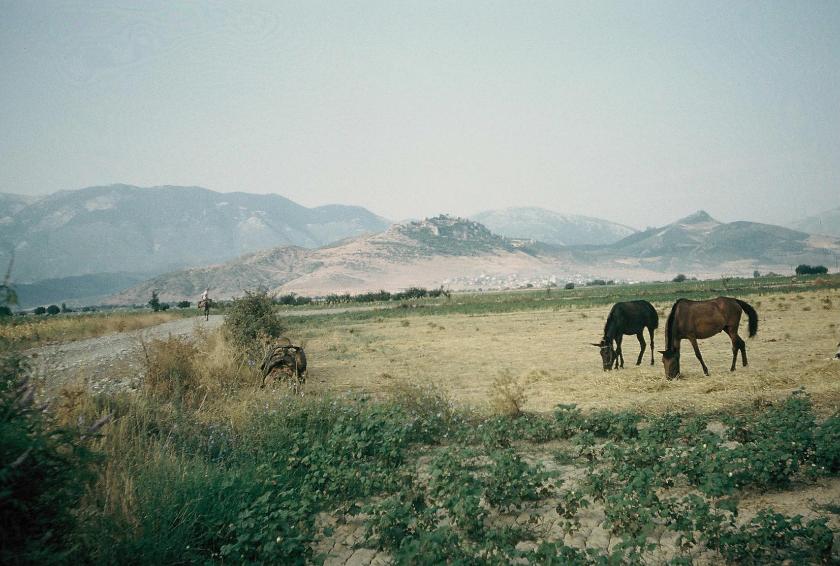
Plate 6B. Panopeus, Cyclopean Wall on Southeast, with John Lazenby.
Phocis is divided by Mt. Parnassos into two regions, the Kephissos valley, on the northeast and east of the mountain, and the coastal areas on the Corinthian Gulf to south of the mountain, namely the Gulf of Itea below Delphi and the Gulf of Antikyra further east. The only practible links between the regions are the pass from Delphi between Mt. Parnassos and Mt. Helikon and the pass from the Gulf of Itea via Amphissa to Doris and the upper northwest end of the Kephissos Valley.
The most important Mycenaean centre in the Kephissos valley was Ayios Vlasios: Ancient Panopeus, with its Cyclopean walls enclosing an area estimated as up to 112,000 m2 (see Chapter 4). To south of Mt. Parnassos was another Mycenaean centre, also enclosed by Cyclopean walls (MFHDC, 94-95 and Chapter 4 below), at Chryso: Ayios Yeoryios (Homeric Krisa) below Delphi. The Mycenaean settlement at Delphi was of only medium size, but other Mycenaean sites nearby, around Amphissa plain, include Kirrha: Magoula Xeropigado above the coast (recent excavations summarized in BCH and AR for the years 1998 to 2000 and 2009). Most recently and intact tholos tomb (LH III) was excavated at Amphissa [AR 61 (2014-2015) 18. To west of Amphissa, the territory of western Locris, along the north coast of the Corinthian Gulf, has not been thoroughly explored; but some Mycenaean settlements have been discovered here between Kirrha and Naupaktos (GAC, B 95 to 97; MG, D 77 to D 79), and Mycenaean sherds at Naupaktos itself [AD 54 (1999) B 272-274, cf. AR 52 (2005-2006) 53-54].
Mycenaean settlements are spread throughout the length of the Kephissos valley, from Chaeronea on the east to Lilaia at the head of the valley on the west. At two of these, Elateia: Alonaki and Amphiklia: Ayioi Anargyroi, there is strong evidence for LH IIIC and Sub-Mycenaean, and at Elateia proof of continuity into the Protogeometric period (Deger-Jalkotzky 1990).
The Phokis-Doris Expedition found Mycenaean sherds at almost all of the prehistoric sites they discovered. Those in their Central Sector are in the territory ascribed to the later Doris. These include Kastro Orias, Panayia, Oinochori and Khani Zagana (Kase et al. 1991 nos. 19, 21, 26 and 26 on figs. 3-4 and 4-1, pp. 41-55 and 67-69, cf. MG, 82 and 212). Early Mycenaean was found only at Dhema (no. 7) further north, and here together with mainly LH IIIA2 and LH IIIB and a few LH IIIC Early. The diagnostic pottery at the other sites is also mainly LH IIIA2 or LH IIIB. No pottery of LH IIIC Middle or LH IIIC is reported from their Central Sector. Sub-Mycenaean is rare throughout the territory surveyed by the Expedition, although some continuity into the Dark Age is claimed (Kase et al. 1991, 74).
EASTERN LOCRIS
Selected references:
Oldfather 1916 = W. Oldfather, “History and Topography of Lokris”, AJA 20, pp. 52-61, 154-172; Oldfather 1926 = W. Oldfather, RE xiii cols. 1135-1288 (Lokris); GAC, 262-263 (G 69 to G 74); MG, 80-81 (C 64 to C 69); Fossey 1990 = J.M. Fossey, The Ancient Topography of Opountian Lokris (Amsterdam, Gieben); Van de Moortel 2007; Dakoronia 1993 = F. Dakoronia, “Homeric towns in East Lokris: problems of identification”, Hesperia 62 (1993) 115-127; Dakoronia 2003, 2006, 2007, and reports in AD from 1977; Lemos 2011-2012 = I.S. Lemos, “Euboea and Central Greece in the Post-palatial and Early Greek Periods”, AR 58, 19-27 with bibliography; Crouwel 2006; Crielaard 2006 = J.P. Crielaard, “Basileis at Sea” in Deger-Jalkotzky and Lemos, eds. Ancient Greece from the Mycenaean Palaces to the Age of Homer, 271-297.
From 1977 the work of the ephorate of Lamia under F. Dakoronia has greatly increased our knowledge of ancient Eastern Locris, mainly in Opountian Locris where several Mycenaean sites have been discovered. Most are chamber tomb cemeteries, usually explored in ‘rescue’ excavations. Previously only one Mycenaean settlement had been found in the interior hill country of eastern Locris, at Agnandi (MG, C 69) where the tombs contained LH IIIA-C pottery and some attributed to SMyc or PG. The newly discovered cemeteries are (from east to west): Tragana, Livanates: Farnaka Rema, Megaplatanos: Palaiokastra, Zeli: Golemi, Kalapodi: Kokkalia, Medon and (to south of the mountains and not far north of Orchomenos) Exarchos: Smixi and Kolaka. Most of the pottery from these cemeteries is LH IIIA and LH IIIB; at Zeli: Golemi the range is LH IIIA1 to LH IIIC and at Livanates LH IIB to LH IIIC. The major settlements found are mainly on or near the coast. Some Mycenaean sherds were collected from the surface of ancient Halai in the east (MG, C 64), but the most important Mycenaean settlement was at Livanates: Pyrgos (Ancient Kynos), occupied throughout Mycenaean times (see Chapter 4 for this site and others in the vicinity, and also for the question of the location of ancient Opous). The excavations at Pyrgos/Kynos by Dakoronia from 1985 to 1995 revealed evidence of habitation here from EH to Byzantine (Dakoronia 2003, 2006 and 2007 and preliminary reports in AD and AR, cf. Lemos 2011-2012, 20-21). Particularly important are the LH IIIC levels, Early, Middle and Late, especially LH IIIC Middle, with workshops and a number of kraters depicting warriors on ships (cf. Crouwel 2006 and Crielaard 2006). After a destruction at the end of LH IIIC Late, there was reoccupation, but only on a modest scale. Another important coastal settlement near Tragana to the east, and between Pyrgos/Kynos and Halai, was that on Mitrou, now an islet but in antiquity probably on the mainland. Survey of the islet revealed evidence of habitation from Neolithic to Late Roman. Excavations from 2004 to 2008 under the direction of Van de Moortel and Zahou have confirmed the size and importance of the site in the EH and MH periods. The Mycenaean Building D began in LH I, with a second phase in LH I to LH IIIB. It also enclosed a rectangular built chamber tomb (LH I). After a widespread destruction in LH IIIA2 Early, there was some pottery from LH IIIA2 Middle to LH IIIB2 Late. In LH IIIC Middle Building B was erected above the funerary enclosure of Building D. It went out of use in LH IIIC Late. Subsequently, flimsy structures were built on top of Building B and to south of it, and Building A in Early Protogeometric. There were also many LH IIIC and Protogeometric intra-mural graves, mainly burials of children. The excavators infer continuity from LH IIIC Late to the Early Iron Age (Van de Moortel 2009, Van de Moortel and Zahou 2011).
At Kalapodi, in the hill country between the Kephissos valley and the coastal plain of Atalante, excavations by Felsch (1973 to 1982) and Niemeier (2004 to 2012) have revealed eight successive temples at this sanctuary, now recognized as that of Apollo at Abai. The temples attest continuity of cult from the LH IIIA period to the Archaic period [preliminary reports in AR vols. 22, 27-29 (Felsch) and vols. 51-57 (Niemeier) and summary by Lemos in AR 58 (2011-2012) 19-21]. The sanctuary was particularly active in LH IIIC Middle, when rich finds in Temple 3 include much fine pottery, especially pictorial (cf. Crielaard 2006 and Crouwel 2006). The LH IIIC and Early Iron Age finds at Kalapodi show links with Pyrgos/Kynos and Mitrou, with Lefkandi and Amarynthos in Euboea and with Eleon in Boeotia (cf. Van de Moortel 2007).
EUBOEA
Selected references:
Sackett et al. 1966 = L.H. Sackett, V. Hankey, R.J. Howell, T.W. Jacobsen and M.R. Popham, “Prehistoric Euboea: Contributions toward a Survey”, BSA 61, 33-112 (abbr. Euboea); GAC, 197-198, 224-234 (F 68 to F 100), 266-271 (G 84 to G 98); MG, 53-57 (B 56 to B 80), 82-84 (C 78 to C 85); Sampson 1980 = A. Sampson, in Archeion Euboikon Meleton (1980) 91-249; Mountjoy 1999, 692-694; Crielaard 2006; Crouwel 2006; Lemos, 2011-2012 (AR vol. 58) 19-27, esp. 22-25.
The island of Euboea stretches along the east coast of the mainland and from Attica to Thessaly, providing a protected channel, the Euripus, for sea communications between it and the mainland. Much of Euboea is mountainous, and most of the best agricultural land is in the small, but fertile, coastal plains, the best of which is the Lelantine Plain between ancient Chalkis and ancient Eretria. The survey by Sackett et al. (here abbreviated as Euboea) distinguishes and describes the five main regions of Euboea, and lists the prehistoric to medieval sites known in these up to c. 1965.
Since the publication of the Euboea survey and the summaries in GAC and MG, the evidence for the Mycenaean and Early Iron Age settlement in Euboea has been greatly increased, especially by the excavations at Lefkandi. The important new discoveries are summarized here, from northwest to southeast (see Euboea pl. 8, map). In the northwest further evidence has been provided by small excavations at Oreoi (Chapter 4 s.v. Histiaia) and at Lichas: Kastri (Euboea no. 2, cf. Chapter 4 s.v. Dion). At Loutra Aidipsou: Koumbi (Euboea no. 5) settlement in EH, MH and LH I-IIIA1 is confirmed by excavation [AD 52 (1997) B 413-416]. Mycenaean and Protogeometric habitation is evidenced at Kerinthos (Chapter 4).
In central Euboea excavations at Oxylithos: Viglatouri (Euboea no. 75 Palaiokastro) revealed rich prehistoric deposits and architectural remains of the EH, MH and Mycenaean periods, and Sub-Mycenaean tombs, below an extensive Geometric settlement around an oval building which contained Middle Geometric pottery (c. 750 B.C.). The site is of great importance in the early history of Kyme, and appears also to have been the main Mycenaean settlement in the vicinity [cf. MG, 56-57 (B 76)]. At Analipsis, near modern Kyme, two chamber tombs had many LH IIIC pots [AD 37 (1984) B 124-125]. In cleaning of the tholos tomb at Katakolou (Euboea no. 68) near Aliveri, Mycenaean, Geometric and Classical sherds were found. The most important Mycenaean settlements in central Euboea, however, are to west of Aliveri, along the coast to Chalkis [MG, 53-54 (B 56 to B 58) and 55-56 (B 69 to B 71)], at Amarynthos, Eretria and Lefkandi.
Amarynthos: Palaiochoria (alias Palaioekklesies)
N EH I-II MH LH I-IIIC PG G A C H R M (Plate 14B).
Euboea no 62; GAC, 229-330 (F 85); MG, 55-56 (B 70) and fig. 8 on p. 71; AAA 12 (1979) 3-14; AEM 28 (1988-89) 91-104; reports in AD 42, 44 and 45 and in AR vols. 36, 40, 42, 50, 53 and 54 Mountjoy 1999, 694; Blandin 2008 and 2011; Lemos 2011-2012, 24.
Plate 14B. Amarynthos: Palaiochoria from West.
Palaiochora (known locally as Palaioekklesies or Gerani) is a low hill above the shore, c. 2.5 km east of modern Amarynthos and at the eastern end of the Eretria plain. The top of the hill, with its three medieval chapels is c. 160 m northeast to southwest by c. 85 m. Prehistoric sherds were abundant here and on the upper slopes, especially the west and northwest. Fine MH and LH were prominent, including several decorated LH IIIC Middle (Euboea 64-66; Mountjoy 19999, 694). A small excavation by G. Parlama in 1978 produced EH II and EH III remains and MH and LH in disturbed levels (AAA loc. cit.). To west of the hill rescue excavations in 1987 revealed deposits containing many figurines of the late Archaic to Early Roman periods, assumed to be from a shrine [AD 40 (1987) B 213], and E. Sapouna-Sakellaraki in 1987 recovered more figurines in trial excavations, which documented occupation here from EH to Late Byzantine. The search for the shrine of Artemis Amarousia was resumed later by members of the Swiss School (AR vols. 50, 53 and 54). In 2006 MH structures were found at the west foot of the Palaioekklesies hill and a rich stratigraphy above, with LH III, Protogeometric, Sub-Protogeometric and Late Geometric sherds. In the 2007 trenches to west of the hill successive Geometric and Hellenistic walls were found. In a layer with architectural fragments above a 2nd century B.C. wall was a block with fragmentary inscription ]ΥΝΘ[. A monumental wall of the late 4th century B.C. may have belonged to the Artemision of Amarynthos [AR 54 (2007-208) 55-56 with plan of Palaioekklesies and surroundings, fig. 62].
Eretria (discussed in Chapter 4) was inhabited from at least the Early Helladic period onwards, perhaps continuously. The relative scarcity of Mycenaean finds here is, of course, due to the later activity. But there is enough evidence to suggest an important settlement in LH IIIA2 to LH IIIC Early. The Swiss excavations, however, have not shown that it was important in the later LH IIIC periods or in the Protogeometric period (Lemos 2011-2012, esp. 24 with refs.), when, by contrast, Lefkandi was flourishing. The floruit of Eretria began in Middle Geometric (c. 800 B.C.). The transition from the Late Bronze Age to the Early Iron Age is now fully documented at Lefkandi.
Lefkandi: Xeropolis, Toumba etc.
N EH II-III MH LH I-IIIC SMyc PG G C
Euboea nos. 48-50; GAC, 228 (F 81); MG, 55 (B 67); Popham and Sackett 1968 = M.R. Popham and L.H. Sackett eds., Excavations at Lefkandi, Euboea, 1964-66 (British School of Archaeology); Popham and Milburn 1971 = M.R. Popham and E. Milburn, “The Late Helladic IIIC pottery of Xeropolis (Lefkandi), a summary”, BSA 66, 333-349; Lemos 2006 = I.S. Lemos, “Athens and Lefkandi: A Tale of Two Sites”, in S. Deger-Jalkotzy and I.S. Lemos eds., Archaic Greece from the Mycenaean Palaces to the Age of Homer (Edinburgh), 505-530; Crielaard 2006; Lemos 2011-2012, esp. 22-24, preliminary reports in AR vols. 28 to 31 and 35 (Toumba and the Heroon) and AR vols. 50 to 56 (excavations at Xeropolis directed by Lemos).
Xeropolis is a large site, c. 500 m long and c. 120 m broad, forming a low promontory between two bays, of which the western at least would have provided a harbour. Above the EH and MH remains the buildings found were LH IIIC. There were few traces of the earlier Mycenaean periods, although surface sherds of all these had been gathered previously. The LH IIIC houses had been terraced back into LH IIIB levels, which were destroyed in the process. Three LH IIIC building phases were distinguished, roughly corresponding to LH IIIC Early Middle and Late. The houses were large, with ample storage space, and some had a second storey. The 1964 to 1966 excavations by Popham and Sackett, both at Xeropolis and in the Early Iron Age cemeteries to the west (on the outskirts of Lefkandi village) were followed by the 1981 to 1984 excavations at the Toumba cemetery and the discovery of the Protogeometric Heroon there (reports in AR vols. 28 to 31). In the excavations directed by Lemos from 2003 to 2009 a ‘megaron’ of LH IIIC Middle was discovered, and it is now thought that in LH IIIC Middle probably the entire site was occupied. These recent excavations securely established continuity at Xeropolis from LH IIIC Late through Sub-Mycenaean to Protogeometric, and there was also evidence of habitation in the Sub-Protogeometric and Late Geometric periods. The site was apparently abandoned after this, i.e. in c. 700 B.C.
The excavations at Lefkandi and at Mitrou, Kynos and Kalapodi in Eastern Locris have demonstrated that the Post-Palatial LH IIIC period, and LH IIIC Middle in particular, was a time of prosperity on both sides of the Euboean channel (cf. Crielaard 2006, Dakoronia 2003 and 2007, Van de Moortel and Zahou 2011, Kaiser et al. 2011 and Lemos 2011-2012).
In southern Euboea there are few traces of Mycenaean settlement. Mycenaean sherds were found at Cape Philagra on the north coast (Euboea no. 89) and a possibly LH IIIC sherd at Nea Styra (Euboea no. 88). It is, however, difficult to believe that the coastal plains of Styra and Karystos, and their harbours, were not used by the Mycenaeans (for Styra and Karystos see Chapter 4).
THESSALY
Selected references:
Wace and Thompson 1912 = A.J.B. Wace and M.S. Thompson, Prehistoric Thessaly (Cambridge).
Stählin 1924 = F. Stählin, Die Hellenische Thessalien (Stuttgart; repr.1967 Hakkert, Amsterdam).
Hunter 1953 = A. Hunter, The Bronze Age in Thessaly and its Environs, with Special Reference to Mycenaean Culture (B. Litt. thesis, Oxford).
French 1960 = D.H. and E.B. French, Prehistoric Sites in Thessaly (manuscript in the British School at Athens).
Feuer 1983 = B. Feuer, The Northern Mycenaean Border in Thessaly (BAR Int. Ser. 176).
GAC, 272-298 (H 1 to H 62, J 1 to J 15) and 18 (bibliography); MG, 161-174 (H 1 to H 58, J 1 to J 11 and appendices to Maps H and J); Mountjoy 1999, 819-832; Adrimi-Sismani 2007; Reports in AD from AD 28 (1973); reports in AR from AR 25 (1978-79), esp. in AR vols. 56, 57 and 58.
Most of the Mycenaean sites in Thessaly are included in Feuer’s list (Feuer 1983, 208-211 and map, fig. 1 on p. 23, numbered in accordance with French 1960). About 20 more sites have been added since, mainly from ‘rescue’ excavations by the Greek Archaeological Service, especially in the Volos district (reports in AD and AR). The main concentrations of Mycenaean population were around the Gulf of Pagasai on the east coast, and in the Larisa plain and the Enipeus valley in eastern Thessaly. In the western Thessalian plain fewer sites have been found.
The most important Mycenaean settlements were in the Volos district, where Linear B inscriptions have been found at the palace of Dimini and at Volos: Kastro Palaia (cf. Adrimi-Sismani 2007). These settlements were of distinctly urban character, apparently with administrative centres at both Dimini and Volos. The presence of LH I-IIA pottery in the Volos district and its virtual absence in the interior (Feuer 1983, 49), mark Volos as the channel by which Mycenaean culture spread inland into the Thessalian plains. Not far inland from Volos were the important sites of Velestino (ancient Pherai) and Stephanovikeion: Petra (see Chapter 4). The route from Volos to Larisa along the southwest side of Lake Karla (Boibe) was lined with smaller Mycenaean settlements (many of which were explored by D.H. and E.B. French, as recorded in Feuer 1983 (loc. cit.).
In the Larisa plain there were many Mycenaean settlements of small to medium size, and a few larger ones, such as Gremnos, Tatar and Argyropouli (for these see Chapter 4), Bounarbasi, Rhodia and Gonnoi (for these see Feuer 1983, 103-121). Most of the sites were on mounds (magoulas) with previous Neolithic and/or Bronze Age occupation. There are no indications that any of the Mycenaean settlements in the Larisa plain were of ‘higher order’ or likely to have been administrative centres.
In the Pharsala district, the Enipeus valley, there was a similar (although smaller) cluster of Mycenaean settlements, the largest of which, Ktouri Magoula, was only of moderate size (see Chapter 4). The Mycenaean pottery in this district is of the same good quality as that in the Larisa plain, although in both districts mainly locally produced and mainly LH IIIA2 and LH IIIB.
The western plain of Thessaly has not been as thoroughly explored as the Larisa and Pharsala districts. But some Mycenaean settlements have been discovered in the eastern part of the plain, mostly in the course of ‘rescue’ excavations. At Pyrgos-Kieriou (GAC, J 8-9; MG, J 5-6; MFHDC, 100) a Mycenaean settlement was found beneath the west part of the village, at the foot of the Ogla hill, the acropolis of ancient Arne-Kierion [reports in AD vols. 36, 50, 52 and 53, esp. AD 50 (1995) B 377-378 with plan; cf. AR vols. 36, 37, 47, 49 and 51 with refs.]. And at Palamas (GAC, J 10; MG, J 7) a wall was uncovered “that might belong to a fortification enclosure … associated with LH IIIB – LH IIIB2-C pottery” [AR 58 (2011-2012) 88-89 with photo fig. 143, citing AD 56-59 (2001-2004) B 575]. Mycenaean and Protogeometric finds were also made at Perino c. 6 km to the northwest [AD loc. cit.]. The Mycenaean tholos tomb at Georgikon: Kouphia Rachi (see Chapter 4) is a strong indication that further Mycenaean settlements await discovery in the vicinities of Karditsa and Sophades. At Philia, c. 8 km to south of Sophades, LH IIIB pottery and figurines were found together with offerings of the Protogeometric, Geometric, Archaic and later periods [AR 51 (2009-2010) 111 with refs.]; and in the hill country to south of the plain (and c. 24 km south of Sophades) the tholos tomb at Dranista, excavated in 1911 by Arvanitopoullos, now proves to be of the LH IIIA-B period [AR 57 (2010-2011) 78 with ref.]. It has been noted, however, that there were apparently no traces of prehistoric habitation on magoulas in the northwestern part of the western plain, and that there were few signs of ancient habitation in the plain between Trikala and Kalambaka (Hunter 1953, 21 and Feuer 1983, 125-127, cf. 179). Feuer (loc. cit.) suggested that parts of the plain in this northwest part may have been susceptible to flooding, or even actual marshland. It is also possible that parts of this territory were still forest or woodland.
In his attempt to define the Mycenaean border in Thessaly Feuer discussed various models proposed by others for defining frontiers and boundaries (Feuer 1983, 179-201). But the concept of any kind of boundary implies a limit, whereas some elements of Mycenaean culture were widely diffused throughout much of the Mediterranean and the Near East. There was obviously no real barrier between the Mycenaean ‘world’ and the world beyond it, and certainly no frontier as between nations or states. Feuer’s distinction between agriculturists and pastoralists is more appropriate for the situation in northern Thessaly. The interaction here between these two ways of life is well illustrated by Feuer’s discussion of the few sites in northern and western Thessaly, which were on the fringe of the more civilized plains of Thessaly and whose economy was based entirely on agriculture. Nevertheless in the far north, beyond Elasson, at Vouvala-Likoudi (MG, L 12) a straight-sided alabastron (LH IIIA or LH IIIB, Feuer 1983, 140) was obviously imported from the south, as were several Mycenaean vases in Central Macedonia, for instance. A fine contribution by Feuer was his partial publication of the finds from the 1953 excavation of the cist graves at Agrilia, (GAC, J 15; MG, J 11), a site deep within the mountainous district to north of the western plain of Thessaly (Feuer 1983, 131-140, figs. 68-79). Here the pottery (probably LH IIIC) is all of local production, and consists partly of crude imitations (especially the straight-sided alabastra) of Mycenaean, found together with weapons of Mycenaean type and rather coarse bronze bracelets and pins. At Exalophos (GAC, J 13; MG, J 10) at the foot of Mt. Pindos and on the western edge of the western plain, the pottery from two cist graves in a tumulus is also of local manufacture (Feuer 1983, 129-131, figs. 66-68). It is apparently LH IIIC Late (Mountjoy 1999, 821). The kylikes have the distinctive ‘champagne glass’ shape of the LH IIIC kylikes from Kephallinia (Desborough 1964 pl. 9b), although the Exalophos examples are of inferior quality.
The sites in Thessaly where LH I-IIA pottery has been found are almost all on or near the Gulf of Pagasai and mainly in the Volos district (cf. Feuer 1983, 49 and fig. 10); Mycenaean culture evidently reached Thessaly by sea. Only a few sites in the interior have LH IIB and LH IIIA1 (cf. Feuer 1983, fig. 11, and pottery in the MH tradition was still in use. LH IIIA2 and LH IIIB pottery, however, was ubiquitous, marking this as the time of floruit. After LH IIIC1, when Iolkos and Dimini were in decline, few sites have Mycenaean pottery, and some were evidently abandoned until a partial revival in the Protogeometric period.
Mycenaean burial practices in Thessaly also reflect the spread of Mycenaean acculturation via the Volos district into the interior (cf. Feuer 1983, 74-80). Large and well built tombs are mainly in the Volos district (at Kapakli, Kazanaki and Dimini), with the exception of Georgikon: Kouphia Rachi (see Chapter 4), with smaller tholos tombs at Pteleon and Marmariani. Chamber tombs are rare, with five at Mega Monasterion (GAC, H 16; MG, H 15) and others at Velestino (Chapter 4). Built tombs resembling chamber tombs in form, are found at a few sites, in the Pharsala district and elsewhere (Feuer 1983, 76-77 with refs.). But simple cist graves (often with only one burial) which had been the usual form of burial in MH, were still by far the most common in Late Bronze Age Thessaly.
MACEDONIA
Selected bibliography:
W.A. Heurtley, Prehistoric Macedonia (Cambridge 1939).
Desborough 1964, 139-146.
D.H. French, Index of Prehistoric Sites in Central Macedonia (circulated typescript 1967).
K.A. Wardle, “The Northern Frontier of Mycenaean Greece”, BICS 22 (1975) 206-212.
MG, 175, 178-184 (L 13 to L 51 and Appendix to Map L)
Reports on Macedonian Late Bronze Age sites (with refs.) in AR from 1975-76, especially the following:
Thessaloniki Toumba, AR vols. 43, 44, 51-53, 55-57.
Assiros Toumba, AR vols. 22, 24, 28, 29, 33-35.
Torone, AR vols. 36, 37, 49.
Most of the Late Bronze Age sites in Macedonia where Mycenaean pottery and local imitations have been found, are in Central Macedonia, particularly in the vicinity of Thessaloniki (Salonica). Most of the LB settlements were on mound sites, and most of the Mycenaean imported pottery is LH IIIB and LH IIIC (with LH IIIA2 at a few sites). The Mycenaean are always outnumbered by the local LB wares, and LH I-II pottery is scarce. But a LH II sherd was found at Thesaloniki Toumba [AR 55 (2008-2009) 61-63] and about 20 LH I-II sherds at Torone [AR vols. 36 and 37]. At Vardarophtsa (MG, L 45) Heurtley uncovered a stratified sequence from LH IIIB to Geometric, and Wardle recorded 9 architectural phases, from c. 1300 B.C. to c. 800 B.C. at Assiros Toumba. Continuity from the Late Bronze Age to the Early Iron Age is also seen at Torone on the Chalcidice peninsula, and probably also at Sedes (L 19) and Gona (L 20) and several other Macedonian sites. Exploration, however, has not been systematic. The site survey by D.H. French (1967) was concentrated on the central Thessaloniki region, especially the Axios and Galliko river valleys. In western Macedonia sites with Mycenaean pottery have now been discovered, mainly in the northern foothills of Mt. Olympos and in the ‘rescue’ survey in connection with the “barrage” on the Haliakmon river (reports in AR 33, 36, 39, 57 and 58).
THE NORTHERN SPORADES AND SKYROS
SKOPELOS
Cape Staphylos: LH IIA-III(A-B)
- Platon 1949; Hunter 1953; GAC, 346; MG, 185.
A rectangular built tomb was excavated on a hill near Cape Staphylos at the southeast tip of Skopelos. It contained mainly LH IIB-IIIA1 vases and one or two LH IIA, together with bronzes, a gold sword-hilt and a gold headband (Hunter 1953, 183, 198, 215 and Cat. Nos. 207 and 208, cf. GAC loc. cit.). LH II and LH III sherds and remains of buildings were found nearby.
SKYROS
Kastro: N EB MH LH IIIA-C PG A C H
Hansen 1951; Hunter 1953; Archeion Euboikon Meleton 6 (1959) 313; AD 22 (1967) B 287; GAC, 347; MG, 185.
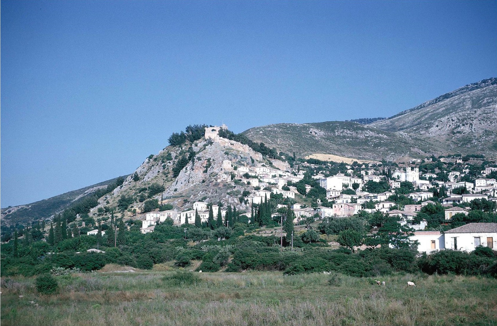
Plate 2A. Kardamyle. The Citadel from West.
Plate 2B. Kyparissia: Kastro from West
The hill of Kastro on the south side of the modern town of Skyros was the acropolis of ancient Skyros. Traces of a chamber tomb cemetery have been observed on the lower northeast slope of Kastro, which may be the source of several vases in the Skyros museum (Hunter 1953, Cat. Nos. 10-14, 64-66, 203, 211). These include a LH IIIC Stirrup jar, decorated with a ship [Vermeule 1972 fig. 34f and Sandars 1978, 130 Ill. 85 (photo)]. Groups of Protogeometric and Geometric cist tombs have been found in the plain north of Skyros. The Protogeometric, of local variety, is not early, so that continuity into the Iron Age is not proven.
Mpasales: LH IIIB-C
AR 40 (1993-199) 39; AD 48 (1993) 197-198, cf. AR 45 (1998-1999) 62.
At Mpasales on Skyros an unlooted chamber tomb was excavated. It had a double-pitched roof and eight niches in the wall of the chamber, used as ossuaries. Finds were 80 pots (one decorated with a fish), an iron dagger, stone and clay conuli, gold beads and gold hair ornaments.
THE NORTH EAST AEGEAN ISLANDS
THASOS
Theologos: Kastri, Kentra and Tsiganadika etc.: LN EB LH IIIB LH IIIC SMyc LB/E1A
AD 26 (1971) B 414-415; AD 27 (1977) B 520-525; AD 29 (1974) B 778-785; AD 30 (1975) B 278-283; AD 32 (1977) B 249-251; cf. reports in AR vols. 22, 24, 28, 30-32; Koukouli-Chrysanthaki 1992.
LEMNOS
Hephaistia: LH IIIA2-LH IIIC Late A C H M
Reports in AR vols. 46, 52, 53, 54 and 56.
LESBOS
Thermi: EB MB LB LH IIIA MG, 209
Antissa: LB LH III(A-B) LH IIIC? PG G A C H MG, 209
Lisvori: EB MB LB LH(III) MG, 209
Gera: Perama, Chalatses: LH IIIA1 – LH IIIB2 and “continuous habitation to Late Roman”; AD 54(1999) B 736-762; AD 55(2000) B 937; AR vols. 53 and 56
CHIOS
Emborio: N EB I-II EB III? MB LH IIIA? LH IIIB-C G A C H
GAC, 369-370; MG, 206; Hood 1982, 1986
Volissos: Lefkathia: LH III(A-) B A C
GAC, 371; MG, 206
Chios town: LH III(A-B) A C H R
GAC, 370; MG, 206; AR 35 (1988-89) 91
Kata Phana: LH IIIB-C SMyc G A C H M
GAC, 370; MG, 206; AR vols. 48, 49 and 54
PSARA
Archontiki: LH IIIA-B
GAC, 371; MG, 207; AR vols. 30, 31, 34, 35 and 51; AD 53 (1998) B 766
On Thasos the trial excavation at Kastri revealed a Late Bronze Age settlement, with pottery mainly of local character (including Troy VII B2 type and wares typical of Macedonia and Thrace) together with some local imitations of LH IIIB and LH IIIC pottery and a few actual imported LH IIIC sherds. The Late Bronze Age cemeteries at Kentria and Tsiganadika nearby produced pottery of LH IIIC, SubMyc and of the transition from LB to E1 A.
The Mycenaean settlement below the Hephaistia on the isthmus of Lemnos was occupied from LH IIIA1 to LH IIIC Late. Two successive building phases were recognized, the first LH IIIA1 – LH IIIA2. After the end of the LH period, the site remained unoccupied until the Archaic period. The preliminary reports in AR do not record the proportion of Mycenaean pottery or local imitations, but these were obviously sufficient to establish the dates of the successive LB building phases.
On Lesbos also it is difficult to assess the degree of ‘Mycenaeanization’. At Thermi Mycenaean sherds were very few, and it seems that the settlement was abandoned after LH IIIA (cf. Desborough 1964, 159-160). At Antissa Mycenaean imports and local imitations were also few; but at Gera there were several substantial Mycenaean buildings, including a potter’s workshop and kiln, and the Mycenaean pottery was said to be of excellent quality.
At Emborio on Chios the only LH IIIB pottery found was from a cist tomb on a hill opposite. But the LH IIIC settlement was of an undoubted Mycenaean character (Desborough 1964, 158-159, cf. Hood 1982), with three successive building periods. At Volissos several LH IIIB sherds were observed on the surface in 1960 (MG, 206). In lower levels at the sanctuary of Apollo Phanaios at Kato Phana LH IIIB-C animal figurines and decorated sherds may signify the beginnings of the cult established here, which continued into Late Roman times [AR 54 (2007-2008) 87].
Along the shore of the west coast of Psara island, to west of Chios, at Archontiki c. 3 km north of Psara village, a cemetery of 26 LH IIIA-B cist graves has been excavated, and remains of a small plundered tholos tomb were found (AD 58 loc. cit., cf. reports in AR cited).
THE CYCLADES AND SAMOS
Selected references (general):
Renfrew 1972 = C. Renfrew, The Emergence of Civilization: The Cyclades and the Aegean in the Third Millennium B.C. (London); GAC, 304-347; MG, 185-191, 205-206; MacGillivray and Barber 1984 = J.A. MacGillivray and R.N.L. Barber eds. The Prehistoric Cyclades (Edinburgh); Barber 1987 = R.L.N. Barber, The Cyclades in the Bronze Age (London); Davis 1992 = J.L. Davis ‘Review of Aegean Prehistory I. The Islands of the Aegean’, AJA 96 (1992) 699-756; Schallin 1993 = A.L. Schallin, Islands under Influence. The Cyclades in the Late Bronze Age and the Nature of Mycenaean Presence (SIMA 111, Jonsered, Åström); Mountjoy 1999; MFHDC, 108-115, 122.
Prehistoric habitation is attested at almost all of the islands. But some of the settlements in the Cyclades were occupied only in the Early Bronze Age periods I and II, represented by the Grotta-Pelos culture (roughly corresponding to EB 1) and the Keros-Syros culture (roughly corresponding to EB II). These settlements, although widespread, were mostly of small size. Few continued into the EB III period. The reasons for the abandonment of the others are not clear; but some good agricultural land may have been lost as a result of the rising sea level, and there may have been a change in the climate. Middle Bronze Age remains are equally rare in the Cyclades, although the MB settlements were often larger. Expansion began again in the Late Bronze Age, when Minoan influences are seen in the Cycladic LB I and LB II pottery, and in the frescoes at Akrotiri on Thera, although incorporated in the distinctive local Theran style. There is also some imported LM I and LH I-II pottery. By the LH IIIA1 period, however, Minoan influences were superseded by Mycenaean, especially at Kea: Ayia Irini and Melos: Phylakopi, where the fine ware, although mainly locally made, now imitates Mycenaean.
Since the publication of GAC and of MG, most reports of Late Bronze Age finds in the islands have been of continued exploration at the major sites, Kea: Ayia Irini, Melos: Phylakopi, Siphnos: Ayios Andreas, Paros: Koukounaries, Naxos: Grotta, and Thera: Akrotiri (all of these are discussed below). There are also some reports of discoveries on islands where no Late Bronze Age remains had been recorded previously. “Early Cycadic to Late Cycladic” finds are reported at Sarkos, a hill by the sea on Ios [AR 31 (1984-85) 52], a Mycenaean tholos tomb at Bryses on Mykonos was mentioned in the Greek Press [AR 43 (1996-97) 91], and at Kiparia on Pholegandros LH, G and C pottery was found [AD 29 (1973-74) B 872, cf. AR 28 (1981-82) 46].
Kea: Ayia Irini.
Selected references:
Preliminary reports by J.L. Caskey in Hesperia vols. 31, 33, 35, 40 and 41 and in AJA vols. 81 and 82; Cummer and Schofield 1984 (House A); Davis 1986 (Period V) Barber 1987 passim; Schallin 1993 passim, and with fuller references; MFHDC, 109 with refs.
The site of Ayia Irini is a low promontory, now partly submerged, in the sheltered Vourkari bay, on the northwest coast of Kea. The settlement here was already sizeable in the Middle Bronze Age, with some substantial houses, and late in MB it was surrounded by a fortification wall c. 2 m thick (discussed in MFHDC loc. cit.). The floruit of the settlement was in LB I-II, when connections with the mainland opposite are evidenced by an amount of LH I-II imported pottery almost equal to that of the imported LM IA and LM IB. The settlement was completely destroyed at a time late in LM IB. After this there were progressively fewer buildings, although the fortifications were partly rebuilt in LM IIIA1. The pottery from LH IIIA1 onwards is purely LH in type. The only material found subsequent to LH IIIA2 is from the “temple”, which was apparently rebuilt after the LH IB destruction and was in use until late in LH IIIC, when another destruction preserved whole pots very similar to the third LH IIIC phase of Lefkandi.
Melos: Phylakopi
Selected references:
Atkinson et al. 1904; BSA 17 (1910-11) 3-32; Renfrew 1982 = C. Renfrew, “Bronze Age Melos” in C. Renfrew and M. Wagstaff eds. An island polity. The archaeology of exploitation in Melos (Cambridge). Renfrew 1985 = C. Renfrew, The Archaeology of Cult. The Sanctuary of Phylakopi (BSA Suppl. vol. 18. London). Barber 1987 passim; Schallin 1993 passim; MFHDC, 110-111; C. Renfrew ed., with N. Brodic, C. Morris and C. Scarre, Excavations at Phylakopi in Melos 1974-77 (London, BSA 2007).
In LB I the settlement was already extensive, with a substantial building of villa type, including two pillar rooms, and elaborate fortifications. The pottery shows strong Minoan influence. In LH IIIA1 there was a building of ‘megaron’ type. Renfrew’s excavations (1974-1977) revealed two successive shrines, featuring miniature clay idols of unusual type. The west shrine, constructed in LH IIIA2 was superseded in LH IIIB1 by the adjoining east shrine, whose use continued into LH IIIC Middle. Part of a LH IIIB1 fortification wall was found alongside the shrines.
In 2003 a topographical and geophysical survey of the site was conducted by members of the British School in conjunction with the Greek Archaeological Service. The site was thoroughly cleaned and planned, and every existing wall was photographed. “The survey suggests that the edge of the site is very clear, which fits with previous theories that a sea inlet or harbour existed to the E and S of the site” [AR 50 (2003-2004) 71 with fig. 91 (plan)].
Siphnos: Ayios Andreas
Selected references:
Reports by B. Philippaki in AAA 6 (1973), in Ergon from 1975 to 1980 and in PAE 1975 to PAE 1980, and summaries in AR from AR 22 (1975-76) to AR 28 (1981-82); Barber 1987 passim; Schallin 1993 passim; Mountjoy 1999, 887; MFHDC, 112-113 with refs.; Ergon for 2013, 44-46 with fig. 36 (plan).
The Ayios Andreas hill is distant from all the coasts of the island, but the rocky summit was suitable for a fortress. The well constructed Mycenaean fortifications, investigated by Philippaki, enclosed its small area, c. 110 m north to south by c. 100 m. The defences consisted of an outer enceinte c. 1.20 m thick and an inner wall c. 3.50 thick with at least eight small rectangular towers. Its outer face has masonry resembling Cyclopean (MFHDC loc. cit.). The fortifications and the floors of two houses within the acropolis were dated to LH IIIB by Philippaki, on the basis of the associated pottery. But Mountjoy (loc. cit.) pointed out that some of the deep bowl sherds in the floor of Building H on the west side behind Tower B are LH IIIC Early (PAE 1976, 285 figs. 2 and 3, pl. 185 β-δ). As Mountjoy says, the fortifications may in fact have been constructed early in LH IIIC, like those of Paros: Koukounaries. Mountjoy also claims that some LH IIIC Late pottery was found in the excavations, suggesting some reoccupation. There was certainly a reoccupation in Late Geometric, when several rooms within the acropolis were constructed or renovated and the fortifications were repaired and modified; the much larger Tower A was apparently built at this time. There was also signs of occupation subsequently up to the Hellenistic period.
Paros: Koukounaries
Selected references:
Reports by D. Schilardi in PAE 1974 to PAE 1990 and in Ergon for 1974 to Ergon for 1991 and summaries in AR from AR 21 (1973-74) t AR 38 (1991-92); Schilardi 1984 = D. Schilardi, ‘The LH IIIC period at the Koukounaries acropolis, Paros’, in J.A. MacGillivray and R.N.L. Barber (eds.) The Prehistoric Cyclades. Contributions to a workshop on Cycladic Chronology (Edinburgh) 184-206 (and commentary by R.B. Koehl, ibid. 207-224; Barber 1987 passim; Schallin 1993 passim; Mountjoy 1999, 932; MFHDC, 113-114 with references to publications by Schilardi in 1979 and 1992.
Koukounaries is a hill of moderate size and height, and rather steep. It lies above the Oikonomos headland on the west side of the bay of Naoussa on the north coast of Paros (Schilardi 1984, fig. 2 site from southeast). Schilardi’s excavations, from 1973 to 1991 revealed a few traces of Neolithic activity and some Early Cycladic structural remains. The first major settlement, however, was in LH IIIC Early (perhaps beginning at the end of LH IIIB), when a substantial building complex was constructed on the level space, plateau c. 25 m by c. 25 m, on the top of the hill. This Mycenaean structure, which was overlaid by the remains of the later Geometric settlement, was only partly preserved. The main surviving units were the three basement storerooms, filled mainly with large pithoi and hundreds of other vessels. There are good indications, especially a large ivory fragment with relief decoration thought to have decorated a throne, that the rooms above (not preserved) had been important; and the storerooms themselves and their contents suggest that this was an administrative centre. The storerooms were set along the inner face of a fortification wall [Schilardi 1984 p. 185 fig. 1 (plan), cf. PAE 1980, 263-286 with fig. 2, Schilardi 1992, 630 pl. 3 and Barber 1987, p. 68 fig. 50 (view of inner face of the wall)]. The wall was placed east to west across the defile which gave access from the south to the upper plateau. It served not only as a fortification but also as a retaining wall for the building complex above. As Schilardi says, both the complex and the fortifications were part of a unified architectural plan. The wall was built in a manner resembling the Cyclopean fortress of the Argolid, with large granite blocks (quarried from the hill itself) many of which were roughly squared, and the characteristic small stones were used in the interstices. It was c. 1.65 m thick, preserved in parts up to c. 3 m in height; it was deduced that it must originally have been at least 8 m high. The blocks were laid lengthwise in two rows with a rubble fill between. At length of c. 16.50 m survives (Shilardi 1984, 187-188, cf. PAE 1981, 269-292). An opening between the wall and the rock on the western side appears to be the location of a gate to the upper plateau.
The ruined complex was discovered under a thick layer of debris and ash, indicating that the collapse of the building was due to a devastating fire. This occurred in LH IIIC Early (Schilardi 1984, 195 n. 4 and commentary by Koehl, ibid. 207-224), perhaps late in LH IIIC Early, since some LH IIIC Middle features are seen, comparable to the LH IIIC phase 2a at Lefkandi (Mountjoy 1999, 932). That the destruction was due to hostile action is strongly attested by the many animal bones in the debris (the animals would have been brought in for safety and/or food). With them were human skeletons, including that of a man aged about 35, and another of an infant. In a basement room was that of a woman whose skull was damaged by the violent blow that had killed her (PAE 1981, 269-292). The fact that she had to be buried in the basement presumably shows that the defenders had been forced to withdraw to the fortified plateau (PAE 1978, 195-210 and PAE 1979, 236-248). Preparations for the defence included bringing stones from the west shore of the island, to be used as missiles. These were found in the storerooms behind the wall (Barber 1987, p. 69 fig. 50) and on the slope of the ascent.
After the destruction in LH IIIC Early the site was apparently abandoned for a time. It was reoccupied in LH IIIC Middle when a wall on the west side (built partly with debris from the destruction) served both as a terrace wall and as a fortification (Ergon for 1990, 104-108, fig. 147, cf. Ergon for 1981, 56-57). In the SubMycenaean and Protogeometric periods there are signs of some habitation (of ‘squatter’ nature). There was a more extensive re-settlement in the Geometric and Archaic periods. A sanctuary of Athena on the southeast slope was in use from the Archaic period to the 4th century B.C.
Naxos: Grotta, with Chora and Palati and the cemeteries at Aplomata and Kamin
Selected references:
AA 1930, 132-134; GAC, 325-326 with refs.; MG, 188 with refs.; Ergon for 1978, 55-56; Ergon for 1980, 27-28; Ergon for 1983, 77-79; Ergon for 1984, 74-79; summaries in AR vols. 26, 27, 31, 32 and 41; Barber 1987 passim, esp. 15 and fig. 17 (paved streets at Grotta); Schallin 1983 passim; MFHDC, 115.
The site of Grotta at the northeast end of the Naxos harbour was occupied by a large settlement in EB I and II, but nothing certainly EB III was found, and there was little MB or LB I and II. In LH III, however, there was an extensive settlement not only at Grotta but also further inland on the lower northeast slopes of the Kastro hill, the centre of modern Naxos, and known also as the Chora. The importance of the Mycenaean settlement here is also demonstrated by the rich contents of its extensive LH III cemeteries at Aplomata c. 2.5 km to the northeast and Kamini c. 2 km to the east. The Grotta settlement flourished throughout the LH III period, particularly in LH IIIA2 to LH IIIB, including a building of ‘megaron’ type. It has been inferred that the LH IIIC settlement was smaller than that of LH IIIB. But the Aplomata and Kamini chamber tombs had some particularly rich LH IIIC contents.
In 1984, in excavations of the Metropolis plot at the northeast end of the town of Naxos, at the foot of the Kastro hill, part of a circuit wall of the Mycenaean settlement was found [PAE 1985, 165-167 especially the plan, pl. H = Schallin 1993, fig. 35, cf. Ergon for 1984, 74-79 with plan fig. 106 and view of the wall, fig. 108, cf. AR 32 (1985-86) 75-76]. The wall must have descended from the north side of the Kastro hill to the sea. The portion revealed by the excavation is c. 14.60 m long and c. 3.10 m thick, and is oriented from southeast to northeast. Its socle, c. 1.10 m high was composed of unworked stones, and the upper structure was of baked mud bricks, of which up to seven are preserved, to a height of c. 0.70 m (where not ruined by the Roman period foundations dug into them). Remains of mud bricks (from the collapse of part of the wall) extended c. 1.5 m behind its inner face. A group of small rooms was found built up against the inner face of the wall. These rooms belonged to LH IIIC houses on its alignment, and there are signs that the wall was later partially rebuilt at some time still within the LH IIIC period. Schallin (1993, 77) conjectured that the remains of a possible circuit wall mentioned by Welter [AA 1930, 134) may be part of this same LH IIIC wall, as may be the wall observed under water in an air photograph (PAE 1985, 144-161, pl. 2, cf. Barber 1987, 63, 226).
Thera: Akrotiri
From 1967 onwards excavations, studies and conservation at Akrotiri have been continuous. After the main excavations by S. Marinatos in 1967 to 1973 (Thera I-VII), the work was continued under the supervision of C. Doumas (preliminary reports in Ergon from 1975 to 2008 and in AR from AR 21 (1975-76) to AR 55 (2008-2009). Among the publications by Doumas are Thera. Pompeii of the Aegean (New York. Thames and Hudson 1983) and The wall-paintings of Thera (Athens 2nd Ed. 1999).
The settlement at Akrotiri and its destruction in LM IA by the catastrophic eruption of the Santorini (Thera) volcano had a profound effect throughout much of the Aegean. The main local consequence was the disappearance into the sea of most of the original island of Thera. The exact calendar date of the eruption has not yet been established. The latest evidence is from the C14 analysis of wood from an olive tree buried alive and well preserved in the volcanic ash (here tephra in a solidified state). The analysis gave a date range of 1627-1600 B.C. with a 95.4% probability [W. Friedrich (Aarhus), B. Kromer (Heidelberg), M. Friedrich (Stuttgart), J. Heinemeier, T. Pfeiffer (Aarhus) and S. Talamo (Heidelberg), report in Science 312: 5773 (2006) 548, cited in AR 55 (2008-2009) 75]. But the accuracy claimed is subject to question (see above under CHRONOLOGY for the critique by Wiener).
Samos: The Heraion, Myloi and Tigani:
The Heraion (prehistoric remains):
AM 72 (1957) 35-51; AM 74 (1959) 1-3; BCH 83 (1959) 727 fig. 8, 729; AR for 1959-60, 17; Samos I = V. Milojčić, Samos I. Die prähistorische Siedlung unter dem Heraion. Grabung 1953 und 1955 (Bonn 1961); AD 18 (1963) B 286; AD 19 (1964) B 403; AA (1964) 220-231; GAC, 368-369; MG, 226; MFHDC, 122.
Myloi:
AD 16 (1960) B 249; BCH 85 (1961) 839; GAC, 369; MG, 206.
Tigani: Kastro (Ancient Pythagoreion):
AM 60-61 (1935-6) 165-169, 190-196; Op Arch 6 (1950) 200; Huxley 1960, 21; AD 22 (1967) B 463; AAA 1 (1968) 168; GAC, 368; MG, 206.
Samos has not been systematically explored. Most of the work of the German Institute has been concentrated on the historic town of Samos and the Heraion. Much of the rest of the island is still covered in forest. The main ancient habitation was in the southeast coastal plain, which has most of the agricultural land on Samos. The Heraion, now c. 100 m from the shore, would have been at or near the mouth of the ancient river Imbrasos, at the edge of the southeast plain, and c. 7 km west of the port of Tigani. The Bronze Age settlement below the Heraion would have been a low mound, before the accumulation of alluvium deposits and man-made deposits associated with the later Heraion. The EB settlement was extensive and had fortifications (Samos I). This was followed by a fortified MB village. The LH III remains attest a substantial settlement, apparently also fortified, and including a small built chamber tomb, apparently LH IIIA, beneath a tumulus (Samos I, 25-26, 70, pl. 25). In the 1958-59 season of excavation E. Buschor found remains of a long Mycenaean wall, apparently part of a circuit wall and traces of late Mycenaean and earlier buildings. Only a brief summary of these finds was published [AM 74 loc. cit., cf. AR for 1959-60, 17 and BCH 83 (1959) loc. cit.]. From this summary, and from the site plan in AM loc. cit., it may be deduced that the section of probable circuit wall was c. 30 m in length, and the width of the wall c. 3 m (marked yellow on the plan). Only one course of stones, or possibly only foundations, may be discerned in the photograph (BCH 83 p. 727 fig. 8). Mycenaean sherds were found later in the area of the ‘Rhoikos altar’ and in the north area of the Heraion sanctuary, above the remains of the EB settlement (AA 1694, 226, cf. AR for 1963-64, 24).
At the west edge of the southeast plain and c. 3 km northwest of the Heraion a small circular chamber tomb (diameter 1.60 m) was discovered, containing LH IIIA pottery and some gold ornaments. This should indicate a separate Mycenaean settlement, but the site has not yet been discovered.
The Kastro of Tigani, a low hill overlooking the harbour, was inhabited from Late Neolithic onwards. The contents of a pit here included sherds of LM IA style and plain ware of MM III to LM I types together with local pottery (Op Arch 6 loc. cit.). LH III surface sherds were also noted (Huxley loc. cit.).
Samos may have played a part in the politics of western Anatolia in the times of the Hittite New Kingdom. As the island closest to Ephesos/Apasa, it may have been the first landfall of Uhhaziti, the ousted king of Arzawa, and his two sons, when fleeing from Mursili II (Mountjoy 1998, 87; Hope Simpson 2003, 214, 217). The Hittite text (in the Annals of Mursili II) concerning the campaign against Arzawa, refers to their place of refuge as “the islands” (gursauwananza, cf. Hawkins 1998, 14 n. 44 with refs., cf. Hope Simpson 217, nn. 73-74). The harbour of Tigani on Samos would also have been the first port of call north of Miletos for traffic along the western Anatolian coast.
Mountjoy includes both Samos and Chios as members of an “East Aegean Koine” (i.e. a shared pottery style) in LH IIIC Early and LH IIIC Middle. The other members of this Koine, as demonstrated by comparisons of pottery styles) are the Dodecanese islands (except Rhodes and Karpathos), especially Kos, Kalymnos and Astypalaia, and in western Anatolia Miletos and Müskebi. Mountjoy carefully distinguishes this Koine from the LH IIIC Aegean Koine between the Dodecanese, Miletos, Naxos and Perati proposed by Desborough (Desborough 1964, 228; Mountjoy 1998, 53-54). She points out that Desborough’s proposed Koine was based on general ceramic features rather than specific ones, and that much of the material now known was not available when he wrote his study (see further discussion below under THE DODECANESE IN THE LATE BRONZE AGE).
THE DODECANESE
Selected references:
Dodecanese I, II, III = R. Hope Simpson and J.F. Lazenby, “Notes from the Dodecanese”, BSA 57 (1962) 154-175 (I), 65 (1970) 44-77 (II), 68 (1973) 127-179 (III); GAC, 348-368; MG, 193-203; Mee 1982 = C.B. Mee, Rhodes in the Bronze Age (Warminster); Dietz and Papachristodoulou 1988 = S. Dietz and I. Papachristodoulou (eds.) Archaeology in the Dodecanese (Copenhagen); Benzi 1992 = M. Benzi, Rodi e la civiltà micenea (Rome); Davis 1992 = J.L. Davis, “Review of Aegean Prehistory I: the islands of the Aegean”, AJA 96 (1962) 669-756, esp. 743-752; Mountjoy 1998 = P.A. Mountjoy, “The East Aegean – West Anatolian interface in the Late Bronze Age: Mycenaeans and the Kingdom of Ahhiyawa”, Anatolian Studies 48 (1998) 33-67; Hope Simpson 2003 = R. Hope Simpson, ‘The Dodecanese and the Ahhiyawa question’, BSA 98 (2003) 203-237.
The exploration of the Dodecanese islands has not been systematic or comprehensive. Most of the excavations and surveys have been on the larger and more populous islands of Rhodes and Kos, and less attention has been paid to the smaller islands, with the exceptions of Karpathos and Kasos, where thorough survey by E.M. Melas has revealed several sites with Late Minoan and Mycenaean pottery, especially in the south of Karpathos. Late Bronze Age sites have been found on almost all of the inhabited islands. Rhodes, Kalymnos, Nisyros, Syme, Karpathos and Kasos are discussed in Chapter 4. Summaries of Late Bronze Age finds on other islands are as follows:
Patmos
Dodecanese II, 48-51; GAC, 367; MG, 202
On the hill of Kastelli, the acropolis of ancient Patmos above the harbour, surface sherds included MB and LB, and at least three of local varieties of LH.
Lipsoi
Dodecanese II, 51-52; GAC, 368; MG, 203
Some coarse ware on the Kastro hill may be MB or LB, but none of the sherds seen in 1967 were definitely LH.
Leros
Dodecanese II, 52-54; GAC, 367; MG, 202
The high acropolis of Kastro above the Ayia Marina harbour on the east coast was the east coast was the main citadel of Leros in historic and medieval times. On the upper northwest slopes outside the castle walls, the surface sherds included LH III(A-B) and one possibly LH IIIC Early. The ‘Cyclopean’ wall at Xerokambos above the south coast is probably late Classical or Hellenistic. Nothing prehistoric was found at the site.
Astypalaia
Dodecanese III, 157-169; GAC, 364-365; MG, 202-203; AD 26 (1971) B 550-551 and AAA 6 (1973) 124 (Armenochori); AD 30 (1975) B pl. 272 and AR 30 (1983-84) 70 and fig. 135 (Synkairos); Mountjoy 1998, esp. 39, 53; Mountjoy 1999, 1138.
At Armenochori: Patelles in the southwest of Astypalaia a pair of adjacent chamber tombs contained a range of Mycenaean pottery from LH IIIA2 Early to LH IIIC Early (Mountjoy refs.). Another two chamber tombs were found later at Synkairos, between Steno and Kato Marmari above the coast at the northwest end of the island, “on the flank of a very low eminence close to the sea” (AR loc. cit.). Bronze implements were found in Tomb 1, a spearhead, two spatulae and two chisels and in Tomb 2 a spearhead, fishhook, chisel and wire, and many lead sinkers. Tomb 2 contained several LH IIIA2 vases (AR 30 fig. 135, cf. Mountjoy 1999, 1138).
Telos
Dodecanese II, 63-68; AAA 13 (1980) 68-73; AD 51 (1996) B 693-697; W. Höpfner, Geschichte des Wohnen 1 (1999) 170-189, cf. AR 48 (2001-2002) 104 and fig. 153.
- Sampson reported a group of MM III to LM IA pottery, revealed by the cutting of an agricultural track, at Garipa, to south of Megalochorio and c. 1 km to north of the bay of Panormos on the south coast (AAA loc. cit.). The ancient town of Melos at Palaiochorio has been surveyed by W. Höfner, together with M. Philomenos of the 22nd EPCA. The date of one of the 30 houses defined by the survey was confirmed as the 6th century B.C., and there were indications that the hill had been occupied from Mycenaean times. The circuit walls, however, may be dated to the 4th or 3rd century B.C. There is epigraphical evidence that it was rebuilt after the 227/6 B.C. earthquake, when Telos came under Rhodian control.
Chalki
Dodecanese III, 156-157; BSA 83 (1988) 403-309 with fig. 6 on p. 288.
Melas (BSA vol. 83 loc. cit.) collected surface sherds of MM III to LM IA from a small area (c. 80 m by c. 60 m) c. 80 m north of the chapel of Ayioi Anargyroi c. 500 m north-northeast of the beach of the Potamos bay, on the south coast of Telos to west of the harbour town of modern Chalki.
Rhodes: Addenda
Since the publication of Dodecanese III and of GAC and MG, excavation at Trianda has been resumed, under the direction of T. Marketou (Chapter 4 s.v. Ialysos). The Danish survey in the south of the island has revealed further Mycenaean tombs and traces of Mycenaean settlements in the Kattavia vicinity [AR 41 (1994-1995, 60]. At Pilona E. Karantzali has excavated several impressive Mycenaean chamber tombs (Chapter 4 s.v. Lindos). When the Mycenaean cemetery of Trapezies, at Apollakia in southwest Rhodes, was cleared and fenced in 1992, sherds ranging from LH IIIA2 to LH IIIC were found, including a large LH IIIA2 alabastron [AD 48 (1993) B 543-554 and p. 1628]. At Gennadi, near the southeast coast, finds from a destroyed Mycenaean chamber tomb included LH IIIA2, LH IIIB and LH IIIC Early pottery [AD 53 (1998) B 956-957, cf. Dodecanese III, 149-150 s.v. Yenadhi: Ayia Sotira]
THE DODECANESE IN THE LATE BRONZE AGE
The main evidence, the pottery, comes mainly from tombs and the stratified deposits excavated at Trianda on Rhodes and the Seraglio on Kos. The history of the Dodecanese in the Late Bronze Age is closely connected with that of the coastal sites of western Anatolia opposite, especially as revealed by the excavations at Miletos. Mountjoy illustrates these interconnections and distinguishes the various influences, Minoan, Mycenaean and Anatolian, and the mixture of local wares with imitations of the Minoan and Mycenaean (Mountjoy 1998 and 1999).
In the MM III and LM I periods (corresponding to LB I-II) Minoan influences are seen in the pottery of Samos (Tigani and the Heraion), the Daskalio cave on Kalymnos, the Seraglio on Kos, Garipa on Telos and Trianda on Rhodes and at Miletos, Teichioussa, Iasos and Knidos on the west coast of Anatolia (Mountjoy 1998, 33, 51). These influences appear to be strong enough to suggest actual Minoan colonies in these places, especially at Trianda. They certainly seem to indicate a flourishing Minoan trade network. On Karpathos a LM IA rural dwelling has been excavated in the Afiartis district in the south of the island (reported in AD vols. 48 and 49, cf. AR vols. 45 and 46). The district has now been surveyed by Melas. In the intensive survey of 7.5 km2 most sites (21) were Minoan (LM IA), and only 7 were N or EB [AR 54 (2007-2008) 94]. This suggests exploitation by Minoan colonists, rather than only trade in this case.
Mycenaean influence in western Anatolia and the Dodecanese began in LH IIA (as seen at Troy in the Lower Town), when pottery of Mycenaean style was being locally produced at Miletos (Mountjoy 1998, 34 with nn. 24 and 25). On Rhodes and Kos Mycenaean influences increase markedly in LH IIIA1, and the first datable Mycenaean pottery on Lesbos and Kalymnos is of this period. In LH IIIA2 many more settlements were established in Rhodes and Kos, and ‘Mycenaeanisation’ is seen throughout the Dodecanese except Karpathos, where the Minoan style co-exists (as LM IIIA2) with the Mycenaean. In the Dodecanese, and in western Anatolia from Miletos to the south (Mountjoy’s ‘Lower Interface’) the pottery has a higher proportion of Mycenaean wares than native Anatolian, and in the cemeteries of Ialysos on Rhodes and of Eleona-Langada on Kos the LH IIIA2 and LH IIIB pottery is of mainland Greek style.
In LH IIIB the Anatolian influences disappear; and pottery production at Miletos after the LH IIIA2 destruction there is of Mycenaean type. A number of LH IIIB kylikes from Kos, Rhodes, Miletos and Iasos depict octopuses so similar that it has been suggested that they are from a single workshop (Mountjoy 1998, 43). In general, there seems to have been a unity, in material culture at least, throughout, the ‘Lower Interface’ in LH IIIA2-IIIB.
The Dodecanese islands seem to have escaped the adverse consequences of the disruptions which afflicted the Greek Mainland at the end of LH IIIB. In the cemeteries at Ialysos on Rhodes and at Eleona-Langada on Kos there was an increase in the number of burials in LH IIIC and an increase in wealthy burials; at Ialysos there were signs of contact with the east Mediterranean (scarabs, cylinder seals and Cypriot objects). There was, however, some depopulation in the rest of Rhodes; and the increase in burials at Ialysos may have been due to the arrival of refugees from the Greek mainland (Mee 1982, 90). Besides Rhodes and Kos, the Değirmentepe cemetery at Miletos, and the chamber tombs at Armenochori on Astypalaia and on Kalymnos were in use in LH IIIB and LH IIIC Early, and some graves at Müsbebi contained LH IIIC pottery.
Mountjoy outlines the development of the LH IIIB pottery into that of a homogeneous LH IIIC Early and Middle style which indicates an ‘East Aegean Koine’ at this time, consisting of the Dodecanese (except Rhodes and Karpathos whose styles are different), Müskebi, Iasos, Teihioussa, Miletos and Samos, and Chios in LH IIIC Middle (Mountjoy 1998, 53-63). Some features of this Koine style were developed from LH IIIB, and most of the shapes remain. A new development is the pictorial style in LH IIIC Middle, “very common in the settlement material from Kos” and also found at Miletos and on Kalymnos and Chios (Mountjoy 1998, 54). The evidence shows a degree of prosperity in LH IIIC Early and Middle comparable to that in some parts of Mainland Greece and the Cyclades.
SUMMARY
Although much progress has been made and many more scholars are now involved, there are still more questions than answers. The development of Mycenaean civilization from the preceding more mundane Middle Helladic culture is a phenomenon not yet satisfactorily explained. Even the largest Middle Helladic settlements were only of ‘village’ size, although the culture was fairly homogeneous throughout mainland Greece, up to Epirus on the west and including Thessaly in the east, and had relations with the islands of the Aegean and Crete and trade connections as far west as Thessaly [BCH Suppl. 52 (2010), the publication of the Mesohelladika conference in Athens]. The Mycenae Shaft Graves, however, exhibit riches far greater than any seen in the Middle Helladic period (Dickinson 1977 and 2010). These, together with the many fine bronze weapons in some of the graves, have naturally suggested elite warriors who had acquired territory by conquest or intimidation. Certainly some such explanation is needed for the rapid rise of Mycenae in the Argolid and of Pylos in Messenia (now vividly illustrated by the profusion of gold and silver objects, seal stones of Minoan origin, and bronze weapons found on the palace hill at Pylos in 2015). The pottery in the Mycenae shaft grave circles A and B shows strong connections with the Cyclades and Crete in the late MH and LH I to LH IIA periods.
It has been inferred that Knossos was already under Mycenaean control in LM II (DMG, 141, cf. Chadwick 1976, 48-60); and the Linear B tablets prove that it was ruled by Greek speakers in LM/LH IIIA2. By the end of LH IIIA2 Pylos had probably absorbed all of Messenia (Hope Simpson 2014, 38-40). Mycenae had already become the main power in the Argolid, and palatial centres were developing elsewhere on the Greek mainland, with similar bureaucracies, using Linear B, at Thebes and Dimini and probably at Orchomenos and at Ayios Vasilios in Laconia. In the LH IIIA2 period, if not before, Mycenaean civilization was diffused throughout southern and central Greece, as far north as Mt. Olympus in the east and Epirus on the west, and throughout the Cyclades and the Dodecanese. This, and the succeeding LH IIIB period, were times of prosperity, when the greatly increased numbers of settlements indicates a ‘population explosion’. The contents of the contemporary Mycenaean tombs, with their bronze weapons and vessels and objects of gold, silver and lead, show a considerable wealth. This was also the time of the great feats of Mycenaean Civil Engineering, not only the fortifications of the main citadels but also the canals and dykes of the Kopais and the highways in the Argolid (MFHDC, 148-159, 185-209). It now seems highly probable that Mycenae is to be identified as the Ahhiyawa of the Hittite documents of this period (cf. e.g. Hope Simpson 2003), when Mycenaeans were involved in the politics of western Anatolia (see Chapter 2) and Mycenaean trade with the eastern Mediterranean was its height.
At the end of LH IIIB2 the destructions at the major Mycenaean centres resulted in the complete collapse of the palatial administration and the abandonment of many of the settlements, especially in the Argolid and Messenia. The causes of this collapse remain obscure, but clearly included warfare (see Chapter 4 s.v. MYCENAEAN AND HOMERIC WARFARE). The following Postpalatial period was one of instability (Dickinson 2006, 58-79). Many of the deserted smaller settlements were not reoccupied until much later (in the Geometric or Archaic period). In LH IIIC Early there was survival or revival at some places. The rebuilding of the Tiryns town was on a large scale (Maran 2006) and there was continuity into LH IIIC at some sites on the shores of the Euboean channel, i.e. at Kynos and Mitrou in Locris and in Euboea at Lefkandi (whose floruit was in LH IIIC), together with the sanctuary at Kalapodi inland from the coast of Locris [these are briefly discussed in Lemos 2011-2012, with references to Evely 2006 (Lefkandi), Dakoronia 2007 (Kynos), Rutter 2007 (Mitrou), Van de Moortel 2007 and 2009 (Mitrou), Kaiser et al. 2011 (Kalapodi), cf. Crielaard 2006 and Eder 2006)]. Attention had also been drawn to some LH IIIC ‘Warrior Burials’, especially in Achaea (Deger-Jalkotzy 2006). These, however, are few in number, and in cemeteries where most other burials are not accompanied by rich goods. In addition to this modest revival in LH IIIC Middle at these sites in Central Greece, there are similar indications in the Dodecanese and western Anatolia of an ‘East Aegean Koine’ at this time (Mountjoy 1998, 53-63), when a LH IIIC Middle ‘Pictorial Style’ develops, similar to that on the sites in Central Greece (cf. Crielaard 2006). In LH IIIC Late, however, there are distinct signs of decline. Although continuity into the Early Iron Age is evidenced at several sites, there was not always a smooth transition.
RECOMMENDATIONS FOR FURTHER FIELDWORK
SURVEY
In the Peloponnese there are large gaps in the coverage of parts of Laconia (especially Kynouria and the Mani) and in western Arcadia and western Elis. Even in the Argolid and the Corinthia more is needed. In Central Greece more attention has been paid in recent years to Boeotia, East Locris and Euboea; but West Locris, eastern Aetolia and western and southern Thessaly have not yet been sufficiently explored, and much of Acarnania and Epirus has not yet been covered. There are also many gaps in the coverage of the Cycladic and other Aegean islands.
EXCAVATION
One priority is the exploration of the so-called ‘bridge’ at Ayios Yeoryios across the Chavos ravine to south of the Mycenae citadel. This ‘bridge’ is totally unlike the Cyclopean bridges of the Mycenaean highways in the Argolid. It is likely that it is, in reality, the dam of a reservoir, as Knauss has proposed. Examination of its inner (upstream) face would probably reveal mud facing of the kind encountered on the upstream face of the reservoir dam M9 on the island of Pseira off the north coast of Crete (see this chapter above for references). Such dams were probably common in Minoan Crete (traces were found of a similar dam at Gournia, and it seems likely that there was a reservoir dam near the ‘Venetian Aqueduct’ across a ravine to south of Knossos. The wealth of Mycenae was obviously based on its agricultural resources. And a surplus of olive oil is suggested by the House of the Oil Merchant and the Linear B tablets found there. A sufficient perennial water supply would be needed for the growth of the young olive trees for the first four years of their lives.
Broneer partly excavated the Cyclopean Wall which faces northeast across the Isthmus of Corinth (MFHDC, 123-140 for full discussion and references). But the excavations were mainly confined to the exposing of some of the surviving sections of the wall, which is only partly preserved (obviously many of its stones were robbed by the builder of the later Hexamilion wall) Broneer’s team did not examine the ground behind the wall; and the ‘robber trenches,’ caused by the removal of many of its stones, were not fully recognized in the excavation and were accordingly not isolated and dug separately. There were no excavations within the best preserved sections. Supplementary excavations are needed, since it is obvious that they only viable date for the construction of the wall is the Mycenaean period.
Unfortunately the dykes and canals in the Kopais have now been largely destroyed by modern agricultural machinery (MFHDC, 185-209, 226). There is now an urgent need here for ‘rescue’ excavations of the few remaining sections of these unique monuments.
