2 CMB 2 – Highway 44
Heidi Daxberger and Phillip Ruscica
GPS Coordinates ( 44°33’38.42″N, 77°58’2.16″W)
Parking: Shoulder of road next to outcrop.
The CMB 2 site is located along Highway 44 next to a rail crossing, about 15 km North West of Havelock (HW 7). As most of the outcrops in the region North of Peterborough the outcrop at this site was shaped by glacial ice flow, hence it has a quite low profile and smooth surface. The age for the rocks is given with a range from Neo- to Mesoproterozoic (Geologic Map of Southern Ontario, Ontario Geological Survey OGS).
Click here to open the Bedrock Geology legend on the OGS website
The Digital Outcrops
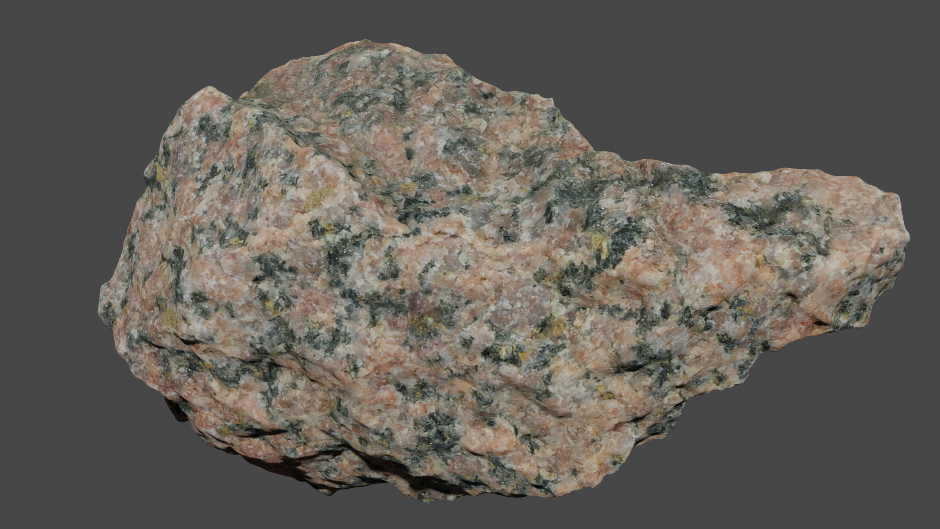
While weathered surfaces show a light pinkish (salmon) color see in this 3D model below, the rock is rather dark red with black on fresh surfaces which is shown in the second 3D model below. The rocks at this site are coarse grained. Vertical joints are visible that trend either NW-SE or ENE to WSW.
Site Images
Besides the in general homogeneous igneous texture, deformation fabrics are visible in some spots due to an alignment of the dark minerals. Furthermore, sets of joints and quartz-filled veins are present. Occasionally, thin felsic intrusions are found.
The Digital Hand Sample
The following rock is igneous rock sample 10, UTSC 3.
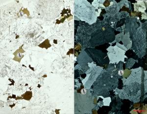
Description of Thin Sections
To view a thin section for this location click on the image below. Further you can investigate three hotspots on the thin section in higher magnification by clicking on the symbols.
Go to the next chapter: CMB 3 – Highway 28 Woodview!