Geographical Setting
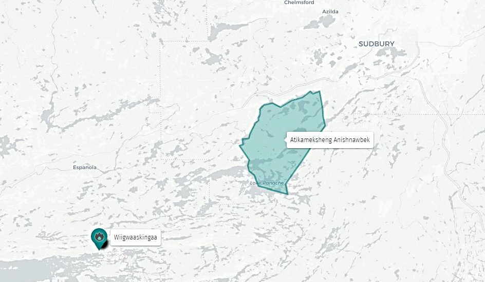
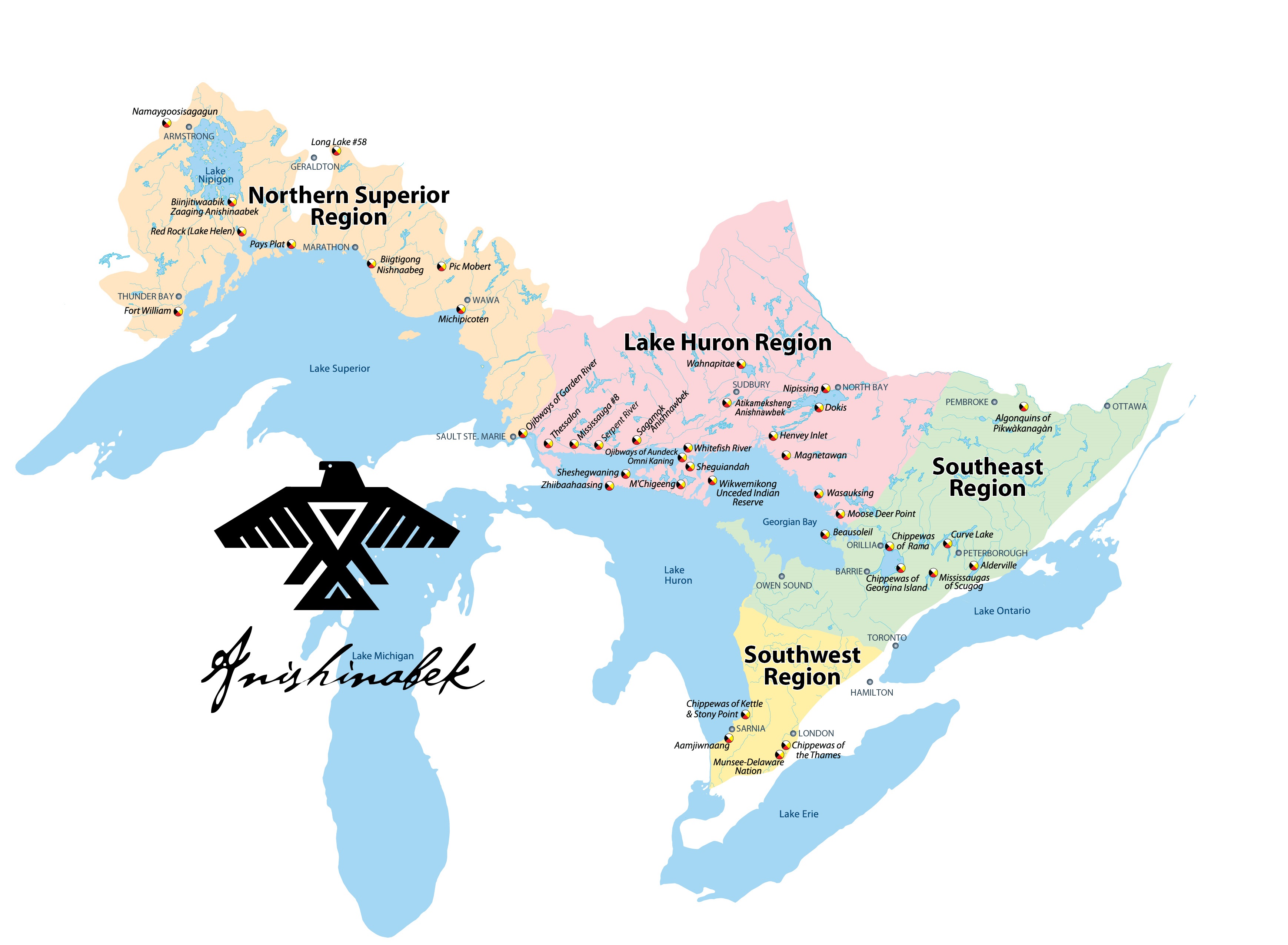
The map provided below illustrates the locations of the First Nations territories in the Lake Huron Region. The City of Sault Ste Marie is located on the traditional territory of the Ojibwes of Garden River. The town of Manitowaning is located close to Wikwemikong Unceded Indian Reserve. Mindemoya is located close to M’Chigeeng First Nation and Little Current is close to Ojibwes of Aundek Omni Kaning. This etextbook focuses mainly on the traditional territory of the Atikameksheng Anishnawbek, the land upon which the City of Greater Sudbury is situated. The other territory of focus is Wiigwaskinaga (Whitefish River) First Nation as small community that lies between Espanola and Little Current, Ontario.
Interesting Facts:
Did you know…
The word “Anishinabe” can be spelled differently (Anishnaabe, Anishnawbe), most likely attributed to dialect differences. There are several variations in the translations such as “first man,” “original man,” or “good person,” but the intent is similar. Similarly, the plural, Anishinabeg or Anishinaabeg, means “first people.” There are also variations in spelling from one territory to the next. For example, The Union of Ontario Indians uses ‘Anishinabe’ (singular) and ‘Anishinabek’ (plural). People from Atikameksheng use the spelling Anishnawbe (singular) and Anishnawbek (plural).
Atikameksheng Anishnawbek
Atikameksheng Anishnawbek is located approximately 19 km west of the City of Greater Sudbury. Although the City of Greater Sudbury is situated on the traditional territory of the Atikameksheng Anishnawbek, the community itself now has a land base of 43,747 acres. There are eighteen lakes within the current land base and the community itself is surrounded by eight lakes. The community is comprised of approximately 1220 members. Atikameksheng Anishnawbek belongs to the following political organizations:
- the Assembly of First Nations
- Chiefs of Ontario
- Anishinabek Nation
- North Shore Tribal Council
Whitefish River First Nation
Whitefish River First Nation (WRFN) also known as “Wiigwaaskingaa” (and formerly known as Birch Island) is located on Highway 6 between Espanola and Little Current, Ontario. The community has a membership of approximately 1,200 citizens with 440 members residing in the village of Whitefish River. This community, located on the shores of Georgian Bay and the North Shore Channel, serves as the gatekeeper to Manitoulin Island, Ontario. WRFN is represented provincially by the Union of Ontario Indians (UOI) and the Chiefs of Ontario (COO) and nationally by the Assembly of First Nations (AFN).
Click on the image of the map below for a more detailed geographic context.