4 CGB 4 – Bala Falls
Sheila Ballantyne and Phillip Ruscica
GPS Coordinates (45° 0’39.68″N , 79°36’53.90″W)
Parking: There are two parking options: at Jaspen Park, off higway 39 just northwest of Highway 169, at the “Precambrian Sheild Parking Lot” off Highway 169 just north of highway 39.
This outcrop is long exposed rock cut, directly south of the falls, in what is called the “The Precambrian Shield Parking Lot”. There are excellent outcrops throughout this area: at the falls, to the south underneath the train bridge, and to the west between the parking lot and Jaspen Park. The stop is located along Highway 169, at the intersection with Highway 39.
Click here to open the bedrock geology legend on the OGS website
The images in the slides below highlight the foliated gneiss, deformed mafic dykes, M-scale folds, and incipient boudins observed at this outcrop.
Digital Outcrop
Click on the arrows in the image below to view various perspectives of this outcrop. A link at the bottom left will take you to a 3D model of the outcrop in Sketchfab.
Digital Hand Samples
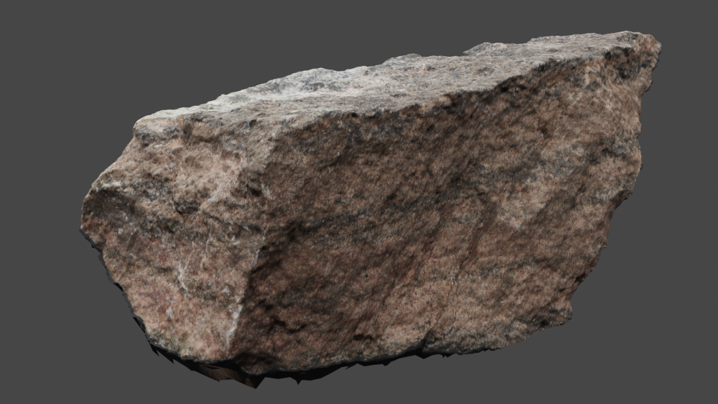
The following rock sample (VLS-21-46) is typical of the gneissic rocks found here, with fine mafic layers and coarser-grained pink layers. Click on the image (or here) to view the 3D model of the sample in Sketchfab!
Sample VLS-21-46 is also from this outcrop, taken from one of the mafic layers. A 3D model of this sample is not available at the time of writing.
Thin Sections
Below you can investigate full slide thin section images of the VLS-21-44 mafic layer and VLS-21-46 finely layered felsic gneiss. In plane polarised light (PPL) and crossed polarised light (XPL). Close-up videos of the thin sections rotating follow.
The following two thin section videos are close ups of sample VLS-21-44.
Plain Polarized Light (PPL) view of sample VLS-21-44.
Crossed Polarized Light (XPL) view of sample VLS-21-44.
The following two thin section videos are close ups of sample VLS-21-46.
Plain Polarized Light (PPL) view of sample VLS-21-46.
Crossed Polarized Light (XPL) view of sample VLS-21-46.
Additional photographs, detailed descriptions, and high resolution images of thin sections are available to post-secondary instructors. Please email virtual.petrology.network@utoronto.ca
All comments, questions, and concerns are always welcome at this email address.
Go to the next chapter: Lake Joseph Road (South of Highway 141)!

