7 CGB 7 – Killbear Lighthouse
Sheila Ballantyne and Phillip Ruscica
GPS Coordinates (45°19’59.02″N , 80°10’12.12″W)
Parking: At the end of the Lighthouse Point Trail in Killbear Provincial Park. There is a parking lot near the lighthouse.
This stop is located in Killbear Provincial Park, and it at the end of the Lighthouse Point Trail. This finely layered gneiss is weathered into shallow-dipping ledges with weaker mafic layers eroding away more quickly than the stronger felsic layers.
Click here to open the bedrock geology legend on the OGS website
The images in the slides below highlight the thinly layered and folded foliated gneiss observed at this outcrop.
Digital Outcrop
Click on the arrows in the image below to view various perspectives of this outcrop. A link at the bottom left will take you to a 3D model of the outcrop in Sketchfab.
Digital Hand Sample
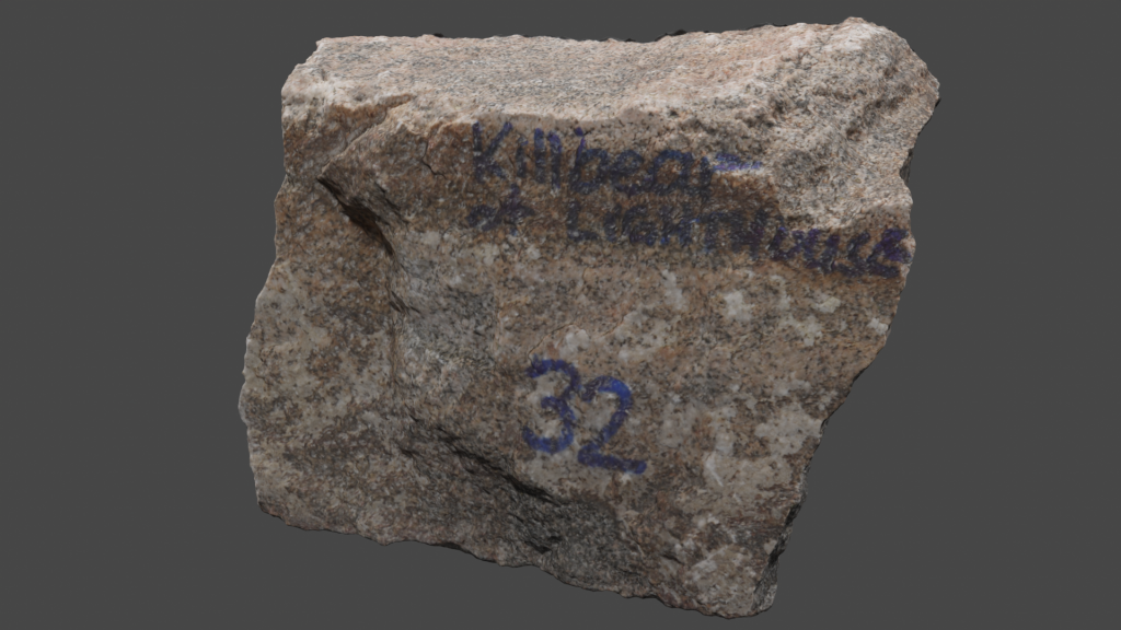
The following rock sample (VLS-21-32) is representative of the finely layered gneiss observed near the lighthouse in Killarney Provincial Park. Click on the image (or here) to view the 3D model of the sample in Sketchfab! Note the fine to medium grained mafic minerals (dominantly hornblende and biotite) peppered with white mineral (mostly plagioclase). Thin sections for this sample are shown below.
Digital Thin Sections from Hand Samples
Two thin Sections images are shown below of the Killbear gneiss (VLS-21-22). The thin section was cut perpendiular to foliation. Close up rotating videos of the sample follow.
.
The following two thin section videos are of sample VLS-21-32
Plain Polarized Light (PPL) view of sample VLS-21-32.
Crossed Polarized Light (XPL) view of sample VLS-21-32.
Additional photographs, detailed descriptions, and high resolution images of thin sections are available to post-secondary instructors. Please email virtual.petrology.network@utoronto.ca All comments, questions, and concerns are always welcome at this email address.
Go to the next chapter: CGB 8 – Magnetawan!

