6 CGB 6 – Parry Sound Salt Dock
Sheila Ballantyne and Phillip Ruscica
GPS Coordinates (45°21’6.01″N, 80° 2’55.55″W)
Parking: There is parking at the Salt Dock Boat Ramp.
The Parry Sound Salt Dock site has four outcrop scans. These stop are at the shores of Georgian Bay, along the North Shore Rugged Hiking Trail, on the north side of Parry Sound, Ontario. The trail starts just north of the large salt pile at the Salt Dock Boat Ramp.
The rock units at this stop can be divided into 4 different lithologies. The contacts can be difficult to discern in the field.
A general description of each unit are as follows (from Davidson et al., 2012).
Unit I: Gneiss with abundant hornblende (Stop 1)
Unit H: Gneissic to granular meta-anorthosite and pegmatite (Stop 2)
Unit G: Amphibolite teconite, locally very contorted. Pods of metagabboroic rocks throughout. (Stop 3)
Teconite: Gneissic tecontite, with quartzite and muscovite schist. Abundant garnet. (AKA Unit F) (Stop 4)
Note that the geology map from the Ontario Geological Society is different from the units identified by Davidson et al., 2012. Significant additional study is required to be certain which, if either, are the correct units. These studies could include more detailed strucutral mapping and geochemical analyses. Geological dating would also be helpful. All geological maps agree that these rocks are highly sheared and metamophosed gniessic rocks.
Click here to open the bedrock geology legend on the OGS website
The following images highlight some of the geological features at this site.
Stop 1 - Salt Dock Unit I
Digital Outcrop in Unit I
This scan was made near the Salt Dock parking lot, near the trail head. The strongly foliated and contorted gneissic layers can be observed. The mafic layers are rich in hornblende. Notebook for scale is ~15cm long. View is looking northeast.
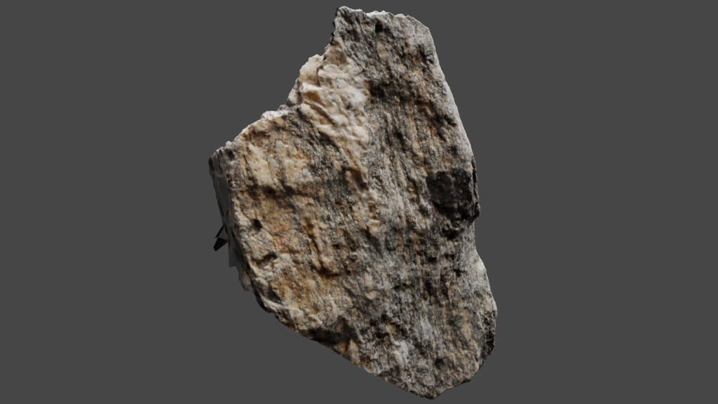
Digital Hand Sample from Unit I
The following rock is sample VLS-21-51, taken from Unit I. Click on the image (or here) to view the 3D model of the sample in Sketchfab!
Thin Sections of Hand Sample 51A from Unit I
The following two thin section videos are close-up rotations of slide 51.
Plain Polarized Light (PPL) view of sample VLS-21-51.
Crossed Polarized Light (XPL) view of sample VLS-21-51.
Stop 2 - Salt Dock Unit H
Digital Outcrop in Unit H
This scan was made in Unit H, approximately 500m northwest from the trail head. View is looking north-northeast. The boudins in the centre of the outcrop are approximately 20cm tall. The shear sense of the boudins appears to be top towards the northwest (similar to the Grenville Front orientation). The rocks here are less mafic than in the previous stop. Abundant pegmatite, which is often sheared and boudinaged.
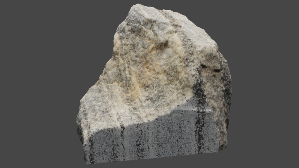
The Digital Hand Sample from Unit H
The following rock is sample VLS-21-55. Click on the image (or here) to view the 3D model of the sample in Sketchfab! This is an example of the granular meta-anorthosite that is common amongst the gneiss and pegmatite.
Thin Sections of Hand Samples VLS-21-55 from Unit H
The following two thin section videos are close-up rotations of slide VLS-21-55.
Plain Polarized Light (PPL) view of sample VLS-21-55.
Crossed Polarized Light (XPL) view of sample VLS-21-55.
Stop 3 - Salt Dock Unit G
Digital Outcrop in Unit G
This scan was made in Unit G, where the shoreline juts out ~20m into the bay. This is approximately 775m northwest from the trail head, ~200m northwest from the small island just off shore. View is looking east. The outcrop is approximately 1.2m in height.
This amphibolotic tectonite is rich in feldspar, with mylonitized layers and lineated augens with the same sense of shear as observed before (top towards the north west). Abundant hornblende through here that appears lineated, as shown in the handsample for this stop (sample VLS-21-81)
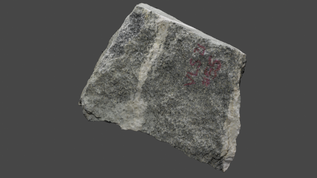
Digital Hand Sample from Unit G
The following rock is sample VLS-21-81 (also labelled 52 but changed to 81 for processing). Click on the image (or here) to view the 3D model of the sample in Sketchfab!
Thin Sections of Hand Sample VLS-21-81 from Unit G
The following two thin section videos are of slide 81A, these show the view parallel to linations of sample VLS-21-81.
Plain Polarized Light (PPL) view of sample VLS-21-81A.
Crossed Polarized Light (XPL) view of sample VLS-21-81A.
The following two thin section videos are of slide 81B, these show the view parallel to foliation of sample VLS-21-81.
Plain Polarized Light (PPL) view of sample VLS-21-81B.
Crossed Polarized Light (XPL) view of sample VLS-21-81B.
Stop 4 - Salt Dock Tectonite
Digital Outcrop in Teconite (Unit H)
This scan was taken aproximately 900m from trailhead, standing on the penisula approximately 75m west of the small creek. Creek likely marks the contact between unit H and G. Highly sheared, finely layered meta-anorthosite. Abundant sheared pegmaite layers, locally covered in rust stains (presumably from weathered sulphides, but these were not observed). Gneissic layers are finer here than earlier stops. There is a small, open notebook (appears as a fuzzy white rectangle in lower, centre part of outcrop) which is approximately 15cm long.
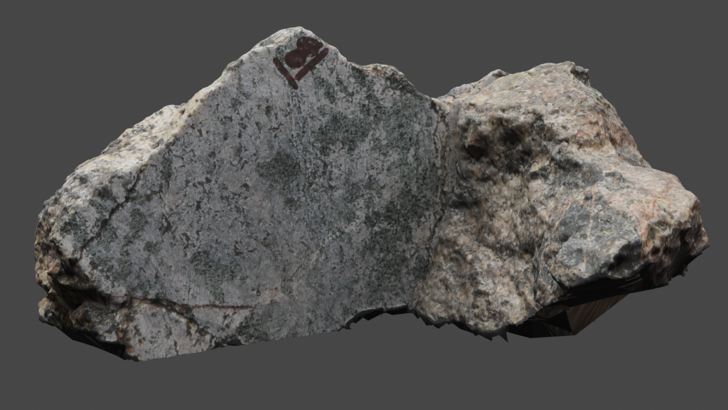
Digital Hand Sample from tectonite (Unit H)
The following rock is sample VLS-21-53. Click on the image (or here) to view the 3D model of the sample in Sketchfab!
 Note that thin sections for this sample are not (yet) available.
Additional photographs, detailed descriptions, and high resolution images of thin sections are available to post-secondary instructors. Please email virtual.petrology.network@utoronto.ca All comments, questions, and concerns are always welcome at this email address.
References
Davzidson, A., Nadeai, K., & Culshaw, N.G. (September, 2012). CLASSIC OUTCROPS IN THE CENTRAL GNEISS BELT, ONTARIO – A RETROSPECTIVE. [Field Trip]. 43rd Friends of the Grenville Annual Field Excursion, Guidebook, Parry Sound, Ontario
Go to the next chapter: CGB 7 – Killbear Lighthouse!


