3.3 Community Science Initiatives in Ontario
There are many community science projects across Ontario for people of all ages to contribute data in their own communities. Projects cover a broad range of topics, including air quality monitoring, mapping precipitation and tracking the spread of flu-like illnesses. However, most projects focus on engaging nature enthusiasts to help monitor wildlife and natural spaces across the province. Many of these projects aim to provide information on population status and trends to help identify species or populations requiring conservation action. Some of these projects also focus on the distribution of invasive species, such as migratory insect pests that harm plants, consequently damaging farmlands, forests, parks and other natural areas.
For a list of all of the community science initiatives in Canada, consult the Government of Canada’s Citizen Science Portal.
Nature Atlases
Atlas projects collect detailed species occurrence data and can harness the collective skills and efforts of community scientists, researchers and organizations across a large spatial scale, which individual researchers or organizations cannot do alone. Occurrence data are important for research and conservation. Ontario Nature has done many atlas projects to monitor population trends and develop recovery strategies for at-risk species.
Community science was integral in creating the Ontario Reptile and Amphibian Atlas, the most comprehensive source of information on Ontario’s reptiles and amphibians. Ontario has 47 species of reptiles and amphibians, including 15 snakes, eight turtles, one lizard, 11 salamanders, 10 frogs and two toads. Over half of the reptiles and amphibians documented are listed as species at risk in Canada (Ontario Nature, 2024). Understanding the distribution of reptiles and amphibians across the province is important to inform conservation management.
Review the The Ontario Reptile and Amphibian Atlas.
Invasive Species Monitoring and Control

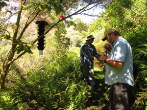
Community science is crucial to mitigate the impact of invasive species on ecosystems. Volunteers can submit invasive species observations to iNaturalist and EDDMapS (Early Detection and Distribution Mapping System) for early detection. Mapping is the first step to prevent the establishment and spread of invasive species. Organizations like the Invasive Species Centre and the Canadian Food Inspection Agency use community science data to monitor the spread of invasive species and develop control strategies.
Volunteers can also help organizations with their efforts to control or even eradicate invasive species. In London, local organizations host removal events where volunteers help to pull invasive plants like garlic mustard and buckthorn.
Visit the Invasive Species Centre’s website for more information on how invasive species are tracked.
Community Nature Project

Conservation authorities protect, manage and restore natural habitats, including rivers, lakes, forests and wetlands and develop programs to protect the wildlife. They also provide opportunities for the public to learn about nature and enjoy natural spaces.
The Upper Thames River Conservation Authority (UTRCA) is one of 36 Conservation Authorities in Ontario (UTRCA, n.d.) The UTRCA oversees the upper watershed of the Thames River, an area that covers 3,430 square kilometres in southwestern Ontario. UTRCA’s Community Nature Program is a community science initiative encouraging the public to learn more about the watershed’s biodiversity using iNaturalist.
The UTRCA then uses the iNaturalist data for their watershed report cards, which report on local environmental conditions to track environmental change. The data are also used to locate invasive species to help inform decisions on control measures. For example, Giant Hogweed is a public safety hazard because its clear, watery sap contains toxins that can cause severe skin inflammation. If the sap gets on your skin and the skin is then exposed to sunlight, it can cause severe sunburns. Community science helps to locate these problematic plants for possible extermination.
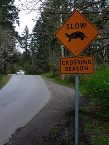
On the opposite end of the spectrum, the data can also be used to locate species that require conservation. For example, turtles often lay eggs in unsafe locations (e.g. along roads, near pedestrian trails, parks). Protecting turtle nests helps to preserve these populations. The Southern Ontario At Risk Reptiles (SOARR) team rescue the eggs from hundreds of turtle nests, incubate them, and release the young back into their natural habitat. The SOARR team uses community science to locate turtles for their recovery efforts.
If you spot a turtle nest at risk in London then you can report it to the UTRCA through their turtle reporting form.
Bird Window Collisions

Window collisions kill millions of birds every year in Canada. Community science can help track bird-window collisions by enabling volunteers to report dead birds. Some buildings are more prone to bird crashes, so the community science data can help identify high-risk buildings that cause the most bird deaths.
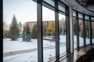
Western University retrofitted buildings with bird-friendly window films after community science data highlighted buildings of concern (Watson & De Guzman, 2021). The window film consists of small, dime-sized dots spread two inches apart. From a distance, these dots are barely visible, so they do not change the overall aesthetic of the building. To the bird’s eye, the dots break up the reflection from the windows, creating visible obstacles to avoid.
The community science data on bird collisions also helps researchers understand the factors contributing to collisions, such as mirrored windows. This information is used to create bird-friendly building designs and window treatments to consider when planning new buildings.
At Fanshawe College, you can spot bird-friendly windows in all recent builds, including the Campus Energy Centre and Innovation Village.
Land Use Planning

Before developing or altering land, the City of London requires that environmental studies be completed to assess the impact of the proposed development on the local habitat and its ecological functions. The environmental studies consist of background information reviews and field investigations to determine the presence of significant habitat features and/or Species at Risk (City of London, 2021).
The City of London Environmental Management Guidelines (2021) outline the steps required for these environmental studies. For the field investigations, multi-season inventories must be completed to determine the species that live in the area. Habitats that contain rare species are more valuable than habitats that do not, so extra measures will be put in place to ensure the habitat remains unharmed. The issue is that these surveys only capture snapshots of the biodiversity and may miss rare species. Community science can help fill in these gaps. In 2021, the Environmental Management Guidelines were updated to recommend incorporating reputable community science data sources, like iNaturalist. That means that iNaturalist data can help to document important habitats for Species at Risk to protect them from future development.
The City of London has published Environmental Management Guidelines that thoroughly explore Land Use Planning in London, Ontario.
City Nature Challenge
The City Nature Challenge is an international community science competition to see which city can make the most observations of wildlife on iNaturalist over a designated 4-day period (City Nature Challenge, n.d.). This event is a fun chance to learn about nature and help track your local biodiversity.
For more information on getting involved, visit the City Nature Challenge website.

