8.3 Terrestrial Biomes
A biome is a large geographic region characterized by a distinct climate and vegetation, which in turn determines the types of animals that can live there. Biomes are classified into two broad categories: terrestrial biomes (occur on land) and aquatic biomes (include marine and freshwater).
The major terrestrial biomes on Earth are distinguished by their typical climate (the long-term pattern of temperature and precipitation in a region). Annual totals and fluctuations of precipitation and temperature variation on a daily and seasonal basis affect the kinds of vegetation and animal life that can exist in broad geographical regions. Since a biome is defined by climate rather than location, the same biome can occur in geographically distinct areas with similar climates.
Some parts of the planet, such as Antarctica, Greenland, and high mountain ranges, are covered by permanent ice and glaciers. These areas experience extreme cold and receive very little precipitation. While they support limited life, they are not typically classified as biomes due to their harsh, uninhabitable conditions.
What Controls Climate on Earth?
Climate is the most important factor in determining the types of organisms that can live in a particular biome. Several key factors work together to control Earth’s climate patterns:
Latitude
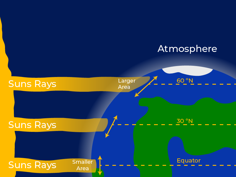
Figure 8.3.1 Image Description
A diagram showing how the Sun’s rays strike Earth differently depending on latitude. On the left, the Sun emits parallel rays that reach Earth’s curved surface. At the equator, rays hit directly, concentrating on a smaller area, resulting in more intense solar energy. At higher latitudes (30°N and 60°N), the rays strike at an angle, spreading over a larger area and passing through more atmosphere, which reduces their intensity. Labels indicate “Smaller Area” near the equator and “Larger Area” near 60°N, with the atmosphere depicted as a glowing blue arc around Earth.
Latitude refers to how far a location is from the equator. The equator receives direct sunlight year-round, resulting in consistently warm temperatures and high solar energy. As you move toward the poles, sunlight strikes Earth at a lower angle, spreading the energy over a larger area and reducing the intensity of heat. This creates a gradient of climate zones: tropical near the equator, temperate in the mid-latitudes, and polar near the poles. These broad temperature zones are the foundation for the distribution of biomes across the globe.
Earth’s Tilt
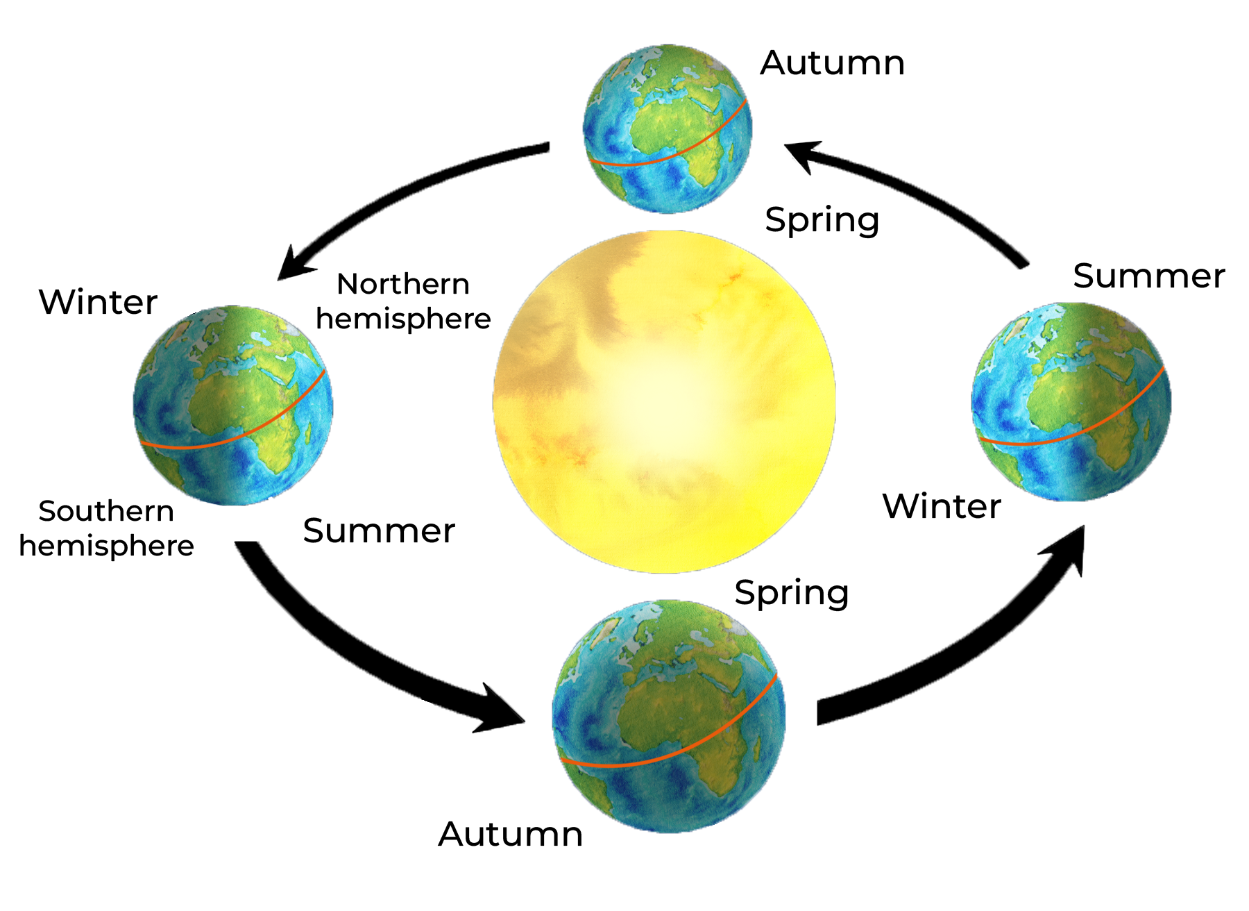
Earth is tilted at an angle of about 23.5 degrees relative to its orbit around the Sun. Because the Earth tilts on its axis, different parts of the planet get different amounts of sunlight throughout the year. This tilt creates the seasons. In the Northern Hemisphere, summer happens when the North Pole leans toward the Sun. Days are longer, and sunlight is more direct. In winter, the North Pole tilts away from the Sun, leading to shorter days and weaker sunlight. These seasonal shifts affect temperature and rainfall, which in turn influence plant growth and animal activity.
Global Air Circulation Patterns
Precipitation is a key factor in determining the types of vegetation and animals that can survive in a region. Global air circulation patterns help explain why some areas are consistently wet while others are dry. Warm air rises near the equator, cools as it rises, and releases moisture—creating the wet conditions typical of tropical rainforests. Around 30° latitude, the now-dry air descends, warming and absorbing moisture from the land, which leads to the formation of deserts. These large-scale wind and pressure systems, such as the trade winds and westerlies, help distribute heat and moisture around the planet and are essential in shaping the world’s biomes.
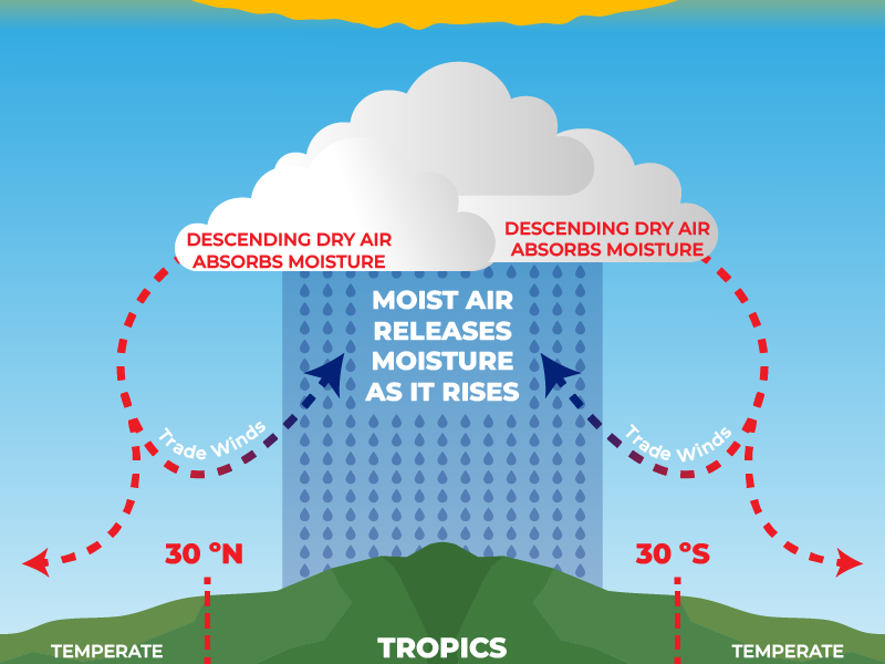
Figure 8.3.3 Image Description
A diagram illustrating the global circulation of moist and dry air. In the center, moist air rises from the tropics, releasing moisture as rainfall. At higher altitudes, the air becomes dry and moves outward toward 30°N and 30°S. The descending dry air absorbs moisture, creating arid conditions. Red dashed arrows show the circulation of trade winds, curving back toward the tropics. The diagram labels the Tropics in the center, flanked by Temperate zones on either side.
Proximity to Water
Water has a high heat capacity, meaning it warms and cools more slowly than land. As a result, areas near oceans or large lakes tend to have milder climates with smaller temperature fluctuations. Coastal regions often receive more precipitation and experience less extreme seasonal changes than inland areas at the same latitude.
Other Influences on Climate
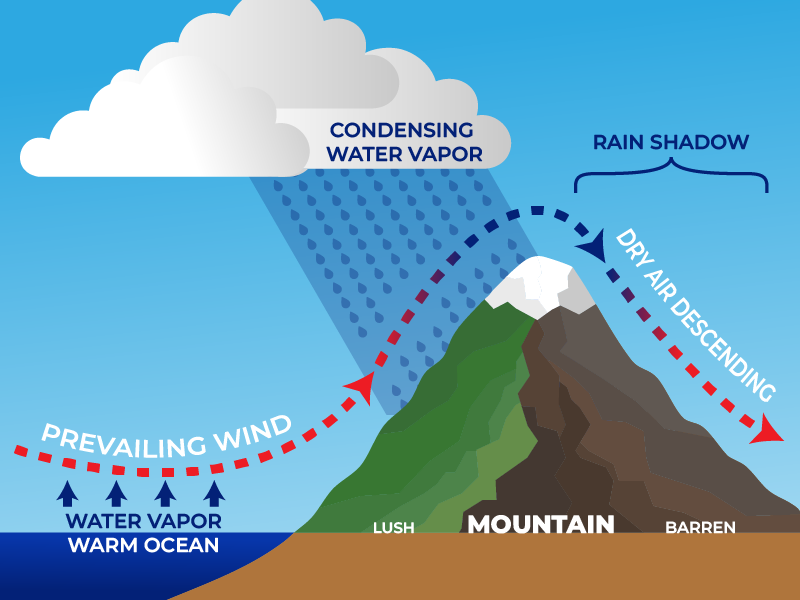
Figure 8.3.4 Image Description
A diagram illustrating the rain shadow effect. Moist air from a warm ocean rises with prevailing winds, carrying water vapour toward a mountain. As the air ascends, it cools and condenses into water vapour, producing rainfall on the lush, green windward side of the mountain. At the peak, the air loses most of its moisture and descends on the leeward side as dry air. This creates a rain shadow, resulting in a barren, brown landscape on the mountain’s opposite side.
There are many other factors that also play a role in global climate patterns. Altitude affects temperature—higher elevations are generally cooler than lower ones. Topography, such as mountain ranges, can block air masses and create rain shadows, leading to dry conditions on one side of a mountain. Additionally, local wind patterns, cloud cover, and human activities can influence regional climates.
Major Terrestrial Biomes
Terrestrial biomes are land-based ecosystems classified by their climate, dominant vegetation, and characteristic animal life.
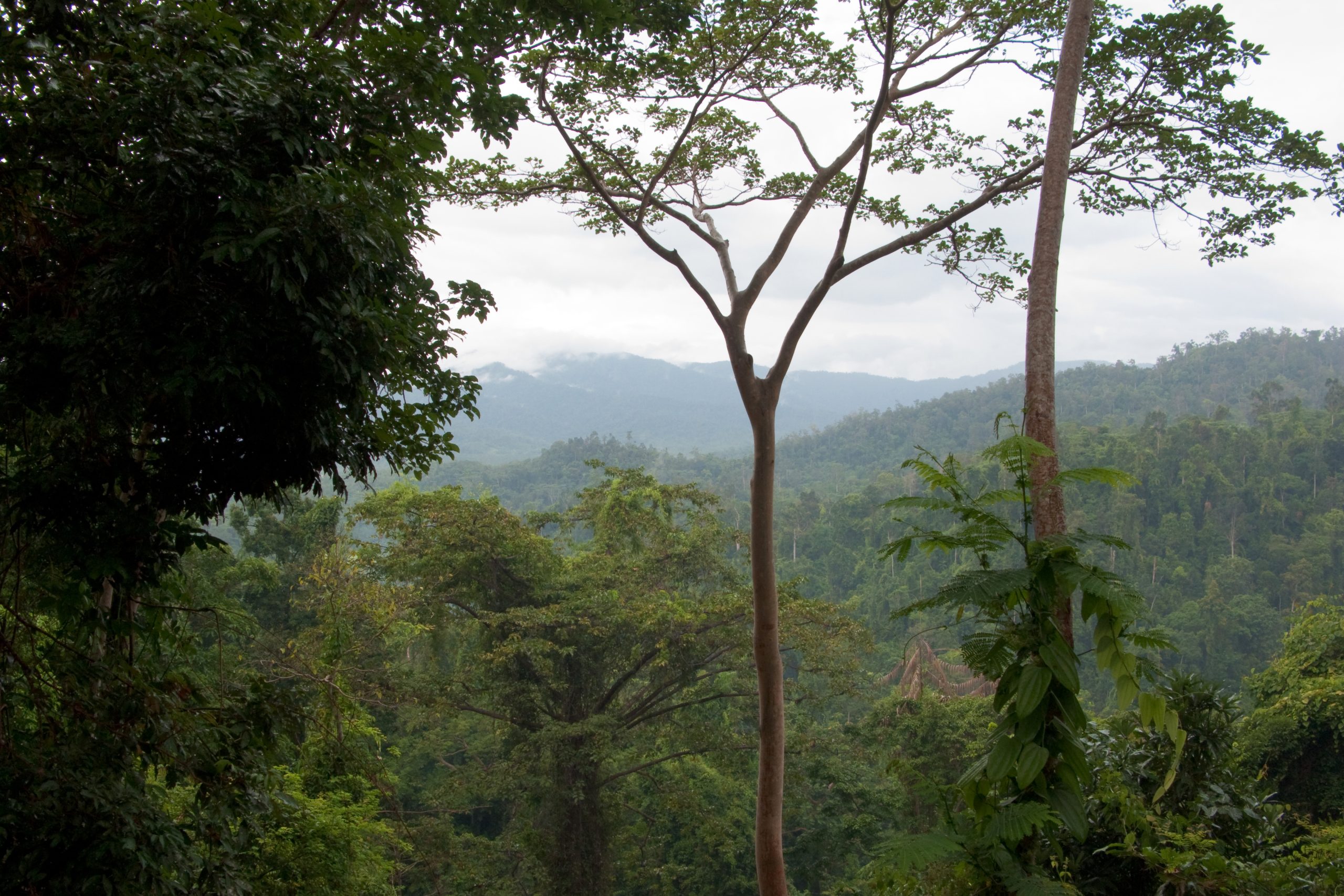
Tropical Rainforests
Tropical rainforests are found near the equator and are the most biologically diverse terrestrial biome. They have warm, stable temperatures year-round (20°C to 34°C) and receive 250 to over 450 cm of rainfall annually. Even in drier months, rainfall remains high compared to other biomes. The consistent warmth and sunlight support year-round plant growth, so these forests are highly productive.
Rainforests are structured in vertical layers, which creates a wide range of habitats. Common plants include broadleaf trees, vines, ferns, and epiphytes (plants that grow on other plants). Animals include jaguars, sloths, toucans, monkeys, frogs, and countless insect species. Many animals live in the canopy and rarely descend to the ground (OpenCurriculum, n.d.).
Tropical rainforests are vital for global biodiversity and climate regulation, but they face serious threats from deforestation and habitat loss.
Savannas
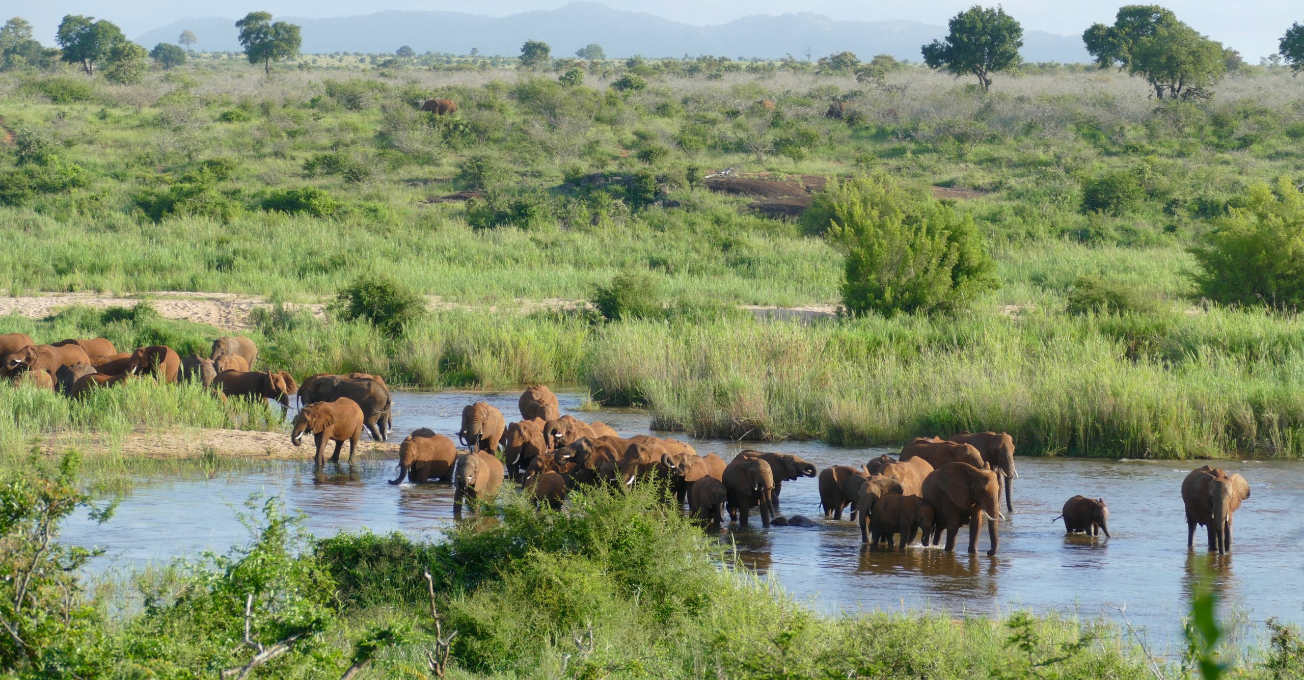
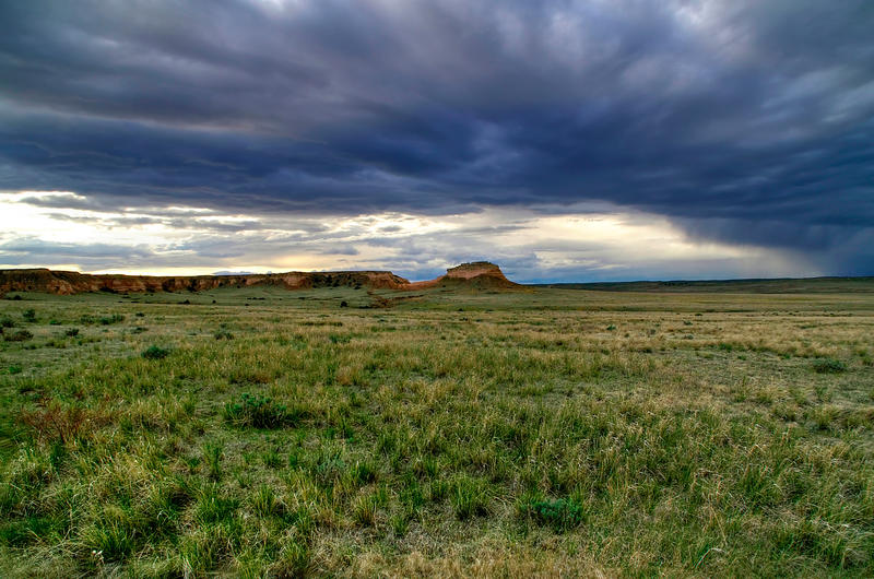
Savannas are grasslands with scattered trees, and they are located in Africa, South America, and Northern Australia. Savannas are hot, tropical areas with temperatures averaging from 24°C to 29°C and an annual rainfall of 50-120 cm. Savannas have an extensive dry season, so trees do not grow well. The open landscape allows sunlight to reach the ground, supporting a rich layer of grasses and herbaceous plants. Since fire is an important source of disturbance in this biome, plants have evolved well-developed root systems that allow them to quickly re-sprout after a fire.
Savannas support a wide variety of large herbivores, including elephants, giraffes, zebras, antelope, and wildebeest. These animals are often migratory, moving in herds in search of water and fresh grazing areas. The biome also supports many predators, such as lions, cheetahs, hyenas, and vultures, which rely on the abundance of herbivores for food. Smaller animals like meerkats, ground birds, and insects also thrive in this environment (OpenCurriculum, n.d.).
Deserts
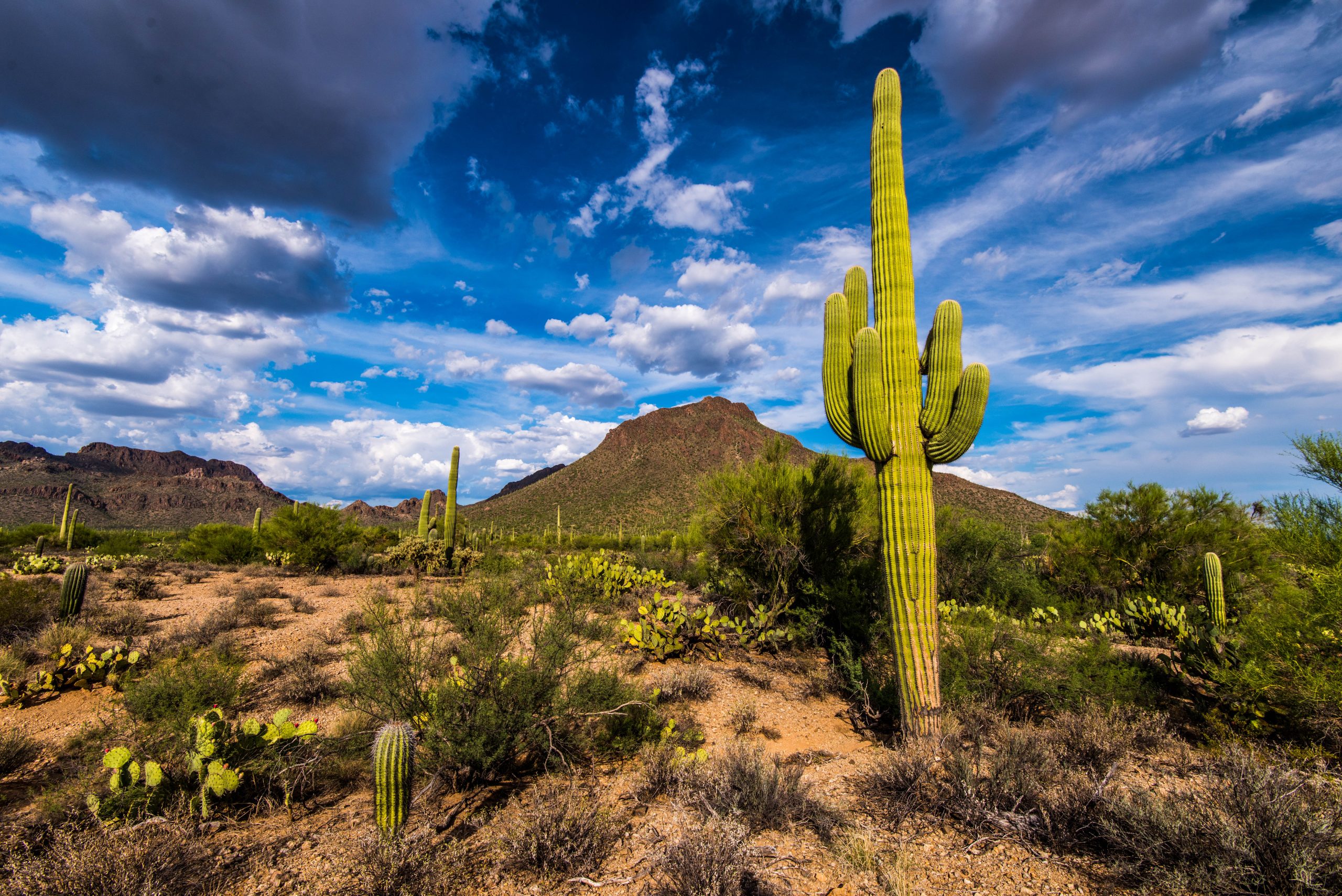
Deserts are dry biomes that receive less than 30 cm of precipitation per year. Most desserts are subtropical and found around 30° latitude north and south of the equator. These regions are known for their extreme heat, low humidity, and sparse vegetation.
Temperatures in deserts can exceed 40°C during the day but drop sharply at night due to the lack of cloud cover. The intense sunlight and dry air create harsh conditions for life, yet many organisms have evolved remarkable adaptations to survive. Plants in deserts are typically succulents, such as cacti and other plants that store water to help them during dry seasons. These plants often have thick, waxy cuticles, spines instead of leaves, and shallow but widespread roots to quickly absorb water from light rains. Animals in deserts are also well-adapted to conserve water and avoid heat. Many are nocturnal, active only at night when temperatures are cooler. Typical desert animals include lizards, snakes, and rodents (OpenCurriculum, n.d.).
In addition to subtropical deserts, there are cold deserts that experience freezing temperatures during the winter, and any precipitation is in the form of snowfall.
Chaparral
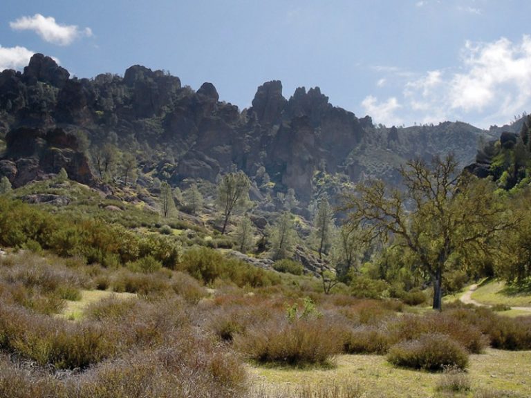
The chaparral is a shrubland biome found in California, along the Mediterranean Sea, and along the southern coast of Australia. These areas experience hot, dry summers and mild, wet winters. Annual precipitation typically ranges from 65 to 75 centimetres, most of which falls during the winter months.
Temperatures in the chaparral can vary widely. Summer temperatures often exceed 30 °C, while winter temperatures are usually mild, ranging from 10 to 15°C. The long dry season and frequent droughts make fire a natural and important part of the chaparral ecosystem. Many plants are adapted to survive and even regenerate after periodic wildfires. The chaparral is a fragile biome that can be easily damaged by human activity like fire suppression, which disrupts natural fire cycles and leads to more intense wildfires.
Vegetation in the chaparral is dominated by dense, woody shrubs and small trees with tough, leathery leaves that reduce water loss. Some species have seeds that only germinate after exposure to fire (OpenCurriculum, n.d.).
Animals in the chaparral are adapted to the dry conditions and often avoid the heat by being active at night or during cooler parts of the day. They include rodents, lizards, and a variety of birds and insects. Most chaparral animals are small because the densely growing shrubs make it difficult for very large animals to move through. The largest animals are deer, which browse on the leaves of chaparral shrubs and trees (OpenCurriculum, n.d.).
Temperate Grasslands
Temperate grasslands are found in the interiors of continents, including the prairies of North America and the steppes of Eurasia. Annual precipitation typically ranges from 25 to 90 cm, which is enough to support grasses but not large stands of trees.
Temperate grasslands experience seasonal temperature extremes. Summers are often hot, with temperatures above 30°C, while winters can be very cold, with temperatures well below freezing. Periodic droughts and fires are common and play an important role in maintaining the grassland ecosystem by preventing the growth of woody plants.
The dominant vegetation consists of grasses that are adapted to survive grazing, fire, and dry conditions. Many have deep root systems that help them access water and recover quickly after disturbances. Temperate grasslands support a variety of grazing animals and their predators. Common animals include bison, antelope, and small mammals such as prairie dogs and rabbits. Predators like wolves, coyotes, and foxes are also found in these ecosystems. Many animals are adapted to open landscapes and use burrows for shelter and protection (OpenCurriculum, n.d.).
Because of their rich, fertile soils, temperate grasslands have been heavily converted to agriculture, especially for growing grains like wheat and corn. As a result, much of the original grassland habitat has been lost, and many native species are now threatened (OpenCurriculum, n.d.).
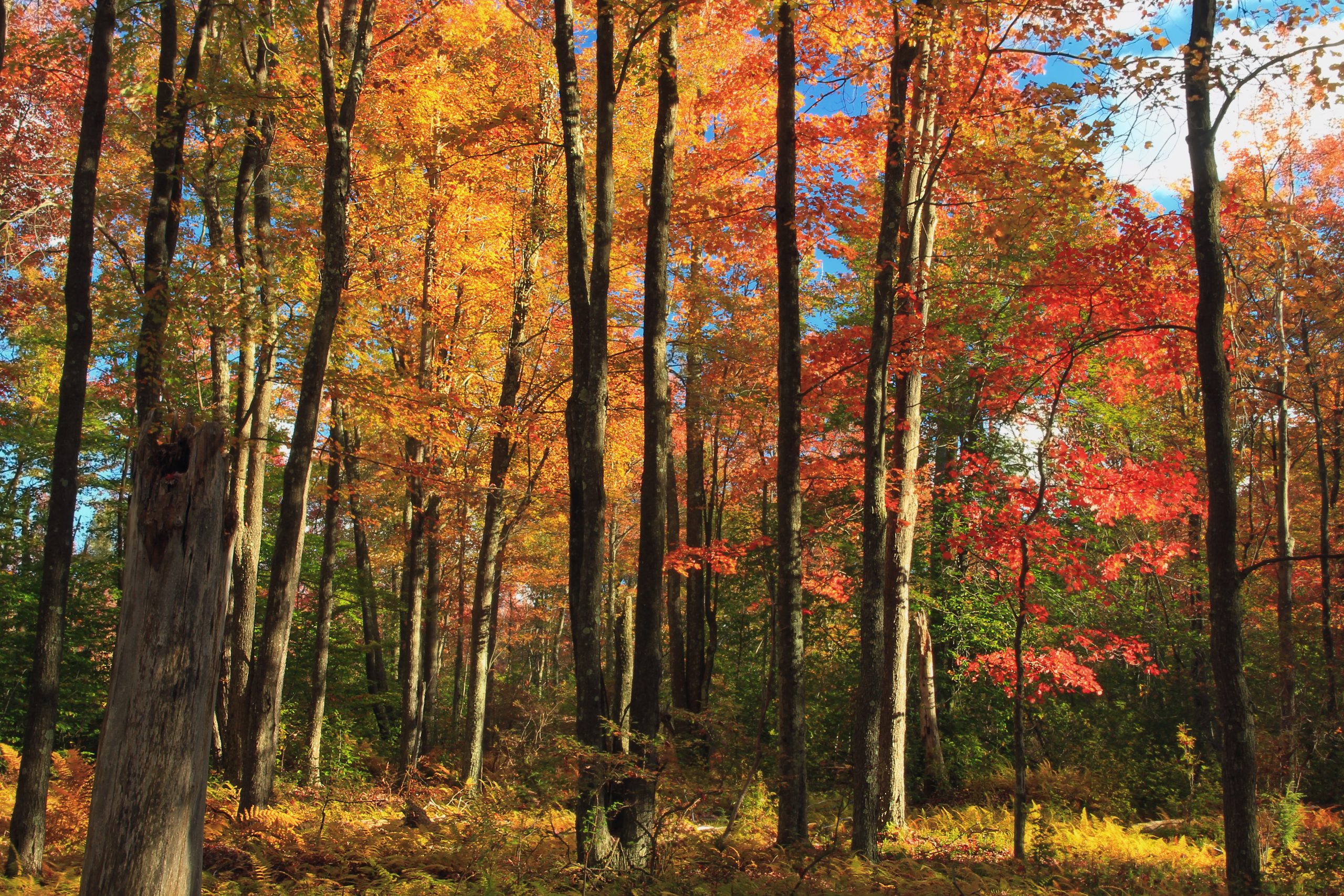
Temperate Forests
Temperate forests are the most common biome in eastern North America, Western Europe, Eastern Asia, Chile, and New Zealand. These areas experience four distinct seasons (spring, summer, autumn, and winter) with temperatures that range between –30 °C and 30 °C throughout the year. Precipitation is relatively constant throughout the year and ranges between 75 cm and 150 cm.
The dominant vegetation in temperate forests includes deciduous trees, such as oak, maple, beech, and birch, which lose their leaves each fall. In some mixed forests, coniferous trees like pine, spruce and fir are also common. The trees of the temperate forests leaf out and shade much of the ground; however, more sunlight reaches the ground in this biome than in tropical rainforests because trees in temperate forests do not grow as tall. As a result, the understory contains mosses, ferns, various herbaceous plants, and shrubs. The forest floor is often rich in organic material due to the seasonal leaf drop. As the thick layer of leaf litter decays, nutrients are returned to the soil. The leaf litter also protects soil from erosion, insulates the ground, and provides habitats for invertebrates and their predators (OpenCurriculum, n.d.).
Temperate forests support a wide variety of animal life. Common mammals include deer, raccoons, squirrels, and black bears. There are also insects, amphibians, reptiles, and birds. Many animals in this biome are adapted to seasonal changes, with some hibernating or migrating during the winter months (OpenCurriculum, n.d.).
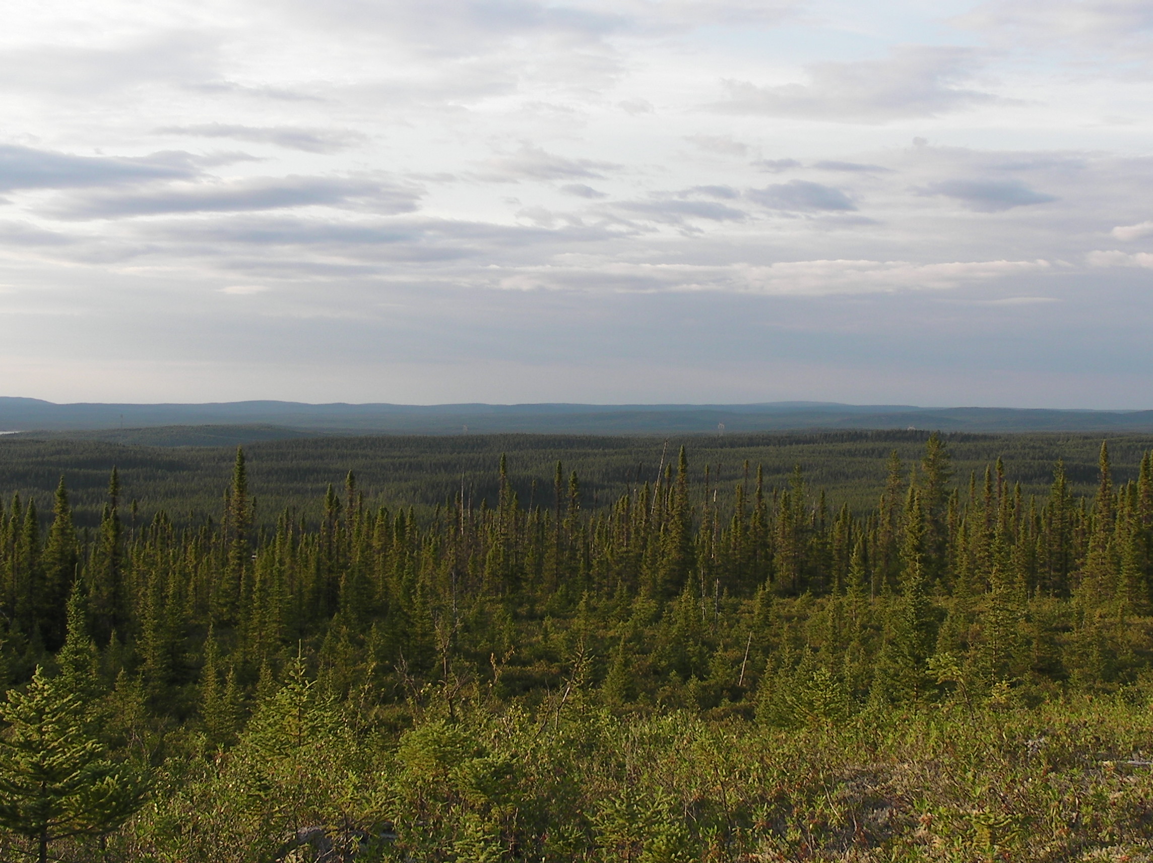
Boreal Forests
Boreal forests, or coniferous forests, are found in the high northern latitudes just below the Arctic Circle, stretching across Canada, Alaska, Russia, and Scandinavia. These forests experience long, cold winters and short, cool summers. Annual precipitation ranges from 40 to 100 cm and usually takes the form of snow.
Temperatures in boreal forests are cold for most of the year. Winter temperatures often drop well below freezing, while summer temperatures are mild, typically ranging from 10 to 20°C. The growing season is short, usually lasting only a few months.
The vegetation is dominated by coniferous trees such as spruce, fir, pine, and cedar, which are well adapted to cold conditions. These trees retain their needle-like leaves and can begin photosynthesis earlier in the spring than deciduous trees. It also takes less energy to warm a narrow needle than a broad leaf, which further allows evergreens to start growing during cooler temperatures. The forest floor is often covered with mosses, lichens, and low shrubs (OpenCurriculum, n.d.).
Animal life in the boreal forest includes species adapted to cold and seasonal changes. Common mammals include moose, wolves, snowshoe hares, and bears. Through the summer, there are also many insects and birds. Caribou spend their winters there. The boreal forest is too cold for amphibians or reptiles (OpenCurriculum, n.d.).
Boreal forests store large amounts of carbon because these slow-growing tree species are long-lived. This makes them important for climate regulation; however, they are often affected by human activities like logging and mining.
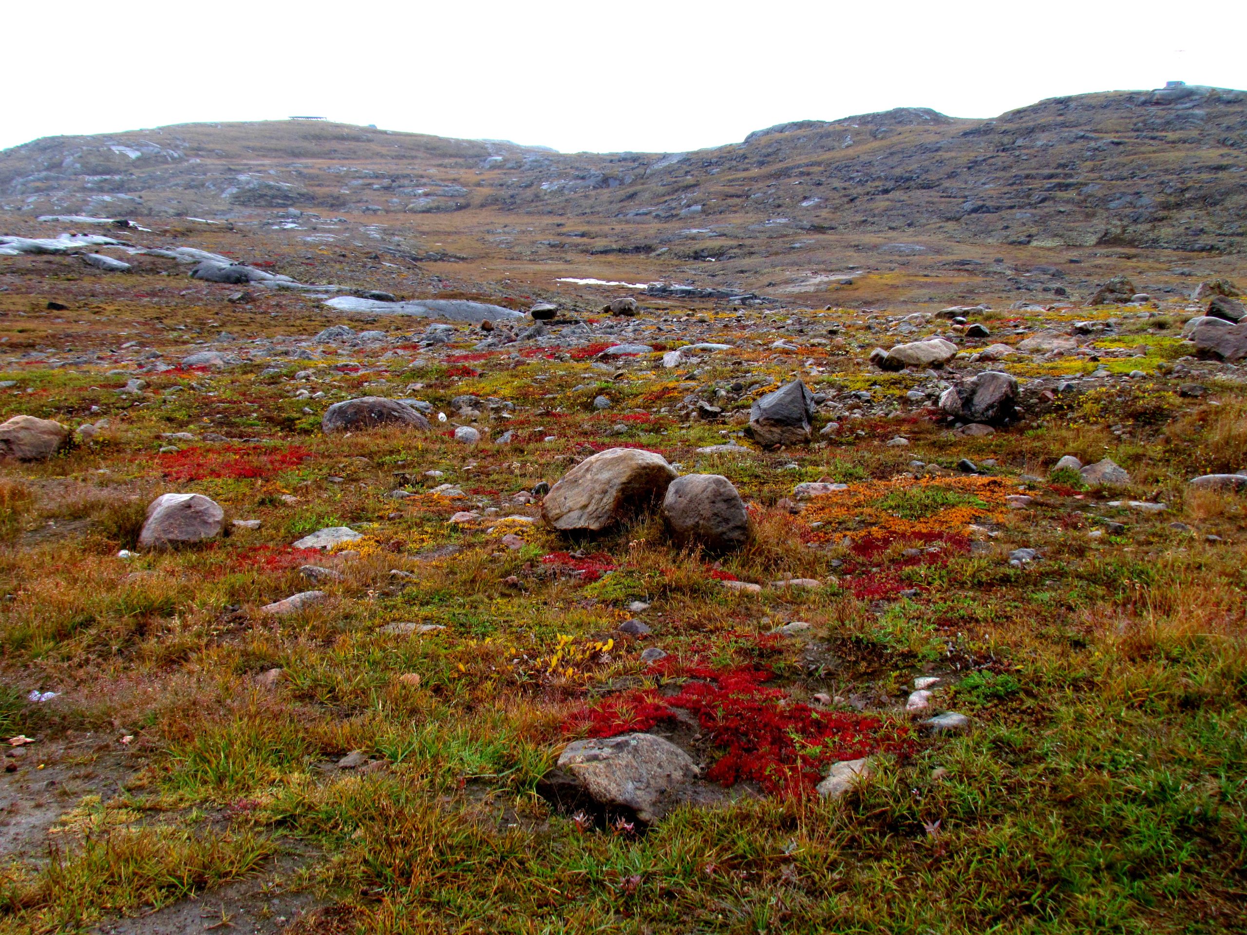
Arctic Tundra
The Arctic tundra is found in the far northern regions of the world, including parts of Alaska, Canada, Greenland, and northern Russia. It is the coldest of all biomes and is characterized by long, harsh winters and short, cool summers. Temperatures can drop below -30 °C in winter and rarely rise above 10°C in summer. Annual precipitation is typically less than 25 cm and mostly falls as snow. The growing season is very short and lasts only about 2 months.
Plants in the Arctic tundra are generally low to the ground and include low shrubs, grasses, mosses, lichens, and small flowering plants. A defining feature of the tundra is permafrost, a layer of permanently frozen soil beneath the surface. The top layer of soil thaws in the summer, but deeper layers do not, so water cannot soak into the ground. This leaves the soil soggy and creates many bogs, lakes, and streams (OpenCurriculum, n.d.).
Few animals live in the tundra year-round. Those that remain have adapted to the extreme cold, including polar bears, arctic foxes and arctic hares. Insects such as mosquitoes can survive the winter as pupae and are very numerous in summer. Many species of birds and large herds of caribou migrate to the Arctic tundra each summer. There are no amphibians or reptiles. The Arctic tundra is a fragile ecosystem that is highly sensitive to climate change. Warming temperatures are causing permafrost to thaw, which can release stored carbon and further accelerate global warming (OpenCurriculum, n.d.).
Knowledge Check
Text Description
- Soil composition
- Altitude and proximity to cities
- Climate patterns of temperature and precipitation
- The types of animals present in an area
- Temperate forest
- Boreal forest
- Temperate grassland
- Chaparral
- Heavy rainfall caused by ocean currents
- Dry air descending from global air circulation patterns
- Frequent monsoons caused by seasonal winds
- Cold air trapped by high mountain ranges
- Broad leaves to maximize photosynthesis
- Shallow root systems to collect water from dew
- Water storage in thick tissues and waxy cuticles
- Large surface area for faster transpiration
- The soil is naturally very rich in clay
- Rainfall increases drastically in the summer
- Permafrost prevents water from draining into deeper layers
- High winds constantly blow water into depressions
Answers:
- c
- b
- b
- c
- c
OpenAI. (2025). ChatGPT. [Large language model]. https://chat.openai.com/chat
Prompt: Create 5 multiple-choice questions using the following content
“17.3 Terrestrial Biomes” from Biology and the Citizen by Colleen Jones is licensed under a Creative Commons Attribution 4.0 International License, except where otherwise noted.
